
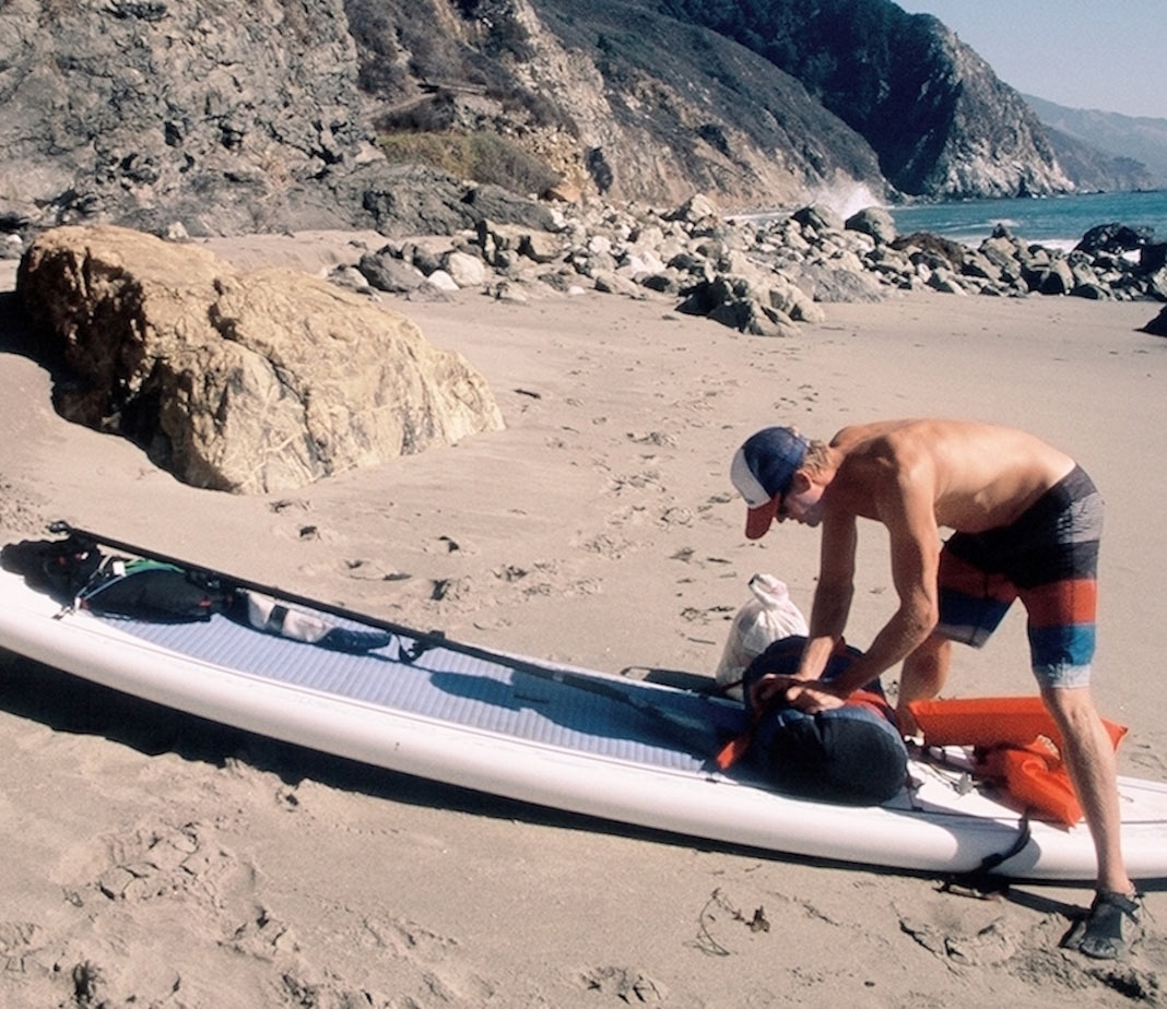
The rain had just started coming down, but fortunately we had just packed away our camping gear in our kayaks or strapped it to our standup paddleboards. The surf though picked up throughout the night and was dumping thick six-foot waves on a steep, gravelly beach along Central California’s Big Sur Coast.
Visibility wasn’t helping. There was a dense, low-hanging ceiling of soupy fog hovering just above the ocean, nullifying any line on the horizon. Mistiming our launch off that deserted beach could’ve been disastrous, possibly ending our trip, but launching successfully guaranteed us at least a chance to land on the next wave-battered beach.
Paddling the roughly 60 miles of Big Sur Coast will require a little planning, some early mornings and most of all some good timing depending on the unruly surf that thunders against those sheer, daunting cliffs the coast is known for. Here are 10 things to consider before doing a Big Sur kayaking trip along the coast.
1. When to go
The best time to paddle Big Sur is late summer into early fall. My friends and I paddled the Big Sur Coast in November and encountered a mixed bag of big, uneven surf, southerly headwinds and poor visibility. On the flip side, we also soaked in some sunshine and glassy, mirror-like paddling conditions. Winter endures more storms with huge surf. You can expect potential landslides and occasional rock fall. Spring is colorful, but northwest winds are at their most volatile. Summer sees south swells, winds and dense fog. Late summer into early fall brings the calmest paddling conditions.
2. Hazards
No matter what the surf reports say, be prepared for the worst. There are many offshore reefs, huge slabs of submerged rocks and craggy sea stacks. Mind tidal fluctuations and study channels between the coast and offshore reefs that might offer safe passage instead of the long paddle out and around.
3. Winds
Winds predominantly blow out of the northwest, resulting in a nice tailwind paddle down the Big Sur Coast. However, be prepared for southerly winds blowing up the coast and offshore winds howling out of the canyons. We had southerly headwinds from McWay Falls to Sand Dollar Beach, about a 20-mile stretch.
4. Logistics
If you’re going solo, leave your car at Andrew Molera State Park and hitchhike back after finishing your paddle. It’s $10 per day to park. There are plenty of places to hide your kayak and gear before returning to pick it up. If you have paddling partners, leave one car in San Simeon, just south of Big Sur, or at one of the trailhead pullouts along Highway 1 in Big Sur.
5. Where to camp
The best places to beach camp include Andrew Molera State Park, Julia Pfeiffer State Park, Rockland Landing, Limekiln State Park and Kirk Creek. Keep in mind that there are lots of hidden coves and beaches to camp on, but they’re tougher to locate when the surf is up and the tides are at their peak.
6. Be intentional about enjoying the paddle
Big Sur is beautiful and breathtaking. There are lots of Mordor-like sea grottos and archways to paddle through. There are waterfalls like McWay Falls that spill off the cliffs and into the ocean.
7. Drinking water
You should bring a gallon or two of water, but there’s lots of fresh drinking water along the Big Sur Coast. Creeks empty onto beaches and into the ocean, so pack a filter into your gear cache.
8. Finding landing sites
Observe potential landing sites from the safety of a channel. Bring a pair of binoculars to scan beaches and coves for the best/safest landings, especially if you’re looking for a beach and dusk is approaching. There are more riptides on the lower tides and more passable channels on the fuller tides.
9. Partington Cove
There are lots of hidden gems along the Big Sur Coast. One of them is Partington Cove, once used as a loading point for tanbark around the turn of the 19th century. Some of the loading apparatus is still embedded in the barnacle-encrusted rocks. It was also rumoured to be a landing point for smuggling alcohol during prohibition. There’s a 60-foot-long tunnel that leads to and from the ocean to a fairy tale-like pygmy redwood forest, and a rushing creek that runs through it to the ocean.
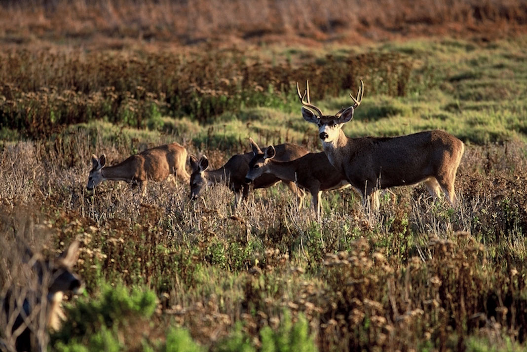
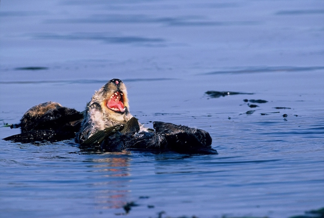
10. Wildlife
Those binoculars will also come in handy for spotting wildlife. Whether on land or in the sea, there is plenty of wildlife in Big Sur. Mule deer are regularly seen along the coast, and endangered California condors are spotted along Highway 1, as they forage for marine mammal carcasses on deserted beaches. The Big Sur Coast lies within the Monterey Bay National Marine Sanctuary, and is part of the California Sea Otter State Game Refuge. Southern sea otters possess the densest fur of any mammal and are regularly seen on the canopy of dense kelp forests. Depending on the time of year, gray and humpback whales are seen off the coast, as well as orcas, dolphins, seals and sea lions.