

The San Juan River holds a long-running record of drawing life to its waters within an extremely arid region of the Utah desert, and today you can add paddlers to the list.
The San Juan consistently supports year-round flow for boating. So obtaining a permit for a trip down the San Juan River, when others have run dry, is a small trifle rafters can appreciate. Various dams on the San Juan, like the Navajo Dam, have tamed seasonal fluctuations and provide consistent residential water for an environment sparse on H2O.

While the rapids on the San Juan River are comparatively mild when considering the roaring waves after its confluence with the Colorado River, the culture recorded in the numerous observable artifacts and the opportunity they provide visitors to time travel are incomparable to many other river experiences in the West. Seeing and experiencing the well-preserved remains of the mysterious Anasazi and their more recent descendants is a precious and invaluable peek into pre-history that is reason enough every paddler should consider a San Juan trip.
-
- Photo: Corryn Smith
-

- Photo: Corryn Smith
Origin story
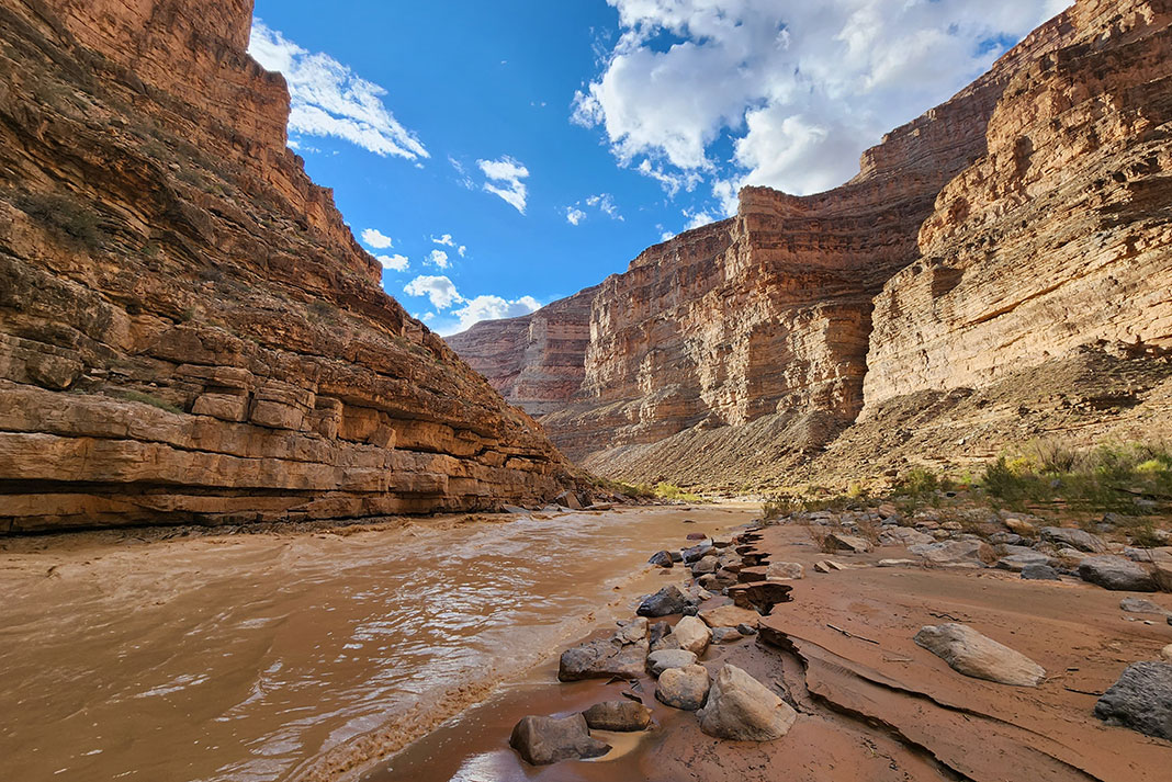
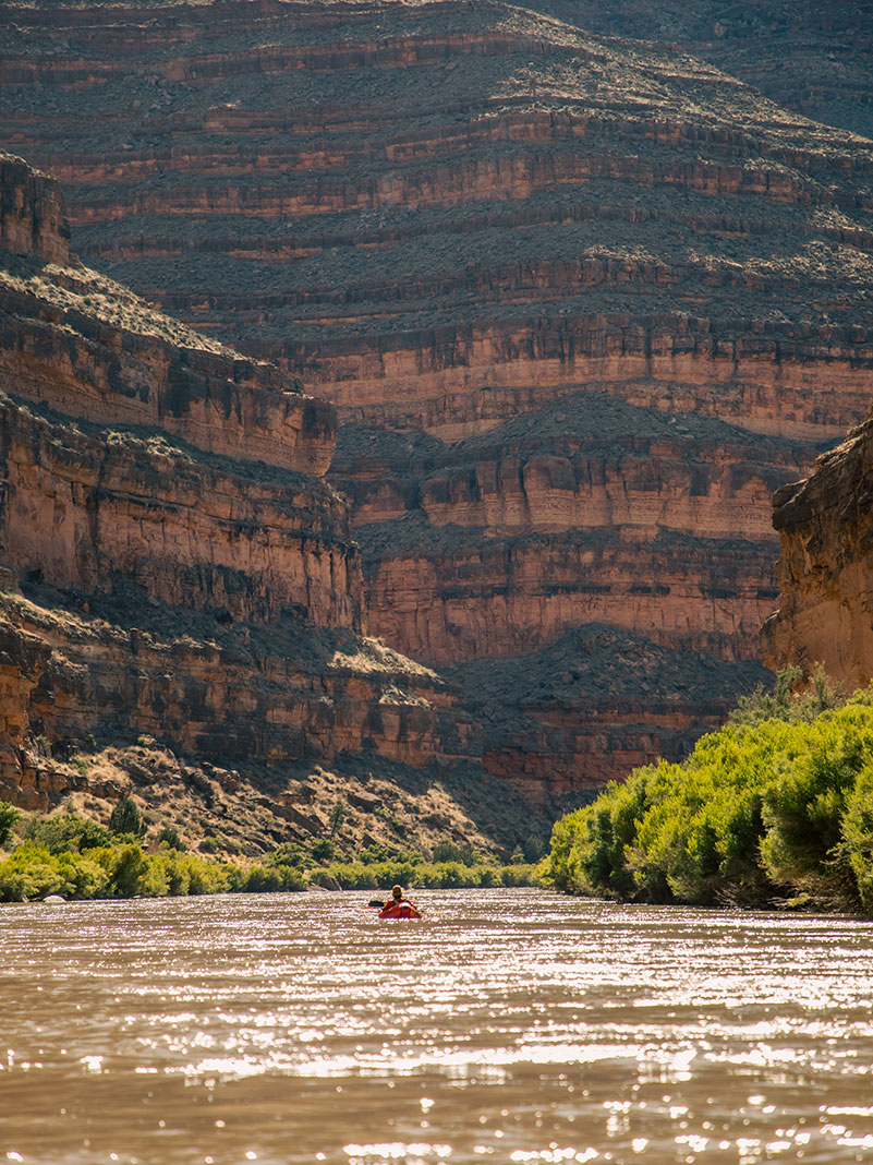
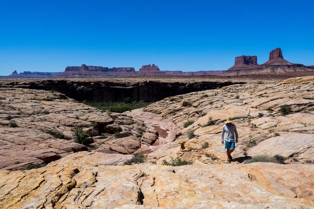
The San Juan River is a major tributary of the Colorado River and forms one of the borders to Bears Ears National Monument. It’s fueled by snowmelt from the arid San Juan Mountains (part of the Rockies) and courses 383 miles before joining the Colorado. Along its reaches are outstanding examples of historic and natural wonders like petroglyphs, ruins, blooming cacti and stacked sandstone that make for some exhilarating jump rocks.
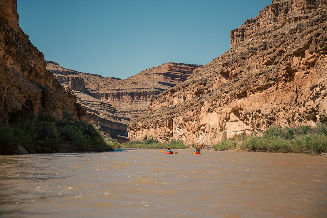
Traveling the San Juan River, rafters weave their way between curving sandstone canyon walls. Layer by layer, a maze of slot canyon labyrinths unfold. Each bend reveals a never-ending stratigraphy of red rocks, sandy beach campsites, heavenly waterfalls, and relics from ancient civilizations, like vertical Moki steps carved around 800 years ago.
Because the San Juan River holds many rich secrets to a 14,000-year human history and is not only located in a hotbed of world-renowned outdoor recreation, but also crosses the landscape in close proximity to sovereign Navajo Nation Reservation lands, permits and access to boating on the San Juan River can seem more highly regulated than other rivers one might have navigated.
How to score a San Juan River permit and plan the ultimate trip
San Juan River permits
To float the San Juan River between the points of Montezuma Creek and Clay Hills (102 miles) in Southeast Utah, a permit is required year-round. Permits are only issued through advance reservation requests and a preseason lottery process.
The peak season of the San Juan River from April 15 to July 15 requires entry in the annual lottery. This is when flows and weather are optimal for most users. You can register for the lottery from December 1 to January 31 through the Bureau of Land Management (BLM).
The process for obtaining a permit outside of the lottery season requires advanced registration through the Montevallo Bureau of Land Management San Juan River permit application guidelines.
The user fee to float the San Juan between Montezuma and Clay Hills for each trip depends on the stretch you plan to paddle, ranging between no fee and $30 per person.
San Juan River access
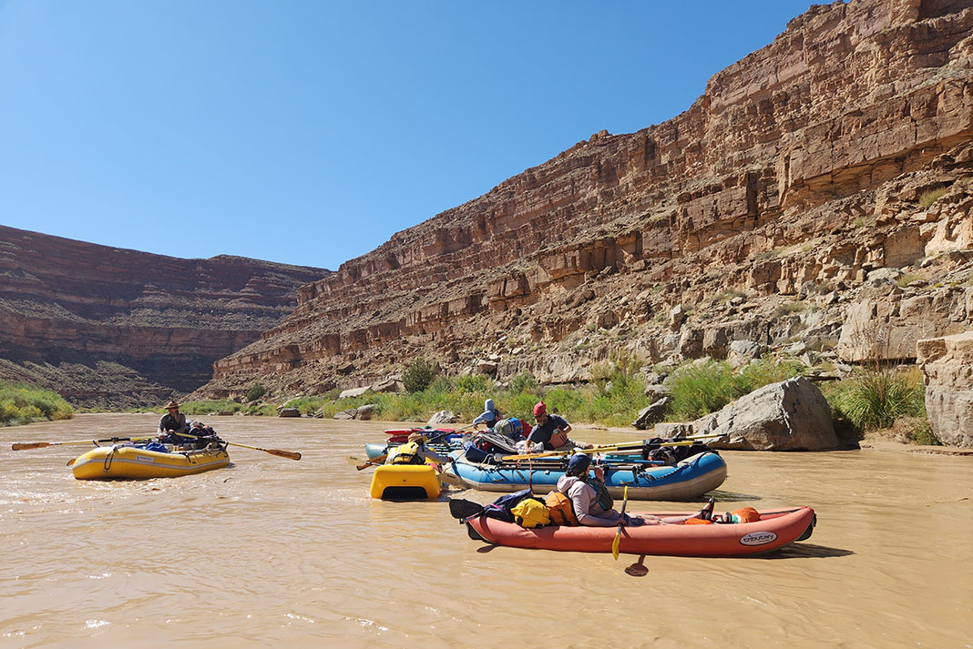
Most trips on the San Juan start at either Mexican Hat or Sand Island and end at Clay Hills.
The trip from Mexican Hat to Clay Hills is 57 miles and takes four to five days.
The stretch starting farther upstream from Sand Island to Clay Hills is 84 miles and takes six to seven days.
River trips on the San Juan can also start farther upstream in Montezuma Creek, making a trip up to 102 miles if you decide to travel all the way to Clay Hills. The Montezuma boat launch is an undeveloped site managed by the BLM and you will need to contact the Monticello Field Office to receive a permit. The Montezuma Creek launch is also within the Navajo Nation and if you plan to camp or hike in this initial stretch you will need to visit Navajo Nation Parks & Recreation for a permit.
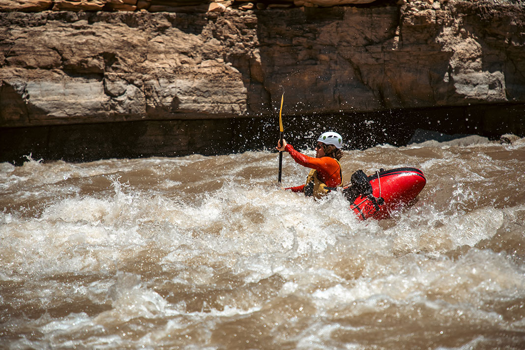
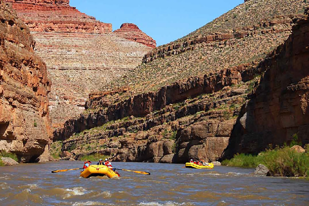
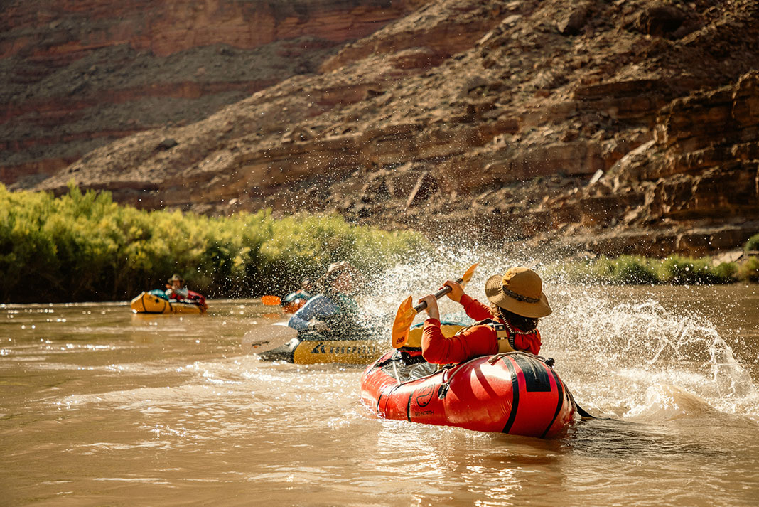
Notable rapids
The San Juan River is fairly mellow in terms of rapids compared to other multiday river trips in the West. For this reason, it makes a great inflatable kayak or paddleboarding trip. The most concerning rapids are Ross (class II) and Government (class III) between miles 63 and 64. A handful of miles above the Clay Hills take-out, shifting sandbars and afternoon winds often kick up.
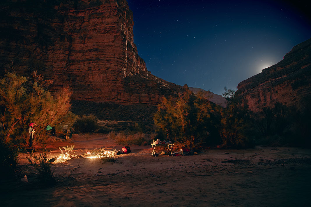
Posting up for the night
Uniquely, camping along the San Juan River from Montezuma Creek to Clay Hills requires at least one campsite reservation, made when securing a permit. If one is not available, the permit will be revoked. Visitors may find San Juan River camping guidelines more stringent than on other rivers and should be sure to familiarize themselves with the regulations well in advance of their river trip. In addition, camping in cultural sites is prohibited including the Butler Wash Petroglyph site at mile 4.2. For further camping information see the Monticello Field Office Bureau of Land Management San Juan River Rules and Regulations fact sheet.
San Juan River flows

Points of interest
Although the novelty of being on any multiday river trip is enticing enough, in particular, the rock art, remnants of Puebloan cliff dwellings and warm water to swim in are attractive features of the San Juan River. River House, a site with architecture of cliff dwellings constructed of sandstone bricks and mud mortar and containing rooms with rounded walls, is a can’t-miss stop.
San Juan River shuttle
Like many western U.S. river trips, the most efficient way to set shuttle on the San Juan is to employ a shuttle service to take your vehicle from the top to the bottom. Wild Expeditions offers shuttle services for the various sections of the San Juan.
San Juan River maps
A river map and guide is a great way to plan and track your way down the San Juan River. The RiverMaps San Juan River Guidebook is an indispensable option now in its fourth edition.
Rafting outfitters
Even though the San Juan is an approachable river in terms of difficulty, going with a guided service is always a fantastic option to skip the lottery system or have a well-versed company handle everything. OARS is a well-known western outfitter and offers trips on multiple sections of the San Juan. Their guided trips cost up to $1,500 USD depending on your trip option.
-
- Photo: Alex Hadik
-
- Photo: Alex Hadik
Know before you go
Paddlers on the San Juan River are required to carry certain equipment. This includes equipment for camp and human waste. See the Monticello Field Office Bureau of Land Management San Juan River Rules and Regulations fact sheet for guidelines before making your trip out to the desert.
Beware: This is flash flood country, which is most common from July through August during the monsoon season. Keep an eye on dry washes, which are the former outlets of flash floods. The San Juan River can also carry one of the highest sediment loads in North America. Keep this in mind when swimming.
We know river time is best with furry friends, but no pets are allowed on the San Juan River. Service animals, as defined under the ADA, must be pre-authorized by the Monticello BLM River Office prior to arrival.
Before departing on your trip, be sure to brush up on best river behavior practices with the Cedar Mesa Visit with Respect guidelines and Leave No Trace principles.
Feature photo: Alex Hadik


