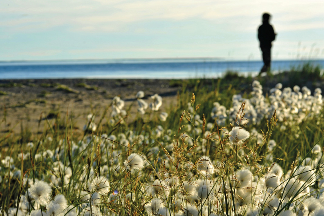
Scrambling through a sea of knee-deep scrub alder and dwarf willow, I scurry to keep pace with Jon’s loping gait. We’re trekking across the rolling taiga into the rapidly sinking sun, and the golden light washes across the mesh face of my bug jacket, obscuring all but the lanky silhouette of my canoe partner. My near blindness and the cloying warmth inside the hood amplify the sound of my panting. At last, I stumble over a rocky rise and my breath catches, half-drawn, in my throat.
Moments earlier, Jon had burst into our campsite where I was hiding with our tripmates, Conor and Kim, from the evening blackfly onslaught behind the screened walls of our tarp shelter. “What is it?” Conor asked, glancing past Jon for signs of a marauding polar bear.
Jon pressed something icy cold into my hand. “It’s what we’ve paddled 35 days to see,” he replied, dropping his arm to reveal the snowball in my palm. “But you have to hurry.”
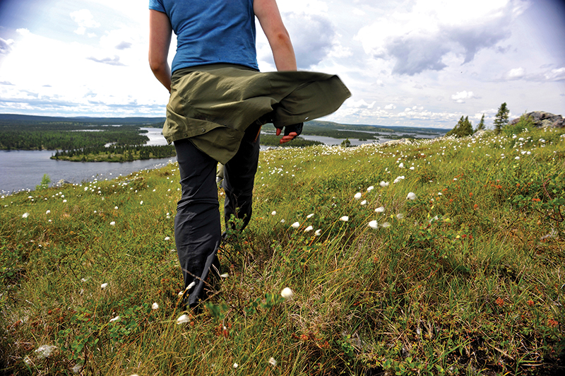
Lush subalpine meadows carpeted in delicate white bunchberry blossoms and a score of other tiny wildflowers tumble down to the edge of a misting precipice. The last rays of sun pour like honey into the deep gorge and spill fully on a thundering avalanche of water. Near the rim of the falls, hidden in shadow for most of the day, a small snowfield clings to the slippery bedrock, irreverent of the early August warmth.
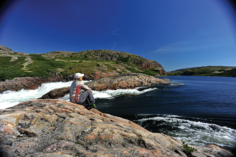
The falls’ cold, billowing mists have formed this remarkable micro ecosystem, a world every bit as sublime as the imaginary Elvish kingdoms of Tolkien’s tales. And yet this spectacular cascade is unnamed on our 1970s-era, black-and-white topographic maps—an unremarkable hatch line where the Nastapoka River doglegs between bald-rock hills on its westerly journey to Hudson Bay.
The falling water whispers a certainty: If this were Banff or Yellowstone, rather than this isolated wedge of northern Quebec, the falls would be among the parks’ star attractions. But up here in Nunavik, the 100-plus- foot plunge is merely an all-but-unknown precursor to Nastapoka Falls, just a day’s paddle downriver, which plummets into Hudson Bay 40 kilometers north of the Inuit community of Umiujaq.
Together, the falls, rapids, valley and headwaters of the Nastapoka River form one of the central arteries of Parcs Quebec’s newest national park, Tursujuq, a 26,100 square kilometer (6.5 million acre) wilderness of taiga, rocky ramparts, swift rivers and crystalline lakes. Designated in 2013, the park is one of North America’s largest protected areas, nearly triple the size of Yellowstone and four times the size of Banff. However, like many parks in the North, Tursujuq is accessible only by bush plane or boat; there are no roads, signs or, for now, marked trails or campsites.
As the sun slips behind a craggy ridge, staining crimson a scarf of woolly clouds, I ponder what park status means for the Nastapoka’s future. Only one other paddling party has traveled our route this summer. Last year, there were none. In five weeks, we’ve seen just four other people—a floatplane pilot and his clients, three American fly fishermen. It’s this isolation, and the sense of discovery it instills, that I’ve come to love most about this place.
Standing at the lip of the falls, with the Nastapoka rumbling beneath the worn soles of my river shoes, I feel like a real explorer.
Reaching north towards the Canadian Arctic like a tattered mitt, with Hudson Bay’s frigid saltwater to its west and Ungava Bay tucked into its thumb, Nunavik is the name given to the vast, roadless region of Quebec above the 55th parallel. It’s also the homeland of Quebec’s Inuit people, who live in 14 small coastal communities forming a sparse perimeter around a hinterland that’s larger than the state of California. Plied by snowmobiles in winter and freighter canoes in summer—and plagued by rapacious insects, unforgiving terrain and savage weather—the interior is empty save a small number of seasonal camps where geese, caribou and fish harvests continue to sustain local families as they have for generations.
“Let Mother Nature be your master,” advises a French Canadian shopkeeper in Radisson, Quebec, when we tell her about our plans to paddle and portage north into this sea of spindly tamarack forests and black spruce bogs. We’ll navigate the confusing mosaics of lakes Bienville and d’Iberville, we explain, before tracing the eastern and northern edges of Tursujuq National Park through the Seal Lakes and, finally, down the mighty Nastapoka River, emerging 40-some days later on the treeless coastal barrens of Hudson Bay’s tidal shore.
Radisson marks the northern terminus of the James Bay Highway, a 620-kilometer-long shoelace of frost-heaved asphalt connecting the Hydro Québec-built town, and the massive hydroelectric complex it services, with the rest of the province. Construction on the James Bay Project’s series of dams, spillways, underground power plants and some 30,000 square kilometers of reservoirs and harnessed waterways began in the early 1970s, and the complex comprised the world’s largest hydroelectric development for a quarter-century. Today, it’s surpassed only by China’s Three Gorges.
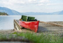
For hardy canoeists, there’s an unexpected upshot to the development. The gravel arteries used to access Hydro Québec’s remote energy outposts also offer a backdoor into the wilderness that, for now, lies beyond the utility’s reach. Our own journey begins on Lacs des Oeufs, a dusty, day-long shuttle from Radisson on the Trans-Taiga Highway. The earth-and-stone barrage at our put-in marks the last vestige of the James Bay Project, and the beginning of Nunavik’s wild and free-flowing rivers.
The shopkeeper’s hazel eyes study my face, checking that I’ve understood her warning. Behind the concern, however, there’s also a knowing look informed by a lifetime spent on the edges of the same wildness and vastness that draw us. Before taking our leave, I assure her that we’re respectfully aware of our position on the bottom rung of Nunavik’s wilderness hierarchy.
Three weeks later, as a wet and blustery headwind saps the energy from our sodden limbs and the heat from our pruney fingers, even that humble foothold feels tenuous. The only upside to the squalls and near-freezing temperature that have dogged much of our trip is that they offer fleeting respite from the hordes of insatiable blackflies, mosquitoes and bulldogs (ping pong ball-sized deer flies) that coexist on the taiga in July. Head nets, heavy-duty bug dope and psychological resilience are essential. Still, there are moments when my guard is down—and breezeless mornings, unfortunately, when so are my pants—and sanity is as elusive as sunshine.
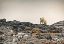
Paddling into the lee of a mop-topped island, Jon and I pause for a moment, thankful to escape the wind-driven rain. Eager for a distraction from the monochromatic lake views, I search the shore for signs of wildlife. We’re hoping to catch sight of what we’ve been calling Nunavik’s “Big Five,” a list of hallmark species that includes wolves, bear, musk oxen, beluga whales and—rarest of all—kasagea, the shy and solitary freshwater seal.
Once again, I’m disappointed. So far, the only other creature we’ve seen, aside from our own soggy and bedraggled forms, is a sky so animated and malevolent I could swear it’s alive.
References to a unique species of freshwater seal, more than 150 kilometers removed from the ocean, in the Seal Lakes date back to the accounts of early 19th century fur traders. Isolated and enigmatic, the seals remained something of a mystery for nearly 200 years. Then, in the early 1990s, Hydro Québec eyed the narrow gorges and churning falls of the Nastapoka, surveying the river for a new waterpower project. Central to this plan was an expansive reservoir that would inundate the Seal Lakes.
In response, the local Cree people supported studies to refute Hydro Québec’s claim that the seals were widespread in northern Quebec lakes. Researchers confirmed that not only is kasagea confined to the Seal Lakes and two neighboring waterways, but that the landlocked species—geographically isolated since the last ice age—is genetically distinct from its cousin, the saltwater harbor seal.
Under pressure from environmental scrutiny and enormous development costs, Hydro Québec ultimately shelved the Nastapoka project. But the bell had been rung. When Nunavik Parks began working with the Inuit and Cree to draw up plans for a co-managed park extending east from Umiujaq to Lacs à l’Eau-Claire (Quebec’s second largest lake, formed hundreds of millennia ago by twin meteor strikes), the locals fought to have the proposed boundaries expanded to include the Nastapoka and 95 percent of its watershed, including the Seal Lakes.
Tursujuq National Park, along with two existing Nunavik parks and two more parks planned for the region, represents a big step towards the goal of protecting 30 percent of Quebec’s lands above the 55th parallel from development. As a new wave of private mining interests clamor to stake their claims in the area’s mineral-rich bedrock, conserving these ecologically intact areas is more important than ever.
Lacs des Loups Marins, the French name for the Seal Lakes, directly translated is Lakes of the Sea Wolves. The Francophone appellation for the lakes’ secretive seals has captured our imaginations since the beginning of our journey. Fisheries and Oceans Canada puts the lakes’ seal population somewhere between 50 and 600 individuals. The possibility that we may not see a single specimen is unthinkable.
When at last we veer our canoes from their northerly pilgrimage and turn west down the larger of the two lakes, glassy calm on this sunny morning, I’m half hoping a seal will leap over our bow.
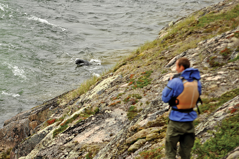
Conor spots it first: a shiny, dark sausage draped atop a sun-warmed boulder. The animal slips into the water as we edge nearer, then reappears, warily circling our canoes from a safe distance. Kasagea’s wide, dark eyes stare out from a round and whiskery face. We’re ecstatic—the first of our Big Five!
In the next week, we’ll spot several more freshwater seals. At a huge dragon’s tongue rapid, the most gregarious hurls itself again and again into the crashing waves, seemingly for the pure enjoyment of bobbing cork-like through the haystacks. Its amusement is ours, and we linger over lunch until the seal makes a final pass and disappears into the roiling current.
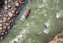
Below the Seal Lakes, the Nastapoka swells, hurtling over ever- larger cataracts, each rapid more astonishingly beautiful than the last. The sinuous, sandy ridges of glacially deposited eskers give way to high rocky domes, through which the river burrows undaunted. The sparse tree cover grows ever thinner, until not even the wizened black spruce can make a stand. Stripped bare of soil and superfluity, the land seems to open itself to our passage. Where weeks before we had staggered under back-breaking loads through swampy forest, snagging shouldered canoes and following only compass bearings and intuition, we now stroll easily, often spotting the end of the portage from its beginning.
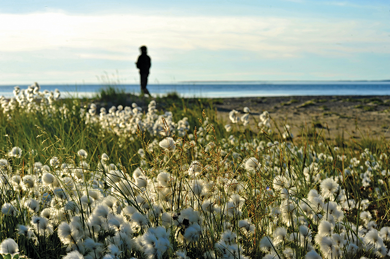
Our wildlife sightings continue down the Nastapoka River: a mother black bear and her two cubs on a rocky ridge; a tawny wolf sauntering along a sandy beach; two shaggy musk-oxen shuffling across the grassy lowlands at the river’s mouth. And, at our final campsite on Hudson Bay, windbound and cowering from a cold drizzle that’s somewhere between fog and rain, we spot the white crescent backs of beluga whales spiriting south along the shore.
Tursujuq National Park’s gleaming new visitor center rises like a mirage beside the lone road linking Umiujaq village with its airport. We’re walking the pavement back to our campsite after a dash to the Northern Store for post-trip ice cream bars, when a Nunavik Parks pick-up slows to a stop. Our brightly colored waterproof camera cases give us away as paddlers, and the truck’s driver, Michel Haarc-Morissette, is quick to offer us a tour of the not-quite-finished building.
Soon we’re studying maps, admiring the park’s fleet of shiny yellow sea kayaks, and nodding with approval at shelves piled high with new, top-of-the-line paddling and camping equipment in the center’s dedicated outfitting room. Michel tells us his role is to develop tourism products for the fledgling park, identifying key attractions and partnering with local Inuit guides and boat drivers. Beginning in 2016, Tursujuq will offer summer sea kayaking packages and snowmobile-supported winter trips in the spectacular estuary of Richmond Gulf, as well as freighter canoe excursions to Nastapoka Falls—coastal areas Michel refers to as the park’s “front-country.”
Our 730-kilometer trip places us among the park’s few backcountry visitors, and Michel is curious to hear about our experiences in Tursujuq’s furthest flung reaches. We relate our encounter with the acrobatic seal, and the black bear that watched us drift beneath his riverside perch. We describe the scenic beauty of the Seal Lakes, and navigating the challenging class II–III rapids of the Nastapoka. But there are some experiences I don’t share.
I don’t tell Michel about the evening kasagea visited the pebble beach just beyond my tent; or the night I crept out of my sleeping bag after midnight to watch the northern lights dance like austral eelgrass across a pure-black sky, framed by the river’s steep-walled valley. I don’t tell him about the bald-rock peak from where you can gaze west across the foam-streaked blueness of Hudson Bay to the islands of Nunavut, and east across the rumpled green-and- grey carpet of northern Quebec. And of the perfect sunset Jon and I savored from the dewy meadows above the nameless falls, I breathe not a word. Some things cannot be told, only discovered.
Virginia Marshall is the former editor of Canoeroots and now the editor of sister publication, Adventure Kayak.
 This article originally appeared in the Canoeroots Early Summer 2016 issue.
Subscribe to Paddling Magazine and get 25 years of digital magazine archives including our legacy titles: Rapid, Adventure Kayak and Canoeroots.


