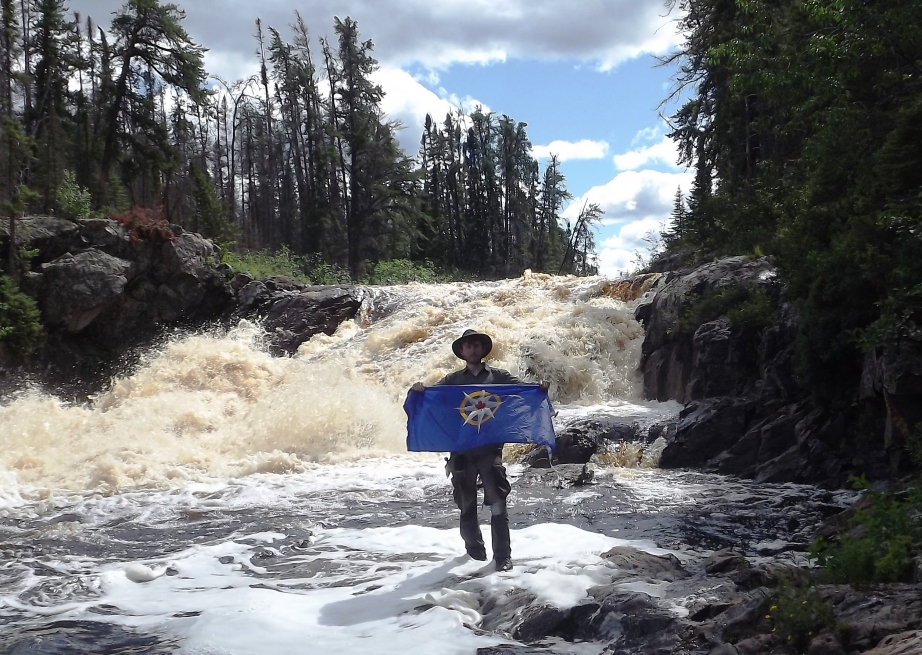
These days, it’s not often that explorers change maps. Even less common that the vehicle of discovery is a canoe. But that’s just what happened in 2012, when Adam Shoalts discovered seven previously unknown waterfalls, accidently paddling over the edge of one in the process.
This past summer, he returned to the 100-kilometer long Again River, which straddles the border between Ontario and Quebec, with funding from the Royal Canadian Geographical Society to properly document his discoveries.
Shoalts, a McMasters University PhD student, says the same things that have always inspired explorers motivate him. “The love of adventure, the thrill of discovery, my innate curiosity and a thirst for knowledge” is what keeps him going, he says.
While maps of the Again River did exist prior, they were based on aerial images taken in the 1950s and weren’t entirely accurate. Returning to document his discoveries meant measuring the height and exact location of each waterfall, information that Shoalts will then use to correct the existing topographical maps of the area.
“I had originally thought this might be possible without the need of a second expedition—but the satellite imagery was so poor that it proved impossible to positively distinguish each waterfall from the many rapids and the existing topographic maps were equally inadequate for this task,” he says.
His journey took him back to a varied landscape—from flat, boggy lowlands dominated by black spruce to rocky hills, cliffs, and small canyons with cedar, pine and birch trees. The river itself is mostly shallow and rocky.
“I like to joke that I spend more time dragging my canoe through swampy forest, thick bush or across muskeg than I ever do paddling it,” Shoalts says. Without trails in the thick forest, portaging a canoe overhead is not feasible and dragging is typically a much better option, he adds. “Bill Mason famously remarked that anyone who tells you they enjoy portaging is either a liar or crazy—I guess that makes me crazy.”
Shoalts comes by his passion honestly, having spent a lot of time in the outdoors as a child. “My backyard was literally a forest. My first adventures were exploring those woods with my dog and my twin brother.” At the age of 13 he read Farley Mowat’s novel Lost in the Barrens and he was hooked on the ideas of wilderness adventure. Studying the history of exploration and Canadian geography more seriously enabled him to transition to serious geographic expeditions with concrete objectives.
For the blood and sweat he left behind, Shoalts leaves a legacy of accurate maps of the Again River. The Royal Canadian Geographical Society will also be publishing Shoalts’ official report, the only description of the river ever written.
Shoalts hopes his expedition will inspire other would-be explorers. “I do hope, in some small way, that the expedition helps more people realize that the age of exploration is not over and that there is still lots to explore in our world,” he says.
This article first appeared in the November 2013 issue of Paddling Magazine.


