Home Blog Page 560

Boat Review: WaveSport’s Transformer

Photo: Rapid Staff
Boat Review: WaveSport's Transformer

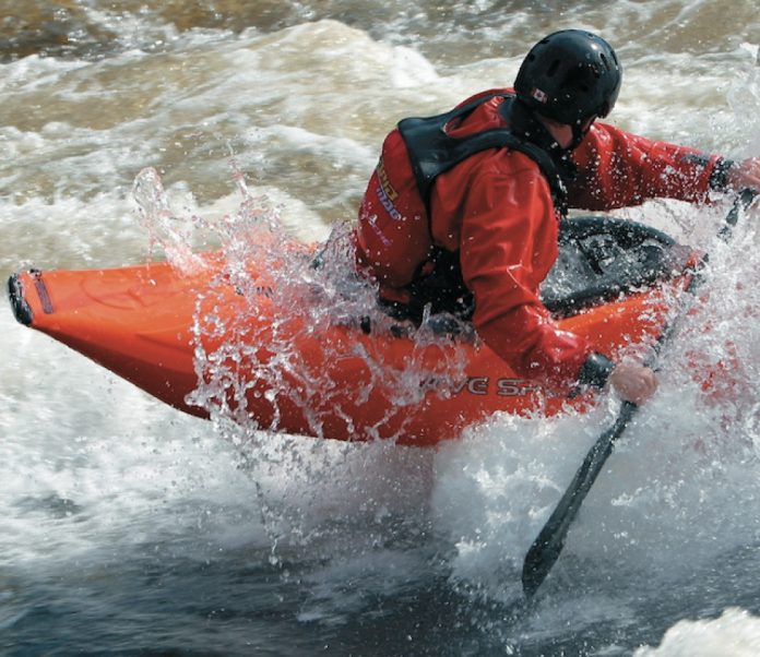
While other boat companies are racing to develop slicy, hole boats and big air, wave boats, Wave Sport has released only one new model for 2003: The Transformer. In its raw state the Transformer comes in four sizes and is a mean-looking aerial spud boat. But just like the original Transformers, there is more than meets the eye. The Transformer mutates in length with the three interchangeable tip options—the stock bumper, and five-inch and eight-inch wings. A little high school math and you realize you have 15 possible performance combinations, which Wave Sport says allow you to adapt to different environments. If it works, the Transformer is without a doubt the biggest step toward offering one boat to do it all.

The Means to the ends

Our 6’4″ T3 caught attention on the river because it was so big. At 60 gallons, the T3 is the same size as a Super EZ. The T2 holds 55 gallons and even the smallest version, the T1, has more volume than the EZ. The pudgy stern looks huge compared to the scooped out bow. We asked designer Eric Jackson why the stern has so much more volume than the bow and he was quick to point out our mistake.

“The bow has more volume than the stern,” he said. “This boat is balanced so that with the seat neutral there is 52.5% of the volume in front of the center of gravity and 47.5% of the volume behind your center of gravity. The stern looks big because you have to account for huge amounts of volume in the knee area.”

The Transformer T3 is extremely wide at 26.75 inches. According to Jackson, the width provides lots of support on the water when bouncing. “When you start the bounce it doesn’t sink in as far, starting you off higher up. You’ll also notice that the planing surface is huge and the rocker is set back to offer an ideal pivot point for the ollie—the bow comes up high so when you push it down your entire boat leaves the water easily.”

Tiggers will like it

If the Transformer did nothing else it’s worth buying just for the bounce. Carve to the top of a wave, point downhill and this boat is air- borne. No fancy heel push/knee pull action required. It just bounces. The trick isn’t to get the boat off the water, it’s keeping it down. Your first few surfs on a fast wave will have you giggling and just trying to hang on. It is a very new and very addictive feeling.

Getting air in the T3 doesn’t require a huge feature. This is where we think the large volume stern is helpful. Here’s our theory: Like pulling a cork under water and letting it pop to the surface, when you carve to the top of a wave the buoyant volume in the stern gets trapped in the foam pile and then squirts you forward into the trough. This little push pro- vides the momentum you need to get the Transformer aerial on small breaking waves.

Good-bye wave carving, hello spins

The Transformer is extremely loose on a wave and is as happy grinding as it is front or back surfing. The edges are far enough out of the water that snagging in the current is not an issue. Front surfing the stock Transformer is twitchy. Besides the fact it is hopping all over the place, the huge planing surface wants to spin if you’re not aggressively carving. Add the tips to the stern and it settles down, stops bouncing, tracks better and falls into a more useable category of boat for most people—at least at first.

The Transformer is very slow edge to edge, simply due to the extreme width. You have to concentrate on getting the boat way up on its side and carving off the front edges to perform vertical blunts and backs stabs. Add the tips and like longer boats, the Transformer will let you carve off the stern or blast down and settle in the trough.

It’s in the hole

The Transformer is very smooth and stable spinning or cartwheeling. We thought it would be difficult to stay ahead of the rotation, yet it seemed to cartwheel slowly and predictably. It’s like cartwheeling an inner tube with some ends to let you know there is a front and a back. The tube keeps you rotating smoothly and the bow and stern get you started.

Without the tips on the Transformer, it was difficult to perform rotational moves such as the tricky-whu or pirouette. When you begin to rotate on a vertical plane around the boat, it tends to fall back into the hole. We asked Eric Jackson about this and he agreed. “Tricky whus are super difficult without the long tip on the stern,” he said. “The long tip provides the length reaching the green water and provides the extra balance you need to do the pirouette.”

Bolt on the eight-inch tips and you have a completely different boat. It’s 100 times easier to bow stall and they make stern squirts possible. The vertical stability of the tips turns tum- bling into traditional controlled cartwheeling.

The Transformer loops with ease. Once the nose is down, the boat is headed up. The high volume central area makes the T3 super retentive, and the short length makes it easy to throw over your head. On a good foam pile, aerial loops are easier than three point cart- wheels.

The ends

Don’t jump in the Transformer for five minutes in flatwater and think you’re going to like it. You’ll feel right at home in the posh F.A.T. 3.0 outfitting but you’ll feel lost in the volume. Get this boat to a play spot however and the Transformer is wonderfully retentive, cart- wheels smoothly, hops like water on a hot skillet, and loops like a drunken circus clown.

Does it change from bouncy to slicy? Not exactly. There is too much volume to make it truly slicy. But the tips do work and make a huge difference to the performance. The tips tame the Transformer down and add vertical stability. They make a full-on bounce boat perform more like a boat most people are used to paddling. Switching the ends allows you to tune the Transformer to your skill level and the move of the day. If the fun of transforming your boat isn’t reason enough to buy one, you might be happy to know that Wave Sport offers the Transformer for $200 less than last year’s models.

Specs

Transformer 1

Length: 70 inches
Width: 25.25 inches
Depth: 12.25 inches
Weight: 30 lbs
Volume: 49 gallons
MSRP CAD/USD: $1495 / $999

Transformer 2

Length: 72 inches
Width: 26 inches
Depth: 12.75 inches
Weight: 32.5 lbs
Volume: 55 gallons
MSRP CAD/USD: $1495 / $999

Transformer 3

Length: 76 inches
Width: 26.75 inches
Depth: 13.25 inches
Weight: 35 lbs
Volume: 60 gallons
MSRP CAD/USD: $1495 / $999

Transformer 4

Length: 80 inches
Width: 27.5 inches
Depth: 13.75 inches
Weight: 37.5 lbs
Volume: 67 gallons
MSRP CAD/USD: $1495 / $999
Screen_Shot_2015-07-13_at_2.49.36_PM.pngThis article first appeared in the Winter 2002 issue of Rapid magazine. For more great boat reviews, subscribe to Rapid’s print and digital editions here.

Trips: Sturgeon Falls in Winnipeg, MB

Photo: Ryan Creary

For some time rumors have been spreading of a mysterious and fantastic playspot in the province of Manitoba.

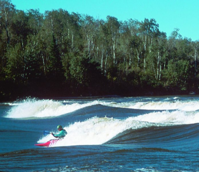
As unlikely as that may sound in a province better known for its wheat farms than its whitewater, the rumors happen to be true. Sturgeon Falls on the Winnipeg River is a playspot to rival the best in the country offering safe plays for paddlers of all skill and confidence levels. It’s located only ninety minutes east of Winnipeg, and about an hour north of the Trans-Canada highway, just a slight detour on a cross-country tour. 

The characteristics and features of Sturgeon Falls parallel those of Lachine Rapids in Montreal. Both are wide rivers with many good playspots and the odd powerboat pass- ing by. The waves at Sturgeon Falls are formed by a rocky shoal situated at a narrow point in the river up-stream from Nutimik Lake. Although Sturgeon Falls has only ten feet of gradient, it has fifteen waves and holes for paddlers to select their own kind of ride. There is an eddy on the river right side providing access to most of the waves making for a difficult decision every time you paddle back to the top. There are six to ten foot glassy waves, big trashy holes and friendly front surfs. Sturgeon has it all.

The size of the waves depends on the water level but even at low flows there are still some nice spots to play. If you are looking for higher flow rates, your best bet is sometime in the middle of June when the snow feeding the Winnipeg River from the north has melted and is on its way south. The water tends to be pretty cold until the end of June and even early July, so dry tops and skullcaps are recommended.

Keep an eye on the water levels online at www.lwcb.ca/waterflowdata.html. Click on the link for Winnipeg River in Manitoba under Water Levels & Flows Primary Sites. This will bring up three graphs providing information on the outflow at the Slave Falls Dam, the lake level at Nutimik Lake and the outflow at the Seven Sisters Dam. The blue line represents the actual water level and ends at the most recent reading. The green and red lines represent where the river is predicted to be with red representing the extreme edge of those predictions. While Sturgeon Falls is worth going no matter the water level, high water starts when Nutimik Lake is at 275.2 metres (903 feet) and flowing at 1200 cubic metres per second (40000 cubic feet per second).

To get to Sturgeon Falls, travel on the Trans-Canada Highway to West Hawk Lake and turn north on Highway 44. Turn north again at Highway 307 toward Seven Sisters Falls. Travel on Highway 307 until you get to Nutimik Lake Campground and follow the signs for the boat launch and campsite. From the boat launch, Sturgeon Falls is a one kilometre paddle to the right.

There are many other users of the area as it is part of Whiteshell Provincial Park, so keep an eye out for fishing boats and day users. During the summer season, a small day use fee is payable at the front gate of the park. Camping is abundant in the campground but food is lim- ited in the area, it is best to come ready to cook for yourself for the duration of your stay. A full breakdown of camping prices is available on the park’s website. There are showers and washroom facilities in the campground though some are locked during the off season.

Whether you are a pro paddler looking for a secret Jedi training ground with big trashy holes and grinding steep waves or a beginner looking for a nice friendly surf break you will find Sturgeon Falls has a little something for everyone. Next time you’re driving across the country stop and surf Manitoba! 

Screen_Shot_2016-04-18_at_2.49.09_PM.pngThis article first appeared in the Fall 2002 issue of Rapid Magazine.
 

If Noah Had Been a Playboater…

Photo: Rob Faubert

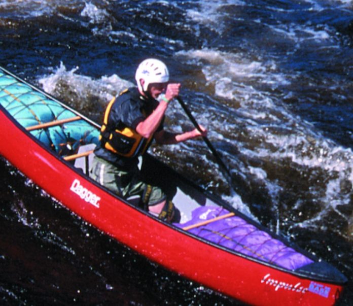
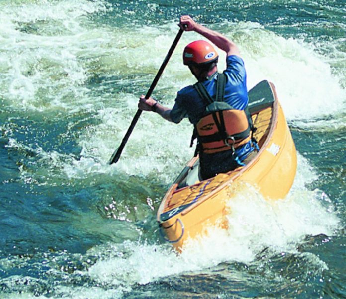
Forty days and forty nights without having to shuttle would have been swweeet. Instead, Noah pretty much set the design standard for displacement hull boats. Good or Bad? It all depends on your perspective.

I’ve spent the last few years convinced and trying to convince everyone else that short, planing hull whitewater canoes are best. Period. Well, maybe I’m getting soft but there may actually indeed be merit to those honking big, twelve foot solo boats.

The objective of a planing hull is to surf on top of the water rather than in it. The faster the wave the less displacement there will be and therefore the looser the boat will feel. Small planing hull canoes such as the Dagger Aftershock or Pyrahna Spanish Fly have very flat bottoms.There is no rocker in this flat section. Instead, near the ends of the boat, the hull breaks away abruptly, slanting up to meet the deck at the end of the canoe. This allows the boat to slide to a sideways position on a wave rather than carve across it. The bottom of the hull is actually concave at the sides making a very sharp chine. This is referred to as a release edge. It makes the hull feel loose when sideways on a wave.

The goal of a displacement hull canoe like the Dagger Phantom, Ocoee and every other open canoe out there is completely different. Some canoes such as the Esquif Detonator have flat bottoms but also have rocker, so are still displacement hulls. A displacement hull tracks well, meaning it is resistant to turning.These boats cut through the water making them fast but they must carve their turns to some degree.This ten- dency to travel in a straight line will be affected by rocker, length and chine. Rocker increases a boat’s turning ability as does a shorter length and harder chines.

Since the big flood, canoes have been fairly multipurpose. Sure, some are better at one facet of canoeing than another, but at least each canoe design had the possibility to perform all the manoeuvres that were known as canoeing. As canoe designs changed it was reasonable to expect that they were generally improving, becoming more manouvreable and lighter. Eventually, planing hull technology was incorporated into an open canoe. This would have happened a lot sooner if Noah had built a flat bottom scow instead of a displacement boat. Suddenly, a whole host of new techniques and manoeuvres were achievable in a canoe. Unless you had to move a whole lot of animals, why would anyone want to paddle something that resembled the ark?

Well there are a couple of reasons. Big boats track well, have good hull speed and are really good at punching holes. If you watch one plowing through a hole you can see the stern of the boat sinking into the green water of the downstream current as the bow pierces the hole. This downstream current pushes the canoe through the foampile. Compare that to a short boat that has to climb up the face of the hole. If the stern is still in the green water, the boat will be at such an angle that the current is actu- ally pushing the stern down. Backender!

Big canoes make rapids and waves seem smaller. I’m guessing the Ark was really big. Their large size, buoyancy and speed allows them to plow through many obstacles that a shorter, more manouvreable boat would have to dance around. Some of the highest boofs I’ve heard of an open canoe attempting were done in big 14 foot solo boats. Kind of the same rational that makes a big car safer in a crash.

WE NEED MORE THAN ONE WHITEWATER PLAYBOAT

So now there are two distinct kinds of whitewater canoes vying for a paddlers attention, roofspace and bankbook— planing hull and displacement hull canoes. Typically what happens is a canoeist wears out or outgrows their old displacement boat. They start thinking about a new boat. Which one is best? They try a few and using experience as criteria determine that the new plastic planing hulls are ugly, slow and wet. No argument from me on those points. It is true that short, flat planing hulls are slow on flatwater. But if I wanted to enjoy the flatwater, I’d paddle a flatwater boat! Now I must admit that if there is flatwater involved and you’re the only one in a freestyle playboat, then a faster displacement boat might be okay.

Most freestyle canoes are wet to paddle, meaning water splashes in more easily than in those massive 13 foot super-tankers. When freeboating, taking onwater is fairly irrelevant since each ride in a hole or on a big wave leads to emptying the boat anyway. Who cares whether you’re emptying a little water or a lot. The only difference is that the small boats are light and easy to empty quickly. If your goal is to stay dry as you descend the rapid, go and buy a short displacement canoe with a bulbous nose that will ride over every wave. It will be great for all those front surfs and eddy turns.

So why are canoeists satisfied with displacement hulls? Kayakers moved on to new and exciting possibilities years ago. First time kayakers who just got their new boat and haven’t even taken the price tag off yet, are working towards doing moves with killer names like blunt, donkey flip, tricky whu and pan am.Your average experienced canoeist is still trying to nail a back surf. Maybe canoeists don’t want to do flat spins on a wave because their displacement hull boats aren’t designed to do that. Or are the canoes not designed to do spins because canoeists don’t know they can?

The answer just might be to admit that we need more than one whitewater playboat. A displacement boat for those occasions when you don’t want to play the river, you just want to run it. And a planing hull canoe to open up new learning opportunities and add fresh excitement to your favourite local rapids.

Paul is a Team-Dagger paddler, freelance cartoonist and wishes to sincerely apologize to his father, the late Bill Mason, for not mentioning the prospector canoe in a previous article.

Screen_Shot_2016-04-18_at_2.49.09_PM.pngThis article first appeared in the Fall 2002 issue of Rapid Magazine.
 

Smart Turns: Water Reading for Eddy Exits

Photo: Rapid Staff

Discuss eddy turns with paddlers and you may hear suggestions like: To exit an eddy pool, angle your canoe ten degrees to the eddy line. Others may tell you: Point upstream for fast current, and open your angle for slow water. These conventional methods of choosing boat angle may work for some eddies, but mysteriously let you down for others. So, is there a way to determine the exact angle to exit an eddy? One guaranteed to work whether you paddle a canoe or kayak in class I or V whitewater? You bet there is, and you won’t need a degree in geometry or one of those protractor thing-a-ma-gigs to figure it out. The secret for eddy turns is to read the water and find wave troughs that meet the eddyline. Then, set your boat angle crossways to the trough and surf it out into the downstream current. Water reading is all about finding helpful river features to make a manoeuvre easy every time. 

Water Reading

Reading water is the ability to see the different currents and waves that make a rapid. Use this skill to place your boat onto the most helpful currents and waves to assist a manoeuvre. For the eddy exit, look for a wave trough that meets the eddyline and angles downstream away from the eddy pool. Larger and stronger waves are usually at the top of the eddy where the eddyline is narrow and easier to cross. Smaller, more forgiving waves may be downstream of the top of the eddy but to get on them you will be forced into crossing a wider boil line.

Surfing the Trough

Think of waves as waterslides to move your boat. All waves have a high point and a low point. By sliding or surfing your boat downhill from higher to lower water you can move with less effort. Surfs can also move you side to side much like a ferry. Surfing is the key to exiting an eddy. By literally falling off the eddyline and into a wave trough, you can surf away from an eddy pool. The surf lasts for just a moment, but it has the ability to launch the canoe out into the downstream current saving you the effort of accelerating your boat. 

Choose the Right Angle

Choosing the best angle to exit an eddy depends on the trough you have chosen to surf out to the downstream current. Imagine a line drawn down the middle of the wave trough beginning at the eddy line and stretching out into the current. Study the water carefully; seeing the trough line will determine the boat angle needed to leave the eddyline. To peel out into the current, paddle your boat into the trough at a perpendicular or ninety degree angle to the trough line. No matter how strong the current, always set your angle crossways to the trough. Now hang on as your boat surfs off the eddyline and into the downstream current.

Reading Trouble?

Having trouble with eddy turns is rarely the fault of strokes, and more likely a difficulty with reading water. Ask yourself: is the boat…. 
  • Angled too much? If so, this will cause the boat to turn too suddenly preventing it from surfing out to the downstream current. Flips are common when the canoe is angled so much it is sideways to the wave trough. Try again pointing your boat across the trough line.

  • Angled too little? If the angle is too small, the canoe will surf back to the eddyline. On your next attempt, look again for the trough line and increase your angle to ninety degrees to the wave trough.

  • Paddling into the wave crest? Basically, this hump of water will push the canoe backward into the eddy. Better to aim for the wave trough and drop out of the eddy and into the depression of the trough and surf out to the main current.

Reading water allows you to tap into the power of the river and use it to move your canoe. Surfing wave troughs can make peel outs easier and faster while making your turns look smooth and effortless. Choosing an exit angle of ninety degrees to the trough line is an easy and fun way to surf out of an eddy pool. Give it a try, it works every time.

Andrew Westwood is a frequent contributor to Rapid Mag, OC slalom competitor and an instructor at the Madawaska Kanu Centre.

Screen_Shot_2016-04-18_at_2.49.09_PM.pngThis article first appeared in the Fall 2002 issue of Rapid Magazine.
 

Re-Actionary of Fear

Photo: courtesy flickr.com/rcsj

Fear. Whitewater paddling is full of it and we all feel it sooner or later. You can die paddling, people do. But there is fear you should have and fear you can live without. Fear you should feel is along the lines of; oh my god this is class V and I can’t roll, or this large sieve seems to be sucking me under. In cases like this you should actually feel; CLASS V, CAN’T ROLL, ROPE, ROPE FEAR or LARGE SIEVE, BACK PADDLE, BACK PADDLE FEAR!

However, it has been my experience that many paddlers psych themselves out before they even hit the river. Some factors influencing how one feels before putting on are: insecurity; lack of skill or experience; and trash-talking boaters.

Insecurity is something perhaps you should see a shrink about.

Lack of skill and experience requires instruction, practice and time on the river.

Trash-talking boaters like to sit around and talk about this run and that. Stories of so-n-so getting trashed so badly or how this run is so steep are quickly exaggerated. There is enough natural fear without certain loud mouths amplifying it unnecessarily. You’re picturing things like holes the size of Texas. You don’t want to paddle into a Texan hole. Hell no! After a sweaty night of dreaming about a Jalapeno hell you wake up to your buddies offering you a breakfast burrito. “No way man, this ain’t Texas!” you scream. “I’m not going to die!” 

Then you’re putting on the river, the river of salsa. Your hands are shaking, your bloodless fingers are cold and stiff. The rand on your skirt seems tighter and for the first time since that glorious day you learned to roll you wonder if you can get out of your boat. Funny, you think, you are both scared and wearing a skirt.

WHAT YOU’RE AFRAID OF ISN’T PADDLING, IT’S FEAR ITSELF

Beware of the big fat liars. People who think that what they do isn’t for everyone; people who think that because they’ve run it you shouldn’t. You ask a local “So what’s this run like?” His reply “Oh my god, it’s this full-on colon purging run that never ends. What boat are you paddling?… Oh that’s no good….”

You have to ask yourself can this jackass even paddle? I mean look at him in his cover-alls playing his banjo. Locals tell you tall tales because they want to believe they are special. Their rivers are tougher than yours. But hey Billy Bob, things are tough all over.

Fear is a great motivator but it is a slippery slope. Many a river isn’t paddled due to pre-river anxiety and that’s a shame. I am not saying don’t be afraid, I’m saying don’t listen to terrifying tall tales, trash-talking fools and lying locals. Save your energy for the actual run. Play safe. If you get scared, you can almost always walk. If you still manage to get trashed, who hasn’t been trashed? So you get worked, so you swim, so you smash your face. Is that what you’re really worried about? Some stitches?

No, what you’re really afraid of isn’t paddling, its fear itself. Like when I paddled into Iron Ring at 14… 

Screen_Shot_2016-04-18_at_2.49.09_PM.pngThis article first appeared in the Fall 2002 issue of Rapid Magazine.
 

Skills: Shifty Movies

Photo: Scott MacGregor
Skills: Shifty Movies

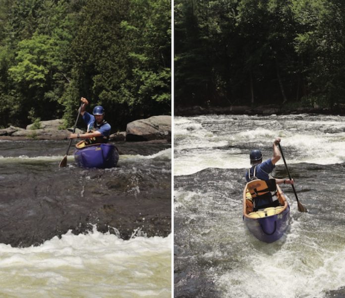
In bad movies, shifty characters move from side to side, eyes scanning for opportunities to gain any advantage and get ahead—just like a good canoeist! Quick and deceptively subtle shifts left and right allow canoeists to maintain their forward momentum and orientation while dodging rocks, holes and breaking waves.

Shifts are not the same as turns. In a turn, you point the bow of your canoe where you want to go and then move your canoe in that direction. During a shift, your hull slides sideways to move around obstacles, so your bow remains pointing downstream.

For quickly sneaking around rocks and skirting holes, shifts are much easier than turns for two reasons: One, they are faster and require fewer strokes. Two, they keep your canoe parallel to the current. moving with the current avoids the danger of broaching on rocks or bridging your hull over two different currents which could result in your canoe spinning out of control.

Shifts are performed by holding your paddle vertically in a stationary draw, pry or cross-draw. Feather the blade so that the leading edge points in the direction you’d like to travel. Water striking the angled blade will provide the force necessary to deflect the canoe to the side. In a solo boat, position the blade ahead of your knees. This forward paddle placement will cause the canoe to drift on an angle, instead of pivoting, as it continues its forward glide.

For the water to exert force on the static paddle blade, your canoe needs to be moving faster than the current. If you hold a shift too long, your canoe will lose momentum and the shift will lose effectiveness. Throw in some forward strokes to keep your speed up.

To help your boat move laterally across the current, throw in a little boat tilt opposite to your shift. This can be very subtle. Just tilt the boat off level, releasing the chine so water can move freely underneath.

Shifts can be used by all canoeists, whether paddling solo or tandem. Tandem paddlers can execute shifts individually for minor course corrections or together as a team for really spectacular shifts.

Next time you are out paddling with your friends, be on the lookout for any paddlers exhibiting shifty behaviour. Not only will they get out of driving shuttle and buying beer, they’ll also be slipping side to side as they stay in line with the current through rock-studded rapids.

Andrew Westwood is a frequent contributor to Rapid. He’s an open canoe instructor at the Madawaska Kanu Centre and a member of Team Esquif. 

Screen_Shot_2016-01-13_at_12.02.49_PM.pngThis article first appeared in the Fall 2006 issue of Rapid Magazine. For more great content, subscribe to Rapid’s print and digital editions here
Trailering Your Boats

Photo: Scott MacGregor
Trailering Your Boats

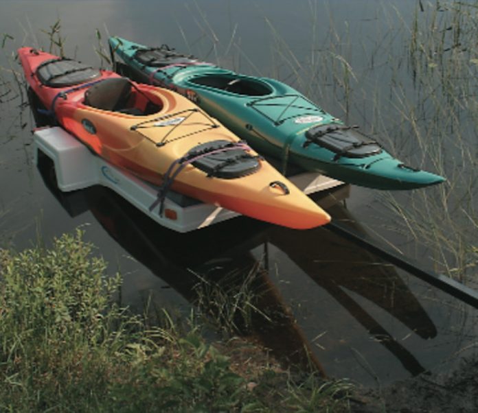
There is something about hauling a trailer that changes how people drive. They start to turn a little wider and feel like they deserve a little more than their fair share of the road. It’s perfectly acceptable to grind the odd gear and wear large belt buckles even if you’re only pulling a small trailer loaded with touring kayaks.

Towing your boats to the water offers plenty of advantages over the traditional roof rack method. However, many potential kayak-towing paddlers shy away from trailers. With a better understanding of the advantages, how to hitch and a few driving tips the only thing left holding them back will be the installation of a CB radio, 10-4? 

Towing Your Boat

You could re-mortgage your house to invest in a KevlarTM sea kayak but it’s often not the weight of the boat that makes it difficult to transport, it is the height of your roof racks and the fact that the boat extends six feet past your wingspan. Kayak trailers are lower to the ground requiring you to lift the boat only to your waist. You can also easily do one end at a time. Some trailers are designed so you can even back down into the water and float your boat off and on the trailer.

Depending on the size of your parking area around home, trailers add the convenience of being able to leave the boats ready to go at any moment. No more loading boats early in the morning or unloading late on Sunday night. Simply unhook the trailer and go to bed. This convenience could come at a severe cost if you’re not careful. Insurance claims indicate that thieves also enjoy the added convenience of stealing boats pre-loaded twice as much as plucking them from your yard or roof.

To prevent your pride and joy from being a fond memory, store your trailer in the safety of your backyard, in the garage or as out of sight as possible. Run a pad lock through the hitch closure and if possible back this up by chaining the trailer to a large tree. There are various kayak locking devices, none are fool proof but they are more work than cutting a rope.

Now that you don’t have to strongarm your boat onto your roof, your hatches become 250 litre suitcases. You can even pack for a trip in the convenience of your own backyard. Keep an eye on your gear when stopping at the grocery store for last minute items. Plastic automotive zip-ties zipped around the closure buckles work well to deter hatch snoopers from helping themselves. Keep a pair of wire cutters handy, so you can get them off. 

Hitching Your Ride

There are few sicker feelings than seeing your trailer full of boats pass you on the highway. Ask around at kayak outfitters, it happens. Where I grew up, ensuring the trailer is properly hitched is the responsibility and pride (or humiliation) of the driver. Get out and check it yourself. 

Ensure the tow ball and the coupler share the same size and the ball is secured to the vehicle. Ensure the coupler is fully around the ball, secure the latch and as a back up lock with a cotter pin or pad lock. Safety chains act as a backup in case your hitch lets go. The chains should be crossed to pre- vent the tongue from falling onto the road and so the trailer follows in a straight line. Be sure the safety chains are long enough so they do not come tight when cornering. Other things that will ruin your day are flat tires, bad wheel bearings or a ticket for a blown taillight bulb. Most kayaks extend well past the trailer, check your provincial or state laws to determine when a red flag or rear light is necessary.

When you are loading your boats ensure they are securely tied down and balanced on the trailer. After a change in weather (wet to dry or dry to wet) and at gas and food stops, check your tie-downs to ensure everything is snug before you head back on the road. 

Get Your Motor Run’n, Head Out on the Highway

Towing a light utility or kayak trailer doesn’t require a Yosemite Sam tattoo or a Billy Ray Cyrus T-shirt, it’s just a matter of modifying a few driving habits to compensate for the extra load. Although kayaks, even loaded ones, don’t weight all that much, your vehicle’s stopping distance will be less. If you are not careful, you can be pushed into intersections or stuffed into someone’s bumper. The solution is easy, slow down sooner and leave yourself more following distance in traffic.

When you pull out to pass, consider that it will take longer to generate rocket speed and you will have to go further to fit your trailer back in ahead of Grandad. Swerving in and out of traffic Montreal style is contraindicated and could result in trailer swayage (new word) or fishtailing (real word). If swayage occurs, slow down. If it wasn’t aggressive driving that caused it, stop and get out to find the problem. Look for blown tires, hitching problems or an uneven load.

Drivers who tow powerboats and RVs typically add mirror extensions so they can see around their wide load. When towing smaller kayak or utility trailers we often have a different problem. The trailers are so small and narrow we can’t see them at all. Try taping a note to the inside of your sunglasses to remind yourself that you are pulling a trailer.

The cart always has a tighter turning radius than the horse, so you need to lead the turn wider to compensate. There is nothing more humiliating for a truck driver than scrubbing the trailer wheels on the curb—and where there is a curb there are pedestrians. Making wider than normal turns is one of the joys of hauling a trailer and a snap to master. Hog the road not the sidewalk! I’ve saved backing up to the end. The driving experts suggest placing your hand at the bottom of the wheel, then if you want the trailer to go left, move your hand to the left, if you want it to go right move your hand right. This technique works of course but takes some practice, ideally in an area where you can’t damage anything. If all else fails and you can’t possibly back up a trailer don’t let that stop you from trailering your kayaks to the water. A kayak trailer is so light you can simply unhook it and roll it away or as a wise truck driver once told me, don’t drive into any situations you can’t drive out of.

Our editor Scott MacGregor has miles of trailer hauling experience under his belt from the years he worked driving tanker trucks for his folks at their company Scotholme Liquid Transfer. 

Screen_Shot_2015-12-23_at_3.40.47_PM.pngThis article first appeared in the Fall 2002 issue of Adventure Kayak Magazine. For more great content, subscribe to Adventure Kayak’s print and digital editions here
The Edge of the Pacific

Photo: Rick Hudson
The Edge of the Pacific

The trouble with Canada’s well-known West Coast Trail is not simply that it’s being trampled to death, which it is. The problem goes deeper than that. It’s an eight day thrash through damp West Coast flora, squelching in and out of mud swamps, skinning knees and elbows on wet roots, suffering days of dripping fog, trudging hours across soft sand with a thirty kilogram pack, competing for moist tide line camp sites and avoiding copious amounts of unburied human waste, all in the name of wilderness recreation.

Folks, there has to be a better way to enjoy the highlights of this justifiably famous coastline, with its beach vistas, rolling Pacific swells and moss-draped forest edges but without all that rainforest hassle. Better yet, wouldn’t you like to experience the wild shore and get back to a hot tub in the evening?

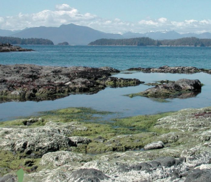
It may take over a week to hike, slither, slide and climb those mud-encrusted ladders but, as the grey whale glides, it’s a mere two fair-weather days of paddling down the coast. Not only that, but the very reason you’re on the West Coast Trail (to see the beaches, headlands and inter-tidal zones) are all better seen from a kayak, than from the inside of a damp forest trail.

Starting this year, the luxurious Tyee Lodge in Bamfield is offering a fully supported sea kayaking package. It includes a twenty-six foot launch to whisk you rapidly along the shore to your chosen starting point and a certified paddling guide to help those who might otherwise be intimidated by the ubiquitous ocean swells.You then play all day among the cliffs and reefs and arches.Watch the surf burst and fly. Approach the sea lion colonies on their foamringed pull-out rocks. See whales spout and bald eagles hunt. And then in the evening that same launch brings you back to the lodge, with its hot tub, elaborate dinner and clean sheets. Can life get any better?

When is the wilderness not the wilderness?

In recent years the dramatic growth in outdoor and adventure sports has meant that more and more people are looking for wilderness. Individual definitions and expectations of wilderness vary, but any time the government declares a new park, the ink is barely dry in the Gazette before squads of wilderness groupies and adventure companies are swarming the place.

Just fifteen years ago, after a long struggle between environmentalists and logging companies, the Pacific Rim National Park on Vancouver Island’s extreme West Coast was created to preserve a string of spectacular sand beaches.At the time, amidst the euphoria about land saved and history preserved, there was little consideration of where the park was heading. In 1993 the land covering the West Coast Trail to the south was added to the park’s boundaries.

Less than a decade later the West Coast Trail hosts over 8,000 hikers during the official season between April 1st and September 30th. At any one time in the summer, there can be up to 400 people on the route, spread out over 77 kilometres. That means 5.3 hikers per kilometre. It’s a trail that draws trekkers from Europe and elsewhere in droves, and has been described in travel literature as one of the finest hikes in the world. That may be true, but the word wilderness should be used with caution.

Nor is this wilderness cheap. Why, I have to ask myself, would anyone want to line up to apply for a hiking quota ($25/person), then pay good money to the Parks to use the Trail ($70/person), to the ferry operators for the two water crossings ($25/person), and finally to the bus company to get back where you started ($55/person)?

Paddling outside the box

By contrast, a competent sea kayaker can start at Bamfield Village, take in Cape Beale as a bonus and finish at Port Renfrew in a long day, or two at the most, a distance of seventy-five kilometres. No long waits at the ferry crossings. No hassles at the cable car creek crossings and no mud.

Of course, there are always purists who say that part of the WCT’s pleasure is skinning your knees on logs, or falling off boardwalks into shrubbery. Camping in the rain is fun, they insist and watching the fog roll in is all part of the charm of the Trail. Sure, and removing devil’s club thorns builds character.

If it’s character you’re looking for, the Tyee Lodge sits atop the headland at the mouth of Bamfield Inlet. From the rhododendron-splashed hot tub, perched on the cliff’s edge, there’s a panoramic view that’s hard to equal. On the right, the village boat traffic is a constant source of interest. In front of you, ocean-going ships throb down the Alberni Channel, bound for foreign ports. 

On the other side of the Channel, the Deer Group and the famous Broken Chain are archipelagos sprinkled in a tranquil sea, backed by late spring, snow-capped peaks. Both are popular destinations for those wishing to experience a sea kayak adventure in calm waters. Paddling those channels brings you to white beaches, rocky coves and islets crowded with tall trees.

To the left of the hot tub, a series of sand beaches and rocky headlands lead towards Cape Beale Lighthouse. Can there be a bet- ter place to call home, when paddling the rugged West Coast Trail?

Each morning after a civilized breakfast we descend to the Lodge docks, where skipper John Johnston loads a 26-foot launch with kayaks and gear, and we’re off into the wilderness (complete with all the creature comforts). The shoreline spins past at a magical speed. Two hours in the launch is the equivalent of eight days on foot. Hikers, believe it and weep.

One of the great blessings of being this mobile is we can choose our daily destination based on the weather. If it’s blowing a westerly, the swells off the WCT are large, the breaks awesome and it’s suitable only for experienced paddlers. Even climbing down into a bobbing kayak from the deck of the rocking launch can be tense.

Instead, we can tuck into the Deer Group or run out to the Broken Chain. But if it’s calm we can paddle some, or all, of the WCT coastline. How much is enough? Perhaps the morning is great but the afternoon gets up a blow. No problem. This is the age of communication; our guide calls up the launch and we move to a different area.

Is this the wilderness in its truest sense? Of course not. But then neither are cable cars, ladders and designated campsites. Remember, the Trail itself is there because the wilderness was too rugged. Shipwrecked sailors needed a route south to 19th century civilization in Victoria. And when paddling, we don’t encounter 5.3 people per kilometer. Plus the flexibility of the guide and launch allow us to experience the best of the West Coast Trail al fresco, while dining each evening a la carte.

All the literature on hiking the West Coast Trail stresses it’s not for the novice.The trail is long and hard, and wet at times.You need to be experienced.The same is true of paddling the coastline. It’s a rugged shore, where rocky capes and sea cliffs offer few landing points, even on calm days. There’s 10,000 km of fetch between Japan and BC’s West Coast and the swells are endless.Watching the surf curl and break on the shoreline gives you just a glimmer of an appreciation why this coast was known as the graveyard of the Pacific—the resting place of over 80 ships between 1850 and 1980.

Today, there are still numerous wrecks visible. The rusting iron boiler of the Michigan, which ran aground in 1893, lies exposed at low tide near Pachena Point. Parts of the 1943 wreck Uzbekistan can be seen at Darling Creek. Elsewhere, modern fishing vessels, obvious from their aluminum and fibreglass fragments, are wedged at impossible heights above the tide line, thrown there by an unforgiving sea.

But what makes the coast so dangerous in winter, also makes it come alive for the paddler in summer. One moment you’re in a valley of green water; the next you’re on a crest so high you can see for miles along the shoreline. Offshore breaks swirl as a wave top passes, then the level drops, exposing huge mussels, starfish, giant barnacles and bull kelp, clamped to an anchoring reef. Water pours off exposed rocks until the trough passes. Then the basalt disappears beneath another green surge. In a kayak you can stand off a few metres in perfect safety. As a mariner, it would send the fear of Beelzebub up your spine to watch those teeth appear and vanish in the restless swells.

And then there’s Plan B

As any back packer will tell you, the West Coast weather, even in summer, can be variable. If you’re out for a week and it turns wet, you don’t have a lot of options, apart from just keeping on going. Not so, if you have launch support and a home base.

If it dawns foggy or windy, a good way to spend the day is to slip across Alberni Channel (25 minutes in a kayak, 5 in the launch), and play in the Deer Group of islands. Several of these forest-capped out- crops are limestone, with arches, sea tunnels and deep sea caves.

There are surge channels so narrow you have to deck your paddles and push yourself through using your hands.

Inside these dark places it’s cool and quiet, even on hot summer days. The Pacific swells barely reach the twilight zones. The kayaks lift and fall gently, as though the ocean itself is breathing in some deep, dark rhythm. Brilliant sea anemones and purple starfish cling to the sheltering walls. At the back of the caves, gentle swells curl and break in diminutive surf, submerging polished marble boulders. Water drips from high ceilings, making loud plopping sounds. It’s a magical world, where visitors tend to whisper, as though they’re somehow intruding on a sacred place. Perhaps they are.

On a more urbane level, we’ll pass through the aptly named Robber’s Channel, where the burned out hulk of Greenpeace’s famous Rainbow Warrior lies at anchor. Still blackened from the bombing and subsequent fire that sent her to the bottom of a New Zealand harbour (courtesy of the French Secret Service), her rusting bow shows the marks of her trade.And on the bridge, smoke-grimed but still visible are the flags of ships rammed and sunk, during an age when environmental militarism was still in its infancy.

Getting the balance right

While the days are filled with the salt water and damp air of the West Coast Trail, the evenings don’t have to be more of the same. After a long hard soak in the hot tub at Tyee Lodge, we emerge to greet the sous-chef, who is bringing appetizers—nachos smothered in melted cheese and black olives, oysters baked in Cinzano and herbs and filo pastry rolls stuffed with BBQ chicken. To retain balance, it’s best to wash them down with Canadian beer and Australian shiraz. Hey, it’s a global village.

Later, a three-course dinner is served at the long table, while the sun sets into a blazing sea, sprinkled with island silhouettes. Between the steak and the dessert, a log-carrier passes slowly down- channel, carrying douglas fir, sitka spruce and jobs to foreign ports. Someone promises to write to Ottawa about the whole sad softwood mess here on the West Coast.Then the cheesecake takes our minds off such matters and an after-dinner liqueur at the bar puts the whole thing into better perspective.

We are indeed a global village. Out on the Trail, hikers from around the world are snuggling down into damp sleeping bags and saying good night in a dozen languages. Now more than ever before, the wilderness, the country, the whole planet itself belongs to everyone. Are those our jobs going out to sea? Is the WCT reserved for eco-purists only? Can we truly appreciate the beauty of this wild coast without experiencing the discomfort?

There are no easy answers, only compromises. Right now, it’s time for a last nightcap, a final coffee, and bed between clean crisp linen. 

Rick Hudson started paddling whitewater in 1976. Age, injuries and common sense have turned him into a sea kayaker where accidents happen more slowly. He now lives next to the ocean on Vancouver Island, BC. 

Screen_Shot_2015-12-23_at_3.40.47_PM.pngThis article first appeared in the Fall 2002 issue of Adventure Kayak Magazine. For more great content, subscribe to Adventure Kayak’s print and digital editions here
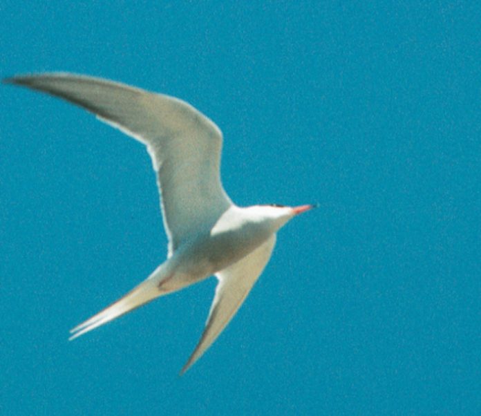
Dunes of Kouchibouguac: Family Paddling with Common Terns and Grey Seals

Photo: Nicole Daigle
Dunes of Kouchibouguac: Family Paddling with Common Terns and Grey Seals

Brilliant white sea swallows, with their black caps and orange bills, dive for stickleback fish, tossing them into the air, and setting them up to swallow whole—head first.

It is the month of August and it is prime time for seeing shorebirds. We drift in our kayaks along the shore of Tern Island, entertained by the 6,000 hungry birds. A few paddle strokes fills the sky with a white cloud of flapping wings as they rise up in sheets. The birds’ agility in flight and precision when diving for food provides us with a continuous aerial spectacle. The sound of their cawing voices floods our ears. This flock is only a fraction of the 30,000 that make the banana-shaped barrier island at Kouchibouguac National Park, New Brunswick their home.

Tern Island has the largest common tern colony in eastern Canada and the second largest along the North American eastern seaboard. Results of an annual count suggest there are approximately 6600 tern nests in the Atlantic Canadian park. The common tern numbers have been declining in the Atlantic provinces since the middle of the century, primarily due to the tremendous increase in gull populations. The gulls compete with the terns for nesting habitat, usually winning, and prey heavily on tern chicks. But here on Kouchibouguac’s protected strands of islands, the terns are alive and well. 

Kouchibouguac National Park is located on the northeast shore of New Brunswick in the Northumberland Strait of the Atlantic Ocean. Kouchibouguac was established as a reserve in 1969 and was given official nation- al park status in 1979. The 238 square kilometers of the Maritime Lowlands ecological region is 80 kilometres north of Moncton and 50 kilometres southeast of Miramichi. One of the characteristics of these rich fertile lowlands, making up the eastern half of New Brunswick, are rivers with tides that travel inland for many miles.A mix of deciduous leaf forest and boreal coniferous forest

surrounds the lowlands and is identified as an Acadian forest. The Maritime Lowlands is also known for its coastal sand dunes and extensive beaches—the main attraction at Kouchibouguac. This family-oriented park contains 35 kilometres of bike trails and 315 sites in their modern campground on the mainland.

Off the mainland there are three main barrier islands and a few tiny islands called Tern Island I and Tern Island II. Tern Island III has eroded down to a sandbar and this is where the terns and grey seals congregate. 

Up to five hundred grey seals arrive in Kouchibouguac in June when the ice breaks in the Gulf of St. Lawrence and stay until early November. They are the largest of the four species of seals living in the Gulf of St. Lawrence, with males reaching 900 pounds and females up to 500 pounds.There are only a few places to see these uncommon seals called marine wolves for their night-time barking and howling. Sable Island, off the coast of Nova Scotia is also a good place to see them where up to 10,000 have been known to winter. The entire Gulf of St. Lawrence has approximately 200,000, which is a small population compared to most species of seals. As special as this sight is, less than 1% of all park visitors venture off the mainland to these islands. This weekend with the help of a sea kayak touring company, Kayakouch Inc., my family and I have come to this little-known paddling destination to live with the terns and the seals and we have the place all to ourselves.

Owners, Victor Savoie and Nicole Daigle, base their trips from their kayak shop on Main Street of Saint-Louis-de-Kent, New Brunswick.Victor is the assistant head her- itage interpreter at Kouchibouguac National Park and Nicole is a national park interpreter. For three consecutive years Victor and Nicole have won the Savvy Traveller Award for their guided sea kayaking adventures in seal country. Most of Kayakouch’s customers opt for an early morning departure with a half-day tour of the Tern Islands and the grey seals. Only a handful choose our multi-day tour.

We begin our trip this morning by paddling eight kilometres down the Kouchibouguasis River from Kayakouch Outdoor Adventure Shop. At the end of our day, we will end up at a primitive campground at Pointe-a-Maxime located at the mouth of the Kouchibouguasis River, which means Little Sister of Kouchibouguac.The national park has set aside half a dozen campsites for paddlers with an outhouse, fire pit, and picnic table. All potable water and supplies must be boated in. Paddlers use these narrow Saint-Louis Lagoon.The wind has picked up to 35 knots so we stay put and call it an early day of paddling. Our evening trip out to the sandbar and the seals will have to wait until tomorrow. Victor checks his weather radio numerous times a day to get the latest weather conditions and plan the best time to see the seals.“Wind is practically the only factor for cancelling trips,”Victor tells us.“If it’s blowing more than twenty knots it’s a small craft advisory and unless paddlers are very experienced, a trip won’t go.” 

We never paddle in more than five feet of water and in the summer the water temperature hovers between seventy and ninety degrees. The most the tide changes in Kouchibouguac is four feet, unlike in the Bay of Fundy where tides fluctuate as much as forty feet. Fog rarely forms on the lagoons so finding your way is nearly always possible with your naked eye. All these factors make Kouchibouguac a very comfortable and safe paddle for families.Victor assures us that early morning is usually the best time to paddle, with less wind, little boat traffic and the seals undisturbed.

I bring my children on kayak trips for many reasons. Every paddling experience opens another world of learning and the first in-camp activity is digging for soft-shell clams, which Victor secured a permit for. The kids excitedly try their hand at it hoping to make a contribution to supper. They crawl in the shallow water on all fours and shout with joy when they’ve found one.

“The trick is to look for two air holes in the sand,” Victor informs us. “You’ll find the clams about six inches underneath.” My 11-year-old daughter, Sierra, devises a way to plunge her index finger quickly into the hole and get a head start before the clam detects it is being harvested and starts to move away. 

The Micmac First Nations people inhabited this area and fished these waters for 3,000 years. For over eight months of the year, they subsisted on four main types of food: shellfish, like these clams; marine mammals, like walruses and seals; bird eggs on the dunes; and fish, with the American Eel being their favourite. Only ten percent of the Micmac population survived the European diseases.Two hundred years later, the families of those who survived the measles and small pox were forced to leave when Kouchibouguac became a national park. Big Cove Reserve on the Richibucto River, eight kilometres south of the park, is New Brunswick’s largest native reserve with 2500 resident Micmacs. 

For their next lesson,Victor shows the kids how to handle a jellyfish without being stung.Victor grabs the floating mass with his bare hand and flips it over into the palm of his other hand.

“As long as you only touch it with this tough inner part of your hand, you won’t get stung,” he tells them. He shows us where to insert our index finger so we can feel its harmless muscular mouth. He tells us some species of jellyfish in the Atlantic Maritime waters reach eight feet wide with thirty-metre long tentacles! 

Lobster season just opened in New Brunswick. As we paddled along the mainland this morning, we stopped to watch the lobstermen unload their catch while the women sized the crawling grey-green crustaceans. Lobstering is still one of the main sources of economy in this Acadian region. One hundred and fifty families use the wharf in the park for the two short months the lobsters are in season and each boat can have up to 250 traps in them. 

The traps are much more sophisticated than the phantom traps from years ago. Storms can render lobster traps lost at sea by moving them far from their original spots. New, coated metal traps have doors with biodegradable hinges that will decompose within a year, opening the traps if they become lost. Lobstermen also use Global Positioning Systems to help pinpoint their traps.

Lobsters are scavengers and are attracted to the bait in the traps. When another lobster enters the trap, the larger one will frequently eat the smaller one.The blood and scent trails from the cage, sending tasty messages to other lobsters that a good meal is available. In this way, the cannibal lobsters will eat forever if the traps aren’t retrieved.

“How much pain will they feel when you drop them in that boiling water?” my empathetic children want to know when Victor asks for their assistance in cooking the lobsters. To them, the crawling active creatures seem to possess more feeling than the clams they caught, but they happily indulge anyway.

The lagoon is as still as glass in the early morning as we head out in search of seals.The children bend over their cockpits mes- merized by the open book beneath them.The clear shallow water shows fish, crabs and Moon Snails creeping along, and all sorts of delicate sea greens undulating gently in the tide.

In the distance, we begin to see the seals beached on a sandbar, so many hunkered on top of each other that it looks like a sizeable piece of island.

“As we approach them,” Victor warns, “the children should stop paddling altogether and you and Todd paddle very low on the side away from them. The more movement there is, the more they can get spooked. ”Victor hands Sierra his binoculars and they become glued to her eyes. 

Through the lens we can see the seals’ whiskers, and the mist snorting through their nostrils. The males have larger heads, pointier noses and look horse-like. Victor tells us grey seals have only one off-spring or pup born in mid-January to mid-February. The mothers nurse for three to four weeks and their milk is some of the richest on the planet—comparable to whales. We stop paddling and allow our boats to drift towards them.

With binoculars we can study individual seals and watch them open their mouths, raise their heads and howl.We laid in our sleep- ing bags and listened to them last night, completely in awe.

Over at their sandbar, forty more seals lumber into the water, looking so ungainly and awkward as they scrape themselves along by contracting their strong belly muscles. Once in the water, they swim with fluidity and grace that defies their huge bulk.

The children are mesmerized by the seals’ presence. Victor whispers to them,“What do you think?”And all they can do is nod their approval and give him the thumbs-up sign.

Perhaps the seals that did move off the sandbar are the inquisitive ones. Some swim to within fifteen metres of our boats.The low morning sunlight spots their heads a brilliant white. They surface so close to our boats—popping out of the water with a snort through their nostrils—we can actually smell their pungent fishy odour. After bobbing for awhile, studying us, they dive down with a slap and a splash. 

We are right smack in the middle of the tide change and the sea is incredibly still. For half an hour we float peacefully, content to be in each other’s presence. Not a single boat has passed on its way out to the Northumberland Strait in the time we visit the seals. It is Sunday and the lobstermen have the day off.

We are all reluctant to head back. After a good half a mile we turn around to see half a dozen seals still following us. They too want us to stay and play a little longer. We feel connected both floating out there—us in our kayaks, them swimming and bobbing. There aren’t many experiences in life that come close to this type of communion with the natural world…a world only revealed through the power of your kayak paddle.

Cindy Ross is a freelance writer and photographer.

Screen_Shot_2015-12-23_at_3.40.47_PM.pngThis article first appeared in the Fall 2002 issue of Adventure Kayak Magazine. For more great content, subscribe to Adventure Kayak’s print and digital editions here
Urban Adventures: Kingston, Ontario

Photo: Scott MacGregor
Urban Adventures: Kingston, Ontario

Few places in Ontario are able to meld the world of kayaking with the continuous presence of history. Kingston is located at the southern end of Lake Ontario and is the meeting place for the St. Lawrence River and the historic Rideau Canal. This area is riddled with history, stories, scenery and great paddling. 

Kingston and Lake Ontario

The best place to enter the waters of Lake Ontario is at Ahoy Rentals located on the water- front in Kingston, Ontario. This small one room business provides kayak, sailboat and bike rentals. There is ample parking with a great boat launch and a low wooden dock ideal for paddlers.

As you enter the clear waters of Lake Ontario fronting the Limestone City you can see many reminders of Eastern Ontario’s past. Kingston is a city mixed with a sense of history and modern growth. Paddling north, the city of Kingston rises on your left. The shoreline has been reinforced with large boulders to protect it from erosion by the prevailing and sometimes strong, southerly winds sweeping in from Lake Ontario. Crossing along the lake to the east, be careful to avoid the Wolfe Island Ferry. This large car carrying ferry travels regularly between Kingston and Wolfe Island. As you approach the point opposite

Kingston, a monumental work from Upper Canada’s military past looms up from the water.

Fort Henry was completed in 1839 following the War of 1812 with the United States. This national historic site rises on a barren, desolate hill overlooking Lake Ontario, guarding the entrance to the Rideau Canal and the St. Lawrence River. This impregnable star-shaped fort is complete with working cannon, uniformed sol- diers and a fife and drum corp. Fort Henry brings to life our military past with daily re-enactments and guided tours. Paddle along the shoreline dot- ted with scruff vegetation to Navy Bay where a Martello tower rises from the cool waters. On the point is a rough beach area great for landing on a calm day to stretch your legs and view the fort more closely. After paddling around this area per- haps a visit within the walls will enhance your day of paddling.

To the east of the fort lies Deadman’s Bay. Within the shallow waters of this bay is a similar shoreline to Navy Bay complete with a second

looming tower. In the depths of the bay you can float above wooden warships that were scuttled following the War of 1812. On a calm day you can see these ships of the past peering towards the blue sky from the lake’s rocky bottom. Similarly, a few miles across the lake at Garden Island, other wrecks can be viewed. The paddle to Garden Island is about two miles and requires a strong and experienced paddler in the event the winds pick up.

Across the bay lies Cedar Island. This small island is part of St. Lawrence Islands National Park, Canada’s oldest and smallest national park stretching from Cedar Island to Brockville through a series of islands protecting a unique natural environment on the Frontenac Axis. This narrow geological area connects the Canadian Shield to the Adirondack Mountains in New York State. This strip of land acts as a corridor for animals and plants to move north and south. These islands are home to plants and animals not usually found in this area but in areas further to the south or north. Cedar Island makes an excellent place for a picnic lunch, complete with a hiking trail, a Martello tower and ghosts. Perhaps, you will see Elizabeth who mysteriously disappeared on the island and is still waiting for her beloved Robert James to return. She never believed he drowned on September 12, 1846 and has waited endlessly for his return.

The Rideau Canal

Lake Ontario’s weather may not always be conducive to a relaxing paddle. With high winds, this Great Lake is for a strong and experienced paddler. If you’re leary about the winds on the lake and are looking for a quiet paddle while maintaining a sense of history combined with Canadian Shield scenery, the Rideau Canal is a great option.

The Rideau Canal is really not a canal. It is a 202 kilometre waterway extending from Kingston to Ottawa comprised of 24 lockstations, 47 locks and numerous lakes and rivers. This waterway only consists of 19 kilometres of man-made canal and structures. The native peoples of this area used these waters for hundreds of years prior to its construction.

Following the War of 1812, the British government wanted a safer and more efficient method of moving men and supplies from Montreal to Kingston and beyond. It was feared that if the St. Lawrence River fell under the control of the Americans, Upper Canada would be cut off from the rest of the British Empire. The British fears were nearly realized when it was discovered following the completion of the war in 1815 that the U.S. Secretary of War, James Madison, had developed such a plan. Just think, if the war had not ended at this time, Kingston could very well be part of the United States today!

In charge of building the canal was Lt. Colonel John By, a Royal Engineer. From the wilderness, using natural lakes, rivers and beaver meadows, By cre- ated a series of stone locks to move men and supplies quickly from Bytown (present day Ottawa) to Kingston and beyond. Although plagued by malar- ia, a lack of infrastructure and harsh working conditions, the Rideau Canal was completed in only six years! Today the locks are maintained as By built them between 1826 and 1832.

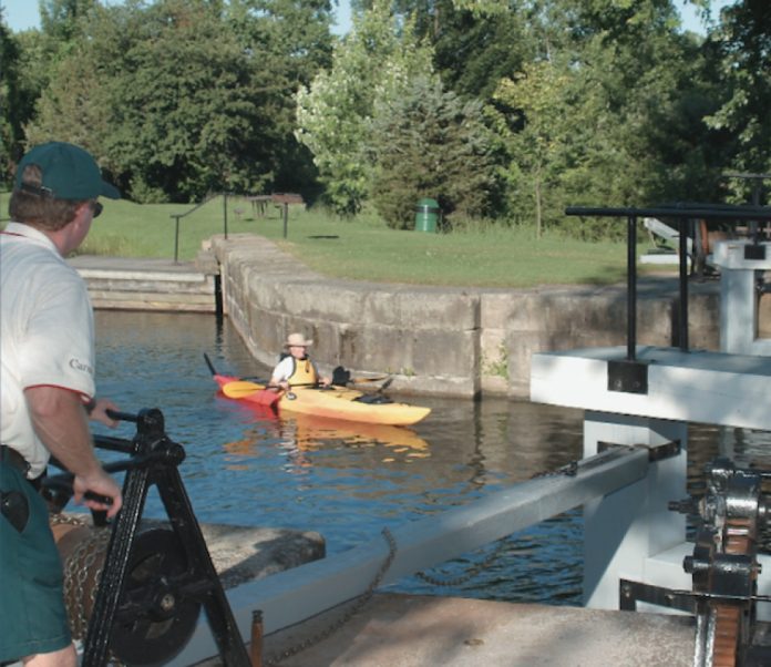
Instead of locking through military boats and barges, the canal is now used for pleasure boats of varying sizes. For a $60.00 transit pass you can paddle the entire 202 kilometre distance without ever having to portage. Within the lock chamber, casually hold one of the plastic cables running along the lock wall to float gracefully from one level to the next. If you prefer to portage or need to get out for a stretch, many lockstations have signs indicating a portage route and log rafts to allow paddlers to easily exit or enter their kayak.

Lake Ontario to Kingston Mills

The Rideau Canal from Lake Ontario to Kingston Mills makes an excellent 6.9 kilometre morning paddle. Enter the canal from Lake Ontario by passing north under the Lasalle Causeway. The landscape is transformed from a cityscape to a narrowing river that becomes reed-lined forming the Cataraqui Marsh. The Kingston Mills lockstation is carved from granite rock on the edge of the Cataraqui River and features three locks in flight; a turning basin, a detached lock and one of four defensible blockhouses built on the Rideau Canal. This stone and wood blockhouse is open to the public and is furnished to the period. A great place for lunch.

For a different canal flavour, drive 24 kilometres from Kingston to the Upper Brewers Lockstation. This lockstation is unique as it melds two distinct geological areas. Downstream from the lock the limestone plains of Kingston dominate. Upstream, the Frontenac Axis rises to the foreground.

The put-in is easy at the top of the lockstation on a grass embankment. Paddling north through a winding narrows you can picture the once plummeting Cataraqui River. As the first bend approaches, lilac bushes and mixed bush push their way out over the calm blue waters. On the hill to the right is the now vacant defensible lockmasters house that was built after the Oregon Crisis and the Upper Canada Rebellions.

Paddling toward Cranberry Lake, the right shoreline rises forming what is known as the Court of the Duke. A short distance ahead on an outcrop is the Profile of the Duke. It resembles a facial profile. It is said to be named after the Duke of Wellington who was instrumental in the building of the Rideau as the Minister of Defence in England at the time.

Once on the lake, Beaupre Island offers its natural beauty with mixed trees and birds singing in chorus. This nationally owned island is now uninhabit- ed. At the turn of the century a clubhouse was built on the southern end of the island and a farm was homesteaded in the middle. These buildings are now shadows of a bygone era on the Rideau Canal as the natural growth of the area reclaims the land. Today, this island is being examined as part of a Black Rat Snake study in conjunction with St. Lawrence Islands National Park.

Whether paddling Lake Ontario or the more protected waters of the Rideau Canal, kayaking in this region is steep in a vibrant history accented by fantastic scenery bracketed by the evening and morning sun.

Don MacKay is an avid kayaker and canoeist who works as a heritage blacksmith and historical interpreter for Parks Canada on the Rideau Canal National Historic Site of Canada. He also represents the Rideau Canal on paddling issues. 

Screen_Shot_2015-12-23_at_3.40.47_PM.pngThis article first appeared in the Fall 2002 issue of Adventure Kayak Magazine. For more great content, subscribe to Adventure Kayak’s print and digital editions here