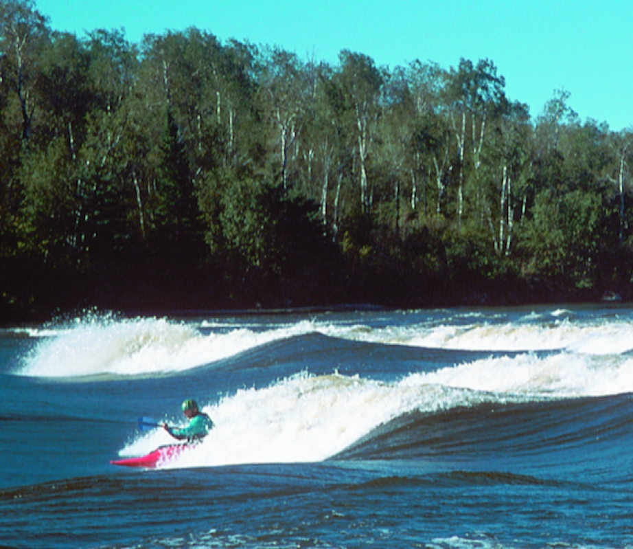
For some time rumors have been spreading of a mysterious and fantastic playspot in the province of Manitoba.
As unlikely as that may sound in a province better known for its wheat farms than its whitewater, the rumors happen to be true. Sturgeon Falls on the Winnipeg River is a playspot to rival the best in the country offering safe plays for paddlers of all skill and confidence levels. It’s located only ninety minutes east of Winnipeg, and about an hour north of the Trans-Canada highway, just a slight detour on a cross-country tour.
The characteristics and features of Sturgeon Falls parallel those of Lachine Rapids in Montreal. Both are wide rivers with many good playspots and the odd powerboat pass- ing by. The waves at Sturgeon Falls are formed by a rocky shoal situated at a narrow point in the river up-stream from Nutimik Lake. Although Sturgeon Falls has only ten feet of gradient, it has fifteen waves and holes for paddlers to select their own kind of ride. There is an eddy on the river right side providing access to most of the waves making for a difficult decision every time you paddle back to the top. There are six to ten foot glassy waves, big trashy holes and friendly front surfs. Sturgeon has it all.
The size of the waves depends on the water level but even at low flows there are still some nice spots to play. If you are looking for higher flow rates, your best bet is sometime in the middle of June when the snow feeding the Winnipeg River from the north has melted and is on its way south. The water tends to be pretty cold until the end of June and even early July, so dry tops and skullcaps are recommended.
Keep an eye on the water levels online at www.lwcb.ca/waterflowdata.html. Click on the link for Winnipeg River in Manitoba under Water Levels & Flows Primary Sites. This will bring up three graphs providing information on the outflow at the Slave Falls Dam, the lake level at Nutimik Lake and the outflow at the Seven Sisters Dam. The blue line represents the actual water level and ends at the most recent reading. The green and red lines represent where the river is predicted to be with red representing the extreme edge of those predictions. While Sturgeon Falls is worth going no matter the water level, high water starts when Nutimik Lake is at 275.2 metres (903 feet) and flowing at 1200 cubic metres per second (40000 cubic feet per second).
To get to Sturgeon Falls, travel on the Trans-Canada Highway to West Hawk Lake and turn north on Highway 44. Turn north again at Highway 307 toward Seven Sisters Falls. Travel on Highway 307 until you get to Nutimik Lake Campground and follow the signs for the boat launch and campsite. From the boat launch, Sturgeon Falls is a one kilometre paddle to the right.
There are many other users of the area as it is part of Whiteshell Provincial Park, so keep an eye out for fishing boats and day users. During the summer season, a small day use fee is payable at the front gate of the park. Camping is abundant in the campground but food is lim- ited in the area, it is best to come ready to cook for yourself for the duration of your stay. A full breakdown of camping prices is available on the park’s website. There are showers and washroom facilities in the campground though some are locked during the off season.
Whether you are a pro paddler looking for a secret Jedi training ground with big trashy holes and grinding steep waves or a beginner looking for a nice friendly surf break you will find Sturgeon Falls has a little something for everyone. Next time you’re driving across the country stop and surf Manitoba!
 This article first appeared in the Fall 2002 issue of Rapid Magazine.


