
With the Pacific Ocean on the front doorstep, many West Coast paddlers forget there’s great paddling in the backyard too, a mountain wilderness with freshwater lakes perfect for trips ranging from a couple of hours to a long weekend. Alouette Lake is one such place where we can paddle right into the Coast Range. It’s a manmade jewel that gleams like a natural emerald in the cradle of the snowcapped peaks.
Alouette Lake is in Golden Ears Provincial Park, a 55,000-hectare mountain playground nestled into the northern rim of the broad, fertile Fraser River Valley. The park is only about an hour’s drive east of Vancouver and a three-hour drive north of Seattle.
[ Paddling Trip Guide: View all paddling trips in British Columbia ]
As we drive through the park gates, signs direct us to the popular boat launch, just 10 minutes inside the park at the southwestern tip of the lake. To skip the boat ramp queues, we can put in at the day use area instead or, if we’re paying to car-camp, at Alouette, Gold Creek or North Beach campgrounds about 4 km farther up the west shore. These options require a few minutes’ portage, but can save time when the ramp’s busy.
Pointing like an arrow from southwest to northeast, Alouette is 17 km long, but only about a kilometer wide on average. We cross the lake and paddle along the eastern shore, close to the land where the air is rich with the scent of cedars and evergreens. Landing to answer nature’s call, we discover wild raspberries. We keep our ears open for noises— because the black bears love berries too!
Back on the water, we pass a large stream that cascades down from the hills to feed the lake. The late afternoon sun backlights the cold, damp air that follows the water down the creek bed, causing the vapour to glow like a spectral second stream that spirals just a foot or two above the lake.
After about 10 km from the boat launch (or about five from the car campgrounds), we reach the Narrows. Also known as the Cut, this constriction marks both a physical and a psychological gateway.
The lake briefly tapers to less than 25 meters wide, and shallows from dozens of meters deep to just a meter or two.
The lake was formed in 1926 when developers dammed a river to create a hydroelectric reservoir, connecting and vastly enlarging two existing smaller lakes. The Narrows is a reminder of the swamp that separated the two natural bodies of water. On either side and beyond, the mountains rise steeply out of the water, creating the feel of a wild freshwater fjord. Very few powerboats venture beyond here.
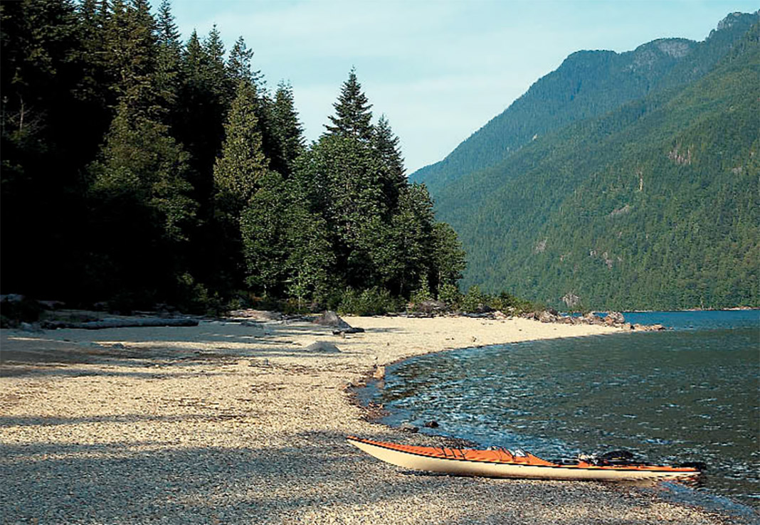
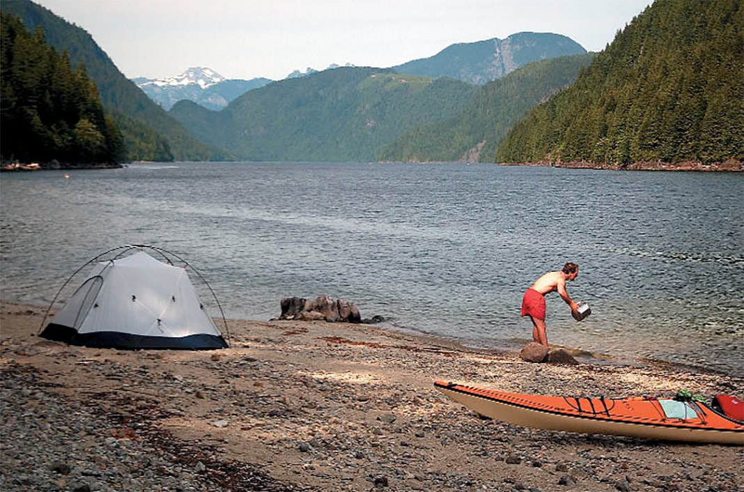
Just beyond the Narrows, we turn left and land at a small beach at the southwest end of the lake’s second segment. Hidden in the trees above the beach are several levelled earth pads built especially for tents, as well as an outhouse. If we were on a day trip, we would stop for lunch at this point, then head back. But we’ve brought camping gear, so we bathe in the lake, then dry out and cook supper over a small fire.
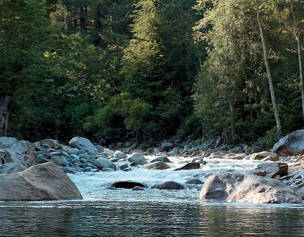
The next morning, we set out on a day trip to the far north end of the lake, about 7 km away as the crow flies. As we paddle, we can trace with our eyes the journey of water from the slowly melting snowfields on the surrounding mountaintops to the white plumes that fall dozens of meters down sheer rock faces, and finally to the streams that merge into the lake.
Along the eastern shore, not far from the end of the lake, is a grey concrete arch reminiscent of a medieval gate tower. It marks the intake of a long, manmade tunnel that feeds water right through the mountain down to Stave Lake and its hydroelectric generators.
At the very head of the lake, the Alouette River, sweeping into the lake across a cobblestone delta, offers a tantalizing glimpse along a mountain valley that seems to recede forever toward the horizon. If we were trained and equipped for it, we could land, find the trail by the river’s edge, and follow it to the peaks of Mount Robie Reid thousands of feet above. But this alpine adventure will have to wait for our return to Alouette. This time we turn around, soon to enjoy one of the best parts of paddling a freshwater fjord: not having to rinse our gear when we get home!
How to get to Golden Ears Provincial Park
From Vancouver, take Highway 7 to Maple Ridge and turn left on the Dewdney Trunk Road. Turn left again on 232nd Street and follow the signs to Golden Ears Park.
Golden Ears Provincial Park campsite reservations
You can reserve your campsites at Cold Creek, Alouette and North Beach campgrounds and purchase backcountry camping permits here.
Special considerations
Tree stumps, relics of pre-flood logging, lurk at or just below water level in some near-shore areas—keep a watchful eye, especially in rough water. Inflow and outflow winds can pick up quickly, so plan any crossings accordingly.
Boat rentals
During the summer months, canoes and kayaks are available for rent at the day use area at the southwest end of the lake. Contact Rocky Mountain Boat Rentals.
This article was originally published in Adventure Kayak‘s Fall 2003 issue. Subscribe to Paddling Magazine’s print and digital editions here, or browse the archives here.
Philip Torrens has been an avid touring kayaker, on both fresh and salt water, for more than 15 years.
Looking north from the popular boat launch on a quiet weekday, you can sense the solitude at Alouette’s north end. | Photo: Paul German


")


