As dozens of folksy sayings attest, you can make your own weather forecast from easy atmospheric and environmental observations. You don’t need a weatherman to know which way the wind blows.
A paddler’s guide to predicting the weather
“Wind from the east, weather a beast, wind from the west, weather is best.”
Changes in wind direction hint at coming weather. A counter-clockwise shift in wind direction (“backing” in mariner parlance) predicts approaching low pressure with its attendant low clouds, strong winds and miserable weather. A clockwise shift in wind direction (known as “veering”) is a sure sign of approaching high pressure, with fewer clouds, lighter winds and pleasant weather. Wind typically backs from west to east and veers from east to west.
“Mackerel sky and mares’ tails make tall ships carry low sails.”
Mottled, fish-scale altocumulus clouds and cirrus streamers indicate moisture and unstable air—and rain within 24 hours.

“When sounds travel far and wide, a stormy day will betide.”
Humid air is better at transmitting sound waves.
“If the moon has a halo around, we’ll soon tread on deluged ground.”
A halo around the moon or sun is caused by ice crystals in high cirrus clouds, which form as a cirrus cloud flattens ahead of a warm front. A halo is often the first sign a low-pressure system is approaching, and that rain is 18 to 36 hours away.
“Red sky at night, sailor’s delight. Red sky at morning, sailors take warning.”
In the evening, red clouds above and to the east mean the sun is shining through clear skies in the west—the direction of approaching weather. Conversely, red sky at sunrise means clearing in the east but unsettled weather approaching in the west—often a sign storms will linger.
“When smoke descends, good weather ends.”
Your campfire provides a reasonable forecaster for the next 24 hours. A low-pressure system approaching makes smoke absorb moisture in the air and sink, enveloping your campsite. Smoke rises in a high-pressure system.
“When leaves show their undersides, be very sure rain betides.”
Rising humidity and shifting winds can cause tree leaves to flip before a storm, revealing their paler undersides. Some flowers may close to protect their pollen, a subtle sign of nature preparing for rough weather.
“If birds fly low, expect rain and a blow.”
Birds fly lower before storms because the insects they feed on stay close to the ground in low-pressure, humid air. High-flying birds usually signal good weather.
“If your muscles all ache and itch, the weather fair will make a switch.”
Aches and pains can worsen as barometric pressure drops—a subtle but common sign of a coming weather change.
 This article was published in Issue 73 of Paddling Magazine.
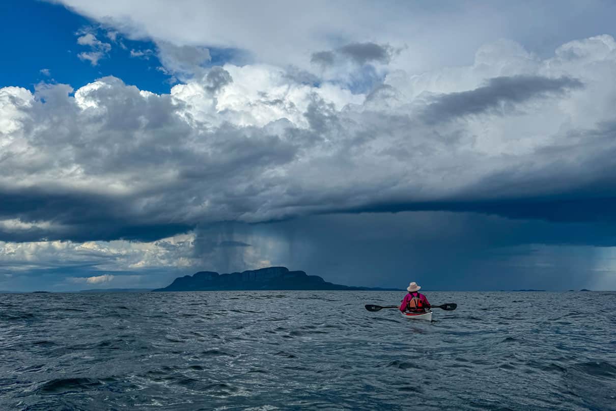
 Just passing through. | Feature photo: Kaydi Pyette


