Every Algonquin Park visitor wants to experience the park’s iconic lakes, trails and campgrounds, but Algonquin’s sprawling geography makes it challenging to know where to start. Add to its immense size the fact that only a small fraction of the park is accessible from the main Highway 60 corridor, a detailed, easy-to-use Algonquin map becomes just as essential as a good pair of hiking boots.
Google Maps and other mapping apps can give you a general idea of where to find Algonquin Park access points and specific attractions, but aren’t suitable for navigating in the backcountry. To explore the park’s vast interior of maple hills, rocky ridges and thousands of lakes, ponds and streams, you’ll need an Algonquin Park trails map or Algonquin canoe routes map. Read on to discover our picks for the best Algonquin Park interior map, Algonquin backcountry map and Algonquin Park lakes map.
[This article is part of the Ultimate Algonquin Park Travel Guide. Find all the resources you need to plan an adventure-filled trip to Algonquin Park.]
View this post on Instagram
Algonquin Park maps for canoe trips
The backcountry of Algonquin Park doesn’t really have specific canoe routes—instead, there is a vast, interconnected canoe route network so you can plan an almost infinite number of possible trips. Planning an enjoyable trip for your group starts with a good Algonquin Park map of lakes and routes.
Official Algonquin Park canoe routes map
The official Canoe Routes of Algonquin Park Map contains all the basic information required by Algonquin Park’s backcountry canoeists. The map illustrates canoe routes, campsites, portages, lakes, access points and more. The reverse side of the map provides detailed information about planning your Algonquin Park adventure including safety information and equipment requirements. This official map receives annual updates by park staff working in Algonquin’s backcountry who are responsible for maintaining the canoe routes network, making it indispensable for park visitors planning an interior canoe trip.
Browse a virtual version of the backcountry canoe tripping map for Algonquin Park here. Purchase a full-sized printed copy to take with you on your trip—the official paper map is available from the Friends of Algonquin Park for $4.95, with 100 percent of proceeds supporting Algonquin Park.
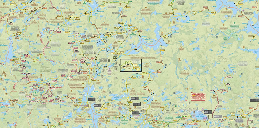
Maps by Jeff’s Algonquin Park Paddling Maps
A lifelong paddler-turned-mapmaking entrepreneur, Jeff McMurtrie parlayed over 600 days exploring and mapping Ontario’s canoe routes into a collection of park maps that have become the gold standard for Algonquin canoe trippers. Jeff’s Algonquin Park Paddling Maps go beyond need-to-know details like access points, lakes, campsites and portages—adding super helpful features like travel times for canoe routes and backpacking trails, outfitter information, fish species for each lake, tons of natural and historical hidden gems, unofficial start points, portage elevation and more. These maps are also relentlessly accurate; frustrated by playing “find the missing campsite” one too many times, McMurtrie mined historical records and combed online canoeing resources to meticulously fill in any details he didn’t ground-truth himself.
[ Paddling Trip Guide: View all paddling trips in Algonquin ]
Algonquin Park is a big place, so there are five double-sided maps with overlapping sections to give trippers a detailed 1:50,000 scale while keeping the map sheet a manageable size for unfolding on the trail or in your canoe. If your map does end up in the lake, not to worry—Jeff’s maps are waterproof, tearproof and float! $25 each with discounts for each additional map you buy.
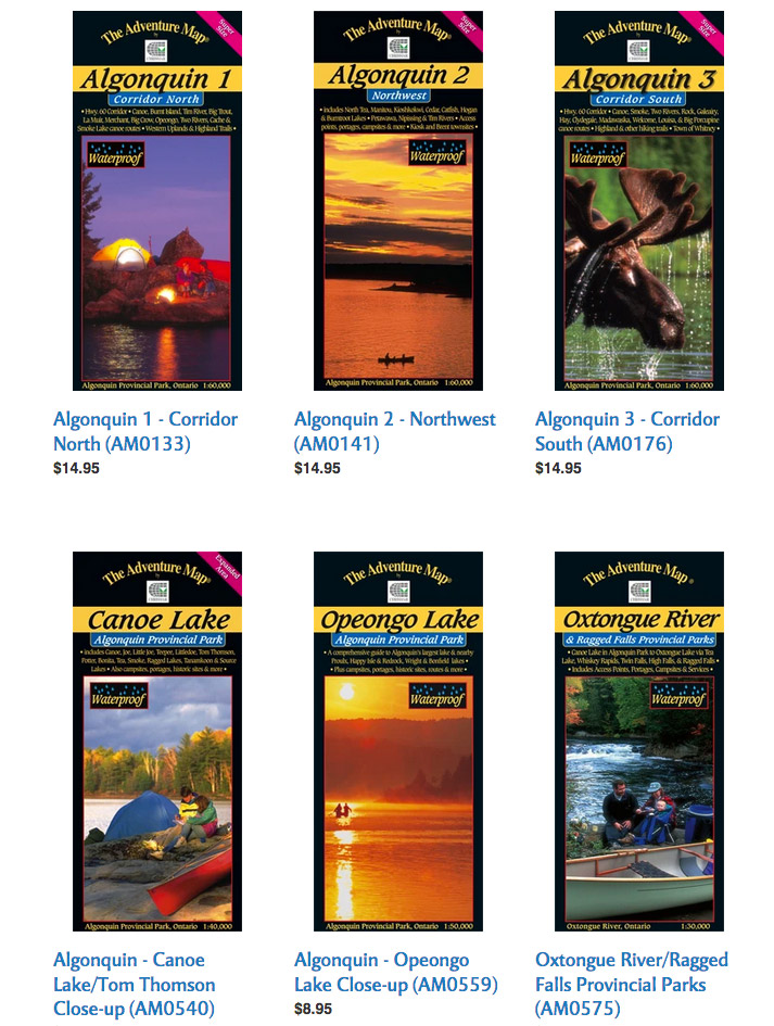
The Adventure Map – Algonquin Park map series
If you’re looking for an Algonquin backcountry map with terrific detail of a specific area of the park, Chrismar’s Adventure Map Algonquin Series is a great choice. Offered at close-up scales of 1:30,000 or 1:40,000, as well as broader overview scales of 1:50,000 or 1:60,000, each Algonquin Park interior map features excellent terrain, vegetation and contour detail making for easy-on-the-eyes navigation. Adventure Maps include campsites, portages, access points, hiking trails, historic sites and other attractions. The back side of each map is perfect for campfire reading with extensive text, photos and graphics describing the area’s natural and human history, route suggestions, safety tips and more.
The Adventure Map Algonquin Series features eight waterproof print maps, including close-up maps of popular areas like Canoe Lake, Opeongo Lake, Oxtongue River and Barron/Achray. $9.95-$16.95 each.
Algonquin Park whitewater guides
For experienced canoe trippers planning a downriver journey on one of Algonquin Park’s whitewater rivers, these spiral-bound guidebooks are indispensable. Detailed maps outline the route, rapids, portages and river conditions. The Petawawa River Whitewater Guide and Madawaska Opeongo Whitewater Guide are available from the Friends of Algonquin Park for $5.95 and $9.95 respectively.
More Algonquin backcountry maps
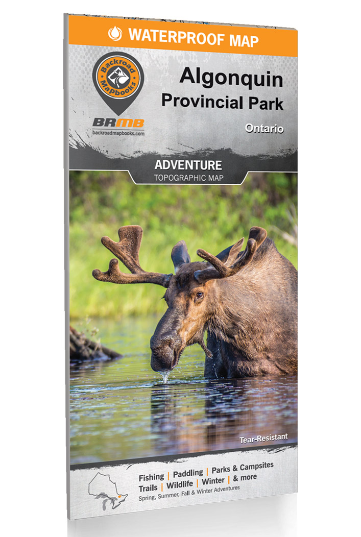
A handy companion to any Algonquin route map is Backroad Mapbooks’ Algonquin Park Topographic Adventure Map. Updated for 2021, this waterproof topographic map features a 1:75,000 scale map of the Highway 60 corridor on one side and a 1:140,000 scale map of the entire park on the other. The Algonquin topographic map includes suggested paddling routes, campsites, trails, outfitters, wildlife and fishing information, and details winter adventures so you can use it year-round.
Once you have a sense of where you want to paddle, Ontario Parks’ online reservation for Algonquin backcountry campsites provides a basic Algonquin Park lakes map with campsite availability in the vicinity of each interior access point. Before making your reservation, you’ll need to know your intended Algonquin Park access point and have a good idea of your route, including daily mileage that’s reasonable for your group. Keep a backcountry canoe routes map or backpacking trails map handy while making your reservation, in case modifications have to be made to your trip.
Algonquin Park maps for hiking and backpacking trails
Want to hike the popular Lookout Trail or tackle a three-day loop on the Highland Backpacking Trail? Many of the Algonquin Park interior maps used by canoe trippers are also suitable for navigating the park’s three backpacking trails and 20 interpretive hiking trails. Maps by Jeff’s Algonquin maps, Chrismar’s Adventure Map Algonquin Park series and Backroad Mapbooks’ Algonquin Topographic Map (see above) are excellent choices for visitors exploring the park on foot.
An official Algonquin Park Backpacking Trails Map is published by the Friends of Algonquin Park. Each of the park’s three backpacking trails is detailed with its own scale and map displaying designated campsites, and the “Planning Your Trip” section offers helpful hints to ensure an enjoyable trip. Updated for 2022/2023, $2.95.
You can also download Jeffrey McMurtrie’s free Backpacking Map of Algonquin Park from Algonquin Outfitters. Like all of Jeff’s maps, this set of three, close-up topographic maps shows Algonquin’s backpacking trails in vivid, user-friendly detail. Each map includes hiking times, campsites and historical and scenic anecdotes.
Algonquin Park campground maps
Algonquin Provincial Park’s beautiful, fully serviced vehicle campgrounds make it easy to enjoy a few nights in the park without backcountry camping. Eight of the park’s developed campgrounds are centrally located along Algonquin’s Highway 60 corridor, while three more campgrounds service visitors to the park’s northern and eastern access points. View Algonquin campground maps and learn more about car and RV camping in the park here: Camping in Algonquin Park: 9 Breathtaking Campgrounds.
Where can you buy an Algonquin Park map?
Purchase Algonquin Park canoe route maps, Algonquin Park trail maps and other Algonquin Park backcountry maps and trail guides from the Algonquin Park Visitor Centre in-person or online from the Friends of Algonquin Park map store.
You can also buy Algonquin Park maps from many park outfitters, an especially convenient option if you’re already renting canoes or equipment from these outfitters. With multiple locations in and around the park—and a comprehensive map shop that sells nearly every Algonquin Park map mentioned in this article—it’s hard to beat Algonquin Outfitters for convenience and selection.
Find more outfitters here: Algonquin Park Canoe Rentals: 11 Best Outfitters.
Where is Algonquin Park on a map?
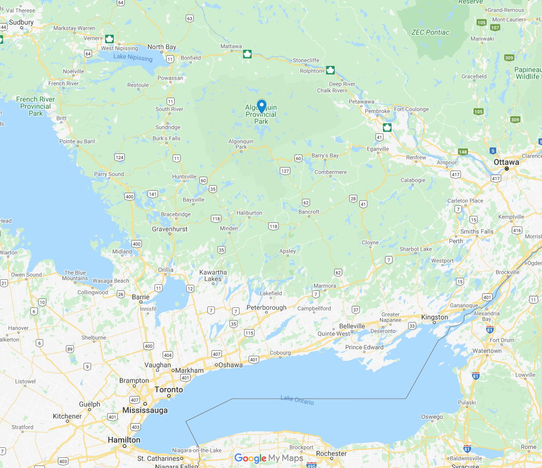
Situated in central Ontario, accessible to Toronto and Ottawa, Algonquin Park encompasses a vast area of more than 7,500 square kilometres. View a map of where to find Algonquin Park here.
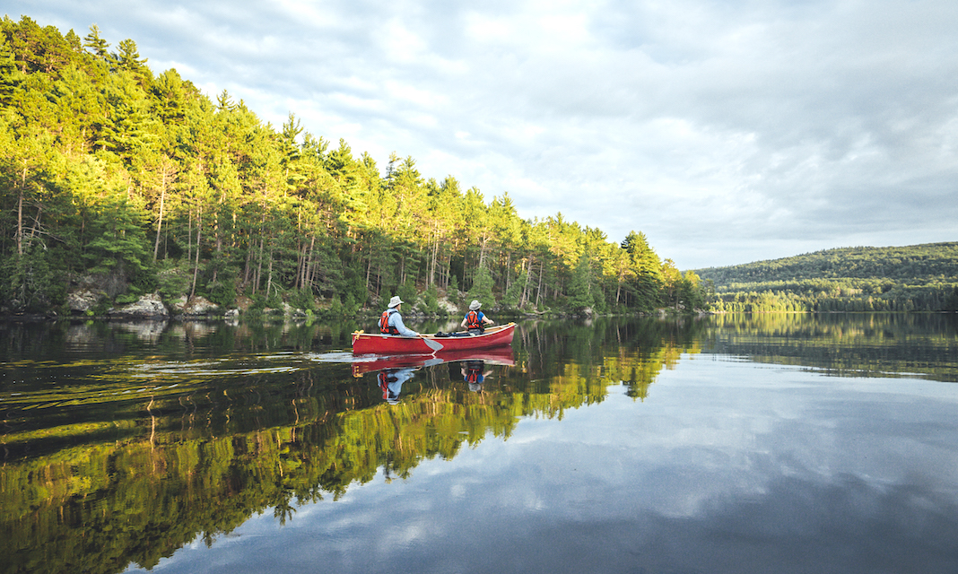
There are so many ways to explore Algonquin Park. | Photo courtesy of: Destination Ontario


")


