This past spring, Norm Hann and I set out from the Gitga’at community of Hartley Bay, tucked in the deep fjords of northern British Columbia’s Great Bear Rainforest. Our goal was to follow an ancient and long-disused section of a traditional Grease Trail, once employed by Coastal First Nations carrying oolichan grease to the interior, where it would be traded for furs and meat.
For years, Norm—the pioneer of the Stand conservation project and an adopted member of Gitga’at Raven Clan—had heard whispers of the route. Traveling up the Quall River, the path led over a portage, into the mysterious Ecstall drainage, and finally down to the Skeena River. Being long-time SUP expedition enthusiasts, Norm and I saw it as a perfect test; taking us upstream, through rugged bush, down unknown rapids, and finally out onto the open ocean. After receiving the blessing of Gitga’at elder Helen Clifton, and invaluable route advice from community members, we set out, carrying seven days of food and minimal camping equipment on inflatable paddleboards.
For two days, we pushed up the Quall, as it slowly shrank into an ankle-deep creek. With fins off, we dragged our boards over rocks, across tumbled log jams, and through thickets of prickly Devil’s Club. Soon exhaustion set it and progress slowed to a crawl. Shins and forearms grew scratched and bloody. It took three hours to cover a kilometer.
[Paddling Buyer’s Guide: View All Paddleboards]
“You’ll know the portage trail when you see it,” Spencer Greening told us, a young First Nations archeologist working in the region. “You’ll know many feet have walked there.”
I wondered how a trail could still exist after a century of neglect, but Spencer was right. Abruptly, amidst rocky slopes and Avatar-like Sitka spruce, an unmistakable trail materialized, leading over the mountains and to the sandy banks of Ecstall. That night we camped in the shadow of a driftwood log, 10 feet in diameter.
The next day we launched in drizzle, unaware and unprepared for the wonders awaiting us downstream. The river was playful, weaving and turning as it descended class III boulder gardens. Elsewhere it was glassy-smooth, a crystal-clear conveyor belt, carrying us into the largest intact-yet-unprotected old-growth rainforest on the British Columbia coast. Amid this world of tangled brush, lush green and constant birdsong, the overriding sensation was not the uniformity we have grown accustomed to in second and third growth stands, but rather an unspoiled wildness; the sense that everything was exactly where it was supposed to be.
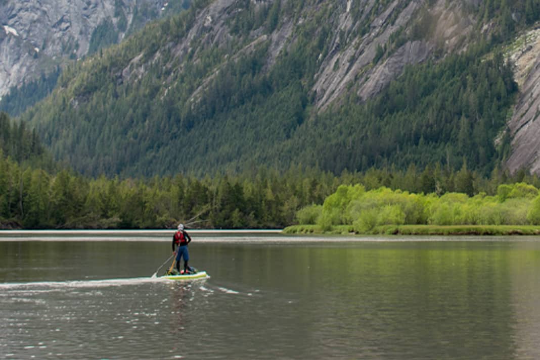
For three days the waters of the Ecstall grew until it felt more like a fjord than a river. Silt caked the banks. Tides pushed and pulled us back and forth. And it seemed we had left the great, hidden wonders behind. Then we rounded a corner and came face-to-face with granite monoliths of a scale and grandeur rivaling Yosemite. Paddling to the base of the steepest cliffs, we lay speechless on our boards for hours, warmed by the sun, munching on energy bars, while gazing upwards at the impossibly sheer walls of rock. It was a moment as perfect as I have ever known.
We would later press on, past log booms and busy shipping-container ports on the ocean, to the First Nation village of Metlakatla, north of Prince Rupert, but by then, the wilderness had released us.
Bruce Kirkby is a photographer and writer living in Kimberley, British Columbia. A Starboard team rider, his third book, Kingdom of the Sky, will be released in fall 2020.
A moment as perfect as we have ever known. | Photo: Bruce Kirkby


")


