

Seventy-year-old Murray Muir has had a lot of experiences in the backcountry, but he’s never come face-to-face with a raging wildfire before this summer.
Muir and five paddling companions, all in their 60s and 70s, had set out on a three-week trip in northern Ontario’s Wabakimi Provincial Park on July 7. On day five of the trip, a huge storm rolled through, bringing lots of lightning and little rain. On day seven, the group found themselves surrounded by smoke-filled skies. They set up camp early on Grayson Lake to monitor the situation, but things took an urgent turn after dinner.
“It got smoky to the north, and then we heard this freight train sound. It’s just like really roaring. And then we could see the flames leaping on the treetops,” Muir says.
The group quickly packed up their gear, jumped into canoes and fled in search of a safer spot on the lake.
Running from the flames
Muir and his companions had checked their Garmin inReach earlier in the day after first spotting smoke and had learned they were surrounded by wildfires. Strong winds prevented them from reaching the larger section of Grayson Lake, which was accessible by floatplane.
“We didn’t really know which direction to go because we sort of had to wait out because some of the fires were south of us…some were east, some were north. We were basically boxed in,” Muir says.
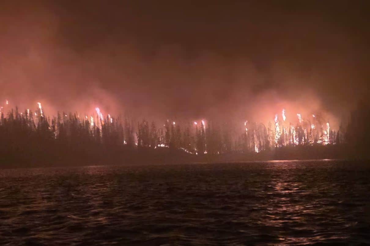
In their post-dinner escape from their campsite, the group was once again blocked from reaching the rest of the lake—this time by fire. They retreated to a small rocky point, which they’d later name “Salvation Point.” They watched as the flames and smoke grew and decided to activate the SOS function on their inReach. A short while later, there was a dramatic wind shift, and the islands in front of them burst into flames.
“And that’s when things got the most scary,” Muir says. “So for a while, we were getting rained down by big flakes of ashes. And along with the trees bursting into flames in front of us, there was a real surge in the wind. It just blew like crazy. And it whipped up the waves in front of us.”
The group dunked themselves in the lake and sprinkled water on their packs to protect themselves and their gear from ash and debris. As flames marched down both sides of the lake, they hunkered down for a sleepless night.
“Every once in a while, some trees would get ripping and burning, and the sky would light up, and then you’d try to relax, and then you’d think, oh, gee, how close is it getting?” Muir says.
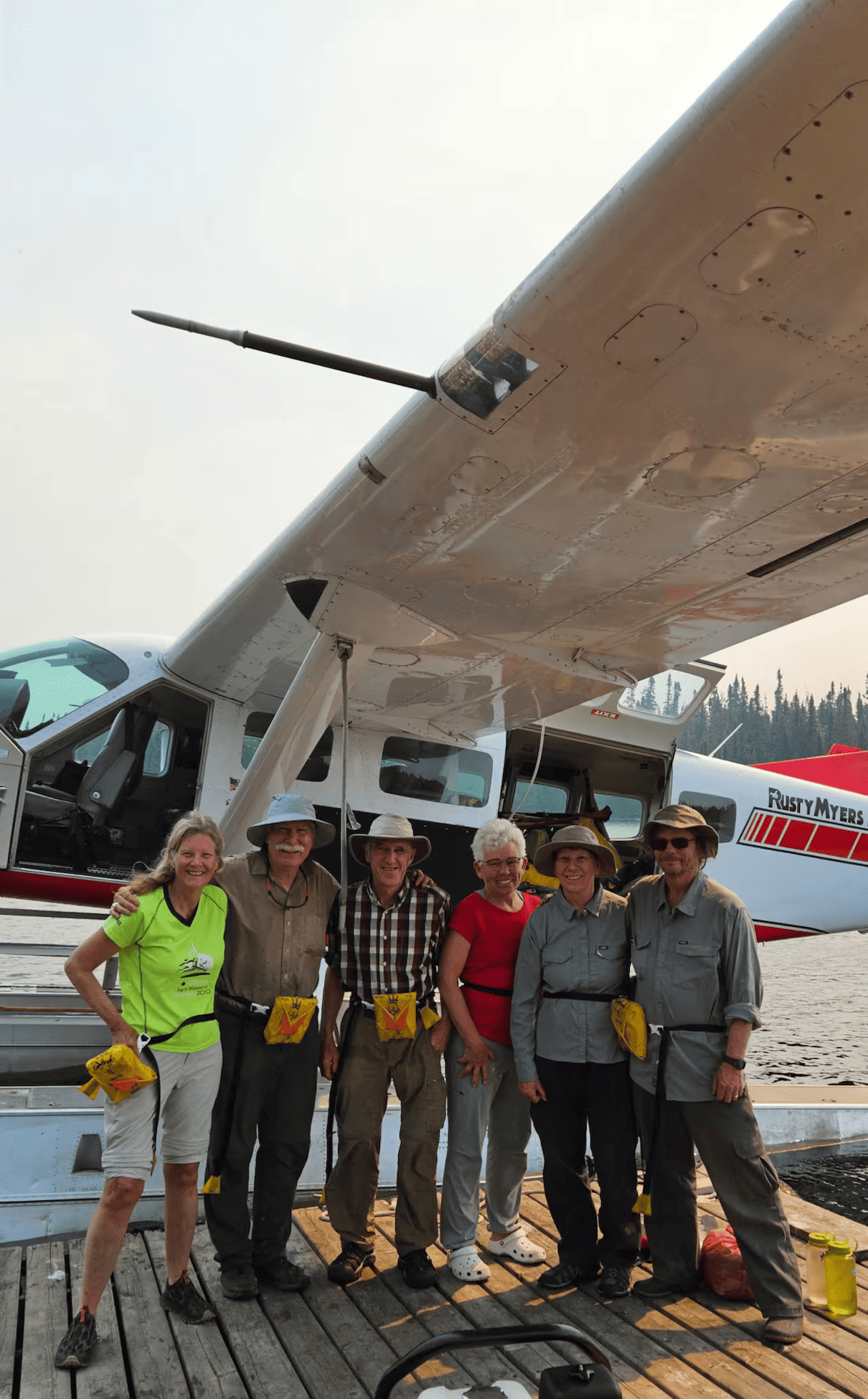
By the time the group left the next morning, “Salvation Point” was one of the only portions of the lake not burned. They paddled out to the larger section of Grayson Lake where they waited at a lodge until they were picked up by floatplane a day later.
How to survive a wildfire
Muir and his group were evacuated two days after having activated their SOS function. While satellite communicators are useful tools in backcountry emergencies, they shouldn’t be viewed as a fix-all. In the case of wildfires, thick smoke or intense fire can prevent planes and helicopters from accessing paddlers.
“Just because you activate [the SOS function], it doesn’t mean it’s going to happen,” Muir says. “It might not happen for a day or two days. Pretty well have to take care of yourself out there in the bush.”
While it’s always preferable to put distance between yourself and a wildfire, if you do end up close to one or in its path, move to a safer area where you can wait. NOLS recommends moving to previously burned areas, a boulder field, a large meadow or a body of water. For padders on a lake, a rocky point or an island are great choices.
“I was just so glad that we had 300 meters of water between us and the flames. I think that’s the secret,” Muir says.
Smoke also poses health risks, and NOLS recommends avoiding prolonged or heavy exertion if visibility is less than three miles. As wildfires in North America are becoming more common and intense, paddlers might also consider adding N95 masks to their first aid kits.
Above all, it is important to monitor weather and fire conditions and be prepared going into a trip. “If fire danger is high or there are fires currently burning, make sure your plan includes multiple routes with a variety of exit points from the area,” Brooke Orte with NOLS writes. For paddlers, that includes knowing where floatplanes can land.
Of course, if fire danger is high and there are fires currently burning, pivoting plans is always an option as well. While it’s never fun to call off a trip, this summer’s fire season displays the rapid rate at which wildfires can grow and spread in the right conditions.








Very scary, reminds me of the great Peter Heller novel “The River”! Must have been terrifying, glad you got out safely.