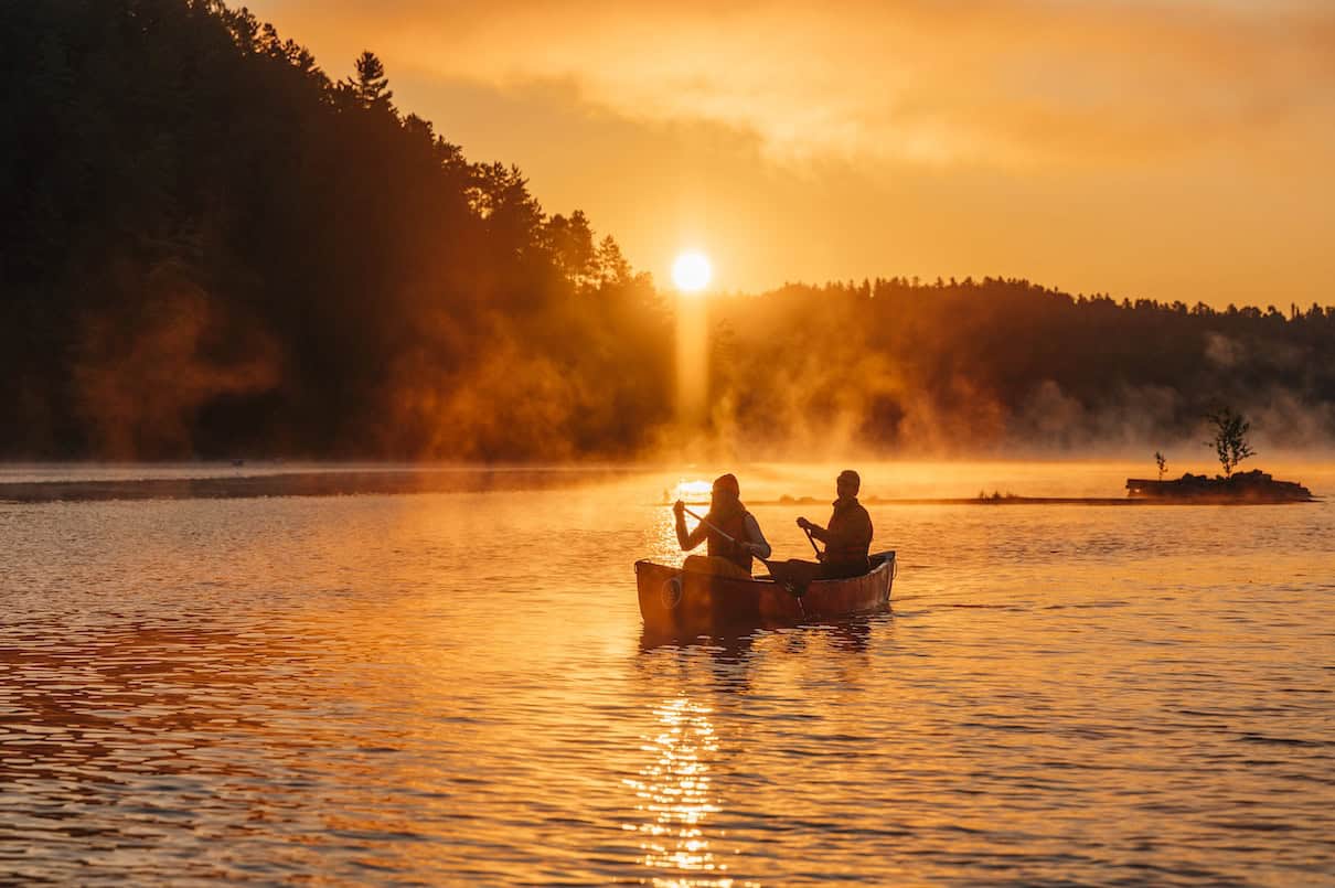
Just across the Ottawa River lies a sprawling labyrinth of deep bays, wild islands, hidden passages, interconnected lakes and spectacular whitewater. Scenic and unspoiled, Québec’s Kipawa region in Abitibi-Témiscamingue offers something for every level of paddling adventure. Explore the peaceful island archipelagos of Lake Kipawa for a relaxing weekend of canoe camping and fishing, or venture deeper into wilderness waterways for a descent of the rugged Kipawa River.
The name Kipawa comes from an Algonquian word meaning “at the narrows beyond which more water opens out,” describing the countless closed-off channels that form the many arms, reaches and bays of Lake Kipawa. The watershed drained by the Kipawa River encompasses close to 6,000 square kilometers of mostly untouched forest and small lakes, much of it within Québec’s largest managed outdoor recreation zone, ZEC Kipawa. Both the lake and river are known for exceptional camping, fishing, canoeing and kayaking with Opemican National Park and the welcoming villages of Kipawa and Laniel providing access and services.
Whether you enjoy portage-free paddling, intimate lake-to-lake journeys, or navigating rapids on a thrilling wilderness river, this guide will help you discover the best Kipawa canoe routes.
Where is the Kipawa region?
The Kipawa region is situated within the Abitibi-Témiscamingue region in western Québec, just east of the Ottawa River, Lake Temiskaming and the Ontario border. The gateway towns of Laniel, which serves the northern end of Lake Kipawa, and Kipawa—on the lake’s south end—are less than a five-hour drive from Toronto and just over an hour’s drive from North Bay. Both communities are readily accessible from Highway 101 and are popular destinations for cottaging on area lakes and outdoor adventure opportunities in Opemican National Park, which lies midway between, 25 minutes south of Laniel and 30 minutes north of Kipawa.
The wider Abitibi-Temiscamingue area is known for its incredible outdoor adventure opportunities, from hiking and paddling to skiing and snowshoeing.
Where to canoe trip
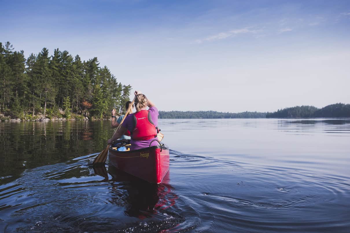
Lake Kipawa canoe camping
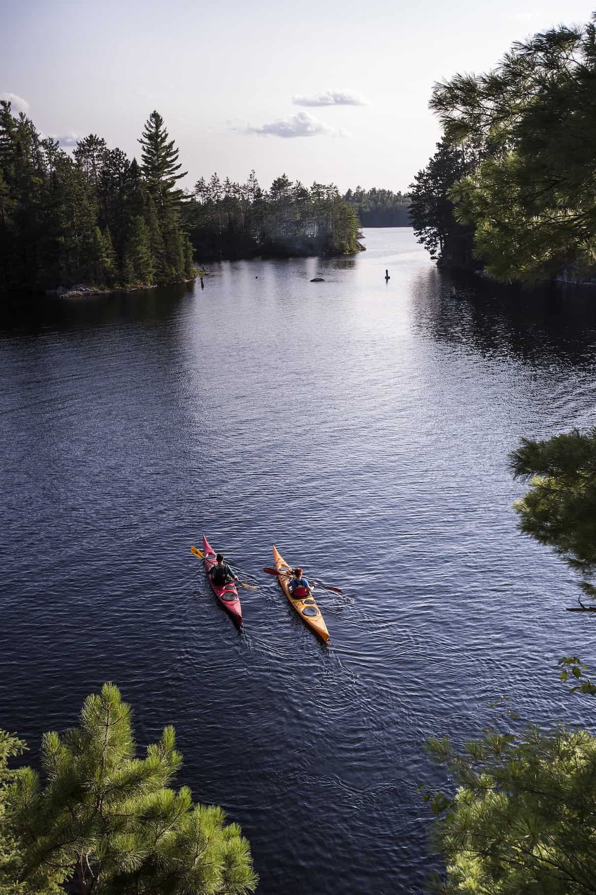
With deep, clear waters covering over 300 square kilometers of rocky Canadian Shield and mature red and white pine forest, Lake Kipawa is a paddler’s paradise comparable to the iconic Ontario canoe country of Lake Temagami, which lies less than 70 kilometers west as the crow flies. Both lakes are roughly 50 kilometers long with sprawling, irregular shapes concealing quiet bays and forgotten islands splintering off in all directions.
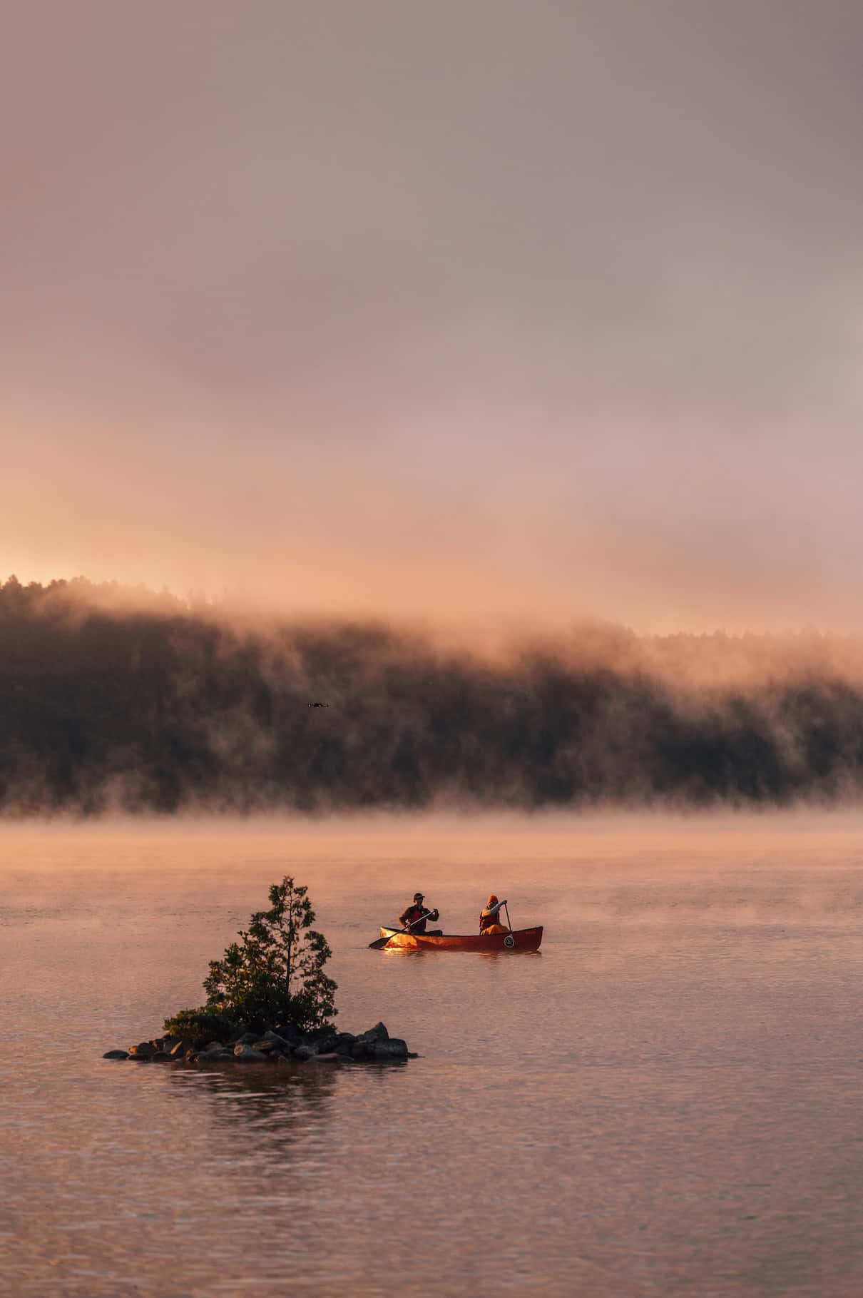
Nearly 50 percent larger than its famed neighbor, Lake Kipawa boasts over 1,300 kilometers of shoreline with minimal boat traffic, fishing lodges or cottages interrupting the wilderness. Countless islands, passages and breathtaking cliffs give the impression of interconnected rivers and narrow lakes. Red pine giants, some over three centuries old, line the lake in several places and sugar maples create a crimson spectacle in autumn. Bald eagles and osprey soar overhead, while the haunting cry of the loon accompanies still mornings and evenings.
Lake Kipawa’s waters reach a maximum depth of 40 meters, with an average depth of 11.5 meters, and remain chilly throughout the summer. The lake and its ancient canoe routes are located on the Anishinaabeg ancestral territory of Hunter’s Point; both are deeply intertwined with the early fur trade era and traditional Algonquin ways of life.
Canoe routes
Lake Kipawa canoe routes include portage-free touring and camping on the lake’s maze of arms and islands or portaging into smaller surrounding lakes for a peaceful backcountry experience. With so much water to explore, routes range from easy two- or three-day loops to longer forays of 100 kilometers or more.
Opemican Archipelago Paddling Trail
For a scenic introduction to this vast lake, the Opemican Archipelago Paddling Trail visits deep-water bays, beautiful cliffs, uncrowded beaches and comfortable island campsites within Opemican National Park in Lake Kipawa’s north end. Launch from Laniel Municipal Park (free parking) or the national park’s Baie-Dorval access (recommended, entry fee applies) for this +25-kilometer “lollipop” loop. Three scenic island and sand beach campsites in the Île aux Fraises area can be reserved through Opemican National Park.
Opemican Crescent Paddling Trail
For a longer one-way (or out-and-back) journey, extend the above route into the Opemican Crescent Paddling Trail (33 km). Connecting the national park’s Baie-Dorval and Lac Ravalet access points, canoeists on this route enjoy paddling in the archipelago, nosing through narrow channels stalked by herons and cranes, and wild camping on the open lake before finishing with a tranquil paddle-and-portage journey along several small interior lakes.
Kipawa Archipelago Paddling Trail
More experienced paddlers can choose from two longer routes or link them for a journey of a week or more spanning much of the lake. The Kipawa Archipelago Paddling Trail arcs through the northern part of the lake for 64 kilometers, with just a six-kilometer shuttle ride on a gravel road separating the starting point from your finish in Laniel. Departing from Deux Milles Bay, enjoy remote beaches, secluded campsites and the old-growth pine forests of McKenzie Island.
Dramatic cliff-lined channels offer pulse-quickening jumping rocks and hint at the region’s active tectonic past. Lake Kipawa lies along the Grenville Front, where two sections of Earth’s crust meet, creating spectacular faults and occasional seismic activity like the 2000 Kipawa earthquake. Make a detour into Canal Bay to witness this narrow pass edged by steep granite walls; an opening at the end reveals an idyllic island campsite nestled within the heart of the mighty lake.
Kipawa Southeast Paddling Trail
As its name suggests, the Kipawa Southeast Paddling Trail departs from Chutes-du-Pin-Rouge, where the Upper Kipawa River flows into Lake Kipawa, and meanders for 55 kilometers through the southern part of the lake, finishing in the village of Kipawa. The route squeezes through some of the lake’s most intimate passages, connecting a series of scenic island campsites and beautiful sandy beaches. Free parking is available at both ends, or arrange a shuttle for a one-way trip.
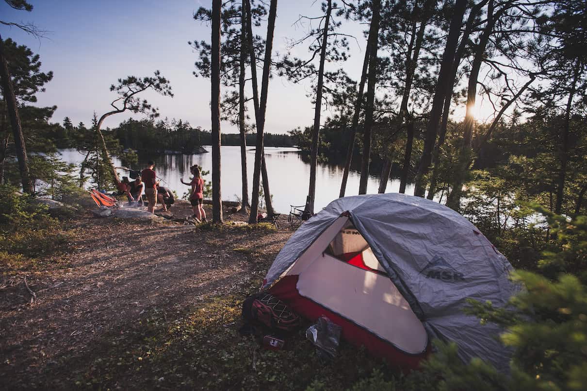
Campsites
Campsites are largely Crown land wild camping (free for Canadian citizens) with a handful of paid canoe campsites reservable through Opemican National Park. Expect basic amenities like a fire ring, cleared tent pads and occasionally a picnic table among the pines at Crown land sites, which are generally unmarked but easy to spot. National park sites feature outhouses and picnic tables and are marked with camping signs.
Reservations
Canoe camping reservations for Opemican National Park cannot be booked online and must be made over the phone by calling Sépaq at 1-800-665-6527, or the park at 819-627-3551. National park campsites are available from mid-June to mid-October.
Outfitters
Contact a local Lake Kipawa outfitter for canoe, kayak, paddleboard and camping equipment rentals. Coop de L’Arriere-Pays (The Backcountry Co-op) in Ville-Marie rents equipment and offers a convenient shuttle service to simplify transportation logistics or relocate your vehicle so it’s waiting for you at the end of a linear trip. Reservations are required.
Located in Temiskaming, Québec, near the south end of the lake, Algonquin Canoe Company maintains and outfits over 500 kilometers of traditional Algonquin canoe routes in the Ottawa River basin. Owned by Wolf Lake First Nation, the outfitter rents canoes, kayaks and camping equipment, offers accommodations and guided tours, and can assist with route planning.
For trips departing from Opemican National Park, Lake Kipawa canoe rental is available at Baie Dorval. Canoe rental includes paddles, PFDs and safety gear. Visit the Sépaq Visitor Centre in Laniel for rental information. Booking in advance is recommended and can be done at the same time as your camping reservation, by phone at 819-627-3551 (June through October).
Fishing
Lake Kipawa fishing is regarded as among the best in Canada, famed for trophy walleye, northern pike, lake trout and smallmouth bass. All anglers must carry a valid fishing license and follow local fishing regulations. In addition, canoe campers who wish to fish on the smaller lakes within Opemican National Park must pay a daily right-of-access fee ($22/person/day); book online or call 1-800 665-6527.
Learn about more fishing opportunities in the Abitibi-Témiscamingue region.
Maps
You can download the GPS track for each of the four paddling trails outlined above from the Access to Outdoors | Abitibi-Témiscamingue website in GPX (GPS) file formats. Each track includes the paddling route, distances, campsites, portages and notable points of interest. You can also download a printable PDF map set and route guide for the Kipawa Archipelago Paddling Trail.
For supplementary navigation on trip, it’s recommended you purchase the 1:50,000 Canadian national topographic series maps for the region: 31 M/03 Fabre, 31 L/14 Ottertail Creek and 31 L/15 Lac Grindstone. These can be ordered from Maptown or World of Maps.
Safety notes
Keep in mind it’s easy to get disoriented while navigating this immense body of water. Paddlers should carry a detailed Lake Kipawa map, compass and GPS with extra batteries—and feel comfortable using these tools to navigate. Because of the lake’s size, dangerous waves can form in windy conditions. Some route sections run along steep rock walls where chaotic reflection waves can form and no landing is possible. Check the forecast and exercise caution when there’s wind.
Lake Kipawa power boat traffic is generally concentrated within a few kilometers of villages (where you’ll also see the most cottages and Lake Kipawa fishing lodges) and to marked deep-water channels. Watch for boat wakes and stay close to shore when possible.
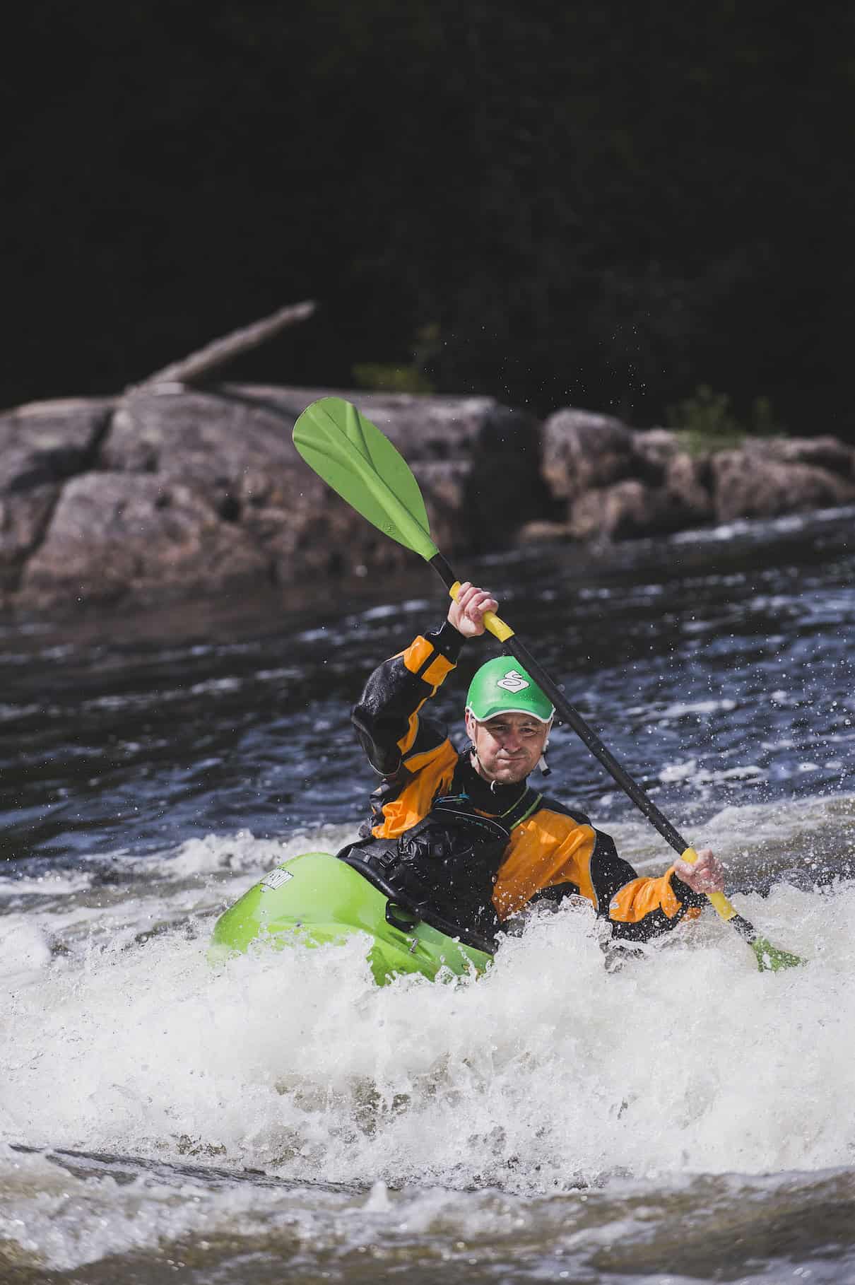
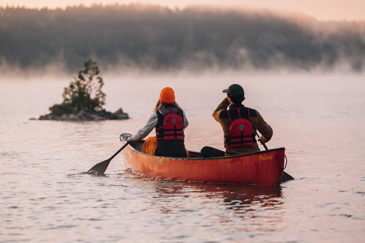
Kipawa River canoe camping
Renowned for its rugged scenery and exciting rapids, whitewater canoe tripping on the Kipawa River rivals popular Ontario rivers like the Spanish, French and Madawaska. Cascading over Precambrian bedrock and dashing beneath towering pines, the Kipawa River flows over 300 kilometers from its headwaters at Lake Dumoine to its precipitous final descent into the Ottawa River.
Along the way, the river meanders through remote forest and lakes, charges over spectacular waterfalls, and vanishes into the vast reservoir of Lake Kipawa, before reemerging for a rowdy, rapid-choked finale.
Learn more about whitewater paddling opportunities across Abitibi-Témiscamingue.
Canoe routes
Lac des Loupes to Lake Charette
Most Kipawa River canoe trips take place on the upper section of the river, with the 40-kilometer route from Lac des Loups (Wolf Lake) to Lake Charette offering a perfect, four-day whitewater adventure for intermediate paddlers. The route begins in ZEC Kipawa and travels south, with straightforward road access to both ends and well-developed camping and portages along its length.
A dozen class I-III rapids challenge canoeists; portages at the more technical rapids mean this route is also suitable for more novice moving water paddlers. Camping beside the thundering ledges of Turner Falls is a Kipawa River highlight. On your last day, enjoy the natural sandy Kipawa River swimming beaches at Lake Sairs and search for striking aqua-green gemstones on Amazonite Island.
Extend your Upper Kipawa trip
For a longer Upper Kipawa River canoe trip, it’s possible to extend your route two or three days downriver to the town of Kipawa, via the southeastern portion of Lake Kipawa. Paddlers who arrange transport to Lake Dumoine can also paddle the Upper Kipawa from its source.
Lower Kipawa River
Plunging 90 vertical meters down more than 20 rapids from the Laniel Dam at Lake Kipawa to the river’s outlet at Lake Temsikaming, the Lower Kipawa River is a wild and thrilling day run (15 km) for expert whitewater kayakers and open boaters. Rapids range from class II to class V, with portage options at some (but not all!) of the more difficult rapids. There is one mandatory portage at Grande Chute, a breathtaking 30-meter waterfall that was featured on the Canada $10 bill.
Multiple put-in-and take-out options make it possible to plan shorter Lower Kipawa River kayaking runs. This section of the river is located within Opemican National Park, and camping is available nearby at the park’s scenic Kipawa River Campground, perched on a high cliff overlooking Lake Temiskaming. Kipawa River camping reservations are strongly recommended since there are only a handful of rustic walk-in tent campsites and glamping cabins available.
Outfitters
Local outfitter Coop de L’Arriere-Pays offers an all-inclusive, five-day guided Upper Kipawa River canoe trip on the upper section, suitable for intermediate paddlers looking to develop their whitewater skills. Guided trips include all meals, equipment, transportation and a professional French-speaking guide. The outfitter also offers equipment rental and shuttle services for self-guided paddlers. For route planning assistance and equipment rental closer to the Kipawa River put-in, contact Algonquin Canoe Company.
Campsites
Upper Kipawa River camping is largely on Crown land with no reservations required. Between Lac des Loups and the road bridge at Petit Calumet Rapids, the river enters ZEC Kipawa and there is a small fee for camping. Paddlers can register and pay camping fees at one of the ZEC welcome centers, self-check-in stations or using the online reservation service.
Fishing
Kipawa River fishing is popular on both the upper and lower sections of river. If you are fishing within ZEC Kipawa or Opemican National Park, you’ll need to purchase a daily fishing permit. Reserve your national park fishing permit online or by phone at 1-800 665-6527.
Maps
For Upper Kipawa River maps, ZEC Kipawa produces a topographic canoe routes map available from park offices. Alternatively, purchase the 1:50,000 Canadian national topographic series maps for the region: 31 M/01 Lac Ogascanan and 31 L/16 Lac Sairs. These can be ordered from Maptown or World of Maps. You can also download the GPS track for the Upper Kipawa paddling trail from the Access to Outdoors | Abitibi-Témiscamingue website in GPX (GPS) file format.
ZEC Kipawa canoe camping
Québec’s largest managed outdoor recreation area, ZEC Kipawa ensures public access to the region’s outstanding canoeing, camping and fishing. Planning a canoe trip in the ZEC is easy: Visitors must register at the welcome centre in Bearn or Temiskaming South upon arrival, or preregister online, and pay user fees to support conservation and maintenance. Reservations for specific campsites aren’t required (or available).
Expect good gravel access roads and well-marked and maintained portage trails. Campsites are marked and offer tent pads, a fire ring and benches. Thunderboxes are located at some sites. Many lakes within the ZEC have road and powerboat access, although traffic is generally light. You’ll see rustic cottages and fishing camps scattered throughout the area.
Explore more parks and wildlife reserves throughout Abitibi-Témiscamingue.
Canoe routes
Kipawa Tuk Tuk Paddling Route
Looping 96 kilometers through a series of picturesque lakes and small rivers via a dozen easy portages, the five- to eight-day Kipawa Tuk Tuk paddling route is the ZEC’s most popular. The rich history of the Kipawa region is concentrated along this route, beginning with the settlement of Algonquin families at Hunter’s Point more than five millennia ago. Diverse landscapes and numerous marshes provide excellent opportunities to observe wildlife. Accessed from Bearn, the route departs from Hunter’s Point or Lake Ostaboningue and features warm waters, sandy swimming beaches, scenic rapids and a visit to the historic wooden church at Hunter’s Point. Learn more here.
Brousse (Bush) Circuit
For a shorter loop combining the cascading Saseginaga River section of the Tuk Tuk route with an exploration of the park’s more remote lakes, try the four- to five-day Brousse (Bush) Circuit. Accessed from Bearn and departing Lake Ostaboningue, this 58-kilometer route links remote lakes and rapids across 13 easy-to-moderate portages and visits a heron rookery as well as the beautiful falls at North Lake.
Saseginaga River
For those looking for a weekend-long adventure, it’s also possible to arrange a shuttle and paddle the pretty Saseginaga River from Albert Creek to the sandy beaches of Lake Ostaboningue. This 29-kilometer route requires just three short portages, making it ideal for an easy two- to three-day trip. Also available as a guided, all-inclusive three-day getaway from Ville-Marie outfitter, Coop de L’Arriere-Pays.
Cigarette Loop
If you are looking to access ZEC Kipawa from Temiskaming South, the easy Cigarette Loop (31 km, 3 to 4 days) tours through a variety of small lakes and visits the exotic, white-sand beaches of Lake Ogascanane. Depart from Lac des Loups (Wolf Lake) and paddle the loop counterclockwise, finishing with a 3,500-meter portage back to your start.
Outfitters
Outfitters offering canoe rentals and shuttles for ZEC Kipawa include Algonquin Canoe Company in Témiscaming, Quebec, and Coop de L’Arriere-Pays (The Backcountry Co-op) in Ville-Marie.
Maps
ZEC Kipawa produces a topographic Kipawa canoe routes map available from park offices in Bearn and Temsikaming South. You can also download a guide to canoe camping routes from their website.
What is the weather like in Kipawa?
Weather in the Kipawa region is similar to that experienced in northern Ontario parks like Temagami or French River. The best time to plan your Kipawa canoe camping trip is from mid-May to early October. Plan an early season trip in May or June to witness spring wildflowers and take advantage of higher water levels on smaller creeks and rivers. Even better, this is prime time for viewing wildlife like moose, beavers and bald eagles, and you’ll experience very little motorboat or cottage activity with many waterways to yourself (just be prepared for biting bugs).
If you prefer warm waters for enjoying Kipawa’s legendary swimming beaches and jumping rocks, the peak summer months of July and August are your best bet. Late summer is also a great time if you’re looking to avoid blackfly and mosquito season. Alternatively, plan an autumn trip to catch hardwood forests ablaze with fall colours. The cooler days and crisp nights of late September through early October reward with bug-free campsites.
Still dreaming of more exploring? Learn more about the best paddling routes in the Abitibi-Témiscamingue region.


")


