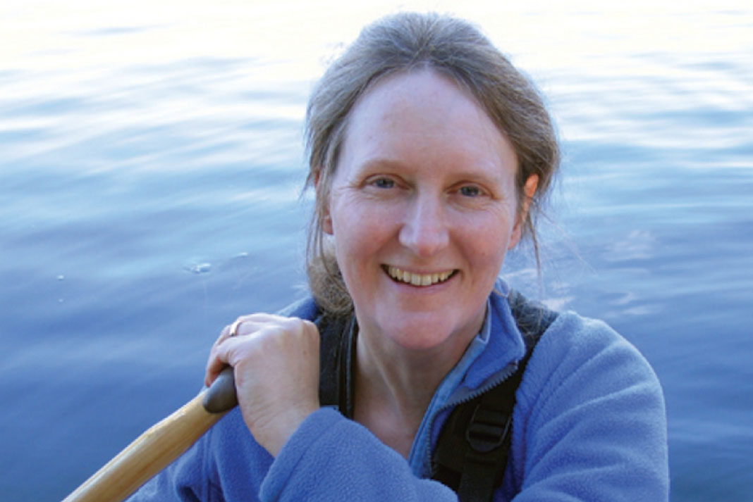
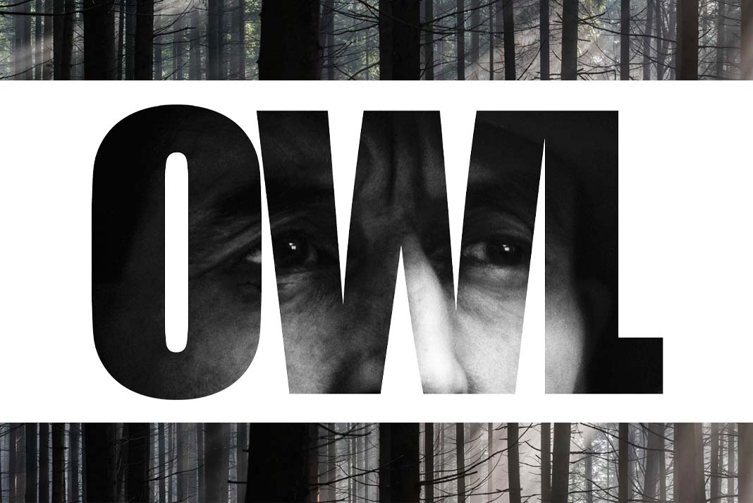
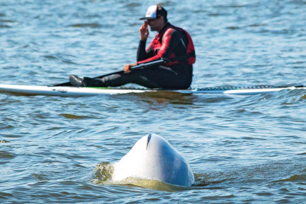
Beluga whales have a protrusion on their heads called a melon. | Feature photo: Daniel Raiti
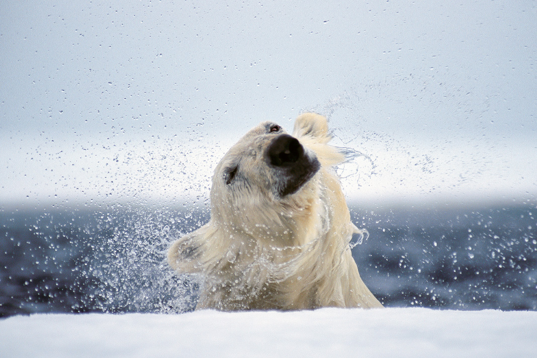
Churchill, Manitoba has been known as the Polar Bear Capital of the World since the 1980s. Each fall more than 12,000 tourists flock to the small frontier town (population: 899) to witness polar bears gathering, awaiting sea ice to form on Hudson Bay.
These ursine kings of the Arctic aren’t the only charismatic mega-fauna to inhabit the area. An estimated 10,0000 beluga whales migrate into Hudson Bay each summer, with approximately 3,000 congregating in the estuary where the Churchill River meets the Bay. The belugas make much friendlier paddling companions than the bears.
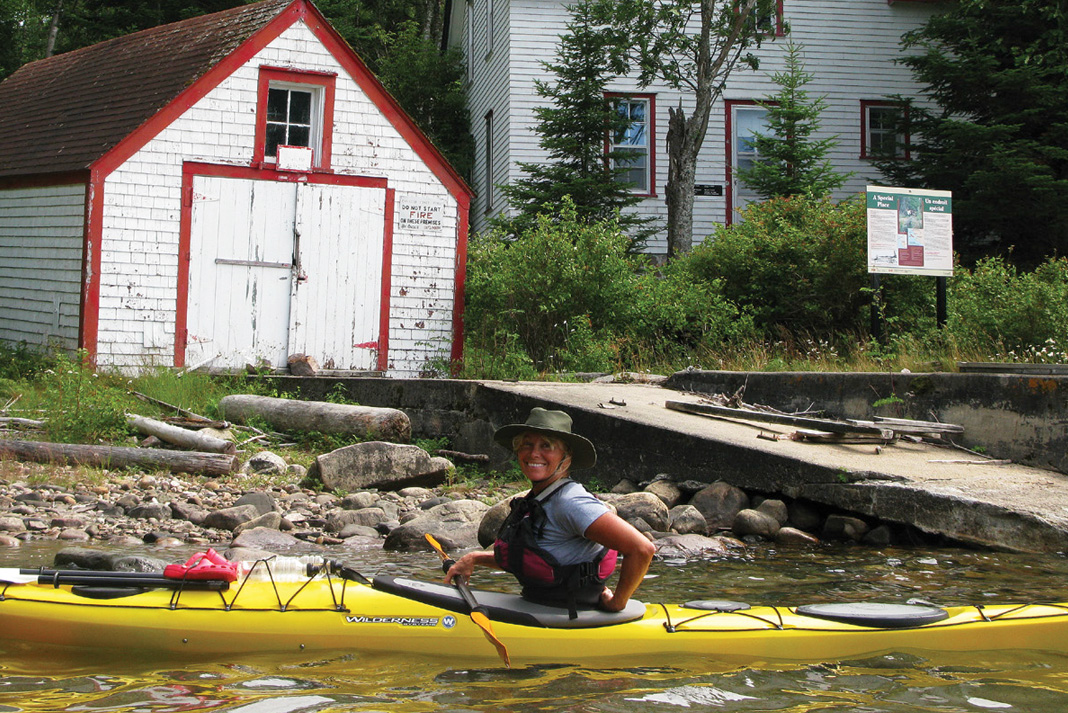
Paddleboard with beluga whales at the edge of Hudson Bay
Kayak trips have been popular for tourists hoping to get on the water with the beautiful 1,000-pound cetaceans, however, standup paddleboarding is a new option for getting close to the playful belugas of Churchill.
Beluga whales have a protrusion on their heads called a melon. | Feature photo: Daniel Raiti
The melon aids in communication and changes size and shape during sound production. | Photo: Dustin Silvey
Belugas are attracted to disturbances in the water, including those created by a paddle. Incredibly curious, the whales often follow the boards, eyeing up at them from just under the surface. They’ve even been known to knock paddlers off their boards with boisterous flicks of their massive white tails. Don’t worry—the gentle beluga prefers a diet of crab and cod to stinky neoprene-wrapped paddlers.
Day trip
Paddleboard tours typically last two hours on the water. With gearing up and a safety briefing, the whole trip totals about three hours. The trips are run at low tide to give paddlers the best view of the belugas in the mouth of the warmer Churchill River, rather than out in cold Hudson Bay.
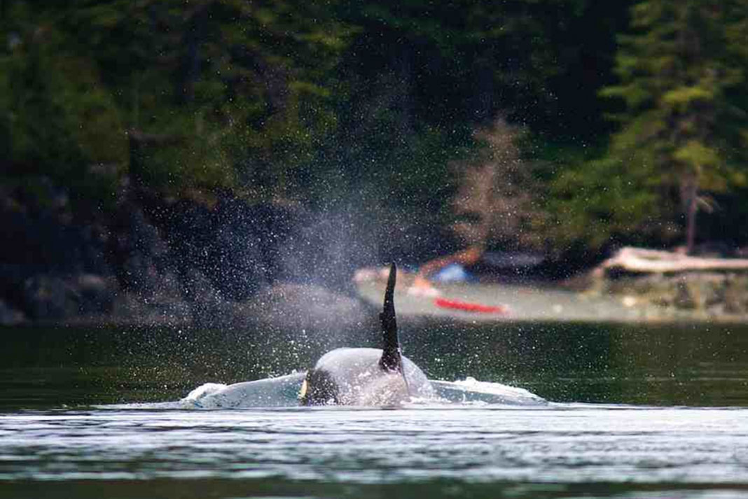
Whales, bears, bald eagles, moose and wolves are plentiful. Book a separate tour to visit the tundra hotspots where polar bears frequent.
Exposure
July and August are best for beluga watching. Visit in August for the best chance of seeing both belugas and polar bears. The weather is typically cool in summer—about 60°F—and it can change quickly. Dress accordingly.
Diversion
Tundra buggies are massive all-terrain vehicles hopped up on extra large tires. Frontiers North Adventures’ buggies take tourists and photographers out to the bears for closer viewing, while keeping them safe from becoming dinner.
Belugas aren’t the only breathtaking attraction in the area. | Photo: Dustin Silvey
Access
The town of Churchill is accessible only by rail and air. Or you could paddle there.
Snacks
The Tundra Inn Dining Room and Pub has the best food in town. Don’t miss trivia night and open mic night.
This article was first published in the 2015 Paddling Buyer’s Guide. Subscribe to Paddling Magazine’s print and digital editions, or browse the archives.
Beluga whales have a protrusion on their heads called a melon. | Feature photo: Daniel Raiti
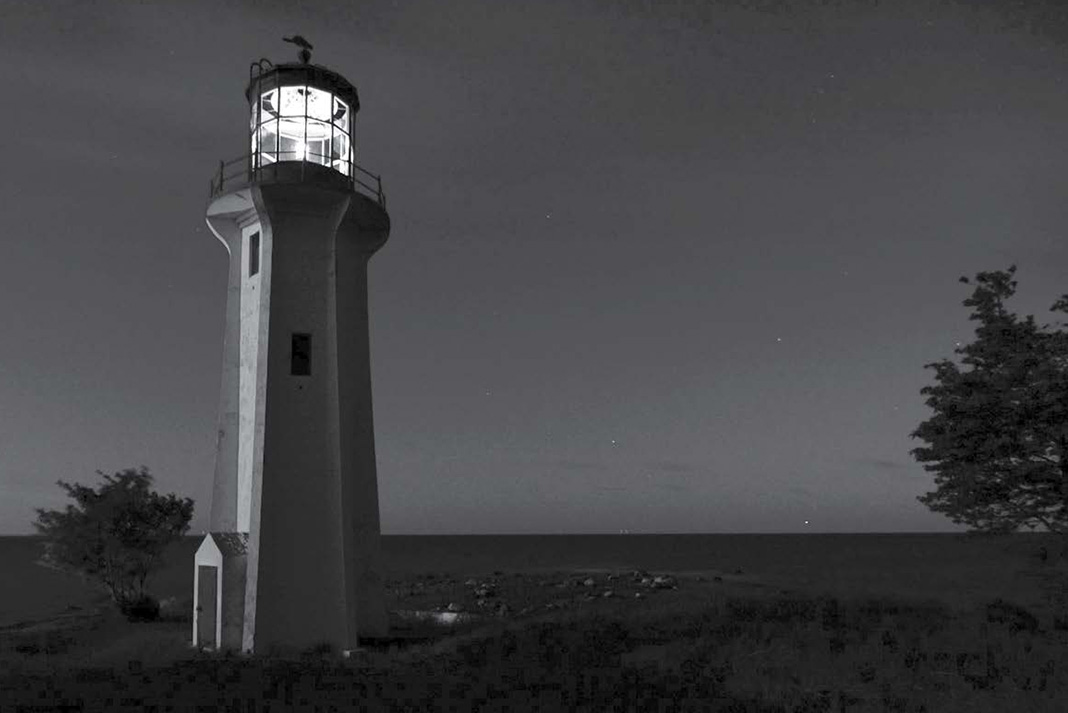
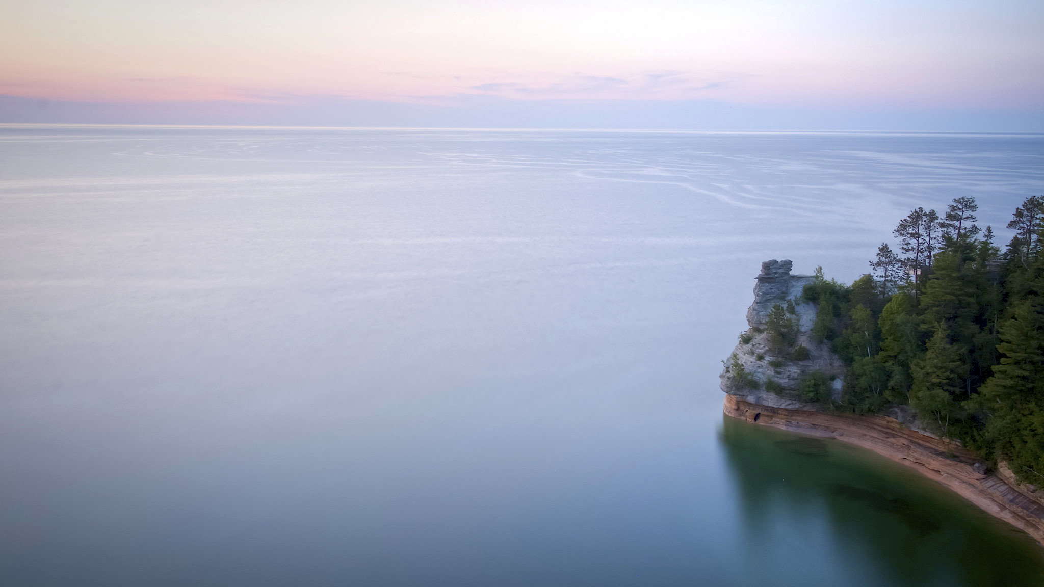
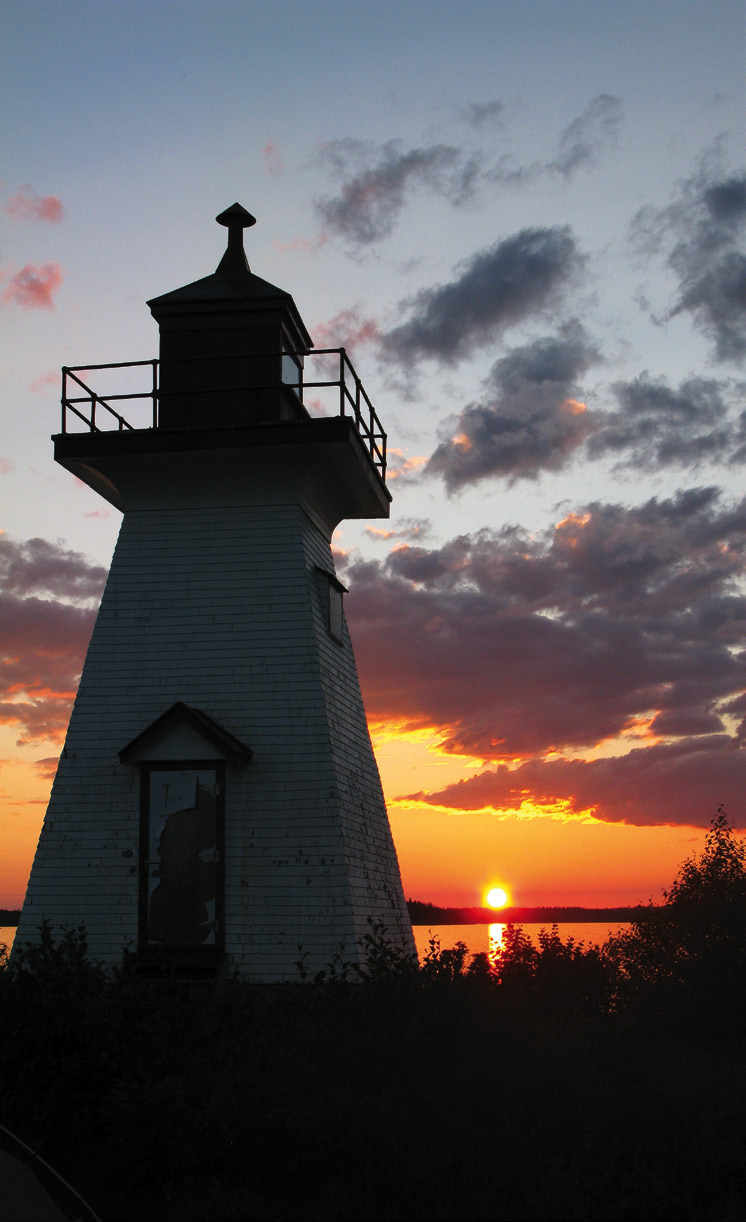
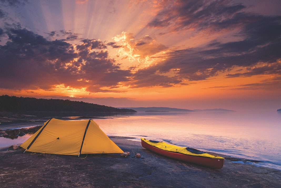
Battle Island lighthouse looks out over the misty waters of Lake Superior. | Feature photo: Susan Miller/Wikimedia Commons
Craig jiggles the handle and elbows the rickety, wood-paneled door. From my paddling buddy’s devious glance I know in a few moments we’ll be inside the cupola of the tallest, most remote lighthouse on the Great Lakes. I dig out a Swiss Army knife from my PFD pocket and with a few turns of a flat-head screwdriver, the hinges release from the rotten jamb and we step into the dark and musty Caribou Island tower.
Red-enameled stairs switchback to a trapdoor; inside the glass room at the top it’s unbearably hot. Through windows caked with desiccated insects, the watery horizon of Lake Superior stretches in all directions, our sea kayaks yellow and white slivers on the rocks below.
[ Plan your next Great Lakes kayaking tour with the Paddling Trip Guide ]
I justify forced entry by a sense of entitlement: My great-great-grandfather worked here for 11 years in the late 1800s. This is the climax to a six-hour open-water crossing—a nerve-wracking affair Craig and I will repeat tomorrow as we begin our 150-kilometer journey back to civilization. But I’m disappointed to realize the signs of lightkeeper C.J. Pim’s Caribou Island tenure have long crumbled away, erased by time and technology. The only tangible evidence of my ancestor’s career is the photocopy of his life insurance policy—valued at $2,000 and dated 1896—stored at home in a desk drawer.
Photo: Virginia Marshall
The 100-foot-tall cement structure we’ve broken into replaced Pim’s stone tower in 1911. Impressive Gothic-style flying buttresses, designed to anchor the tower in hurricane winds, symbolize the halcyon days of lightkeeping, when hardscrabble men and women and their families were integral to maritime safety—responsible for tending whale oil and kerosene lamps, operating foghorns, recording weather observations and bravely assisting mariners in distress.
A century ago, the Caribou Island lightkeeper was paid $1,260, from which he pulled a salary for an assistant. Since then, the occupation faded into obsolescence. With the advent of accurate charts, improved navigational tools and, finally, solar-electric power, the Canadian Coast Guard de-staffed the last light on Lake Superior in 1991.
Final abandonment came in 2010, when the government listed 986 lighthouses in Canada, including 12 on Lake Superior, as “surplus”—meaning they “could be replaced with simpler structures whose operation and maintenance would be more cost-effective.” Coast Guard lightkeepers still maintain beacons in a few isolated spots in the Pacific Northwest, but as the lights of Lake Superior wink toward an uncertain future, a handful of hopelessly anachronistic individuals have found their own creative approaches to reinventing this long-lost way of life.
It could be argued that once you’ve seen one lighthouse, you’ve seen them all. But the more you visit, the more you appreciate these marvels of engineering. Towers cling to the craggy bedrock of some of the most rugged headlands on Lake Superior. Tons of concrete, rebar, two-by-fours, aluminum roofing, oil drums, asbestos insulation, lead paint and more were hauled to the middle of nowhere where the buildings were erected largely by hand. So it makes sense the government favored cookie-cutter architecture. Structures were often duplicated from place to place—the keepers’ houses at Île Parisienne, at Lake Superior’s south end, mirror those at Michipicoten Harbour on the east shore; and the light towers at Battle and Davieaux islands are twins, as are those at Otter and Slate islands.
More importantly, though, the simple argument of design ignores the human aspect of the lights. Regrettably, I don’t know much about how Pim occupied his lightkeeping days. But many stories documented from other lights tell of an unpredictable existence—from uplifting tales of quaint family life to accounts of tragedy and suffering that make your blood run cold.
The assistant keeper’s house at Otter Island is located in Old Dave’s Harbour, a crescent-shaped nook three kilometers off the Pukaskwa mainland, midway along a 200-kilometer-long stretch of wilderness. It’s a haunting place: Native Ojibwa made mysterious, prehistoric stone structures here, believed by some to align with the setting sun on the June solstice. Trees grow to the water’s edge, muffling the sound of the swell on the outer coast and creating quietude that’s unsettling after days of wind and waves. Fog flows like gauze through the narrow channels, and a few remnant woodland caribou ghost into thick bush. The atmosphere is made spookier still by the decrepit two-storey Victorian, with its peeling paint, sagging eaves and creaking floors.
“I don’t want to stay here,” says Anne, a client I’m guiding on a sea kayak trip along the Pukaskwa coast. Relaxing on the cement pier in front of the eerie house, I’ve just told the story of assistant keeper John Moore, who slipped, cracked his head and died here on a cold night in November 1930. Main keeper Gilbert MacLachlan tended his colleague’s body for two weeks, until a Coast Guard vessel arrived to transport man and corpse home at the end of the shipping season.
Spectacular skies, remarkable geology, sheltered waters and dainty Arctic plants enchant visitors to the Slates archipelago. | Photo: theplanetd.com
I assure my guest we’re safe and show her the lighthouse logbook revealing the numerous times I’ve camped here before: Windbound again… Played lightkeeper for a few days… Nice here but hoping for calm… I’ve lost count how many times I’ve made the long walk to the lighthouse on Otter’s rocky tip, desperate to pull in fragments of the weather forecast through static on the marine radio. “So you’re saying we’re going to be stuck here awhile?” she asks. I don’t bother mentioning that even in good conditions, it’s a white-knuckle paddle to the north or south along a cliff-bound shore with few landings. Heebie-jeebies aside, Otter Island is a welcome refuge on a treacherous coast.
Oftentimes, the journey to and from beacons comprised the greatest risk of the lightkeeping profession. In the 1910s, the Coast Guard issued sailboats to lightkeepers for their commute to work—a short-lived policy that proved deadly for some unlucky workers.
In December 1919, Caribou Island keeper George Johnston survived an epic eight-day escape, piloting a tiny, open-decked boat through massive waves, ice chunks and freezing spray back to the mainland. A couple of years later, when the government decided to assign a Coast Guard boat for the job, the CGS Lambton disappeared in a winter storm without a trace. Twenty-two men died, including new Caribou lightkeeper George Penefold.
Lightkeepers suffered heart attacks, starved to death, fell through the ice, and drowned in various boating accidents. Lake Superior’s first Canadian light was built on Talbot Island, a knife-edge escarpment 100 kilometers east of Thunder Bay, in 1867. It was abandoned after three Talbot keepers perished on the job in just six seasons. One drowned and another died of exposure in separate end-of-season boating mishaps. Keeper Thomas Lamphier died suddenly while overwintering. After guarding his frozen corpse for months, Lamphier’s wife was discovered the following spring in a state of madness, her once-black hair turned pure white. The site, long since overgrown, became known as the “lighthouse of doom.”
Photo: Paul Steyn
Woodland caribou ply the calm channels of the Slate Islands. | Photo: Brendan Kowtecky
Keeping the lightkeeper spirit alive
Viewed from the mainland on a calm day, the Slate Islands interrupt the southern horizon with a series of smooth hills. This doughnut-shaped, 10-kilometer-wide archipelago was created when the earth’s crust rebounded from a meteorite impact about 450 million years ago. Eons later, Mortimer and Patterson islands cradle an inner harbor and a cluster of smaller islands like a set of misshapen parentheses. It’s an exposed, 11-kilometer paddle from the mainland—risky enough that most kayakers employ a boat shuttle from the town of Terrace Bay.
Few places better capture the split personality of Lake Superior: On the outside, wave-washed cobble beaches, jagged, slate-blue volcanic rock formations and hardy Arctic plant communities; inside the harbor, verdant black spruce forests and a healthy population of woodland caribou, which are often seen swimming the glass-calm channels.
The Slate Islands lighthouse is perched on a 250-foot cliff on the south side of Patterson Island, where its flashing light once guided coal ships to the railway town of Jackfish. For three decades starting in 1948, the islands captivated late lightkeeper Jack Bryson. While Jack tended the light, the rocky shoreline with its protected wharf in Sunday Harbour, and the deep forests draped in wispy old man’s beard, were a playground for the four Bryson boys. When Jack retired in 1978, the Coast Guard let him continue to use the main keeper’s residence on the outer coast as a cottage; a tradition his wife—now in her nineties—and sons keep up to this day, sharing the experience with their own families.
For Rod Bryson and his brothers, maintaining the Coast Guard buildings on their own dime and time is a rewarding trade-off for the privilege of spending summers on the islands. After traveling the world with the Canadian Armed Forces, Rod was happy to return to Superior, explaining that the Slates feel like home—he sees no reason to be any other place.
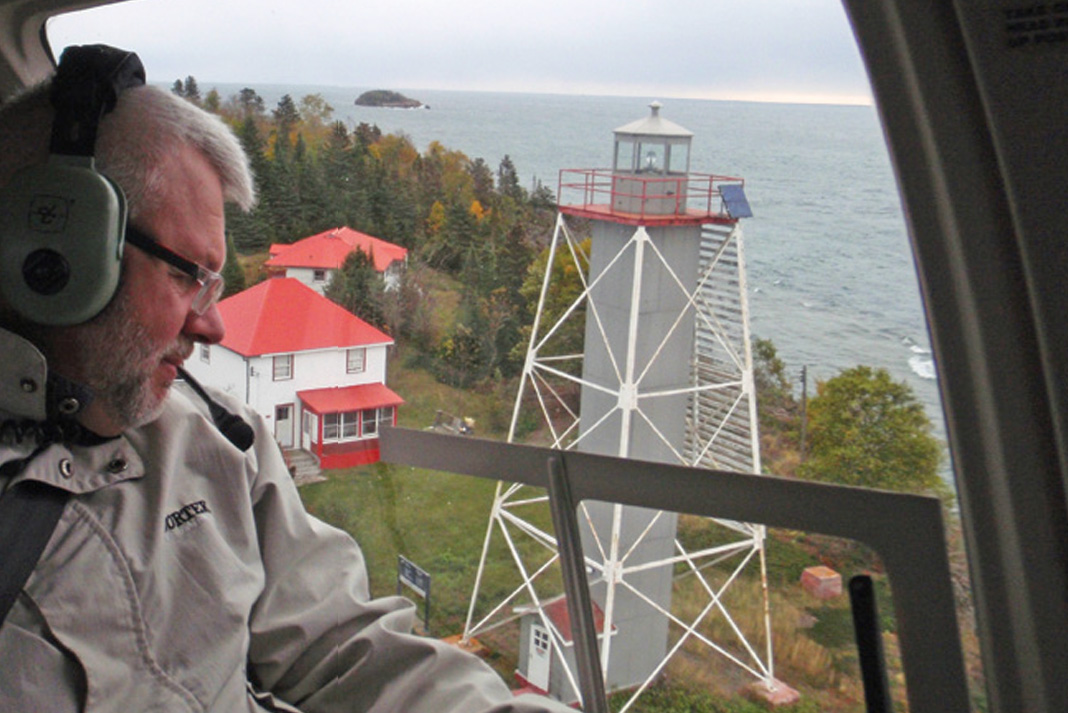
Canadian Lighthouses of Lake Superior chair Paul Capon wings over the restored Porphyry Point light station. | Photo: courtesy Rob Patterson/CLLS
Amongst last-generation lightkeepers, the Brysons weren’t alone in their Peter Pan-like quest to stay in Neverland. Further west, in the group of islands offshore from the village of Rossport, Bert Saasto continued a lightkeeper’s life after the Coast Guard terminated his contract on Battle Island in 1991. For years, the diminutive Saasto—invariably clad in paint-stained dungarees—welcomed sea kayakers as a break from his self-imposed task of slapping red and white paint on structures around the property. Strolling across a golf green lawn from his immaculate farmhouse, a yellow lab at his heels, Saasto was at first taciturn, but quickly warmed up to visitors.
“The waves coming from the southwest were 50 feet high,” was Saasto’s familiar refrain, describing a wicked storm in 1977, his first year on the job. “When they hit the rocks, the spray shattered the glass in the lantern”—which stands 120 feet above the water.
More colorful still was Thunder Bay resident Maureen Robertson, who was compelled to rent lights at Porphyry Island and Trowbridge Island for 17 summers, despite declaring, “I never had a romantic interest in lighthouses.” On vacation from her job at a health clinic, Robertson made annual solo retreats to northern Ontario lakes, hiring a floatplane to access remote fishing and hunting camps. On one such vacation in 1993, the pilot took the scenic route home, buzzing the red and white keepers’ residences on Porphyry. “When I saw the lighthouse I thought, ‘Oh my gosh, would I ever love to have that,’” says Robertson. “It was like something out of Hansel and Gretel.”
Robertson sweet-talked the Coast Guard into giving her the keys to a place that lacked electricity, running water and indoor plumbing. “At first they said I could never live out there alone,” she says. “They said, ‘What’s an old woman like you going to do out at a lighthouse?’ Well, what’s so dangerous about an island with a nice house on it?”
She spent four years at Porphyry before moving to tiny, rockbound Trowbridge. There, she decorated each room of the lightkeepers’ two-story duplex with unique themes, including a recreated post office and a fur- and snowshoe-decked bedroom dedicated to the Royal Canadian Mounted Police. Nearly every room in the house had an old rotary telephone, despite a lack of phone service. All of her furniture and decorations were purchased at yard sales and thrift shops and hauled to the island by helicopter.
“If people are going to think I’m eccentric,” she says, “then I’m going to live up to it.”
Robertson was 76 years old when she left Trowbridge for good in 2010, the year the Coast Guard divested nearly a thousand lights. I felt fortunate to have encountered a woman whose simple lifestyle was likely analogous to my great-great grandfather C.J. Pim’s. Then, a few years later, I learned about a group of Lake Superior enthusiasts working just as hard to keep the lightkeeper spirit alive.
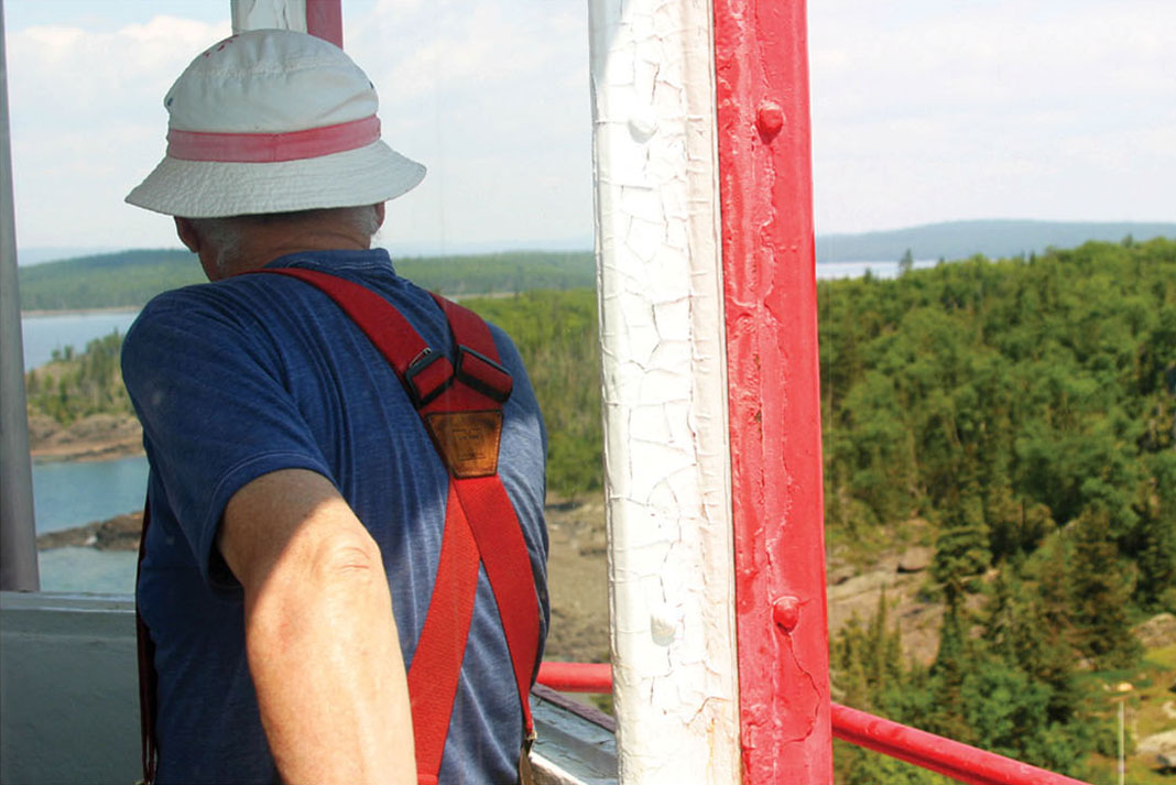
Retired keeper Bert Saasto surveys his beloved Battle Island from the light tower. | Photo: Virginia Marshall
Protecting Lake Superior’s heritage
Darrell Makin fell in love with lighthouses 20 years ago, when he kayaked from the Sibley Peninsula across the gaping mouth of Black Bay and landed in a grassy cove on the west side of Porphyry Island. After hiking a kilometer from the landing to the lighthouse grounds on the island’s tip, Makin had his first introduction to Maureen Robertson—two 1950s-vintage automobiles, sporting fresh pink and purple paint. The Coast Guard had issued the cars to the lightkeepers, ostensibly to make it easier for them to get around. Now, they were central to Robertson’s landscaping.
“The place was in great shape,” recalls Makin, an outdoor educator and author of a guidebook to paddling the Lake Superior National Marine Conservation Area. “Maureen made people welcome out there. It was an eye-opening encounter with a part of maritime history.”
The historic Island No. 10 light tower before its restoration by CLLS volunteers. | Photo: Virginia Marshall
After Robertson moved to Trowbridge, Makin witnessed the slow demise of the Porphyry Island lighthouse with sadness. Unkempt grasses overtook the grounds and vandals damaged both the main keeper’s two-story house and assistant keeper’s bungalow. “As a kayaker, I felt I had an additional responsibility to protect Lake Superior’s heritage,” says Makin. “Lighthouses are icons.”
The silver lining of the Coast Guard divestment is the Heritage Lighthouses Protection Act, which enables citizens like Makin and a handful of like-minded cottagers from the Thunder Bay area—who collectively formed a non-profit known as the Canadian Lighthouses of Lake Superior (CLLS)—to acquire lighthouse properties from the government. The organization received ownership of Porphyry and Island Number 10, a tiny outpost midway along the paddling route from Sibley to Rossport. In 2014, hundreds of volunteer hours were committed to drywalling, painting, replacing windows and tending the grounds at Porphyry, and sprucing up the light tower and installing a pit privy at Island Number 10, a popular campsite.
The overall goal, says Makin, is to keep Lake Superior lighthouses accessible to the public. Similar grassroots initiatives on the Great Lakes have saved lighthouses on Manitoulin Island and at Lake Erie’s Point Dover. This year, Makin anticipates operating Porphyry’s two-story residence as a bed-and-breakfast, with administration space and possibly hostel-style accommodations in the assistant keeper’s house. Meantime, the organization is pitching similar plans to the government for other lighthouses along the Sibley to Rossport corridor—ultimately creating a “lighthouse trail” for sea kayakers.
The original lightkeepers would, I think, approve of the resourceful characters who have stepped in as stewards for their lights. Relicts of an increasingly distant era, the lake’s historic sentinels may well have succumbed to senescence were it not for the efforts of these mariners, misfits, enthusiasts and adventurers—a motley band whose members I count myself among.
That evening at Caribou Island, I consider how sea kayak wanderlust is my own connection to C.J. Pim and the lightkeeper tribe. A 1914 obituary to my progenitor reveals the parallels between his life and mine: Pim “was very familiar with the coast for many miles on either side of the Sault,” reported the Sault Star. “Michipicoten Island, Gargantua, Dog River and other spots along the shore of Lake Superior saw him frequently.” These are some of my favorite haunts a century later.
As the sun pulses on the horizon, the feeling of timelessness sparks a kinship with my great-great grandfather. The gulls become silent and the lake laps rhythmically on the gravel shore; the beacon stirs to life, casting its first beams into the twilight; and somewhere in the distance, the sound of a freighter’s engine drones across the water.
Plan your Lake Superior lighthouse tour
The Slate Islands were designated an Ontario provincial park in 1985, recognizing the archipelago’s unique geology, rare Arctic plants and woodland caribou. Though protected, it’s free to visit and registration isn’t required for overnight stays. The islands are the perfect destination for a base camp sea kayak trip. When the wind is blowing, stay inside the harbor and check out the abandoned mine shaft in Copper Harbour, troll for lake trout off of McColl Island and explore the century-old logging camp in Lawrence Bay, a caribou hotspot. In calm conditions, circumnavigate Patterson Island, visiting the lightstation, camping at Horace Cove and keeping your eyes peeled for shattercones—flaky, fractured rock formations created by meteorite impact.
The Slates mark the eastern boundary of the Lake Superior National Marine Conservation Area, the world’s first freshwater preserve, which stretches over 150 kilometers west to the mouth of Thunder Bay. Porphyry Island and tiny Island No. 10 are just two of the hundreds of isles in this sprawling archipelago. Contact the Canadian Lighthouses of Lake Superior on Facebook to learn more about the area’s paddling opportunities and staying at the restored lightkeeper’s residence on Porphyry.
Photo: theplanetd.com
Best season
Cold water, strong winds and fog are Lake Superior staples. Mid-summer offers the best chance of fair, sunny weather and moderate winds.
Access
The crossing to the Slate Islands is long and exposed to the brunt of Lake Superior’s wind and waves; paddlers without open water experience should contact Bluebird Charters for a boat shuttle. Journeying in the Lake Superior National Marine Conservation Area requires numerous open water crossings—including the seven-kilometer vault from the Sibley Peninsula to Porphyry Island—and is recommended for experienced paddlers only.
This article was first published in the Spring 2015 issue of Adventure Kayak Magazine. Subscribe to Paddling Magazine’s print and digital editions, or browse the archives.
Battle Island lighthouse looks out over the misty waters of Lake Superior. | Feature photo: Susan Miller/Wikimedia Commons
Offshore rocks are magnets for paddlers, but one mishap can mean a damaged kayak. If you are paddling where there are no suitable landings, the ability to repair your kayak on-water can be the difference between an epic and just a good story.
In this video, Leon Sommé and Shawna Franklin of Body Boat Blade show you some top tips for managing and repairing a kayak on-water, as well as some of the simple tools they use to fix a boat on the water. Practice on flatwater first, but realize these repairs can also be done in a good-sized sea state.
Being able to fix your kayak on the water is the must-have skill. | Photo Credit: Body Boat Blade
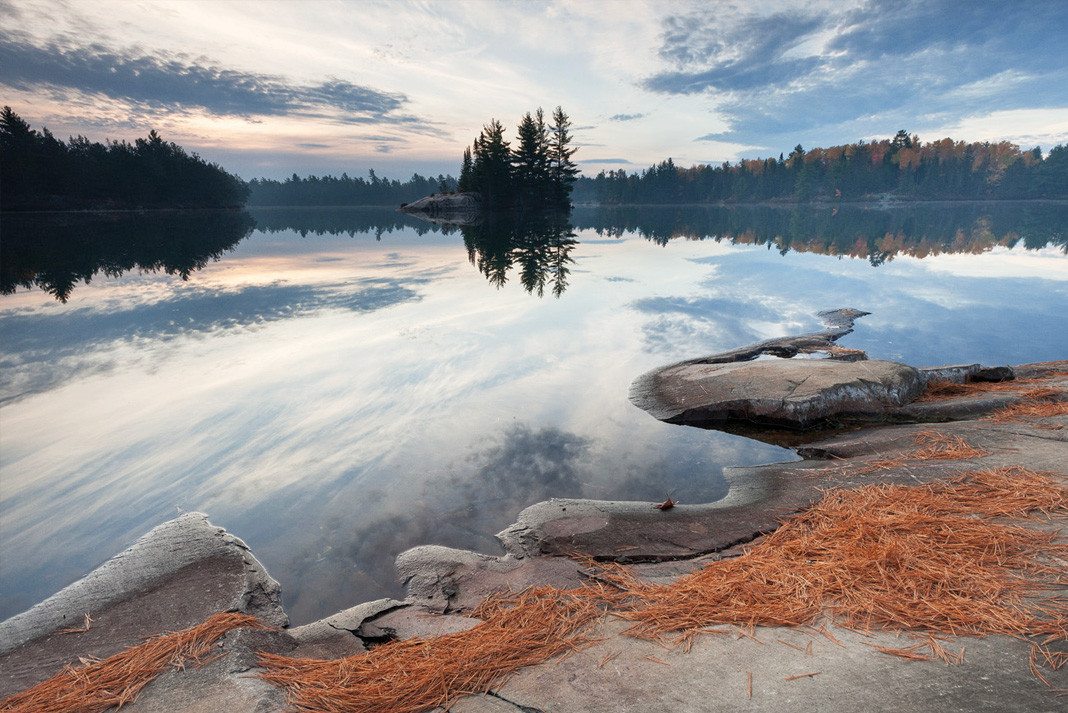
Killarney's Interior Paradise | PHOTO: MIKE MONAGHAN
Photographer Mike Monaghan has traveled far with his canoe but returns each year to Killarney Provincial Park on Georgian Bay, where he finds unparalleled paddling and artistic inspiration.
What sets Killarney apart from other accessible canoeing areas is its beauty. While I’ve paddled much further from home, and often in more remote wilderness, this paddler’s paradise embodies a combination of landscapes that can’t be found anywhere else.
It’s no wonder that members of the Group Of Seven, pioneering landscape painters, found inspiration in this area.
I love the park’s diversity, from the towering white quartzite ridges of the ancient La Cloche range, to quiet creeks and silent ponds, to the pink granite of the park’s southern border along the Georgian Bay coast. On dark nights, the Milky Way stretches overhead and looks so close I feel like I can almost touch it. Instead, I pick up my camera. In the 15 years since I first paddled here I’ve returned every season.
Large red and white pines co-exist with hardwoods, giving the park a unique look that changes spectacularly throughout the year. George Lake campground, situated in the park’s southwest, provides a jumping off place for day-trippers and family campers. For those who are looking for the backcountry experience, the network of portage routes, from simple to challenging, ensures that everyone will find a rewarding adventure.
Killarney’s Interior Paradise | PHOTO: MIKE MONAGHAN
TRIPS
If you have a half-day paddle the meandering Chikanishing River to its outlet on Georgian Bay and explore Killarney’s rugged coastline. Alternatively, paddle the perimeter of George Lake, the transition zone where sculpted granite shores give way to towering quartzite cliffs.
If you have a day pack a lunch and head east from George Lake over two easy, well-worn portages into Killarney Lake. The dramatic beauty of Killarney Lake, with its turquoise water and towering quartzite ridges, is a prime example of why this park continues to be a popular destination for artists throughout the year.
If you have a weekend a loop through Balsam Lake, into David, Silver, and back to Bell offers striking scenery, and an opportunity to camp out on one of the many beautiful backcountry campsites in the park’s interior. Hike to the top of Silver Peak; the views from the highest point in the park are breathtaking (and so is the strenuous hike). Be aware that a reservation system is in place for interior camping.
If you have a week the northwest portion of the park has it all—rugged beauty, physical challenge, and picturesque camping on granite outcroppings. Several loops are possible. Grace Lake (stunning scenery) and Nellie Lake (90 feet of visibility) are highlights of the park; try to include one or both of them on your route.
PHOTO: MIKE MONAGHAN
PHOTO: MIKE MONAGHAN
STATS
Population Density
0.8 people per square mile
Average Temperature
Winter: -13C; Summer: 19C
Wildlife
Moose, deer, black bear, wolf, coyote, fox, porcupine, hawks and eagles.
Access Point
George Lake campground
Campsites
Developed wilderness sites, with pit privy and fire ring
Best Eats
Herbert Fisheries, a local favorite offering freshly caught whitefish served dockside.
Outfitters
Killarney Outfitters (www.killarneyoutfitters.com) and Killarney Kanoes (www.killarneycanoes.com), as well as local wilderness lodges offering similar services.
Must-Have
Freestanding tent, boots with ankle support, camera with underwater housing
This article first appeared in the Spring 2015 issue of Canoeroots and Family Camping magazine.
Subscribe to Paddling Magazine and get 25 years of digital magazine archives including our legacy titles: Rapid, Adventure Kayak and Canoeroots.
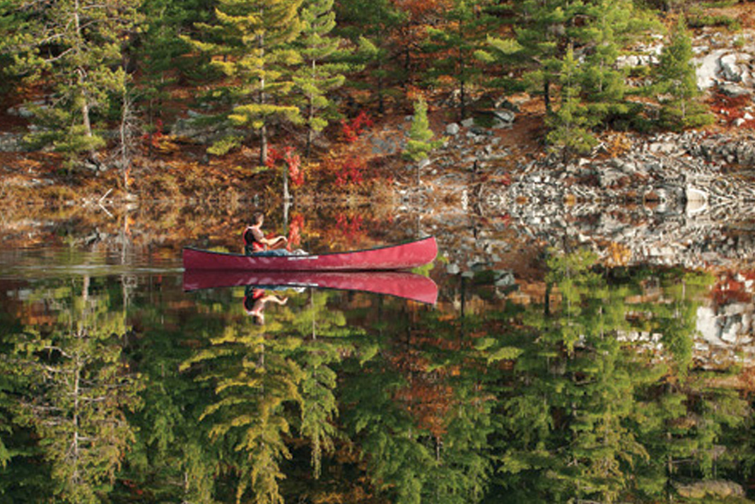
SUP paddles can be purchased as single unit, or a two piece that has the utility to fit a range of paddler heights. SUP paddle size can be tricky. Whether you enjoy SUP touring, racing or surfing, there’s a blade that’s the perfect fit for you and figuring out how to size one is very simple.
SUP paddle size shouldn’t be too difficult if you ask the right questions. It is one of the most popular questions that gets asked at any paddlesports store and in this video, Standup Paddling expert Peter deMos from LivOutside: Gear + Adventures explains how to fit the correct size and length standup paddleboard paddle for you. Whether you prefer a wooden version or a fiberglass model these tips will make choosing a SUP paddle the easiest of any watersports blades.
When I started my first job as a river guide, I had no equipment of my own. Other than a couple short canoe trips at summer camp, I hadn’t spent much time on the water. So it was with confusion that I read this pre-season email, sent out to all first-year staff:
As you budget for the summer, bear in mind there is some gear you will want for your job. You WILL be in cold water. We can supply you with a paddle, PFD, helmet and wetsuit. Said gear will be entirely safe and functional, but be forewarned: you will look like a dork. You will have no sex appeal. All our staff inevitably invest in their own equipment.
More broke than fashion-conscious, I arrived ready to wear whatever they gave me.
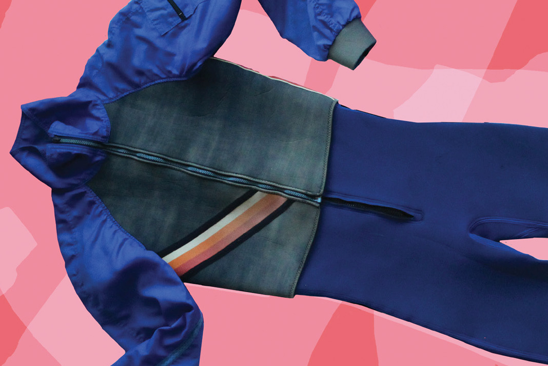
The first thing I noticed was the color. Angular pink patches cut through a blue body so faded it looked more like acid-wash grey. The stiff, thick neoprene made me walk with straighter-than-normal knees—the fabric pulling my joints back into alignment with the suit’s own curvature, a shape that, when dry, looked like it might actually be freestanding.
A few years later I blew my river guide salary on a hot new form of temperature control: a drysuit and technical layering system well worth breaking the bank.
Drysuit donned, I outfitted newbie interns in their own well-worn neoprene. I was cozy during an early-season rescue course. I stayed bone dry as I taught new staff how to swim effectively in whitewater. I was warm. I was comfortable. I looked like I knew what I was doing.
IN WITH THE OLD. | PHOTO: EMMA DRUDGE
There were good reasons I replaced ol’ faithful: too many consecutive river days resulted in an irritating itch. The faded fabric’s pores, rife with sun-dried urine the river never quite washed away caused an odor that ripened when wet despite years of valiant laundering attempts. I even tried a cocktail of every home cleaning product I could get my hands on—the only result was a rash.
But my blue and pink-polygon suit was never tossed to the curb.
Somewhere in the depths of a Rubbermaid storage bin, I hoard this relic of paddling days gone by. It gets pulled from retirement from time to time to enrobe a rightfully self-conscious first-time paddler friend; more often I just flip past it as I reach for my replacements. But like listening to an old song, seeing it there takes me back to another place and time.
I’ve never paddled as many days in a year as I did those first few summers. They were endless river days. Nights were spent under the stars on shore, around a campfire surrounded by friends with a similar lack of responsibility and urge to play, then falling asleep to the roar of rushing water. More than a piece of gear, it’s a memory of the places and people who helped shape the person I’ve become. And that’s something you don’t throw away.
Emma Drudge is the editor of Rapid magazine. She looks forward to letters from readers who still rock these suits.
This article first appeared in the Spring 2015 issue of Rapid magazine.
Subscribe to Paddling Magazine and get 25 years of digital magazine archives including our legacy titles: Rapid, Adventure Kayak and Canoeroots.
Blackflies are attracted to humans largely because of the carbon dioxide we exhale, but these bloodsuckers can also be attracted by dark colored clothing, perfumes and sweat.
In Maine, black flies are so numerous they’re referred to as the unofficial state bird.
The best defense against black flies is to cover up, including tucking trousers into socks and tightening wrist cuffs. Blackfly fever affects a sensitive minority following multiple bites, and causes short-term nausea and fever.
In 1995 pop star Alanis Morissette showed the world she didn’t understand the meaning of the word ironic through a release of a song by the same name. Some of the many things she listed that are not ironic, and merely unfortunate, include: rain on your wedding day, 10,000 spoons when all you need is a knife, and a blackfly in your chardonnay.
The good news is that blackflies are markers of the health of an aquatic ecosystem. Their larvae are only found in flowing, clean and well-oxygenated water—let this fact comfort you next time you’re being swarmed.
When numerous enough, blackflies have caused suffocation of farm animals by crawling into the nose and throat. There are also reports that black flies have to caused exsanguination (death due to blood loss) in livestock from extreme rates of biting.
“Always the black fly no matter where you go, I’ll die with the black fly picking my bones” is the chorus to folk songwriter Wade Hemsworth’s well-loved ode to the tiny terror.
This article was first published in the Spring 2015 issue of Canoeroots and Family Camping magazine.
I got a good scare last fall on a late October multi-day trip when a loaded oar rig flipped and not everyone came out from underneath it.
Flipping a loaded oar rig is always bad news—something to be avoided at all cost. Once upside down, they become giant, heavy, out-of-control entrapment devices. So it was with this one.
I spent several years river guiding in the desert southwest, and days off were all about rock climbing. Big walls were my thing then—long, technical, gear-intensive and sometimes multi-day tests on a massive cliff face. I wasn’t athletic enough to climb the good sport routes, and there was something more appealing about the slow, methodical pace of aid climbing. A single pitch can take hours—hours of intense concentration and focus on the minute details. Aid climbing requires every movement to be planned, precise and methodical. Big wall climbing narrows the universe down to just gravity, arm’s-reach imperfections in the rock face, your belay partner and whatever goes on in your head. The saying ‘don’t sweat the small stuff’ doesn’t apply to big wall climbing. Nor to running stiff whitewater in oar rigs.
Social psychologists tell us certain people are better at details than others—it’s accounted for in our personality traits, which science has narrowed down to the Five Factor Model of Personality. As the anchor of the ‘big five’ traits, conscientiousness measures one’s tendency towards detail, organization and diligence. (The other factors are agreeableness, neuroticism, openness and extraversion). There are reams of research on this, and it all points towards conscientiousness as a reliable predictor of almost any form of human performance—more predictive than any other of the big five traits. The more that details matter to an activity, the more predictive conscientiousness is. I often pull out this quote when teaching my outdoor students: “Show me a person who cannot bother to do little things, and I’ll show you a person who cannot be trusted to do big things.”
Devil In The Details | Photo: Rob Faubert
Aspects of conscientiousness are learned skills—one can improve their ability to take care of details. Here I hope I am stating the obvious: safety critical activities like rock climbing and running oar rigs are detail intensive.
This brings us back to the upside down entrapment device, the one out from under which too few helmets emerged.
Standing on the river left shore, I watched the 15-foot oar rig line up for the steep, shallow rapid. We’d taken our time setting up the run, taking care of all the potential details, and settled on the most conservative plan given our options.
The first raft patiently drifted through the shallow entry and locked into the crux slot just a raft-width wide. That the second raft scrubbed a rock on entry and turned a little sideways was not unexpected—nor when it did one of those slow slide-up-the-edge of-the-slot-and-tip-over moves—but when one helmet did not emerge it was rescue 911 mode.
“Show me a person who cannot bother to do little things, and I’ll show you a person who cannot be trusted to do big things.”
Two guides were in the water with their hands on the boat in a flash, slowing it down and getting it out of the current. I bashed my way through the bush to get downstream of it where we corralled the raft to shore—30 seconds passed. Just as we got control of it, the trapped guide-in-training emerged, knife in hand, having successfully cut himself free.
Too close for comfort.
The bow line, which in this case was a clipped throwbag, had trailed out after the flip even though the bag itself stayed in place. The rope found its way around the passenger’s ankle.
A tightly coiled bowline or slip knotted throwbag are just one of a hundred details it takes to put together an efficient oar rig. Getting behind the oars and adding moving water introduces hundreds more. Add some clients and multiply the details by a thousand.
How does one decide which details matter and which ones are less important? The answer is simple: they all matter. In this whitewater gig, whether rigging a half ton oar rig or just wedging your feet into a playboat, every little detail matters. Our safety critical environment means that the detail overlooked or left undone may be the one that makes all the difference.
Jeff Jackson is a professor with Algonquin College’s Outdoor Adventure guide training diploma and is the co-author of Managing Risk: Systems Planning for Outdoor Adventure Programs.
This article first appeared in the Spring 2015 issue of Rapid magazine.
Subscribe to Paddling Magazine and get 25 years of digital magazine archives including our legacy titles: Rapid, Adventure Kayak and Canoeroots.
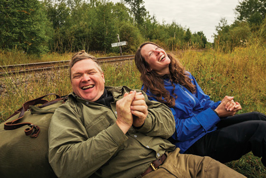
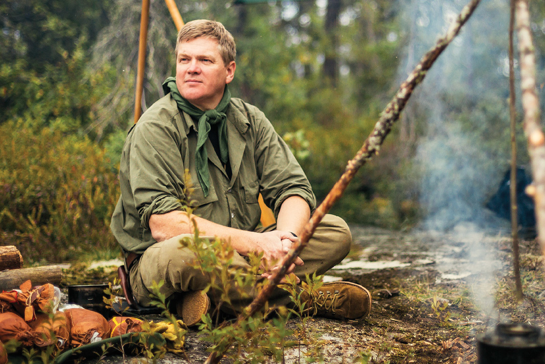
Ray Mears & Me | Photo: Goh Iromoto / Ontario Tourism
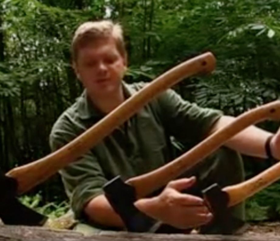
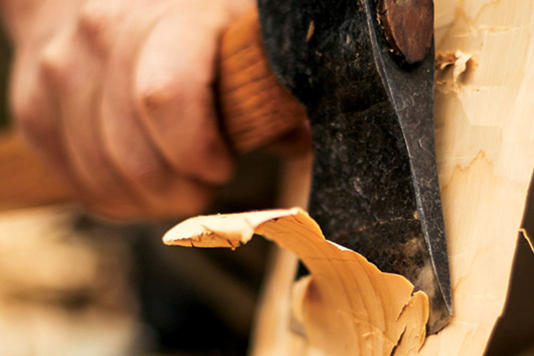
“If I were to paddle with a carbon fiber blade I think I’d develop a palsy,” Ray Mears tells me as he carefully axes another chuck from a six-foot tall cedar board.
We’re camped by the shore along the southern edge of Wabakimi Provincial Park’s sprawling 3,440 square miles of boreal forest in northwestern Ontario. There’s drizzle in the chill September air. I’m hunched under a forest green sil-nylon tarp watching the almost lost art of carving using only axe and crooked knife come alive before me.
“I want a wooden paddle because it’s not perfect,” continues Mears, surrounded by increasingly large pile of wood chips. “The grain will lift when it gets wet, and one day I will have to throw it away.” Thunk. Thunk. “But when that time comes, I can throw it back into the forest, where it came from and nature will reclaim it without any further intervention from me. The canoe leaves no trace and neither does the paddle if it’s made of wood.”
He stops to consider the shape he’s made—what was a section of tree just an hour ago has been transformed in his skilled hands. I can see the shape of the blade Mears will use to paddle out of here.
Allenwater Bridge hijinks. | Photo: Goh Iromoto
One week in Wabakimi’s boreal forest with Ray Mears
More well known than Survivorman, and far more reputable than Bear Grylls, Mears is celebrity and bushcraft master rolled in one. For seven days we’ll be paddling through Wabakimi Provincial Park—a canoeist’s paradise and one the largest Boreal forest preserves in the world. The park has more than 2,000 kilometers of lake and river routes, which are made sweeter by being accessible only via canoe, float plane or train.
In addition to the world’s foremost bushcraft expert, I’m traveling with Wabakimi Outfitters’ owner Bruce Hyer, who helped created the park in 1983, his son and trip guide Michael, famed canoeist Becky Mason, and a few media types.
Mears is here as part of a deal to promote the park in the U.K. and as recon for a future trip, but I’m here with a question on my mind. As modern life becomes increasingly disconnected from wild spaces and wilderness gear becomes ever-more high tech, what place does bushcraft have in the twenty-first century?
I decide not to ask this question on the first day.
“Bushcraft is a joy.”
Forever clad in New Zealand-made Swazi clothing and under the brim of his ubiquitous Tilley hat, 50-year-old Mears exudes a boyish enthusiasm. “Bushcraft is a joy,” he tells me multiple times—and he means it.
Despite being thousands of kilometers from home, Mears is at ease in the Boreal forest. | Photo: Goh Iromoto
His is a household name in the U.K., famous for sharing the love of his craft on BBC shows such as Ray Mears’ Bushcraft Survival and Ray Mears Goes Walkabout. When he’s not working on a television project, Mears runs wilderness skills courses through his school, Woodlore.
“At its core, bushcraft is a love and understanding of nature,” says Mears. “It’s a knowledge that enables you to travel safely, and to rely on nature to some extent for your safety and welfare.” It is not just rubbing two sticks together to make fire; it’s the familiarity with the resources your environment offers so you can live comfortably.
Despite being thousands of kilometers from home, Mears is at ease in the Boreal forest.
Local flora and fauna are referred to fondly. His knowledge of the landscape is intimate, whether he’s turning an alder branch into a toothbrush, or describing the uses of birch polypore—good for making a bandage and dried it settles the stomach, I learn.
In conversation, Mears downplays his most tabloid-worthy tales—assisting U.K. police in tracking killer Raoul Moat, and helping the wounded after a helicopter crash. But on the subject of the wilderness, and especially canoe tripping, he opens up.
“The canoe epitomizes bushcraft—it is knowledge combined with natural resources that enables us to float on water. It’s a miracle really,” he says. Mears has made two birch bark canoes. “I don’t see canoeing as a sport, it’s a way of life, it’s something more. When you come to remote places, it has a cleansing effect spiritually.”
“At its core, bushcraft is a love and understanding of nature.”
Into the Wabakimi wilderness
Our bush flight entry into the park reveals 360 degrees of near pristine wilderness. Jack pine, black spruce and water everywhere. We’re dropped at a remote fishing cabin under a blue sky and set off into the wind to find our first campsite with gear loaded into our four canoes.
Despite volunteer efforts, Wabakimi remains a mostly unserviced park. Its campsites and portages are unmarked and unmaintained. It’s not uncommon to reach a map-marked site or portage and find it strewn with blow down.
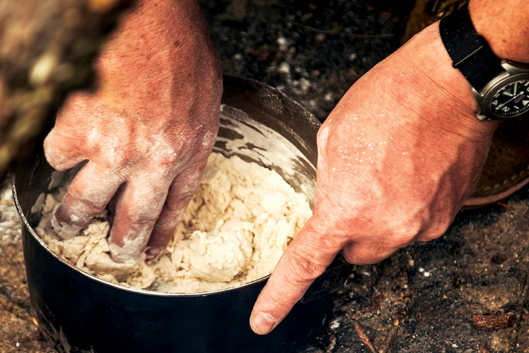
We luck out today, however. After a speedy setup at our first site—I’m thrilled to be bunking with Becky Mason—we gather around to watch Mears erect a hearth with a Voyageur-style tripod and start fire with flint and steel. Later we enjoy a delicious demonstration in making bannock using hand-carved utensils.
A bannock-making demonstration. | Photo: Goh Iromoto
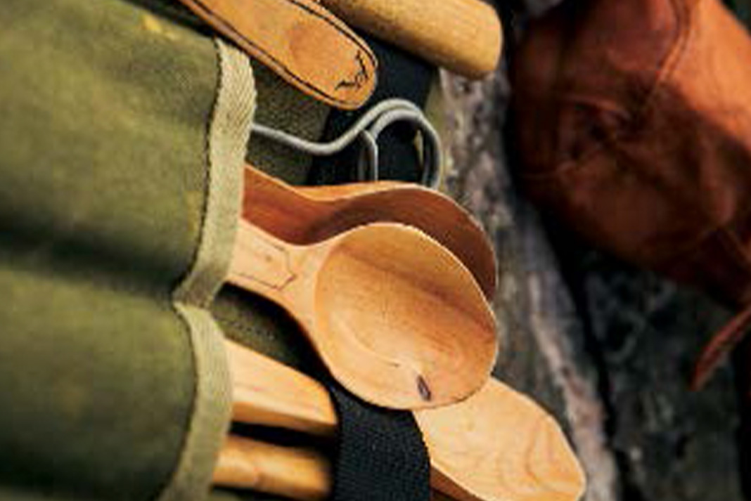
Mears carries a kit of hand-carved utensils. | Photo: Goh Iromoto
Mears’ camp kit is a hybrid of old and new. Wooden utensils nestle in well-used canvas canoe packs, next to a modern Hilleberg tent and lightweight tarp. Though he adopts new technology where he feels it’s appropriate, “The old way is the better way” will be a common phrase throughout the trip.
Perhaps it’s because he’s not leading this trip—the Hyers are officially our guides—but Mears is pretty laid back except on one subject. Don’t call what he does survival.
“I don’t like that term. It makes me think of people who stockpile tins of beans and toilet paper in case the world ends,” he says. The fire crackles and gentle waves lap the rocky shore beside us. “What we’re doing out here isn’t survival, this is a joy.”
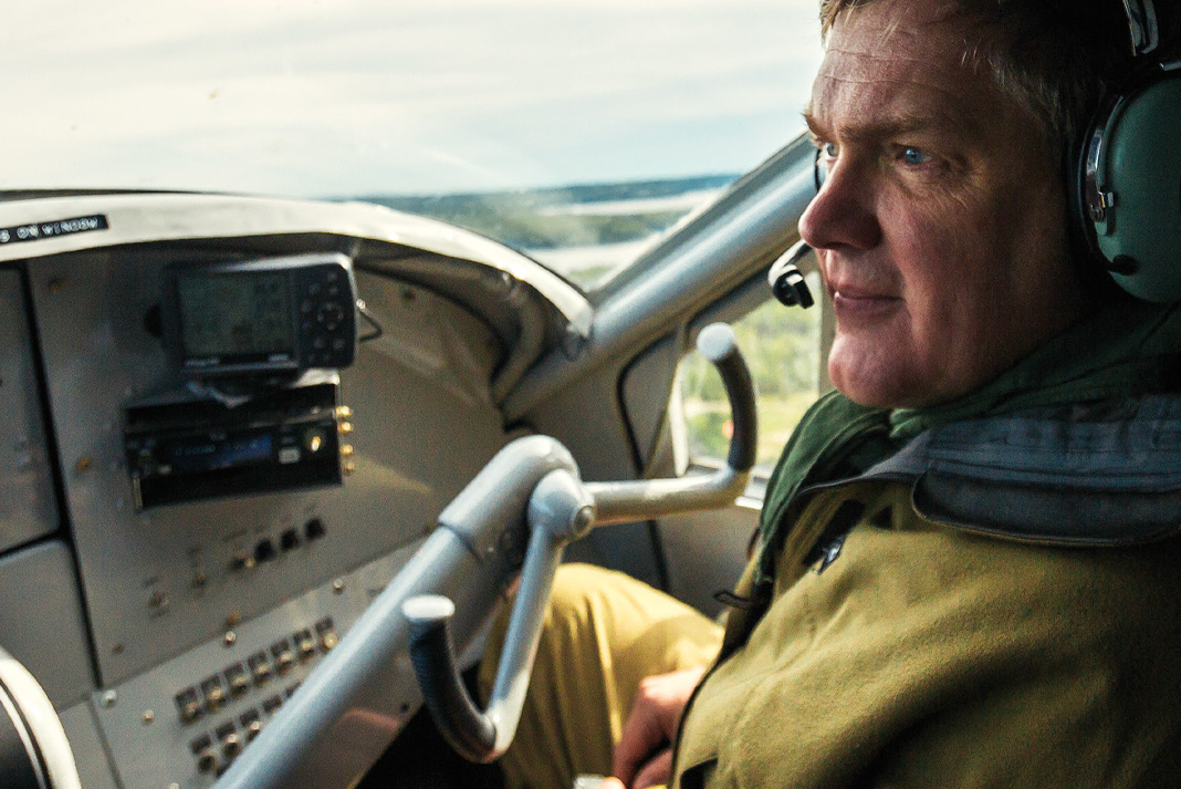
Mears at the co-pilot seat in our Turbine Otter seaplane. | Photo: Goh Iromoto
While we explore the area by canoe, our group gets to know each other. I discover Mears has a soft spot for Cohen brothers movies and the ‘80s Brit comedy show, Blackadder. Though he says he’s not afraid of any animal, he admits a deep respect for crocodiles over four meters long (“That’s one animal I have very serious views on,” he says). His real fear is industry destroying wilderness spaces for short-term gains.
Mears’ encyclopedic memory and impromptu historic tale-telling delight our group. Whether describing Samuel Hearne’s travels to the Arctic—complete with dates and source references—or Grey Owl’s environmentalism, his tales often end with the phrase, “It was absolutely fantastic.” Fascinated by his storytelling as much as the stories themselves, we can’t help but agree.
Photo: Goh Iromoto
Hitching a ride on the rails
A frosty morning a few days later finds us waiting near the Allenwater Bridge on the CN rail line. The tracks cut a corridor through Wabakimi and across the nation. The occasional freighter screams by while we wait for the VIA Rail passenger service. I wonder if it will really stop in the middle of the forest at mile marker 54 to pick us up with all our gear. This is the train that will take us back to the village of Armstrong Station (population: 220) where we’ll re-supply before leaving on the next leg of our journey.
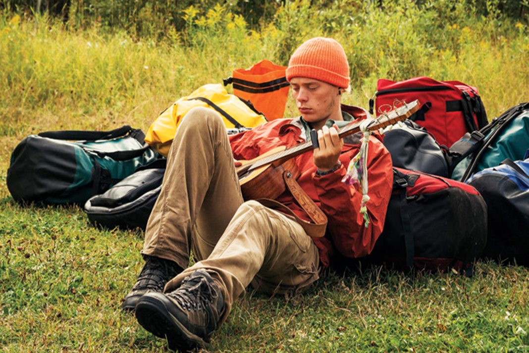
Our group wanders up and down the tracks as we wait. I see how far I can walk balancing on a single rail, Mason naps in a Prospector and our young guide Michael picks a bluesy riff on his guitar. I show the group how to mimic the mournful cry of the common loon and there’s much huffing and puffing into cupped palms. I’m excited to have found the one thing I can teach Mears.
When our train rumbles to a halt, we load canoes and packs in a freight car with the help of a few burly train hands. A young woman in a business suit jumps down from the passenger car, planting her sensible leather shoes amongst a sea of camera bags, Gore-Tex and fleece. “Tickets, please,” she trills.
Next thing I know, I’m sitting with a beer in hand in the observation car, Boreal forest whipping by at 80 kilometers an hour, thinking I’ve certainly never ended a canoe trip like this before.
Michael Hyer picks out a backcountry riff. | Photo: Goh Iromoto
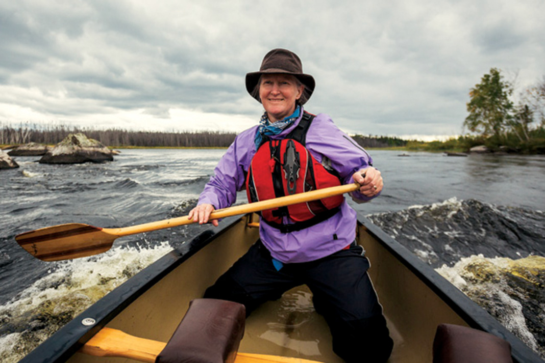
Becky Mason practices her fine art. | Photo: Goh Iromoto
Down south to the Kopka River
Our return to civilization is brief. We resupply, and within a day, we’re back in the air, this time spiraling down towards the deep, dark water on the Kopka River system, located along Wabakimi’s southern border.
On this route, large open lakes meet shallow narrows. Paddling with Mason in a Prospector, we scout and run everything. I resist my impulse to turn around and watch her graceful stokes.
Mears—never short for words—sums up Mason’s ability succinctly. “Becky,” he tells her, “when it comes to canoe strokes, you write the alphabet while the rest of us are mere journalists.”
I’m definitely cramping her style.
Mears met Mason while filming a documentary and later had her teach his wife to paddle. Mears and Mason speak with a reverential respect about each other.
Writer in the mist. | Photo: Goh Iromoto
“She always knows how to make herself comfortable in any situation,” Mears adds a short while later. I turn around to find Mason perched on a rock in the pouring rain, cozily clad in layers and rain gear, happily eating her oatmeal.
A few days later Mears is demonstrating how to make a paddle with only axe and crooked knife under a steely sky. I’m explaining pop culture’s current zombie obsession, putting into context several years of off-the-wall questions from the press.
As he gets to work shaping the shaft with the crooked knife, I finally ask him what I’ve been pondering for days: is bushcraft still relevant? He offers a very practical example for wilderness trippers.
“I have a GPS with me, but the first thing that goes into my pocket is my compass. And before that is the knowledge of the environment,” says Mears. “When you can understand a map and compass you can understand the value of a GPS. But if you start with a GPS you are half blind.”
Of course, I agree, navigation skills seem like the foundation for any wilderness adventure. Maybe my question is more abstract—are we losing anything when we don’t use bushcraft?
“The wilderness is a place where you become insightful and alert to nuances in the world. You learn to trust your inner voice and that’s something that very few of us have an opportunity to do today,” says Mears.
While Mears’ connection to the land may seem like magic to me, he in turn admires the connection the First Nations have. “This is their place, they know it in a way we never will,” he says. Though Wabakimi looks untraveled, the rich cultural heritage here of the Anishinabe people is thousands of years old.
Canoeing the Kopka River. | Photo: Goh Iromoto
Mears has traveled around the world to learn traditional skills from First Nations elders and speaks sadly about the old ways dying with each generation.
“Once that knowledge is lost, an interface with the landscape is lost,” he adds.
For indigenous groups, the consequences of losing traditional skills and ways of life can be catastrophic. “Part of their magic is their connection to their landscape,” he says.
But does the loss of bushcraft knowledge affect the average city-dwelling canoe tripper?
“It means we fear where we needn’t have to,” says Mears. Lost or broken gear can either be an emergency or an adventure.
“Becky,” Ray tells her, “when it comes to canoe strokes, you write the alphabet while the rest of us are mere journalists.”
We meet a pickup truck along a skinny gravel swath that carves through the Boreal just outside of Wabakimi’s reach. Saplings stretch into the road seeking sunlight, making it feel like the forest is quickly reclaiming this brief human diversion.
A few in our group jump into the bed of the pickup and the rest of us squish into the cabin. We’re sardined four abreast in the back seat when Mears confides in a posh British accent, “Well, I’m rather more used to traveling in first class.” His chuckle means he’s joking, I think.
Our return to the world of 24-hour news networks stirs political conversation, a newspaper is brought out, and iPhones chirp and sing.
We reluctantly catch up on bad news we were privileged enough to forget for a week. Technology already chips away at the peace the forest has cultivated. Bouncing around on that gravel road, something Mears said earlier in the trip comes back to me.
“We’re all on this planet on a journey through the universe together. Whatever our differences, we need to work together to take care of it,” he warned. “Of course, I don’t push that view. Once people start to learn the skills, nature does the rest.”
“The wilderness is a place where you become insightful and alert to nuances in the world,” says Ray Mears. | Feature photo: Goh Iromoto/Ontario Tourism
If you go to Wabakimi
In the vast Wabakimi interior trip possibilities are endless. Contact Wabakimi Wilderness Outfitters for trip planning advice. Wildlife enthusiasts may be delighted with sightings of moose, woodland caribou, bears and wolves, while bird watchers will find raven, grey jay, osprey, bald eagle and loons. Historians will be fascinated by the enduring legacy of the local First Nations.
Trip launching point, Armstrong Station, is three hours by car north of Thunder Bay. Those coming from the United States can expect several hours of beautiful scenery traveling from Minnesota. For a more direct route, Thunder Bay is a short 90-minute flight from travel hub Toronto.
This article was first published in the Spring 2015 issue of Canoeroots Magazine. Subscribe to Paddling Magazine’s print and digital editions, or browse the archives.
“The wilderness is a place where you become insightful and alert to nuances in the world,” says Ray Mears. | Feature photo: Goh Iromoto/Ontario Tourism
THE ROAD TO REGRET IS FOUR LANES WIDE. | PHOTO: ROWAN GLOAG
Some say Berners Bay and Lynn Canal are haunted, that on certain days when the ocean is quiet you can hear the ghosts of those lost at sea. There are stories of shamans buried on rocky points jutting into the ocean and ancient Tlingit villages swallowed by hungry rainforest and voracious brown bears.
In the early spring of 2014, I kayaked through eerie mist and across the still waters of the bay, hairs prickling on the back of my neck. It wasn’t the threat of tormented spirits, bruins or the restless ocean that filled me with trepidation. The pall that hung over my route was more mundane and far more devastating: the threat of myopic greed and industrialism masquerading as progress.
An 80-kilometer road is planned through this wild land. My trip paralleled the route the road would take along the coastline. Sea lions, land otters, harbor seals and a host of newly arrived waterfowl and shore birds parted before my kayak. Hidden in the forest, a granite boulder etched with ancient images of anthropomorphs, salmon and geometric shapes by Tlingit slaves lay in the shadows. In certain angles of light, it’s said the figures came alive. Seeing this place in its raw grandeur,I had the feeling I was experiencing the eulogy of a wilderness I knew and loved.
I grew up just south of Berners Bay and Lynn Canal in Juneau, Alaska’s capital. There’s no road in or out of this small outpost of 30,000—it is surrounded by ocean, mountains, glaciers and the largest remaining temperate rainforest in the world. Most who live there are happy to reside in close proximity to roadless, wild country. After all, there’s no shortage of freeways, billboards and gas stations nearly everywhere else we turn. To be able to experience creation untrammeled, where we bow to the Earth instead of trample it, is invaluable.
Some people, however, don’t see the inherent worth in keeping Southeast Alaska from following in the footsteps of the industrialized Lower 48. Governor Sean Parnell and Alaska Department of Transportation (ADOT), despite astronomical costs, are set on bulldozing the road extension. It will charge through Berners Bay to the Kensington Mine—and open up other privately owned mining claims for development—before piercing the east side of Lynn Canal to the Katzehin River Delta, where a new ferry terminal is to be constructed.
I paddled to where four large salmon rivers drained into a sprawling estuary. Wolf, moose and brown bear tracks wended along sandy beaches. Flocks of waterfowl fed on the expansive flats as bald eagles and northern harriers turned lazy circles on the breeze. In a few weeks eulachon would come to the river delta to spawn in the millions—along with thousands of sea gulls, eagles, seals, sea lions, humpback whales and other species converging to feast.
Meter-high waves greeted me as I entered Lynn Canal, one of the longest and deepest fjords in the world. It’s considered among the most treacherous waterways in the Inside Passage. I pushed aside thoughts of shipwrecks and icy water, focusing instead on a raft of sea lions blocking my way. One, bobbing contentedly in a wave, almost bumped into my kayak as I slid past.
THE ROAD TO REGRET IS FOUR LANES WIDE. | PHOTO: ROWAN GLOAG
The coastline here is impenetrable, broken only by 43 massive avalanche paths for the next 40 kilometers. Beaches dissolved into sheer mountains jutting more than 2,000 meters straight up from the ocean. Glaciers embraced all but the most vertical summits. At dusk, I made camp at the edge of an avalanche run-out. Fresh tracks from a wolf pack imprinted a sandy section. Nearby, orange surveyor’s tape, marking the route of the proposed road, disappeared into a huge outflow of avalanche debris.
It’s not just environmentalists who question the rationality of the project. Besides marking the loss of one more wild place, the road also seems like an economic disaster.
A respected avalanche forecaster testified to a state representative that the road would be a deathtrap for motorists for much of the year unless ADOT budgeted millions more on infrastructure, maintenance and avalanche control programs. His warning fell on deaf ears. A local ultra-adventurer and builder asked an ADOT representative how they were planning to construct the road through a gigantic rock glacier. He didn’t get an answer. Proponents initially claimed that ferries (the method of transportation most Southeast Alaska residents depend upon to travel from community to community) were too expensive and that the road would save the state money. In the most recent study ADOT released, however, the state admitted the road would actually cost millions more to maintain each year than the current ferry schedule.
Late in the afternoon the following day, I drifted into the Katzehin River Delta, the end of the proposed road. Six kilometers away, across the fjord, the town of Haines crowded the shore. I tried imagining building, utilizing and maintaining a highway along the last 40 kilometers of cliffs and avalanche paths. More than a gratuitous invasion of a wilderness or an impracticable attempt to boost the state’s economy, it seemed nearly impossible.
I paddled towards the west side of the fjord, where the peaks, rainforest and glaciers of the Chilkat Mountains were aflame with alpenglow. Beer, pizza and a ferry back to Juneau awaited me in Haines. Or, I could turn the kayak south and see the coast as it had been since the Pleistocene.
It’s not just environmentalists who question the rationality of the project. The road is an economic disaster.
Civilization and convenience, or raw vitality undiminished by ease and development. The same decision lies at the core of the Wilderness Act, which celebrated its 50th anniversary even as the gavel fell on Berners Bay and Lynn Canal. The landmark act represents the belief that some places should be left free from human influence, that there’s inherent worth in wilderness. But it’s not a victory that sustains itself. It’s a choice we must make—with courage and care—every day.
I choose wilderness and solitude. Accustomed to expeditions in Southeast Alaska being existential odysseys that leave me battered and trembling, I am shaken instead by the evening’s dreamlike calm. Marbled murrelets, loons and grebes, ghostly white in their winter plumage, float tranquilly. Flocks of white-wing and surf scoters wing along the ocean’s mirrored surface. A pod of Dall porpoises swim nearby and sea lions snort and splash. Thousands upon thousands of green sea urchins cling to the rocky shore and a mesmerizing play of light illuminates the shimmering ocean, glaciers and mountains.
As I write, construction of the road is scheduled to begin this spring. There’s still some hope litigation or a lack of federal funding may stop the project, but it’s against the tide of the current political atmosphere in Alaska.
In the gathering twilight, I study the eastern shore across Lynn Canal, feeling humbled by the cold, honest expanse between—the serrated peaks and rugged coastline seem almost untouchable.
Bjorn Dihle is a writer, guide and fisherman based out of Juneau.
This article first appeared in the Spring 2015 issue of Adventure Kayak magazine. Subscribe to Paddling Magazine and get 25 years of digital magazine archives including our legacy titles: Rapid, Adventure Kayak and Canoeroots.


 This article was first published in the 2015 Paddling Buyer’s Guide.
 This article was first published in the Spring 2015 issue of Adventure Kayak Magazine.
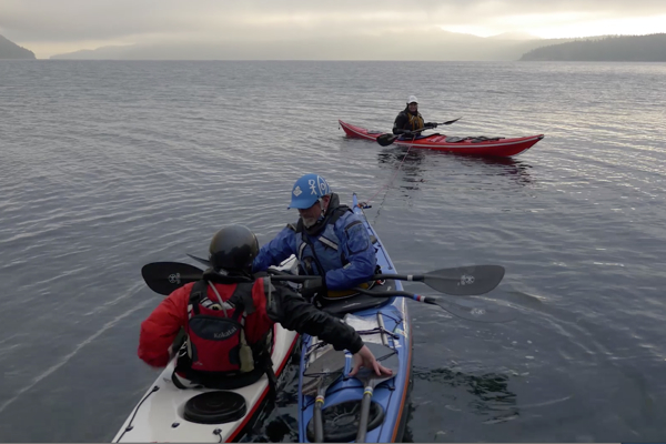

 This article first appeared in the Spring 2015 issue of Canoeroots and Family Camping magazine.