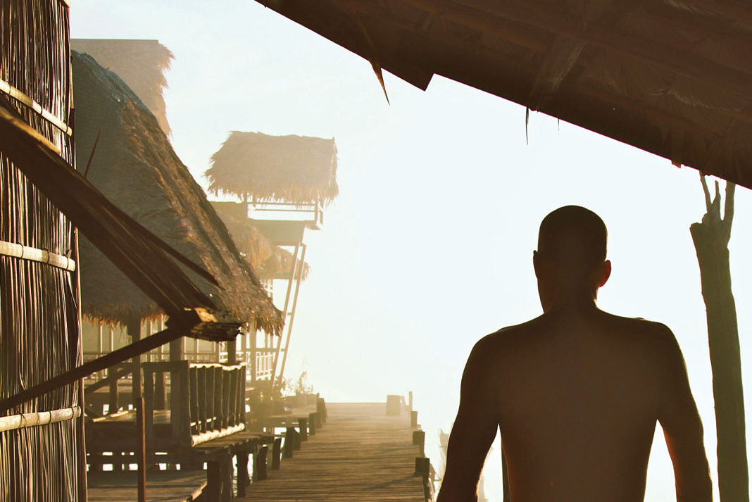
Two canoes on a lake against a mountain backdrop in Canada.
Any canoe tripper knows that all it takes is a half-day paddling on a remote lake or foggy river for you to subscribe to the notion that canoeing can make you feel healthier. Clarity of mind, time away from screens and a focus on the now can allow you to feel happier and more vibrant. It’s not all in your head; there are concrete reasons why canoeing makes you healthier.
Low impact exercise
Canoeing can be a great workout, but compared to sports like running and skiing, impact on the joints is low. If you have sore knees or hips and are slowing down your participation in high-impact activities, canoeing allows you to maintain fitness and enjoy being outside while still being easy on the joints. Canoeing can also be combined with other low-impact exercises on the same trip, like trail walking, yoga and swimming at the campsite.
In basic terms, cardiovascular fitness is how well the circulatory and respiratory mechanisms in your body can give oxygen to muscles while you exercise. The better your cardiovascular health, the less effort your body expends sending oxygen to the parts of your body that need it. Regular canoeing can increase cardiovascular fitness, meaning that not only will your paddling be more efficient, but you may see benefits in other sports and activities as well. Don’t forget—portaging may not always be enjoyable, but lugging an aluminum canoe up a hill is another way to amp up cardiovascular fitness.
Increased strength
Although it varies based on the kind of canoeing you are doing and how frequently, the motion of pulling or pushing water with your paddle can increase strength and muscle in your arms, shoulders, core, back and chest. Challenging conditions like wind, waves and whitewater can require powerful bursts of energy and work muscles. Lifting heavy canoes onto trucks and trailers is a decent work out too!
Reduced stress
Research shows that exercise can have a mitigating influence on stress. When that exercise is in a cedar-strip canoe on a deep lake framed by golden larch trees, we think the effect on stress could be amplified. In addition to beating stress, canoeing is an activity that is hard to do while multitasking. Going for a paddle means you can live in the moment and forget about your to-do list or meeting on Monday and focus on smooth sweep strokes and how many loons you can spot.
While it may look like it’s all in the arms, the act of taking a paddle stroke relies significantly on core strength and torso rotation. Those who frequently canoe can increase their core strength, a major health benefit. Good core strength is linked to injury prevention, decreasing back pain, improving posture and protecting the central nervous system. Oh, and your abs will look awesome too.
Every whitewater weekend warrior knows the feeling of paddling rapids on a gorgeous river and wondering, “What if this could be every day?” Rivers bring life to communities, can be a source of economic and recreational development and add vibrancy and scenery to the landscape. For those who love to paddle, fish and engage with the rivers during our time off, the idea of working in or at the river every day is a dream—or if you pursue one of the jobs below, simply the 9-to-5 routine.
Top 7 coolest river jobs
1 Raft guide
The classic river job means you can be on the water every day in the spring and summer. Great qualities in a raft guide are excellent social skills, a sense of humor and an ability to react fast under pressure. Raft guiding is as much about river culture as it is paddling. Many rafting companies have on-site staff housing, great parties and a large community of like-minded paddlers to go kayaking with on time off. If you have wrapped up your North American raft guiding season and aren’t ready to put down the paddle, learn how and where you can continue the guide life all winter long.
If you love rivers, working as a fly-fishing guide is a great way to engage with the intricacies of these waterways. A key part of fly-fishing is reacting to the conditions of the river and being able to mimic the insects present on the surface. Expert fly fishing guides know every detail of their home rivers at every time of year. Working as a fly-fishing guide is seasonal work, but some get creative and spend the winter working in warm water destinations or at other jobs.
Testing new boats is a whitewater gear junkie’s dream job. We are lucky at Paddling Magazine that we get to paddle our awesome local rivers in the newest boats. Experiencing new designs and materials first hand makes us pretty stoked to head to the river. But don’t be too jealous: mid-January boat testing is not as fun as June boat testing.
“What if this could be every day?” | Feature photo: Kamil Porembiński/Flickr
4 Trail-builder
Trail-building jobs in North America’s provincial, state and national parks can put you on the shores of some of the most iconic and powerful rivers on the continent. In the summer, many trail builders live out of tents close to where they are working. For a paddler, this is a great excuse to get to know all the features and sets on a river in depth before heading out to paddle them. Bonus? Your extensive knowledge of the area you worked in means you will know all the prime camping spots.
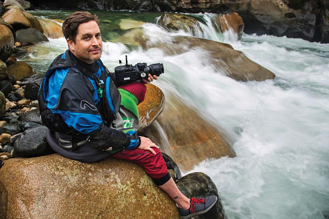
5 Whitewater photographer/videographer
Getting paid to travel the world shooting kayaking means you can combine a love for rivers and work. Professional photographers and videographers working in this area are usually skilled paddlers already immersed in the paddling community. The ability to be creative, resourceful and problem solve are key as well. We interviewed Mike McKay to find out how he quit his day job to film kayaking full-time.
Whitewater play parks are an amazing way to invigorate a community and give urban paddlers a place to improve their skills. For the city-dwelling kayaker, a play park also means a place to connect with other paddlers and form friendships. While play parks are sometimes not on real rivers, a job working with architects to simulate river features means understanding the ins and outs of how rivers work. For someone who wants to spend lots of time outside and contribute to the whitewater stoke in their city, engineering play parks is a perfect fit.
No, it’s not really a job. Yet the river rat life is full of work, from constantly re-organizing the van to stealing grocery store Wi-Fi to locating the nearest public pool showers to rationing white bread and peanut butter. The benefits? No dental, but unlimited access and time on rivers.
“What if this could be every day?” | Feature photo: Kamil Porembiński/Flickr
Photo by Nick Valmores : https://www.pexels.com/photo/people-riding-kayak-on-lake-4476968/
Which came first: Bill Mason or the popularity of red canoes? Hard to say for sure, but the iconic red canoe has since been co-opted to sell everything from heritage clothing (Red Canoe Brand) to upscale cuisine (Red Canoe Bistro).
During the early 20th century the Chestnut Canoe Company offered their wood-canvas canoes in two stock colors, either red or green. A third color made by mixing green with a porch grey enamel was offered on working class freighters and some other models—the color was called Dead Grass.
“I am contacted from time to time by canoeing enthusiasts around the world wanting to know the exact color that Bill Mason’s canoe was painted,” reports Canadian Canoe Museum curator, Jeremy Ward. Bill Mason’s daughter, Becky, recently donated a half-can of red paint found in the Mason canoe shed. “It has a Chestnut brand on the label, matching exactly the color of Bill’s famous red Prospector displayed at the CCM, in case there are still any keeners wanting a color match.”{loadposition MidContent}
Men in red are more desirable to women, according to a study published in the Journal of Experimental Psychology. When asked to rate pictures of men wearing a variety of colors, women rated men in red “higher in status and more likely to earn a better living.” That perception led to higher reported rates of attraction, according to the researchers. We can only assume this hypothesis holds true for men in red canoes. The study said nothing of beards.
The largest red canoe in the world is found in Toronto, Ontario’s Canoe Landing Park near Lake Ontario. Designed by artist Douglas Coupland, the 30-foot-long canoe is an homage to artist Tom Thomson. Local news source BlogTO rates its cozy interior one of the best make-out spots in the city.
Red canoes go faster. No, really—this campfire joke might actually hold water. A 2005 study by British scientists found that “wearing red is consistently associated with a higher probability of winning” over blue-clad competitors, according to the journal Nature. A few hypotheses: referees favor red players, crimson teams perform better or red makes opponents cower. Whatever the reason, it’s enough to make us buy red.
This article originally appeared in the Canoeroots Summer/Fall 2016 issue.
Subscribe to Paddling Magazine and get 25 years of digital magazine archives including our legacy titles: Rapid, Adventure Kayak and Canoeroots.
Ready for adventure? We’ve roamed the world’s oceans and lakes to compile this look at eight of our favorite island escapes, from lounging in the palm trees of the South Pacific to paddling with whales in the Bay of Fundy and gazing at grizzlies in Alaska. We’ve also included one escapade that’s so daring, it may never be repeated. —VM
Raja Ampat, WEST PAPUA, INDONESIA | PHOTO: SETH & JENN KOEBERNICK
Raja Ampat
WEST PAPUA, INDONESIA
More than 1,500 small islands fringed by vibrant coral reefs and blue water mangroves make Raja Ampat a paradise for paddlers. Nestled in northeastern Indonesia’s West Papua province, the archipelago is home to the richest marine biodiversity found anywhere on earth. The warm waters teem with life, forming the livelihood for the local Papuan people. Over the last 20 years, the archipelago and its sprawling marine park have emerged as a leading example for sustainable ecotourism. The Raja Ampat Research & Conservation Centre (RARCC) supports the locals in developing community-based projects such as traditional homestays. Perched on stilts above the emerald waters, these palm-thatched guesthouses offer warm Papuan hospitality and authentic cuisine. Through the non-profit organization, Kayak4Conservation, locals have also learned the art of fiberglass boatbuilding, crafting a fleet of fully equipped sea kayaks. Crystalline waters reveal whales, manta rays, sea turtles, sharks and endless varieties of reef fish, all visible from the seat of a kayak gliding amidst the labyrinth of limestone karst islands.
The 140-kilometer circumnavigation of Gam Island encapsulates the diversity and essence of Raja Ampat. From leafy tunnels of mangrove forest and white sand beaches lined with coconut palms at the island’s south end, head north to explore Kaboie Bay’s soaring limestone stacks and hidden, paddle-in amphitheaters dripping with stalactites. Allow five to seven days, staying in the homestays found every 15 kilometers, or wilderness camping. Natural sources of freshwater are scarce, so bring collapsible containers for drinking water and plan to refill in your host communities. Monsoon season is from May to August; visit from October to December to enjoy sunny skies and the most stable weather. — Seth & Jenn Koebernick
IF YOU GO:Kayak4Conservation arranges homestays and offers kayak rentals and three- to 10-day trips with Papuan guides. The kayak fleet is still small (15 boats) so reserve in advance for rentals during peak season.
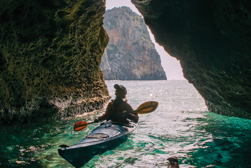
Crete, GREECE, MEDITERRANEAN SEA | PHOTO: KILIII FISH
Crete
GREECE, MEDITERRANEAN SEA
On postcards beckoning visitors to Greece, the neon-blue waters of the eastern Mediterranean appear suspiciously enhanced. Not until sitting inside a kayak inches from the warm, alkaline water does it become apparent: that electric hue is not a trick of Photoshop. Greece’s largest island, Crete, is renowned for its varied and ethereal landscape, from the snow-capped White Mountains to surf-washed cobble beaches and scrublands peppered with pastures and orange groves. Crete’s role in Greek mythology is equally diverse—the island is celebrated as the birthplace of Zeus and dwelling place of the monstrous Minotaur.
Palaiochora, at the island’s western end, is a favorite launch point for overnight trips east to Hóra Sfakíon and beyond. The sun-bleached cliffs of Crete’s southern coastline dwarf paddlers, while herds of goats traverse the impossibly vertical faces. Rock gardens and sea caves abound between the pretty coastal villages of Sougia, Agia Roumeli and Loutro. Agia Roumeli is perched at the southern entrance of the famed Samariá Gorge National Park. Plan a layover day here to hike the 16-kilometer trail up this ruggedly scenic, 1,500-foot-deep defile. While summer brings tour groups, arriving in April almost guarantees solitude on the water. The weather can change rapidly on this exposed coast, turning a calm day into a tempest of rain and boiling seas. Have a backup plan to hike or be prepared to wait out the wind. Luckily, every taverna will welcome you with plenty of rakı—a traditional apéritif not for the faint of heart —Addie Asbridge
IF YOU GO: Ferrying back from Hóra Sfakíon saves time but there’s no set schedule— be prepared to hop aboard when the whistle blows. Enjoy Crete offers kayak rentals, day trips and four- or eight-day guided tours.
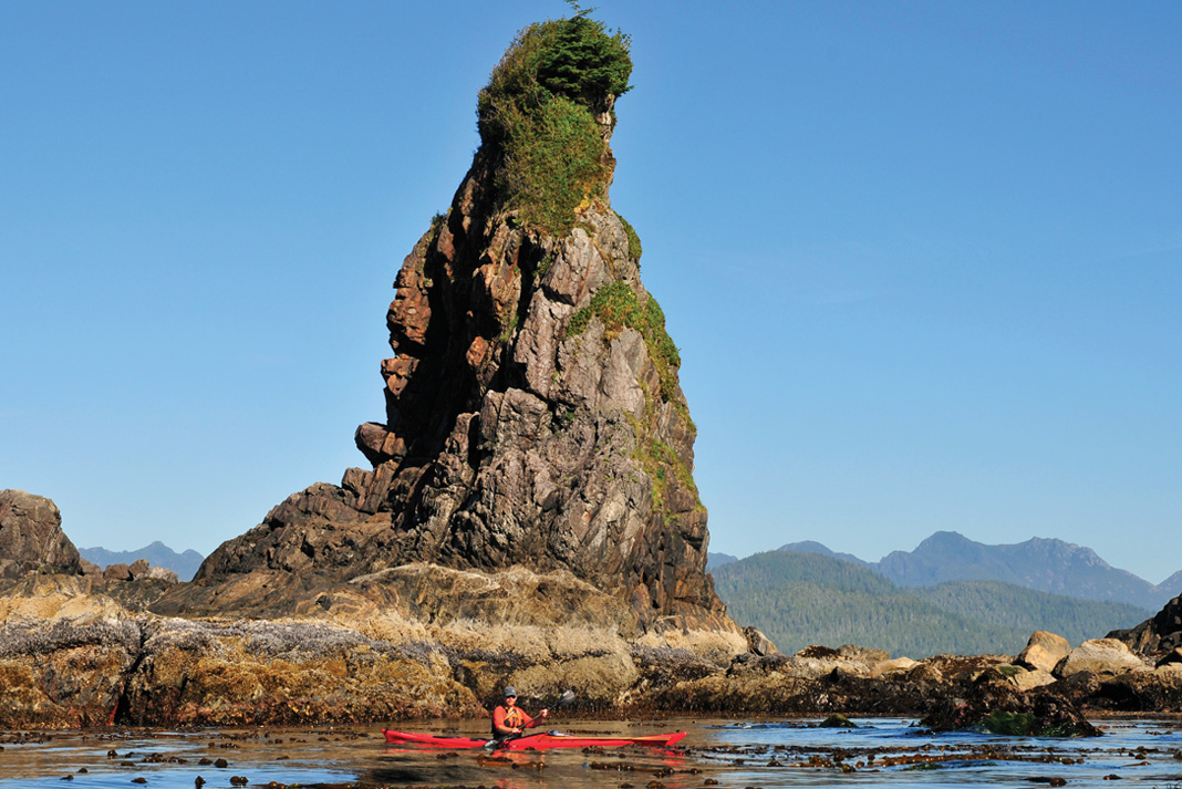
Bunsby Islands, CHECLESET BAY, BRITISH COLUMBIA | PHOTO: VIRGINIA MARSHALL
Bunsby Islands
CHECLESET BAY, BRITISH COLUMBIA
Untamed, isolated and exposed, few places better exemplify the wild nature of Vancouver Island’s rugged northwest coast than the Brooks Peninsula and the adjacent Bunsby Islands. Sheltered by the peninsula and the off-lying Barrier Islands, the Bunsbys are relatively protected from the mighty Pacific swell. Within their quiet passages, paddlers enjoy rich marine life, lovely wilderness campsites, unusual rock formations and spectacular sunsets. With the exception of Big Bunsby Island, which is a provincial park, all of the islands and their surrounding waters lie within the vast Checleset Bay Ecological Reserve. Along with important seabird nesting sites and an abundance of whales, the reserve is home to a thriving population of sea otters. Centuries of hunting lead to the extirpation of the sea otter from the B.C. coast in the 1830s, but the reintroduction of the luxuriantly furred marine mammals in 1969—and the creation of the reserve in 1981—has triggered a comeback. Today, rafts of the moon-faced critters feast on Checleset Bay’s smorgasbord of clams, abalone and sea urchins, and doze contentedly among the kelp beds, welcoming kayakers.
Kyuquot Sound is the starting point for most trips to the Bunsbys. The Kyuquot/Checleseht First Nation maintains launches at Artlish and Fair Harbour, from where it is a two-day paddle out the sound and up the coast to the islands. The final 11-kilometer stretch is an exposed crossing and for this reason it’s best to camp at the mouth of the sound and wait for a weather window to cross to the islands. Both the Mission Group, lying just north of the sound, and Rugged Point Provincial Park, at Kyuquot’s south entrance, offer wonderful opportunities for first (or last) night camping and exploring. Don’t miss the short footpath through lush old-growth Sitka forest to Rugged Point’s south beach—a clean, expansive crescent of fine sand printed with wolf, bear and cougar tracks. —Virginia Marshall
IF YOU GO:West Coast Expeditions offers multi-day trips to the Bunsby Islands from their idyllic basecamp on Spring (Tle:hoh) Island in the Mission Group.
Cuba, CARIBBEAN SEA | PHOTO: COURTESY JAY MOTHERSILL
Cuba
CARIBBEAN SEA
From cultural stereotypes like Cuban cigars and vintage American cars, to political iconoclasts like Che Guevara and Fidel Castro, the largest of the Caribbean islands is also one of its most eclectic, diverse and fascinating. Cuba’s natural history is just as remarkable. One hundred million years ago, the island rode the drifting continental plates, hitchhiking from the Pacific Ocean to the Caribbean. Today, more than half of Cuba’s plants and animals are found nowhere else on the planet. From leaping crocodiles, bat-eating boas and millions of bright orange crabs marching through the forest each year, to miniature frogs and the Caribbean’s largest flock of flamingos, Cuba surprises at every turn. Due to limited development, the island is also home to arguably the healthiest coral reef ecosystems in the Caribbean, if not the world. Ancient coral cliffs, pristine mangrove forests, white and black sand beaches, mountainous lakes and rivers yet to be explored by outsiders make Cuba a paradise for adventurous paddlers.
Cuba’s thawing relations with the U.S. will no doubt bring great change to this insular country, and the chance to be part of an exclusive club is reason enough to visit now. In 2014, Cuba Kayak Adventures (now Cuba Adventure Company) became the first commercial outfitter to be granted permission to paddle these heavily restricted waters. “Putting together an adventure kayak program in Cuba was a Herculean effort, but worth every minute,” says Cuba Kayak Adventures founder Jay Mothersill. Explore the mangrove lagoons of the Guamá Islands, tour the waterfalls and grottoes of the spectacular mountain lake of Hanabanilla, ride aquamarine swell and paddle with pink flamingoes on the south coast. —Peter Whaley
IF YOU GO: For now, it’s virtually impossible for individuals to legally access coastal waters with personal kayaks, and rental boats are restricted to within resort boundaries. Instead, during the dry season November through April, join an eight-day tour with Cuba Adventure Company.
Fundy Isles, BAY OF FUNDY, NEW BRUNSWICK | PHOTO: HARRY DALEY
Fundy Isles
BAY OF FUNDY, NEW BRUNSWICK
Wedged between the Canadian Maritime provinces of New Brunswick and Nova Scotia, the Bay of Fundy is notorious for its massive tides, rising and falling up to 50 feet every 12 hours. At the mouth of the Bay hides a relatively unexplored archipelago of islands, shrouded by the fog that so often blankets this area. The Fundy Isles are sparsely populated—colorful fishing villages, herring weirs and lobster traps dot their coastlines. As the tide ebbs and flows around the islands, rich nutrients are stirred from the ocean floor creating an ecosystem that plays host to a vibrant community of marine life, including at least eight species of whales. Bruce Smith, who has been paddling these waters for over 20 years with his company Seascape Kayak Tours, confirms this complex food web “supports what scientists have identified as one of the world’s biodiversity hotspots.”
The eastern shore of Deer Island provides the perfect jumping off point to explore the magic of the West Isles. Deer Island is only accessible by ferry from mainland New Brunswick or via Campobello Island if arriving from Maine. Spend a day paddling the rocky shoreline, then make the two-kilometer crossing to undeveloped Casco Bay Island and choose a beach to set up camp. Enjoy sweeping views of the iconic Head Harbour lighthouse and access to the Isles’ best paddling and wildlife viewing. Don’t let the tranquility fool you; the southern tip of Deer Island is home to Old Sow Whirlpool, the largest in the western hemisphere. To the north, a tricky web of tidal currents race between the islands. Proficiency with chart, tide tables and compass are crucial when navigating these chilly waters. — Harry Daley
IF YOU GO: August and September provide the best weather and wildlife viewing opportunities. Based on Deer Island, Seascape Kayak Tours offer sunset, half-day, day and multi-day tours in the West Isles.
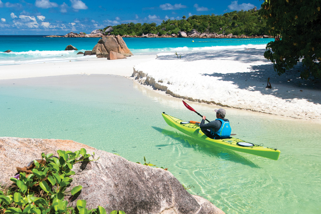
Seychelles, EAST AFRICA | PHOTO: MICHAEL NEUMANN
Seychelles
EAST AFRICA
Located 1,500 kilometers off the coast of East Africa in the Indian Ocean, midway between the Horn of Africa and Madagascar, the Seychelles are a tantalizing idyll of white sand beaches, ancient granite, lush rainforest, swaying palms and emerald waters. Paddlers exploring the central archipelago’s 32 Inner Islands are spoiled for choice. The spectrum ranges from the main island of Mahé— with 72,000 inhabitants, spectacular foggy forests and a national park around the highest mountain, Morne Seychellois (2,969 feet)—to the tiny atoll of St. Pierre. Just 100 feet across and crowned with palms, the real magic here occurs beyond the beach, where deep currents lure colorful fish of all shapes and sizes to the coral reef and sea turtles glide amid rapt snorkelers.
The islands’ splendor makes them a popular tourist destination, but kayaks offer a passport away from the crowds. Access isolated tropical beaches like Anse Badamier on the national park island of Curieuse, home to hundreds of giant Aldabra tortoises and known as the “very most beautiful beach in the world.” Explore beyond the world-famous beaches and striking granite boulders of La Digue, paddling into forgotten bays on the island’s far side where local families serve up papaya shakes and Creole curry. Many more islands are uninhabited—nearly 50 percent of the country’s total land area is designated nature reserve. While you can explore the Seychelles with your own kayaks, it’s hard to beat chartering a yacht with a guide and local skipper. These comfortable sailing vessels are the camper vans of the islands, serving as motherships for kayakers while hitting all the hard-to-reach highlights of the Inner Islands. —Stephan Glocker & Michael Neumann
IF YOU GO: There are no readily available sea kayak rentals in the Seychelles. Bring your own boats or spring for a multi-day sail-and-kayak tour with Silhouette Cruises.
Kootznoowoo Wilderness, ADMIRALTY ISLAND, ALASKA | PHOTO: BJORN DIHLE
Kootznoowoo Wilderness
ADMIRALTY ISLAND, ALASKA
Admiralty Island is better described by its Tlingit name, Kootznoowoo, meaning Fortress of the Brown Bear. Located in Southeast Alaska’s Alexander Archipelago, the island’s old-growth temperate rainforest makes it the most ecologically intact large island in the Tongass National Forest, and it is believed to have the world’s densest population of brown bears—roughly one per square mile. Thanks to conservationists who battled timber companies, most of the mountainous island is now designated a National Monument. Ken Leghorn, a wilderness guide who has spent decades sharing Kootznoowoo with visitors, calls the island a “timeless place for undiminished wild salmon, bears and eagles, where solitude and adventure can still be found throughout the year.” Overshadowed by nearby Glacier Bay National Park, Kootznoowoo offers paddlers more solitude, wildness and critter viewing opportunities than the comparatively crowded park. Besides the coastal grizzlies, its bays are full of humpback and orca whales, Steller sea lions, sea otters and hundreds of breeding bald eagles.
The island’s most popular kayak trip begins in Juneau, Alaska’s small and isolated capital. A five-mile open water crossing of blustery Stephens Passage ushers paddlers into Kootznoowoo’s narrow Oliver Inlet, where a short portage leads over muskeg to Seymour Canal. From there, it’s just 15 miles south to the famous Pack Creek Brown Bear Viewing Area. During salmon spawning season July through August, all sizable streams and estuaries offer opportunities for seeing bruins, but many of the bears at Pack Creek are accustomed to visitors. Few kayakers venture beyond Pack Creek; if you do, expect a whole lot of solitude. For a truly existential experience, spend a couple weeks (or more) making a 250-mile circumnavigation of the island. Unpredictable weather, currents and bears make this a challenging trip for experienced wilderness travelers. Learn proper bear etiquette—how to store your food, where to camp (and where not to) and how you should behave if confronted by a bear—before venturing onto the island. — Bjorn Dihle
IF YOU GO: Visit from mid-May through mid-August for best weather and wildlife viewing. Above & Beyond Alaska offers day and multi-day kayak rentals and floatplane packages.
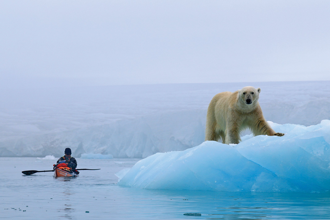
Tears streamed down my face. Through the fog I watched the faint outline of my two companions moving further and further away from me with each passing hour. I battled with every stroke, struggling to stay awake, my mind exhausted and my hands numb with cold.
For centuries, explorers and dreamers have been drawn to the icy waters and barren landscapes of the Arctic. Inspired by romantic notions of the Land of the Midnight Sun, where polar bears roam across ice and tundra and glaciers plunge into the ocean, early adventurers journeyed on quests ever further above the Arctic Circle. Many of those bound for the North Pole departed Svalbard, a cluster of isolated islands anchored roughly midway between mainland Norway and the pole. Time passed, and although those pioneering days slowly faded into history, the magnetic attraction was not lost. It was deep inside of me.
So, on a foggy day in late June 2015, Jaime Sharp, Per Gustav (“PG”) Porsanger and I left on our own quest—to paddle more than 2,000 kilometers around the four main islands of Svalbard. The route around this desolate Arctic archipelago was, despite the passage of time, a circumnavigation that remained unclaimed.
Seven years earlier, two paddlers—Alon Ohad and Tim Starr—set off from the colorful settlement of Longyearbyen on the largest island, Spitsbergen, and paddled north, their kayaks loaded with what they hoped would be enough supplies to get them around the first-ever circumnavigation of the archipelago. Passing tumbling glaciers and windswept landscapes they worked their way towards the 80th parallel. On the coast of Nordaustlandet—the northernmost island and the crux of the circumnavigation, guarded by a 160-kilometer stretch of glacial cliffs and the highest numbers of Svalbard’s infamous polar bears—they were trapped in sea ice. After five hours of hauling their 200-pound kayaks across the shifting ice mass, a back injury forced the pair to call for an evacuation.
The second major attempt followed two years later. Two young Norwegians—Sebastian Plur Nilssen and Ludvig Fjeld—struggled north, battling the strong winds that funneled out of the mouths of the archipelago’s massive fiords. Two weeks in, they burned a pile of their food supplies to lighten the load and increase their speed. Then, after 24 days, their journey came to an abrupt end. While they were sleeping, a polar bear crawled under their trip wire, ripped through the tent and grabbed Sebastian’s head in its jaws. Ludvig shot the bear, likely saving his friend’s life. After a rescue helicopter delivered Sebastian to Longyearbyen for surgery, he spent three months in the hospital recovering from a punctured lung and extensive injuries to his chest and shoulder.
The incident cast a pall on the circumnavigation, and for the next five years the coastline remained silent. It was clear that in order for us to succeed, we needed a team of at least three. That way we could maintain a bear watch roster, with one of us staying awake and on guard at all times.
The crunching of my bow slicing through bands of brash ice awoke me from my thoughts. Somewhere beside us, the occasional booming of glaciers slowly faded into an eerie silence. It had been damp for days and I longed to escape the fog and paddle in the glistening sunshine again.
That evening, camped on a small island, I climbed a hill behind our tents. A few hundred meters away, a polar bear roamed over a ridge. It paused and looked at me for a moment before continuing away from our camp. For as far as I could see, the ocean was covered in sheets of broken sea ice with thin veins of water between.
As a team we were walking on equally unstable ice. Conflicts in personalities, paddling speed and goals created an uncomfortable tension that I struggled to shake. I had never expected that the competitive and controlling tendencies of someone else could affect my self-esteem so drastically.
On past journeys, paddling alone around New Zealand and Vancouver Island, I’d found inner contentment and a total sense of happiness. I enjoyed taking on challenges alone and the sense of satisfaction that came with succeeding was both empowering and humbling. I was left feeling a stronger, more confident person for it. But on this cold polar night I sat huddled by a small fire, tears rolling once more down my face. Never before had I felt so low in such a wild and beautiful place.
I hung onto the hope that when this journey was over, I would remember the splendor of camping on tundra alive with wildflowers, herds of reindeer roaming nearby, and the exhalations of beluga whales breaking the silence. Morale was low, but there was still beauty all around us. It was the one thing that kept me going. That, and the fact that there was no other option than to keep going.
Days were slowly becoming distinguishable from nights. The sun no longer moved in a halo above us. Instead, it swept the sky in a slow burning streak as it dipped towards the horizon. Soon, the land would be covered in a months-long blanket of darkness, the temperatures would plummet, and the sea would freeze into solid ice for the winter.
Our window was closing and we began paddling through the twilit nights in a bid to spend the few hours of dusk and darkness away from the bears. We were only a week’s paddle from Longyearbyen—just a few hundred kilometers away from closing the loop. Hour after hour, my paddle dipped in and out of the water. Rocky mountains and headlands slowly grew taller and then ever so slowly faded into the distance behind me. We crossed the mouths of wide fiords and bays backed by walls of calving ice. After nine weeks, it was as if nature wanted us to succeed. We had tiptoed lightly, and Svalbard had allowed us to pass. —Tara Mulvany
Fathom Five, LAKE HURON, ONTARIO | PHOTO: HENRY LIU
Fathom Five
LAKE HURON, ONTARIO
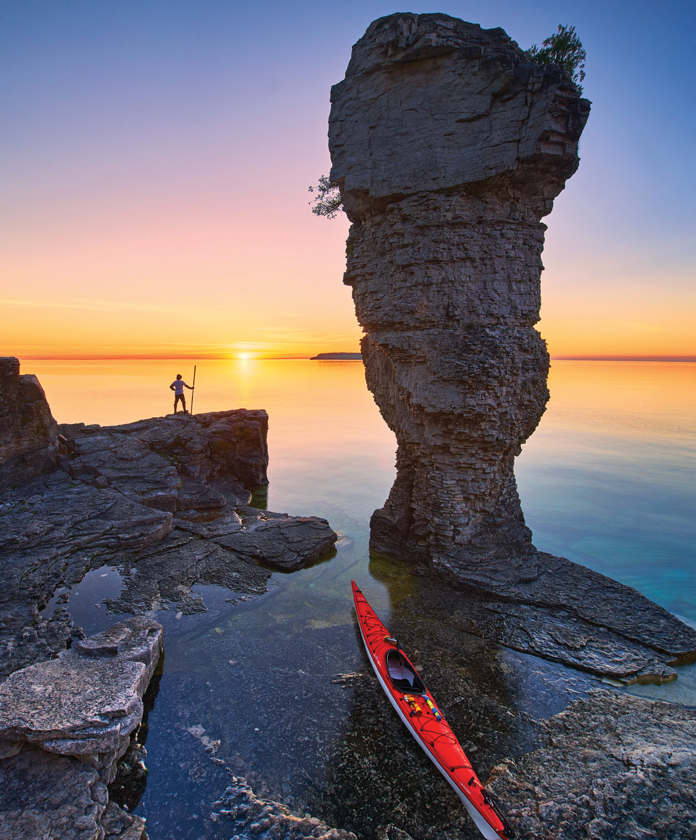
At the tip of Ontario’s Bruce Peninsula, where the white, fossilized cliffs of the Niagara Escarpment plunge into the cold, cobalt waters of Lake Huron, lies a constellation of limestone islands protected within Fathom Five National Marine Park. The park’s name is borrowed from Shakespeare’s The Tempest: “Full fathom five thy father lies; Of his bones are coral made; Those are pearls that were his eyes: Nothing of him that doth fade.” A fitting eponym given that the park, much of it underwater, was founded in 1972 to preserve the more than 20 shipwrecks that litter its shoals. A natural absence of silt and algae makes for spectacular water clarity, offering divers, snorkelers and kayakers the chance to view the ghostly remains of 19th-century schooners that once supplied the villages of Georgian Bay. Above the waves, the park’s seven main islands are home to two historic light stations, walking trails and—most famously—the Flowerpots, dolomite sea stacks eroded into fantastic shapes.
Flowerpot Island is a four-kilometer crossing from the Tobermory town docks in Little Tub Harbour. This is the only island with camping and the six sites fill quickly; overnight visitors should reserve when registration opens in early May. From the camping area, short trails lead to the two Flowerpots, a large cave and the immaculate red-and-white clapboard light station at Castle Bluff. Fathom Five’s many smaller islets beckon further exploration by kayak. Crossings are generally short but exposed, and paddlers should be prepared for near-frigid waters and boat traffic. — Virginia Marshall
IF YOU GO: May through September is the best time to visit. Kayak rentals and guided day trips are available through Thorncrest Outfitters in Tobermory.
This article originally appeared in the Adventure Kayak Summer/Fall 2016 issue.
Subscribe to Paddling Magazine and get 25 years of digital magazine archives including our legacy titles: Rapid, Adventure Kayak and Canoeroots.
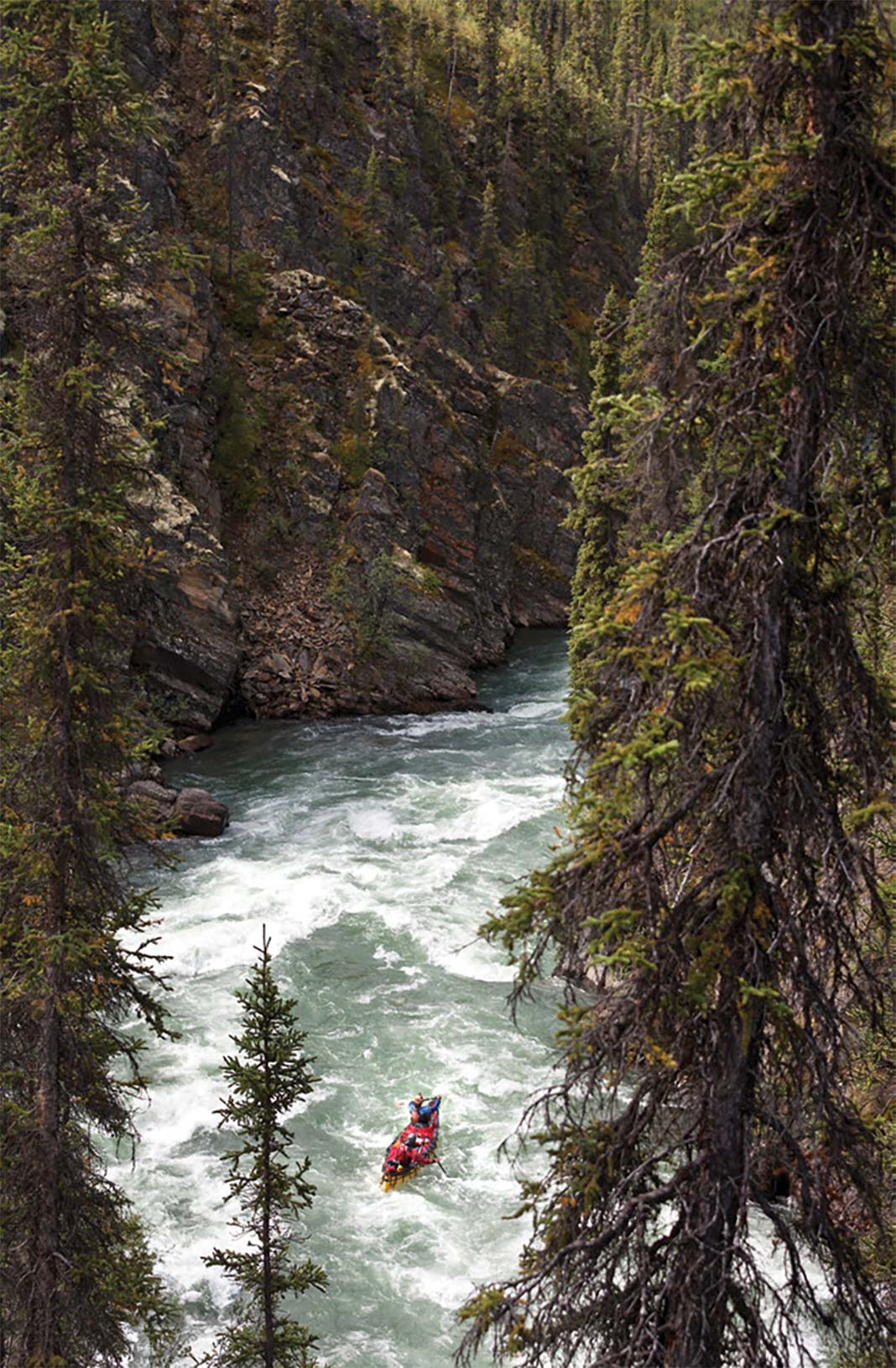
It wasn’t until the tenth day of the expedition that it happened. The canoe was sideways; my paddle could only reach air. All I could see was the icy rapids of the water below. Ken, in the stern of my canoe, was screaming at me. Was this it? Was I finally going to dump the canoe? Was my camera gear going to go floating down the river? All the fears that the team had about having an inexperienced paddler on a remote wilderness trip were about to come true.
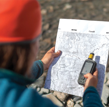
Ten days before I almost brought about catastrophe; a storm was raging in the small town of Fort Simpson in Canada’s Northwest Territories. Our rag tag group of six travelers had arrived 24 hours before in preparation for the 14-day exploratory canoe trip down the Little Nahanni River. Sponsored by Parks Canada, our aim was to scout the river and create a guidebook, turning the intense 85-kilometer route into the next must-do whitewater canoe destination of the north.
It’s everything a river tripper could want: fast crystal water, thrilling rapids of all classes, looming canyons, wildlife sightings and remote landscapes. Also, maybe a couple things you don’t want, such as lack of beta, high consequence drops and, at the time, seriously terrible weather.
Full steam ahead. | Photo: Dustin Silvey
Located about 60 kilometers northwest of its more famous counterpart, the Little Nahanni River runs through two national park reserves that border each other: the famous Nahanni National Park Reserve and little-known and recently created Nááts’ihch’oh National Park Reserve. Combined, the two reserves cover an area of almost 40,000 square kilometers, larger than the country of Ireland.
Until now, fewer than 10 paddlers have descended the river each year. Most have been doing so with very little beta.
“We knew that people had paddled the river, but there was very little information available,” says Lyn Elliott, our trip leader from Parks Canada. “It’s a technical beast, so the goal was to collect enough river information so that more paddlers can enjoy it. And there’s only one way to get that—by paddling the river.”
Prior to the trip, Lyn scoured online resources to find more on the Little Nahanni. She got in touch with half-a-dozen paddlers who had run the river over the past few decades. One paddler, Mike Fischesser of North Carolina, paddled there in 1987 and recalled being given a hand-drawn map by a friend at the time.
“He drew a line on a piece of paper and said, ‘I think there’s a rapid there,’” Fischesser says.
“That’s the scope of the information they went down the Little Nahanni with in the ‘80s. Despite all my research and interviews, I didn’t feel like we had much more tangible information almost 30 years later,” says Lyn.
Our scouting team included two expert whitewater canoe guides, two Parks Canada employees, including Lyn, and a second writer and photographer who was also a seasoned paddler.
Everyone else had an air of confidence I didn’t share. I was cleanly shaven, with a short crew cut and gelled hair, sporting my shiny new Bergans gear I’d received specifically for the trip.
Access to the river via bush plane or make the long drive from Watson Lake, Yukon.
Thanks to this trip, Parks Canada’s trip planner includes GPS points for rapids and points of interest.
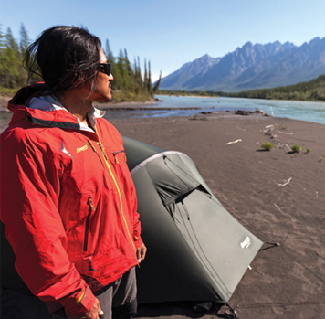
Campsites are a mix of rocky shores and sandy sites.
My paddling background equated to flatwater canoe trips with Scouts in my early teens. The only reason I was here was because my photography portfolio had impressed Lyn enough to ignore my lack of paddling skills. Having worked in conflict zones as a photojournalist, I figured I’d be able to handle a little canoe trip, but looking at my companions I started to think I had made a mistake.
[ Paddling Trip Guide: View all paddling adventures in the Northwest Territories ]
I knew nothing about whitewater paddling, little about tripping, and the journey down the Little Nahanni’s almost constant class II to IV rapids would be my first expedition.Before we set off, Lyn had reviewed Hans Baer’s trip journal, one of the first known paddlers to have descended the Little Nahanni in 1972. In one particular entry, Baer’s party had just arrived at the Little Nahanni, and met a couple men from the local tungsten mine. Baer wrote:
“A young chap who stopped by for a while inquired what we were up to. He was very pessimistic about our Little Nahanni adventure and told us that he had heard of parties trying to get down the river, but apparently all of them had come walking back up, and he knew of nobody who had actually made it. Also, he thought that nobody had tried it this year. Well, this didn’t sound too encouraging.”
I couldn’t help but agree.
The best time to paddle the Little Nahanni is from mid-June to mid-August. Plan for eight to 12 days. | Photo: Dustin Silvey
The best time to paddle the Little Nahanni is from mid-June to mid-August. Plan for eight to 12 days. Thanks to this trip, Parks Canada’s trip planner includes GPS points for rapids and points of interest. Campsites are a mix of rocky shores and sandy sites.
There are two main ways into Nááts’ihch’oh National Park Reserve, either a floatplane from Fort Simpson, or a six-hour drive from the nearest gas station in Watson Lake, Yukon. Those who choose the latter route must bring extra fuel for the trip back.
Catching a lull in between storm cells, we descend under a steely sky to Flat Lakes and the Little Nahanni River valley. None of our party of six saw a thing however—the pilot had to fly high above an oncoming storm for visibility and the oxygen level in the unpressurized plane dropped enough to cause all of us passengers to fall unconscious. The resulting headache was unbearable, and I went straight to bed that evening while the rest of the team feasted on celebratory steaks—including mine.
The remoteness of this river means there’s no easy way out. I was especially aware of this on our first morning in camp as I received a lesson on how to prep the canoes and we discussed safety.
With us Lyn had brought a copy of Baer’s 1972 trip report. Paddling downriver in fiberglass boats, Baer’s journal details the extensive repairs required after one boat cracked its keel in a set of rapids. The team repairs it enough so it could limp along, but had to pull off the river to fire up a stove, melt resin and stage repairs. The group is lucky that they had already paddled through the most difficult section of the river.
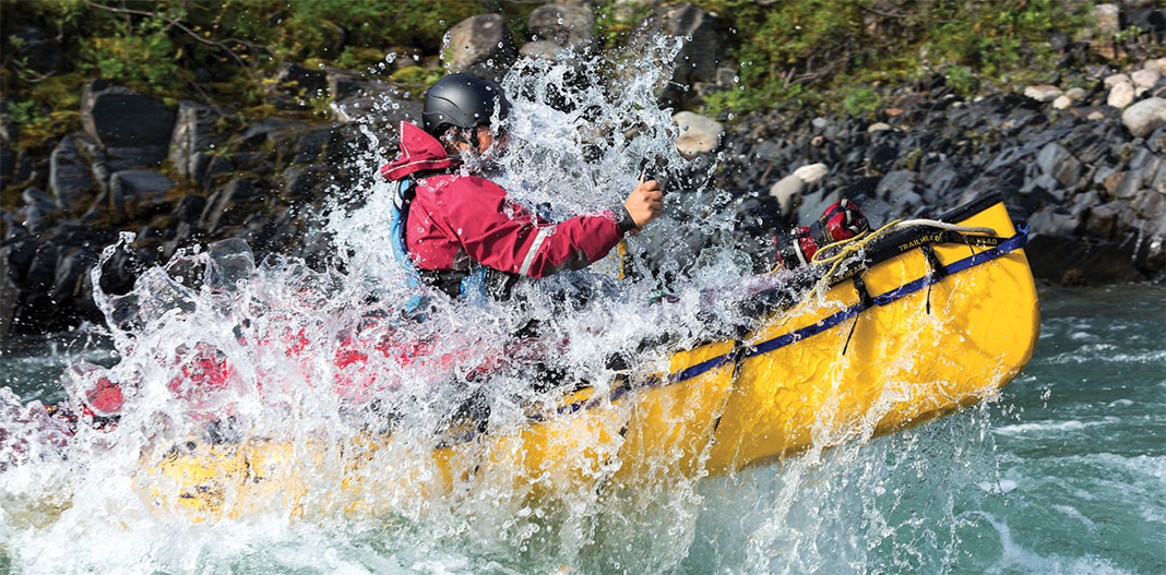
The third day on the water we reached the Little Nahanni. The weather hadn’t been in our favor so far. Rain and hail pelted our faces and helmets, as well as the spruce trees around us. Droplets bounced high off the water. The spray from the class III rapids we navigated was frigid.
I paddled in the lead boat with Ken MacDiarmid, our best paddler. The arrangement suited me just fine. At a lunch break one afternoon, fellow photographer on this trip, David Lee, turned to me.“That was pretty intense, eh?” he asked about the previous set. I looked at him in surprise.
“It was? I don’t know. I have nothing to compare to this,” I replied. Being in the lead boat I never knew what was coming, had little understanding of what was required and just did whatever Ken yelled at me. The other boats followed ducky style, more or less oblivious to the chaotic canoe that led them downriver.
Most nights we camped on rocky shores. On the odd day we were lucky to find huge sand bars to rest our heads. Each evening, Lyn transcribed her notes from the day, noting the class of rapids, obstructions and tips for navigation, as well as marking GPS waypoints on a series of topographical maps. Then she’d pull out Baer’s notes to see what the following day might have in store.
By day seven, the rain had seldom stopped for more than a few minutes at a time. It was late in the afternoon when the shoreline peeled away sharply into a high rock face, the water sped up, and the river darkened and disappeared as it dog-legged around a canyon wall. Ken eddied out. “We’re here,” he told me.
With constant class III and IV rapids throughout the two-and-a-half kilometers, Crooked Canyon is considered the most challenging section of the river and was the only area Lyn worried we would have to portage around. We had heard about the brutal portage and none of us were keen to repeat that suffer-fest.
Fortunately, Ken and fellow guide Pablo decide they’ll paddle the canyon with our gear the following morning, leaving us to hike the portage and allowing me to get awesome bird’s eye photos of the canyon run. Ken and Pablo were halfway through the canyon when the sun finally came out and breathed new life into all of us.
After a week paddling together the six of us seemed like a strong team. I even felt like I’d learned a bit. With just a handful of comparatively easy rapids left I almost ruined it all. My mind wandered. I didn’t notice the river increasing in intensity. At last, Ken’s frantic yells to paddle woke me from my dreamlike state.
I plunged my paddle ahead expecting the weight of water—instead, only air. Searching for leverage with my blade, I leaned out over the gunwale, throwing the boat’s balance into chaos. On the verge of swamping, a moment of unwelcome clarity reminded me of the thousands of dollars worth of camera gear hidden just under my sprayskirt.
“You stay in this damn boat,” Ken screamed at me. We completed the wave train with our canoe almost on its side, me barely hanging on, gunwale partially submerged under the frothing water. Ken wasn’t impressed with our style.
Later that day, we arrived at the confluence of the South Nahanni. It’s the location of one of Bill Mason’s most famous paintings, titled “Confluence of the Nahanni.”
From there it was an easy three-day float to Rabbitkettle Lake, where we waited for our floatplane. Many people begin their Nahanni River adventure here, and Virginia Falls—at 300 feet tall it’s twice the height of Niagara Falls—is just a four-day paddle away. Around the camp stove that night Lyn deemed our mission a success—she was sure our team had gathered enough beta to make this tough little river safer and more accessible for future paddlers.
Seven months later, Parks Canada digitally published a 48-page guidebook for would-be paddlers of the Little Nahanni River. I reviewed my copy in the comfort of my home. Toward the back, emblazoned in 30-point font above a tandem canoe crashing through a wave, the text reads: “No place for rookies.”
I think they’re talking about me.
After his career as an elite wrestler ended due to injury, Dustin Silvey bought a camera and started taking pictures of everything. He now works as a photojournalist while completing a PhD in medicine.
A kayaker with two kayaks strapped to his feet does a seal launch.
1986 German film Fire and Ice.
Video: Fire and Ice
We thought we had seen a lot of brave kayaking moves until we saw someone wear two kayaks on his feet and seal launch 25 feet into a narrow walled section of river.
This brilliant collection of kayaking ridiculousness is a scene from the 1990 movie Fire, Ice and Dynamite. Never before have we laid eyes on so many boof-less drops or potentially back-breaking entries.
Directed by Willy Bogner, the full movie has awesome freestyle skiing scenes.
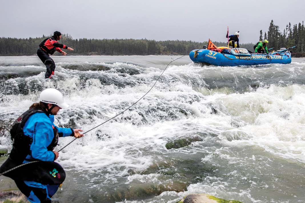
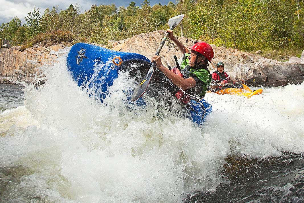
On the last morning at Dream Wave, Ben Marr takes his final surf as the sun rises on the Nelson River. | Feature photo: David Jackson
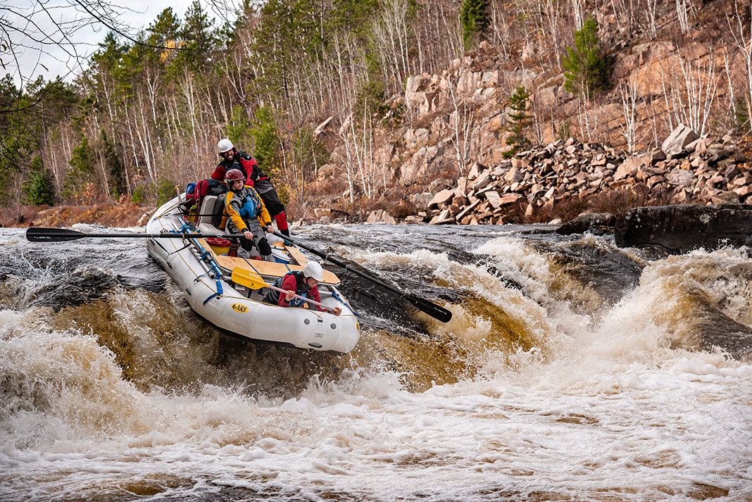
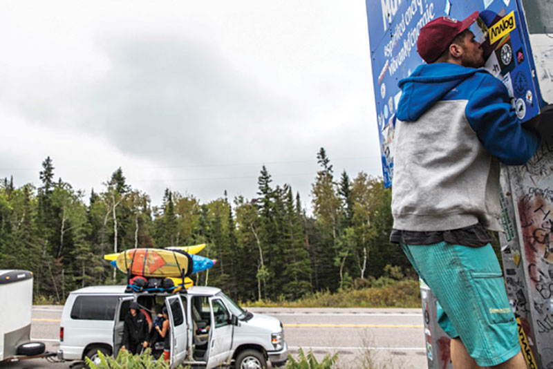
Uncharted rivers are few and far between in 2016. There’s a tribe who seek their fruits for various reasons, often leading them to the most remote stretches of wilderness on earth. The Nelson River, tucked in the wilds of northern Manitoba, is no exception.
Catching the dream wave on northern Manitoba’s Nelson River
Joel Kowalski had been staring at the Nelson River on Google Earth for more than four years. From what he could tell from the satellite images, Canada’s fourth largest river looked like an oversized version of the Ottawa. For Kowalski, who grew up on the banks of the Ottawa River, the Nelson was everything an elite freestyle kayaker could ask for. Except maybe easy access.
“The Nelson isn’t like a river draining a big basin, it’s more like a river draining an inland ocean,” he noted prior to departure. “There are a few qualities that make a place have a lot of really good surf waves, but this seemed to be on a scale we hadn’t experienced yet.”
From the satellite images, Kowalski could tell this was a very high-flow river with low-gradient. Also appealing was the Nelson’s many parallel channels separated by long sections of flat water, which would allow the team to motor downriver in two 20-foot rafts and have multiple options to pick their way through drops.
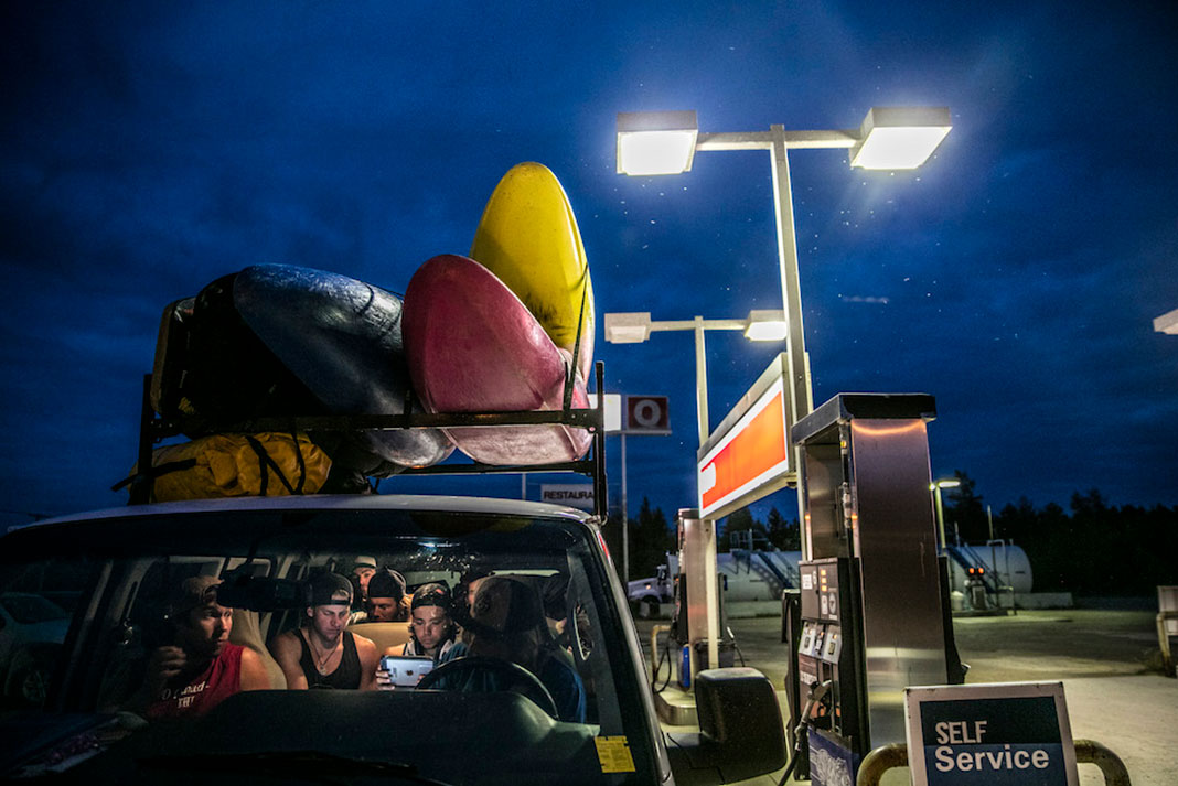
With kayaks on the roof and a trailer full of raft support equipment in tow, the team drives 3,000 kilometers to reach Nelson Lake, Manitoba. | Photo: David Jackson
After 26 hours of driving, the team arrives at the Manitoba border. Bren Orton greets it with a kiss. | Photo: David Jackson
The road to Cross Lake
On September 6, 10 paddlers set out from the Ottawa Valley on a 40-hour drive northwest. Kowalski had compiled a team of elite competition, freestyle and racing kayakers to seek out the Nelson River. The team included Ben Marr, Dane Jackson and Bren Orton. A passenger van, borrowed from the Kowalski family business, rafting operator Wilderness Tours, towed a colorful trailer full of expedition gear and freestyle kayaks.
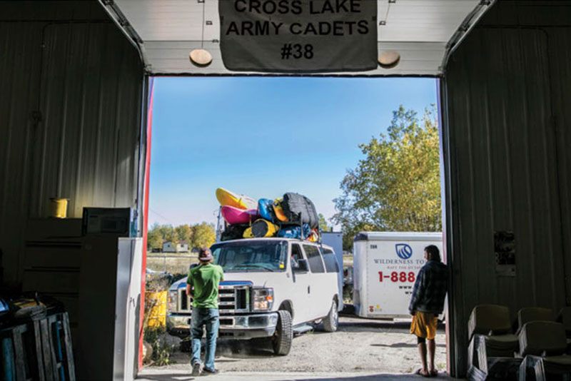
The team made the continuous drive and arrived under the northern lights in Cross Lake at 2 a.m. Located 771 kilometers north of the provincial capital of Winnipeg, the tiny town is home to just 338 residents. Half of the boys pitched on a modest motel room; the others curled up under transport trailer beds only to be awoken in the wee hours of the morning by a roaming black bear.
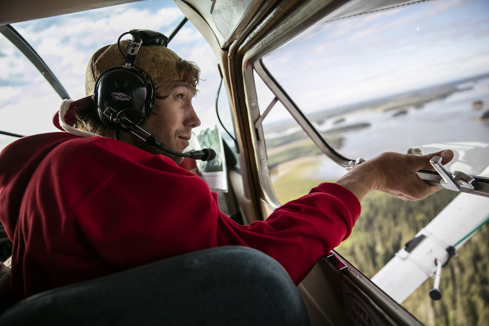
Blue skies that day were a fortuitous sign for Kowalski and Marr, who met their floatplane pilot lakeside, ready for a reconnaissance flight over the section of the river in question.
Joel Kowalski gets his first glimpse of the major rapids on the Nelson River, Manitoba. Hal Monkman gets some well-deserved shut-eye after the 40-hour drive. | Photo: David Jackson
“These flights can do a few things. It will either answer our questions or give us a lot more,” Marr said before the flight.
While calm and collected at first, elation set in when Kowalski and Marr laid eyes on the rapid they had been calling Powerline. Spotting a shoulder on the edge of an enormous hole, Marr shifted and straightened to get a better look. Could it be? The two met with wide eyes before peering once again out the bubble window of the de Havilland Beaver. The pilot did three slow closer passes, circling and dropping lower each time.
“Things were starting to take shape—we were looking at what we had been dreaming of,” says Kowalski. There was so much water flowing, beyond anything they had expected.
Beaver’s-eye view of White Mud Falls. | Photo: David Jackson
“We were thinking both the same thing, but we didn’t want to say anything to the other guys—it’s easy to get too excited and make judgments too early,” says Kowalski, who admits he played it pretty low-key afterwards. By the time the plane landed Marr and Kowalski were stoic again, childlike Christmas morning excitement put aside.
Setting out for the Nelson River
Back in Cross Lake, the rest of the group had attracted a curious and increasingly concerned entourage as they were packing the rafts. Locals voiced heavy skepticism. Many thought this was a death mission, as the wild river had taken many local lives in years past. The team was invited to a send-off feast by the local Pimicikamak Nation where they dined with the council on moose, fresh-baked bannock and walleye.
“Half the town was excited; the other half were sure they were never going to see us again.”
Offered safe passage by the council, the team departed the next morning with local flags waving under cloudy skies.
“Half the town was excited; the other half were sure they were never going to see us again,” says Kowalski.
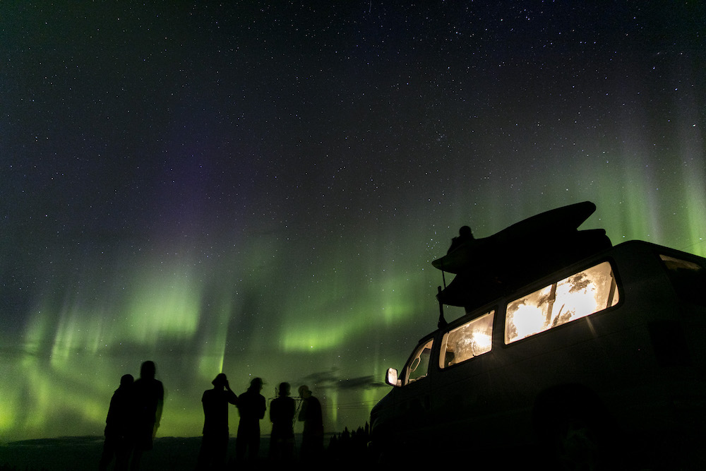
The northern lights greet the team on the banks of the Nelson River. | Photo: David Jackson
The river quickly took on a prehistoric feel. White pelicans flew overhead, eagles screamed as they dove for fish and not a single other soul was seen.
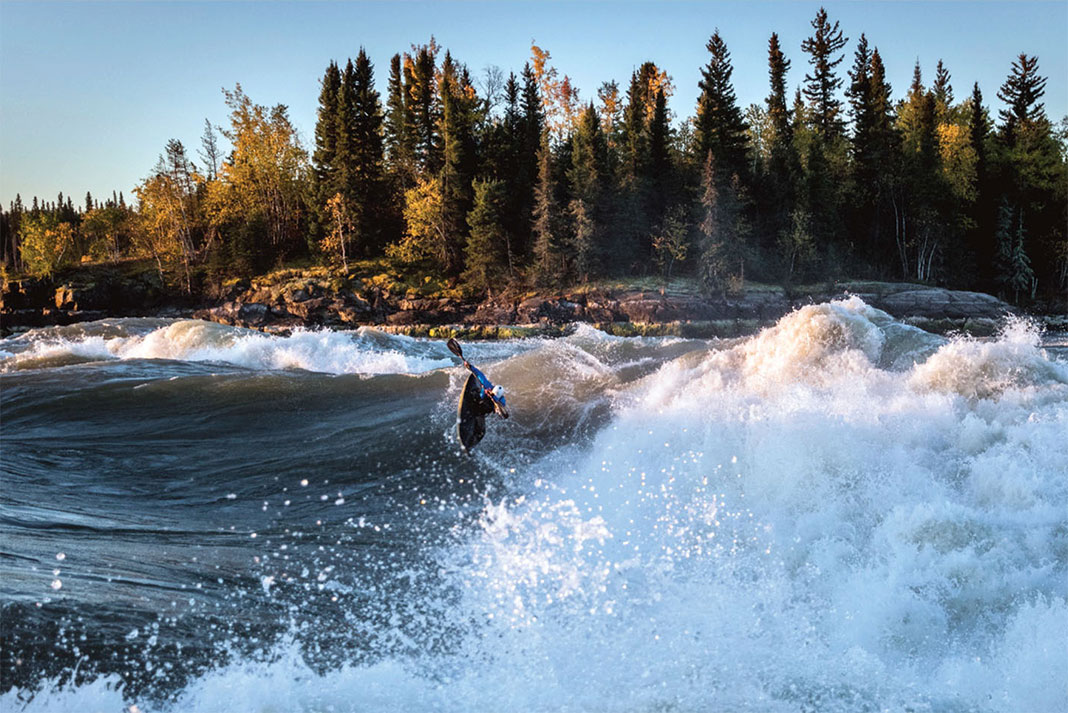
The first evening out they came to the first rapid. “It was so much bigger than either Benny or I had thought from the air. It was the same size as Hermit on the Grand Canyon. That really surprised us,” says Kowalski.
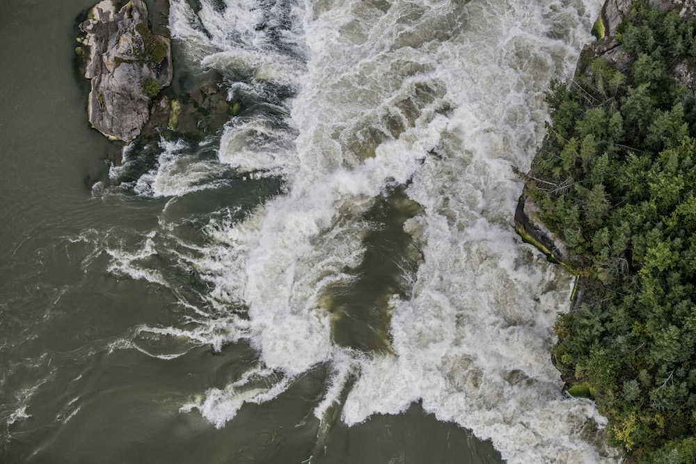
Still, it wasn’t until the fourth day of the trip that the team arrived at what they had been calling Powerline—and what the locals referred to as Bladder Rapids—uncovering what would be aptly renamed, Dream Wave.
Dream Wave found
“As we got closer, we were starting to get anxious, bordering on nervous, because when we were still about three kilometers from the start of the rapid we could see massive explosions of water bursting over the horizon line,” says Kowalski.
Dane Jackson rotates under an airscrew. | Photo: David Jackson
When the group pulled off river right to scout, the team was stunned by the size of the gigantic hole and massive wave. “Half of the team wanted to drop everything and just start surfing right then and there, but we set up camp first,” says Kowalski.
“We could see massive explosions of water bursting over the horizon line.”
Once a main shelter was established the team started kayaking. For the next six nights, time disappeared in Northern Manitoba and the greatest river wave ever surfed was in session. For Kowalski, it was the culmination of four years of dreaming, 40 hours of driving and four days of searching.
“It was the combination of everything you could want out of a surf wave. It was really tall, really wide, really fun and surfable left to right—even if you weren’t throwing tricks you’d have fun,” says Kowalski. “Easy and smooth to surf. As easy as Pushbutton on the Ottawa, but huge.”
The team lived in a kind of Never Neverland. Always in earshot of the roar of the river and surrounded by black spruce and jack pine, they were united by all-day surf sessions and only interrupted by fishing, shooting guns, making fire and food. The rafts had carried in a generator with gasoline, propane cook stoves and five coolers of food. “We didn’t pack light—it was as cushy as you could get considering where we went,” says Kowalski.
Ben Marr, Tom Paterson and Louis-Philippe Rivest work together to keep the rafts away from Eve’s Falls, it was the only portion of the trip where the rafts had to be lined. | Photo: David Jackson
Returning from a world-class run
After enjoying 10 days on the river it was a full day to motor out and meet the shuttle.
A welcoming crowd greeted the team at the take-out. Back in town the kayakers were revered, and again hosted at an amazing feast. Kowalski put together a short presentation with videos and photos for the chief and local councils to showcase the expedition. In turn, the hosts shared their own experiences on the river.
“The locals travel the river to fish for sturgeon and hunt. They’ll bring tin boats to the edge of the rapids then portage with a winch system. But many people have drowned or simply disappeared,” says Kowalski.
On the last morning at Dream Wave, Ben Marr takes his final surf as the sun rises on the Nelson River. | Feature photo: David Jackson
Arriving back in town, the team is received like celebrities. After the celebration they fell asleep in the cadet building. | Photo: David Jackson
“Yet, in light of what we were telling them, they were very excited,” he adds. “None of them had considered they were sitting on top of some of the best whitewater in the world.”
Kowalski plans to return next summer for a second mission to Dream Wave.
David Jackson is an award-winning photojournalist with a penchant for paddling adventures. When he’s not on assignment, he calls the Ottawa Valley his home.
This article originally appeared in the Spring 2017 issue of Rapid. Subscribe to Paddling Magazine and get 25 years of digital magazine archives including our legacy titles: Rapid, Adventure Kayak and Canoeroots.
Ben Marr surfing on Manitoba’s Nelson River. | Feature photo: David Jackson
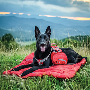
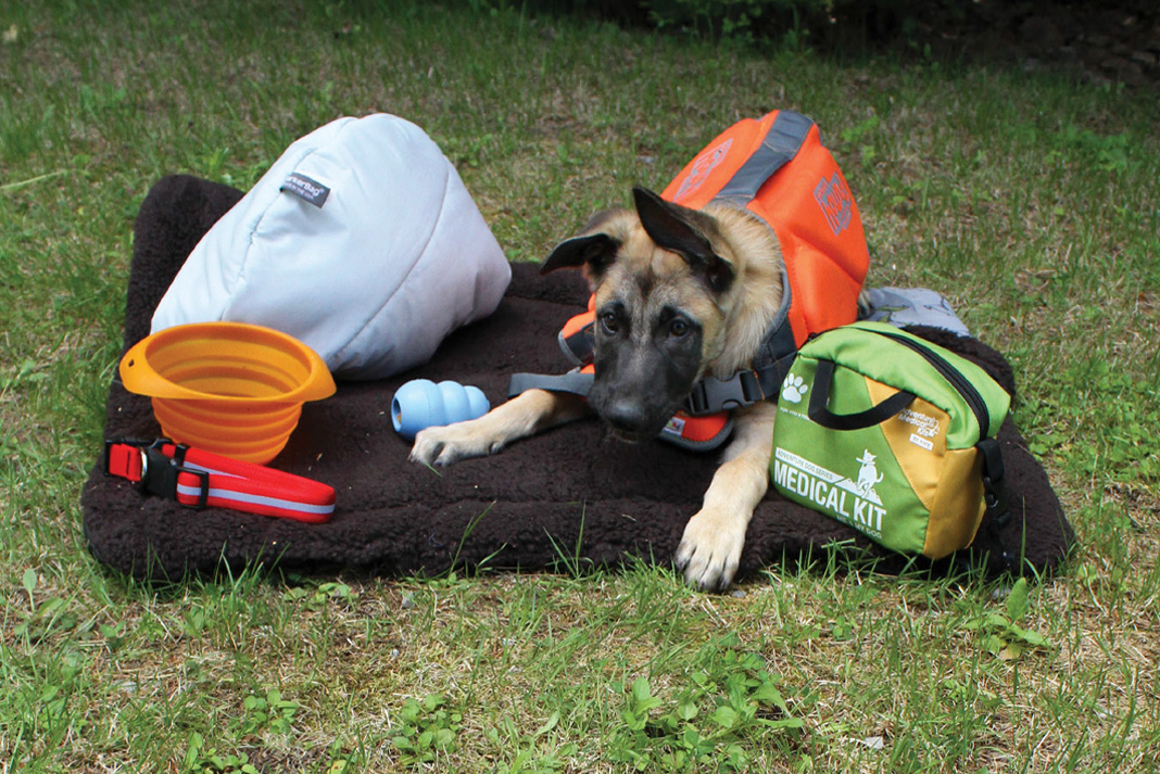
They track mud and dirt into the tent, occasionally almost capsize the canoe, and bark at every critter they come across… but camping trips just wouldn’t be the same without our canine companions. Whether you’re taking your dog camping for the first time, or want to upgrade your dog’s gear closet, take a look at our picks of the best dog camping gear below.
It’s all about safety, comfort and ease when it comes to these awesome pieces of equipment.
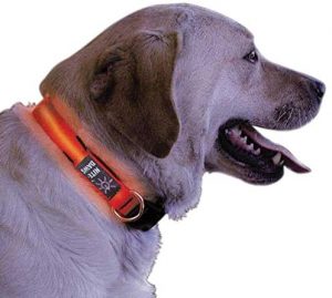
Keep track of your gear hound at night with the NiteDawg LED collar by NiteIze. The bright LED illuminates along its entire length for high visibility up to 1,000 feet away. Have a swimmer on your hands? The NiteDawg is water resistant for salty dogs that love to jump in the lake anytime of day. Adjustable and its 100-hour battery is easy to replace.
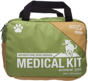
Your pup loves the freedom of the trail as much as you, so this kit has comprehensive first aid solutions to keep both of you safe on all your adventures together. You’ll find all the essentials you’ll both need for a one- to four-day trip in the Me & My Dog Kit (pictured), but if you prefer to travel light, opt for the far more compact Heeler kit ($10) for day-trip bare necessities.
Reward your best bud after a long day of adventuring by letting sleeping dogs lie on Kurgo’s ultra-cushy Loft Wander Dog Bed. As perfect for the car or home as it is for the campsite, this travel doggie bed is a cozy place for your snooze hound to sleep it off. The Loft Wander Dog Bed’s waterproof and non-slip bottom makes it perfect for sand and dewy grass, but if soaked it would take a while to dry. The Wanderbed rolls up like a sleeping bag and has a built-in carrying handle.
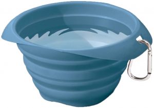
This slick and award-winning travel bowl collapses to barely an inch-thick disc when not in use. It springs back into a voluminous shape with enough kibble room to satiate even the biggest mutt. And it’s not just dogs that love the Collaps-A-Bowl—we came across a few online raves from parents who bought them as snack bowls for their kids.
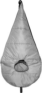
Your dog’s adventurous life might be about to get a little more luxurious. The BarkerBag is a zip-on extension for your mummy bag that accommodates dogs up to 70 pounds. A built-in cinchable collar helps keep your canine in place all night, putting a muzzle on midnight tent prowls. The best part? Not only does Fido stay warm, so do your feet.
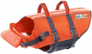
This high-flotation neoprene life jacket is a must-have for dogs on canoe trips and any woofer spending lots of time in the water. The flexible design of the Pup Saver means mobility remains unencumbered, while Mom and Dad can keep a closer eye thanks to high viz colors. A durable back handle offers easy rescue and restraint.
A gold standard among dog owners for more than three decades, stuff treats into your dog’s Kong toy and you’ll keep them out of trouble so you can set up camp or tend to dinner.
THERE’S NO BUSINESS
LIKE FLOW BUSINESS. | PHOTO: TOM GOMES
Born and raised in Scotland, Gordon Brown is well-known by paddlers around the world for his charming accent, exceptional coaching and incredible coordination in a kayak. His many contributions to the sport include the award-winning DVD skills trilogy Sea Kayak with Gordon Brown, an indispensible book, Sea Kayak: A Manual for Intermediate and Advanced Kayakers and guest coaching at events from Chilé to Israel to San Francisco. When he’s at home on Scotland’s Isle of Skye, Brown balances family time and running Skyak Adventures with his wife, Morag, and studying for his Masters in Performance Coaching. Another book is also in the pipeline. But if these seem like the achievements of a lifelong paddlesports professional and natural academic, you don’t know Brown as well as you may think.
WHO IS THE REAL GORDON BROWN?
At school, I was much more interested in woodwork, metalwork and outdoor studies. I spent all of my time building kayaks and sailboats, maintaining the school minibus and running a business repairing the teachers’ cars. I left at 15 having completed no academic qualifications whatsoever. I started competing in motorsport and by 18 was the Scottish road rally and Autotest champion. I had also earned my British Canoe Union (BCU) Sea Proficiency Award through the school’s canoe club. Instructor and Senior Instructor awards and then the Advanced Proficiency Award followed. After some 20 years working in the motor trade, I left and started to develop sea kayaking work around the UK.
WHAT KEEPS COACHING FRESH AND EXCITING?
There is always something new to learn or discover. The most fascinating thing to come out of my academic studies is that what I have done intuitively—because it feels like the right thing to do—has been studied and written about by clever people with letters after their names. That I am now able to engage with this writing and understand it, has really added to my knowledge about coaching. Also, as a coach, I can allow others to see some of what I have seen and hopefully make it easier for them as I’ve made most of the mistakes it is possible to. Seeing the coastline through my students’ eyes, and seeing people develop way beyond what they thought was possible, is amazing and very rewarding.
THERE’S NO BUSINESS LIKE FLOW BUSINESS. | PHOTO: TOM GOMES
WHEN DID YOU MASTER STANDING IN YOUR KAYAK?
Good balance comes from falling in lots and lots and lots. When I was nine, my dad saw an advert in the local classifieds for a home-built sea kayak. Initially, a length of line was tied to the kayak in order that, should my brother or I fall in, there was a means of getting back ashore. Capsizing was quickly followed with exploring the boundaries of what was possible. Since then, I have fallen in more times than I can remember, by trying things that I’ve been told are impossible. If you are not prepared to fail at something, then you will never reach your potential. I also have huge feet, which helps.
WHERE IS A HELMET APPROPRIATE EQUIPMENT?
I choose whether I wear a helmet or not based on where, what and who I am coaching and the context of the session. For example, if the session is about landing in rough water in the context of journeying, and if a helmet is not a normal part of expedition equipment, then paddlers have to be able to make decisions about the outcome. So, for me, this comes to the fore as decision making, which is what my MSc is investigating.
WHY ARE YOU SEA KAYAKING’S SEAN CONNERY?
I often come across as brash, but I really am quite shy. It is very strange when people nudge each other and whisper such things as, “That’s him…” I am really just a normal guy who tries hard to be a good dad to my kids, honest to my beliefs and generous with my time. I love music and have been singing at the local folk club, which is fun and scary at the same time. Coaching is a bit like this too—it is a performance. I remember the late Derek Hutchinson saying to me, “Showtime, young Brown.” That has stuck with me, and if it is a performance, I hope that I will be able to perform for a long time to come.
This article originally appeared in the Adventure Kayak Summer/Fall 2016 issue.
Subscribe to Paddling Magazine and get 25 years of digital magazine archives including our legacy titles: Rapid, Adventure Kayak and Canoeroots.
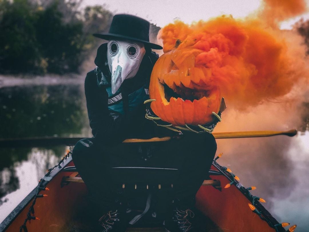
Halloween is approaching quickly, and if you are like us, you’ve been too busy squeezing in last paddling trips to formulate the perfect costume.
Why not incorporate your favorite activity into your costume or Halloween decorations? Plus, you already have most of the necessary elements.
Still not feeling entirely inspired? Take a look at our some of our favorite paddling-themed costumes, pumpkin carvings and decor and get planning.
Happy Halloween!
Photo: Kaydi Pyette
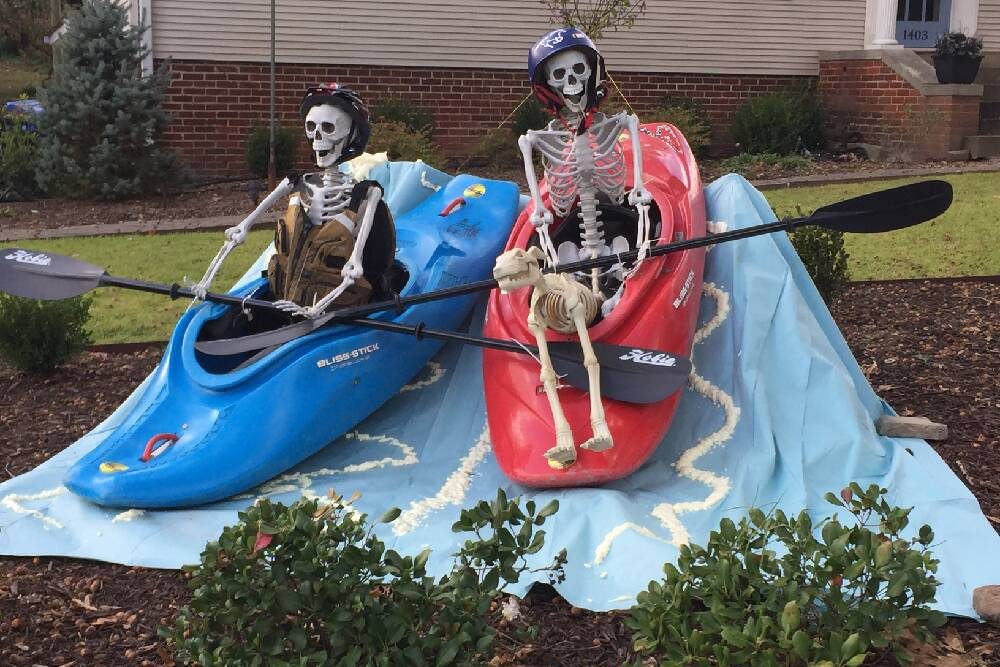
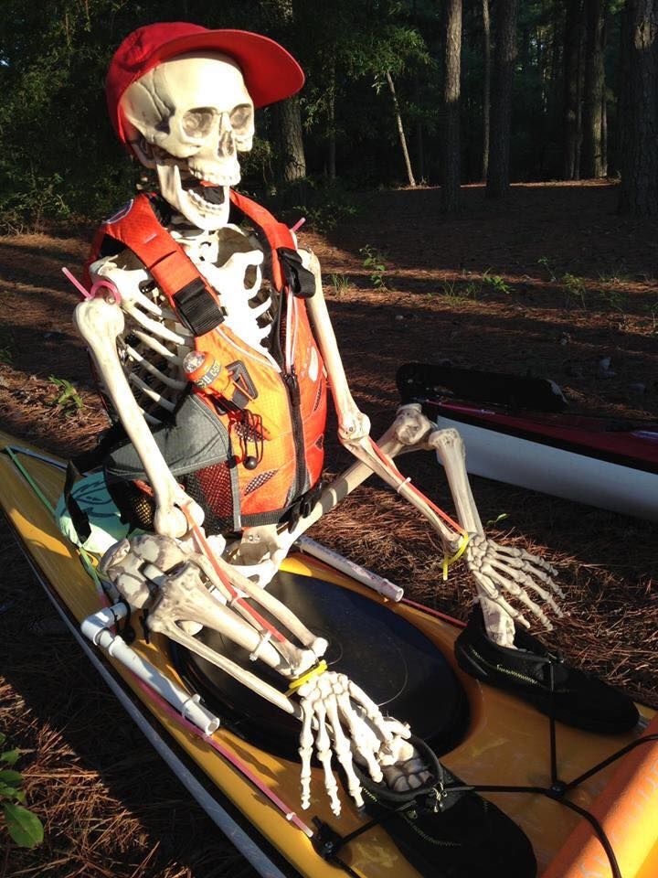
Paddling Themed Halloween Decorations
Instead of buying decorations from the store, why not create your spooky masterpiece from your paddling gear.
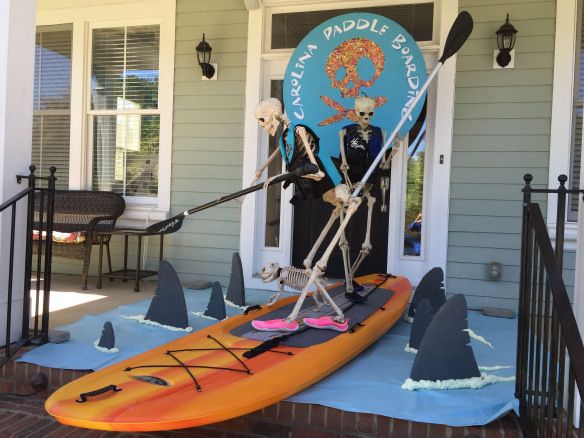
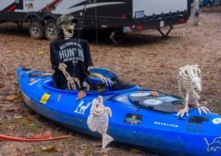
Even Ribs goes along for the ride when Mr. and Mrs. Bones pull out the kayaks. | Photo: Bev FulbrightPhoto uploaded by lancecollins28Ding Dong The Witch Is DeadBaxter Skeletons – What SUP? – Paddle boarding with sharksCatch of the day – a fish skeleton! | Photo: Roads Less Traveled
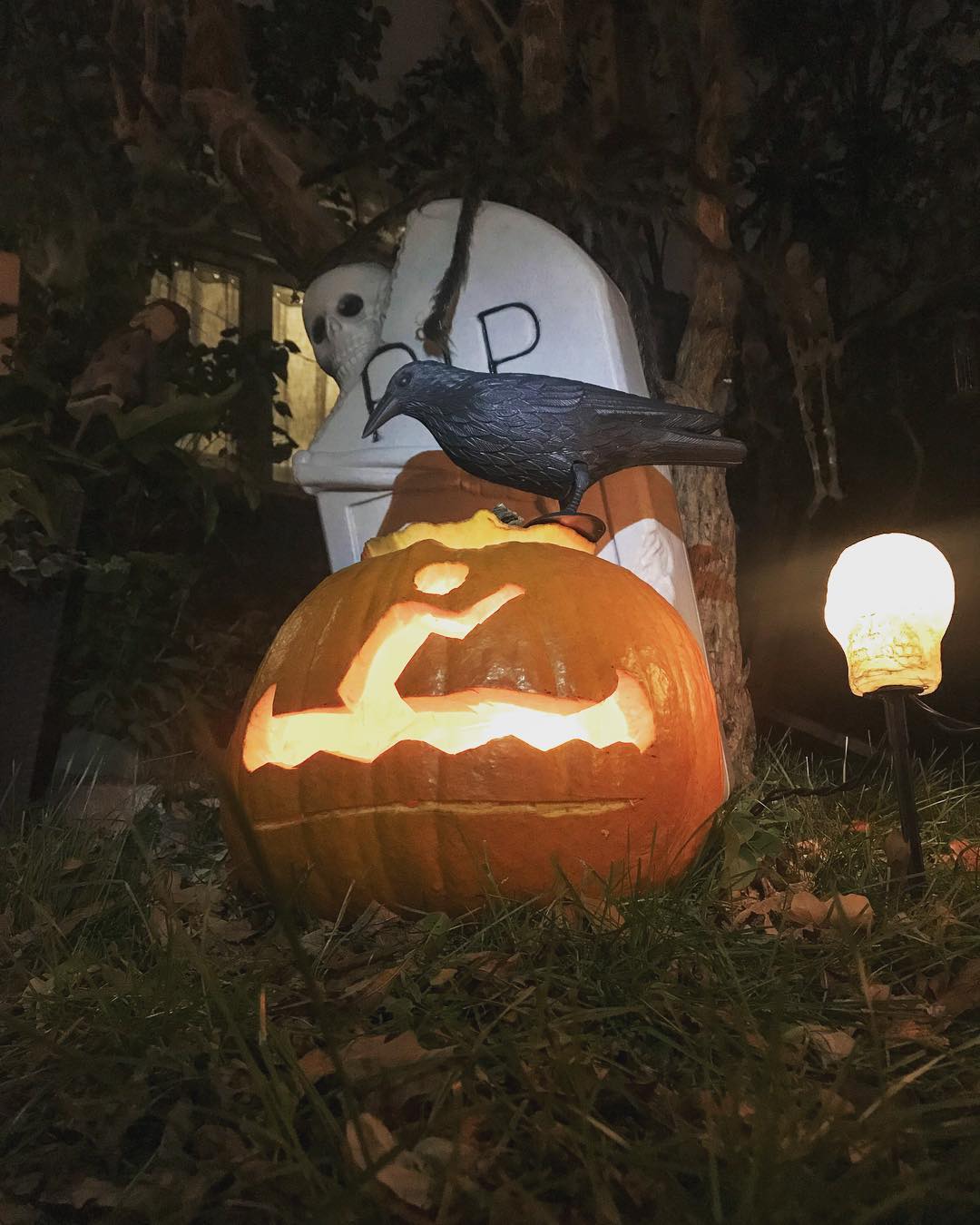
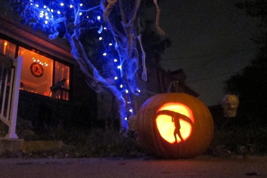
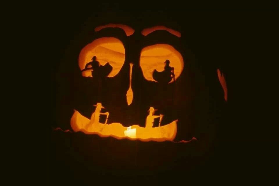
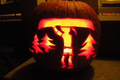
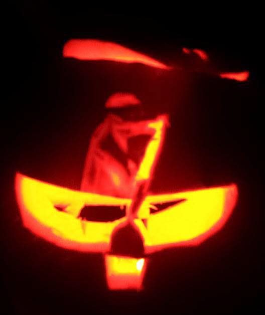
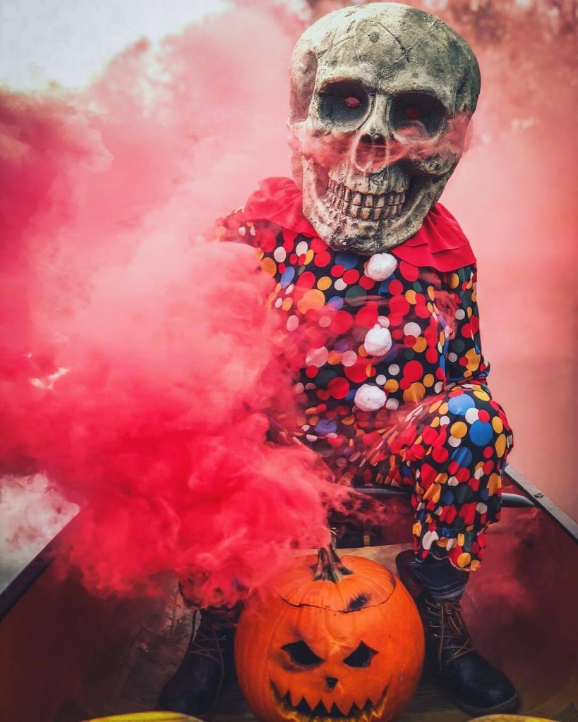
Paddling Themed Halloween Pumpkin Carvings
Photo: Kaydi Pyette
Photo: Kaydi Pyette
Kayaking/canoeing pumpkin carving | Photo: Nova Craft Canoe
Photo: Northern Sound CanoesPhoto: Life Mission.orgPhoto: Owen Brett
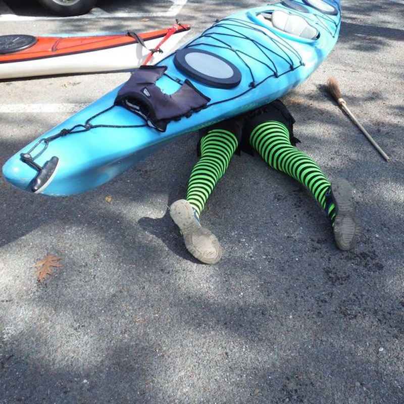
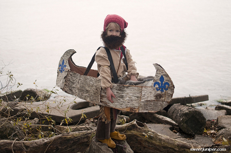
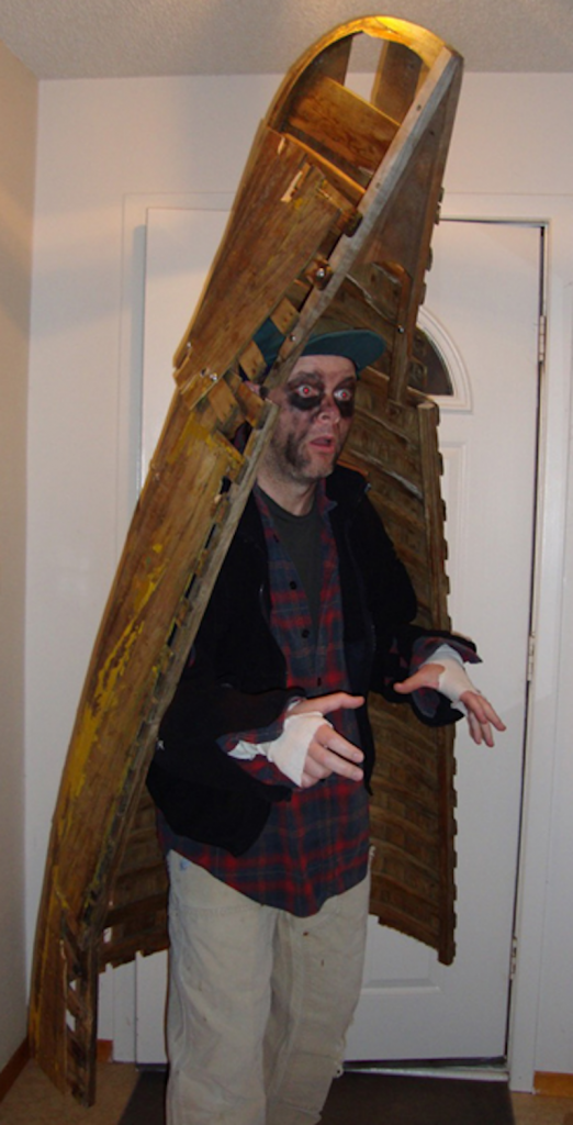
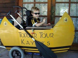
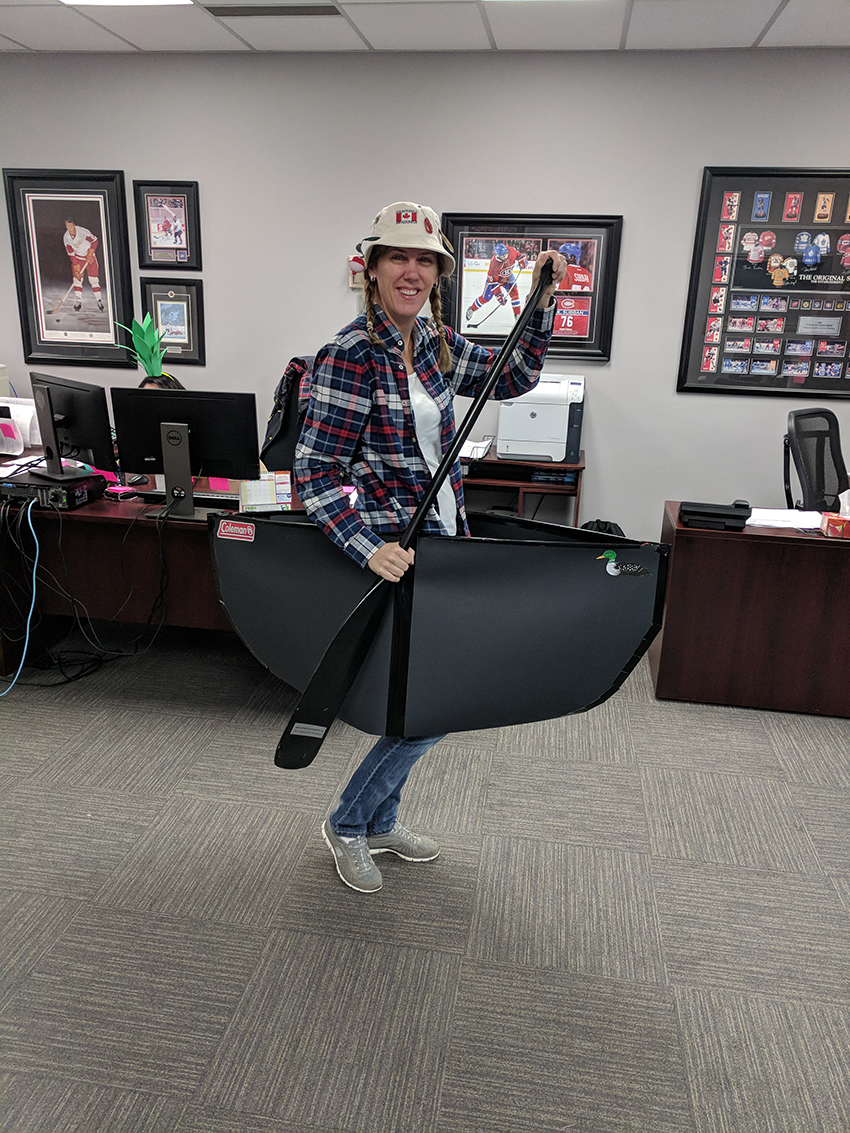
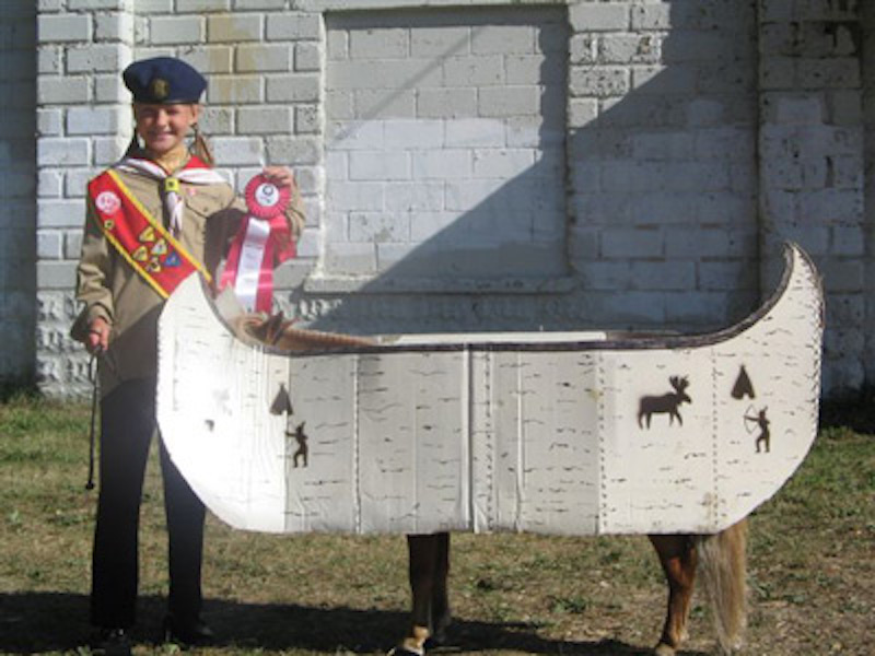
Paddling Themed Halloween Costumes
Halloween is approaching quickly, and if you are like us, you’ve been too busy squeezing in last paddling trips to formulate the perfect costume.
Why not incorporate your favorite activity into your costume? You probably already have some of the necessary elements.
Still not feeling entirely inspired? Take a look at our ten favorite paddling-themed costumes and get planning.
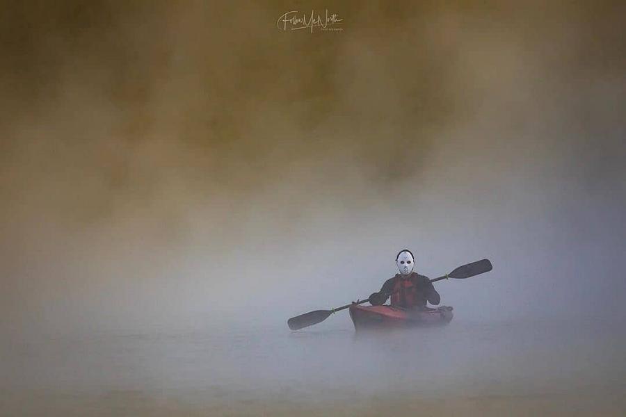
Now, Voyageur | Photo: Sweet JuniperPaddle faster! The top photo on our Instagram in October 2019 was this nod to Halloween by Jesse & Susan, featuring the Jason character from the “Friday the 13th” film series paddling a kayak in Algonquin Park. | Photo: Jesse & Susan @followmenorth / Instagram
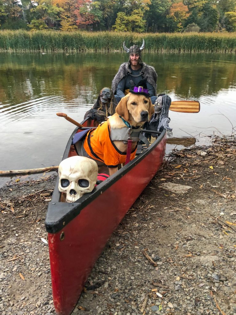
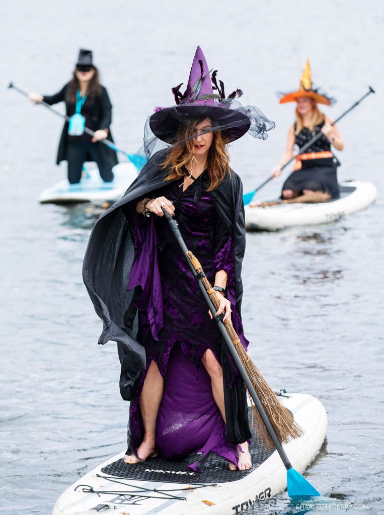
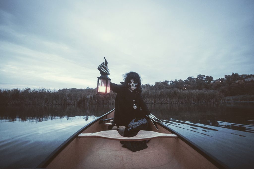
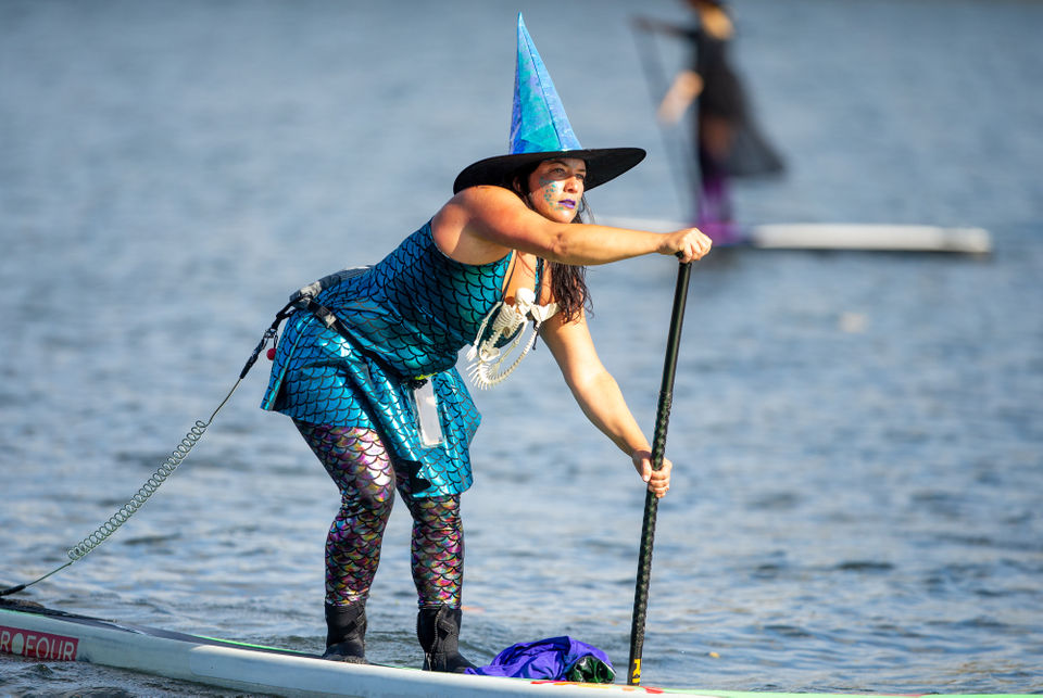
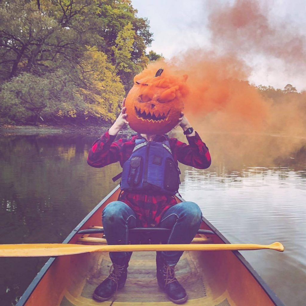
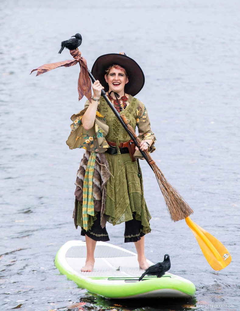
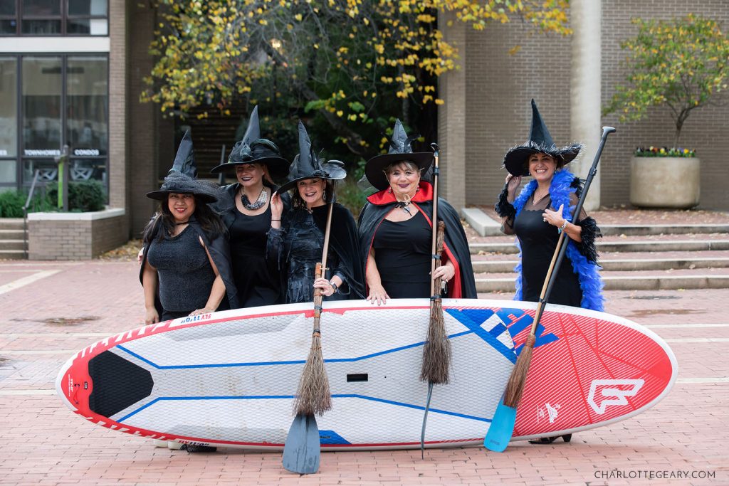
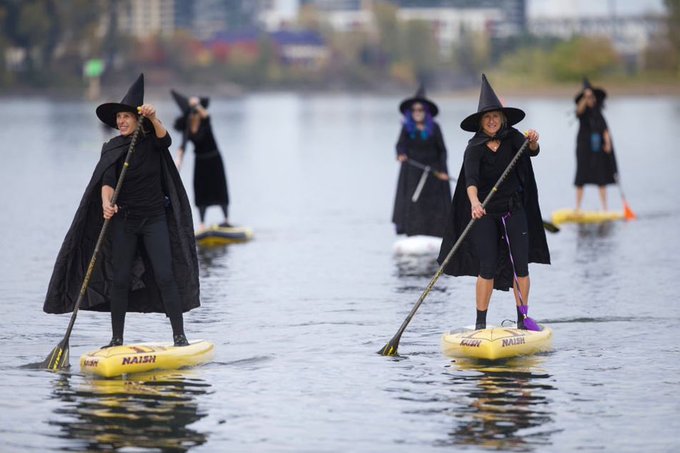
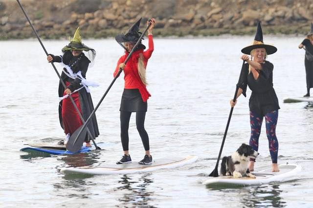
Photo: CHARLOTTE GEARY“Here’s one of my favourite Halloween costumes I’ve done…the zombie canoeist! A big hit at the party but not popular on the dance floor.” — Jonathan Mahood, Bleeker the Rechargeable Dog | Photo: COMICS KINGDOMPhoto: Kaydi PyetteHundreds of paddle-wielding witches ditched their broomsticks and stormed the sunny Willamette River on Saturday for the Third Annual Stand Up Paddleboard Witch Paddle. | Photo: Mark GravesPhoto: Kaydi Pyette
Photo: CHARLOTTE GEARY
Photo: Kaydi Pyette
Photo: David BrucePhoto: Cambrian
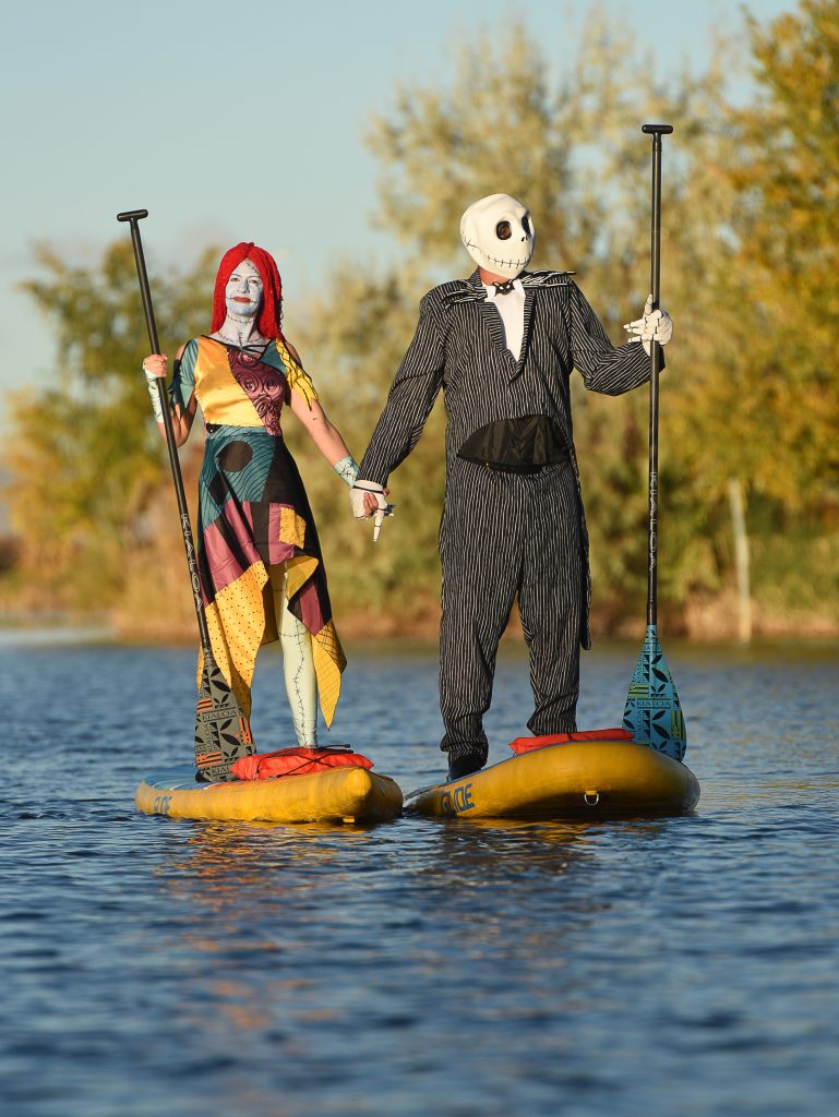
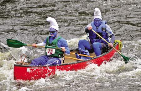
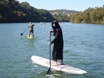
Photo: CHARLOTTE GEARY(Francisco Kjolseth | The Salt Lake Tribune) Stand up paddle board enthusiasts Roxy Christensen and Chris Knoles take to the water at Bountiful Pond on Tuesday, Oct. 30, 2018, in what has become a Halloween tradition for the 4th year in a row as they dress up as Jack and Sally Skellington from the movie Nightmare Before Christmas. “We paddle year round but actually paddle more in the winter,” exclaimed Knoles, who carry the tradition on at Christmas, dressing up in something festive and paddling on the Great Salt Lake where the high salinity usually keeps the water from freezing.Canoeists painted and dressed as Smurfs paddle down the Lamprey River in the 34th annual Lamprey River Canoe Race | Photo: seacoastonline.com
Kaydi Creeps It Real | Photo: Kaydi Pyette
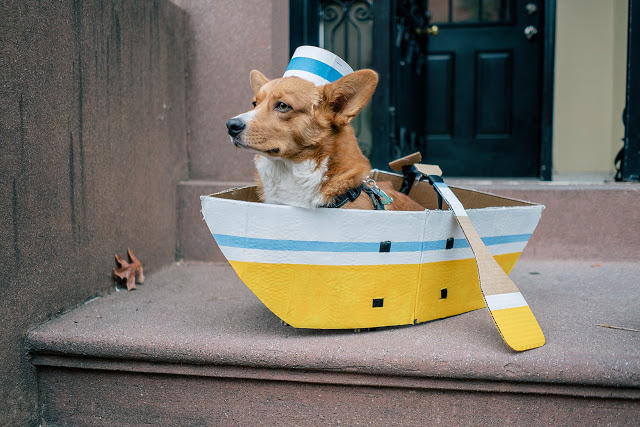
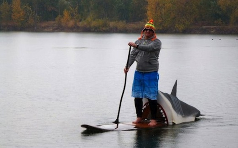
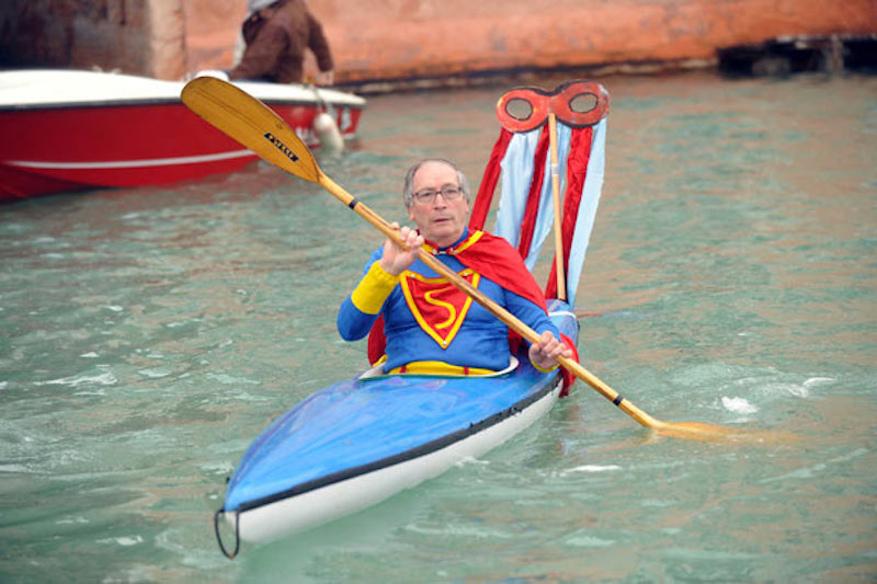
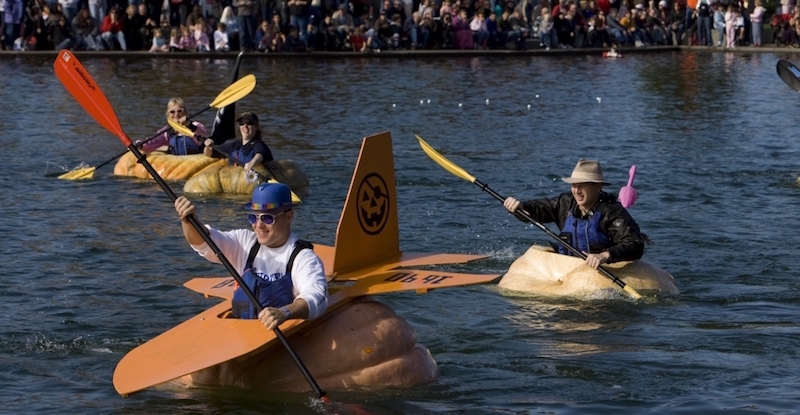
Hundreds of witches pick paddles over broomsticks to paddlleboard the Willamette Rover | Photo: Sam BugarskyBoat Costume for Our Dog | Photo: Paper and PlatesShark Attack on a SUPNot Quite Faster Than A Speeding BulletThe Pumpkin RegattaPhoto: Om Sunshine Yoga
MONSTROUS DISCOUNT
For a limited time, grab a two-year subscription to Paddling Magazine and get 8 print magazines delivered to your doorstep along with an exclusive Paddling Magazine neck gaiter and a waterproof vinyl sticker for only $31 – a savings of 72% off the cover price.
Just apply the promo code sale_halloween when you place your order to get this Spooktacular Deal!


 This article originally appeared in the Canoeroots Summer/Fall 2016 issue.
 This article originally appeared in the Adventure Kayak Summer/Fall 2016 issue.


 This article originally appeared in the Spring 2017 issue of Rapid.