
Home Blog Page 346

Baja Bound: Planning the Perfect Baja Getaway

All photos this page: Gary Luhm
Baja Bound: Planning the Perfect Baja Getaway

The Baja Peninsula is a 1,000-mile-long invitation to adventure. In places you can stand on mountaintops and see both the Pacific Ocean and the Sea of Cortez. The Pacific coast is where expedition paddler Dan Kennedy broke his nose over the deck of his Nordkapp while landing through surf. The Sea of Cortez is where most sea kayak companies run trips.

The Sea of Cortez is the world’s youngest and richest ocean at about 100 miles wide. The Guaymas trench, in roughly the middle, plunges nearly a mile deep and contains belching volcanic and hydrothermal vents which support life based on hydrogen sulfide instead of sunlight. That discovery was a major shift in our understanding of what makes life possible.

Baja seems to be a place of new perspectives, a place of opening. Something moves people. Is it the incredible scale of the landscape? The inspiring tenacity of the plants and intertidal life? The hugeness and mystery of the whales? Is it what a vacation does to people?

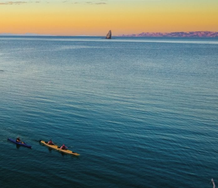
Those who are tuned into energy fields say that between the coastal Sierra de la Giganta mountains and the islands near Loreto is a basin for catching energy. No matter how you look at it, the view from Carmen Island stirs the soul as the evening sun works its way over the peaks and long rays pick out Los Tres Reyes and other spires in turn.

There are four ways to trip in Baja with something for every type of paddler: destination trips, mini expeditions, road trips and full-on expeditions. Here’s a sampler with a taste of each so you can dream and plan your own perfect Baja trip.

1. DESTINATION TRIPS
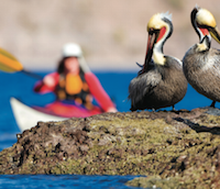
Screen_Shot_2015-07-24_at_11.33.22_AM.pngDestination trips are the most straightforward, where you launch and land in roughly the same place and paddle around for a week or so in between. popular destinations include three national marine parks with islands: Bahia de Los angeles—or Bay of L.A. — (1,013 km or 630 road miles from Tijuana), Bahia de Loreto (1,700 km or 1,100 miles) and Espiritu Santo (near La Paz, 2,414 km or 1,500 miles). Recently protected for their uniqueness, fragility and abundance of life, these parks also manage kayakers. Permits can be bought in the park office in the respective towns.

Sample trip: Circumnavigate Carmen Island, Loreto
Access: Loreto International Airport. Recommended launch: Puerto Escondido, 24 km (15 miles) south of town via taxi.
Kayaks: local rentals to appropriately skilled individuals; custom guided trips; scheduled outfitter trips.
Length: 120 km (65 nautical miles), 8–10 paddling days.
Permits: Parque Nacional Bahia de Loreto.
Highlights: White limestone fossil formations on the south end of the island and in Marquer Bay, historic salt village, spectacular geology on the rugged northeast end, excellent wildlife viewing opportunities.
Experience Sez: the steep north end is exposed to wind and swell. Choose your weather window wisely for this crux move—it’s 37 km (20 nautical miles) between protected landings. On calm days, access can be had at four or five beaches along the way. Carry water, organize a resupply boat, desalinate, or take your chances at the salt village or from yachts.

2. MINI EXPEDITIONS

Mini expeditions go a short distance, so the shuttle constitutes less than 50 per cent of the travel budget and adventure quota. The most popular and accessible mini expedition is Loreto to La paz, or variations thereof.

Sample trip: Loreto to la Paz
Access: international airports in Loreto
and La Paz; regular buses between. Recommended launch: Puerto Escondido (24 km or 15 miles south of town) or Agua Verde (80 km or 50 miles south), via taxi which can carry kayaks.
Recommended pick-up: Punta Coyote, almost 97 km (60 miles) north of La Paz.
Kayaks: Custom guided trips; scheduled outfitter trips; rentals in Loreto or La Paz to appropriately skilled individuals.
Length: Agua Verde to Punta Coyote: 130 km (70 nautical miles). Puerto Escondido to Punta Coyote: 180 km (100 nautical miles). Loreto to La Paz: 300 km (160 nautical miles), 8–14 days.
Permits: Parque Nacional Bahia de Loreto, perhaps Parque Nacional Espiritu Santo
Highlights: Solitude, mountains and sea. Agua Verde to Punta Coyote is uninhabited coast except for a few fishing villages.
Experience Sez: it’s remote! Play conservatively. Filter the water you get at Timbabichi, Los Dolores or Los Burros. San Evaristo has a desalinization plant, a very basic grocery store, and cold beer.

3. ROAD TRIPS

Road trips have the fun of exploring Baja by land as well as sea and target paddling destinations along the way. This has been my favorite method of exploring.

Sea of Cortez road tripping destinations include Bahia de Los Angeles and Bahia de Concepcion. Pacific destinations: La Bufadora and Asuncion.

Sample trip: Coast to coast
Access: Drive from the border
Kayaks: BYOB or rent from San Diego–based Aqua Adventures
Length: 10+ days
Permits: Bay of L.A. Buy permits at park office.
Highlights: it’s the journey! Driving attractions include the Valle de los Cirios (strangest plants on the planet) and the Viscaino Biosphere reserve. Bay of L.A.: Coronado island volcano hike, island hopping, and floating rocks. Bahia Concepcion: protected waters, sandy beaches, nighttime bioluminescence, hot springs. La Bufadora and Asuncion: world class pacific surf and rock gardening. La Bufadora is featured in the video This is the Sea 4.
Experience Sez: prepare your vehicle; carry tools and spare parts. Be thoroughly versed in pacific surf before tackling La Bufadora or Asuncion. Lock your vehicle or leave it with someone you trust.

4. EXPEDITIONS
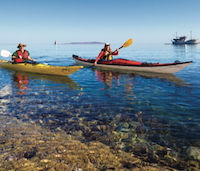
Screen_Shot_2015-07-24_at_11.33.52_AM.pngExpeditions commit serious time to travelling by sea. Paddling the length of the sea of Cortez often begins in unremarkable san Filipe. “The only reason people start at san Filipe is to say they did the whole thing,” declared expedition paddler Dan Kennedy after starting there three times.

Expeditions come with a bonus shuttle adventure. For example, according to Jen Kleck of aqua adventures, “a couple recently paddled the length of Baja and found transport back to San Diego for them and their kayaks in a semi heading north empty. They made this connection at the Costco loading dock in Cabo. A couple of guys heading to Mulege have arranged transport back north with a gringo who owns a hotel in Mulege.”

Sample trip: San Felipe to Cabo San Lucas
Access: get creative on this one. Have a friend drop you off in San Filipe and figure it out in Cabo. Or just stay.
Kayaks: BYOB.
length: about 1,300 km (700 nautical miles), 3 months.
Permits: Check in at park offices as you pass by. To fish, you need licenses for both your kayak and yourself. Ask at the park offices about where to buy.
Highlights: living with the rhythms of the sea and its animals, remote sections nobody else bothers to do the logistics for.
Experience Sez: a basic command of Spanish would be really helpful.

Ginni Callahan is the founder of Columbia river Kayaking and Sea Kayak Baja Mexico. She teaches and guides during summer on the Lower Columbia River and during winter in Baja, Mexico.
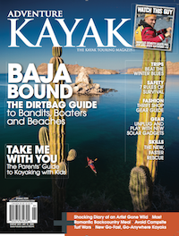
Screen_Shot_2015-07-24_at_8.38.49_AM.pngThis article first appeared in the Spring 2009 issue of Adventure Kayak Magazine. For more great content, subscribe to Adventure Kayak’s print and digital editions here.
Editorial: I Hope I Never Learn

Photo: Scott MacGregor
Editorial: I Hope I Never Learn

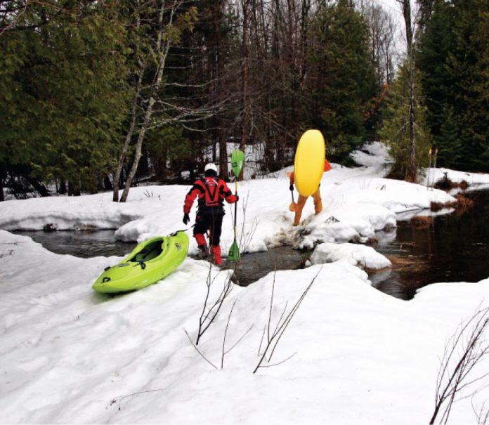
Days before, local reports on the Marmora Area Canoe and Kayak Festival website said Beaver Creek was still frozen. At 3 p.m. when we finally arrive, however, the water beneath the take-out bridge is running high and fast.

We head to the put-in eight kilometres upstream—no shuttle arranged, agreeing that we’ll walk back to the truck if we have to.

The Beaver is considered an intermediate to advanced class III-IV run, one you could run in four hours but typically stretch to a full day. Now 3:30 on a cold, sleeting early spring afternoon, we need to hustle to get down before dark.

At the bottom of Triple Drop, the first significant rapid, the Beaver slips away from us beneath a layer of spongy ice. The half-frozen crust is thick enough to support the surface area of our boats, but not enough that we can walk on top without falling through. After a kilometre of poling with paddles and swinging our boats beneath our arms as if on parallel bars, we face an icy crossroads.

Straight ahead as far as we can see is another 500 metres of ice. To the right a flooded but open channel dekes into the woods. We figure with the 50-year record high water and the constriction of ice below, this temporary channel will link back to the Beaver’s main flow.

After the first couple kilometres of fast-moving class I and II we know we’ve left the Beaver for good. We also know that we are well past the point of no return. Joking of a new first descent, we continue threading our way down through flooded hardwood forest.

Finally, at the intersection of an old train bridge and hydro line corridor, we climb up to take a look. Beyond the bridge the swollen creek feeds through dense bush, thick and constrictive as a kitchen strainer.

We guess we have an hour of daylight left, tops. Eating the last of our lunches and weighing our options, we thank God that our wives and girlfriends aren’t here. Infrequent faint rumbling of heavy equipment off to the right urges us to begin dragging our boats in this direction, away from the river.

By the time we reach a log landing, the skidder crews have long gone home. We continue hiking, boats now scraping along a muddy bush road, until we reach the end of a country road and the home of Dianne MacDonald. Dianne is feeding her birds when her flashlight bounces off the reflective strips on my drysuit.

“Are you guys kayakers?”

“Yes.”

“What in Lord’s name are you doing in my yard?”

Too difficult to explain.

Dianne feeds us cookies and hot tea, loads us in the back of her deceased husband’s Dodge Dakota and drives us 22 kilometres back to where we had set off to almost run the Beaver.

Hunkered down out of the wind and sleet we’re giddy with our good fortune. It turns out that continuing past the bridge would have meant two kilometres of bush-crashing leading into a 100-acre swampy meadow. Dragging our boats in the other direction would have taken us down 16 kilometres of snowmobile trails before reaching Beaver Creek.

Even with a river full of ice, missing the run entirely, hiking out in the dark and hitching a ride with a kindly widow, we agree this is river running at its best—exploration, camaraderie and adventure. You just don’t find this in a man-made whitewater park.

“I certainly hope you boys have learned your lesson,” Dianne warns, waving and driving away.

“Oh yes, ma’am,” we shout. Knowing full well we haven’t.

Scott MacGregor is the publisher of Rapid, Adventure Kayak, Canoeroots and Kayak Angler magazine. This year on the Beaver he’ll be carrying a compass and wearing shoes.

This article first appeared in the Spring 2009 issue of RapidThis article first appeared in the Spring 2009 issue of Rapid Magazine.
 

San Joaquin’s South Fork Descent

Photo: Darin McQuoid
San Joaquin’s South Fork Descent

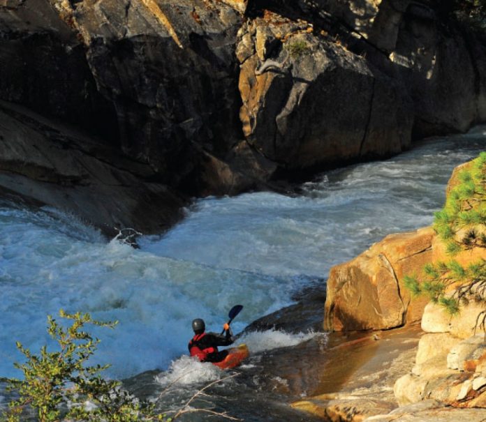
Carving a descent through 6,200 feet of unyielding granite, water from the South Fork San Joaquin has earned a reputation for being the hardest working water in the world. On its turbulent journey, the water is reused nine times as the river runs a gauntlet of lakes, tunnels and powerhouses all part of the Big Creek Hydroelectric Project. Construction of Big Creek began in 1912 and the last powerhouse at Balsam Meadow, built in 1987, is 1,000 feet underground and carved from solid granite. Big Creek, California’s largest hydro project, swallows all but a trickle of the South Fork’s aquamarine waters.

Information regarding the project is held as tightly as the hold on water flows. In late August, American Whitewater volunteer Paul Martzen heard rumours of a release. 

“The hydro project had to move more water than they could get through the generators,” explained Martzen. Thirsty farmers down the valley meant water in the South Fork, and a shot at a first descent. The flow window would be brief and uncertain—the release starting on the Friday of Labour Day weekend. “My contact was fairly sure that the release would last through Sunday.”

With a three-day window, a group of four California and Oregon kayakers decided to go for it. Ben Stookesberry, Darin McQuoid and Matt Thomas drove through the night to meet with Kevin Smith for a once-in-a-lifetime assault on the river.

“It was no surprise that we had to portage large sections of Mono Creek, a small tributary inundated by 500 cubic feet per second,” says Smith. “The Middle Fork San Joaquin is known as the hardest run in California, but the South Fork takes everything about it to the next level.”

The run is filled with inescapable granite gorges, mandatory class V+ rapids, complex portages and pure wilderness scenery. For the first three days the group was surprised at how much they paddled, but late into day three it was painfully obvious they wouldn’t get out in the alloted time.

“Large sieves made us leave river level and portage over gorges,” says Thomas. Increasingly numerous and treacherous portages made for slow progress. As three days stretched to four, Big Creek’s gates closed and the South Fork eased back underground into restless hiding.

 “The South Fork San Joaquin is the hardest of the High Sierras,” says Stookesberry. “It’s an absolute classic multi-day.” 

Too bad it’s gone.

This article first appeared in the Spring 2009 issue of Rapid

This article first appeared in the Spring 2009 issue of Rapid Magazine.
 

Skills: Sweet Momentum

Photo: Marilyn Scriver
Skills: Sweet Momentum

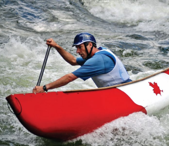
 Traditional canoe instruction says that the most effective steering strokes are done in the stern; typically stern draws, rudders and pries. But try watching experienced solo boaters and more often than not you will see them steering at the bow. In whitewater, momentum means the difference between catching must-make eddies and falling short. Bow control strokes maintain precious momentum, while steering from the stern essentially slams on the brakes. Choosing to steer from the bow or stern is determined by where you are going on the river and the momentum needed to make your move.

Power Steering

Steering from the bow, called power steering (Rapid Open Canoe Technique V10, I2), relies on adapting your forward and cross-forward strokes to control your boat angle. The advantage of power steering is that these strokes add to your momentum. The efficiency of using forward strokes means that you eliminate the drag caused by momentum-killing strokes like stern pries and rudders.

Picture yourself planning an S-turn across some fast moving water. In executing the move your canoe will begin facing upstream and travelling against, and then progressively across, the current. The swiftly flowing downstream water dragging on a stern draw or pry will kill your momentum and possibly blow the move. Power steering, with propulsion and control coming from forward strokes at the bow, is a much better method of maintaining momentum and controlling angle to pull off the move.

Stern Control 

Stern strokes such as pries, rudders and draws are the traditional steering strokes used by all canoeists. They work incredibly well for steering. Anytime you need to turn your canoe in a hurry, the leverage created by these strokes is practically guaranteed to do the trick. The downside of these friction strokes is that they all slow you down—some more than others. 

So, when is the best time to use stern control? Anytime you have enough momentum to counter the drag of the stroke—like when you are charging downstream and want to eddy out. You are carrying loads of downstream momentum and facing a rapidly approaching 180-degree turn. A sure way to make that eddy turn happen is a stern control stroke. Friction here is not an issue—you are going downhill, building momentum as you approach the turn—heck, you may even want to slow down.

Making the Move 

Making your move every time will depend on matching your paddling technique to how you plan on using the current. Your strategy has to account for the momentum gained or lost from both strokes and the river current. Think of bow control as having less friction and higher efficiency, while stern control gives you leverage and security. In the end, choosing to steer from the bow or stern comes down to one simple rule: Use the type of control strokes that provide you with the momentum you need to make your move.

Andrew Westwood is an open canoe instructor at the Madawaska Kanu Centre, member of Team Esquif and author of The Essential Guide to Canoeing. www.westwoodoutdoors.ca.

This article first appeared in the Spring 2009 issue of Rapid

This article first appeared in the Spring 2009 issue of Rapid Magazine.
 

A Final Descent Of The Ashlu River

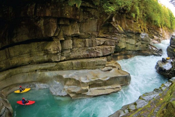
two whitewater kayaks float in the Ashlu River in British Columbia while a third sits on a rocky ledge
The tranquil pool of Tea Cup Eddy offers an evanescent reprieve from the Class V cataracts of Box Canyon. | Feature photo: Phil Tifo

I pile the last creeker atop an already swollen stack of boats, recklessly exceeding the recommended load for my rack. A posse of river runners who flood into Squamish every year at this time is packing the last of their gear into my truck. Across a bed of perennials, my neighbor is washing his Windstar and staring in disbelief at our macramé of boats. Two more vehicles stacked to precarious height pull into our quiet cul-de-sac.

My cell phone is ringing with stragglers looking to get in on the mission. We are heading up the Ashlu today; this is the last season that the river will be free-flowing. Paddlers from all over the world are now chomping at the bit to explore the majestic, moss-covered granite canyons of the Ashlu before it is diverted into a tunnel.

A final descent of the Ashlu River

Fifteen years ago in British Columbia, running rivers and creeks was at the very core of whitewater. Entire mountain ranges of expeditions and adventures were to be had in long pointy Dancers, Overflows and Corsicas. Sporting thick neoprene and teal Pro-Tec helmets, function far outweighed fashion for the early pioneers. The thought of giant aerial blunts at Skookumchuck had not crossed their minds. They were too busy trying to determine the magic amount of flow and gradient that would make possible successful descents easily accessible from logging roads.

In 1993, Stuart Smith launched into the upper sections of the Ashlu and returned with reports of polished granite bedrock and crystalline blue water. Four years later the next wave of local Squamish paddlers, including LJ Wilson and Sam Maltby, completed the first descent of the Ashlu’s lower reaches, now known as Box or Commitment Canyon. The river quickly became the most sought-after classic in the Sea-to-Sky Corridor. Just 30 minutes outside of Squamish, the rapids were clean and the scenery was colossal. Little did these paddlers know BC Hydro had already identified the Ashlu as one of the best candidates for what they call “run of the river” hydroelectricity generation.

Crossing into a changed landscape

It’s now the fall of 2008 as we caravan toward the Ashlu River. Driving almost due north out of Squamish we turn off the Sea to Sky Highway and slip through First Nations reserves around the town of Brakendale and cross the dam-besieged Cheakamus River. The vine maples’ giant leaves litter the narrowing road as we pass under their thick canopy beneath the lurking shadow of the Tantalus Range. The hot summer has melted most of the snow off the peaks, leaving the bluish-grey glaciers exposed and glistening in the sun.

The pavement soon turns to gravel as we hook a left off the Squamish Valley Road to head up the Ashlu drainage. The once overgrown logging road barely passable with a 4×4 is now a wide and well-traveled thoroughfare. Power poles line an immense clearing that parallels the road for several kilometers, interrupting the otherwise dense forest. I can’t help but think about how much the landscape must have changed here since the first paddlers explored this valley almost 15 years ago.

security checkpoint at Ashlu River in British Columbia
Inside the security checkpoint. | Photo: Phil Tifo

We reach the security checkpoint at the entrance to the construction zone and my vehicle license plate number is documented as is everyone’s name. The guard has the same look of disbelief that my neighbour expressed just a couple hours earlier. “Watch out for the rock trucks, park to the side of the road, be sure to report back to us when you leave, and have fun,” he says.

The checkpoint is a metaphor for the deeply divided local struggle over the Ashlu. On one side of the fence stand bitter paddlers, local residents and fishermen who fought to keep the valley wild through three years of public hearings. On the other side stands the Ledcor Group, with hundreds of personnel and pieces of heavy equipment, and the sweeping pro-industry legislation that supported the construction of this private power project.

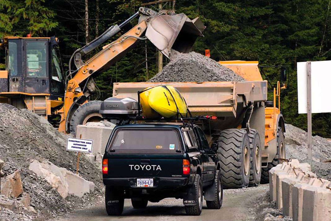
We drive up the road, through the construction and past the tunnel site. Massive iridium lights tower overhead, sprouting on alien steel poles where an earthy grove of giant Douglas fir trees once stood. One of the mossy roadside cliffs is now scraped bare with a four-meter-wide bullet hole punched into it. This is the exit end of the tunnel, where the water of the majestic Ashlu will one day pour through power-creating turbines. Dust created by the boring machine billows out of the hole and settles in a grimy film on a 30-tonne Volvo dump truck awaiting another load of gravel. The river flows just below in a perfectly natural state, unaware of its fate.

tea cup eddy along the Ashlu River before it was rerouted underground
The tranquil pool of Tea Cup Eddy offers an evanescent reprieve from the Class V cataracts of Box Canyon. | Feature photo: Phil Tifo

The Ashlu is a river runner’s dream

The Mile 25 Bridge above the waterfall we call 50/50 is our immediate destination. This is where we get a good visual on flow and decide that the level looks perfect for us to link three different sections for what will amount to my favourite B.C. river run.

To run the Mine Section, through the Mini-Mine and straight into Box Canyon, we have about 10 km to cover with at least two mandatory portages. This is the first time anyone in our group has attempted to run these three sections of the Ashlu in a single day. This feat has been accomplished before, but with the hydro development underway, today’s run may be the last.

We put in on river-left just upstream of an abandoned granite mine. The derelict trucks, buildings, pipes and fuel barrels have been rusting a slow death since the late seventies. The trashy landscape reminds us how humans have scarred this beautiful valley many times before. Walking through the forest to our put-in, the thundering sound of the Ashlu drowns out the distant noises of excavation and all of the energy expended to get here feels well worth it.

On the river, I splash my face several times before tucking my skirt under my drytop and securing my helmet. Directly below is a technical Class IV rapid and immediately the group’s focus turns from environmental issues to running the river.

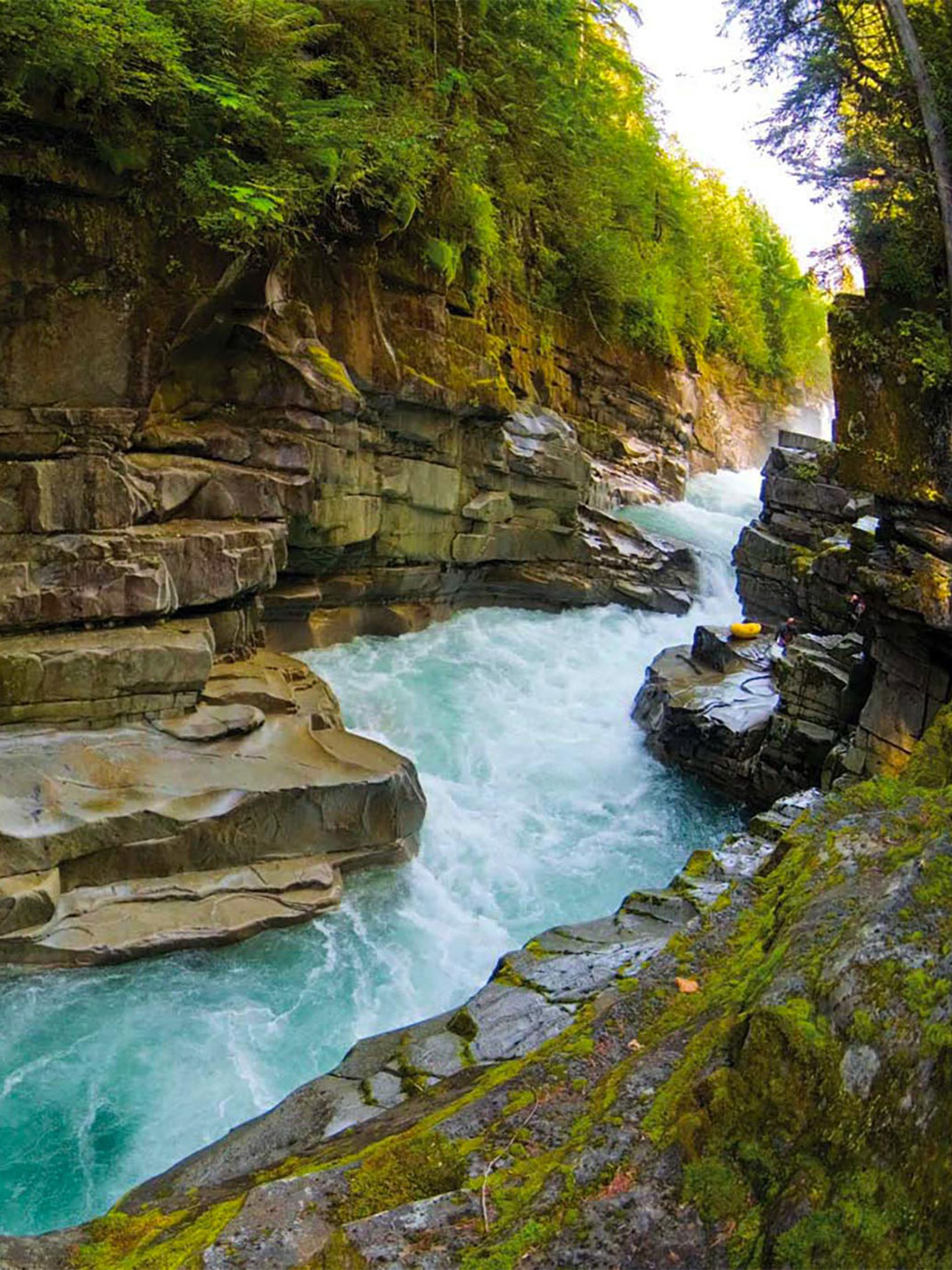
The Ashlu is glacial-fed late in the season. The silt deposited by the glaciers gives the water a milky, opaque color that blends almost seamlessly into the polished granite bedrock. This is a river runner’s dream with everything you could possibly want. Clean water, technical boulder gardens, runnable waterfalls, ledges, stunning scenery and enough eddies to break the run down rapid by rapid. Every section of the Ashlu is pool-and-drop. Up high the Ashlu has runs for Class III paddlers, in the middle it becomes Class IV and the lower sections challenge even the best Class V boaters.

Dropping deeper into the Mine Section our attention is consumed by the river. All the earlier sights of hydro development have been replaced with narrow horizon lines. I blink my eyes to take a picture for my neighbor and the guard. If they could only see the ferns waving high along the canyon rim, hear the power of the river squeezing through the granite canyon, smell the pitch from the Douglas firs baking in the sun or just feel the refreshing splash of the cool water they might understand our motivation to squeeze into eight feet of plastic and paddle down the river. They might understand why so many of us fought to keep the Ashlu this way.

A calm green path leads into the lip with not even a small wave or ripple in the way. Then you fall through the air…

After two hours on the river, the Mine run is easing and we approach the weir and diversion site. Once a shallow Class III boulder garden, this stretch of river has now been transformed into a composition of concrete structures designed to control the flow of the river. Soon the Ashlu will have a two-way valve, where water can either be directed through the gaping maw of the diversion tunnel or released into the canyon below. Big excavators are digging the foundation for a building to house the computer controls. We drop over the weir one by one and realize the same water we are floating on will soon be used for electricity. Once diverted into the cavernous tunnel the water will be sent thundering through the mountain, spinning three giant turbines to power up to 20,000 homes.

The Box is directly downstream. It’s entrance is guarded by a tricky 10-meter waterfall named 50/50. Every time I see the falls, I think of a trip I took down the river with Willie Kern in 2006. An icon among expedition paddlers, Kern has more than a decade of paddling experience on rivers around the world. Together with his twin brother and five other team members, Kern bagged a first descent of Tibet’s Tsangpo Gorge in 2001, widely acknowledged as one of the greatest kayaking expeditions of all time. His reputation has led to a belief held by many of his contemporaries: “If the Kern brothers won’t run it, nobody will.” That day on the Ashlu, Kern told me the waterfall should be named “10/90… 10 percent of the time you look at it and don’t run it and 90 percent of the time you walk right past it.”

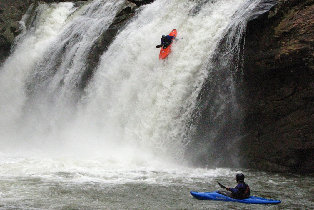
We all hop out at the calm pool above. Instantly people start talking about wanting to run it. We formulate a plan and scout the line while the rest of the group portages around to the ledge below. A calm green path leads into the lip with not even a small wave or ripple in the way. Then you fall through the air becoming engulfed by the falls itself before getting spit out in the pool below. In a matter of seconds the run is over. Four of us run it and one manages to come out upright. Today we are 25/75.

Ashlu Falls on the Ashlu River in British Columbia
Ashlu Falls on the lower Ashlu River in British Columbia. | Photo: Andrew Enns/Wikimedia Commons

Work continues to keep wild rivers flowing

Over the past few years I have surrounded myself with paddlers who enjoy running rivers. Not just people who want to go paddle whitewater, but friends who share the passion for exploring, working as a team and using kayaking to travel through the world’s most majestic places.

A sense of exploration with unpredictable aspects is ultimately what we are after. The challenge of having to pick apart the river and being rewarded for getting it right are second to the wilderness experience and camaraderie found in paddling as a team.

It is hard to stomach the loss of rivers like the Ashlu. Our battle to keep wild rivers wild parallels the plunge we took at 50/50. Up against a power company and the government in our fight to save the Ashlu, our chances of success may have been 50/50. River runners everywhere need to continue to work hard as a team to plan our lines through the myriad of proposed power projects. If we don’t, before long we may find ourselves walking them all.

Bryan Smith is a filmmaker based in Squamish, British Columbia, and a veteran of expeditions in India, Peru and North America. His award-winning films 49 Megawatts and Pacific Horizons are available through Reel Water Productions.

This article originally appeared in Rapid’s Spring 2009 issue. Subscribe to Paddling Magazine and get 25 years of digital magazine archives including our legacy titles: Rapid, Adventure Kayak and Canoeroots.

The tranquil pool of Tea Cup Eddy offers an evanescent reprieve from the Class V cataracts of Box Canyon. | Feature photo: Phil Tifo


Betcha Didn’t Know These 15 Facts About Turtles

Photo: pexels.com
  1. The first turtles are thought to have (slowly) roamed the earth 215 million years ago, before lizards and snakes.

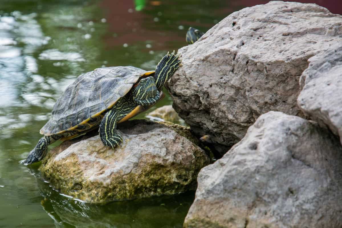
2. Painted turtles spend the winter buried half a metre deep in the mud at the bot- tom of lakes and ponds. They breathe through gas-exchange sacs below their tails.

3. Turtles play a key role in many aboriginal creation stories. According to Ojibwa legend, North America rests on the back of Maukinauk, the great turtle.

Photo: Pexels.com
4. Baby painted turtles often spend their first winter in a semi-frozen state, with their heart and breathing stopped.
5. Teenage Mutant Ninja Turtles, a comic series, television show and movie in the 1980s and ‘90s, told the story of four turtles that evolved from sewer ooze and fought evil with martial arts. It was inexplicably popular.

6. Courting wood turtles dance side to side for up to two hours before making things official.

Photo: Pexels.com

7. According to the book Up North, the Soviets sent the first spaceturtles around the moon in 1971.

8. Snapping turtles can live to be 90 years old.

9. An overturned turtle can lever itself back upright with its neck.

10. Since turtles can’t expand their ribcages, in order to breathe when out of water they use an air pump to draw in air.

11. Four of Canada’s 15 species of turtles are listed as endan- gered under the federal Species at Risk Act.

12. Nestlé Turtles blend caramel, pecans and cashews inside a milk chocolate shell. Each turtle contains 90 calories— enough energy to paddle a canoe for about 20 minutes.

13. A group of turtles is called a bale. No deaths have ever been attributed to stampeding bales.

14. A turtle’s shell, just like a geo- desic tent, gains much of its strength from its dome-like shape.

15. Californian pop-rock band The Turtles were originally called Crossfires from the Planet Mars. They crawled to the top of the Billboard charts in 1967 with the single “Happy Together,” dislodging a song called “Penny Lane” by another band known for its hard shell.


This article on turtles was published in the Fall 2008 issue of Canoeroots magazine.

This article first appeared in the Fall 2008 issue of Canoeroots Magazine.

Butt End: You Can Take it With You

Photo: Sandy Easton
Butt End: You Can Take it With You

I’ve been spolied when it comes to camp gadgets. Over the past few years I’ve done a television talk show circuit during which I show off the latest camp gear.

Before the interviews I head to the local outdoor store to borrow the season’s hottest items and then go on air to discuss the pros, cons and absurdities of everything from new mosquito repellent to solar radios to cold fusion-powered lanterns.

One morning a few years ago I arrived at a studio with a pack full of non-essentials—including a device that lets women urinate while standing up. The female co-host looked over the gear before the show and asked a few questions, particularly about the plastic tube-shaped fake phallus, called the Peemate.

The male host, however, hadn’t bothered. He walked on set just as we went live, made some arrogant remarks about how silly camping was, grabbed the Peemate and asked what it was.

“It’s a whistle. Give it a try,” I said. He did, and his co-host fell over laughing. Almost every talk show in the country phoned me the next day asking me to be on their show—provided I bring the Peemate.

To me, a camp gadget is a luxury item you can do without—but would rather not. A camp chair even qualifies, as long as it has a backrest and a cup holder and allows you to sit high up off the cold, wet ground. 

I teased him about his chair—until he let me sit in it. He had to tip me out. 

A friend once brought a camp chair on a one-month, portage-heavy trip. I teased him nonstop about packing such a bulky item, that is until he let me sit in it for five minutes one evening. He had to tip me out of it.

There’s no sense fighting it. We’ve been trying to increase our comfort and take advantage of the latest wonder of technology since we first went back to the wilderness.

I admire those campers who hold themselves to the primitive approach, but I suspect they have gadget-related jobs and so are desperate for an escape from the high-tech world. Or perhaps they are atoning for something.

Of course, it’s possible to get carried away. I never want to skewer a marshmallow by the light of a laptop. But if you follow the simple rule, “If you want to use it, you carry it,” we should be able to keep things below the gunwales. 

This article on gear was published in the Fall 2008 issue of Canoeroots magazine.

This article first appeared in the Fall 2008 issue of Canoeroots Magazine.


Camping Clothes

Photo: Martin Lortz
Camping Clothes

The dermatologist assured my mother and me that many other 10-year-old boys also suffered from what he called crotch rot. In case you avoided this itchy ailment, blue jeans and cotton swimsuits don’t dry quickly and where things don’t dry, fungus grows. Trust me.

The treatment was a small jar of white cream, applied liberally twice daily. The solution however is to spend more time—and sometimes money—when shopping for kids’ outdoor gear.

A friend of mine is a manager in a very posh ski shop north of Toronto, a place where the skintight ski suits are trimmed with furry hoods. Yet many of her well-to-do customers refuse to spend $59 on snowboard helmets for their kids. Why? Because they say they’ll just grow out of them.

I want my two kids to enjoy their time camping as much as we do and outfitting them with good gear has been worth every penny.

To me, helmets for kids are a no-brainer in any gravity or action sport. of course they will grow out of them, but what about now? Aren’t their heads worth protecting no matter what size?

Nobody runs, jumps, falls, rolls and climbs more than camp kids—rain or shine. In my mind we should be dressing them in hard-shelled, quick-drying, fuzzy, waterproof, breathable, cool, bug-proof and rugged clothing; whatever it takes to protect them, but also whatever it takes to make their time outside as enjoyable—and rash free—as possible.

The sun is probably the most dangerous and underestimated hazard our children encounter. Too much sun can ruin any camping trip, not to mention cause long-term damage to their skin and eyes. Properly fitting sun hats with good coverage and SPF-rated beachwear are worth it. After five summers guiding whitewater rafts I can barely open my eyes on a sunny day without a good pair of shades. Some parents don’t bother with sunglasses for their kids because they say they’ll just break or lose them.

Do you remember being dressed in a garbage bag instead of a raincoat? How expensive were raincoats that it made more sense for our parents to blow through a box of garbage bags every camping trip? Not to mention the fact that plastic sacks with three big holes cut in them really aren’t that dry.

Socks that fall down in boots are not only annoying, sweaty bare feet in boots get blisters. Companies like Smartwool and Wigwam have virtually eliminated this childhood nuisance, not to mention that these socks dry quickly and resist odours.

Smart shoppers save money by buying clothes that will serve double duty, like long underwear for camping in the summer and skiing in the winter. They choose colours that both boys and girls will wear as they are passed down, or ferret out other outdoor families through the scouts or ski clubs and buy, sell or trade clothes. shopping out of season can save you up to 50 per cent. While rooting around at a used clothing store we found a $28 MEC sunhat for $3. Don’t limit yourself to camping brands; just consider the styles and fabrics that will keep kids dry and warm or cool and shaded.

I want my two kids to enjoy their time camping as much as we do and outfitting them with good gear has been worth every penny. I’ve stopped thinking of this as an expense, but rather an investment. If we don’t invest and outfit our kids with gear that allows them to be warm, dry and safe it won’t only be the clothes they grow out of, it will be the outdoors. 

This article on clothing for kids was published in the Fall 2008 issue of Canoeroots magazine.

This article first appeared in the Fall 2008 issue of Canoeroots Magazine.


Paddle to Cuba

Photo: Foundation For Nature and Humanity
Paddle to Cuba

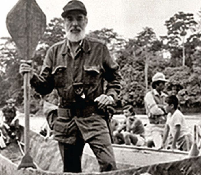
It took a trip to Cuba for me to appreciate, a quarter century later, the legitimate genius of Don and Dana Starkell’s canoe trip from Winnipeg, Manitoba, to the mouth of the Amazon River.

I was invited to Cuba by the Foundation for Nature and Humanity to help develop a training program for environmental teachers. All was on track until my host casually referred to Cuba as a “canoe culture.” If I looked surprised when he said that, I was speechless when he said, “If you don’t believe me, come check out our canoe museum.” Canoe museum?

There in a back room of the foundation’s Havana office was one glorious canoe—a 42-foot dugout canoe called Hatuey (named after Cuba’s first national hero, a Taino Chief who had warned the residents of Cuba of the impending arrival of the Spanish in the early 16th century). Inside the canoe were paddles carved in exotic rainforest leaf patterns. Surrounding it, in glass cases that lined three walls, were fascinating Latin curios including a still-menacing stuffed piranha and, so my host said, the world’s largest collection of erotic pottery. So they not only had a canoe museum, they appeared to have a Cuban angle on the whole love-in-a-canoe theme as well!

But the story got better. In the years leading up to the 500th anniversary of Christopher Columbus’ conquest of the Americas, Antonio Nunez Jimenez, the scholar and naturalist who had inspired the creation of the Foundation for Nature and Humanity, decided to play down the European “discovery” of the New World and celebrate instead how people came to Cuba in the first place, long before 1492. That migration, research revealed, was by canoe from high in the Andes in what is now Ecuador. 

So they not only had a canoe museum, they appeared to have a Cuban angle on the whole love-in-a-canoe theme as well. 

Jimenez commissioned five 42-foot dugout canoes and corresponded with people all along the migration route. In the late 1980s he led an historic reenactment of the founding canoe trip, down the Napo River to the Amazon, along the mighty Amazonas to the junction of the Negro River, then upstream to the height of land in what is now

Guyana, over the divide, and down the Orinoco River to the Caribbean Sea. There, they tied outriggers on their canoes and made their way over open ocean among the Antilles and eventually to Cuba.

As I stood at a map in the Cuban Canoe Museum, listening to my host recount this amazing tale (and yes, he explained how the erotic pottery, the canoe, and a powerboat called Love all factored into the story), I recalled that this term “canoe” that is so near and dear to the hearts of Canadians is likely indigenous to the Caribbean, probably derived from the Arawakan term, canaoua. I wondered why we acknowledge that north-south linguistic connection so rarely.

So often Canadians assume we have the corner on all things canoe. True, considering our own history and the role that the canoe, particularly the uniquely Canadian birch bark canoe, has played as an east-west transportation and communication link, there is a temptation to think that there ends the story. Not so. Remember that crazed guy from Winnipeg who loaded his two sons in a 22-foot fibreglass canoe called Orellana and set out for the Amazon?

It took them two years. One Starkell son bailed out near the Gulf of Mexico. But Don and Dana Starkell covered a large portion of the route through South America that Jimenez and his crew would travel a few years later, rejoining the historic canoe connection between North and South America. Starkell, in his bones, knew that our canoe culture and theirs were related, and that to understand one, we are obliged to appreciate the other. 

This article on paddling to Cuba was published in the Fall 2008 issue of Canoeroots magazine.

This article first appeared in the Fall 2008 issue of Canoeroots Magazine.


On The Line: 11-Week Canoe Trip Through the Boreal Forest

All Photos: Frank Wolf
On The Line: 11-Week Canoe Trip Through the Boreal Forest

“Draw! Draw! Forward hard! Hard! Hard!” Taku has never been on a canoe trip before so I call out his strokes like a coxswain. He reacts instantly and the canoe slips around a pillowing rock the size of a Smart car before we bash through a series of waves that high-five Taku’s face.

With his hair slicked back into a pompadour care of the Albany River, Taku looks like an Elvis impersonator from Tokyo as we spin into the eddy. Born in Japan and raised in the dirty streets of Chicago before becoming a West Coast boy, Taku had been slow to try out the oldest North American pastime. From backcountry skiing with him in B.C.’s Coast Mountains I knew he had the temperament required for an extended wilderness trip so I asked him along on my 75-day paddle through the boreal forest—there’d be plenty of time to teach him about canoeing along the way. 

Screen_Shot_2015-08-26_at_12.02.53_PM.png 

Five seven five. Every evening by the water Taku writes haiku in Japanese and Chinese characters using a brush dipped in a well of black ink. We’re 25 days in at the base of Kagiami Falls on the Albany River. Taku sits and writes. His newness to tripping is refreshing—everyday he learns something, sees it in a different way than I do. I want to learn more from him so I press him on his ritual. Looking up from his script to the setting sun, the words come calmly.

“Your daily existence in the boreal is simple—it consists of moving forward and doing what’s necessary for survival and comfort. In the city, all the annoying details of life are a distraction. The isolation of the wilderness removes the clutter and makes me more reflective and meditative.”

He glances at Kagiami Falls then returns to his haiku. In a few words, he has captured this place. Five seven five. 

Our 3,100-kilometre trip began in downtown Winnipeg. Carrying our gear down the aptly named Portage Avenue, we parted gawking lunchtime crowds and put in at the Red River. Our route would take us to Parry Sound on Lake Huron’s Georgian Bay via Lake Winnipeg, the Bird River, Woodland Caribou Provincial Park, Lac Seul, Lake St. Joseph, and the Albany, Kenogami, Kabina, Pivabiska, Missinaibi, Mattagami, Grassy, Sturgeon and French rivers. The route dances above and below the 51st parallel, the partition that separates pristine boreal forest in the north from the industrialized south. It’s a line on the map you might be hearing more about soon.

A globally significant swath of green, the boreal is like a giant carbon bank, holding 67 billion tonnes of the element in deposit.

In summertime, worldwide carbon levels measurably drop as this great lung of our planet takes in a deep breath for us all. Due to its remoteness, the zone north of this latitude remains the greatest area of undisturbed boreal forest in Canada. The First Nations of this region called for a moratorium on development in 2005 as forestry, mining, and hydro interests began creeping north.

On day 21 we pick up our food parcel from the post office in the Mishkeegogamang First Nation at the head of the Albany River. 

The owner of the general store is a sharp-featured woman with dark, curly hair named Laureen Nassaykeesic. She is a former member of band council, well versed in local politics and firm in her opinions. Laureen speaks softly as she twirls a daisy in her hand. “We are prepared to fight to make sure they don’t come and develop the area. The only benefit would be a stumpage fee, which would be nothing. Then, what, wait 100 years for a new set of trees? I have grandchildren and I’d like them to enjoy the green forest and the natural way of things. We’re very lucky to live here.” 

Taku is wolfing down pork chops and mashed potatoes provided by our host Norman “Dude” Baxter. We are one week down the Albany at the Marten Falls First Nation. Dude is a fishing and hunting guide with a drill sergeant buzzcut. He found Taku wandering around the village and invited us in just as a ferocious sideways storm swept in. Sixty years ago, his father would spend two weeks paddling from Marten Falls to Calstock to trade furs for supplies. There are no roads even today, just waterways.

“The Albany is our highway,” Dude explains. “It gives us our fishing and hunting—it’s everything.”

Despite the Albany’s status as a provincial park, the Ontario Power Authority has proposed that two major dams be built on the river by 2020, one of them at Kagiami Falls. The projects would carve up the surrounding boreal wilderness with roads and transmission lines as well as flood existing habitat and hunting grounds. A current agreement between the province and First Nations limits power projects above the 51st to 25 megawatts but as power demand increases, so does pressure to renegotiate the deal. Apparently everything is negotiable; everything is on the line.

The first big boulder to catapult its way into the region is the Victor diamond mine on Ontario’s Attawapiskat River, spearheaded by international giant de Beers. The project, already underway, will clear 5,000 hectares of forest, generate 2.5 million tonnes of leeching waste per year and pump 100,000 cubic metres of salty water from the pit into the attawapiskat daily. In all, the entire project will affect an area 22 times the size of Vancouver. All for a mine forecast to produce for only 12 years. 

Rounding the corner at the confluence of the Missinaibi and Mattagami rivers we turn away from James Bay and head back upstream into the heart of the Boreal. Taku is not the only one being meditative. Staring down 450 kilometres of upstream paddling makes you live in the moment, fixating on how each stroke—and all too often each stride—gets you closer to the next height of land.

Taku’s head is down as he tracks the canoe and stumbles repeatedly over sharp, slippery rock. The wide, shallow Mattagami River is too low to paddle and seems to stretch endlessly ahead. We are travelling through the industrialized wilderness that exists south of the 51st parallel—still remote, mostly unseen and yet bent sharply by our desires. there was little joy yesterday and today is the same. Taku’s haiku tonight will be a sad one.

The Mattagami drops and rises based on the electrical demands of people who have never heard of it. the water is coffee-coloured with brown foam lining its edges—like a bowl of cappuccino. Fish are inedible due to mercury leeched from flooded ground, upstream mines and mills mean drinking water has to be drawn from feeder creeks.

On the morning of our third day up the Mattagami I peer through the mesh of our tent to the other side of Grand Rapids, but the river is gone. All i can see are piles of broken limestone. Wet streaks between rock piles are the only indication that this was a river the day before.

Three hours later, galaxies of lights and computers turn on far to the south as the workday kicks in. Four unseen dams release and water begins to fill the quarry-like riverbed. It steadily bubbles back to life. The level rises half a metre—enough for taku and i to begin our slog for the day, looking around each point for a feeder creek to fill our water bottles. We pull our canoe up the rest of this formerly great rapid, one the voyageurs used to sing songs about as they pushed to James Bay.

As the collective demand for more comes from the south the Mattagami responds and by midday the water is deep enough for us to paddle. the river is running hot now—an alien high tide with the power grid acting as full moon.

We paddle hard against the steady outflow.

Hugging the shore, we strain through the current at the tops of eddies. Sometimes the paddle strokes seem futile, and i think of the Albany. Sitting in a 16-foot canoe I felt helpless against the current of that great river; on the Mattagami i feel helpless against the current of a society that seems bent on pushing ever deeper into wilderness.

But we keep cranking, because if more people know about what the Albany is like, and what the Mattagami has become, there will be hope for the boreal above the 51st. Stroke after stroke we strain against the current. We know easing up means going backward. 

This article on a canoe trip through the Boreal Forest was published in the Fall 2008 issue of Canoeroots magazine.

This article first appeared in the Fall 2008 issue of Canoeroots Magazine.