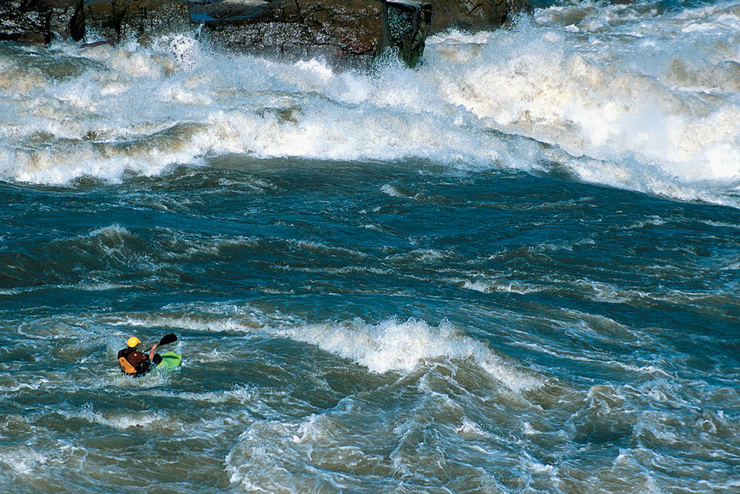
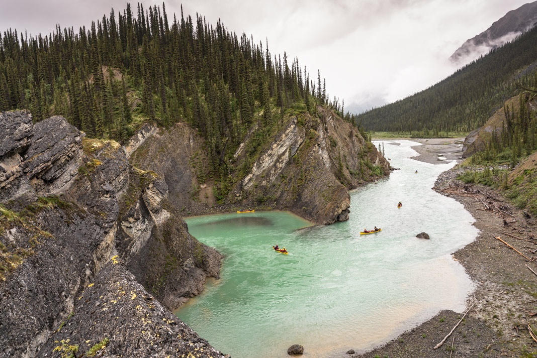
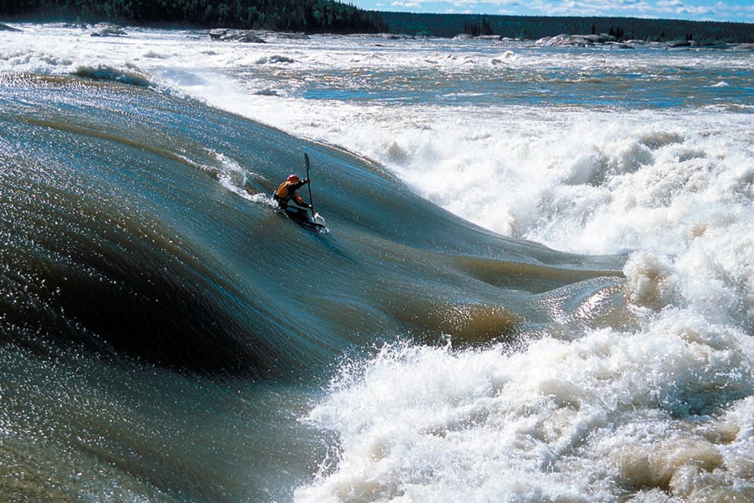
David Lech, Ottawa ON: Planning a self-supported kayak trip you struggle to leave behind the comforts of home yet discover on the river that you possess absolutely everything you need.The minimal gear and food that you are able to take actually reinforces the vastness of the land- scape, the power of the water, the vagaries of weather and the foolishness of your ambi- tion and pride. Most of all, wherever you may explore, expedition kayaking teaches you to rely on yourself.
Derek Endress, Whitehorse YT: I look up at Ken standing at the put-in for the Alsek River, gear and food strewn around us. We are just outside of Kluane National Park in Haines Junction, Yukon. He just smiles when I tell him I can’t fit everything into his Dancer. On two days notice I bor- rowed his spare boat for a 12-day unsupported trip to look at the notorious Turnback Canyon. Ken looks at me, “Hey, you could wear the backpack you have to get your gear around the eight-mile walk on Tweedsmuir Glacier.” Great idea Ken.
Heading down the Dezadeash River into the Kaskawalsh then the Alsek, the first day, of many, goes by with our narrow displacement-hull sterns underwater.Smiling at each other paddling our plastic barges with an additional 20 pounds on our backs, I keep asking him, “Where is the first Class IV rapid?”
Scott MacGregor, Quadeville ON: Expedition kayaking is canoe tripping with two blades and no cappuccino maker.
Stuart Smith, Squamish BC: During solo kayak expeditions, the challenge is recognizing or approaching your limits, be they physical limits—portaging across a range of mountains, paddling a difficult rapid, or dealing with adverse conditions—or mental limits—maintaining the focus needed to do days of hard whitewater, dealing with the intensity of remote and isolated areas where there is no assistance, and the challenge of learning self sufficiency in unknown or changing conditions.
When paddling with a group you add group dynamics.The challenges are not only your own personal tests, but also those of the other group members. The rewards are often greater as the shared experience creates kindred bonds which last the rest of your life.
As with most truly moving experiences the rewards and satisfaction are proportional to the efforts, and oftentimes to the risks. To grow I find myself needing to explore beyond known bounds.
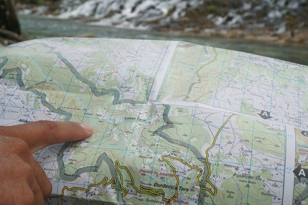
Steve Whittall, Whistler BC: Expedition kayaking represents the ultimate paddling experience, combining the exhilaration of whitewater with a grander notion of river travel and exploration. Running a tough drop three days into a week-long expedition feels very different than paddling roadside. The team’s combined paddling skills allow you to explore with confidence, unravelling the mysteries posed by a few winding blue lines on the topo map. And in the end, whether or not you choose to run the big line is almost irrelevant.
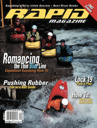
This article first appeared in the Spring 2003 issue of Rapid Magazine.
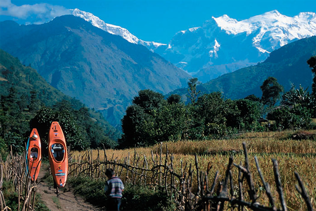
Marsayandi River, Nepal: Five miles and uphill both ways. | Feature photo: Dunbar Hardy
Expedition paddling is about the journey. It is immersing yourself in an untouched, inaccessible wilderness to experience some incredibly beautiful places. Once you find yourself getting fired up over topo maps, wondering what excitement lurks in a particular drainage and needing to find out, the next step is outfitting yourself for the journey. Every kayak trip you’ll come up with a few new outfitting ideas and once you have your system dialed, there will be no stopping the inquisitive explorer within you.
Big trip, small boat: Outfitting yourself for an expedition
1 Estimating time
If the river has been paddled before, try to find magazine articles, guidebook descriptions, firsthand knowledge and photographs of the expedition you plan to tackle. If little or no information is available, a lot can be determined from topographic maps.
Calculate distances and gradients, breaking the run down by the kilometre or mile and contour interval to estimate the duration of the trip. As a rough guideline, estimate travel speeds at five kilometres per hour for gradients less than 100 feet per mile (fpm), two km/h for steeper sections of 100–150 fpm and for intervals over 150 fpm, anticipate portages and add time accordingly. Be conservative. Aim to paddle four to six hours per day. This will give you time to dry camping gear by the fire in the morning and to dry paddling gear in the afternoon. If the weather dictates, you can always pick up the pace.
Knowing how many days you’ll be on the river allows you to select your kayak, sleeping system, menu and cooking system and packing strategy.
Marsayandi River, Nepal: Five miles and uphill both ways. | Feature photo: Dunbar Hardy
2 Boat selection
Kayak selection will depend on the difficulty of the run, river character, gradient and volume, length of trip and climate. Most likely, you’ll be paddling a creek boat to ensure that there’s enough room for all of your gear. For less difficult rivers, larger volume expedition boats will allow you to travel with a few more camp comforts.
Regardless of your selection, your kayak will paddle differently when it’s loaded. The boat that you love for your roadside paddling adventures may sit too low in the water once you add 40 pounds of overnight gear. Your favorite creek boat’s usually forgiving stern may start to grab, or even squirt, on eddy lines. The added weight will make boofs more effort, quick direction changes more challenging and technical paddling a half-grade more difficult.
Your kayak’s lower position in the water will exaggerate its tracking tendencies. As a result, you may be happier in a kayak with more rocker than you might normally enjoy. I typically paddle a Perception Java, but for longer, more gear-intensive multi-day expeditions, I may pull out the larger-volume Phat. For my weight of 145 pounds, I find that the Phat actually paddles better when loaded, with the extra weight and hull displacement taming its spin-on-a-dime nature and improving its hole-punching abilities. Experiment for yourself!
A high back deck, with removable backband, is crucial for allowing easy access for packing gear into the stern of your kayak. Adequate space in front of your bulkhead is also important to ensure that your loaded kayak is balanced. If necessary, shift your seat forward to help adjust the trim of your kayak.
Kayaks such as the Prijon Embudo and Eskimo Salto that don’t require structural pillars are certainly easier to pack gear into. Extra room tends to get filled with more stuff, so be careful—especially if you anticipate any long, arduous portages. Think twice about removing pillars to make additional room for your gear. For one expedition, I removed the stern pillar from a Pyranha Micro 240 only to realize that it served a major role in stabilizing the seat laterally. Five or six big drops later, my seat had split in two.
Increase the available packing space by customizing your boat. Cut out access panels in your pillar and/or bulkhead to create storage compartments. Build a shelf under your front deck. Carve a hole in your hip pad for your Leatherman or toothbrush. Use a hole-saw to lighten the weight of your outfitting components, but again, consider structural integrity. Rig up a shoulder pad or backpack harness for long portages. Be creative.
[ Paddling Buyer’s Guide: View all creek boats ]
3 Sleeping gear
Volume is usually the critical factor when selecting sleeping gear. You’re not going to be able to bring a tent unless you are on a longer, easier trip in a big boat. You’ll have to settle for some low-volume combination of sleeping bag, mattress and tarp or bivouac sack.
The debate over down versus synthetic sleeping bags is quite simple. Down is better when cold temperatures are expected since you definitely won’t be able to fit a winter-weight synthetic bag in your kayak. But remember that a wet down bag spells trouble.
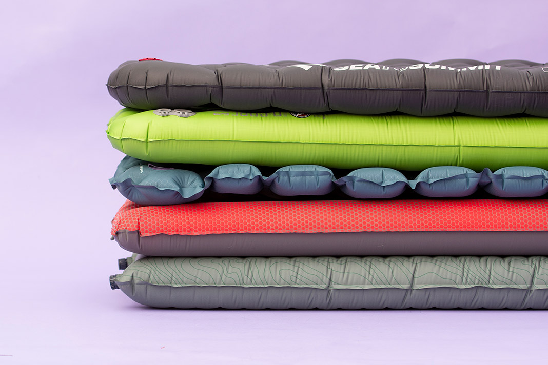
Research what type of campsites can be expected. Will you find open, sandy beaches or have to make do with a rocky ledge in a tight canyon? Hardcore expedition paddlers will use their paddling gear to sleep on. You’ll probably appreciate the extra comfort of an ultralight sleeping pad which rolls down to the size of a football and should be easy to fit in your boat. Although I’ve seen it done, a closed-cell blue foamy will take up too much space.
If mosquitoes or blackflies are anticipated, a bivy sack complete with mesh inner liner is your best bet. For rain protection, the bivy sack will also do the trick, but torrential downpours are definitely better spent under a lightweight tarp. The tarp is also indispensable for cooking or time spent hanging out in the rain. Quite likely, if it’s a solid rain, you’ll just want to keep on paddling. Better yet, check the extended weather forecast—if you can’t postpone your trip until better weather, you may want to bring a tarp and bivy sack.
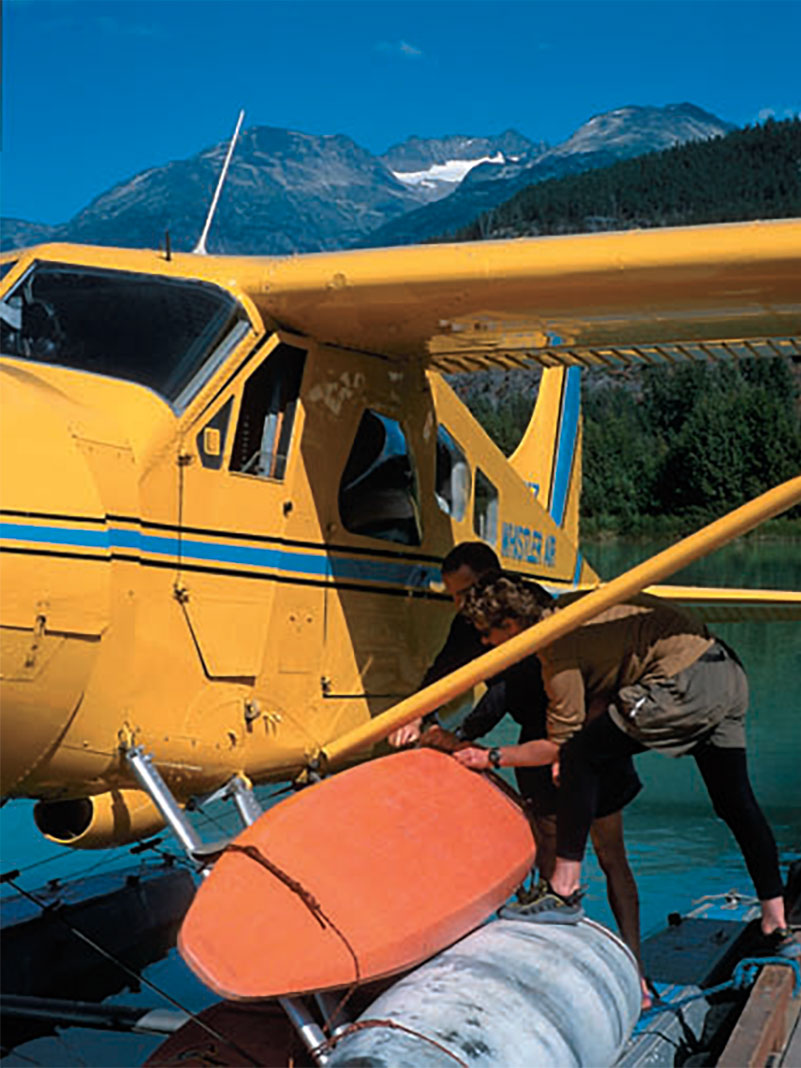
Planes… | Photo: Steve Whittall
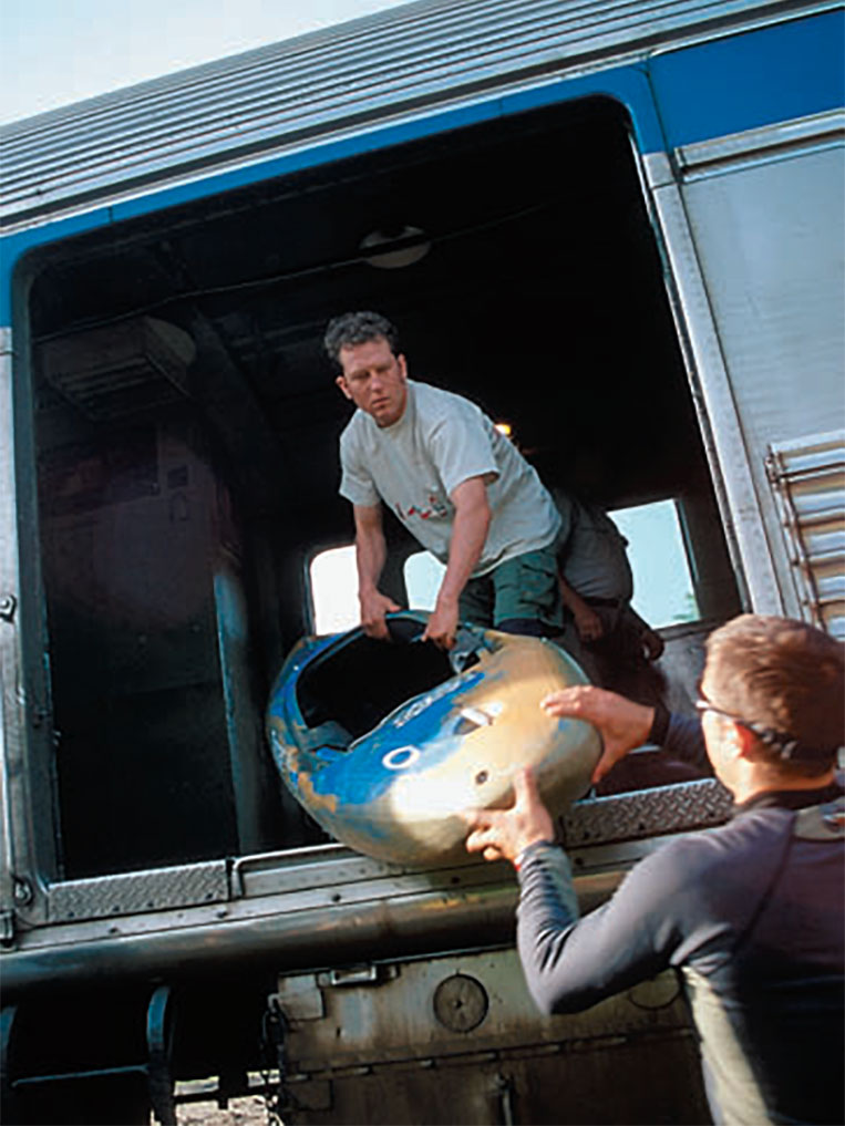
Trains… | Photo: Tyler Curtis
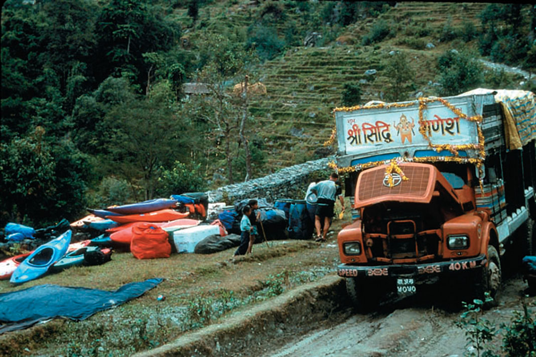
…And automobiles. | Photo: Dunbar Hardy
4 Food and cooking equipment
Is a stove absolutely necessary, or can you get by cooking on an open fire with a single pot? For northern trips, firewood may not even be an option. If there is a source of wood, you’ll probably want a fire simply for warmth or drying gear. Bring waterproof matches or a lighter and some type of fire starter (tea light candles work well) to dry out kindling and get even the wettest of wood going.
Plan a typical backpacking-style menu of dehydrated meals, pasta or rice, instant oatmeal for breakfast and dried fruit. On shorter trips, limiting yourself to dehydrated food isn’t really necessary. If you’re Clay Wright, just buy six or seven Big Macs, squish them into a small Tupperware container and you’re ready to go.
Organize your food into meals and/or days for longer trips. Ensure easy access to snacks and your lunch—you don’t want to pull your boat apart every time you’re hungry. Where possible, prep your food at home. And don’t forget your water filter if water quality issues are a concern. A Nalgene bottle with filter attachment is a great combination.
5 Rescue gear
Whether paddling for the day or on a multi-day self-supported expedition, a throw bag, wrap kit, whistle, river knife and first aid kit are essential tools for every kayaker. As with all rescue pre-planning efforts, you need to prepare yourself and your team for the worst-case scenario. Brainstorm the “what ifs” that pertain to your trip and come up with a plan, as a group, to deal with each of these potential situations.
The big difference between multi-day expeditions and day-trip paddling is the increased consequence of any problem. Carrying a breakdown paddle, for example, is absolutely necessary if the alternative to being able to continue paddling is a 100-kilometre hike. Note that a four-piece breakdown may be required for today’s shorter kayaks.
Consider some method for patching boats while on the river. As a minimum, wrap some duct tape around the shaft of your paddle. Willie Kern carried—and ended up using—roofing material to patch a cracked kayak on his 2001 Stikine Expedition. A Leatherman and basic tools may also be invaluable. Make sure you have a multi-head screwdriver and wrench to fit every nut and bolt on your boat. And don’t forget your headlamp.
Does the river require that you bring specialized climbing gear? A wrap kit of webbing slings, prussiks, carabiners and spectra throw-bag is an absolute minimum. Know how to build a harness out of webbing, rappel and belay and practice basic climbing skills.
Finally, consider the communication requirements of your team. Can a cell phone be of any use? If not, a satellite phone can be rented for the duration of your expedition and is worth every penny. Consider radio communications within your party and research all useful frequencies for contacting outside parties.
6 Clothing
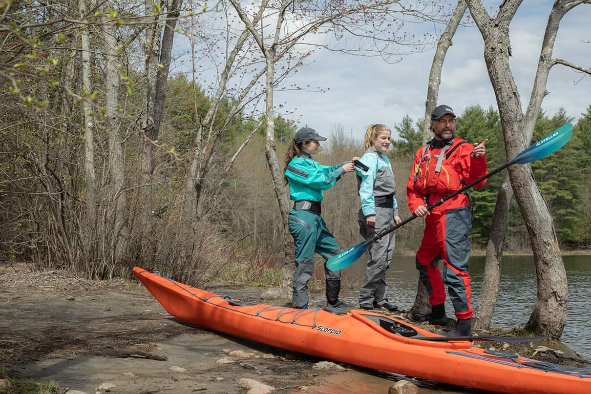
Obviously your clothing requirements will depend on the local climate, extended forecast and typical water temperature. It’s easier to pack for a multi-day trip in California or Costa Rica than for northern or alpine rivers. In any event, consider both paddling and camp gear, trying to combine these if possible. In colder climates, a full Gore-Tex drysuit with camp clothes underneath greatly reduces the amount of clothing you need to bring. For camp, a hooded down jacket provides the most warmth for the least volume. But if you bring down, be anal about keeping it dry. And bring a toque, eh!
Don’t bother with rain gear—a tarp is much more versatile. Keep your river gear on if it’s raining. Wear sturdy river shoes that you are comfortable making basic rock-climbing moves in. If you lose your boat or gear, you may be hiking out a long way. As a treat, bring some comfortable camp shoes or sandals to give your feet a break.
Make sure the drybags you intend to use fit in your boat and fit all of your gear before you head off to the river. Do a dry run of your packing strategy at home. Tapered drybags are great for taking full advantage of the potential packing space in your kayak. A cheap alternative to drybags are plastic Ziploc bags, but double them up and only include items that you can afford to get slightly wet.
For cameras or video gear, Pelican cases are great, but may be difficult to pack. You may be able to cut them into the foam of a rear pillar. Many paddlers keep cameras in cases or bags between their legs for quick, easy access. Make sure you can still get in and out of your boat.
8 Packing your boat
It’s always easier to pack the stern, so the challenge is to get enough weight forward to balance the trim of your kayak. To get gear forward of the bulkhead, it’s easier to pack in multiple small bags, rather than one larger drybag. I double-Ziploc food items and slide them past my bulkhead individually. To ensure that these smaller items can’t slide out, I glue a thin foam barricade to the bulkhead.
If you have long legs, you might have to remove all the foam from the bulkhead to create more packing space. In any event, work out some system to pack your heaviest items up front, within the pillar or bulkhead, or right behind your seat. Adjust your packing strategy as you go through food supplies to keep your boat balanced.
Expedition kayaking is all about exploring and finding magical places that would be impossible to access without paddling. It’s our big reward for a few hard knocks and a lot of persistence in becoming competent whitewater boaters. These special places are ours alone, reserved for paddlers only.
This article was first published in the Spring 2003 issue of Rapid Magazine. Subscribe to Paddling Magazine’s print and digital editions, or browse the archives.
Marsayandi River, Nepal: Five miles and uphill both ways. | Feature photo: Dunbar Hardy
Ten miles off the tarmac approaching Winnipeg I peered from my tiny emergency exit window at country roads, schools and farms bordering the winding Red River. It seemed we’d been gliding forever, sinking ever so slowly from the grey, overcast sky.
Close enough to the ground to recognize kids playing tag at recess, in the cockpit our pilot takes an elbow to the shoulder from a nervous copilot. Snapping out of it he rolls the yoke to the right, dipping the wing of the silver pterodactyl. Passengers’ sleeping heads jerk back on their flabby necks. Now on line, the pilot levels, flares, chirps the wheels down still slightly sideways on the cold runway and finishes his otherwise perfect flight.
In the realm of air travel and the pilot’s career this offline approach will go completely unnoticed, but some jackass two rows back couldn’t help from commenting: “What kind of pilot can’t hit Winnipeg? Christ, you can line it up from Michigan!”
First of all, there’s a place for arrogant loudmouths like this guy—First Class—but it seems his company didn’t think as much of him as he does. Secondly, I thought, this guy doesn’t paddle. If he did paddle he’d know the mesmerizing feeling of floating above your line, the stillness of flatwater and how big the world feels around you. He’d know about the lack of urgency floating in the dark, felty water before it accelerates into a glassy tongue.Like our pilot he’d know how his sense of speed is dulled by the lack of perspective. He’d also know how a winter of five months of snow-covered landscape can slow the metabolic rate, cover paddling gear in dust, and make a game of checkers last until it is almost too late.
Luckily the Earth spins on a slightly drunken axis, and around this time of year the sun pours more light and heat on the north side of the equator. Snow melts, birds chirp, rivers flood and jackasses rake the sand in their horseshoe pits.We know spring is coming.You can even see it coming from Michigan.Yet we need to roll our yokes and make some last minute seasonal adjustments before our rubber hits the tarmac and we make the pilgrimage from our snowy winter caves to our river lives.
Replace the gasket on your drytop, carve out some foam from your hip pads, revarnish the blade of your tripping paddle—where are my pogies?—and fibreglass the crack in your slalom boat. The long cold flight I call winter is over. Wake up and paddle.
This article first appeared in the Spring 2003 issue of Rapid Magazine.
It might not be a rule necessarily; perhaps you’d consider it a guideline or maybe a mantra. No matter what you want to call it, these are words to paddle by: Wave to everyone you see. A friendly wave hello is the best way to enrich your trip, build friendships and sometimes get some help along the way.
At the government docks in Silver Islet, a tiny community of 140 dwellings on the north shore of Lake Superior, I pumped my stove to life after a morning of steadily building seas. Between pumps I waved a foggy good morning to a middle-aged couple out for their morning walk.
“That’s not a stove,” Frank yelled over. “Put that thing away and come and have tea with Susan and me.”
The black and white Findlay cook stove was Frank and Susan’s only source of heat in their 19th century log home. Over tea, looking out to where a few cribbings remained, I heard the history of the richest silver mine in the world. Between 1868- and 1884, the Montreal Mining Company extracted $3,250,000 worth of silver from Silver Islet, but it wasn’t easy. At one time the cribbing was 70 feet wide and 20 feet above the water level, expanding the small rock islet to 10 times its original size. Twice, Superior’s storms destroyed the cribbing surrounding the mine and flooded the shaft. Eight hundred feet below the mighty lake’s surface, pumps ran constantly to keep the mine from flooding.The return on investment at this depth was slim and finally, in March of 1884, a fuel supply ship didn’t arrive, the fuel tanks ran dry and the mine flooded for the last time.
As Susan warmed my tea and put the pot back on the hundred-year-old stove, I thanked her for the history lesson and asked why they invited me in.
“You gave us such a friendly wave, we were afraid you’d invite us over,” Susan said, smiling. “It was too cold to stand out there waiting for you to get that little stove going.”
Waving hello is the golden rule if you do happen to need something along the way. Maybe its fresh water or a telephone to update your float plan. Or maybe you just need a small piece of shoreline along Lake Ontario to call home for the night. Paddling the Toronto waterfront is a mixture of breakwaters, marinas and ritzy waterfront homes offering few places to land a kayak and even fewer to pitch a tent.
George McGillicutty was cutting his grass when my kayak surfed to shore in his backyard. I dragged my boat up to a rusty snow-fence post holding a weathered “private beach—KEEP OFF” sign. George saw me walking up his pebbly beach and steered his Toro mower toward me.
George is a semi-retired stockbroker. He still commutes three days a week to Bay Street. He’d like to make it four, but his family thinks he should quit altogether.Too much stress on his heart they say.
“Hi, my name’s Scott,” I hollered and waved over the screaming lawn mower. “I left Thunder Bay three months ago and I’m headed home to Hamilton.” I offered a handshake.
“I’ll be God-damned, that’s a long way,” said George. “Pull your boat up a bit further. You’d better spend the night. This whole stretch of water is private. Nobody will let you camp along here.”
Nobody, that is, until I gave George a friendly wave.
This article first appeared in the Winter 2002 issue of Adventure Kayak Magazine. For more great content, subscribe to Adventure Kayak‘s print and digital editions here.
The guttural throb of two powerful engines rattles the cramped cabin of our chartered Twin Otter aircraft, piled high with paddling gear. Nine eager passengers crane their necks to scan the arctic waters for beluga and right whales.
We have flown from Edmonton, Alberta,to Inuvik, NWT, where the stunted northern treeline meets the historic Mackenzie River. From Inuvik we chartered the Twin Otter to take us north, two hours and 750 kilometres across the Beaufort Sea to Banks Island, the westernmost of Canada’s High Arctic islands. A two-week paddle will take us down the country’s northernmost navigable river, located in one of the nation’s newest and least-visited national parks—Aulavik.
We are an eclectic mix of arctic buffs, sea kayaking enthusiasts and birders drawn together by a shared urge to explore Canada’s mystical High Arctic regions. Our ages are as diverse as our interests, ranging from the cherubic seven-year-old Navarana Smith and her stuffed animal entourage, to the ageless Nipper Guest. Nipper’s tales of his far-reaching global adventures—everything from the horror and glory of WWII to riding his bike across Canada at the age of 70—will fill our windbound days with smiles and respect. Falling somewhere in-between on the age scale, the rest of us try our darndest to match the boundless energy of these two exuberant arctiphiles.
Our final brush with civilization is a brief stop to refuel and pick up supplies in Sachs Harbour, a community of 150 on the southern tip of Banks Island. Fully supplied, we zoom north across endlessly rolling tundra, flying low enough to see small groups of Peary caribou, flocks of snow geese, packs of wolves and herds of muskox panicking from the roar of the aircraft.
Dominating a broad, fertile valley on the northeastern tip of Banks Island is the azure meander of our destination, the Thomsen River, snaking its way through ancient glacial till toward the Arctic Ocean.
The plane leaves us and our mountain of gear on a small gravel bar near the river, in the middle of what the Parks Canada website calls “one of the most remote places in North America.” A charter
flight from Inuvik costs over $20,000, and the park gets an average of 25to 30 visitors a year.The only signs of modernity in the park are two tiny shacks of wind-free comfort in 12,000 square kilometres of untouched arctic landscape.With more than one muskox per square kilometre, the land is an arctic Serengeti, one of the world’s great remaining intact wilderness areas.
At midnight, the sun is still high in the northern sky, casting the warm light that photographers live for. We eat a 2 a.m. dinner in a persistent north wind and begin to set up our folding Klepper kayaks as two yellow-billed loons eye us suspiciously from the river. These boats give us the freedom to paddle in remote airdrop-only regions. Folded, they occupy two large suitcase-sized bags that will fly anywhere. Set up, they weigh in at 70 pounds and will hold enough gear for months of well-planned exploring. Their wood frames and canvas/hyperlon skins mimic the designs that originated in the arctic regions a thousand years ago.The kayak provides a per- fect conduit for historical exploration of these regions.There is no more effective time machine than a historically relevant means of travel and an active imagination.
On Banks Island, wind seems to constantly stimulate the senses, keeping the notorious arctic insect hordes grounded at the same time. The clouds of mosquitoes do not seem as intent on biting as on simply irritating all living things.
For two weeks, the current of the Thomsen carries us steadily northward and we are boggled by the abundance of life on Banks Island. It brazenly contradicts our mental image of “the barrens.”
A snowy owl twists its tail and wheels from its arcing glide, its sharp eyes drawn by a ripple of movement across the tundra below. The owl feeds on the abundant lemmings, ptarmigan, and small birds. Each brief arctic summer, snowy owls fly 3,000 kilometres north to breed in the Thomsen River valley, where they are joined by over 50 other species of migratory birds.A short stroll among the endless tundra ponds dotting the landscape would fulfil any North American birder’s wildest dreams.
The treeless landscape leaves wildlife almost naked—a wolf cruising along a ridge a kilometre away will catch the eye like a lightning bolt in a cloudy sky.The dark shapes of muskox grazing in a sedge meadow stand out like boulders on a snowfield.
Biologists trace only one living relative to the muskox—the takin of the Tibetan high plains—and these two isolants rest somewhere on the evolutionary line between goats and antelope. Seventy thousand muskox roam the valleys and swails of Banks Island. These staggering numbers are testament to the astonishing capability of the Western Arctic’s vegetation to support life and provide locals with a valuable source of revenue and food.
As we float down the river,mysterious white forms,out of place in the low sea of brown-green tundra vegetation, catch our eyes. We rudder hard and cross the steady current to land our kayaks on the far shore below the strangely white-speckled hill. We stumble like drunks over the endless tundra hummocks, trying in vain not to disturb the fragile blanket of flowers. A pair of croaking sandhill cranes soars noisily overhead, and a small flock of Lapland longspurs flits nervously from our path as we reach the first of the weather-bleached objects.
The objects turn out to be ancient bones, some bleached, others painted with the brilliant orange of xanthoria lichen. Small bits of caribou antler, ribs, vertebrae, and scapulae are spread over many hectares of this lonely, wind-blasted hillside. But the muskox skulls are what really trigger our primordial imaginations. Someone bends down to inspect a bone—the teeth of a primitive saw have scarred it. With no reminders of modernity to anchor us in the present, no sign of today’s culture anywhere to be seen, our thoughts travel 500 years back in time.We imagine the peaceful serenity shattered by the baying of the dogs that walked with the Inuit.We can almost see the dogs as they drive the muskox to the top of the rise, where the herd predictably forms a defensive ring, young near the center. Their shedding winter underfur, called qiviut, waves in the arctic wind like ragged flags flying from the animals’ humped forms.
This instinctual defence works well against the muskox’s main predator, the arctic wolf, but is suicidal when the attackers are armed with arrows and spears. Soon the animals are killed and butchered. Extra meat is buried under heavy stones to keep the foxes, weasels and wolves away until it can be used. What we see today are these grave-like meat caches along with the stone tent rings of the hunters’ families.
The gradual evolution of cultures in this region took a sudden leap in 1851 with the arrival of the first Europeans.The great age of arctic exploration was in full swing, and dozens of European ships cruised the ice-choked waters in search of the grail of that age—the fabled Northwest Passage to the rich lands of the Orient. Ships and men were marooned and starving all over the Arctic. It was only a matter of time before one of the poorly prepared European expeditions came ashore on Banks Island.
Captain Robert McClure led one of a wave of voyages sent by the British Navy to determine the fate of the now-infamous Franklin expedition. McClure sailed the HMS Investigator from Hawaii around Alaska to the northern tip of Banks Island, inching his way eastward until he encountered heavy ice in September, 1851. McClure sought a safe haven from the impending arctic winter in a small harbour near the Thomsen River delta, christening it, with pre- mature optimism, the Bay of God’s Mercy. It was the last harbour Investigator would ever enter.
The following summer came and went with no sign of the Investigator’s icy trap melting. The expedition was forced to spend a second winter in total darkness. Supplies and crew morale disap- peared along with the sun.
Finally, a rescue party from the Investigator’s sister ship, HMS Resolute, spotted two members of McClure’s crew who had been sent in search of help.The two lonely figures, blackened from head to foot with coal smoke, were wandering the ice near Banks Island. McClure and his crew abandoned the Investigator and returned to England, becoming the first Europeans to complete the Northwest Passage.
The precise fate of the 450-tonne, copper-sheathed ship is not known. All that remains of the ship are some old piles of coal and a few barrel staves.The more enduring stone and bone signatures of the Copper Inuit tell the rest of the Investigator’s tale. Archeologists know that sometime in the mid–late 19th century, the Copper Inuit abruptly changed their migration routes to use the Thomsen drainage as a main travel corridor.
The Investigator’s wreckage may have prompted the shift. One can only think of a wrecked spacecraft, full of unimaginable technologies, to get a hint of the significance of this discovery to a people whose only sources of wood were the occasional piece of driftwood and tiny bits of arctic willow. Early translations of Inuit encounters with similar ships indicate they believed them to be carved from a single block of wood! In addition, the ship’s copper, iron, and woven fabrics would have been a lottery-sized bounty. In Mercy Bay, the visible remains of over 150 campsites and 3,000 muskox skeletons are the legacy of annual trips to gather goods for everyday use and for trade.
The ponderous tale of Banks’ 4,000-year human history culminates in Sachs Harbour where the formerly transient Copper Inuit that once came off the ice in the warm arctic summers to follow the muskox and caribou are now permanently anchored. Here, the centuries-old practice of muskox hunting continues, but in a highly modernized form.
The Inuit use ATVs and Skidoos to round up the 3,000 muskox to fill their quota. The animals are herded from holding pen to holding pen, bringing them eventually to a large pen near the village. Here the animals are processed—the meat shipped out in 30 DC-3 loads to Edmonton for packing, and the qiviut shipped to Peru to be carded and spun.
This mystical fibre is purported to be 10 times warmer than wool by weight, and has the silky texture of cashmere. Stores like the Qiviuk Boutique in Banff sell qiviut sweaters to high-end tourists for as much as $5,000. Back in Sachs harbour, a dark stain of entrails on the ice in front of the village, waiting for the spring melt, is all that remains of the yearly muskox hunt.
An estimated 18,000 muskox reside in the Thomsen River valley, and we continually paddle past small herds of these Paleolithic beasts. Typically, our five boats drift toward a resting group of muskox until one exceptionally vigilant animal slowly rises to inspect us.
One by one, each animal in the herd stands, looks at us, and glances at the others as if to say,“are we really seeing what I think we’re seeing, and should we be worried?” Finally, one animal decides that, yes, they should be worried, and its break from the riverside sends the entire herd stampeding wildly across the tundra.
But we did not arrive by dogteam like the hunters in the animals’ ancient memories. Nor are we clad in the furs of the Old Ones, but in colourful modern jackets and pants, with toques permanently affixed to our crowns to ward off the seeking north wind.
And it’s not the sound of barking dogs that spooks the herd, but the drone of an approaching plane. It circles the gravel bar once, twice, then puts down with a dusty roar on the makeshift airstrip. We pile into the belly of the plane, take off with a roar and speed steadily southward, forward to the 21st century.
Dave Quinn of Canmore, Alberta, teaches high school outdoor education and guides kayak trips in the Canadian Arctic, the Queen Charlotte Islands and Patagonia.
This article first appeared in the Winter 2002 issue of Adventure Kayak Magazine. For more great content, subscribe to Adventure Kayak’s print and digital editions here.
“We’re not going out in those waves, are we?” we ask apprehensively. Two-metre-high breakers roll in and crash ashore near the hotels and tourist shops of downtown Monterey. It’s easy to imagine our kayaks spinning like tops, then emerging as toothpicks in the surf. “Sure we are,” Frank Knight replies confidently. “If you look closely, you’ll see smaller waves mixed in with the big ones. We’ll launch you in a nice calm interval, so you’ll be beyond the swells before the next breaker rolls in.”
Knight, we reasoned, should know what he’s talking about. He was born in nearby Carmel and his father worked as a refrigeration mechanic in Cannery Row,the historic Monterey waterfront that inspired John Steinbeck’s 1945 novel of the same title. The sardine canneries of Steinbeck’s day now house museums, restaurants, and shops, as well as Monterey’s renowned aquarium.
Fifteen years ago, Knight caught the tourism wave and began renting bikes from his home. Now he owns a company, Adventures by the Sea, and his biggest business by far is kayaks. The small boats are perfect for viewing the seabirds, marine mammals and expansive kelp forests of Monterey Bay National Marine Sanctuary. Stretching 445 kilometres north from Big Sur, past Monterey to the edge of San Francisco and 48 kilometres out to sea, this is the largest marine sanctuary in the U.S.
We sit in our kayaks as wave after wave pounds the beach in front of us. Then, Knight and one of his guides launch us like stones in a slingshot. We find ourselves smoothly gliding
through the sapphire water, 200 metres off- shore. There are no breakers here, just gently rolling waves.
“This is a rough day,” says Knight when he joins us. “Normally it’s as smooth as glass.”
From the water, the weather-beaten canneries propped up on barnacle-encrusted pylons resemble the backside of a theatre stage set. A backdrop of sandy beaches, rocky cliffs and rolling mountains embraces the bay. It’s hard to believe that we’re in an ecological haven, just two hours south of San Francisco and directly offshore from downtown Monterey, whose population of 33,000 doubles in the summer/fall tourist season.
Travelling over the kelp forest is much like paddling through thick vegetable soup.The voluminous brown seaweed grows up from the bottom, then spreads itself along the surface, supported by air-filled bladders.
“Kelp is the largest algae in the world,” says Knight. He explains that during the summer it can grow up to 25 centimetres a day, reaching heights of more than 30 metres. The kelp is protected here, but farther south, Knight adds, it’s harvested with sea combines. Algin from the kelp is used as a stabilizing and homogenizing agent in ice cream, salad dressings, chocolate milk, toothpaste, shaving cream and dozens of other common products.
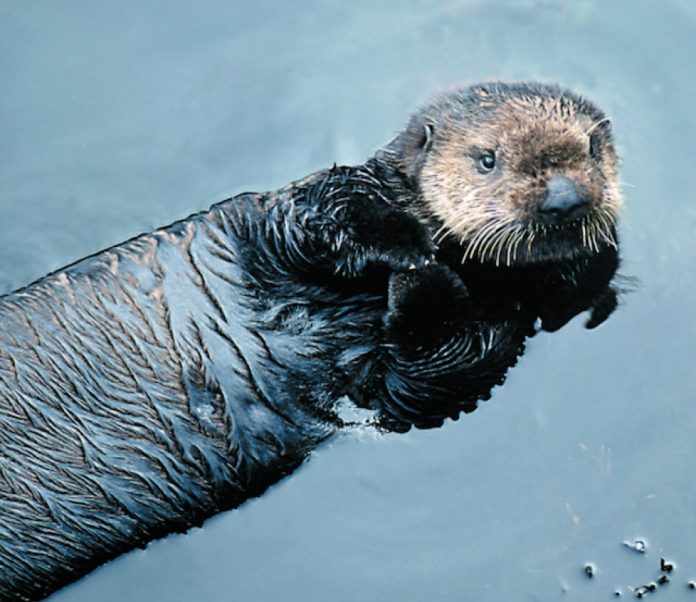
Kelp forests, undulating below the surface, also provide food and shelter for the bay’s aquatic inhabitants, notably the sea otters. These endearing, be-whiskered mammals once widely inhabited the northern Pacific Rim. Then, in the early days of international seafaring, fur traders hunted otters nearly to extinction. It wasn’t until hunting was banned in 1911 that populations began to recover. Otters didn’t reappear in Monterey Bay until the 1960s, and the species is still considered threatened. There are only about 2,000 California sea otters compared to an estimated original population of 15,000.
A brown head pops up 20 metres away and surveys us with its teddy bear button eyes.
“They’re very curious animals,” remarks Knight. “I brought someone out last week and an otter clambered aboard his kayak for a closer look.”
A schoolteacher once returned from a kayak tour with an even better story. A sea otter emerged next to her kayak with a waterproof camera tucked under its arm. A couple minutes later, two scuba divers surfaced in a burst of bubbles and told her that the otter had stolen their camera. When she paddled closer to the otter, it swam toward her, threw the camera into the kayak and dashed off.
Another otter bobs up next to our kayaks and nonchalantly floats on his back munching an abalone the size of a small pizza. The crunching of his teeth on the shell sounds like he’s cracking nuts.
Unlike whales and seals, which have a layer of blubber to keep them warm in the cold ocean, sea otters rely on their fur coats. While humans have about 100,000 hairs on their heads, sea otters have up to a mil- lion hairs per square inch of surface area. The hair is so thick that the water never comes in contact with their skin.
The fur’s insulating property is lost if it’s matted by oil, making otters especially vulnerable to oil spills. The 1989 Exxon Valdez spill killed nearly 5,000 otters in Alaska. Tankers routinely ply the waters offshore of Monterey, and U.S. risk assessment experts estimate that six large oil spills will occur over the next 30 years. Environmental groups are fighting to limit oil transport and exploration near the coast.
Closer to home, paddlers do what they can to pro- tect the fragile ecology of the area. Knight frequently donates his staff, kayaks and time to pick up any trash that floats into the bay.
“We pick up soft drink cans, beer bottles and plastic bags that blow in from fishing boats,” he says.“A sea turtle will die if it eats a plastic bag. If the bag gets caught in its stomach, it will starve.”
As we watch an otter wolf down $50 worth of abalone, then dive down to his kelp forest grocery store to retrieve more food, Knight explains that the animals’ high rate of metabolism also helps to keep them warm.
“They stoke the furnace all the time by eating up to a quarter of their body weight each day to maintain their temperature,” Knight says. That’s equivalent to an average-weight human eating 120 hamburgers.
This means that each otter is devouring up to five kilos of crabs, clams, mussels, snails and abalone every day—much to the chagrin of local fishermen.The otters are actually doing the fishermen a service, however. By feasting on sea urchins, which destroy kelp forests if left unchecked, otters keep the kelp ecosystem in balance.
“Did you notice that the abalone shell was broken on one side?” asks Knight.“That’s because the otter used a tool to dislodge it from a rock.” Otters carry their tools under their arm-flaps and pull them out when needed to crack open clam shells, or even to bash open a sunken aluminum can to remove an octopus that’s taken refuge inside.
While most otters use rocks as tools, Knight remembers one who used the thick base of an old Coke bottle. Sometimes, an otter will use a rock or concrete slab on its belly as an anvil to hammer open a shellfish. It eats the meal using its midriff as a table, turning its torso over in the water to clear away the crumbs.
Mother otters also use their stomachs as portable playpens for their furry pups. Sculling along on their backs, they deposit their youngsters on the kelp bed canopy before diving for food. Securely wrapped in the kelp blanket nursery, the helpless pups won’t be washed ashore by the surf.
We, too, anchor ourselves by grasping the kelp strands to keep our kayaks from drifting ashore while we observe the animals. Another otter surfaces with a crab, disassembling and eating one leg at a time before twirling the body like a jelly donut to gnaw at the edges.
A couple of seagulls descend on his belly to snatch away some tasty tidbits. We see other birds as well—web-footed auks, pterodactyl-like pelicans, and black cormorants that stand on the rocks with their wings spread out to dry. The cormorants dive as deep as 18 metres, but they lack oil in their plumage so their feathers absorb water. Sometimes the birds are too heavy to fly until they dry off.
There’s so much life in the bay, we forget that we’re still within sight of Monterey’s built-up coastline. Seals and sea lions also compete for our attention. There’s a year-round colony of about 85 sea lions on the rocks by the shore. Because it’s windy, they’re out in the water instead of sunning on the rocks. Knight explains how we can tell the difference between a harbour seal and a California sea lion.
“The seals have a very hydrodynamic profile, since they don’t have an external ear, while the sea lions have ears as well as bulbous foreheads. ”The sea lions are also much larger, weighing up to 400 kilos compared to the seals, which weigh less than 140.
A harbour seal playfully pokes his head up next to our kayaks. By the time we focus our cameras, he’s disappeared. We wait in vain for him to resurface, only to discover him watching us from the opposite side of the boat. Other seals escort us back to Cannery Row, where Knight guides us in so that we’re riding the smooth water behind a breaker.
We slip ashore amidst the bustle of tourists on the Monterey waterfront.We’ve seen so much on our two-hour paddle, we think maybe the other tourists are missing the boat, so to speak. For us, the heart of Monterey is in the Bay.
Barb and Ron Kroll have recorded and photographed wildlife from water level in destinations ranging from the Amazon and the Arctic to Africa and Asia.
This article first appeared in the Winter 2002 issue of Adventure Kayak Magazine. For more great content, subscribe to Adventure Kayak’s print and digital editions here.
I had a chance to catch the final leg of the Liquid Skills Showdown this past September.
I rolled in for semi-finals of the Kayak International Boater Cross event. I could tell from a distance that this wasn’t just another paddling event—I could hear cheering. I’ve never heard cheering at a paddling event before. Maybe somebody swam, I thought.
Boater cross, if you haven’t seen it, is like motorcross or snow boarder cross. Four paddlers mass start and paddle like hell racing to the finish line. It’s greyhound racing without the rabbit. It’s primitive but the crowd loves it. Not only does the crowd like it; the paddlers are into it.They were high fiving at the finish line, replaying the last 30 seconds with their opponents, like children on the playground.
“Oh man, I thought I had you until I got sucked into that boil.”
“Bummer, dude.”
BOATER CROSS HAS EVERYTHING WE NEED
Boater cross has what it takes to put paddling into the extreme mainstream. Think about it, what does a sport (I use that word loosely) need to have to make it to TSN? What do dog trials and logger games have that paddling hasn’t? Head to head competition and an immediately chosen winner. Boater cross is the drama we’ve been missing.
You can have an event almost anywhere there is whitewater. No more fussing about water levels and the rules are simple enough. Let’s see if I can remember them. GO—and the first one across the finish line wins. Hand Ron MacLean the program, a few jargon words and another $400,000 and away he’ll go with the play-by-play commentary. I suspect it won’t be long before there are teams and team strategies. Boater cross will have its own breed of hockey goons whose sole purpose is taking-out the leading scorer. Fox will release a line of team jerseys. And EJ will be on the cereal box with Tony the Tiger.
Ex-Olympic slalom racers will finally be able to make it big. After they retire from amateur sports instead of joining the Icecapades they can have a professional career in boater cross. Kids will collect paddler cards of their favourite “players”. They’ll put them in their bicycle spokes and twenty years from now look back and wish they still had their David Ford rookie card. There will be rivalries between slalom and freestyle paddlers. Drug testing will be protested. It won’t be long before canoeists get in on the action with tandem boater cross. Now that’s exciting.
Freestyle paddlers will finally get the free ride they’ve been looking for. Why? Because we can sell boater cross to TV-industry big wigs. A light bulb will pop on in some producer’s head; he will think he has found this great new sport—paddling. Guys shelling peanuts sitting at bars will eat it up. Boater cross has everything they need. Beautiful locations, carnage and spectacular instant replays.
This article first appeared in the Winter 2002 issue of Rapid Magazine.
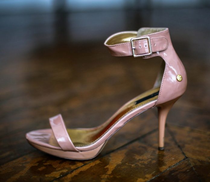
I need to ask the women out there a stupid question: do you like the way your feet feel in high heels? I know, you never want to take them off. You just pretend you’re in pain at the end of the day only so you can merit a foot rub once in a while, right? Wrong. We women are in pain because heels were designed by men, for men, and somehow the market for these shoes has been successful regardless of how women feel. Since the emergence of play- boating, boats have also been designed by men, for men. Mark Lyle from Dagger has been around since the beginning of freestyle, but he weighs about two hundred pounds and is as wide as a refrigerator. Wave Sport’s designer Eric Jackson may not be the tallest paddler out there, but his biceps are also the size of my head! Corran Addison once said that he’d design a Riot women’s boat when women started cartwheeling. I recall kicking his butt at a rodeo that same year, but still no boat! I think all of these men have designed great boats, but how could they possibly think small? And furthermore, how could they possibly think female?
Until now there’s been little need for smaller boats. Eighty to ninety percent of paddlers were men. But over the last couple of years, women and smaller, younger paddlers have been emerging onto the scene. They can’t wait to learn the moves being pulled off by the men, but can’t understand why it’s so much more of a struggle than it looks. A few boats have been designed for women, but if you’ve ever seen an average-sized guy cram into one, it’s obvious they aren’t really suitable for women at all. They’re ego boosters for guys who couldn’t throw down their own boy boats.
Here’s the skinny: men and women have different power-to-weight ratios. For the most part, men weigh more and carry more muscle than women. Since this can be rather deceiving, I tested my theory by asking a few relatively small guys to try out some bigger boats. These men looked smaller but in fact weighed more and were inherently stronger than I, and were able to handle the bigger boats. So it’s not just about weight ranges. Women need even smaller and lighter boats because of smaller upper body muscle mass. And that doesn’t even begin to address the issue of fit. Thigh-hooks, displacement, width and length, you name it—they all need to be built differently to fit women.
Damn, it would be great to change places with my ape-shaped boyfriend for a day. His argument that I’m not trying hard enough would no longer hold ground after experiencing the many boat handling struggles I have ventured to explain in the past! And when he finally saw the light, I’d go throw a hundred flatwater cartwheels and then stuff my face with chocolate cake!
High-heeled shoes were designed because men thought women looked sexier wearing them. They’re still around because women think they feel sexier and keep buying them. When it comes to boats, guys think it’s sexy to see a woman throw down in a hole. But boys, where are the boats? Perhaps you’d rather we gain 40 pounds so we can flatwater cartwheel for you? Then how’d we look in those heels?
This article first appeared in the Winter 2002 issue of Rapid Magazine.
I bolted upright in my hammock at 3 a.m. with the feeling that someone was hammering a nail into my elbow. The pain was from a one-centimetre-long scrape I had acquired a week earlier amidst the jungle of Malaysia’s Selangor River. I didn’t notice the scrape until it flared up into an unsightly and painful “Popeye” arm. I had cellulitis, a bacterial inflammation of the inner skin.
For boaters in Canada and the U.S., fall and winter often mean taking off to places like Southeast Asia or Latin America. Names like Ecuador, Thailand and Costa Rica elicit images of drinks topped with mini-umbrellas and bathtub-warm rivers. The problem is that warm waters and humid climates are the perfect breeding grounds for nasty systemic bacterial infections. On a tropical river, a small cut or scratch that could usually be ignored with no consequences in North America can admit foreign bacteria that our bodies are not equipped to handle.
BEFORE YOU GO
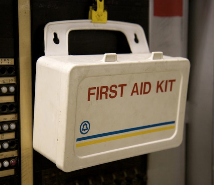
A first-aid kit is essential, particularly in developing countries where your kit may be better-stocked than the nearest hospital. Be sure to include the following: moisture-retentive, transparent film dressings and tincture of benzoin (friar’s balsam) to make them stick; sterile gauze; topical antibiotic such as Polysporin; and a water-based iodine solution for disinfecting water to flush the wound.
Talk to your family doctor or travel doctor about getting the required vaccinations for your destination and prescriptions for a broad- spectrum oral antibiotic and a strong painkiller. Doing some advance research about the environmental risks and the drugs will likely further your case.
Buy travel medical insurance before you leave your home country. It’s often available through a travel agent. The insurance should pay for your hospital stay and, if necessary, an evacuation back home or to the nearest reputable medical facility (if you’re afflicted in Laos, for example, you’d be evacuated to upscale Thailand). Understand your provider’s restrictions before you commit to a policy. Many insurers will not cover evacuations from countries the Canadian government considers politically unstable.
MANAGEMENT OF THE WOUND
Prevention of course is the key. If it’s tolerable, wearing even a thin, long-sleeve paddling jacket will help protect your body from cuts and scrapes. Make sure you do a cut check every day; even the smallest opening will admit bacteria.
Clean any new wound with disinfected water before applying a dressing. The rule of thumb is to irrigate wounds with water that is suitable to drink, either boiled for 3 minutes or chemically treated. Avoid cleaning the wound with any alcohol-based solutions such as hydrogen peroxide as they can actually kill skin cells. The wound may require scrubbing to get any ground-in debris; a little pain now is better than a lot of pain later when the wound has to be re-opened and scrubbed.
Band Aids or typical gauze-and-tape dressings will immediately be soaked in the river and become a breeding ground for opportunistic bacteria. Transparent film dressings, also called occlusive dressings, provide a clear, waterproof and breathable Saran Wrap–like barrier between the wound and the river environment. Film dressings such as OpSite, Tegaderm and Biopore can be found in larger pharmacies and medical supply stores. Applying a thin layer of topical antibiotic over the wound will reduce the chance of bacterial growth. Minor abrasions and lacerations aren’t reason enough for you to take your oral antibiotic unless there are signs of infection.
WHEN AND WHY TO GET OUT
Continue your trip but monitor the wound for signs of a local infection. Watch for redness around the edges and local pain, tenderness and throbbing. The surrounding skin may also become abnormally firm and hot to touch. Now would be the time to begin a cycle of antibiotics, ensuring you follow the prescription, to try and reduce the spread of an infection.
Red streaking under the skin away from the wound, swollen and painful lymph nodes, fever, shock and general flu-like signs and symptoms indicate the infection has spread from the wound into your circulatory system. If this occurs, mentally prepare yourself to be rolled over onto a bed by nurses instead of rolling your kayak on the river. You have exhausted the resources in your first aid kit and need to get to a good medical facility as soon as possible. Depending on your medical insurance and which country you are in, this could mean a day or two of travel.
Frank Wolf has completed sea kayaking and whitewater kayaking explorations in Malaysia, Indonesia, Alaska and in his home province of British Columbia.
This article first appeared in the Winter 2002 issue of Rapid Magazine.
Ten Colorado Rivers plus a 300-meter-wide channel equals boxcar-sized waves and 30-foot-deep whirlpools at Pelican Rapid. | Feature photo: Ryan Creary
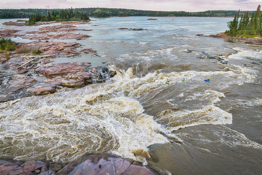
In Canada’s Northwest Territories, arctic winds blow in temperatures below –40°C much of the year. But as the seasons change, the sun’s heat awakens a sleeping giant. The Slave River roars to life and flows with ten times the volume of the Colorado and four times that of the Fraser. Three thousand five hundred cubic metres of water per second travel from the prairies to the Arctic Ocean.
As the river crosses the Alberta-NWT border, it plummets off the Canadian Shield’s red granite shelf, some of the oldest and hardest rock on the planet. It passes through a sieve of islands sculpted by water and time to produce hundreds of good, bad and ugly river features. The result is one of the world’s most awe-inspiring labyrinths of whitewater—a series of rapids 30 kilometres long—a 60-square-kilometre big-water playground lit 24 hours a day by the arctic summer sun.
Extended hot days on the river are combined with never-ending golden sunsets, no McDonald’s for hundreds of miles, no cell phone towers, no distractions of globalization, and, until recently, no other kayakers in the eddy waiting for their turn on the wave.
Every summer or two for nearly a decade, I have made the 16-hour drive from Edmonton to the “end of the road” town of Fort Smith to kayak the Slave. When I first started coming here, you could paddle for two weeks and not see another paddler. Now, there are a few locals and maybe 50 to 75 visiting paddlers a year. This may not seem like much, but it’s a major increase for a river north of 60, a testament to the growing attention the Slave is getting in the whitewater kayaking world in the past couple of years. A few years ago, kayakers described huge waves and crashing holes as “Zambezi-sized.” Today, many big-water play-boaters refer to the best waves as “Slave-like.” Whitewater kayakers from around the world have heard stories about the Slave’s enormous features and have started to make their way north.
Ten Colorado Rivers plus a 300-meter-wide channel equals boxcar-sized waves and 30-foot-deep whirlpools at Pelican Rapid. | Feature photo: Ryan Creary
Descriptions of “holes that would cartwheel a Greyhound bus” and “waves 30 feet high” are actually quite true. But these stories definitely do not speak for all of the features on this river. There are many smaller holes and waves dispersed throughout these rapids that can be safely paddled providing you have respect for the size of the river.
The river is channeled through a 300-meter-wide chute into a real wave train—waves the size of boxcars.
Bays filling up and then overflowing downriver create surging and cycling water levels. Pulsating like a river in flood, the water expands, folds, and erupts because of the enormous volume trying to squeeze into the path of least resistance. “Elevators” (huge eddies that provide a way to paddle upstream and work your way across the river) can be the size of football fields and have two-foot standing waves in the opposite direction to the main flow. The volume creates pressure waves and whirlpools of dramatic proportions.
Float bags are essential. Volume is the name of the game and losing your boat is more than an expensive experience. Mostly, floatbags are helpful when you’re hanging onto your boat as you get sucked into the darkness of a giant whirlpool, which can reach 30 feet deep and are as dangerous as their tornado counterparts.
Paddling with a group is another must. This river is three kilometres wide in places. If you lose track of someone, they’re basically on their own. It’s very difficult to see swimmers in the silty brown water amid the numerous channels and holes.
Visiting paddlers should be armed with good knowledge of the features and lines. The only way to do this is to find a local guide or someone with previous Slave experience.
A final word of advice: Be prepared with a bug jacket in your boat or end up possibly overdosing on bug repellent.
Paddling the Slave River
The Hudson’s Bay Company and Northwest Company set up fur trading posts at either end of the Slave’s rapids. Fort Fitzgerald, at the top of the rapids, is all but abandoned today. Fort Smith, overlooking the last set of rapids, marks the site where river boats once reloaded after the long portage. Now, Fort Smith is the NWT’s government, education, and whitewater center.
The local population is very friendly, the mood is relaxed, and you can find all the necessary amenities—a pool with hot showers, a movie theater, and a couple of watering holes to quench your thirst. Each of the Slave’s four main rapids—Cassette, Pelican, Mountain and Rapids of the Drowned—has its own put-in and take-out along the road from Fort Smith to Fort Fitzgerald. Since the rapids are a few kilometres long followed by lengthy portions of flatwater, each one is a separate day trip out of Fort Smith.
1 Cassette Rapids: Land of a thousand holes
At the put-in for Cassette, the first rapid, you’ll recognize the dock where old paddle-boats used to end their long journey down the river’s lake-like upper reaches. Named after a trading company’s money cassette lost on a misguided run through the rapids, this set is the most difficult to navigate. Here, the river is three kilometres wide with many islands breaking up its course. Ferrying across to the opposite side can take up to 45 minutes.
Cassette is special for its amazing surf. Waves named Outrageous and Rollercoaster offer big, fast, bouncy rides if it’s ideal water level and you know where to look. Along with the big waves goes an expansive area known as Land of a Thousand Holes that you must cross on your way to the take-out. This run is a full day affair.
[ Plan your next Northwest Territories paddling trip with the Paddling Trip Guide ]
2 Pelican Rapids: Prepare to be ragdolled
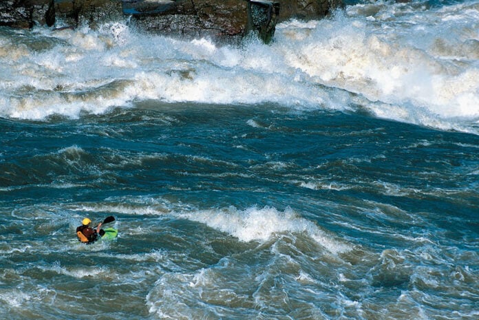
The second set of rapids is notably larger and more dangerous than Cassette. Most of the river is channeled through a 300-metre-wide chute into a real wave train—that is, the waves are actually the size of boxcars. On either side of the main flow are enormous holes with eddylines and whirlpools to match. The power of the virtual lake raging through the main channel creates a gut-wrenching roar that will awaken any sub-conscious fears. On calm days, a rising mist makes the hairs on your neck stand at attention.
Although Pelican doesn’t require significant paddling skills to line up, this is definitely an advanced section, requiring comfort with house-sized waves dumping on your head and an ability to remain calm as the river ragdolls you without warning.
In 1998 my partners and I finally worked up enough nerve to tackle the main flow and I ended up with the first surf of Pelican. We each took turns pulling out of the pulsating eddy, across a smaller wave train and down the highway-like ramp. At the bottom of the long, sloping, runway, we met the first wave; a 30-foot cycling monster followed the gigantic wave train. With the surging water levels, the Pelican wave changes shape every 30 seconds or so from a crashing wave to a rolling hump.
My first surf was made possible by lucky timing. I floated toward the awaiting ramp, turned my boat around to face upstream, and, with my stomach in my throat, climbed the face just as it broke behind me like a perfect storm.
Now, we run Pelican in pairs to aid rescue situations. The time it takes to break into the main flow from the eddies below makes it impossible to get to a swimmer in time, if you can even find them. A swimmer with a wingman can get to one of the closest islands—two kilometres downriver—that much sooner.
One of our group members tested this theory inadvertently. His spray deck imploded when a wave crashed down on him. He swam out of the notorious river left hole, down the boiling and folding eddy line, and into a giant whirlpool, only able to look up to the unreachable cone of air. Resurfacing was followed by repetitive breathless periods of underwater, unsynchronized swimming. After finally being towed by his rescuer to one of the small islands, he violently ejected river water from his stomach and lungs, along with any illusions he’d had about the mercy of the river.
Left… or was it right? Too late… may the force be with me. David Manning on Molly’s Nipple. | Photo: Ryan Creary
3 Mountain Rapids: Butterscotch Nipple
With Pelican being the most intimidating rapid, the next, Mountain, is one of the most welcoming. It has many surf waves and holes for paddlers of all abilities. The Slave bends around a peninsula and over a series of ledges and shelves. The rapids are named after Mountain Portage, an arduous trek up and over the 150-foot-high trail to the other side of the peninsula. The portage was once used to transport supplies around the rapids, but today kayakers use it as an easy way to paddle this section without a shuttle.
These are the rapids that should have been named Pelican. A large colony of the birds breed on the islands in the middle of the rapid. These islands are a wildlife sanctuary and must be avoided. The area is even a no-fly zone because helicopters were disturbing the pelicans.
These monsters are Slave-sized servings of pounding recirculating holes.
One of the possible routes through Mountain takes us to Molly’s Nipple, a mesmerizing drop that, at the ideal water level, forms a rounded, gently curved ramp into a large, horseshoe-shaped recirculation. The silty water rippling over the underlying sculpted rock takes on the texture of hot butterscotch toffee.
For the wild at heart, Fury and the Edge are super-sized servings of pounding recirculating holes. These monsters will consent to the biggest of aerial maneuvers and dole out the largest of thrashings. Various big-name American kayakers have swum out of the Edge.
The intermediate run on this section usually begins with Turnpike, followed by Avalanche, and finishes with Playground, a really exciting and challenging day for a first big-water run. Playground, which can be accessed directly by the takeout, is as good as it gets for beginner rodeo stars. Next to a sandy-beached bay lies an outcropping of rocks, creating a fabulous BBQ site and a great rodeo hole conspicuously named Spanky.
Last before Fort Smith are Rapids of the Drowned. Here, the Fort Smith paddling club hosted the 1994 Canadian Whitewater Slalom Championships. The racecourse was erected around a channel between three or four connected islands. Spectators were shuttled by motorboat to the islands where kayakers raced through gates between the large granite outcroppings.
The rapids are seldom visited by kayakers due to the lengthy paddle out to the playing features. But it’s worth driving to the take-out, to spend an afternoon on the rocks, watching the pelicans feed and looking for black bears foraging on berry bushes along the bank. Or, to truly appreciate these rapids, take a walk at sunset to the lookout directly across from the graveyard. Here, the sepulchral mood is often enhanced by the dark blackened eyes and curiously tilted heads of the ravens perched upon the wooden crosses of the buried rivermen who came before.
Shawn Grono has kayaked rivers in New Zealand, Chile, Ecuador, the U.S. and Canada and made the first descent of Molly’s Nipple on the Slave. He is an Alberta Whitewater Association Kayaking and River Rescue Instructor and maker of whitewater adventure films including the documentary Slave to the River.
This article was first published in the Winter 2002 issue of Rapid Magazine. Subscribe to Paddling Magazine’s print and digital editions, or browse the archives.
Ten Colorado Rivers plus a 300-meter-wide channel equals boxcar-sized waves and 30-foot-deep whirlpools at Pelican Rapid. | Feature photo: Ryan Creary


 This article first appeared in the Spring 2003 issue of Rapid Magazine.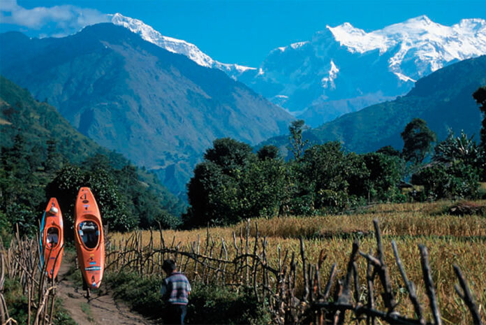
 This article first appeared in the Spring 2003 issue of Rapid Magazine.
 This article first appeared in the Winter 2002 issue of Adventure Kayak Magazine. For more great content, subscribe to Adventure Kayak‘s print and digital editions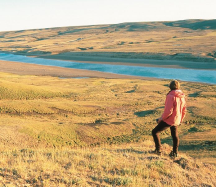
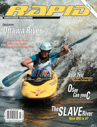 This article first appeared in the Winter 2002 issue of Rapid Magazine.