Home Blog Page 298

Idaho: Home of the Best Hole in America

Photo: Mike Leeds
Idaho: Home of the Best Hole in America

“It’s the sickest play hole probably ever built,” says Junior World Champion freestyle kayaker, Jason Craig. “At least, that I’ve paddled in—and I’ve paddled in a lot.”

He compares the top feature at Kelly’s Whitewater Park to the Ottawa River’s world-class waves, but at Kelly’s, there’s never a line in the eddy.

It’s a ghost town a lot of the time says Craig, who spent a month at the Cascade, Idaho, park last summer—an eerie emptiness that you’d expect to see bustling with big-name boaters and beginners alike, based on the quality of whitewater.

There are four main waves at Kelly’s and the biggest is Craig’s secret training ground, a hole he says is the best in the country for boosting freestyle scores. The bank is landscaped with boulders that form amphitheater-style seating for more than 3,000 spectators near this feature alone, benches that are packed on event weekends when people flood to Kelly’s to join or watch high-level competition.

BRINGING IN BUSINESS FOR CASCADE

Since it opened in 2010, the park has hosted two National Kayak Championships and the 2013 Payette River Games, which drew 14,000 people, including a long list of world- class kayakers, to the park for a weekend of SUP and kayak competition.

The 2014 Payette River Games are from June 20 to 22 and have a prize purse of over $100,000, with $10,000 top prizes in both men’s and women’s categories—the biggest money weekend in whitewater history.

The events are booming business for Cascade, a single-store town that only 1,000 people call home.

Mark Pickard is the man responsible for plopping this world-class whitewater on the map in the middle of Idaho. A retired Wall Street hedge-fund founder, Pickard and his wife Kristina poured funds into the park as an act of philanthropy— a memorial to Kristina’s late sister, Kelly, and an economic jolt for Cascade, a town the New York-Miami Beach couple had fallen in love with.

“We’re not paddlers,” says Pickard, who transplants to the area for a few months each year. But a whitewater park was a long- time dream of the community so Pickard worked with a team of engineers to blast through its planning and construction in a matter of months, turning a donated abandoned sawmill site into what he hopes will become a national tourist attraction.

MORE THAN JUST WHITEWATER

Everything at Kelly’s is completely free, and Pickard didn’t stop with whitewater. Beach volleyball courts, an outdoor concert area, horseshoe and bocce ball pits and an extravagant visitor’s center are all part of the plan to bring more people to the not-for-profit park, on more than just competition weekends.

Between events, the site is scattered with small groups of local kids attending Kelly’s Academy—a program where fifth- to twelfth-grade students from the area get free lessons from world champs like Craig, who agrees that it’s just a matter of time before the park catches on as a whitewater hotspot.

“It feels like paradise. Every level of paddler would love that whitewater park,” he says, adding that it’s only a short drive from Kelly’s to the legendary 15 miles of Class V on the North Fork of the Payette River.

It’s “an incredible place to be a kayaker,” he says. 

This article on whitewater in Idaho was published in the Spring 2014 issue of Rapid magazine.This article first appeared in the Spring 2014 issue of Rapid Magazine. For more great content, subscribe to Rapid’s print and digital editions here

Access Denied in Wyoming

Photo: courtesy National Archives ID# 79-AGG-1
Access Denied in Wyoming | Photo: courtesy National Archives ID# 79-AGG-1

I write this stuck in Wyoming’s Grand Teton National Park—not a bad place to be—but the park is closed, the place is deserted. The river I came here to run is now out of bounds; one of the most famous, historic and flat rivers most paddlers have never heard of.

Here for a risk management conference at a private lodge, we are victim to the U.S. government’s Obamacare shutdown and budgetary deadlock. We’re carrying on with our conference, but the park’s gates are locked. We can leave but we can’t get back in if we do.

Famed landscape photographer Ansel Adams’ black and white The Tetons and the Snake River (1942) seared the jagged skyline of the Teton Range into the American psyche, making them what most Americans picture when they think of mountain peaks. Snow capped, ominous and rising from the western plains, the iconic mountains have served as the center of American mountaineering for over a hundred years.

Adams’ famous photo used the upper reaches of the Snake River to contrast against the triangular peaks: the river’s sinuous curve draws the eye from the foreground, down the bank and up the jagged peaks into the sky above. When I first saw the photo on a Christmas gift coffee table book, the image of the Snake drew me in, left me longing to be pulled down the humble river beneath those peaks. And now I sit here, struck by the reality that the river is beyond my reach, its access controlled by the government’s whim.

Rows and rows of sad-looking rafts and dories sit on trailers on the parking lot of Jackson Lake Lodge, where I’m locked up. They, too, are imprisoned, leaving one of the busiest scenic float rivers in the world deserted like the rest of the park. River guides either mill about with nothing to do or have called it a season and moved on. The same Snake that downstream passes through whitewater Ho-

back and Hell’s canyons, up this high is just flat and swift, dwarfed and humbled by the Tetons. The Snake is often overlooked by seri- ous whitewater paddlers, but is magnificent in views and important in our history.

Grand Teton National Park is one of the birthplaces of commercial rafting and the Snake continues to put any other commercial rafting river to shame—upwards of 200,000 tourists float this section every year.

Photo: courtesy National Archives ID# 79-AGG-1
Access Denied in Wyoming | Photo: courtesy National Archives ID# 79-AGG-1

THE TETONS FAMED HISTORY

The famous and extremely wealthy John D. Rockefeller Jr. was an avid outdoorsman and visited the Tetons in the 1920s. Rockefeller secretly began buying up land with the intention of handing it all over to the government as a gift.

Political and legal wrangling got in the way, and it was not until 1950—more than 20 years later—that his donated land gained of- ficial park status.

Rockefeller promptly set about building Jackson Lake Lodge and hired horse wranglers to take clients down the Snake in WWII surplus inflatable bridge pontoons with sweep oars.

That was the start of commercial rafting in this watershed. Further to the south in Utah and Arizona, Bus Hatch and Norman Nevills were pioneering commercial whitewater on the Green and Colorado, but for Rockefeller, the river was about scenery. He wanted people to float through Adams’ photo, and revel in the spectacle of the mountains looming overhead. When whitewater daredevils were gaining media attention in the mid-60s, a half dozen river operators sprung up and still operate on the Snake, capturing the road traffic through the Tetons and nearby Yellowstone National Park.

As the creator of the commercial float trip, Rockefeller waited out decades of government delay to ensure this land would spread the love of rivers to the masses. Like Rockefeller and so many others, I was drawn to this river, but here I sit, my access denied, looking at a real-life image of the Tetons and the Snake River, and a snapshot it will remain.


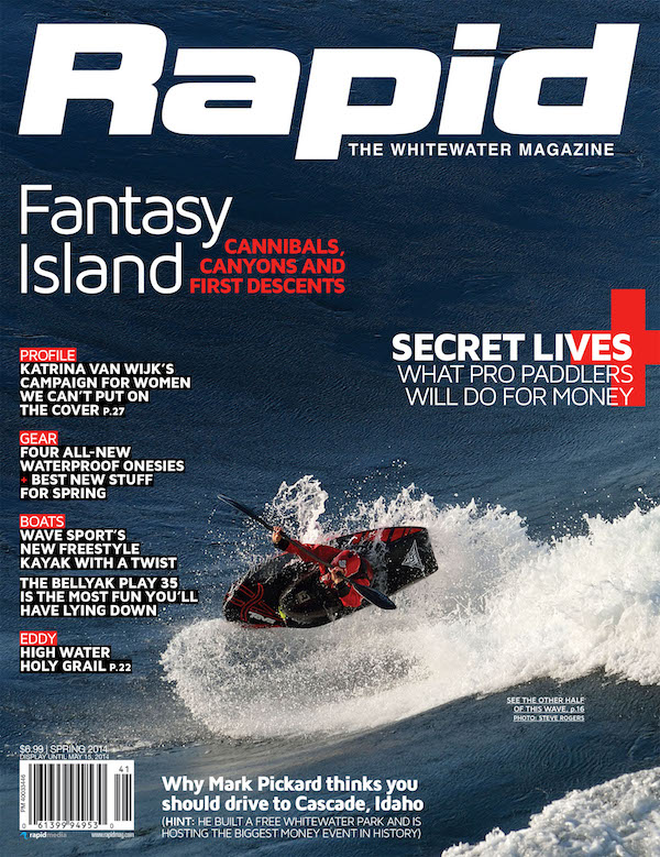
This article was first published in the Spring 2014 issue of Rapid Magazine. Subscribe to Paddling Magazine’s print and digital editions, or browse the archives.

Discovering the Bay of Fundy

Photo: Virginia Marshall
Discovering the Bay of Fundy | Photo: Virginia Marshall

“When a nor’east or a nor’west comes in hard, the arse can really fall out of it,” Christopher Lockyer tells me as the road squeezes to a single lane and doglegs between roof rack-high stacks of lobster pots.

In places, the neck of Cape Forchu is so narrow it’s little more than a causeway. A rugged headland that juts south from Yarmouth, Nova Scotia, the cape’s crescents of surf-pounded sand and rows of weathered fishing wharves are lapped on one side by the Bay of Fundy and on the other by the unforgiving North Atlantic. It’s easy to imagine a northerly blow ripping across here with arse-spanking fury. In a couple of months, the docks will be bustling with lobstermen, but on this bright late-September morning our convoy of kayak-topped vehicles is the only sign of activity.

Colorful local expressions slip easily from Lockyer’s mouth. Beguiling host of the inaugural Bay of Fundy Sea Kayak Symposium, the bay is in his blood. Lockyer has spent most of his adult life on the bay, first as a lobster fisherman and later as a sea kayaker. His family, in- laws and friends have all worked on the bay in boats of various sizes. Now a GIS tech in Halifax, he also runs Committed 2 the Core Sea Kayak Coaching and is raising his own family near the small town of Truro, Nova Scotia, at the bay’s head.

Home to the world’s largest tides and a wildly varied coastline—from the rust-colored cliffs and sea stacks of Cape Chignecto to rugged archipelagos of glacially-formed islands wreathed in fickle currents—the Bay of Fundy is a natural paddler’s playground. It’s remarkable, then, that its potential as a world- class kayaking destination has remained largely untapped.

When Lockyer caught the kayaking bug in 1994, he traveled to paddling events in Wales, Scotland and Georgia to develop the advanced skills that would allow him to play in Fundy’s dynamic tide races and rock gardens. Five years ago, he realized Maritimers needed their own venue for sharing ideas and connecting with other paddlers. Working with Paddle Canada, Lockyer helped develop the Atlantic Paddling Symposium, a multi-discipline event hosted in a different Atlantic province every year. Then, in 2012, the bay called him back.

“All of the Atlantic Symposiums were 75 percent sea kayakers,” he says, “so I figured, why mess around chasing canoeists? Why not do an event just for kayakers?”

There was never any doubt where the new event would take place.

The Shubie’s chocolate waters are a play paddler’s fantasy; sampling the famous Maritime hospitality. | Photo: Virginia Marshall

Salted Chocolate

Amidst bucolic farmland and sleepy hamlets, tucked deep inside the Bay of Fundy, the Shubenacadie River plays a twice-daily game of Jekyll and Hyde. When the Bay’s 56-foot tidal exchange is on the ebb, the Shubenacadie—or Shubie, as it’s known locally—flows sedately to the sea. But on a flood tide, the lower reaches of the Shubie transform into rollicking rapids flowing upriver, the bay’s briny seawater charging between high banks of slick red mud. Nothing escapes a liberal plastering of that famous Shubie muck; even the river runs a rich, chocolatey brown.

A full harvest moon has brought the highest tides—and largest rapids—of the month, and Lockyer has brought 10 of the global paddling community’s top coaches to experience his backyard river before the very first Bay of Fundy Sea Kayak Symposium (BOFSKS) kicks off. A dozen eager students have also signed up for the pre-event fun.

We meet in the historic village of Maitland—formerly a shipbuilding center and still home to a wealth of fine Victorian architecture—at sunrise, up early to put on the river before the incoming tide.

Showcasing Fundy’s play
potential comes naturally to Paul Kuthe. | Photo: Virginia Marshall

I tag along with guest coaches Matt Nelson, visiting from Washington’s San Juan Islands, and Rowan Gloag, hailing from British Columbia’s Vancouver Island.

We’re joined by Fernando, a local Nova Scotia paddler, and Haris, a sea kayak instructor from Chicago. Matt is tasked with seeing us down (up?) the river safely, as well as hunting out the best play spots along the way.

In the quiet stillness of the morning’s slack tide we wait expectantly, straining to spot the vague ripple on the horizon that signals a coming tidal bore. After an hour of anticipation and holding position against a weakening ebb, the current turns almost imperceptibly, then begins to pick up speed.

The bore—a river-wide, surfable wave that pushes upriver, promising 10- or even 20-minute-long rides—never materializes. Formation of the Shubie tidal bore requires a specific alchemy of factors, including tidal exchange, river volume, wind speed and direction, and the

depth and width of the channel at the river’s mouth on Cobequid Bay—it’s by no means a sure thing. But that doesn’t mean there’s nothing to play.

Photo: Virginia Marshall

Wave sets soon develop over under- water sandbars and at constrictions, the features building and flooding out with the rising tide. Imagine watching the daily transformation of a snowmelt or glacier-fed river on super fast-forward. Rides are as fleeting as the features themselves, and we chase Matt around the wide, lumpy channel of the Shubie like hounds on a scent. He seems to have an uncanny sense of where the next wave set will materialize, rising from the coffee-colored water like a surfacing sea serpent.

“I’m so excited to be here!” Dawn Stewart gushes when I catch her bump- ing merrily through head-high haystacks. Backwards. On purpose. Stewart traveled all the way from North Carolina, she tells me, for Fundy’s challenging conditions and the event’s world-class coaches. “I’m star-struck, it’s like…” she pauses, searching for the right word, “Hollywood!”

The day’s best rides are had in the “Killer K” upstream of a bluff known as Anthony’s Nose. Actually, relative to
the sea, this kilometer-long wave train is downriver from the Nose, but directions on the Shubie change with context. “Yeah, it’s a bit confusing,” Matt admits, “just think of the river in relation to the prevailing current.”

Haris scores a dream surf—nearly a minute of carving gracefully on the glassy leading wave. I fall down a four- foot face, sliding sideways into a muddy trough as the Shubie crashes playfully across my shoulders. For a moment, I view the world through a barrel of this strange, salty river and feel as though I’m surfing through one of those TV commercial swirls of molten chocolate.

Sometimes it’s
fruitless to argue with fate | Photo: Virginia Marshall

Home of the Whopper

“Look at the coaches Chris brought in for this event—these are the big dogs, the coaches known for paddling rough water really well,” muses Justine Curgenven. We’re sitting cross-legged on our beds and I’m doing my best to conceal my giddiness—OMG! I’m bunking with a big dog, the fearless, famous star of This is the Sea.

Mercifully oblivious of my hero-worship, Curgenven continues, “If you want to showcase Fundy as an exciting, chal- lenging kayaking destination, these are the paddlers you invite.”

The day before, Lockyer had surprised Curgenven and the other coaches with another local play spot. After our Shubie run, we hustled into vehicles—mud- slicked drysuits still tied around our waists—and followed him through storybook-pretty countryside. Rolling pasture, tidy collections of impeccably restored or charmingly derelict clapboard homes, and the bay’s ruddy waters flashed past the windows. A sign announced our arrival in Walton, “home of the Walton Whopper.” But Lockyer hadn’t brought us here for burgers.

Beneath Walton’s solitary bridge, the tide was ebbing. Before long, what began as an innocuous green tongue had transformed into a chundering, kayak-eating maw—the real Whopper.

The mayhem that followed was not only a glorious spectacle of kayak carnage, but also a lens to focus the diversity of talent gathered in this unlikely spot: West Coast hotshot Paul Kuthe’s controlled carves and foam pile flatspins, informed by years of paddling whitewater rivers. Welsh coach Nick Cunliffe’s inimitably fluid style, as smooth as the wave itself. California surf kayak champion Sean Morley’s hard-charging power, Great Lakes coach Ryan Rushton’s tenacity, Curgenven’s whack-a-mole-like resilience.

Kuthe seemed a lock for the inaugural Whopper win with a series of cartwheels that had onlookers cringing at the audible thuds of his bow and stern striking submerged rocks. Then New Zealand paddler Jaime Sharp entered the fray for a final wild bronco ride. His rightful claim to the title was settled when his borrowed Valley Gemini endered and pirouetted on its bow to the wild cheers of battered coaches and baffled spectators alike.

If the Whopper confirmed Curgenven’s assessment about Lockyer’s choice of BOFSKS ambassadors, it also demon- strated in no uncertain way Fundy’s ability to humble even the most experienced paddlers.

Photo: Virginia Marshall

When Life Gives You Bananas

“The ‘check engine’ light has been on the whole bloody drive,” Rob Avery gripes as we pull out of Maitland and turn his well-abused, early ‘90s vintage Chevy Suburban toward Argyle, 350 kilometers distant.

Actually, Avery—an affable Brit now residing in Seattle—isn’t the truck’s owner; it came attached to a trailer full of kayaks he picked up in Rhode Island several days earlier. “I slapped a banana sticker over the light so it doesn’t bother us any,” Avery continues, chuckling with satisfaction. From where I’m seated shotgun, I can just make out the ominous orange glow through a blue-and-gold Chiquita logo.

An hour later, a sudden clunking noise erupts from beneath the truck’s faded green hood and we drift falteringly into the shoulder. Behind us, the convoy grinds to a halt. At least the symposium can’t start without us—half of the coaches are standing with me on the side of Highway 102 somewhere outside Halifax.

One tow, two hours and a spirited round of touch wrestling and tailgate lunches in a Petro-Canada parking lot later, we get the bad news: the Suburban isn’t going anywhere without a new engine. Abandoning the truck and its attendant $4,500 repair estimate at the garage—and cramming the remaining vehicles well beyond recommended capacity with people, boats and soggy paddling gear—we continue the four-hour drive to Argyle.

Photo: Virginia Marshall

Ripple Effect

Ye Olde Argyler Lodge occupies an enviable perch steps from Lobster Bay; its spacious dining hall, wide wraparound verandahs and grassy lawns overlook sunset views of the bay’s sleeping islands. Fresh sea air wafts across a clean cobble beach. Lockyer knew the moment he saw the lodge that he had found the Bay of Fundy Sea Kayak Symposium’s home base.

Flung on the very tip of Southwest Nova Scotia, Argyle, Yarmouth and the neighboring villages of the Acadian Shore occupy a scenic but socioeconomically depressed hinterland between the Bay of Fundy proper, and the province’s more prosperous South Shore. Although the lo- cal lobster and scallop fisheries survived the early 1990s Atlantic groundfishery collapse, like the rise and fall of the tides that inform all aspects of Maritime life, an ebb was coming. When the ferry from Bar Harbor, Maine, to Yarmouth ceased operation in 2009, it gutted the region’s all-important summer tourist economy. With the BOFSKS, Lockyer, the organizing committee and their municipal tourism partners hope to help turn the tide.

“There’s phenomenal paddling here, it’s just taken 15 years for the rest of the world to discover it,” Sue Hutchins, a local photographer, avid expedition paddler and Maine transplant, tells me over a plate of the lodge’s fresh Fundy haddock and scallops au gratin. I learn about the fog-shrouded drumlins of the Tusket Islands, of Brier Island’s sheer cliffs and nutrient-rich waters teaming with whales and seabirds. Witness firsthand the hospitality of the proud Acadian French people who have lived and worked on these shores since 1653.

Indeed, it is the warmth and generosity of the locals—more so even than the skills of the coaches or the sublimity of the paddling environs—that sets BOF- SKS apart. After three days—heck, three hours—I feel like a member of the family.

The initial impact of our modest kayaking clan gathering here for a long weekend may not be enormous, but the lasting effects are immeasurable. “You are 130 stones sending your ripples far into the pond,” Lockyer tells the paddlers gathered on the Argyler’s lawn, “spread the word, tell your friends.”

Discovering the Bay of Fundy | Photo: Virginia Marshall

Fame and Forchu

Cape Forchu’s fishing sheds lean with silvered siding and vacant windows into the wind, awaiting Dumping Day, the late-November start of lobster season. Brightly painted trawlers rest at drunken angles on drying sandbars. Swell rolling out of the Atlantic booms against the cape’s polished cliffs, sending spray far above our heads.

I’ve joined Matt Nelson and Jaime Sharp, along with a handful of daring

students, for a rock-hopping session around the cape. This tour, like all of the symposium’s most demanding sessions, is rated comfortable intermediate, rather than advanced, because as Lockyer will later explain, “We wanted to stay away from that scratch-your-balls, bang-your-chest connotation.”

Matt is showing participants Jerome Trottier and Ted Tibbetts how to ride the “swell-evator”—dancing nimbly up and down the cliff face with the surging rise and sucking fall of the ocean swell. The classic symposium stigmas—overstated conditions, underwhelming classes, inflated egos—fall away like seawater down the rocks. There is such a wealth of expertise, abundance of beautiful coast and variety of challenge here; it’s all but impossible to be disappointed.

While the rough water classes enjoy ideal sea conditions, the weekend’s surf sessions find little action on area beaches. Johanne Lavoie, an adventurous Montreal paddler who counts her city’s high-volume Lachine Rapids as a favorite after-work sea kayaking spot, found her Surfing in Style class relocated to the sheltered waters of Lobster Bay, alongside the event’s milder sessions.

“Nick [Cunliffe] started the class with edging our boats on flatwater and I thought ‘F***, not this again! Is this all we’re going to do?’” she tells me later that afternoon, “But then he added a small correction, and then another and another—he kept me busy.” When Cunliffe moved their practice to an area of swift tidal currents and swirling eddies, says Lavoie, “It was the perfect progression.”

Lockyer is enormously pleased with the first annual BOFSKS. As the weekend winds down, he’s already sharing the event’s 2014 dates with participants and coaches, and wondering what effects their small ripples will have on his beloved bay. The tide, it seems, is turning.

The Bay of Fundy is many things—world-class and down-home, brutal and beautiful, intimate and enigmatic, pantry and playground—but it’s no longer a secret.


This article on the Bay of Fundy was published in the Spring 2014 issue of Adventure Kayak magazine.
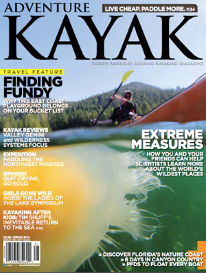
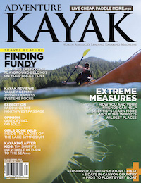
This article first appeared in the Spring 2014 issue of Adventure Kayak Magazine.

Subscribe to Paddling Magazine and get 25 years of digital magazine archives including our legacy titles: RapidAdventure Kayak and Canoeroots.


Discriminating Divas: All-Women Paddling Events

Photo: courtesy Bill Thompson
Discriminating Divas: All-Women Paddling Events

Flappers and card sharks, gangsters and molls, hippies and celebrities. At the Ladies of the Lake Symposium, held every August in Michigan’s Upper Peninsula, the question of what to wear applies as much to the Saturday night costume party as it does to paddling gear.

Themes for the all-women event’s Werner Paddles party have included the Roaring ‘20s, Las Vegas, Prom, Woodstock and the Oscars. Each year, the costumes increase in creativity and complexity.

Shopping at thrift stores and raiding closets is all part of the fun says West Coast paddling instructor Cindy Scherrer, a regular coach and carouser at the event. “It’s usually a cooperative effort with several friends,” she reveals, “We pool the things we find and have a great time putting it together.”

Ladies of the Lake founder Bill Thompson credits Werner Paddles’ marketing manager Danny Mongno for the unusual tradition. It all started, Thompson says, when Mongno was welcoming participants to the 2007 symposium in Manistique.

“He told them, ‘By the way, tomorrow night we’re having the Werner Paddles party and it’s a pajama party,’” Thompson recalls. “Nobody knew he was going to do that, and we thought, we can’t do that! That’ll never fly. But I went out and bought a nightgown and, lo and behold, all the ladies showed up in nightgowns and pajamas.”

It’s that spontaneity and adventurous spirit that Mongno loves about the event. “There is a bit of a feral attitude amongst participants,” he says, “they paddle a bit harder, they laugh a bit harder. The boundaries of the everyday are thrown to the curb.”

THE BIRTH OF LADIES OF THE LAKE

The ladies have been surprising Thompson, co-owner of Marquette outdoors store Down Wind Sports, since he first dreamed up the idea of an all-female paddling event. Inspiration struck while he was thumbing through a special women’s issue of Paddler magazine at the 2003 Great Lakes Sea Kayak Symposium. He mentioned the idea to Jo Foley, one of the female coaches. Within hours, another female coach approached Thompson to inquire about the new event. The first Ladies of the Lake was held the following summer.

LOL is a traveling symposium. From Munising to Marquette, the Keweenaw to the Straits of Mackinac, it’s hosted in a different location in the Upper Peninsula every year.

In 2013, the event celebrated its 10th anniversary in swash-buckling style with a Pirates of Drummond Island theme. Marooned on the remote Lake Huron isle, the motley crew danced, swilled grog and marauded late into the night.

Thompson says the annual theme party is every bit as important as the kayaking. “As silly as that sounds,” he admits, “Ladies of the Lake is really all about friends getting together and letting loose and having a good time.”

When she’s not playing castaway, Sharon Bloyd-Peshkin is a co-founder of Chicago-based Have Kayaks, Will Travel (havekayakswilltravel.com). 


AKv14i1 cover300This article first appeared in the Adventure Kayak, Spring 2014 issue. Subscribe to Paddling Magazine and get 25 years of digital magazine archives including our legacy titles: Rapid, Adventure Kayak and Canoeroots.

You Are Here: The Art & Science Of Mapmaking

woman reads a map while sitting on a log at riverside beside her beached kayak
“I am told there are people who do not care for maps, and I find it hard to believe.” —Robert Louis Stevenson, Treasure Island | Feature photo: Fredrik Marmsater

Maps and charts are magical pieces of paper. Layered with a wealth of information, they can tell us everything from what kind of scenery to expect to where to camp and when to paddle. They can be a source of inspiration, or show you the way home when you are lost. Maps are truly the backbone of any trip, but rarely do we give much thought to how they were created, or by whom.

You are here: The art & science of mapmaking

Maps have been around since at least 2,400 B.C., when they were used in Mesopotamia to show property boundaries for taxation purposes. These maps were largely inaccurate, however, as their creators struggled to draw a bird’s-eye view without leaving the ground.

It wasn’t until 1539 when Dutch mathematician Reiner Gemma Frisius developed a surveying method of dividing an area into triangles—triangulation, as it’s known as today—that cartographers could begin to map large areas with much greater accuracy. It was another Dutchman who first employed concentric lines, or contours, to show areas of equal water depth in 1727. Still, topographic maps using contour lines to represent land elevation didn’t catch on for another 150 years.

woman reads a map while sitting on a log at riverside beside her beached kayak
“I am told there are people who do not care for maps, and I find it hard to believe.” —Robert Louis Stevenson, Treasure Island | Feature photo: Fredrik Marmsater

In North America, most early maps were developed by laborious land surveys. Teams of geologists and surveyors scrambled over the land, documenting, measuring and sketching. It was excruciatingly time consuming, often taking many years just to collect the initial information.

In the 1930s, the U.S. Geological Survey (USGS) started using aerial photography, which significantly increased the accuracy and reduced the development time for new maps. For the first time, cartographers could truly get a birds-eye view of the landscape they were trying to draw.

Modern advances in mapping

Today, the first step in topographic mapmaking is still the collection of aerial photographs by either airplane or low-orbit satellites. The process requires meticulous planning. To get a stereoscopic or 3D image of land elevation, the land is photographed from two different, overlapping angles. The images are then scanned into a computer to extract the topography and convert it into contour lines. The development process for nautical charts is quite similar, but rather than using aerial photography, the sea floor is mapped by ships equipped with specially designed SONAR.

[ Browse the widest selection of boats and gear in the Paddling Buyer’s Guide ]

Field survey staff check accuracy by measuring the exact location of various control points in the area of the new map. There are over 69,000 topographic maps covering North America that must be accurate to within 40 feet. With over 1,000 charts covering over four million square miles, the Marine Chart Division of the National Oceanic and Atmospheric Administration maintains accuracy to within 33 feet.

“Technology has helped speed up the development process of new maps,” says Jean Pinard, a Geomatics Technician at Natural Resources Canada, “but it is still a very time- and labor-intensive process and it’s not uncommon for it to take up to five years to go from initial research to final product.”

It used to be, the more popular the map, the more frequently it was updated and reprinted. As recently as five years ago, paddlers planning a remote trip in some far-flung northern wilds had to content themselves with maps that were last updated in the 1950s. Now, however, all Natural Resources Canada and USGS maps are kept as up-to-date as possible by using a print-on-demand service, enabling quick adjustments and annual updates without waiting for existing print stock to sell out. And of course, there are always the navigation apps if you can’t stand paper.

David Johnston is the founder of www.PaddlingHQ.com. He dreams in rasters and vectors.

Cover of the Summer/Fall 2013 issue of Adventure Kayak Magazine
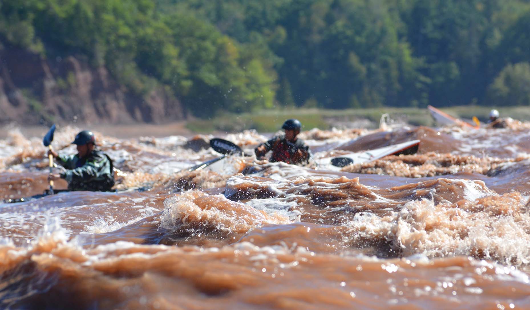
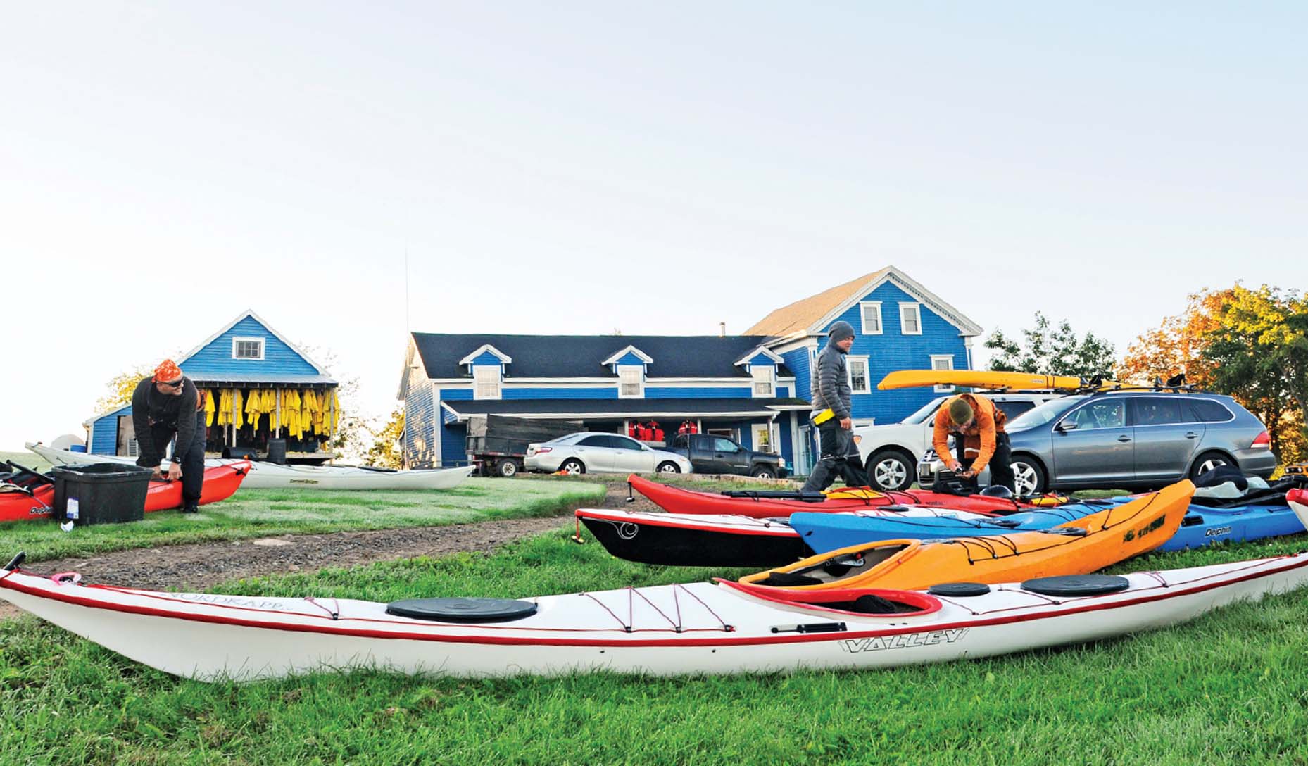
This article was first published in the Summer/Fall 2013 issue of Adventure Kayak Magazine. Subscribe to Paddling Magazine’s print and digital editions, or browse the archives.


“I am told there are people who do not care for maps, and I find it hard to believe.” —Robert Louis Stevenson, Treasure Island | Feature photo: Fredrik Marmsater


Train for the Ocean in Freshwater

Photo: Virginia Marshall

How can Great Lakes paddlers and ocean paddlers in areas like southern California, the Gulf of Mexico and many areas in the southeastern U.S. learn to handle dynamic ocean conditions? Whether you want to prepare yourself for British Columbia’s Skookumchuck tidal rapid or notorious races such as Wales’ Penhryn Mawr, or earn top certifications with any of the major paddlesports bodies, paddling high-volume, class II to III rivers in your sea kayak can improve your skills between trips to challenging tidal environments.

How do river currents compare to the races, rips and overfalls of the ocean?

Whitewater currents are created by gradient, the loss of elevation along the river. The steeper the gradient, the more powerful and technical the whitewater. Ocean currents are created by the tide. The larger the tidal range, the faster, more powerful and technical the currents and features.

Beyond causality, there are differences in the currents themselves. Tidal currents constantly change as the current goes from slack to max and back to slack again (and then turns and goes the opposite direction as ebb changes to flood). Whitewater currents stay relatively constant with the only change due to rising or falling water levels. Many tidal features are significantly affected or amplified by wind and ocean swell, whereas these environmental factors do not really affect whitewater.

Though these are significant differences, there are many similarities when paddling sea kayaks in these seemingly polar environments. Eddylines, standing waves and pourovers are found in both tidal and gradient-inspired currents. How you manage boat speed and position, angle of approach and edging are basically the same. Eddy turns, peel-outs, attainments and ferry glides remain the most common maneuvers. The ability to surf a standing wave on a whitewater river transfers directly to surfing a standing wave at an overfall. Ditto coping with whirlpools.

When selecting a river for practice, look for a high-volume flow, wide deep channels with swift current, numerous eddies and standing waves, and a safe wash-out zone. Avoid technical rivers with obstructions, strainers and tight turns where there is a risk of pinning or entrapment.

Remember the acronym SPANGLES to focus on the main factors for successful maneuvers: Speed, Position, ANGLe, Edge, Stroke.

Begin by practicing eddy turns and peel-outs into current. Exit the eddy near the top— a clean eddyline and perpendicular approach will result in the current pivoting you quickly downstream; you’ll want to approach with more speed if the eddyline is turbulent. Edge down into the turn and use a static low brace for support during the transition.

Next, try ferrying—crossing the main current—and attaining—paddling upstream using eddies to ascend a rapid. Cross the eddyline with speed and a parallel approach so the opposing current is less likely to spin your boat. Edge away from the oncoming current and fine-tune your angle until the kayak glides effortlessly.

With coaching and practice, river features can prepare you to paddle anywhere the ocean beckons.


Ryan Rushton is the founder of Geneva Kayak Center in Illinois. He is an ACA Advanced Instructor Trainer, Swiftwater Rescue Instructor and BCU 5 Star Sea Leader.


AK v12i3 coverThis article originally appeared in Adventure Kayak, Fall 2012. Download our free iPad/iPhone/iPod Touch App or Android App or read it here.

Skill: Build a Debris Hut

Photo: Flickr user JustTooLazy
Debris Hut in Forest.

Squirrels are kings of survival in the forest. Have you ever wondered where squirrels sleep?
 Next time you’re in the forest, look high up in the trees and see if you can spot a ball of dry leaves and twigs nestled in the branches. This is a squirrel’s nest—an insulated home that uses leaves to keep the temperature inside comfortable, just like a debris hut. You too can be a king of forest survival with this fun-to-build shelter that serves as both a tent and a sleeping bag. Each hut is unique and perfectly sized for the person building it.

Materials

  •     One long, sturdy stick roughly twice your height
  •     Rope—about one metre
  •     Lots of smaller sticks—half to one metre long
  •     Lots and lots of debris—leaves, grass, cattails, 
hay and/or straw

Instructions

1. Find a flat spot next to a sturdy tree. Tie one end of your long stick to the tree at waist height and rest the other end on the ground so it makes a ridgepole above the flat area. 


2. Lie underneath the pole with your head at the trunk and use some sticks to mark out your body’s outline on the ground.

3. Lean all of the smaller sticks that you found against your ridgepole with the base of each stick just outside your outline. Place enough sticks to cover your debris hut on both sides and around your feet like a tent. Leave an opening on one side of the tree trunk big enough to crawl through—this will be your door.

4. Cover your new home with all the leaves and debris you can find. A 30-centimetre-thick layer of debris will keep out the rain; an arm’s length will provide insulation for survival through a cold night.

5. Block the door with your back pack or anything else you can find—this will seal in the warmth.


This article first appeared in the 2009 Late Summer issue of Canoeroots and Family Camping magazine. Read the issue in our free iPad/iPhone/iPod Touch App or Android App or read it online here.

This photo is by Flickr user JustTooLazy and licensed through the Creative Commons. 


Humpback Whale Collision

Berthold Hinrichs

Berthold Hinrichs was paddling near Senja island in northern Norway this January when humpback whales began surfacing right beside his kayak. “That day there were about 30 humpbacks and 50 orcas in the bay,” says Hinrichs, who had his camera recording when a humpback surfaced at his side. “It did not capsize me, but [splashed] my camera and me,” he says. Hinrichs was busy drying his camera when “it happend again and then I was on the back of the humpback. I got a lot of water in my kayak, which froze to ice so I had to return to the harbour Hamn i Senja.”

Hinrich’s short film of the close encounter has been viewed worldwide, demonstrating our endless fascination for these friendly creatures of the deep. You can also view a magical 19-minute video from his trip paddling with whales at http://www.youtube.com/watch?v=zxsArgxPcqc

Sweet Water

Photo: Kaydi Pyette
Sweet Water

Don’t be put off by its name; the Katadyn Hiker Pro is as appropriate for backcountry paddlers as it is for those pounding out miles on the trail. The Hiker Pro is a pump water filter that is compact, light and reliable


Katadyn sweetwater


Nov2013 PMThis Field Test gear review originally appeared in the November 2013 edition of Paddling Magazine. Download our free iPad/iPhone/iPod Touch App or Android App or read every issue of this new monthly magazine here.


Make Safe Passage: 7 Tips For Canoeing In The Wind

Two people canoeing on a windy day, train bridge in background
Wind can create some tricky conditions, but these tactics will help. | Feature photo: Image Ontario

Windy days on the water can be exhilarating or frightening, depending upon how you face the challenges they present. By keeping in mind these tips for safe passage, you can cut out the frustration and paddle your canoe on to more sheltered waters.

Here’s our best advice for canoeing in the wind, to keep you safe and frustration-free.

Make safe passage: 7 tips for canoeing in the wind

1 Maintain trim

Your canoe is a weathervane in wind. Avoid pinwheeling by weighing the bow down one to two inches when traveling upwind and weighing down the stern in a tail wind. Don’t go overboard with this method; an end that rides too deep may take on waves.

Two people canoeing on a windy day, train bridge in background
Wind can create some tricky conditions, but these tactics will help. | Feature photo: Image Ontario

2 Quartering waves

The most common advice canoeists receive for travel on windy days is to quarter waves. This means paddling into big waves at a 30- to 45-degree angle, which is effective because it allows the craft to fit between wave crests. While this technique promises a drier ride and a craft that rises faster to meet oncoming waves, it’s not for everyone.

A canoe quartering waves is constantly on the verge of broaching to the wind. One mistake and it’s a potential capsize. For this reason, quartering waves is for experienced paddlers only. Beginners are safer to move closer to the center of the boat, thereby lightening the bow and stern, and paddle head-on into the wind.

3 Running sideways

How your canoe handles waves is generally determined by wave length, rather than wave size. If you have an 18-foot-long canoe and the waves are spaced 14 feet apart, you’re in for a wet ride. Facing those waves head-on could mean swamping.

If head-on running results in a dangerously wet ride and you can’t hold a quartering course, try running broadside to the waves, paddling in the trough between them. Your canoe will fit between the waves and bob like a cork, up one face and down another.

4 Tacking

If you’re looking to paddle to a distant point but are confronted with a side wind, try tacking. If you paddle directly toward your destination, a strong side wind will blow your canoe off course and result in having to paddle back upwind. The solution is to aim 45 degrees upwind of your target and paddle hard—the wind will take you straight to your mark.

5 Same side

Despite what you’ve heard, it’s sometimes okay for canoeists to paddle on the same side. Paddling on the same side—in unison—is the right choice when you can’t hold the course in a quartering or side wind. Paddle on the downwind side of your boat.

6 Rest stop

Take advantage of quiet-water wind eddies that form in bays and around points. Conserve your strength by darting quickly from one protected spot to another, then resting briefly before powering on to the next calm place.

[ Paddling Buyer’s Guide: View all canoes ]

7 Big crossing

Make all open water crossings short and fast by crossing at the narrowest point when possible. Plan on paddling one mile an hour in a heavy headwind and five miles an hour in a tail wind. I’m suspicious of any crossing more than half a mile long with a headwind or five miles long with a stern wind, and will consider changing or delaying my route to avoid it.

Wind can create some tricky conditions, but these tactics will help. | Feature photo: Image Ontario