
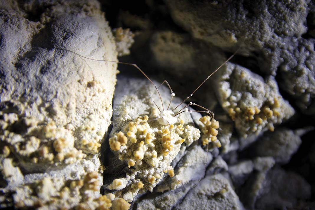
Want to know if the deadly fungus Batrachochytrium dendrobatidis is affecting the Boreal toads and rough-skinned newts on Alaska’s Coronation Island? To find out is no beginner-friendly bit of citizen science. Here’s what you have to do:
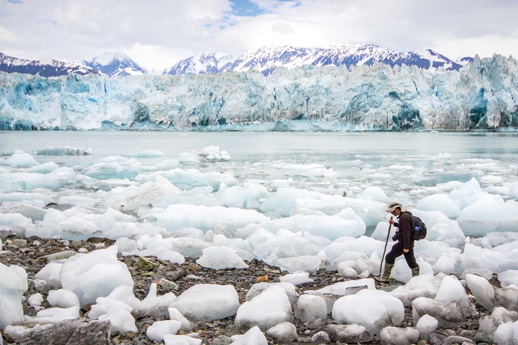
Kayak the foggy and swell-battered outer coast for six days. Land through surf and wrestle with maddening thickets of devil’s club and alder to reach the alpine zone. Catch the elusive amphibians in chilly ponds. Rub a swab along the squirming creature’s belly, then break off the swab’s tip and attempt to air-dry it for five minutes in the notoriously soggy climate. Place the swab in a tube and label it. Bushwhack back down to the coast and launch through the surf. Paddle another 10 days to reach a post office. Mail the samples to a lab in Ohio for analysis.
In Alaska, kayakers go to extreme measures for citizen science
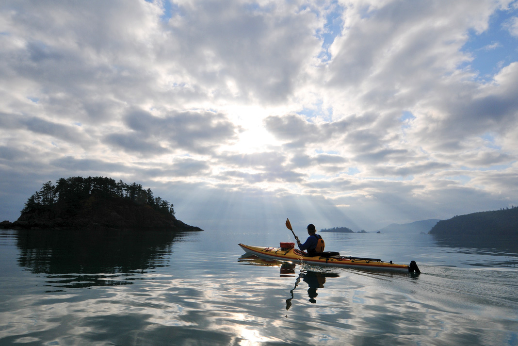
The hardships of conducting field ecology in remote and rugged places like Alaska are legendary. But that same ruggedness draws kayakers from all over the world. The brainchild of Adam Andis, Wilderness Stewardship Director of the Sitka Conservation Society (SCS), the Outer Island Survey partnered experienced kayakers with the Society and the U.S. Forest Service. The expedition represents part of a growing strategy for extending science into wild places using sea kayaks as the vehicles.
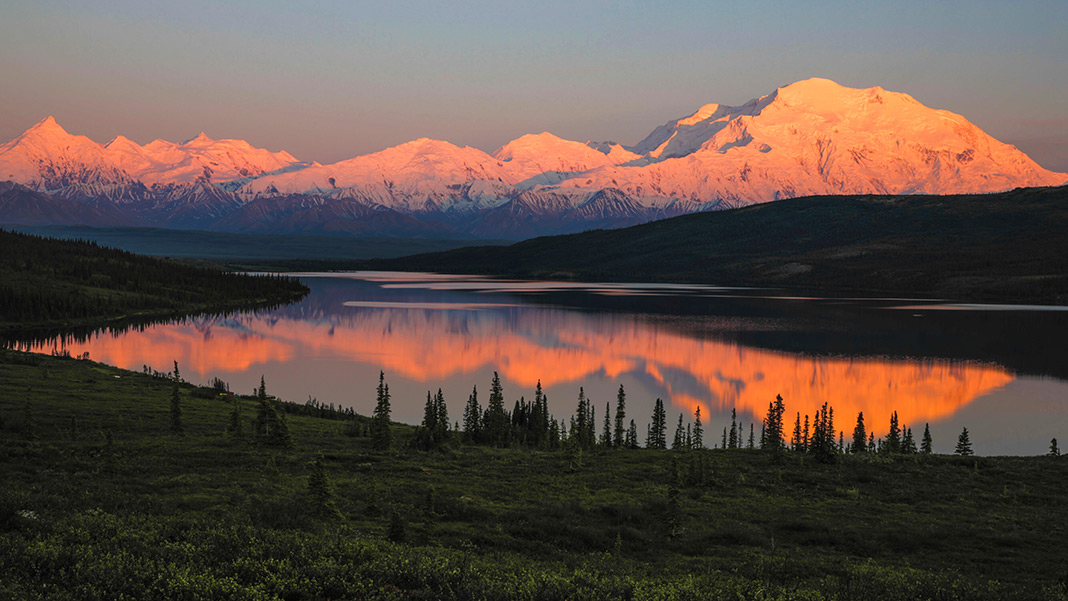
A thick braid of current-swept channels and mountainous islands, Alaska’s panhandle may be small by the standards of the 49th state, but it is still a vast wilderness. The panhandle is dominated by the Tongass National Forest, a single forest larger than the state of Maine. Hemmed between icefields and the North Pacific, travel is by floatplane and boat. The season is short. Weather delays are as common as rain.
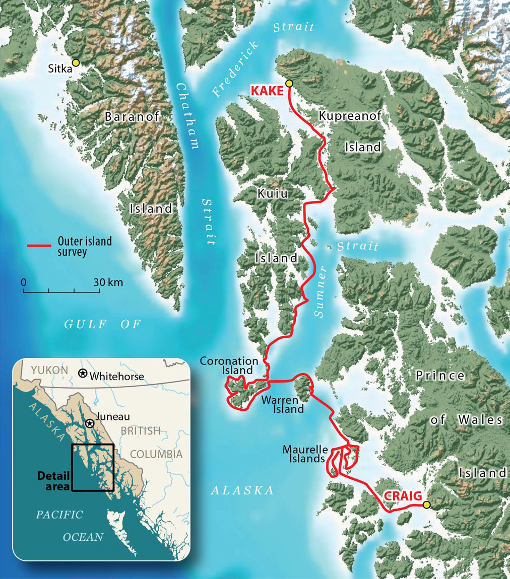
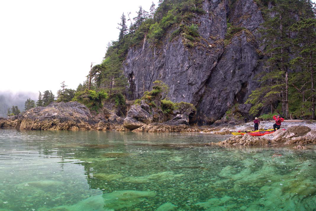
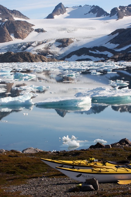
The Kuiu, Coronation Island, Warren Island and Maurelle Islands wildernesses lie in one of the most isolated parts of this already-remote area, clinging to the southwest edge of the panhandle, exposed to the stormy Gulf of Alaska and the massive tidal exchanges of Chatham Strait. In June 2013, the Outer Island Survey team spent 16 days tracing every nook and cranny along 230 miles of this wild coastline, collecting data no one else could.
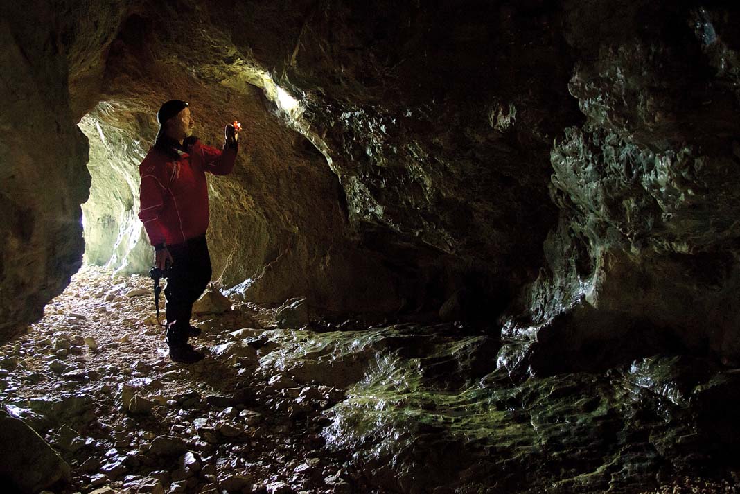
Working from 6 a.m. until well after sundown, they surveyed alpine plants, swabbed amphibians and landed on every single beach to check for invasive plants and signs of human use, from modern campsites to centuries old culturally modified trees. They recorded birdsongs, mammal tracks and every human encounter, including distant fishing boats and airplane flyovers. After dark, they hiked into the woods to play owl calls and listen for responses.
The results of Andis and his team’s efforts will help shape an accurate picture of ecological well-being and human use on these islands, allowing conservationists and land managers to create strategy based on facts on the ground. “We can use the data from the Outer Island Survey to inform management decisions and assess what’s a reasonable carrying capacity for outfitter permits in the wilderness,” says Tory Houser, a Recreation Planner for the Forest Service. The data will also provide a baseline for a 2018 Forest Plan update.
The hardships of conducting field ecology in remote and rugged places like Alaska are legendary. But that same ruggedness draws kayakers from all over the world.
Recruiting skilled ocean paddlers
This rubber-boots-on-the-ground approach to ecology is essential in remote landscapes like Alaska’s Southeast. Far from the watching eyes of land managers, these areas can easily suffer from benign neglect during the long intervals between visits. Camps and boat traffic can intrude into areas meant to be refuges. Sensitive species can decline before anyone notices.

Southeast’s particular geography makes studying the region as critical as it is difficult. Islands like Coronation, far out to sea, will be the last to feel the disruptive effects of invasive species that are spreading across the globe. But if invasive species do make it to Coronation, they will spread like wildfire thanks to the isolated biogeography of small islands.
Southeast Alaska is also the northern limit for many plant species. “We expect forests to move northward with warming trends,” says Lauren Oakes, a researcher at Stanford University who used kayaks to study Alaska yellow-cedar decline, “so the latitudinal margins are a critical laboratory for understanding the effects of climate change.”
Declining Forest Service budgets in the sprawling Southeast have taken “spreading thin” to the point of gross understatement. “We’re lucky if we can get out there once a year,” says Houser. “You charter a boat months in advance, and then you get held up by weather. We couldn’t put in the time you can from a kayak, seeing the shoreline on a slow, intimate level.”
Nor can satellite imagery, LIDAR and Geographic Information Systems provide answers. These gizmos can’t reliably tell a stand of Alaska yellow-cedar from hemlock, let alone distinguish native from invasive plants in the alpine zone where a whole botanical community exists in a single square foot. Satellites can’t spot outlaw cabins hidden under trees, swab newts or measure the elusive feeling defined as “wilderness character” that includes everything from the sound of aircraft to footprints on a beach.
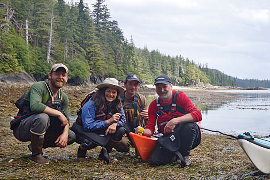
The Sitka Conservation Society has long tapped local paddlers, hikers, hunters and fishermen to report on-the-ground conditions, but the Outer Islands’ pounding surf, open-water crossings, powerful wind and thick fog demanded a more experienced team. Andis, an advanced American Canoe Association instructor and former Alaska sea kayak guide, sought out skilled ocean paddlers from the broader sea kayak community. He recruited Rob Avery, a Seattle-based BCU five-star paddler and veteran of Alaskan expeditions; Cris Lewis, who hails from California’s Half Moon Bay and cut her teeth in the rock gardens of Cape Mendocino; and Paul Norwood, a 13-year Sitka resident, SCS intern and botanist.
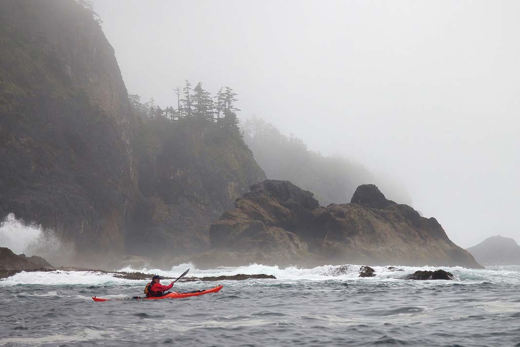
“Nobody but seasoned sea kayakers could go where we went,” notes Avery, “A trip like this requires interpreting the weather and currents, reading the barometer and knowing what the sea will be doing.”
Adding a scientific workload to an already challenging expedition took its toll on the group. Wind slowed their pace, and two expedition members fell ill from the daily grind. On top of coping with sea conditions, complex navigation and camping in bear country, there were data sheets to keep track of, plant presses to keep dry and extra batteries to haul around.
Decisions had to be made for science. “Do we want to paddle six more miles up that inlet and back to survey that beach—yes, we have to,” explains Avery. “You’re not on a pleasure trip. There’s a job to be done and we’re going to do it right.”
Alaska’s natural bounty
There’s another critical element to the hands-on-science done by outdoors lovers: a deep and complex relationship with wilderness. It’s been central to Alaska ever since William Seward scraped together $7.2 million in 1867 to buy 586,412 square miles of wilderness from the Russian Empire.
Alaska’s natural bounty is its raison d’etre. Everyone who comes here, for a week or a lifetime, comes either for the natural environment, for a job related to the natural environment or for a job providing infrastructure to those who are here for the natural environment. As a tourism report dryly notes, “Very few people visit Alaska for the culture or the built environment.” The conflicts that have polarized Alaska over the decades have been about the best use of this bounty: as board feet, fish, solitude or science.
In Southeast, 50-year contracts between the Forest Service and the timber industry after World War II built an economy on logging old-growth trees from public lands and feeding massive pulp mills. Commercial and recreational fishing made up the rest. Conservation gathered steam with the environmental laws of the 1970s, culminating in the Alaska National Interest Lands Conservation Act in 1980, which spawned the state’s vast network of parks and wilderness areas.
By the late ‘80s, both sides in the logging versus environment debate had dug in. Conservation organizations saw the Forest Service as favoring logging and settled on two strategies: litigation and lobbying. Then the ground began to shift under their feet. Tourism overtook timber, then fishing, in job creation and economic impact. As the economic tide turned, wilderness science offered a path to common ground amongst Alaskans who loved the land.
Today, conservation groups still litigate and lobby, but SCS also fights for the Forest Service’s budget, trying to stave off a 50 percent cut in wilderness management and redirect funds from large timber operations toward science and stewardship.
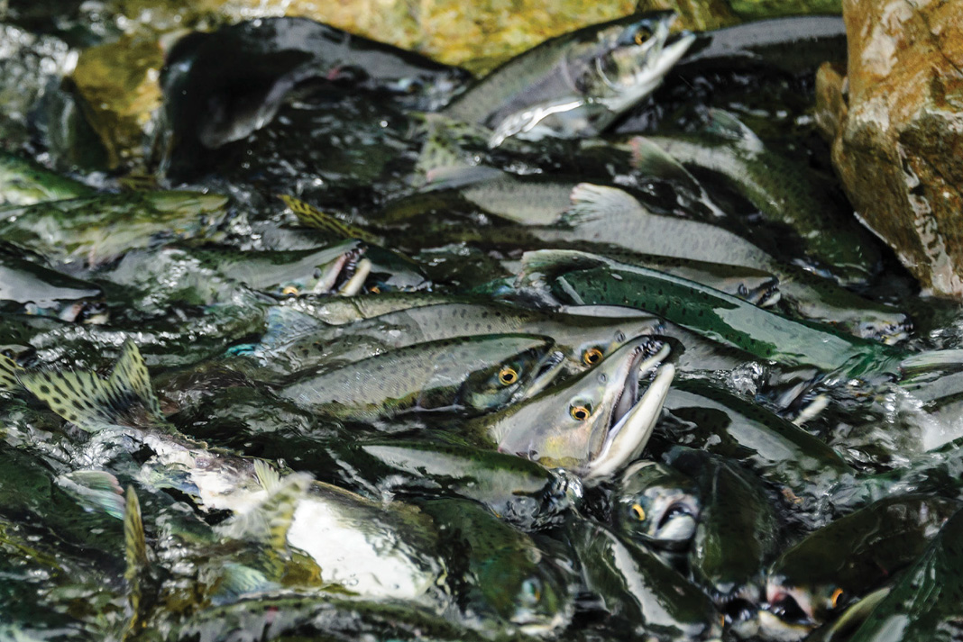
“We’re surrounded by public lands, and we depend on them for subsistence, for our fish and deer and beach asparagus,” says Andis. “All the tourism operators understand viewsheds and pristine areas. They have to.”
In addition to local paddlers ground-truthing proposed timber sales in preparation for appeals, in 2009 the Sitka Conservation Society began running wilderness expeditions to provide the Forest Service with data for management. Two years later, they also helped the Southeast Alaska Conservation Council create similar trips. By 2013, SCS was running 21 expeditions to nine wilderness areas, including nine paddle trips.
Adventurers and scientists for conservation
The trend of paddlers donning lab coats under their PFDs reaches well beyond the borders of Southeast Alaska. “In the sea kayak community, people have always gone on expeditions to raise awareness of one thing or another, but now we’re seeing more involvement in hard science,” says Steve Weileman, who founded The Ikkatsu Project in 2012 with partner Ken Campbell. Through expeditions and films, The Ikkatsu Project monitors and raises awareness of tsunami debris and plastic pollution on the Olympic and Aleutian coasts. Weileman and Campbell conduct beach surveys and water sampling and share their findings with NOAA and other scientific organizations.
SCS runs more paddle-based expeditions each year. But the surface has barely been scratched. “Kayakers, climbers and hikers have the potential to gather data scientists need but can’t access,” says Gregg Treinish, founder of Adventurers & Scientists for Conservation, a Bozeman, Montana-based organization that has been matching adventurers with scientists since 2011. “There’s a potential army of outdoor enthusiasts all around the globe—we have over 1,400 adventurers collecting data for 130 scientists on everything from ocean microplastics to ice worms.”
Nor is a rugged expedition required. “We have samples collected by the world’s best mountaineers and by people going for an afternoon spin across Lake Washington,” notes Treinish.
One of the challenges with citizen science is collecting data accurate enough to be useful. Few paddlers with skills for the open coast can also tell invasive Timothy grass, Phleum pretense, from the native Phleum alpinum, or recognize the song of a Eurasian Collared Dove. The Outer Island Survey team was built to address both. Andis and Norwood’s deep ecological knowledge helped Avery and Lewis recognize and collect useful data. “Paul would say, ‘We’re looking for this plant, here’s where it grows, see if you can find it,’” recalls Avery. “If you have good powers of observation and can be detail-oriented, a non-scientist can contribute.” Andis agrees, “Anyone can take photos, report problem areas, fill out simple data sheets and record GPS points.”
Citizen science closes the gap between trained scientists and outdoor enthusiasts. Anyone can take photos, report problem areas, fill out data sheets and record GPS points.
Matchmaking groups like Adventurers & Scientists for Conservation offer another window onto how to close the gap between trained scientists and outdoor enthusiasts. When someone going on a trip contacts them, ASC scours the scientific literature for related projects. When a scientist wants samples from a particular spot, ASC looks for someone headed there. Scientists use Skype to train adventurers on sampling and surveying techniques, and ASC confirms results with labs and looks for large data sets.
Outer Island Survey member Cris Lewis says there’s another reason to embrace your inner scientist. “If you want to learn the [local] ecology, what better way to do it?” she asks, “That education was part of the magic.”
What drives paddle-powered science
Budding wilderness stewards may well have an even greater impact than paddle-wielding science nerds. During a debate about protecting Southeast’s salmon streams, veterans of the Sitka Conservation Society’s science expeditions generated 60 letters and several hundred postcards. The potential is huge. “Americans spend about the same amount of money on outdoor recreation as we do on cars and gasoline every year,” Andis says, “We just need to put our mouth where our money is.”
Ultimately, a deep love for wilderness drives paddle-powered science. “I suppose I could have done something in my backyard, but in the larger sense, places like Coronation are my backyard,” muses Avery. Andis is philosophical about his chosen craft. “I think doing our work by kayak rather than by floatplane or motorboat is what the writers of the Wilderness Act would have wanted,” he says.
Even as SCS continues to disseminate the Outer Island Survey findings, fundraising is underway for upcoming expeditions. Meanwhile, on Coronation Island, mysteries remain. “Some years we see tons of wolf sign, and then nothing for five years,” notes the Forest Service’s Tory Houser. “What happens? Does the population crash? Do they swim to other islands?” Someday, someone will find out. They might arrive by kayak. One of them might be you.
Extreme citizen science tips
1 Do your research
Make finding scientific opportunities a part of your trip planning. “Is there a friends group? Is there a land manager? Usually the answer is yes, but most people don’t plan ahead or make contact,” says conservationist Adam Andis.
2 Don’t be intimidated
“We were afraid we wouldn’t be taken seriously,” says Steve Weileman of The Ikkatsu Project. “All of a sudden, there were seven PhDs who wanted to meet with us. They thought we were rock stars.”
3 Make it a party
“It’s harder to work with individuals than with groups, for reasons ranging from communication to liability,” says the Forest Service’s Tory Houser. Working with clubs and shops can provide people power and a social component.
4 Use your voice
Let decision makers know you value wild places. “Any time you visit public land, write a quick email that says you appreciate that place and send it to two people: the land manager and your elected official,” says Andis.
Scientists in sprayskirts
From urban waterways to the planet’s most remote coasts, paddlers turned citizen scientists are using kayaks to bring back findings no one else can. Here are a few to look out for:
Adventurers & Scientists for Conservation matches outdoor recreationists with scientists who need data from the field.
Center for Coastal Margin Observation & Prediction uses a sensor-laden kayak to collect data on water quality and algae blooms in the Columbia River Estuary.
The Ikkatsu Project tracks tsunami debris for NOAA on the Olympic and Aleutian coasts.
The Kamchatka Project, a crack kayak team led by Bryan Smith, collected hydrologic and water quality data on pristine rivers in the Russian Far East in 2010.
U.S. Forest Service Kayak Rangers in Tracy Arm-Ford’s Terror Wilderness near Juneau, Alaska, monitor air quality emissions from cruise ships.
Margo Pelligrino, a self-styled “stay-at-home mom who paddles for the ocean,” collected microplastic samples on outrigger journeys along the Atlantic, Gulf and Pacific coasts between 2007 and 2010.
Forest Succession Study at Stanford University used sea kayaks in the summer of 2012 to study the ripple effects of Alaska yellow-cedar decline linked to climate change.
The Cetacean Society and Bay Area Sea Kayakers collect observations of harbor porpoises, which have returned to San Francisco Bay after a 65-year absence.
Willamette Riverkeeper volunteer paddlers monitor water quality on Oregon’s Willamette River.
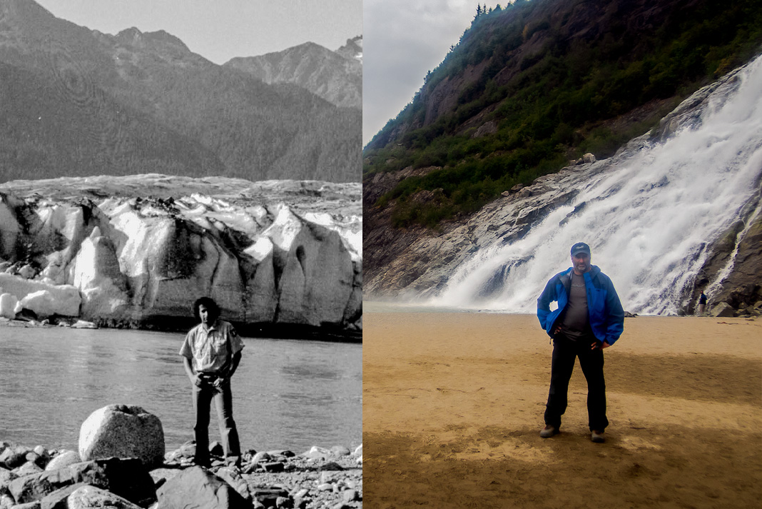
Neil Schulman is a kayaker, writer and co-founder of the Confluence Environmental Center in Oregon. He lived in Southeast Alaska long before cellphones or Google Earth.
 This article was first published in the Spring 2014 issue of Adventure Kayak Magazine.
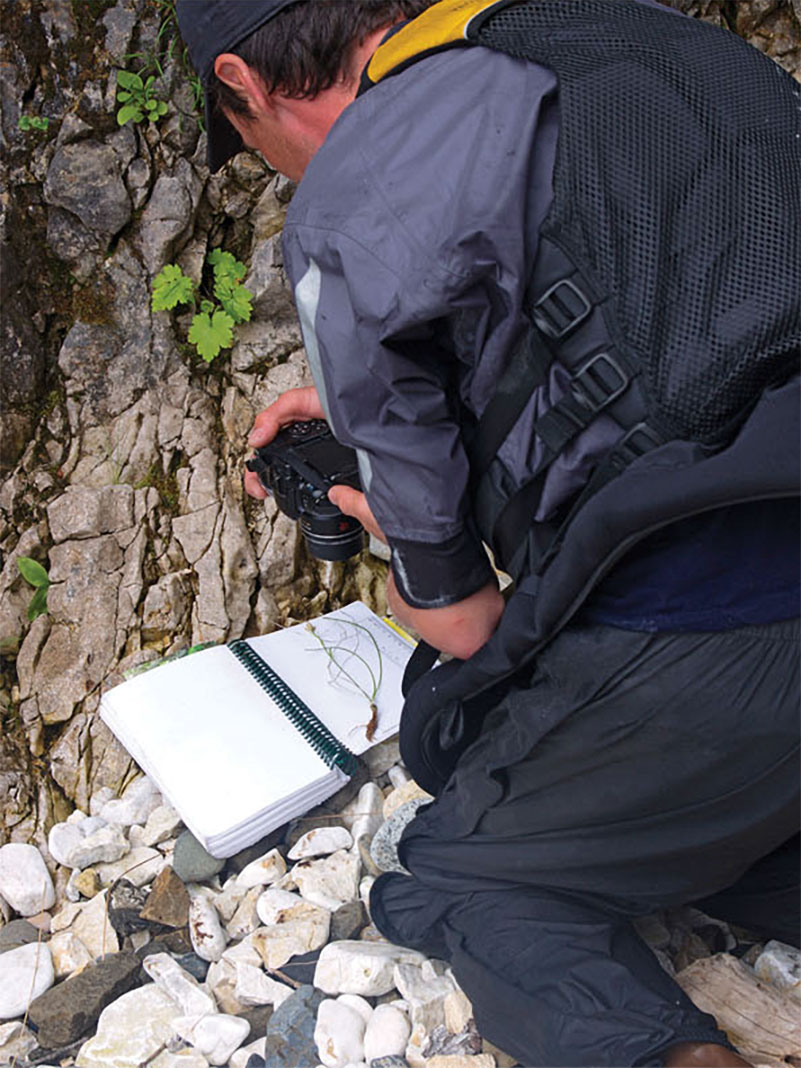
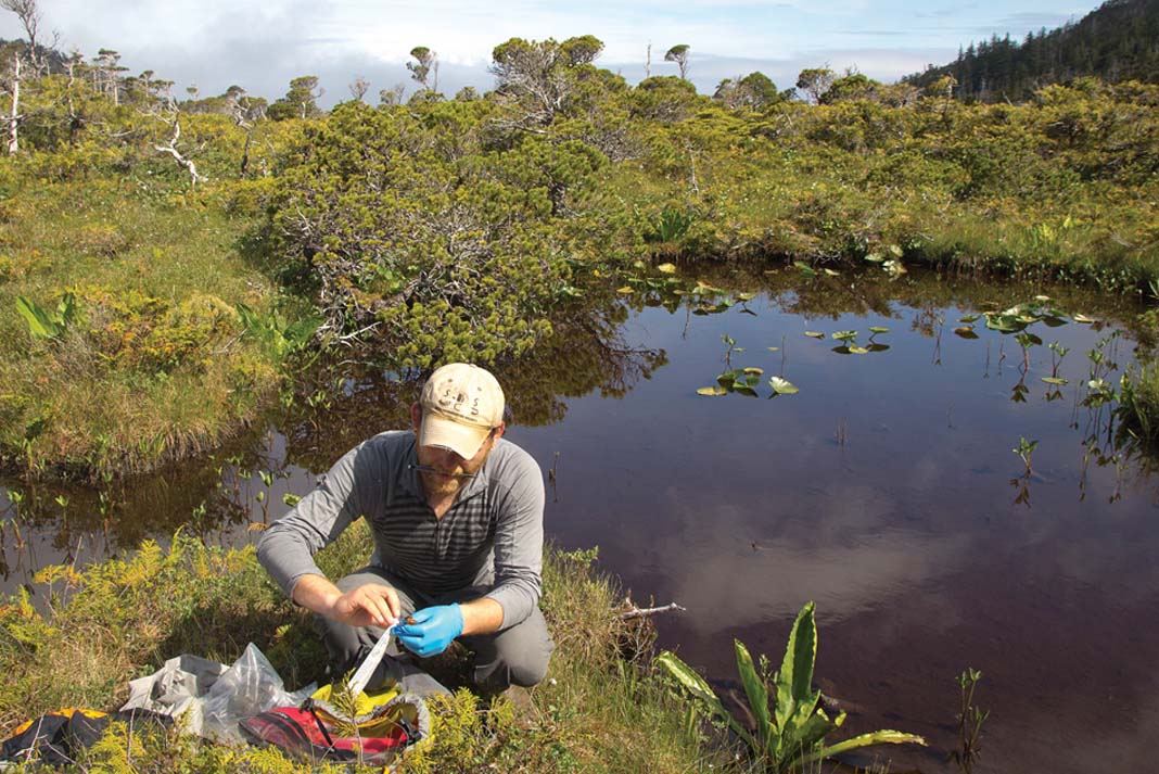
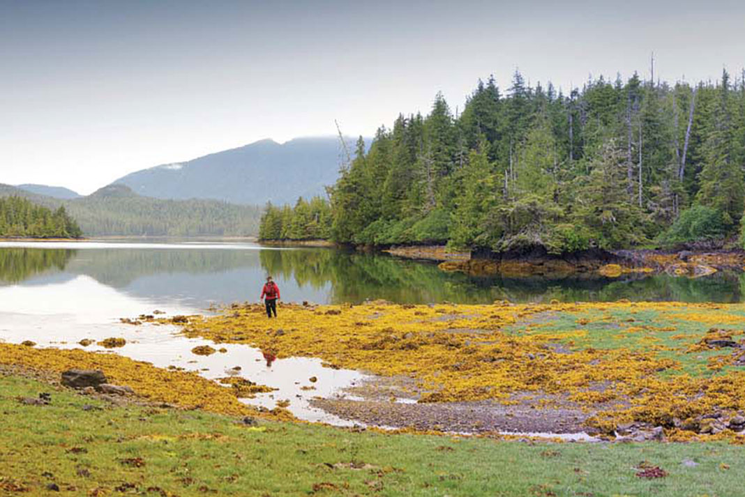
 The Outer Island Survey team landed on every beach to collect data no one else could. On Coronation Island, Paul Norwood makes a botanical inventory. | Feature photo: Adam Andis

 Continue reading this article in the digital edition of Canoeroots and Family Camping, Spring 2014, on our free
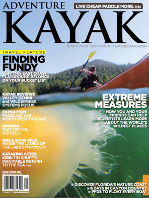 This article first appeared in the Adventure Kayak, Spring 2014 issue.
 This article originally appeared in Canoeroots and Family Camping, Spring 2014. Get more great gear reviews by downloading our free


 This article was first published in the Spring 2014 issue of Rapid Magazine.


