Sadat Kawawa joins Kokatat’s Global Team | Photo Courtesy: Kokatat
ARCATA, CA – Kokatat announced that it has signed Uganda National Team paddler Sadat Kawawa to its Global Team. The paddler from Jinja, Uganda, who grew up on the banks of the Nile, has become one of the words top paddlers.
“Sadat is a great addition to our team as he inspires other young paddlers to follow their dreams through his accomplishments,” said Lisa Kincaid, Kokatat’s Promotional Marketing Manager.
Kawawa was first introduced to the sport by paddlers visiting his hometown to take on the local rapids. He was quickly enamored by the sport and in exchange for carrying boats for tourists he earned paddling lessons and used gear. He quickly progressed in the sport, entered local competitions and went on to international events including multiple World Championships. Last year he won the 2020 King of the Nile.
“I’m proud to be a part of the Kokatat Global Ambassador Team and hope other Black men and boys around the world will see me and know that paddlesports are possible for them too,” said Kawawa.
“Sadat had been on our radar for a while, but thanks to our partners at Diversify Whitewater we learned he was in the market for partnerships and we moved quickly,” added Kincaid.
Diversify Whitewater cofounder Antionette Lee Toscano recently profiled Kawawa for her XOTV channel Whitewater TV and connected Kokatat with him. Diversify Whitewater’s mission is to promote diversity, equity, and inclusion in whitewater paddlesports for Black, Indigenous, People of Color (BIPOC) + Allies to enter and excel at whitewater kayaking, rafting, and stand up paddleboarding.
As part of the partnership Kawawa will paddle exclusively in Kokatat dry tops, dry suits, and life jackets.
To learn more about Sadat and Kokatat’s team of paddlers visit kokatat.com.
Sadat Kawawa joins Kokatat’s Global Team | Photo Courtesy: Kokatat
About Kokatat Inc.
Kokatat has been manufacturing paddling gear in Arcata, California for 50 years. At a time when many technical apparel brands were moving manufacturing offshore, Kokatat continued to invest in infrastructure in the United States. Kokatat founder Steve O’Meara was committed to the development of the finest and driest paddling apparel in the world and recognized the need to control and continually evolve the development of our dry wear. In the early days, Kokatat worked closely with W.L. Gore & Associates, makers of GORE-TEX®, to refine the sewing and sealing techniques required for full immersion suits and tops. Today, our hands-on approach to manufacturing continues to set the standard in paddling apparel. Into the water with Kokatat! Learn more atkokatat.com
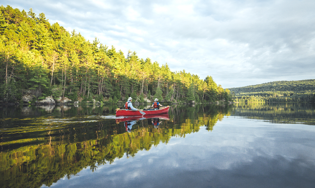
You'll enjoy the peace and serenity on a well-planned canoe trip. | Photo courtesy of: Destination Ontario
Every Algonquin Park visitor wants to experience the park’s iconic lakes, trails and campgrounds, but Algonquin’s sprawling geography makes it challenging to know where to start. Add to its immense size the fact that only a small fraction of the park is accessible from the main Highway 60 corridor, a detailed, easy-to-use Algonquin map becomes just as essential as a good pair of hiking boots.
You’ll enjoy peace and serenity on a well-planned canoe trip. | Photo courtesy of: Destination Ontario
Google Maps and other mapping apps can give you a general idea of where to find Algonquin Park access points and specific attractions, but aren’t suitable for navigating in the backcountry. To explore the park’s vast interior of maple hills, rocky ridges and thousands of lakes, ponds and streams, you’ll need an Algonquin Park trails map or Algonquin canoe routes map. Read on to discover our picks for the best Algonquin Park interior map, Algonquin backcountry map and Algonquin Park lakes map.
[This article is part of the Ultimate Algonquin Park Travel Guide. Find all the resources you need to plan an adventure-filled trip to Algonquin Park.]
The backcountry of Algonquin Park doesn’t really have specific canoe routes—instead, there is a vast, interconnected canoe route network so you can plan an almost infinite number of possible trips. Planning an enjoyable trip for your group starts with a good Algonquin Park map of lakes and routes.
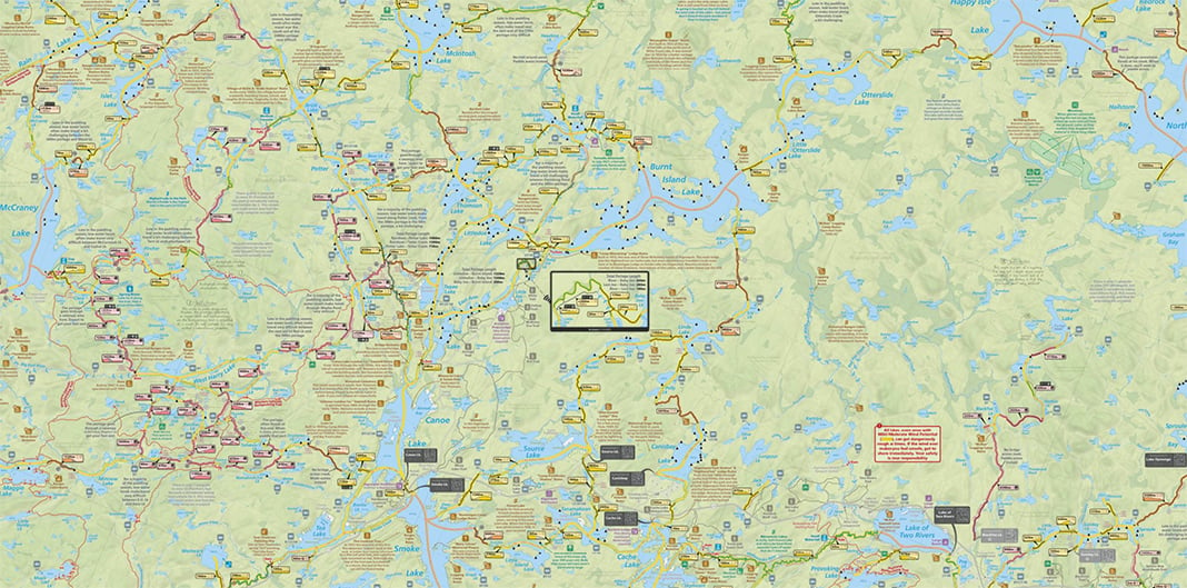
Official Algonquin Park canoe routes map
The official Canoe Routes of Algonquin Park Map contains all the basic information required by Algonquin Park’s backcountry canoeists. The map illustrates canoe routes, campsites, portages, lakes, access points and more. The reverse side of the map provides detailed information about planning your Algonquin Park adventure including safety information and equipment requirements. This official map receives annual updates by park staff working in Algonquin’s backcountry who are responsible for maintaining the canoe routes network, making it indispensable for park visitors planning an interior canoe trip.
Browse a virtual version of the backcountry canoe tripping map for Algonquin Park here. Purchase a full-sized printed copy to take with you on your trip—the official paper map is available from the Friends of Algonquin Park for $4.95, with 100 percent of proceeds supporting Algonquin Park.
Plan the ultimate canoe trip with this highly detailed map. | Photo: Courtesy of Maps by Jeff
Maps by Jeff’s Algonquin Park Paddling Maps
A lifelong paddler-turned-mapmaking entrepreneur, Jeff McMurtrie parlayed over 600 days exploring and mapping Ontario’s canoe routes into a collection of park maps that have become the gold standard for Algonquin canoe trippers. Jeff’s Algonquin Park Paddling Maps go beyond need-to-know details like access points, lakes, campsites and portages—adding super helpful features like travel times for canoe routes and backpacking trails, outfitter information, fish species for each lake, tons of natural and historical hidden gems, unofficial start points, portage elevation and more. These maps are also relentlessly accurate; frustrated by playing “find the missing campsite” one too many times, McMurtrie mined historical records and combed online canoeing resources to meticulously fill in any details he didn’t ground-truth himself.
[ Paddling Trip Guide: View all paddling trips in Algonquin ]
Algonquin Park is a big place, so there are five double-sided maps with overlapping sections to give trippers a detailed 1:50,000 scale while keeping the map sheet a manageable size for unfolding on the trail or in your canoe. If your map does end up in the lake, not to worry—Jeff’s maps are waterproof, tearproof and float! $25 each with discounts for each additional map you buy.
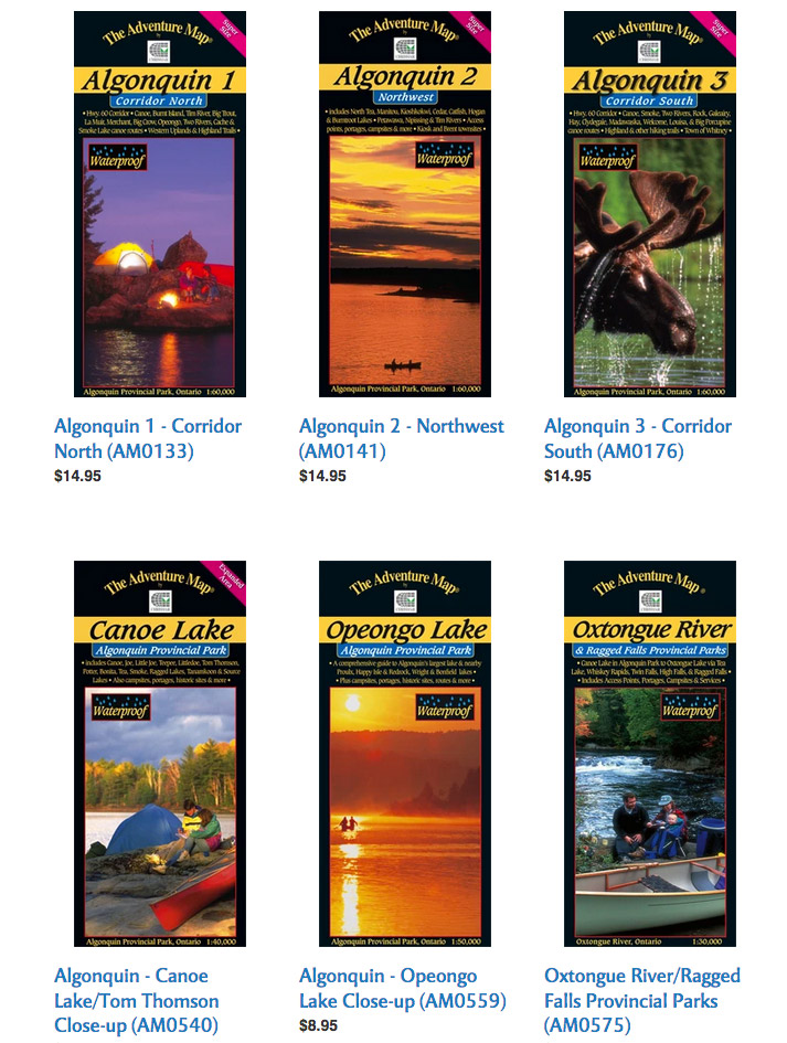
The Adventure Map – Algonquin Park Map Series
The Adventure Map – Algonquin Park map series
If you’re looking for an Algonquin backcountry map with terrific detail of a specific area of the park, Chrismar’s Adventure Map Algonquin Series is a great choice. Offered at close-up scales of 1:30,000 or 1:40,000, as well as broader overview scales of 1:50,000 or 1:60,000, each Algonquin Park interior map features excellent terrain, vegetation and contour detail making for easy-on-the-eyes navigation. Adventure Maps include campsites, portages, access points, hiking trails, historic sites and other attractions. The back side of each map is perfect for campfire reading with extensive text, photos and graphics describing the area’s natural and human history, route suggestions, safety tips and more.
The Adventure Map Algonquin Series features eight waterproof print maps, including close-up maps of popular areas like Canoe Lake, Opeongo Lake, Oxtongue River and Barron/Achray. $9.95-$16.95 each.
Algonquin Park whitewater guides
For experienced canoe trippers planning a downriver journey on one of Algonquin Park’s whitewater rivers, these spiral-bound guidebooks are indispensable. Detailed maps outline the route, rapids, portages and river conditions. The Petawawa River Whitewater Guide and Madawaska Opeongo Whitewater Guide are available from the Friends of Algonquin Park for $5.95 and $9.95 respectively.
Algonquin Park Ontario Adventure Topographic Map
More Algonquin backcountry maps
A handy companion to any Algonquin route map is Backroad Mapbooks’ Algonquin Park Topographic Adventure Map. Updated for 2021, this waterproof topographic map features a 1:75,000 scale map of the Highway 60 corridor on one side and a 1:140,000 scale map of the entire park on the other. The Algonquin topographic map includes suggested paddling routes, campsites, trails, outfitters, wildlife and fishing information, and details winter adventures so you can use it year-round.
Once you have a sense of where you want to paddle, Ontario Parks’ online reservation for Algonquin backcountry campsites provides a basic Algonquin Park lakes map with campsite availability in the vicinity of each interior access point. Before making your reservation, you’ll need to know your intended Algonquin Park access point and have a good idea of your route, including daily mileage that’s reasonable for your group. Keep a backcountry canoe routes map or backpacking trails map handy while making your reservation, in case modifications have to be made to your trip.
Algonquin Park maps for hiking and backpacking trails
Want to hike the popular Lookout Trail or tackle a three-day loop on the Highland Backpacking Trail? Many of the Algonquin Park interior maps used by canoe trippers are also suitable for navigating the park’s three backpacking trails and 20 interpretive hiking trails. Maps by Jeff’s Algonquin maps, Chrismar’s Adventure Map Algonquin Park series and Backroad Mapbooks’ Algonquin Topographic Map (see above) are excellent choices for visitors exploring the park on foot.
An official Algonquin Park Backpacking Trails Map is published by the Friends of Algonquin Park. Each of the park’s three backpacking trails is detailed with its own scale and map displaying designated campsites, and the “Planning Your Trip” section offers helpful hints to ensure an enjoyable trip. Updated for 2022/2023, $2.95.
You can also download Jeffrey McMurtrie’s free Backpacking Map of Algonquin Park from Algonquin Outfitters. Like all of Jeff’s maps, this set of three, close-up topographic maps shows Algonquin’s backpacking trails in vivid, user-friendly detail. Each map includes hiking times, campsites and historical and scenic anecdotes.
Algonquin Park campground maps
Algonquin Provincial Park’s beautiful, fully serviced vehicle campgrounds make it easy to enjoy a few nights in the park without backcountry camping. Eight of the park’s developed campgrounds are centrally located along Algonquin’s Highway 60 corridor, while three more campgrounds service visitors to the park’s northern and eastern access points. View Algonquin campground maps and learn more about car and RV camping in the park here: Camping in Algonquin Park: 9 Breathtaking Campgrounds.
Where can you buy an Algonquin Park map?
Purchase Algonquin Park canoe route maps, Algonquin Park trail maps and other Algonquin Park backcountry maps and trail guides from the Algonquin Park Visitor Centre in-person or online from the Friends of Algonquin Park map store.
You can also buy Algonquin Park maps from many park outfitters, an especially convenient option if you’re already renting canoes or equipment from these outfitters. With multiple locations in and around the park—and a comprehensive map shop that sells nearly every Algonquin Park map mentioned in this article—it’s hard to beat Algonquin Outfitters for convenience and selection.
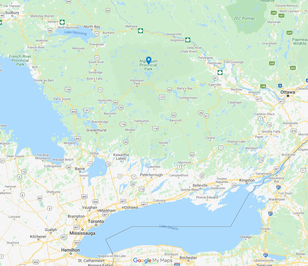
Algonquin Provincial Park is easy to access. | Photo courtesy of: Google Maps
Where is Algonquin Park on a map?
Situated in central Ontario, accessible to Toronto and Ottawa, Algonquin Park encompasses a vast area of more than 7,500 square kilometres. View a map of where to find Algonquin Park here.
There are so many ways to explore Algonquin Park. | Photo courtesy of: Destination Ontario
Registration opens Feb. 14 for 22nd Yukon River Quest
Registrations will be accepted beginning February 14, 2021 for the 22nd Yukon River Quest (YRQ), which will be held June 23 to June 26, 2021. The event was cancelled in 2020 but will go forward this summer under COVID-19 health and travel mandates. As such, race registration will initially be limited to Yukon and Canadian teams only. Yukon teams currently on hold from the cancelled 2020 event will be registered first.
All international teams that were previously registered from 2020 will be withdrawn but will have the option of getting on a wait list for entry if travel restrictions are lifted before the race. They will not lose their spots in the queue.
The 715-kilometer (444-mile) marathon paddling race is run on the Yukon River from Whitehorse to Dawson City in Canada’s Yukon Territory during the last week of June. The race passes through the traditional lands of five Yukon First Nations and honours the cultures of those who have lived off the river and nurtured it for centuries.
The “Race to the Midnight Sun” for many years was the world’s longest annual paddling race and remains unique because teams race round-the-clock on a wilderness river and under a sky that never gets dark.
The allure of the Yukon River has made the YRQ a huge success. In the two years preceding the COVID pandemic, more than 100 teams registered, prompting race officials to adjust the team registration limit to 125 teams. During the last race in 2019, a record 117 teams were at the start line, and 86 of them finished.
The 2021 race may be limited in numbers due to health mandates, and several COVID-prevention procedures are in the process of being adopted in order to have a safe event on the river and in our communities.
For example, Canadian teams outside of the Yukon and any support crew members in their bubble currently would have to quarantine in the territory for 14 days prior to the event. It is hoped some restrictions will be modified as we move into summer, but the health of our territory’s residents, along with our volunteers and paddlers, is top priority. For current Yukon and Canada health and travel mandates visit:
Yukon: https://yukon.ca/en/covid-19-information
Despite anticipated restrictions, the race will go on. Peter Coates, president of the Yukon River Marathon Paddlers Association (YRMPA), explained the board’s reasoning for moving forward with a race in 2021:
“The race will happen, come hell or high water, preferably high water.”
“The race will happen, come hell or high water, preferably high water. People need something to look forward to, and even if it is just a local race it keeps the name alive,” Coates said.
Online entry forms are available starting at 14:00 (2 PM) Mountain Standard Time on February 14 via a link under the Register tab on the race website https://www.yukonriverquest.com. Entry fees for the full YRQ are: $650 per solo team (C1, K1, SUP); $950 per tandem team (C2, K2); and $1550 for a C4 team, $2150 for a 6-person voyageur canoe (VC) team, and $2750 for an 8-person VC. Payment is required at time of registration to secure a spot.
While the overall limit of 125 teams likely will be reduced, there also is a voyageur canoe limit of 15 teams, and a solo team limit of 50 teams. Solo paddlers who have not completed a YRQ must provide a satisfactory paddling resume prior to registration to demonstrate that they have sufficient marathon racing or wilderness paddling experience. Paddling resumes should be e-mailed to the race office at info@yukonriverquest.com. See the registration page for more details.
New this year for teams that want to get a feel for the race but not commit to the full YRQ experience is the Half Quest, which will end in Carmacks. A separate set of rules including entry fees is now posted on the website. It is hope that a lot of local Yukon teams will take advantage of this opportunity to race on the river.
Regardless of which race you choose, you need to be prepared.
“Prospective paddlers thinking about entering need to be aware that this is a race that is tough mentally and physically,” Coates said. “Be prepared to be cold and sore, mentally and physically exhausted, out in the middle of nowhere. A very beautiful but unforgiving nowhere. Do not enter on a whim, but only if you are up to the challenge.”
All paddlers should become familiar with details in the 2021 YRQ COVID Rules, which are posted in English on the website, along with several preparation tips.
Each team is required to have a SPOT, IN REACH, or similar tracking device mounted on top of their vessel and activated for tracking before the team is officially allowed to race. This requirement allows teams to be able to be tracked during the race from links on the Yukon River Quest website. Following the actual race live online has been hugely popular with spectators all over the world. During recent races, the reach exceeded more than 30,000 via the event’s Facebook and Instagram pages.
Total possible prize money for the full YRQ remains at $42,830, based on 100 teams registered by June 1. The purse is adjusted upward or downward by a percentage point based on the final number of teams registered above or below 100. The top three male, female and mixed teams per class receive prize money as long as they beat another team in its class and finish within 25% of the top team in the class. Bonus prize money also will be given in several areas to: the top 10 teams overall; any team that breaks a record in its class; the top All-Indigenous team; the top Yukon male, female and mixed teams; the top senior team (age 55 and over), and the top young adult team (age 19-24). Several special awards are also donated by Yukon sponsors. A complete prize breakdown can be found in the race rules on the website.
There will be no prize money for the Half Quest in this experimental year. However, many do the race for the personal satisfaction of staking their claim to a
coveted YRQ Finisher Pin (there also will be Half Quest pins). Paddlers who have finished multiple YRQs also now covet entrance into the “Great River Club” which was
unveiled for the 20th anniversary. Racers who have logged 5,000 and 10,000 kilometers are members of that club and receive special pins. For more information visit the Great River Club page https://www.yukonriverquest.com/great-river-club/ ”
The full race is all about endurance. Aside from two mandatory layovers at Coal Mine Campground in Carmacks and Minto Resorts (new this year), teams paddle non- stop to reach Dawson City. Teams in the full YRQ will have the option of choosing their rest times at the two layover locations, as long as they add up to 10 hours.
The YRQ course record still belongs to Canadian voyageur Team Kisseynew’s winning time of 39 hours, 32 minutes, 43 seconds in 2008. The 2019 overall winning time was 44:59:10 by the C2 team #wepaddletogether (Mike Vincent and Ivan English) of Saskatchewan, Canada.
The race’s continued success depends on hundreds of dedicated volunteers, who are greatly appreciated by our racers and have a good time helping out during the last week of June. Various volunteer opportunities are listed under the Volunteer page on the website, where you can see the various jobs and shifts and sign up online.
Watch for a schedule and more news about YRQ events as we move into spring. YRMPA also welcomes new members.
The Yukon River Quest is the premier paddling event in Canada’s North and is widely recognized throughout the paddling and adventure racing world. It has been featured in numerous publications, online, and in shows on NBC-TV, the BBC, and the CBC. The YRQ was named one of the ten toughest races in the world by renowned adventure racer and “Boundless” TV star Simon Donato. The race typically draws an international field, which we hope will be back in 2022. In 2019, 13 countries were represented.
The race was beautifully featured a decade ago in the National Film Board of Canada’s critically acclaimed “River of Life” about Paddlers Abreast, a voyageur team of Yukon breast cancer survivors that races every year. In 2021, they will be celebrating their 20th anniversary. Many other worthy causes have been represented as well.
Major logo-level sponsors are: Yukon 1000 Race Timing Software, Gold Trail Jewellers, Paddel Jumper, CKRW-The RUSH, Air North, Kanoe People, Whitehorse Star, PR Services-yukoninfo.com, Pepsi–Aquafina, City of Whitehorse, Up North Adventures, Superior Roofing YT, Total North Communications, Yukon Civil Air Search & Rescue (CASARA), Yukon Wide Adventures, The Coal Mine Campground, Minto Resorts, Fireweed Helicopters, North 60 Petro, and Make IT Solutions.
Many small businesses also have supported the race by sponsoring paddler bibs – see details on the website or contact the race office at 867-333-5628.
For more information, view the pre-registration instructions, rules, and numerous paddler preparation links at www.yukonriverquest.com and watch for updates on Facebook.
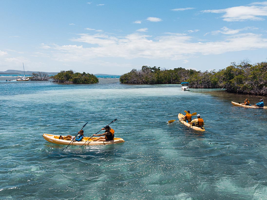
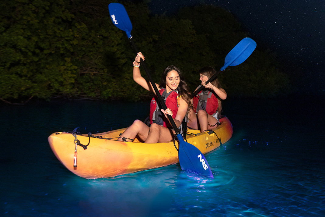
Bioluminescent kayaking is an otherworldly experience. | Photo courtesy of: Discover Puerto Rico
Nestled between the Dominican Republic and the British Virgin Islands, the archipelago of Puerto Rico is a premier paddling destination for many reasons—but only one of these reasons is almost entirely unique to Puerto Rico. There are only a handful of bioluminescent bays in the world—and Puerto Rico is home to three of the best.
The rare glow-in-the-dark effect is caused when single-celled organisms (dinoflagellates) are stimulated by movement, including paddles moving through the water. During night kayaking in Puerto Rico, the water of these bays lights up with swirling neon blue-green trails, like something out of the movie Avatar.
During the daytime, you can find family-friendly and beginner-level excursions to the territory’s colorful coral reefs, mangroves and white-sand beaches. Puerto Rico is an easy five-hour direct flight from Toronto, and its waters make for some of the most pleasurable paddling in the Caribbean.
So much beauty you won’t know where to look. | Photo: Courtesy Discover Puerto Rico
Best places to kayak in Puerto Rico
Even though the mainland is relatively small—it’s only 180 km across at its longest point—it can be hard to narrow down exactly where to go kayaking in Puerto Rico. Here are our favorite spots for snorkeling, swimming, standup paddleboarding and, of course, kayaking.
San Juan
In San Juan, the capital of Puerto Rico, cruise ships dock near Old San Juan. Since we suspect your watercraft of choice is a wee bit smaller, we’d recommend heading farther away from the main city area and toward the tourist-friendly resort strips of Condado and Isla Verde.
At Condado, you’ll find “the lagoon.” Known as Laguna del Condado, this popular snorkeling spot is well-maintained. You have a good chance of spotting fish, turtles and even manatees in the waters below. Kayak and SUP rentals are available seven days a week from San Juan Paddleboarding at Parque Benitez on the edge of the lagoon.
If the lagoon feels a bit too touristy, head 20 minutes east to the laidback Piñones Beach instead. Here, you’ll find the Torrecilla Lagoon, which has mangrove forests and islands to explore. It’s also a bargain; the COPI Cultural Center offers hourly kayak rentals for a donation of $10.
Laguna Grande in Fajardo
If you want to kayak among the blue-green bioluminescence in Puerto Rico, Laguna Grand is the closest spot to San Juan to do so; it’s only an hour drive east near the town of Fajardo. But if you’re dreaming of living that dreamy bioluminescence scene from Leonardo DiCaprio’s The Beach, think again. In order to protect the lagoon’s unique ecology, swimming isn’t allowed. (Pyrodinium bahamense requires clear waters to complete the process of photosynthesis. Entering the water can stir up the bottom and make it murky, and adds pollutants like insect repellents, sunscreens and deodorant in the process.)
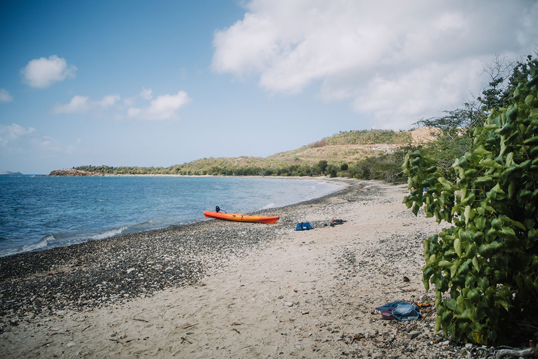
Paddle out to secluded beaches—the rest is up to you. | Photo courtesy of: Discover Puerto Rico
Vieques Island’s Mosquito Bay
Located less than 10 km from the main island of Puerto Rico, Vieques Island’s Mosquito Bay may be more difficult to get to than some of the other spots on this list (you can catch a small plane for under $100 USD or take a ferry from the town of Ceiba, which takes about 40 minutes). But it’s one of the best places to kayak in Puerto Rico for good reason—this is where you’ll find the world’s brightest bioluminescent bay.
Like Laguna Grand, swimming isn’t permitted in Mosquito Bay, but the stroke of your paddle will be more than enough to create glowing trails in the water. During the daytime, this destination also has numerous reefs teeming with colorful fish that you can kayak out to.
With a focus on social responsibility and supporting the surrounding community, Black Beard Sports runs daily tours of the area, including to small islands and pristine beaches, through mangrove tunnels, and to the bio bay at night in tandem, clear-bottom kayaks.
Culebra Island
About 27 km east of the mainland is where you’ll find Celubra, an island oasis of secluded beaches, reefs and cayos (sandy islands surrounded by coral reefs). Since it attracts many species of sea turtles, it is also one of the best places to snorkel and kayak in Puerto Rico.
The best way to experience both activities is with Kayaking Puerto Rico’s two-hour “aquafari.” After kayaking to Flamenco Beach, you’ll have the opportunity to snorkel among the rich sea life in the Luis Peña Marine Reserve.
La Parguera in Lajas
The southern coast of Puerto Rico is where you’ll find some of the territory’s best beaches and mangroves, along with countless kayaking tour operators. But we’re kind of burying the lead here—this is also where you’ll find the only bio bay in Puerto Rico you’re allowed to swim in. The blue effect will coat your body, but consider this fair warning: there may also be jellyfish in the water.
La Parguera is located a two-hour drive southeast of San Juan in Lajas. Kayaking Parguera offers rentals, including hands-free (pedal-drive) kayaks, as well as tours of the mangrove tunnels and the bioluminescent bay.
When you’re vacationing on an island, there’s no excuse to not get out on the water. | Photo courtesy of: Discover Puerto Rico
Isla Ratones
On Puerto Rico’s eastern coast near Cabo Rojo, you’ll find the boat-access-only Isla de Ratones reserve. A family-friendly excursion, the island has white sand, mangroves, coral reefs and clear waters, making it perfect for all ages of paddlers. Pack for a full day: you won’t find much here, but there are picnic shelters (complete with barbecue pits) and washrooms.
In addition to shuttling tourists back and forth to the little island and running sightseeing tours of the wider area, Adventures Tourmarine offers kayak gear rentals.
Interior
In a Caribbean country, straying far from the coast might seem like an unusual choice—but those who do so will be rewarded with uncrowded waterways (including some 50 rivers) and more immersive cultural experiences.
To get started, head 45 minutes south of San Juan to Lago Carraizo. This is where you’ll find kayak and standup paddleboard rentals with Paddle Paradise.
With balmy weather and crystal-clear waters year-round, there’s arguably no bad season to go kayaking in Puerto Rico. There is, however, a bad time to kayak on a bio bay.
While bioluminescence isn’t seasonal—it can technically be seen at any time of year, on any night—tides, water temperatures and storms all have an effect on its brightness. But the factor that matters most is how dark the night’s sky is. Plan your visit to coincide with the darkest nights of the month, which are typically on either side of a new moon.
Puerto Rico is one of the only places in the world you can kayak on a bioluminescent bay. | Photo courtesy of: Discover Puerto Rico
What to wear kayaking in Puerto Rico
Trying to figure out what to wear? As with any kayaking trip, be prepared to get wet—wear a bathing suit and, if available, water shoes. Water-repellent layers will also be key. If you’re kayaking during the daytime, sun protection is a must.
If you’re night kayaking and plan on swimming in a bio bay (La Parguera being the only bay where this is officially allowed), avoid wearing sunscreen, insect repellent or any other personal care products; they can harm the organisms and dim their magical blue qualities.
Bioluminescent kayaking is an otherworldly experience. | Feature photo: Courtesy Discover Puerto Rico
Photo courtesy of: State of Alaska // Jocelyn Pride
Considered one of the world’s greatest paddling destinations, there’s no end to Alaska sea kayak adventures. It’s one of the few places in the world where you can paddle past towering icebergs, watch orcas and humpback whales at play and explore the glacial blue depths of ice caves—all in one day.
The northern state is perhaps best-known for its sea kayaking, although it offers whitewater of all classes for more experienced paddlers deep in its remote wilderness. Whatever route you choose to take—whether it’s the calm waters of a glacial lagoon or down fast-moving river rapids—you’ve come to the right place.
From afternoon excursions for beginners to multi-day expert adventures, here are the best places to kayak in Alaska.
Natural beauty is everywhere you look in Alaska. | Photo courtesy of: State of Alaska // Chris McLennan
Best places to kayak in Alaska
Alaska has a long and rich history of kayaking; qayats, made of animal skins sketched over wooden frames, have been used here by the Indigenous people to hunt marine animals for thousands of years.
It also has plenty of coastline to explore—54,563 km of it, to be precise. But if you’re trying to figure out exactly where to go kayaking in Alaska, it’s best to narrow your search to the southernmost part of the state in the Gulf of Alaska. This is where you’ll find some of the best places to kayak, including:
Seward’s Resurrection Bay and the nearby Kenai Fjords National Park
Prince William Sound, which can be accessed from Whittier or Valdez
Spencer Glacier near Anchorage
Kachemak Bay outside of Homer
The Inside Passage, with day trips departing from Sitka and Ketchikan
Kayaking in Seward, Alaska
Located about 2.5 hours south of Anchorage, the city of Seward is tiny (pop. 2,700) but its kayak tours and adventures are a massive operation, extending into nearby Kenai Fjords National Park.
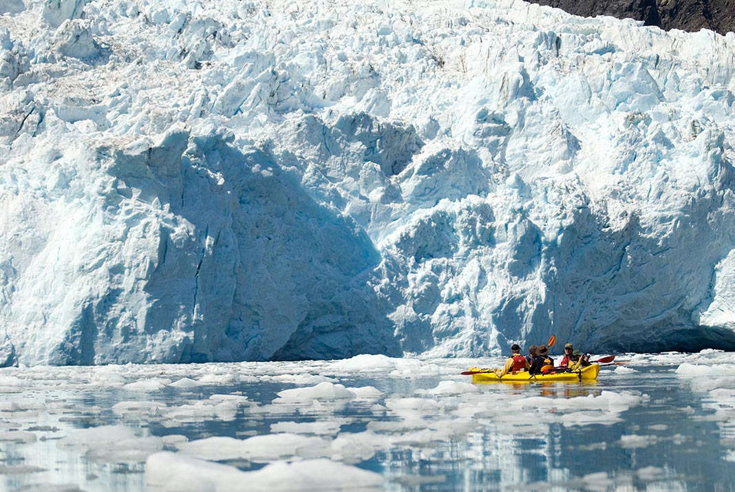
From the edges of Resurrection Bay—considered one of the most reliable places in the world to see marine wildlife—you’ll be well-placed to explore the fjords and valleys of the park, nearly 51% of which is covered with ice. This is where you’ll find tidewater glaciers, icebergs floating on glacial lagoons, towering waterfalls, and plenty of tour operators to take you there.
[ Paddling Trip Guide: View all kayak trips in Alaska ]
Best Seward kayak rentals and tours
The only outdoor adventure company that’s open year-round in the region, Adventure Sixty North offers kayak, camping gear and fishing gear rentals, as well as guided tours to Bridal Veil Falls, Bear Glacier and Aialik Bay.
A one-stop shop, Miller’s Landing is a secluded fishing camp and adventure outfitter just outside Seward. From accommodations and rentals, to lessons and tours, they’ve got you covered.
A bit farther afield (one hour north of Seward) is Cooper Landing’s Kenai Kayak Company. A women-led and -owned outfitter, the company rents out kayaks for use on Kenai Lake as well as runs a three-hour tour of the lake, which is ideal for families or beginners.
Set out for the adventure of a lifetime in Alaska. | Photo courtesy of: State of Alaska // Jocelyn Pride
Kayaking in Homer, Alaska
Homer’s claim to fame may be that it’s the “halibut fishing capital of the world,” but we promise it’s worth the trip for more than the fresh fish. The small city is located near the Alaska Maritime National Wildlife Refuge (translation: the waters are plentiful with more than just halibut), Kachemak Bay State Park and multiple fjords.
Some of the most popular trips include paddling around Yukon Island’s Elephant Rock, and kayaking among the icebergs of Glacier Lake. Then again, if you’re really keen on the fish thing, there’s also nearby Halibut Cove.
Best Homer kayak rentals and tours
Whether you’re looking for remote lodging in Kachemak Bay, a Homer kayak rental or one of the best Homer kayak tours, you’ve come to the right place. Based on Yukon Island, True North Kayak Adventures are experts in the Kachemak Bay area, with itineraries that include Elephant Rock, Eagles Nest and Halibut Cove.
With Three Moose Kayak Adventures’ full-day Glacier Lake tour, you’ll get close to the face of the 19,000-acre Grewingk Glacier. You can extend your stay at the operator’s lodge, which is located right on the edge of the lake.
Kayaking in Anchorage, Alaska
Anchorage is Alaska’s largest city—but this is a situation where biggest doesn’t necessarily mean best. Unfortunately, there are only a handful of Anchorage kayak tours departing directly from the city’s shores.
Instead, this is the place to get your feet (literally) wet before heading out on an adventure north of 60. One place to do this is on Cook Inlet, with its city skyline views and small population of beluga whales. Then there’s Eklutna Lake, which is about an hour northeast of the city limits. Finally, it’s also the best point from which to access the Spencer Glacier, which we mention in more detail below.
Best Anchorage kayak rentals and tours
Alaska Outdoor Gear is an outfitter in the truest sense of the word. Regardless of whether you’re looking for an Alaska-grade parka to wear, a sleeping bag for subzero temperatures or an Anchorage kayak rental, this is the place.
At Eklutna Lake, you can rent a kayak from Lifetime Adventure. Paddle the length of the lake (13 km) and when you reach the other end, switch it up by riding a rental bike back.
Located outside Anchorage in Chugiak, the family-owned AK Paddlesports hires out kayaks and offers relaxed and family-friendly two-hour guided tours of Beach Lake.
Paddle amid icebergs. | Photo courtesy of: State of Alaska // Jocelyn Pride
More can’t-miss kayaking tours in Alaska
Best glacier kayaking in Alaska
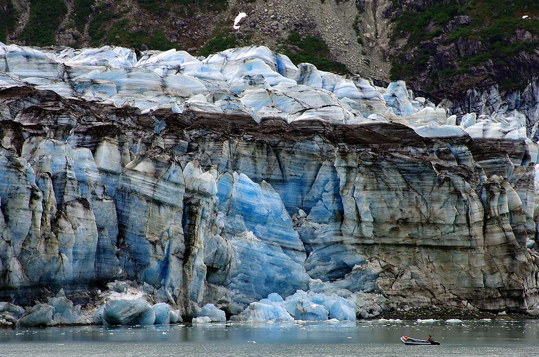
With an estimated 100,000 glaciers covering a mind-boggling 75,109 km sq, it’s not hard to cool down in America’s 49th state. But finding accessible and safe spots to launch and kayak around icebergs as they calf off glaciers is another matter altogether.
If you’re looking for the best glacier kayaking in Alaska, we recommend visiting Prince William Sound or Seward.
Prince William Sound
On the east side of the Kenai Peninsula is Prince William Sound, a body of water surrounded by the glaciated Chugach Mountains and the United States’ second-largest national forest. The area is renowned for having over 100 named glaciers and flatwater paddling conditions.
The two main departure points from which to explore the Sound and its glaciers are Whittier—about 1.5 hours southeast of Anchorage on the Sound’s western shores—and Valdez, in the Sound’s northeast.
Seward: Aialik Bay & Bear Glacier
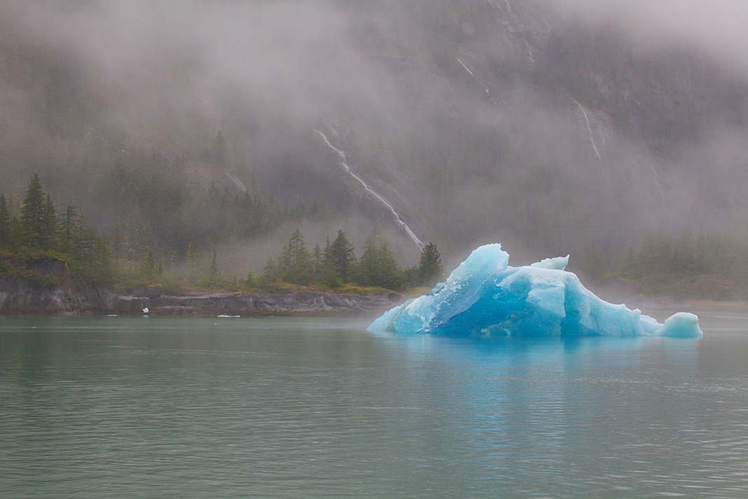
Located on the Kenai Peninsula, the city of Seward is the main access point to Kenai Fjords National Park, where the ice-capped mountains rise 2,100 m above the sea. The area is home to the Sargent and Harding icefields; this is where you’ll find tidewater glaciers, which actively calf off icebergs that eventually make their way out to sea.
Two of the most popular spots to paddle are Aialik Bay and Bear Glacier, the latter of which is a remote lagoon that can only be accessed by helicopter or jetboat.
Choosing between the two is a tough decision, but we’ll try to break it down. Aialik has more wildlife viewing opportunities (you’ll spend more time on the water), including bears, orcas, humpbacks and eagles. Bear Glacier, however, has calmer conditions, larger-than-life icebergs and the largest glacier in the national park area. The only real solution? Do both.
Confront glaciers and icebergs at Kenai Fjords National Park. | Photo courtesy of: State of Alaska // Brian Adams
Kayak with glaciers tours
Based out of Whittier, the family-owned Lazy Otter Charters has year-round tours and kayak rentals. Their full-day guided kayaking expedition takes paddlers through the iceberg-strewn Blackstone Bay and around Blackstone Glacier.
Alaska Sea Kayakers is also based out of Whittier. Their best-selling backcountry destination is Blackstone Bay, where you paddle through ice floe surrounded by seals, otters and eagles.
If you’d prefer to paddle Prince William Sound from Valdez, contact Pangaea Adventures. They offer beginner-level day trips to both the Columbia Glacier—the largest tidewater glacier in Prince William Sound—and the beautiful Shoup Glacier.
Working on a limited budget and can’t afford the helicopter ride to Bear Glacier? Seward’s family-owned Liquid Adventures has the perfect solution—it delivers kayakers up the glacial river to the lagoon by a high-speed jetboat.
Where to kayak in ice caves in Alaska
There’s a reason people get so excited when they talk about the surreal blue interior of Alaska’s ice caves. It’s an ethereal experience that will leave you with chills, of both the literal and figurative variety.
Each experience in Alaska humbles you. | Photo courtesy of: State of Alaska // Reinhard Pantke
Found beneath or beside glaciers, these caverns are usually formed when flowing water creates a channel or pathway and then refreezes. That’s also why seeing them isn’t a guaranteed experience—glaciers are dynamic and continually moving. With that in mind, here are some of the best opportunities to see them:
Mendenhall Ice Caves
One of the most famed places to walk inside these cerulean blue caves is just outside Juneau, the state’s capital, at the Mendenhall Ice Caves. The kicker is that the best way to get to them is by kayaking—and we don’t say that by way of a complaint. (Just to be clear though, you’re not paddling into the caves; you’re kayaking to a point near the glacier and then continuing your journey on foot.)
Spencer Glacier
Located about 100 km from Anchorage in Chugach National Forest, the Spencer Glacier is only accessible by taking a train ride and then kayaking to the glacier’s crevasses and ice caves.
Kayak in ice cave tours
Whether Chugach Adventures uses kayaks or rafts to access Spencer Glacier depends on the seasonal access point—but either way, you’re in for an epic adventure with its small group glacier trek tours.
Ascending Path works in partnership with the Alaska railroad to operate a half-day kayak tour of Spencer Lake, where you’ll touch icebergs and hike to the face of Spencer Glacier.
Above and Beyond Alaska is perhaps best known for its canoe trips to the Mendenhall Ice Caves, where after paddling across the water you’re guided into the deep, blue wells of moulins and ice caves. However, if a kayak is your watercraft of choice, you can arrange an exclusive tour into the blue.
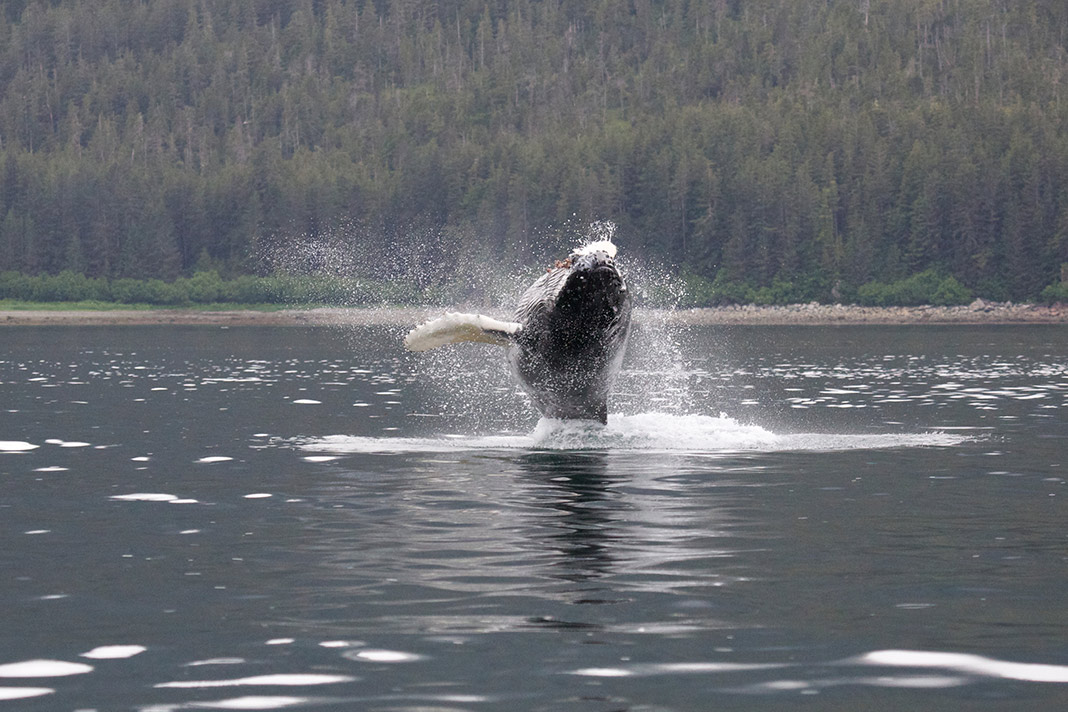
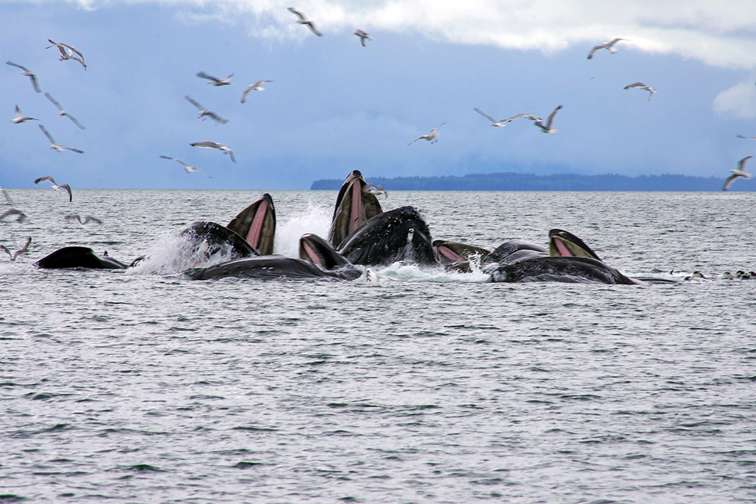
Kayak with whales in Alaska
During the summer, Alaskan waters and marine parks are a fertile feeding ground for a population of thousands of humpback whales that breed in Hawaii during the winter months—and there’s no better way to see them than from the water. And that’s not even making mention of the orcas, fin whales, grey whales, sea lions, puffins and otters that also make the Alaskan coastline their home.
Alaska is one of the top places to whale-watch. | Photo courtesy of: State of Alaska // Jocelyn Pride
Kodiak
According to Alaska.org, this commercial fishing town on an island south of Cook Inlet “may be the state’s best kept whale-watching secret.” Yes, it has the brown bears and salmon you’ve come to expect from Kodiak, but it also has grey, humpback and fin whales.
Considered one of the most reliable spots for whale-watching, including for spotting orcas, Seward’s Resurrection Bay is protected, making for a rich marine ecosystem. If fins aren’t your thing, it’s also home to otters, sea lions and puffins.
Kayak with whales tours
Kodiaks Wild Side offers some of the Kodiak area’s best whale-watching. Long-time local and wildlife photographer Wendy Eskew is renowned for delivering marine mammals to her guests, including orcas, fin whales, humpback whales, bears, mountain goats, puffins, seals, otters and more.
Winner of the 2020 TripAdvisor Travelers’ Choice Awards, Kayak Adventures Worldwide is committed to sustainability and ethical wildlife interactions. It has several Seward kayak tours, but its most popular day trip combines a wildlife-watching tour by boat with seeing a glacier up close by kayak.
Join a whale-watching tour for once-in-a-lifetime experiences. | Photo courtesy of: State of Alaska // Reinhard Pantke
Bucket list trips for sea kayakers in Alaska
Kayaking the Kenai Peninsula
If you have one takeaway after reading this article, it’s likely that the Kenai Peninsula—with its massive tidewater glaciers, 2,100-m mountain peaks and rushing rivers—is where you’ll get your fix of both wildlife and icebergs.
If you’re having difficulty narrowing it down to one tour, though, we don’t blame you. That’s where Expedition Engineering’s Kenai Peninsula Kayak Expedition comes in. This greatest hits tour packs paddling past feeding bears, touring ice caves and arches, and exploring remote wilderness locations all in 16 days.
Kayaking the Inside Passage
Kayaking the Inside Passage—the 1,600-km route between Skagway, Alaska and Puget Sound, Washington—is a bucket list trip for many paddlers. Couple its calm waters with thousands of islands, coves and bays to explore, and you have the trip of a lifetime. Unfortunately, it’s only for those with experience under their belt and time to spare—the whole journey typically takes somewhere between 60 and 80 days to complete.
If you don’t have months to spare but want a taste of what the Passage has to offer, Sitka Sound Ocean Adventures operates custom multi-day expeditions, half-day and full-day tours in the area.
Venture into the wilds. | Photo courtesy of: State of Alaska // Jocelyn Pride
When to kayak in Alaska
High season in Alaska—when campsites book out and it’s harder to experience true wilderness on the busy waterways—falls during the summer school holiday months of July and August.
Mid-May until mid-June is the best time to avoid the crowds—and the mosquitoes. Late August or September is another good option, but keep in mind that weather conditions grow more unpredictable as autumn approaches. Heading out later in the season requires keeping a close eye on the weather forecast.
What to wear kayaking in Alaska
Even in the summer months, the temperature can range from an average low of 3º Celsius (37º F) to an average high of 22º C (71º F). You’ll want to exercise all the basic principles of dressing for the elements (we outline these more fully in our article What To Wear Kayaking).
Layers—including a high-quality top waterproof layer—are key, and as you likely already know, “cotton kills.” Instead, choose fabrics with natural water-repelling qualities such as wool. Dress for the temperature of the water (about 10º C) not the air. Finally, don’t let the cool climate fool you—sun protection is a must even in the Arctic. After all, the sun stays up a lot longer in the northern latitudes.
Kayaking in Alaska provides experiences that few other places on Earth offer. | Photo: State of Alaska // Brian Adams
Yikes! This clip was captured and submitted to the GoPro Awards by Lukas Reilly after his close encounter with an orca.
Reilly told ABC News: He was paddling off Kuaotunu Beach in New Zealand when a few orcas began diving for stingrays underneath his board. Reilly, a 27-year-old restaurant owner, told 3News he had a GoPro camera in his pocket and pulled it out to capture the moment that one of the orcas came over to check out his board.
“I was a bit nervous thinking, ‘What’s this guy going to do?,’” Reilly said. “Then he slowly crept up and grabbed the back of my board and I yelled, ‘What are you doing!'”
Reilly told another local news station, TVNZ, that the orca “had a chew” on his board but described the close-up with the orca as a “friendly encounter.”
“It was quite freaky but so amazing at the same time,” Reilly told TVNZ.
If planning the next family vacation makes you sweat, settle in for a 3400km, three-month family canoe journey from Jasper, Alberta, to the Arctic Ocean at Tuktoyaktuk, NWT. The Clark family left their jobs, home and community behind for a 100-day northern adventure.
Have Kids, Will Paddle won the Best Canoeing Film award at the 2014 Paddling Film Festival. “We go on wilderness trips to escape our civilized world, to strengthen our family bonds, and to get grounded in nature,” explains a wild-blooded and gentle-mannered Clark.
“We appreciate the opportunity to live in the moment, enjoying a simple existence as a family.”
The film captures the essence of a family vacation, except the disappointments include the shock of a savaged landscape near the tar sands along the Athabasca River, and the discovery that 1500 river km of the trip had very little current. The lows are eclipsed by the highs of a 4 a.m. paddle on the mirror of Great Slave Lake, the kids asleep in their cockpit, and 100km river days on the Mackenzie.
I don’t where the river mouth is, I don’t know what f***ing town this is… I got a broken toe, a chafe to the left arm and right nipple, and these shorts are starting to stink.”
In 2007, Beau Miles attempted to paddle 4000km from one side of Africa to the other. Starting in Mozambique and continuing along the South African coast, Beau allowed five months to complete the voyage. With him for over half the journey was Jared Sharples of New Zealand.
Together the pair experienced the magnificent coast until Jared, who was very ill, left the expedition. Beau paddled alone for six weeks, experiencing for the first time in his life, a truly nomadic, solo existence. Battling huge surf, Beau completed 2000km of the original plan after realizing that his trip wasn’t about kilometers gained but rather the quality of the experience.
Africa By Kayak is one of Miles’ first kayaking films and a fan favorite. Miles is a jack of many trades—sea kayaker, educator, ultra-runner and craftsman. His frank and quirky humor have turned many of his films into award-winners. Bass By Kayak and Junk Paddle won awards at Paddling Magazine’s annual Paddling Film Festival. Watch them below.
In this video, YouTuber Advoko Makes shows how to build a quick and easy bushcraft kayak. The idea is simple: you can build a fully functional survival kayak in the wilderness if you have a knife, fir tree branches, plastic wrap and scotch tape.
Even though we don’t typically carry yards of plastic wrap or scotch tape in our survival kit, this fully functional kayak is pretty cool. It weighs less than 10 pounds, is waterproof, and only takes a day to make. Because the vessel is transparent, you can see the bottom and fish swimming under you—fishing, in particular, is an exceptional experience, according to Advoko Makes.
Sure, we’re a little skeptical about its long-term durability—but for just a couple of dollars and a single day of work, what do you expect?
If building your own kayak thrills you, find out how to build your own transparent, fiberglass light-up kayak here.
In this video published by National Geographic, the seal follows a kayaker in Scotland’s Forth Estuary, an arm of the North Sea near Edinburgh. After tailing kayaker Alistair Forrest and his companion for about a mile, the seal took advantage of a break in the paddling to hop aboard Forrest’s kayak. There, the sleek marine mammal sprawled out as if ready to come along. Forrest and his companion voice their amazement at the unplanned wildlife encounter.
According to the accompanying National Geographic article, “Instances of seals hauling out onto kayaks aren’t common, but neither are they entirely unheard of. And sea lions, which are often mistaken for seals, are also known to hitch a ride. This particular seal—likely a juvenile, judging by its size and especially brazen interest—showed no signs of fear or aggression, instead seeming to enjoy a novel adventure.”
So what should you do in situations like the one in this video? According to the article, “Splashing a hand in the water or reaching out to touch the seal are definitely not the actions to take. In the United States, the Marine Mammal Protection Act prohibits people from approaching seals and other marine mammals. In the rare scenario a seal tries to hop onto your kayak, it’s best to paddle away calmly.”