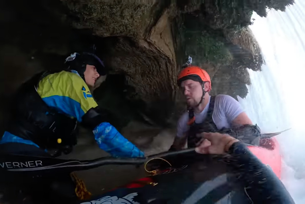
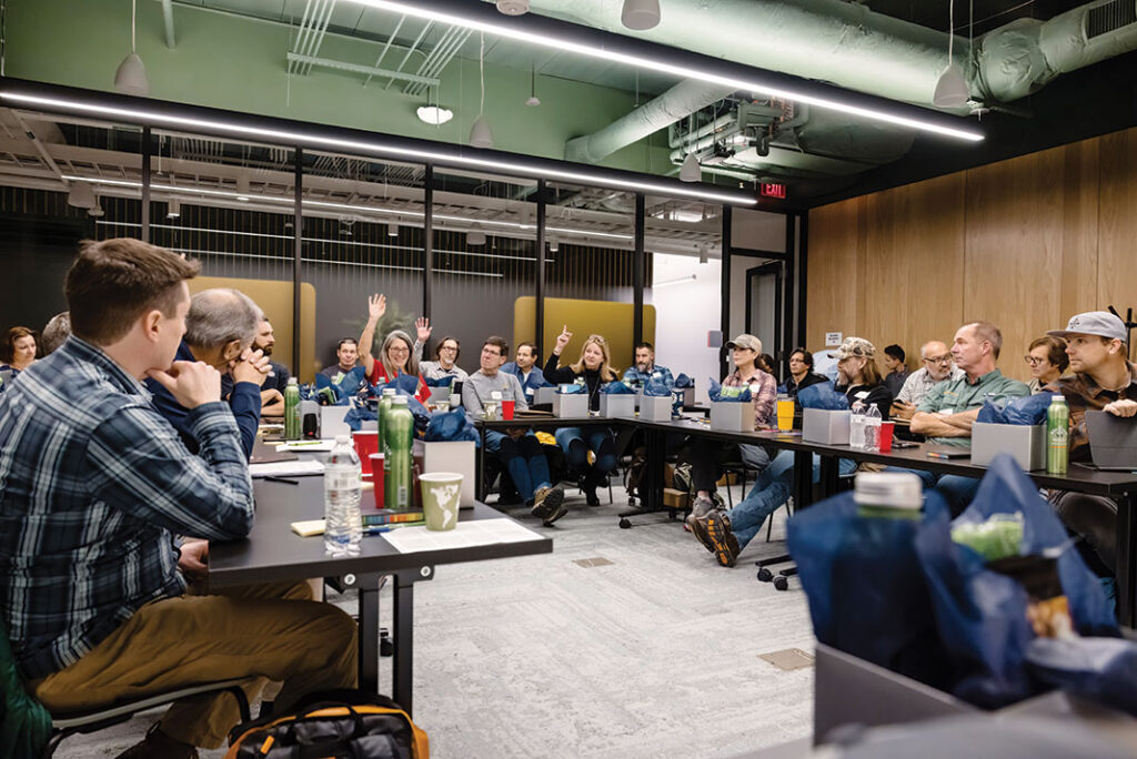
A group of stunt performers known as the Sickos decided landing a jump on skis and snowboards was just too easy. Instead, they set out to build the biggest snow jump they could fathom possible for a sled to stick. Only, their sled of choice was no toboggan but rather an inflatable kayak.
On the slopes of Mount Hood, the Sickos spend a day building up their dream sled jump. As they construct the jump, they take their Star inflatable kayak further and further up the slope to get the ramp dialed.
[ Find inflatable kayaks for their intended form of water in the Paddling Buyer’s Guide ]
Fortunately, as they figure out how to launch the self-bailing hull into the troposphere, they have some soft snow to keep them intact.
Their snowy kayak stunt culminates with a run from the top of the slope. They are destined to catch some of the biggest air we’ve seen from an inflatable. But more importantly, will they stick the landing? Watch and see.
The Paddling Magazine team is thrilled to announce that we have won the People’s Choice Award for Best Print Publication at the Outdoor Media Awards. Considered the most prestigious award for media in the outdoor industry, Paddling Magazine faced stiff competition from legacy media titles, including Outside and Backpacker magazines.
Thank you to our incredible community of readers who made this win happen. Your engagement and loyalty have been the driving force behind our content, inspiring our commitment to delivering exceptional paddling stories that inform, entertain and inspire.
We’re grateful to have such incredible readers who share our love for the water—thanks for being the best part of Paddling Mag!
The official press release from Outdoor Media Summit follows.
Outdoor Media Summit is thrilled to announce the Outdoor Media Award winners for the People’s Choice Awards. After weeks of voting and anticipation, the winners have been chosen, representing excellence and innovation in outdoor media content creation.
The People’s Choice winners for the 2024 Outdoor Media Awards are as follows:
Paddling Magazine: People’s Choice – Best Print Publication
Adventure Chasse: People’s Choice – Best Print Publication
Tooth and Claw: People’s Choice – Best Podcast
Run Wild My Child: People’s Choice – Best Digital Publication
@OutThereColorado: People’s Choice – Best Social Handle
@KweenWerk: People’s Choice – Best Social Handle
Stephane Monette: People’s Choice – Best YouTube
Kyle Hates Hiking: People’s Choice – Best YouTuber
These winners have demonstrated creativity, engagement, and dedication to the outdoor media space. Their content has resonated with audiences, inspiring and informing outdoor enthusiasts everywhere.
“Congratulations to all the winners of the People’s Choice Awards! Your passion for the outdoors and commitment to producing exceptional content shows,” said Yoon Kim, founder of Outdoor Media Summit. “We’re excited to recognize your achievements and celebrate your work at Outdoor Media Summit in Missoula on October 16th.”
The Outdoor Media Summit team extends its appreciation to everyone who participated in the voting process and helped make this year’s People’s Choice Awards a success.
For more information about the Outdoor Media Summit and the Outdoor Media Awards, please visit outdoormediasummit.com.
Paddling Magazine Subscription
If you’re not already a subscriber, you can dive deeper into the world of paddling with a subscription to Paddling Magazine. If you’re passionate about paddling adventures and value top-notch storytelling, subscribing is the perfect way to ensure you never miss out on our exclusive content. From thrilling expedition stories to expert tips and the latest gear reviews—Paddling Magazine is crafted for enthusiasts by enthusiasts. Subscribe now and let us bring the adventure to your doorstep. If you love paddling, you’ll love Paddling Magazine.
Award-winning editorial features
Print issues delivered to your doorstep
Every page of every issue in our digital archive
First access to digital issues
Download our app to read stories anywhere, online or offline
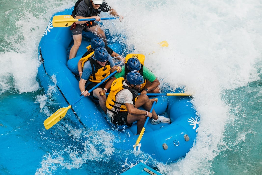
Montgomery, Ala. – Mar 4, 2024 – Montgomery Whitewater Park, Alabama’s newest and most technologically advanced outdoor adventure destination, was honored with the Project of the Year designation at Business Alabama’s annual awards luncheon, which was hosted last week in Birmingham.
Opened in July 2023, Montgomery Whitewater Park is a world-class recreational attraction offering adventure sports and lifestyle experiences for residents and tourists of all ages and skill levels. Designed by S2O Design and Engineering, the center boasts the world’s most advanced channel system, which simulates a natural river with class II–IV rapids to accommodate beginners, seasoned whitewater enthusiasts or professional athletes for a variety of whitewater activities including rafting, kayaking and stand-up paddleboarding.
Photo: Courtesy Montgomery Whitewater Park
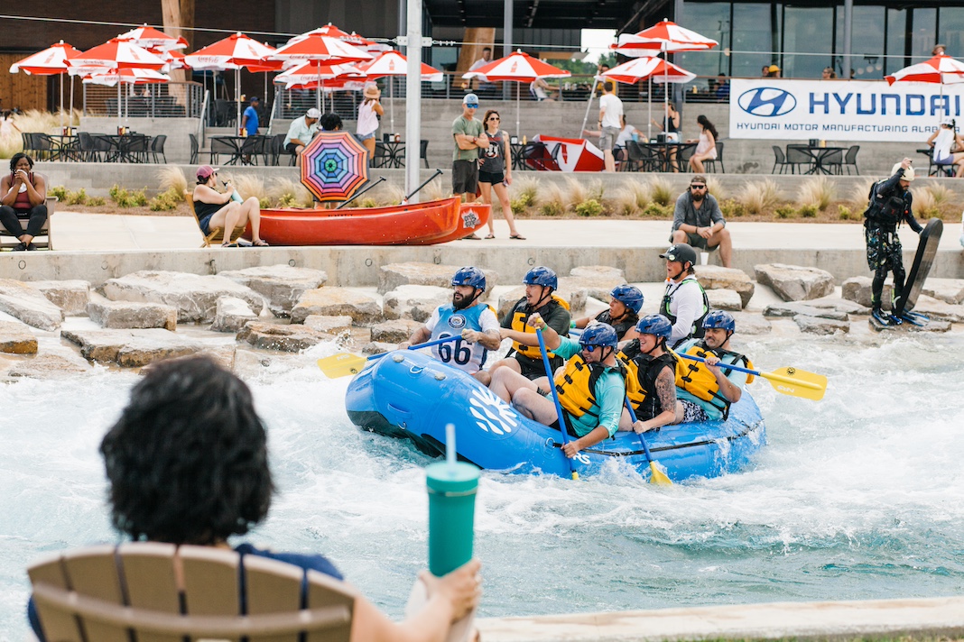
Apart from water activities, visitors can also enjoy an array of family friendly activities including a variety of free concerts, an outfitter store and restaurant, Eddy’s Restaurant and Bar.
“Since opening in July, the Montgomery Whitewater Park has drawn crowds from across the nation, helped us recruit thousands of new high-paying jobs and provided additional recreational opportunities for Montgomery County residents,” said Montgomery County Commission Chairman Doug Singleton. “This prestigious honor from Business Alabama shows the strength of this investment and its continued benefits to Montgomery County, the River Region and state of Alabama.”
Photo: Courtesy Montgomery Whitewater Park
Photo: Courtesy Montgomery Whitewater Park
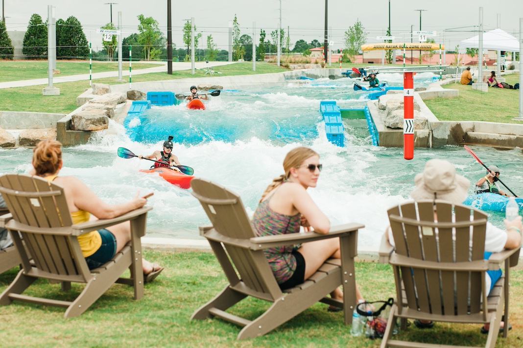
Montgomery Whitewater was made possible by the innovation and leadership of state, local and community leaders who formed the Montgomery County Community Cooperative District, which serves as the ownership entity of both the park and overlaying district. The Montgomery County Commission, the City of Montgomery and the State of Alabama jointly led this unprecedented partnership to enhance the quality of place for the River Region, drive economic development, boost tourism, support the military and recruit and retain talent.
“None of this would have been possible without the vision and dedication of the many elected officials and business leaders who collaborated to bring Montgomery Whitewater into existence,” said Chief Executive Officer Dave Hepp. “What resulted from that collaboration isn’t just a groundbreaking outdoor attraction, but an opportunity to enhance residents’ quality of life and foster a meaningful appreciation for the outdoors for the people of Alabama and beyond.”
Photo: Courtesy Montgomery Whitewater Park
About Montgomery Whitewater Park
Montgomery Whitewater Park is a 120-acre state-of-the-art recirculating whitewater park and outdoor adventure center located off I-65 in Montgomery, Alabama offering a variety of outdoor lifestyle activities both in and out of the water for all ages and skill levels. Developed and operated by Southern Whitewater Design Group for the Montgomery County Community Cooperative Group, this park was conceived and developed as a large-scale public-private investment to catalyze economic growth and provide health-focused recreation and employment opportunities. More information is available at Montgomerywhitewater.com.
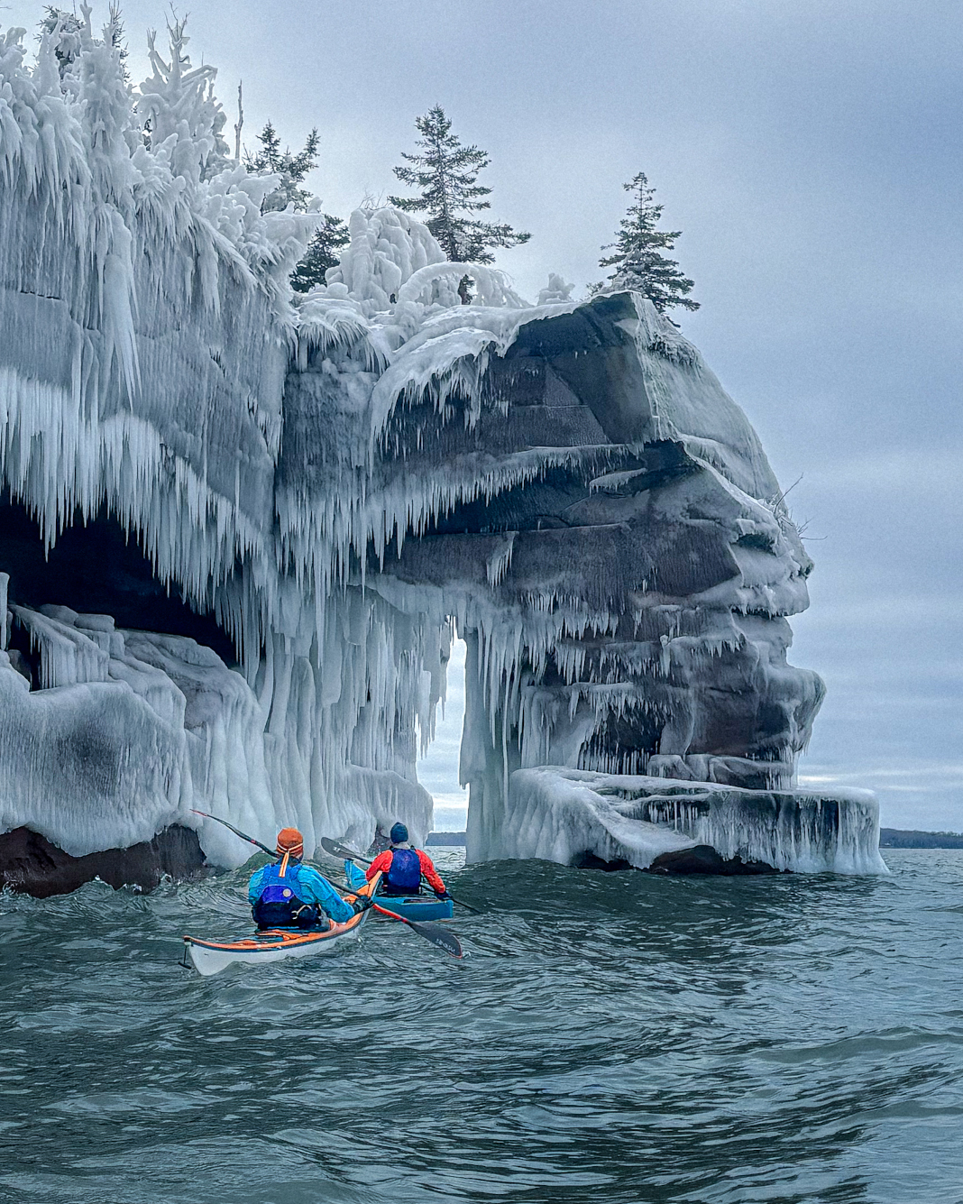
Winter paddling on Lake Superior. Feature Image: Maddy Marquardt
Last year at a wilderness medicine course, I shared a quick story about an incident with a bee sting to the neck on the water. A woman just a little older than me approached me afterward, wanting to know who I was and where I was from.
“I’m a sea kayaker too,” she said. “I guided for two years in the San Juan Islands.”
There were only three other women in the class of more than 25. We were the only two who had taken the course before, and I could tell she did not like me. She had approached me with the intent of comparing her guiding and outdoor resume to mine—to correct me on something I had shared.
I’m a fifth-year coastal kayaking guide and people often ask if I experience sexism in the outdoors. Yes and no, I respond, and never from the direction I expect it.
The words we choose to cut each other down
Truth is, outdoorsy girls can be mean girls. We undercut each other in wilderness medicine courses, competing for who has more experience because we’ve convinced ourselves there are limited spaces for women in the outdoors. We make jokes about other guides: “Her form is shit” or “She takes her job way too seriously.”
I’m complicit myself.
Talking with a friend recently about hiking and how hard it is to find people to winter camp with, we paused to joke about another girl. “Well, I mean… she only hikes for the photo, you know?”
I laughed and didn’t think much of it until later.
People have said that about me, too—that I only go outside for the content. People have also said I am only outdoorsy because my boyfriend is. I know these things aren’t true, but they sting.
No one goes outside just for the photo, which is maybe why the phrase feels so cutting as an insult. Humans go outside because it feels incredible; it’s where our brains are happiest. Humans as a species evolved in the outdoors, and by heritage, we are all outdoorsmen. The insults imply someone is so vapid they can’t appreciate a fundamental part of being human.
When I first started guiding, I was unskilled and didn’t have a concept of to what degree. I was told by other women in the field I would have to work harder for the same respect as my male coworkers. So I worked first on my confidence and on seeming competent. In hindsight, the result as a first- and even second-year paddler was I often exaggerated my skills. There were occasions when my abilities were questioned and at the time I felt these doubts about me were unfair. Now I believe people were likely seeing through the cracks of false confidence.
This doesn’t happen anymore, because the confidence is not false, and my skills and experience speak for themselves. It’s been years since I’ve had a man whom I’m speaking with face to face truly question my place in the outdoors.
Today, almost all the insults, undermining and negativity I’ve experienced in the outdoors come from other women in the outdoor community.
Winter paddling on Lake Superior. | Feature photo: Maddy Marquardt
The self-inflicted notion of limited space
My theory is that because we see so few women in leadership roles in the outdoors, we think there are only so many spaces available and we’re all competing with each other for them. It’s as if in order to validate my own skills and experience, I must belittle hers. I must demonstrate I know better than her. That I can do what she does and look less silly, with less makeup, be tougher but still feminine and palatable. However, competency in the outdoors is not a limited resource.
Recently, I published a winter paddling image of Lake Superior and received a comment that read, “Sorry but I hope someone less experienced doesn’t feel emboldened by this post. Too many things can go wrong.” The comment came from another woman, clearly someone also active in the outdoors.
I read the comment after spending the week mulling over the phrase, “She only hikes for the photos,” feeling guilty for using it but not being able to articulate why. It came after reading the thoughts of other women outdoor creators discussing how they, too, have observed judgments being made about who is and who isn’t legitimately outdoorsy. Judgments made without knowing a person in real life or likely even really examining their content.
When we comment, “I hope you (a person who has clearly stated their specialized skills) don’t embolden anyone to take similar risks,” what are we really saying if we say it most often to women?
It seems what is being implied is that people are less likely to take risk seriously when it is attached to a person who looks like me. If something is being done by a small, blonde female, then surely it’s something that can be done by anyone. And so, the tax for the safety of others is me experiencing less and sharing less with others. I’ve been told this explicitly and implicitly since I was six.
I believe the outdoors and access to it is a right, not a privilege. Humans as a species are meant to sleep with our heads on the ground, to see trees and not concrete, to swim in cold water, to feel waterfall mist and be in movement.
Retiring a tired phrase to make the outdoors a more welcoming place
When we make casually cruel statements against other women, we strip someone we don’t know of their relationship to the outdoors as if it proves something positive about ourselves.
I’ve joked with other girls about women who wear makeup camping as if I don’t full well understand how hard it is to feel comfortable in your own skin.
I’ve watched while younger women and guides struggle like I did with forced confidence and exaggerated skill because we’ve been told we have to fight tooth and nail for respect.
I’ve looked at the pretty Pacific Northwest girls with their perfect hair and leggings and sports bras on the tops of mountains and thought, “She only hikes for the photo.” Because in their perfect photos, I see my own imperfections, how much I struggle with my own body image and how I could never look like that on top of a mountain. I’ve told myself the phrase because for some reason in order for me to be a competent outdoorsperson, she can’t be—as if there is not room for both of us.
But there is room, and it starts with the statements we make.
We can build our own outdoor spaces and communities. We can change the ways we teach about the wild and welcome people in instead of pushing them out.
Maddy Marquardt is a paddling guide and writer based in Northern Minnesota. This essay originally appeared in her newsletter Hello Stranger.
Winter paddling on Lake Superior. | Feature photo: Maddy Marquardt
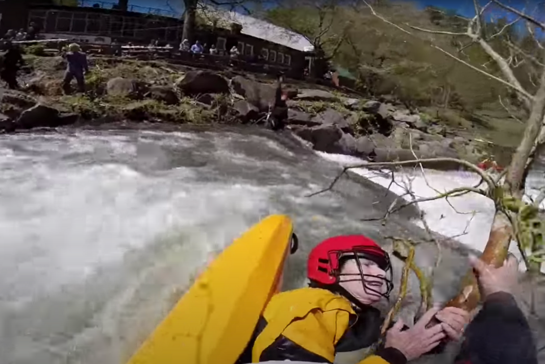
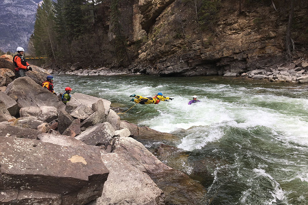
A day down a familiar class III-IV creek took a nearly fatal turn for a group of three paddlers in North Carolina. When kayaker Baker Martin became pinned underneath a strainer, a bold rescue by paddleboarder Hank Cheatham saved his life.
A Day On The Big Laurel Gets Scary
The Big Laurel is a classic creek run in the mountains of Western North Carolina, with mostly class III rapids, spiced up with some class IV.
Standup paddleboarders Hank Cheatham and Will Saylor and whitewater kayaker Baker Martin were through the majority of the four-mile run. Martin was out in front of the group at what is known as a relatively straightforward stretch.
As Martin entered a rapid, he noticed a log was blocking most of the river, but by then, it was too late. His boat was sideways to the log. He was flipped, and his stern became pinned to the river bed. With the kayak pinned vertically, Martin was on the downstream side of the tree and held underwater, unable to breathe.
Kayaker pinned beneath a strainer on the Big Laurel. Image: SUPPaul // YouTube
A Paddleboarder’s Bold Rescue Saves Kayaker’s Life
Cheatham makes a bold maneuver, driving the nose of his SUP over the log.
Approaching a strainer from the upstream side is risky. If the rescuer were to flip or not clear the log, they could be pulled beneath the strainer themself. But reaching a paddler in distress from an eddy or the shoreline eats precious time that could turn a rescue into a resuscitation. In the words of Marshall Mathers, sometimes “you only get one shot.”
Cheatham’s board goes up and over the log, bringing him right alongside Martin. His position with the board allows Martin to grab hold. At this point, Martin has been underwater for about a minute. Cheatham pulls his arms, stabilizing the distressed kayaker and allowing him to breathe. Cheatham then grabs the loop on Martin’s sprayskirt. Once the sprayskirt pops, he’s able to free Baker from the log, and the pair float downstream. It’s a rescue that plays out within a matter of moments.
“The whole thing worked out about as perfectly as you could work out,” Cheatham shared in the interview with SUPPaul.
Afterward, Martin was brought to the shoreline. He was disoriented and throwing up water. He would go on to paddle out of the run and hike a mile back to his truck. Later, at an urgent care, he was diagnosed with aspiration pneumonia.
The group mentioned the Big Laurel is a run they are all familiar with. It’s a reminder that no matter how well you know the stretch of river, unknown hazards can appear, especially following major weather events.
Martin was ahead of the group, but fortunately they were close enough together to make the rescue when it was needed.
Successful Rescues—An Indispensable Resource
The consensus in the podcast was that it was a rescue a kayak would be unlikely to make in timely fashion. Because of Cheatham’s paddleboard, he was able to land directly on the strainer and be in a position to pull Martin’s skirt.
When we watch an incident after the fact, we have the benefit of reviewing in hindsight. Ultimately, Cheatham’s remarkable rescue took less time to pull off than reading this article. Because of it, Martin is here and able to talk about the experience.
We want to hear from readers. How would you react if you encountered a similar circumstance on the river, especially with various types of paddlecraft?
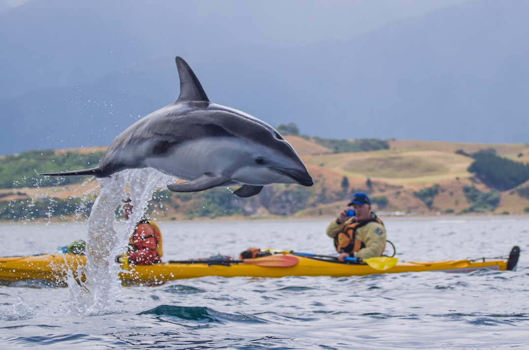
For as many kayakers and whales travel the ocean, it’s incredible just how magical the moment remains for the two groups to share an interaction. Now, imagine how it would feel to have an Orca swim right up to the side of your boat.
Orcas Investigate Kayakers
When a group of kayak guides in New Zealand, who seek to show others whales and wildlife, actually came face to face with a pod of Orcas, even they had trouble finding the words to express the astonishment.
Kaikoura Kayaks operates on the northeast coast of New Zealand’s South Island, and the Kaikoura Peninsula provides the kayak company opportunities to show guests fur seals, dusky dolphins, and albatross. The peninsula is also New Zealand’s whale-watching capital, which means there is no shortage of viewing year-round resident sperm whales as well as other migrating species, including the orcas.
[ Find wildlife viewing around the globe with the Paddling Trip Guide ]
Depending on your perspective, having an orca alongside your kayak could be either an exhilarating or terrifying moment. We’ll lean toward the former for most paddlers willing to take a trip on the ocean. Orcas have garnered a particular reputation. In some ways, they’ve earned it, including their well-known hunting displays and recently targeting vessels off the Iberian Peninsula in Europe. Yet, there are no documented incidents of an orca attacking a kayaker during an interaction. As these moments captured on video continue to find their way to our feed, they tend to bring up conversation from all corners, including conservation.
Feature Image: Kaikoura Kayaks // YouTube
The Kaikoura Peninsula Has A Knack For Finding The Spotlight
During her reportage, Wynne Lockhart travels to Kaikoura Kayaks firsthand for the story. The author was drawn there partly because of a video from the outfitter showing a seal slapping a kayaker with an octopus.
As you can imagine, the clip created a sensational buzz, leading visiting tourists to the peninsula, yearning to recreate the moment for themselves. It seems the outfitter has no shortage of viral close encounters for our viewing pleasure.
Kayaking at Badwater Basin on February 9, 2024. Featured Image: NPS/Michael Kohler
Kayaking in the middle of Death Valley National Park in California is likely not on your paddling bucket list. Forgivable, considering most days there is nowhere to launch a boat in the driest place in North America. But right now, in early 2024, it’s one of the hottest paddling destinations in the U.S.
Why Death Valley Is A Kayak Hotspot Right Now
Southern California has seen multiple major precipitation events in the past six months. There was Hurricane Hilary back in August. And just recently, a four-day atmospheric river. These events and others have brought Death Valley nearly five inches of rainfall in the past six months. However, it’s a place which typically sees little more than two inches of rain over the entire year.
All the excess water has found its way down, 282 feet below sea level, to fill an ancient lake bed within the Badwater Basin.
The ancient lake is known as Lake Manly. During the Ice Age, it was hundreds of feet deep, but it dried up about 1,000 years ago. Today, its major tributary is technically the Amargosa River, which originates in Nevada. The Amargosa though usually evaporates and is absorbed into aquifers before any substantial amount of water can reach the lake basin.
“You might think with no drain to the sea, that Death Valley would always have a lake,” park ranger Abby Wines shared in a statement. “But this is an extremely rare event. Normally, the amount of water flowing in is much less than the evaporation rate.”
The recent rainfall in the region has changed the situation. According to the park, as of mid-February, the temporary lake is about six miles long, three miles wide, and one foot deep.
Kayaking at Badwater Basin on February 9, 2024. Featured Image: NPS/Michael Kohler
Catch Lake Manly While You Can
“The lake was deep enough to kayak for a few weeks after Hurricane Hilary, but unfortunately people couldn’t come enjoy it then,” said Wines. “Every road in the park was damaged by flash floods, and it took two months to open the first road into the park. Now most of the main roads are open, so it’s a great time to come visit.”
The park believes the lake may only be deep enough to kayak for a few weeks. Paddlers have already started to flock to the basin. If kayaking an intermittent ancient lake in Death Valley was on your to-do list, you’d be best to get to it.
After 46 years manufacturing all manner of paddlesports equipment, most notably PFDs, Stohlquist has ceased operations. | Feature photo: Vonpics/Pixabay
After 46 years manufacturing all manner of paddlesports equipment, most notably PFDs, Stohlquist has ceased operations. The decision was made public in early January, following the acquisition of Stohlquist’s parent company, Aqualung Group, by investment banking firm Barings.
According to Ryan Lightbody, former senior product manager at Stohlquist, there had been lots of top-level management shifts at Aqualung in the last five years, so the expectation among Stohlquist’s staff was that there would be more of this following the acquisition. But no one thought it would spell the end of Stohlquist.
“With any acquisition there are going to be changes,” says Lightbody. “But you don’t necessarily think they are going to shut you down.”
On December 8, 2023, a press release was published announcing the completion of Barings’ acquisition of Aqualung.
“Then four or five days later, we had an all-company meeting, at least with the North American employees, and the senior management announced then that they would be shutting down that office,” explains Lightbody.
After 46 years manufacturing all manner of paddlesports equipment, most notably PFDs, Stohlquist has ceased operations. | Feature photo: Vonpics/Pixabay
The official decision was that the company would no longer be pursuing sporting goods within North America, affecting Stohlquist as well as a couple other internal brands in Aqualung’s portfolio.
Twenty years of partnership
Based in France, Aqualung started out manufacturing cutting-edge diving gear in 1943 and has since grown and acquired other diving and watersports brands. In 2004, they joined forces with Stohlquist to enter the paddlesports market in North America.
Lightbody, who has been with Stohlquist since 2008, says it was a great partnership.
“We were able to take advantage of this bigger company and have some support and distribution and sales support from Aqualung,” he explains. “That was really where Stohlquist grew the most was during that time, between 2004 and 2017.”
When Jim Stohlquist started the company in 1977, the focus was solely on whitewater apparel, but following the partnership with Aqualung the offerings grew to include recreational paddling and kayak fishing.
“I think the partnership helped bring some focus to the brand and really grow the offerings in a more meaningful way, rather than just making odds and ends pieces,” says Lightbody.
Barings acquisition brings dramatic changes
In 2017, Aqualung was bought by a private equity firm. This was when the management turnover began, and Lightbody says he started to see decisions that were very different from what Stohlquist would have decided for itself as a brand.
[ Paddling Buyer’s Guide: View all PFDs ]
Talks of Barings acquiring Aqualung began in June 2023 and continued throughout the summer with various personnel changes and an office move for Aqualung’s California employees. Then the official acquisition announcement and decision to shutter sporting goods operations in North America.
“I think the main thing was they wanted to focus dollars on Aqualung, the namesake of the parent company,” Lightbody says. “I think the military professional business is typically a little more stable than the recreation market. With the ups and downs of COVID and things like that, I think they see that as a safer investment at the end of the day. It’s definitely interesting, definitely educational in terms of how bigger businesses look at us.”
Following their acquisition, Aqualung Group is expected to focus on the company’s namesake scuba and snorkelling brand. | Photo: Kevin Galeano/Pexels
Benjamin Gillett, managing director at Barings, said in an email that the company didn’t wish to comment at this stage. Michel Abaza, chairman and chief executive officer at Aqualung Group, also declined to comment while the companies are still in the preliminary stages of the sale.
While he was disappointed in the decision to shutter Stohlquist, Lightbody says he understands private equity and investment bank firms have a different way of looking at things than small businesses do.
“It’s easy to point the finger and say, ‘Those guys did this terrible thing.’ But they’re doing what they do, and hopefully we can get back to what we were doing.”
“I think you have to look at their decisions as being a separate business model than what a brand in paddlesports would do,” he continues. “Stohlquist is in the business of making great products that help people enjoy time on the water. And those guys’ business is buying and selling companies and hopefully making money. Sometimes, some things don’t align.”
In other words, the decision was all business.
“It’s easy to point the finger and say, ‘Those guys did this terrible thing.’ But they’re doing what they do, and hopefully we can get back to what we were doing,” says Lightbody.
A second wind for Stohlquist?
There have already been inquiries from other names in the paddlesports industry who are interested in acquiring Stohlquist and keeping the brand alive. But Lightbody says it’ll be up to Barings and Aqualung to accept these offers.
“We had some pretty exciting stuff playing, so that’s probably the most disappointing thing,” says Lightbody. “I’m hoping something can be revived, and some of those exciting things can see the light of day one of these days.”
As for Lightbody, he says he’s hoping to stay in the industry, whether that means sticking with Stohlquist if the brand is carried on or moving on to a new company.
“I’ve always enjoyed being part of paddlesports and the industry,” he says. “I think that’s one of the things that really stands out to me about paddlesports, is that despite being competitors, everyone knows each other, everybody’s buddies. It’s such a fun group of people to hang out with.”
After 46 years manufacturing all manner of paddlesports equipment, most notably PFDs, Stohlquist has ceased operations. | Feature photo: Vonpics/Pixabay
Emeryville, CA (February 16, 2024) – Oru Kayak, the original origami kayak brand, is excited to announce the latest upgrade to its foldable fleet of kayaks: Electric motors. Developed in partnership with Bixpy Motors, Oru’s e-propulsion system offers Oru paddlers a unique electric-assist kayak in a lightweight package that is portable and easy to install.
Enhancing the maneuverability, as well as adaptability and control of each of Oru’s foldable kayaks, the collaboration Bixpy electric motor supports Oru’s mission to increase accessibility to paddling. At the push of a button, paddlers can explore more waterways with less concern about safety or exhaustion.
The Bixpy Electric Motor is specifically designed at the apex of performance and convenience. Built with corrosion-resistant components and an aluminum body, the motor is durable for exploring different waterways and produces zero emissions. Featuring 12 forward speeds and 3 reverse speeds, the motor runs for approximately 80 minutes at its top speed and up to 12 hours at slower speeds. Paddlers can change the speed with a wireless Bluetooth remote control that fits anywhere inside the kayak. In case of an accident, the Outboard Power Pack and remote control float.
“We are thrilled to announce our collaboration with Bixpy Motors and to introduce our compatible electric motor,” commented Oru Kayak Director of Product Forrest Harvey, “When we first introduced our concept of origami kayaks, the portable, lightweight design expanded paddling accessibility. Our partnership with Bixpy Motors reinforces this mission and grows our kayaking community to support individuals of all experience and mobility levels.”
Bixpy Motors also expressed their enthusiasm for the partnership. “We’re excited to expand the reach of the electric watersports industry by offering our motor for compatibility with Oru Kayaks,” commented Bixpy founder and CEO Houman Nikmanesh, “Aligned with Oru Kayaks, we seek to improve the kayaking experience with our simple and innovative devices.”
Paddlers can install the electric motor onto their kayak in a few simple steps. The battery and motor package are ultra-lightweight at just 10 lbs, allowing paddlers of all skill levels and ages to utilize the technology. When paddlers are ready to return to manual paddling, the quick-release motor can be removed with just one bolt.
The Oru Kayak Electric Motor is available for direct shipping. For more information, visit: orukayak.com or bixpy.com.
About Oru Kayak
Founded in 2012, Oru Kayak is a leading innovator in the kayaking industry and the first to bring a foldable kayak to market utilizing the principles of origami. Beyond the functionality of its engineering, the Oru Kayak stands apart from the competition for its superb on-the-water performance, durability, easy assembly, and stylish design. Based in Emeryville, CA, Oru Kayak is sold in dozens of countries across five continents, including Europe, Australia, Asia, and the Americas. For more information, visit: orukayak.com.
About Bixpy Motors
Bixpy is a dynamic company, specialized in engineering electric marine motors and lithium batteries tailored for personal watercraft and outdoor use. They first began shipping their products to the public in 2017, and have rapidly grown their offering of motors, outboard batteries, mounting adapters, steering systems, power banks, and solar panels. Bixpy products are designed to be compact, portable, waterproof, and user-friendly. The latest innovations, comprising the K-1 Motor and PP-768 Outboard Battery, continue to highlight the robust ingenuity of the company and the technological advancements for watercraft and outdoor enthusiasts. For more information, visit: bixpy.com.
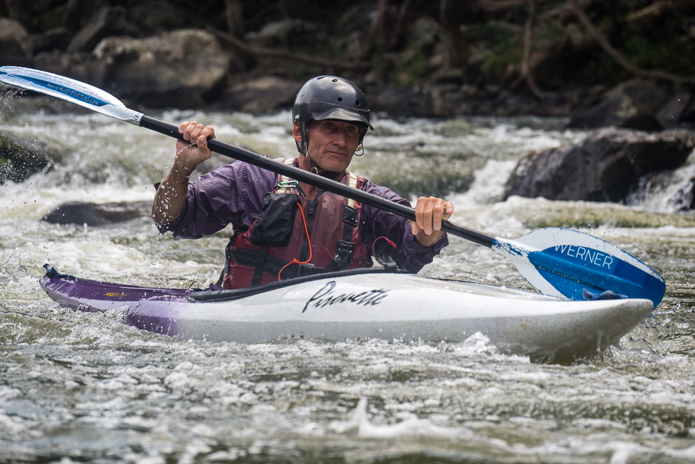
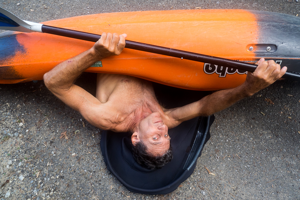
Dan Dixon shows the finer points of a roll on dry land. Feature Image: Mike Bezemek
“I put the student out in front,” explains kayak instructor Dan Dixon. “They lead me down the river, and I let them get into anything I can get them out of.”
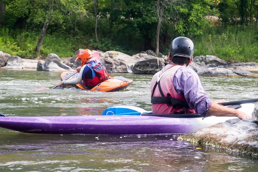
Three of us are kayaking down Section 9 of the French Broad, eddy hopping and joking along the way. Going first is Jean-Marc, an adventurer from Mexico City who has worked with Dan for five years. After decades of cenote diving, sailing and car racing, an accident forced Jean-Marc to have several vertebrae fused. So, he sought Dan’s guidance to adapt his paddling.
After a dry summer, the river is low. But Dan believes in getting the most from whatever level he encounters. Spotting some deep current with several mid-river rocks, he calls us over for an exercise. From the top of our eddy, paddle below one rock, loop around another, and return in the fewest strokes possible. After 30 minutes, each of us has reduced our total strokes by half.
NOC Master Instructor Dan Dixon driving a classic. | Photo: Mike Bezemek
Out in front with kayak instructor Dan Dixon
“I’ve been out there a few times when things went wrong,” Dan later tells me. “Being fully aware of the consequences reinforces the importance of certain skills, like putting everything into make an eddy.”
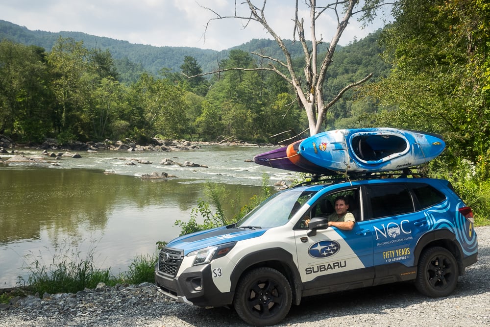
A few days earlier, I was paddling the Nantahala River, and I ran into Dan when I was taking out at the Nantahala Outdoor Center (NOC). Before we knew it, we’d spent over an hour sharing river stories. When he invited me to tag along for a class, I practically jumped into the Subaru he was driving, with colorful decals celebrating NOC’s 50th anniversary.
Equally impressive, in 2024, Dan will celebrate his own milestone: 40 years with NOC. These days, Dan lives in Ecuador, where he guides paddling trips. But he returns to the NOC Paddling School each summer, primarily as a private instructor. Most of Dan’s students are return clients, and they often seek out his assistance with more complicated situations, like preparing to kayak the Grand Canyon, paddling with disabilities or embarking on expeditions abroad.
In recognition of Dan’s dedication and expertise, NOC named him a Master Instructor about a decade ago, and he’s currently the only staff member to hold the title. Now, Dan’s not necessarily humble, but he doesn’t brag, and he listens just as much as he talks. After hearing some intriguing comments, it took several follow-up conversations with him to learn about his adventurous paddling career.
Dixon monitoring a student’s technique. | Photo: Mike Bezemek
Pulled around the world of whitewater
As a teenager living in Northern Illinois during the late 1970s, Dan sold some farm animals to buy a 13-foot Hollowform, one of the earliest plastic kayaks. After paddling solo for a year, he befriended some Chicago paddlers. Soon, he was paddling with them from the Midwest to the Southeast and beyond.
“For me, kayaking was about going places that I couldn’t get to other ways,” says Dan. “As my skills grew, the limits started dropping away.”
An American Canoe Association instructor course led Dan to NOC in the early 1980s. While working on the Chattooga River, he earned a nickname that stuck. Back then, like today, Dan’s preferred paddling apparel was a speedo. During that time, there was a movie remake titled Greystoke: The Legend of Tarzan, Lord of the Apes. The jovial guides believed Dan should have been the lead actor.
“A lot of the nicknames were worse,” recalls Dan. “I got off light.”
As the decade continued, Dan increasingly paddled outside the U.S. First was Canada, where Dan worked on the Ottawa River. Next came Mexico, with months spent zigzagging around in a Datsun hatchback. Later, he paddled the entire Mosquito Coast.
“Nepal was the first big thing,” recalls Dan. After a few months in-country, he was invited to join an NOC commercial kayaking expedition. The guests were Dan’s Chicago friends. He jokes that, since he often rescued them on private trips, why not join up officially as safety boater. The group ran rivers like the Sunkoshi, Seti Gandaki, Marshyangdi and Trishuli. When the guests left, the guides continued exploring, and the waters weren’t the only rough part.
“We were detained on the Tamakoshi,” says Dan in his understated way. “Held for three days and made a break.”
“A break?” I ask. “Like a jailbreak?”
A first descent fortunately avoided
More like a house arrest related to permits, explains Dan. Kayaking was so new, Nepalese tourism officials didn’t know how to respond. Back then, he continues, China had recently opened occupied Tibet to independent travel. The government wanted a huge fee for the first permit to run the Upper Tsangpo. So, Dan and his friend, an NOC guide named Arlene Burns, slipped in by taxi with two kayaks on the roof.
They started near Lhatse, where the Tsangpo was a braided river with class II-III rapids through high-desert valleys. After 100 miles, Arlene left at Shigatse, but Dan continued solo. Eventually, the river gorged up with mostly IVs and some Vs. He portaged once, cold and shivering, over enormous boulders.
Dan was most worried about getting caught. He paddled several times at night to sneak past a guarded bridge and a few Chinese encampments. Upon reaching the Lhasa River, he took out and went up to visit Tibet’s mountainous capital city. When he returned, his boat had been stolen.
“Perhaps luck,” admits Dan, “kept me from running the lower sections.”
Over a decade later, one of those sections—the ferocious Tsangpo Gorge—would drown expedition kayaker Doug Gordon. Four years later, the famous Scott Lindgren-led expedition would spend 30 days making the first successful descent.
Dan originally planned to stay three months in the Himalayas. But nine had passed when he walked into a U.S. consulate and was recognized. He’d been reported missing by his parents, who feared the worst. Distraught, the 24-year-old realized he hadn’t called home in six months. It was the first of two times Dan would be erroneously feared dead while paddling abroad.
No matter where Dixon’s misadventures lead, he has found his way back to NOC every year for the past 40 years. | Photo: Mike Bezemek
Finding Eden and facing disaster
During the 1990s, Dan split time between Costa Rica and NOC. In 1997, he guided his Chicago friends on an exploratory kayak expedition to Ecuador. Immediately, Dan was smitten by the rivers and culture.
“I have a habit of trying to stay longer in places,” says Dan.
In the early 2000s, Dan obtained residency in Ecuador. He and his wife initially lived on the banks of the Rio Tena. But during a harrowing night of flooding in 2010, they had to paddle away from their house and decided to move seven blocks uphill.
In Ecuador, Dan found strong paddlers to explore with. One was a conservation warrior hoping to convince Ecuadorians to preserve their pristine ecological and river resources. Another was a U.S. photographer named Oli, a great athlete with an impressive roll. Together, Dan and Oli began documenting their first descents in the region.
One day, they were exploratory paddling on the Quijos River below San Rafael Falls (which eroded away in 2020). The two had previously scouted by rappelling from the cliffs above. Dan says it wasn’t an overly challenging section, but it was running high. After Oli swam a few times, he seemed off his game. Dan went ahead to mark the take-out eddy, which was just upstream from an un-runnable chasm. As Oli approached, he was deflected off a curler. He flipped on a wave, rolled up and flipped again.
“I knew he was coming out,” says Dan. “So, I went after him.”
Dan got Oli on the back of his boat and aimed for the far shore. But the two were swept over a 10-foot pour-over and went deep into the hydraulic below.
“I felt a tug as my friend was yanked away,” says Dan. “I never saw him again.”
A few weeks later, the American Whitewater Journal erroneously reported that Dan Dixon had drowned that day. A correction came a few months later, along with a promise to improve the criteria for posting an accident report.
Dan Dixon shows the finer points of a roll on dry land. | Feature photo: Mike Bezemek
Philosophies for a long, happy paddling life
“I want people to have the skills so they can enjoy the sport forever,” says Dan about his teaching philosophy. “When people think they can’t make an eddy, they give up. A lot of times, there’s more opportunities to make it.”
My time with Dan is coming to an end, yet I can tell there are more stories to share. We briefly talk about how he’s managed to have so many remarkable adventures over the years. Paddling skills aside, Dan believes it’s a mix of social awareness and how he responds to situations. When I ask for an example, he recalls a tense moment during his expedition up the Mosquito Coast.
Dan was camping in Nicaragua when, around midnight, a villager entered his tent. The villager had a machete and a request that bordered on a demand: would Dan buy 10 kilos of cocaine?
“Ten kilos!” Dan tells me. “How you respond in a moment like that may dictate whether you live or die.”
Speaking in Spanish that night, Dan thanked the armed villager for the gracious offer. Then Dan diplomatically explained there were several reasons why the deal couldn’t go through. The villager seemed unconvinced until Dan made one particularly reasonable point.

 Paddling Magazine Subscription