Home Blog Page 462

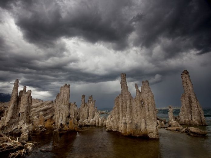
Mono Lake Kayak Trip

Photo: Barrett Donovan
Mono Lake Kayak Trip

This kayak trip destination is excerpted from the “Killer Trips” feature in Adventure Kayak magazine. 


Mono Lake State Natural Reserve, California

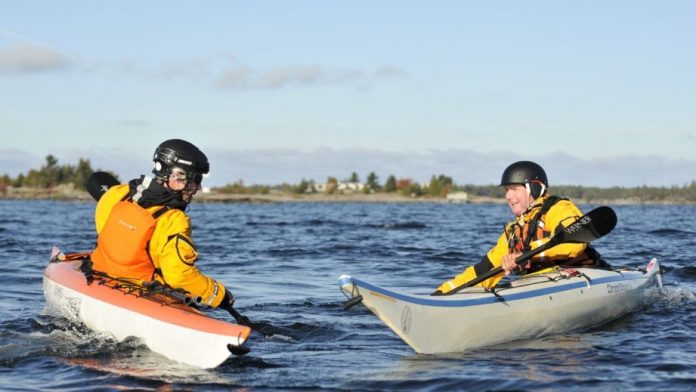
Perched at 6,384 feet in the Eastern Sierras, the flat basin that cradles Mono Lake also creates an unobstructed tunnel for storms to flow through. Lightning, when it strikes, can ignite wildfires fanned by gusting 70-mph winds. Get a weather update at the ranger station in Lee Vining before launching at Navy Beach on the lake’s south shore. From here it’s a short paddle to reach unrivalled seasonal birdwatching and the famous tufa towers—calcium-carbonate spires formed by freshwater springs interacting with the alkaline lake water. Mono has no outlet, and thousands of years of evaporation have concentrated minerals in the water, making this puddle more than twice as salty as the ocean. www.parks.ca.gov/?page_id=514


This article is a sneak preview from the Early Summer 2013 issue of Adventure Kayak. Download our free iPad/iPhone/iPod Touch App or Android App or read it here.

Daily Photo: Water Ballet

Photo: Virginia Marshall
Daily Photo: Water Ballet

The interplay of paddler, blade and boat can be a graceful dance of pinwheels and pirouettes, especially when White Squall Paddling Centre’s Tim Dyer (aka Baryshnikov) takes to the water.


Want to see your photo here? Send to [email protected] with subject line Daily Photo.


Drop Steeps on Tatlow Creek

Photo: Maxi Kniewasser
Tatlow Creek

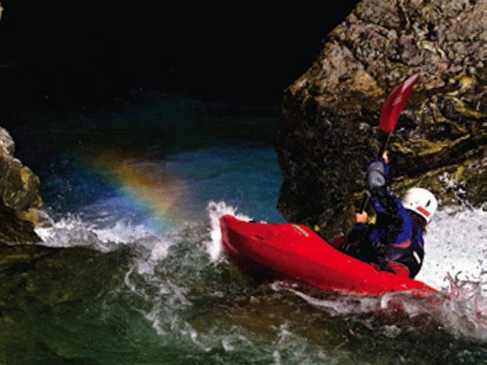
The discovery of Tatlow Creek by Jonavan Moore a few years back rocked the world of creek boaters. Stories of clean waterfalls and soaring, polished granite slides elevated Tatlow into a mythical class.  Even after a dozen runs down this elusive gem, persistent paddlers are still lured by Tatlow’s ephemeral rewards.

Getting to the put-in is arguably the most challenging part of the trip; a steep carry up the creek’s length is followed by a gruelling descent to the bottom of the gorge. Once at river level, boaters are rewarded with emerald water and some of the most enjoyable class V creeking this side of the Coast Mountains. Tatlow drops just over a mile (2 km) at 600 feet per mile towards the Ashlu, which offers its own justifiably famous whitewater.

Creativity is required on- and off-water as rope work, teamwork and balancing acts on slippery logs are needed to make downstream progress. At the bottom of the gorge, a final tight drop plunges into a sparkling pool framed by lush ferns, mossy rocks and feathery western red cedar.


Beta

Tatlow flows into the river right side of the Ashlu, about 45 minutes above the 50/50 bridge. Allow two hours for the hike in from an overgrown left turn on the Ashlu road (park at the culvert), and three to four hours for the descent. The season is tricky as the window is very narrow; mid-August is usually best. The distinctive golden rock at the take-out bridge should have just a bit of water flowing over it—none is too low, an inch is very high.


Planning

 Leland and Andria Davis’ new book The River Gypsies’ Guide to North America (Brushy Mountain, 2010) has some info on the run. However your best bet is to ask a local Squamish/Whistler boater who’s run it before to come along and show you. 


This article originally appeared in Rapid magazine, Early Summer 2010. Download our free iPad/iPhone/iPod Touch App or Android App or read it here. 

Daily Photo: Resolutions

Photo: Kellie M. Short
Daily Photo: Resolutions

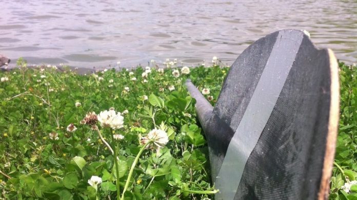
Adventure Kayak reader Kellie Short sent this photo of a well-loved paddle with this note: “My 2013 summer plan is to get out and kayak places that I’ve never been before.” Amen.


Want to see your photo here? Send to [email protected] with subject line Daily Photo.


Open Canoe Slalom

Photo: Marilyn Scriver
Canoe Slalom

This article originally appeared in Rapid magazine.

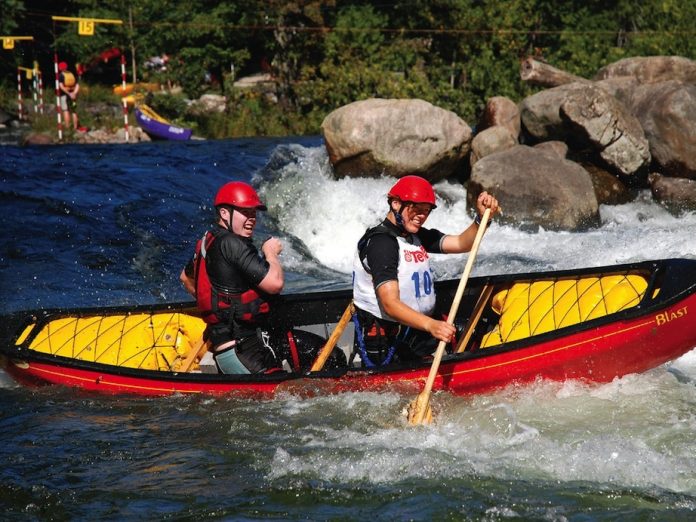
Thirty-one years ago, the first Gull River Open Canoe Slalom Race took place at the Minden Whitewater Preserve in Ontario. Since then, the event has become a classic, serving as a model for engaging new paddlers and growing grassroots participation, all while retaining top-level competitors.

Whitewater canoeing groundbreakers Wendy Grater, Fred Loosemore, George Drought, Jim MacLachlan and Maureen Bretz founded the event. “At the time, you could only race on a gated course at decked-boat slalom events,” says Bretz. “We felt there was a need for a slalom event just for open canoes.” During the first few years, 17-foot tandem tripping boats with truck inner tubes for flotation dominated the river. “There were almost no dedicated solo boats,” recalls Bretz.

Slalom canoeing rewards both strength and experience. This led to the addition of a Master’s class during the race’s second decade, for the growing set of men over 40, tired of being outdone by the young summer camp guides, home after a season on the river.

In 2003, the category was expanded further. “The first year I was coordinating the event, we introduced a solo class for Women’s Masters,” says then race director and medalist, Beth Kennedy. “There were only a handful of paddlers that first year but the class has since grown to the same size as the Women’s Solo category.”

Last year—the event’s 30th anniversary—a new category was added once again, as aging race organizers vied for glory and hardware. The Legend’s class gives men and women over 55 a break from the now crowded Master’s class. Before the introduction of the Legend’s category, the same boaters consistently won the Master’s. “The over 40 class was starting to get crowded, with most of the best paddlers now qualifying for that category,” says longtime competitor, Peter Farr. “It’s great to be able to race in the Legend’s class where there’s room to move up the standings.”

The Gull Race has also evolved into a family gathering. The Solo Men’s, Women’s and Junior’s classes consist of a range of paddlers from North American champions to those who dust off their canoes for their third or fourth run of the season. The Junior–Senior Tandem class usually consists of proudly grinning parents paddling with their children, like Rapid publisher Scott MacGregor and his son, Doug. “Racing with Dougie is the most fun I’ve had at the Gull,” says MacGregor. “We started racing together when he was four.” Doug’s medals hang on his bedpost all year long.

As modern whitewater open boating matures, so do pioneers like Bretz who continues to compete every year. “Where else can you see a competitive, challenging slalom race where the youngest competitor is three and the oldest is in their 70s?” says Bretz. “It serves as a breeding ground for new paddlers, having junior boaters mentored by others.”

With a record number of race starts there is clearly a demand for competitive, family-oriented events like the Gull Race where world-class open boaters race alongside legends in the making.


Mark Scriver enters the Gull Race yearly. While he’s creeping up on Legend status, he also keeps up with his sons. For more info on the event, visit www.whitewaterontario.ca.

This article originally appeared in Rapid, Summer/Fall 2011. Download our free iPad/iPhone/iPod Touch App or Android App or read it here.

Tarp Shelter Tactics

Photo: Dave Quinn
Tarp Set-up

This article originally appeared in Canoeroots and Family Camping magazine.

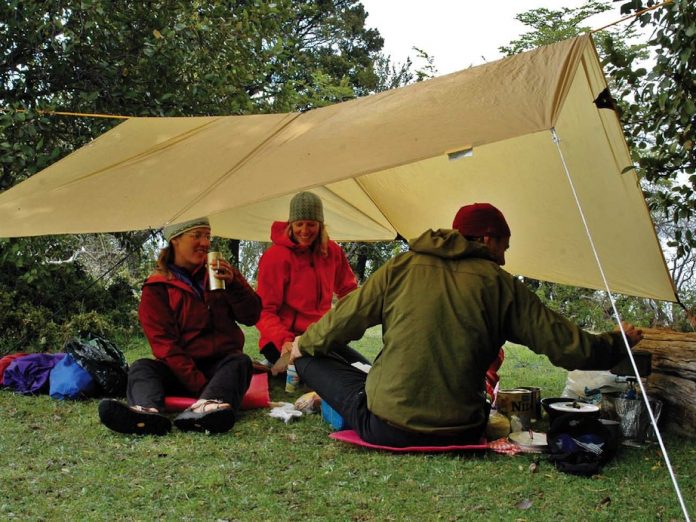
Granting protection from the rain or shade from the sun, no other piece of equipment is as useful and versatile yet easy to pack along as a tarp.

The most secure and comfortable set-ups have a stable ridge forming the highest part of the tarp.

The best way to support the ridge is to string an independent line between two trees or poles. This is called a ridgeline and once this sturdy line is established at the right height you can drape the tarp over it.

If there is no natural anchor point exactly where you need it, then run a line at an oblique angle between two adjacent trees. Tie a loop in this line where you would have your anchor and secure your ridgeline to the loop.

Next, run anchor lines from the corners at about 45 degrees from the ridgeline axis, with additional lines from grommets or tabs on the sides as wind conditions warrant. Be creative about what you anchor to: tent pegs, trees, roots, bow or stern grab handles and thwarts. The heavier the rain, the steeper the tarp’s side slopes should be so it sheds water better in case the tarp is worn and not entirely waterproof.

Remember that most tarp fabrics stretch when wet. This means the water pools just inside the hemmed edges, which don’t stretch as much. Create a drainage valley by using a line to pull down one of the attachment points near the center of the tarp’s lowest edge. Tie this line to an anchor, or simply weight it with a stuff sack of stones or a water bottle.

Think outside the box

Bungalow-style roof set-ups are great where they work, but campsite geography or weather conditions might demand creativity.

» On oddly shaped sites, run the ridgeline from one corner of the tarp to the opposite corner. This creates a longer ridgeline and triangular sloping panels that fit more easily between trees.

» For a simple lean-to, you can tie only the tarp’s highest edge to the ridgeline, instead of draping half the tarp over to create a second roof aspect. This protects from a driving rain while still providing maximum overhead coverage.

» If the weather is terrible and you don’t need much space under the tarp, set it up with one high corner and three low corners to create a cave-like set-up that opens downwind to provide maximum shelter.

Tips

»  Carry at least 20 metres of stout cord that ties and unties easily. More line means more options.

»  Learn to tie the trucker’s hitch for a tensioned ridgeline and the taut-line hitch for anchor lines that you can adjust without retying.

This article appeared in Canoeroots & Family Camping, Early Summer 2009. Download our free iPad/iPhone/iPod Touch App or Android App or read it here.

6 Reasons to go GPS

Photo: Peter Mather
6 Reasons to go GPS

This skills article was originally published in Adventure Kayak magazine.


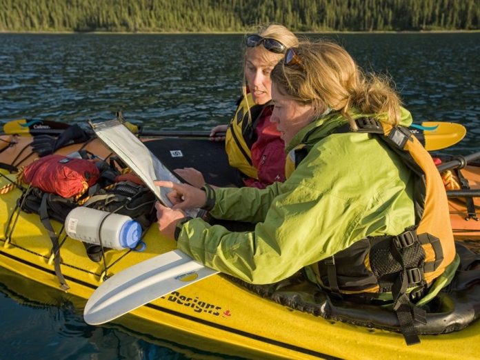
First, people used the stars to stay on course. Then, maps and charts. Now we look back to the heavens to help us navigate, only this time, we use satellites. Today’s GPS devices offer more functionality for paddlers than ever. Leave the map and compass in your hatch and start taking advantage of these six things GPS does better.


GPS SHOWS YOU EXACTLY WHERE YOU ARE

Early receivers were accurate to within 100 meters—enough to give you a rough idea of your position but with a margin of error dangerous for kayakers on lengthy crossings or in limited visibility circumstances. Wide Area Augmentation System-enabled receivers are now the norm and are accurate enough to determine your position to within three meters.


GPS PUTS A WORLD’S WORTH OF MAPS AT ANY SCALE AT YOUR FINGERTIPS

Downloadable map packages include continent-wide coverage allowing devices to contain a library of maps in one place. Preview maps on your computer and preset your own routes, waypoints, landmarks and other information before you head out on trip.

Both topographical maps and marine charts are available for GPS. For most paddlers, topo map sets include more than enough detail to navigate successfully. Nautical chart sets are useful in more challenging ocean environments because they display shoals or submerged rocks, marine aids to navigation, tidal currents and overfalls and large vessel transit zones.


GPS TELLS YOU WHERE TO GO

With a map set and route or destination inputted, it’s just a matter of connecting the dots on the water. Like units designed for in-car use, navigation involves following an arrow to your preset destination. Unlike automobile GPS, there’s no bossy voice calling out un-wanted instructions.


GPS IS MORE THAN JUST MAPPING

Some handhelds can be loaded with global tide tables for those paddling in coastal regions, as well as sunrise and sunset data and lunar cycles, keeping all your navigation data in one place, ready when you need it. Units with barometric pressure sensors can be useful in tracking and predicting weather patterns.


GPS HELPS WITH KEEPING IN TOUCH

Some units are available with two-way radio capability for communication between paddlers or over longer distance using VHF. Others can be paired with satellite communication devices to send email, call for help and even post messages to Facebook and Twitter so your social media network can follow your progress.


GPS HELPS DOCUMENT YOUR JOURNEY

Program your handheld to record your tracks and you can save your route to retrace later or share with paddling buddies. Most units also record distance covered, average traveling speed and time spent on the go—all useful for route planning or training. Marking points of interest helps with remembering aspects of a trip. Some devices come with cameras so you can tie images to places, great for trip logs, reports and storytelling.


This article originally appeared in Adventure Kayak, Early Summer 2012. Download our freeiPad/iPhone/iPod Touch App or Android App or read it here.

One Man’s Epic

This video compilation of British adventurer Tom Smitheringale’s One Man Epic expedition down Egypt’s Nile River by kayak originally appeared in the Early Summer issue of Adventure Kayak magazine. Video, photos and story by Dave Brosha.

To read an exclusive feature on the incredible story of Smitheringale’s journey, capture and escape from a Libyan militia prison, download our free iPad/iPhone/iPod Touch App or Android App or read it here.
Daily Photo: River of the Stick-Wavers

Photo: Virginia Marshall
Daily Photo: River of the Stick-Wavers

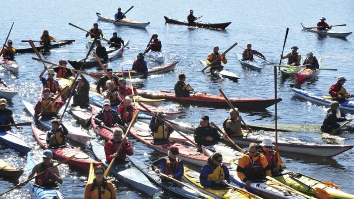
Paddlers at the Ontario Greenland Camp in Muskoka gather for a celebration of skinny stick paddling, tradtional rolling, and Greenlandic kayak culture.


Want to see your photo here? Send to [email protected] with subject line Daily Photo.


Freestyle Move: Split Phonics

Photos: Nick Troutman
Emily Jackson freestyle

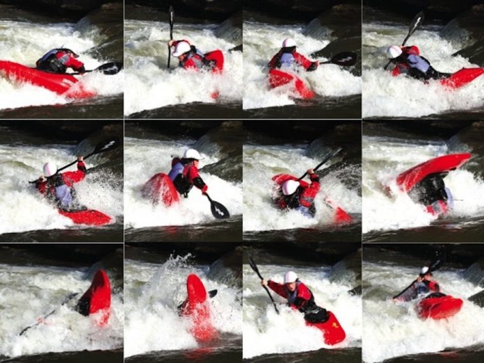
This is a fun trick because it combines a balanced cartwheel move—a splitwheel—with one that can give you some really big air—a phonics monkey.

The split phonics surfaced in 2009 when hole combos gained popularity because they scored higher in freestyle competitions than any individual moves. Combos also save time when you’re trying to squeeze in all your moves before your ride times out. At this year’s Worlds, a new combo bonus will make these moves even more attractive to competitors.

These steps outline a left-to-right split, into a right phonics.

1. Facing upstream, initiate a lefty cartwheel with a back sweep of your left paddle blade.

2. After the first end of your cartwheel gets vertical, reverse your rotation by twisting 90 degrees to look over your right shoulder and pulling the stern through with a forward stroke on the left blade. This completes the split.

3. As your bow comes down, plant a cross-bow draw with your left hand to begin a pirouette. Don’t wait too long to reach across for the pirouette or it won’t be considered a combo. Make sure you dig beneath the foam pile to grab the green water—this 
is what will pull you around 360 degrees.

4. Continue the pirouette until you
are facing back upstream. Holding the pirouette all the way around is crucial. If you are falling over on this step, you are probably going too vertical on the pirouette. Your chin and chest should finish facing up and out so that you can jump when you get to the next step.

5. Once facing upstream, lift your paddle out of the water and jump to throw a loop. Make sure you jump upstream, not straight up, or you will not complete the loop. If your loop never feels straight, you may be jumping too soon.

6. Finish your loop on top of the foam pile and facing upstream. Do a fist pump and blow kisses to your fans.


This article originally appeared in Rapid, Early Summer 2011. Download our free iPad/iPhone/iPod Touch App or Android App or read it here.