Home Blog Page 473

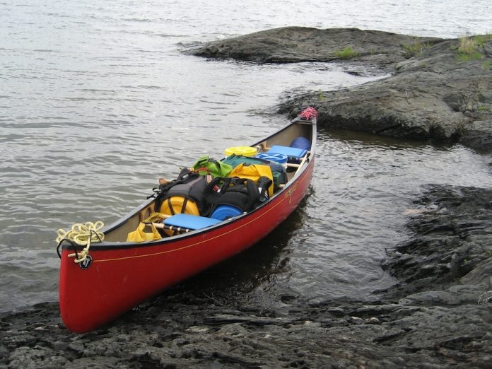
Daily Photo: I’m Ready!

Photo: Judy Burgschmidt
Saskatchewan

“Love Canoeroots magazine…not just for the tips, blogs, articles, pics, but for the sharing of the passion for paddling!!!” writes Judy Burgschmidt. “We are sitting with 3 feet of snow in our yards, and the rivers are frozen with a foot or tow of ice….BUT we know we will be paddling soon! This pic is from the Sturgeon Weir River in Saskatchewan, one of the many historic canoe routes just a five hour drive away to put it. We were all loaded up after an awesome night and loving the black rock of the shield.”

This photo was taken by Judy Burgschmidt. Want to see your photo here? Send to [email protected] with subject line Daily Photo


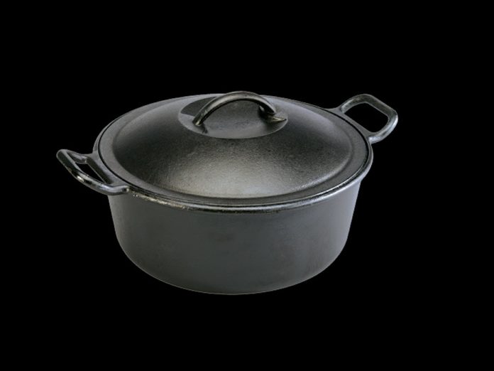
Lodge Camp Dutch Oven Review

Photo: Lodge
Lodge Camp Dutch Oven

This gear review was originally appeared in Canoeroots and Family Camping magazine.

There’s bad heavy metal and there’s good heavy metal. Bad heavy metal is Def Leppard. Good heavy metal includes AC/DC and Lodge Camp Dutch Ovens. Lodge has been doing their thing for 115 years (longer even than AC/DC). Prepare breakfasts, breads, dinners and cakes all with one pot. With a flanged lid for resting coals on top and legs to keep the oven from smothering coals underneath, these ovens are designed to spend long evenings nestled in hardwood coals. Available in 2- to 12-litre sizes, from 8 to 16 inches in diameter.

From $50 to $160 | www.lodgemfg.com

This article appeared in Canoeroots & Family Camping, Spring 2009.


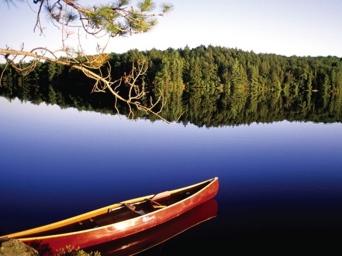
Paddling in Papineau-Labelle

Photo: Kevin Callan
Travelling weather.

This article originally appeared in Canoeroots and Family Camping magazine.

Papineau-Labelle is known to some as Quebec’s Adirondacks. Though it’s not as mountainous as the ‘Dacks, the area boasts turquoise-colored lakes surrounded by prime hilltop hiking terrain. Better still, the park is less then a few hours’ drive from Montreal or Ottawa. Created in 1971 as a wildlife reserve, it protects a total of 770 lakes just begging to be looped together.

Papineau-Labelle has more than a dozen entry points. Access point Pie IX is where you get your permit and access to Lac des Sept Fréres, the main starting point for loops of two to four days with portages from 300 to 1,000 metres. Try plying Lacs Montjoie, Marceau, Primeau, Clement, Ogilvy, Mercier, Lartigue and Diamond back to Lac des Sept Fréres.

Bring your fly rod. All the park’s lakes are stocked with lake and speckled trout, and the Rivère de Sourd (one of the best spring weekend river trips in Quebec) is an angler’s paradise for spring brookies.


Need-to-know info:


Canoe Rental

Tuckamor Outfitters, www.tuckamor.ca

Topographic Maps

31 J/03 Duhamel, 31 J/04 Bouchette, 31 G/13 Low

Papineau-Labelle Information

1-800-665-6527

www.sepaq.com/rf/pal/en

This article appeared in Canoeroots & Family Camping, Early Summer 2009. Download our free iPad/iPhone/iPod Touch App or Android App or read it here.

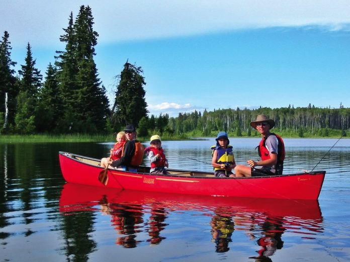
Alberta’s Best Backcountry Canoeing

Photo: Megan Kopp
Fish beware.

This article originally appeared in Canoeroots and Family Camping magazine.

Lakeland is a wildland getaway on the edge of the boreal forest that’s home to Alberta’s best backcountry canoe circuit (rebuttals welcome). The route may come with a few quirks (such as motorized aluminum fishing boats towed by ATVs into all but McGuffin Lake), but the park’s draws include easy access, uncrowded backcountry campsites, outstanding angling and frequent flyovers by white pelicans, red-necked grebes and raptors.

Access is 55 kilometres east of Lac La Biche at the Jackson Staging Area (Mile 12 on Touchwood Lake Road). Load a nearby canoe cart and follow the portage trail for 3.2 kilometres to the dock on the north arm of Jackson Lake. From there it’s less than a one hour paddle to a large, grassy campsite on the eastern shore (if you arrive late you can stay at Touchwood Lake Campsite). In the morning, duck under the Isthmus Bridge separating Jackson and Kinnaird lakes and follow the western shore to Kinnaird Island’s campsite. Solitude-seekers can strive for McGuffin Lake by following the southeastern shore of Jackson Lake through several scenic ponds to a 600-metre portage.

No need to adopt a minimalist approach. Canoe carts are available free of charge where needed. 

Need-to-know info:


Canoe Rental

Totem Outfitters in Edmonton. www.totemoutfitters.ca

Map

Online at www.gateway.cd.gov.ab.ca/pubsandmedia/lake_land_pp_map.pdf

Park Information

www.gateway.cd.gov.ab.ca/siteinformation.aspx?id=280

This article appeared in Canoeroots & Family Camping, Early Summer 2009. Download our free iPad/iPhone/iPod Touch App or Android App or read it here.

Columbia Lake Canoeing

Photo: Dave Quinn
Rocky Mountain paddling.

This article originally appeared in Canoeroots and Family Camping magazine.

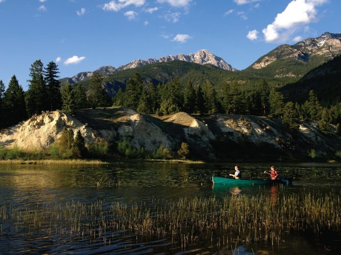
Columbia Lake glows like a blue-green glacial jewel set in the Rocky Mountain Trench. The 14-kilometre-long eastern shoreline is one of the last pristine natural lakeshores in the vicinity. Good news for the Ktunaxa (Too-na-cka) Nation Spirit Trail, which hugs the slopes above the shore and offers hiking paddlers a chance to experience the open forests and grasslands of the Trench.

The trip begins at the lake’s northern outlet in Columbia Lake Provincial Park. Head north on Columbia River Road from Fairmont Hot Springs. Once on the park’s gravel access road, look for two obvious gravel tracks to the lakeshore for put-ins, one is at the gated end of the road. Two easy days can get you to a shuttle vehicle at Canal Flats Provincial Park at the south end of the lake, but many paddlers opt for an out-and-back trip. Campsites are numerous, but try to set up below the spring high-water mark.

At more than 2,000 kilometres from the Pacific, Columbia Lake forms the headwaters of the Columbia River, the fourth largest river in North America. Millions of salmon spawned here until the construction of Washington State’s Grand Coulee Dam in 1942. 


Need-to-know info:


Canoe Rental

Kootenay River Runners, www.raftingtherockies.com

Columbia River Outfitters, www.columbiariveroutfitters.com

Good Read

River of Memory: the Everlasting Columbia, by William D. Layman

Park Information

www.env.gov.bc.ca/bcparks/explore/parkpgs/columbia_lk/

This article appeared in Canoeroots & Family Camping, Early Summer 2009. Download our free iPad/iPhone/iPod Touch App or Android App or read it here.

Minnesota Weekend Escape

Photo: Stephen Brede
Boundary Waters bounty.

This article originally appeared in Canoeroots and Family Camping magazine.

Yes, you can find weekend solitude in the Boundary Waters canoe area. Just portage into
a dead-end lake or pond-hop between beaver streams. The 
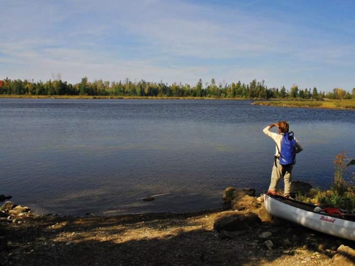
Ham Lake to Long Island Lake loop consists mostly of large, clear ponds and beaver streams. Navigation is easy—just don’t leave your map at home. Short, easy portages link lakes filled with reasonably secluded campsites.

Access is from the Gunflint Trail, north of Grand Marais. There is a Forest Service parking area at the Cross River landing (BWCA entry point #50). Two short portages bring you to Ham Lake and your first campsites. Portage 140 yards to Cross-Bay Lake. Camp here or continue west to Snipe Lake or south to Long Island Lake. The few portages that connect these lakes are less than 275 yards.

Adventurous paddlers will want to explore the beaver stream that runs from Long Island Lake to Fool Lake in May or June when the water is high. Wading, dragging and lining are part of canoeing beaver streams. Wear sturdy wet shoes and keep a 15-foot line attached to each end of your canoe.


Need-to-know info:


Canoe Rental

www.quetico100.com, look under partners

Maps

Voyageur Maps #6, #9 and #3

W.A. Fisher Co. F12

Mackenzie #4 and #7

Route Planning

Exploring the Boundary Waters, by Daniel Pauly

General BWCA Wisdom

Boundary Waters Canoe Camping, by Cliff Jacobson

—Cliff Jacobson

This article appeared in Canoeroots & Family Camping, Early Summer 2009. Download our free iPad/iPhone/iPod Touch App or Android App or read it here.

York River Canoe Trip

Photo: Kevin Callan
Egan Chute.

This article originally appeared in Canoeroots and Family Camping magazine.

The York River’s initial surveyors called it the great-grandchild of 
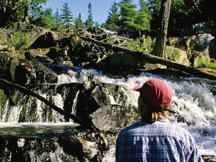
the mighty St. Lawrence. They may have gotten the lineage—or at least flow direction—wrong but the route comes complete with beautiful cascades that plunge over unique geological formations as it twists its way along a deep and forested valley. But what’s most special about the York is that no one knows about it. Spotting the re-introduced elk herd living in the area is more likely than seeing another paddler on the York.

A perfect two-day novice outing is between Egan Chutes Provincial Park and Conroy Marsh. Egan Chutes is
 11 kilometres east of Bancroft along Highway 28. The take-out is a public launch at the west end of Combermere on Highway 62. The first quarter of
 the route includes three major drops. Each have possible campsites but further downstream, between the Great Bend and King’s Marsh, are fantastic sand bars for campsites. Pack along a rock guide. Rockhounds consider this area to be the Mineral Capital of Canada. The three chutes abound in nepheline, sodalite, biotite, zircon, and blue corundum.


Need-to-know info:


Canoe Rental and Shuttle

Silgrey Resort, www.silgrey.ca

Canoe Rental

Trips and Trails Adventure Outfitting, www.tripsntrails.ca

Topographic Maps

31 F/4, 31 F/5

Route Information

A Paddler’s Guide to Ontario’s Lost Canoe Routes, by Kevin Callan.  

—Kevin Callan

This article appeared in Canoeroots & Family Camping, Early Summer 2009. Download our free iPad/iPhone/iPod Touch App or Android App or read it here.

Butt End: Camping with a Canine

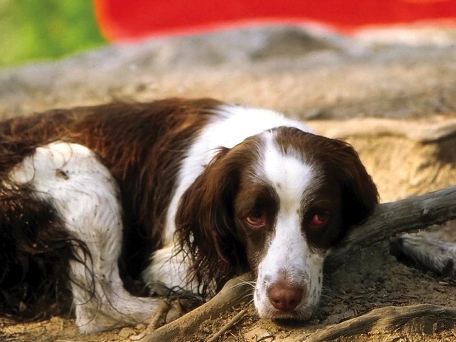
Canine Canoeist | Photo: Kevin Callan

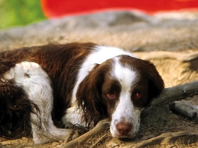
An hour after my canoeing companion of 12 years had been euthanized, I put my feelings about her life on paper. I wrote up a list of Bailey’s faults and strengths, her crazier character traits and the stunts she pulled during a life that included more than 600 nights out on canoe trips.

I posted my thoughts on my blog that evening and by the end of the next day I had received more than 500 emails of condolences from people who either knew of Bailey or were trippers who also rejoiced in canine company.

I wouldn’t have guessed that so many people knew my dog (or read my blog, for that matter) but I suppose it makes sense, since she has appeared in a dozen books and countless magazine articles.

More surprising was the number of people who wrote about willingly subjecting themselves to the maddening appeal of canoeing with a dog.

Bringing Bailey along on trips was a challenge. I carried her specially designed pack full of kibble and chew toys more then she. She was the first to have breakfast, lunch and dinner. Her sun umbrella strapped to the gunwale and foam cushion glued to the belly of the canoe made portaging difficult. She insisted the bug shelter be put up for her immediately once we reached camp. I lifted her in or out of the canoe at every single put-in and take-out.

Bailey was chased by skunks, porcupines, a lynx, raccoons, hawks, snakes, swarms of hornets, one nasty chipmunk, and a couple of black bears (some of which followed her right back toward me). She loved rolling in crap. When she was in the canoe she whined to be lifted out and once out she whined to be put in. Every time I hooked into a fish the ever-helpful dog would try to retrieve it for me.

Canine Canoeist | Photo: Kevin Callan

So, why did I, and all those other dog owners, put up with dog paddling? It wasn’t just because by attracting all the bugs she made a good shoofly-pie, or that she could sense a thunderstorm better than any polyester-clad weatherman or that if it weren’t for her ability to sniff out a trail I’d still be on one particularly confusing portage on the Steel River.

I loved tripping with Bailey because she never once left my side. She was a constant companion, no questions asked. My daughter, Kyla, even nicknamed her my shadow. How I miss my shadow. I doubt that canoe tripping will ever be the same without her.

Rest in peace my dear friend.

KEVIN CALLAN won’t comment on rumours that Bailey was named for his favourite drink.

This article appeared in Canoeroots & Family Camping, Early Summer 2009. 

Gibson River Getaway

Photo: Hap Wilson
Muskoka, minus the movie stars.

This article originally appeared in Canoeroots and Family Camping magazine.

Clean water, dark night skies, swimming under a 15-metre waterfall, ancient pine forests (we won’t mention rattlesnakes yet),
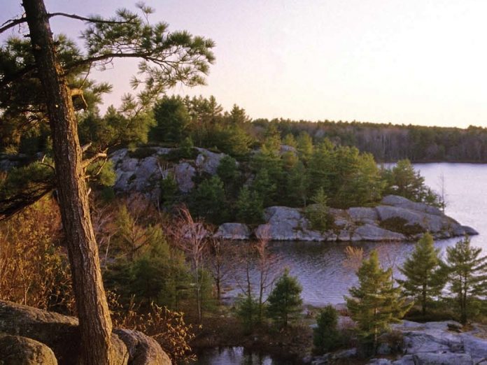
 the quiet Gibson River has it all. Muskoka might be known as a cottager’s playground of million-dollar summer homes, but the Gibson stubbornly and successfully retains a wilderness charm. The Gibson River corridor is partially protected for its rich Atlantic Coastal Plain flora, gneissic bedrock outcrops, superb vistas and yes, the threatened (but not threatening) Eastern Massasauga rattlesnake. The 45-kilometre Gibson river route is a novice mix of small river, creek and lake canoeing with a few short portages around shallow rapids and plenty of great campsites.

To put in, take Highway 169 north as far as Torrance. Drive eight kilometres south on Southwood Road to Nine-Mile
 Lake Marina (705-762-5303). Follow the Gibson through the southwestern outlet of Nine-Mile Lake and continue to Woodland and Brothersons lakes, then through ponds and stretches of river to Gibson Lake and Go Home Lake. Take out is generally the Go Home Lake Marina (on Go Home Lake Road, west off of Highway 69, 705-375-2211). You’ll need to do a one-hour vehicle shuttle and might be able to arrange it with either marina if you call ahead.


Need-to-know info:


Canoe Rental

Muskoka Paddle Shack (705) 687-9415

Algonquin Outfitters (705) 645-9262

Muskoka Outfitters (705) 646 0492

Topographic Maps

31 D/13

Route Information

Canoeing, Kayaking and Hiking Wild Muskoka, by Hap Wilson. 

—Hap Wilson

This article appeared in Canoeroots & Family Camping, Early Summer 2009. Download our free iPad/iPhone/iPod Touch App or Android App or read it here.

Tumblehome: Alone Across the Atlantic

Courtesy of James Raffan
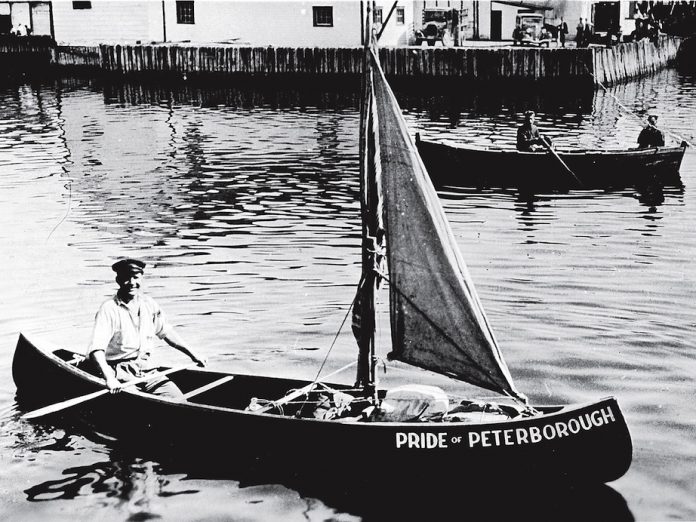
Pride of Peterborough

Sooner or later, everybody who owns a canoe scans the boat in the rosy light of evening and wonders what adventures it has been on and what future odysseys are in store. A trip upstream to the source of the local river? A trip across the country? In a nation of rivers like Canada, it’s easy to think that with the right boat, the proper gear, enough food and dollop of daring and ingenuity, epic journeys are possible for any- one willing to take a risk.

And then there’s John Smith of Peterborough.

It was the spring of 1934. Smith, 34, had spent the previous five years being a whaler and merchant mariner. But he had returned home to realize a dream that had been brewing in his fertile mind since his early adult years working for the Peterborough Canoe Company. The dream was simple. He would paddle a 16-foot cedar-canvas canoe, called “Pride of Peterborough,” from Peterborough, Ontario, to Peterborough, England—solo across the Atlantic.

Really. He would load the boat with 500 pounds of fresh water and hard tack, sew a canvas cover to keep waves at bay. All in, he would leave the George Street wharf on the Otonabee River in June and, in two to three months, would be relaying personal greetings to family and friends in Ireland. Then onward across the Irish Sea to Peterborough, Cambridgeshire, on the River Nene.

And that’s exactly what he set out to do. The reporter who broke the story in the Peterborough Examiner was initially skeptical. But Smith’s shy demeanour and earnest determination convinced him otherwise. “Yes sir, Smith is serious,” he wrote. “For the past eight months… he has been analyzing carefully the various problems involved. And right now he is busy seeking a canoe of the proper type and arranging for the food rations and equipment he will carry with him.”

Smith… well… didn’t make it. He’s buried in an unmarked grave near Stephenville, Newfoundland. He made his way safely to the tip of the Gaspé Peninsula and, from there, struck out into the open waters of the Gulf of St. Lawrence to make the 435-kilometre crossing to Newfoundland.

His journal, which turned up as beach flotsam in a waterproofed tin can, detailed that partway over he stopped aboard a freighter whose captain gave him a hot meal, a mariner’s rubber safety suit and a map and sent him on his way again. Somewhere between there and Newfoundland, Smith came a cropper.

His body washed up in one place, his surf-bashed canoe in another, the tin can containing his journal in another; all pieces of Smith’s impossible dream.

It was on those beaches that Smith’s story would have faded into obscurity had it not been for two Peterborough artists who have kept the tale alive.

Singer and songwriter Glen Caradus premiered a splendid new ballad about John Smith at a concert at The Canadian Canoe Museum earlier this year. When asked, he allowed that he was inspired to write the song by an art installation created by Mount Pleasant, Ontario, artist JoEllen Brydon.

In the early 1990s, Brydon was pulling up flooring in her 19th-century farmhouse and came upon old newspapers that included a June, 1934 edition of the Peterborough Examiner. So captivated was she by Smith’s story that she created a whole art installation around the tale—18 paintings installed on a wall behind a 1930s-style diner counter where visitors can sit on padded chrome stools and read reprints of the Smith story as it appeared back in the day. This work is now in the Museum of Civilization in Ottawa.

Not only do we need John Smiths for inspiration, we also need artists like Caradus and Brydon to keep their stories alive. The stories they tell remind us that epic journeys of discovery, whatever the vehicle, whatever the goal, begin far closer to home than most of us ever imagine.

All it takes is a dream.

James Raffan is the executive director of the Canadian Canoe Museum.

This article appeared in Canoeroots & Family Camping, Summer/Fall 2009.