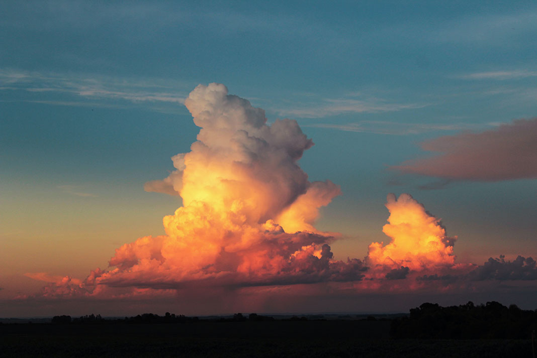
Using cloud identification to forecast weather is a skill that mariners have used for hundreds of years. Watching clouds is simple and easy, yet it has been empirically proven that cloud observation as a means to predict the weather yields an accuracy of 60–75 percent. Not bad for just looking up. See illustrations of the different types of clouds—and what they mean—below.
4 types of cloud to help you predict the weather
Seasonal weather follows fairly predictable patterns in each part of the world. Different types of clouds form in very different ways in the atmosphere, depending on pressure and the moisture available. Since certain weather produces certain cloud types, observing clouds can tell you how and when the weather will change.
The key here is learning the basic cloud groups. Clouds are classified by shape and height, with names derived from Latin words describing their form. There are three basic categories you should commit to memory, as well as a fourth variation that deserves special notice.

1 Cirrus
Appearance (above): White, feathery looking patches and strands; usually spreading across the sky.
Prediction: Cirrus are high level clouds. These thin wisps are often the forerunner of approaching bad or unsettled weather. A gradually increasing cover shows that an approaching weather system will bring wind and possible precipitation. By observing their movement, you can tell from which direction the weather is coming.
In much of North America, cirrus clouds in the west or southwest quadrant of the sky usually indicate that the weather will change for the worse within 24 hours.

2 Stratus
Appearance: Uniform pale gray or white layer, looks like cheese cloth spread across the sky; can be translucent so that the sun or moon shows through as a hazy disk.
Prediction: High or mid-level stratus usually follow cirrus clouds. When they cover the entire sky, weather change is 12–18 hours away.

3 Cumulus
Appearance: Puffy white cotton balls; if they begin to tower—become taller than they are broad—with flat bases and tops that look hard like the head of a cauliflower, they are called cumulus congestus.
Prediction: When cumulus remain the same size and shape and do not show signs of vertical growth, they are called fair-weather cumulus, meaning the weather will remain the same for at least 24 hours. If towering cumulus continue to grow, they can develop into cumulonimbus clouds with showers or thunderstorms within the next few hours.

4 Cumulonimbus
Appearance: Large cloud mass with very dark base and bright top that may flatten into an anvil-head.
Prediction: The rapid vertical growth and anvil-like shape of cumulonimbus indicate high winds within and above the clouds. These clouds can forecast some of the most extreme weather on the planet including very strong wind gusts, heavy rain, hail and lightning.
In North America, when you see these on the western or southwestern horizon, get off the water and seek shelter. The storm is often as little as one hour away, particularly when you hear thunder as well.
Use these tips on cloud types for a quick DIY weather forecast. | Feature photo: Guy Kimola


 This article was first published in the Early Summer 2011 issue of Adventure Kayak Magazine.


