Home Blog Page 525

Betcha Didn’t Know About the Hudson’s Bay Company

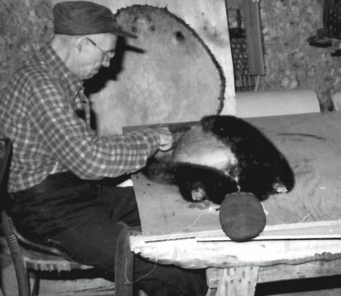
Photo: Algonquin Park Archives 5573 (MNR)
Betcha Didn't Know About the Hudson's Bay Company
  • The Hudson’s Bay Company (HBC) is the oldest incorporated merchandising company in the English-speaking world. When you buy socks at The Bay you’re continuing a 338-year-old tradition.
  • During the first half of the 19th century, the HBC held sway over 1/12th of the earth’s land surface—allowing HBC overseas governor Sir George Simpson to be introduced at a fancy 1838 dinner as the “head of the most extended dominions in the known world, the Emperor of Russia and the Queen of England excepted.”
  • Although HBC are the initials of English heart-throb actor Helena Bonham Carter (who has never portrayed a beaver but did appear as a chimp named Ari in Planet Of The Apes), HBC also once stood for “Here Before Christ” in the minds of traders frustrated by the company’s monopolistic ways. Those who found themselves inside isolated fur trading posts often left thinking HBC stood for “Horny Boys’ Club.”
  • In a related story, it is rumoured that Sir George Simpson sired 70 children between Quebec and the Pacific during 40 years with the HBC, lending legitimacy of a sort to his title of father of the fur trade.
  • The original Latin motto of the HBC, pro pelle cutem, meaning “a skin for a skin,” sounds benign enough for a fur trading company, until one realizes that these words were interpreted by employees to mean that to join the fur trade they had to trade their own skin for the brutal and short life of a fur trader.
  • The iconic voyageur canoe paintings of Frances Anne Hopkins notwithstanding, after 1820 most HBC freight was carried not in canoes but in boats fashioned after Orcadian dories that were rowed, not paddled.
  • Though many assume that 19th-century Canada was buzzing with folk-song-singing French-Canadian and Métis voyageurs, 80 per cent of HBC employees at the time were stolid Scots from Orkney, who had as much trouble carrying a tune as they did their heavy dories.  

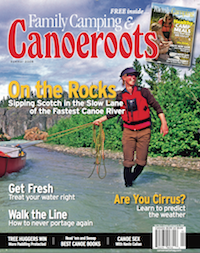
This article on the Hudson's Bay Company was published in the Summer 2008 issue of Canoeroots magazine.This article first appeared in the Summer 2008 issue of Canoeroots Magazine. For more great content, subscribe to Canoeroots’ print and digital editions here.

Editorial: The Right to Bear Paddles

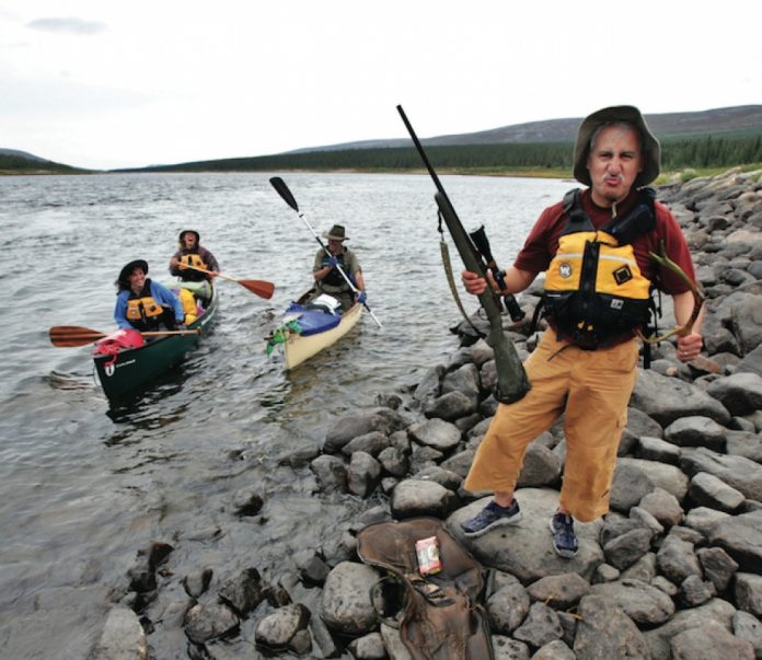
Photo: Gary McGuffin
Editorial: The Right to Bear Paddles

Imagine a smiling figure walking to the front of a crowded hall. Those nearby slap him on the back while the rest cheer. Stepping onto a stage he squints into rapid-fire camera flashes.

He grabs a paddle, raises it above his head and tells the crowd that if someone wants to take the paddle from him they will have to pry it from his “cold, dead hands.” The crowd roars; the politicians fall in line.

You probably have an easier time picturing a gun-toting Charlton Heston—movie star and former president of the National Rifle Association—in this situation rather than Paddle Canada president Richard Alexander. Here’s hoping Paddle Canada finds a way to put a little NRA firepower into its organization. The time may be coming.

As reported in the Summer 2008 issue of Canoeroots, Paddle Canada has entered a braided section of river and chosen what it hopes is the channel with the strongest current.

At first we were gun-shy about reporting on Paddle Canada’s political manoeuvres. Paddle Canada owns Kanawa magazine and the Waterwalker Film Festival, two ventures that compete, however politely, with Rapid Media’s magazines and our Reel Paddling Film Festival. We were wary of being seen as biased, but in researching the story I came to appreciate its importance.

BRINGING IN ADVOCACY AND LOBBYING

Paddle Canada was formed in 1976 to promote four pillars of recreational paddling: instruction, safety, environmental awareness and appreciation of our paddling heritage. It had struggled lately and some doubted it could continue fulfilling any part of its mandate. The 2006 sale of its member-built Ron Johnstone Paddling Centre headquarters and the liquidation of its inventory of boats, computers, staplers and a few paper clips fuelled the worries.

Alexander told me Paddle Canada will run a surplus this year for the first time in five years. He understandably feels a huge sense of accomplishment and credits the strength of the money-generating instructional program. But when I asked about the other quarters of Paddle Canada’s mandate the conversation slowed while we checked the website to remind ourselves what they were.

“Advocacy and lobbying are not primary purposes of this paddling organization,” explained Alexander.

Perhaps not now, but if Alexander continues to strengthen Paddle Canada, why couldn’t they become more a part of its purpose? Imagine for a moment if paddlers had a vehicle for wielding political influence. That’s where the famous scene with Charlton Heston comes in (the one from the NRA convention, not when he finds the Statue of Liberty on the beach in Planet of the Apes and goes ape).

The NRA marshals more than four million members, claims an 86 per cent success rate in helping the politicians it endorses get elected and is routinely ranked by members of Congress as the most powerful lobby group in the United States.

Paddle Canada could be similarly influential. After all, if the NRA can convince politi- cians not to renew a ban on semi-automatic assault rifles, which it did in 2004, then surely an activist paddling organization could lobby for more palatable things like fewer dams, more parks, rights of access and a halt to the creep of canoe licencing fees.

If we found our voice we could have politicians pandering to canoe-owning voters by promising chain gangs for portage clearing and long weekends every other week from May to October. Wide-brimmed Tilley hats would become a symbol of power and prestige.

What’s more, if we model ourselves after gun owners, our bumper stickers would become way more interesting. 

This article on Paddle Canada was published in the Summer 2008 issue of Canoeroots magazine.This article first appeared in the Summer 2008 issue of Canoeroots Magazine. For more great content, subscribe to Canoeroots’ print and digital editions here.

Off the Tongue: Rivers Without Borders

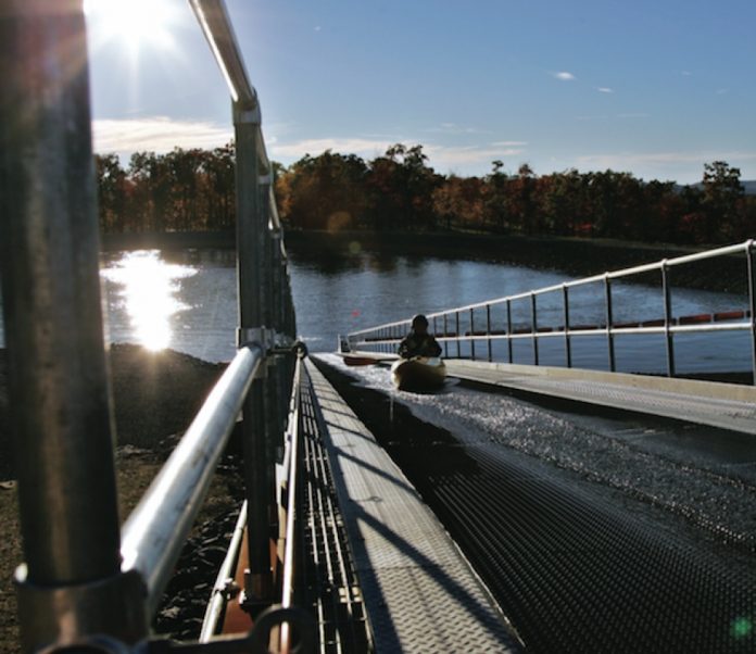
Photo: Scott MacGregor
Off the Tongue: Rivers Without Borders

Lasy fall I rode my first ever conveyer belt to the top of the river. It was so intriguing I rode dozens of times. I was riding on a dream, the dream of every long-time whitewater boater. “Dude, what we need is a river that goes in a circle and we end up back where we started.” But none of us dudes ever thought it would happen, nor did we consider what it would do to the sport.

The fifth annual Whitewater Symposium was held in McHenry, Maryland, home of Adventure Sports Center International and America’s newest and most technologically advanced circular river.

The Whitewater Symposium is a gathering of like-minded river professionals who come together on a yearly basis to plan the future of the sport. Many see these whitewater parks as the saving grace of declining participation. They say they are the climbing gyms of whitewater.

The theory goes that more climbers on safe and attainable plywood walls morphs into more climbers on rock. More climbers on rock leads to a healthier industry and stronger stewardship organizations like the Alpine Club, or in our case American Whitewater.

There was plenty of talk like this at the Whitewater Symposium. But no one had the answer to my big question, Is this true? Do more gym climbers lead to a healthier rock climbing industry and community?

Afterward, I called David Chaundy-Smart, the editor of Gripped, a magazine similar to Rapid but for climbing. The similarities and growing pains of the two activities are strikingly similar and his advice about what to expect from whitewater parks was simple: “be prepared for massive change.”

Paddling, like climbing, has traditionally been made up of guys like me—a homogenous group of white, outdoorsy men sworn in to the fraternity by like-minded, scruffy-bearded brothers. We learned the hard way. Long drives, frigid swims, blackflies and hiking out after dark were just part of the adventure and the culture. And for the most part we liked it that way. Whitewater grew slowly.

Climbing gyms and whitewater parks on the other hand distill everything that is fun about the sport, taking away the unpleasant stuff like risk and personal discomfort. At the ASCI course you can be on the water right after dinner, paddle a few circuits on the sweetest waves and be back in the chalet slamming gin and tonics by eight-thirty.

Do climbing gyms create more climbing enthusiasts and environmental stewards? David thinks yes, but not the way you might expect.

He estimates that a big climbing gym in a major city puts 300 new climbers in harnesses every week. Fifteen years ago that number would have been true for the region’s entire outdoor climbing season. That one gym would introduce 15,000 people to climbing a year. Even if only three per cent of those become climbing enthusiasts—the type who climb outside on real rock—that’s 450 new core climbers coming out of one gym, every year.

Whitewater Parks are Rivers Without Borders

This trickle-down, small percentage of the bigger number appeals to me most. This issue of Rapid we’ve called “Rivers Without Borders,” and in a way whitewater parks are rivers without borders. Parks open the floodgates so wide virtually anyone can try whitewater. We’ll have a wider, healthier cross-section of paddling enthusiasts including some who’ll bring their gangster rap persona to the river, but also soccer moms and soccer teams, steel workers, lawyers, environmentalists and politicians—people with money and power.

Some of them will buy a lifetime family membership to the Action Sports Center. I hope others will take their $5,000 and give it to American Whitewater for the preservation and access of real rivers, so they’ll run free longer than just our lifetime.

This article on whitewater parks was published in the Early Summer 2008 issue of Rapid magazine.This article first appeared in the Early Summer 2008 issue of Rapid Magazine.


Standing Waves: Boundary Creek

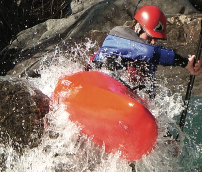
Photo: David Faubert
Standing Waves: Boundary Creek

Across most of the continent, the 49th parallel fuses two political siblings–Canada and the United States–like Siamese twins. Other than a line on a map and a few well-guarded crossings, it’s not much more than a toe line in the soil.

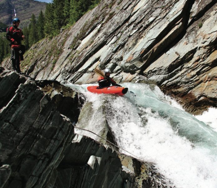
In Alberta’s Waterton National Park this political boundary becomes more than just a fantasy fence line. Tucked into the extreme southwest pocket is Boundary Creek, a liquid no-man’s-land that skirts back and forth along the two nations’ border. It has never smelled smuggled tobacco or twisted a barrel of bootleg moonshine because this Alberta-to-Montana crossing is self-regulating: it’s a class V run.

“Running Boundary Creek is a full-day commitment,” said Spencer Cox, one of a team of four who were the first to storm the border in the high spring runoff of 2006. “To get there you have a long flatwater paddle, a longer slog up a horse trail and to end it all, an illegal border crossing.”

Cross border kayaking

Like any crossing, you have to go through Customs first. That leads directly into the full-on class-V Cavity Search; eddy left at the bottom of the rapid and this is a straightforward domestic run. Eddy right and you’ve just paddled into foreign waters (unless of course you’re American, in which case you’re home).

“The scoured bedrock drops and crystal clear blue water make it a classic example of steep creeking in the Canadian—or is that American— Rockies,” Cox says.

The creek ends four kilometres later when it spills into the U.S. side of Waterton Lake. Paddling down the lake a few hundred yards gets you back into Canadian waters.

Chris Goble, who discovered the run, managed to enlist Cox, David Faubert and Joel Fafard for a first descent of the creek in spite of the international security risk. Now with the initial run made and passport laws relaxing ever-so-slightly to allow those wonderful, tiny, waterproof driver’s licence cards, the Treasure State of Montana could see a rash of border jumping creekers paddling toward her other jewels.

This article on running Boundary Creek was published in the Early Summer 2008 issue of Rapid magazine.

This article first appeared in the Early Summer 2008 issue of Rapid Magazine.


River Alchemy: Mystery Moves of Squirt Boating

Photo: Paul Villecourt
River Alchemy: Mystery Moves of Squirt Boating

The Tao Te Ching (pronounced something like ‘Dow De Jing’) is perhaps one of the oldest known books. As mysterious as its author Lao-tzu, its exact origins are unclear but likely date to before the time of confucius (551-479 b.c.). translated literally, the title becomes The Book of the immanence of the Way and how it Manifests itself in the World or, more commonly, The Book of the Way.

Translated into dozens of languages several times over, the Tao Te Ching is a book of wisdom; an instruction manual on how to navigate the forces of the universe. Its most oft-quoted line is likely familiar to all river people:

Nothing is more soft and yielding than water. Yet for dissolving the hard and inflexible, nothing can surpass it.

Lao-tzu’s philosophy is based on one of softness, and the giving up of control. One must understand and harness the forces of the universe rather than being rigid and fighting them, he suggested—common in the practice of Zen, t’ai chi and aikido. Throughout the years the Tao has been mined by hippy spiritualists, yoga instructors, high-powered management gurus, and squirt boaters.

Seen by the general paddling public, squirt boating is viewed as either confusing or passé… and totally awesome, on rare occasions. Unanimously regarded as the parent to modern playboating, pure squirting enjoyed its heyday in the early ‘90s on big-water rivers such as the Gauley and Ottawa.

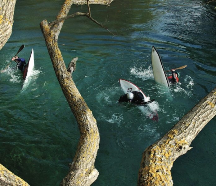
The tight-fitting, custom-built, surfboard-like kayaks were designed for neutral buoyancy—half way between floating and sinking—and to tap into un- derwater currents. Back in the day, moves like pirouette squirts, cartwheels and blasting were radical and completely out of the realm of possibility for the voluptuous plastic boats of the time.

The last of the purists (all 70 of them) still gather every summer on the river-left eddyline above McCoy’s on the Ottawa for the infamous Jimmy Cup. The event’s namesake is, of course, Jim Snyder, the Lao-tzu of squirting.

His The Squirt Book is both a manual of squirt technique and an unintentional river translation of the Tao Te Ching. It is as instructive in the art of living as it is in squirting, and as relevant today as when it was first released in 1987 (Menasha Ridge Press).

Even though the moves seem quaint, it is worth re-visiting Snyder’s words at a time when freestyle kayaking is moving about as far away from the Tao as possible.

With pure squirting all but gone—stern squirting in a plastic playboat is incredibly uncool, I’m told— and freestyle defined by aerial acrobatics—getting as far away from the water as possible—softness and “going with the flow” are gone.

The similarities in message and style between the Tao and The Squirt Book are striking. Approach, humility, and control are a few of the many parallel themes.

Like the Tao, Snyder’s guiding philosophy is what he calls charc; the angle of one’s approach to the current dictates the outcome. Charge in and we will be rejected; look at the current and work with it, and we find the “power to apprehend the slipperiness of freedom for those few fleeting moments and to let it soak into our souls,” Snyder writes.

The Tao speaks of this, but refers to an approach towards life:

Rushing into action, you fail.
Trying to grasp things, you lose them. Forcing a project to completion,
You ruin what is almost ripe.

Ultimately, squirting is about humility and respect

Snyder writes, “Our attitudes are putty in the hands of the river… almost everyone went through the stage of being an expert-turned-beginner. Expertise re-emerges as an ability to learn, to listen to the river and our friends.” While Lao-tzu wrote simply:

All streams flow to the sea. Because it is lower than they are. Humility gives it its power.

Snyder’s approach to squirting, rivers and life mirrors the Tao every step of the way. Snyder’s book, while setting the stage for much greater things in kayaking, speaks louder now as a comment on putting the river, current and universe first. It stands in contrast to the bounce and bravado in today’s kayaking, approaching the timelessness of the Tao Te Ching’s verse and message.

But if both of these philosophers are right, and time seems so far to have proven it so, it is worth noting these two final thoughts:

“The best way to affect the outcome of an event is through its beginning” (Snyder).

The master takes action
By letting things take their course.
he simply reminds people
of who they have always been. (Lao-tzu)

Do you think they know where kayaking is going in the future?

Jeff Jackson is a professor of Outdoor Adventure at Algonquin College in Pembroke, Ontario 
This article on squirt boating was published in the Early Summer 2008 issue of Rapid magazine.

This article first appeared in the Early Summer 2008 issue of Rapid Magazine.
 

Hell Bound and Determined on the Huallaga River

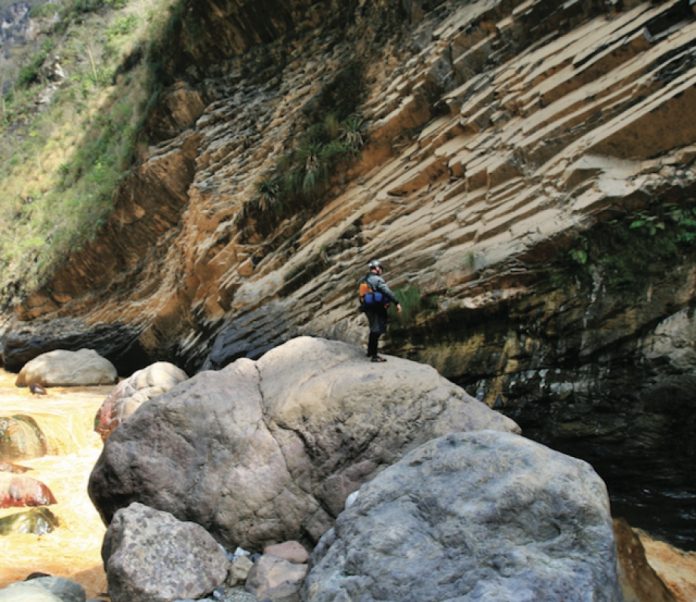
In the heart of the Great Bend, the entrance to the most constricted stretch of the Huallaga, the river-left wall rises straight up 2,000 metres. Photo: Todd Gillman & Andrew Oberhardt
Hell Bound and Determined on the Huallaga River

Disappearing into a deep canyon abyss just downstream of Huanuco in northern Peru, El Rio Huallaga carves its course around the base of a massive Andean peak, and doesn’t rejoin a road until it drifts into the steamy jungle town of Tingo Maria nearly a hundred kilometres later. The Department of Huanuco considers this River Styx unsafe for travel and the U.S. State Department forbids its employees from visiting it. The jungle surrounding the Huallaga’s lower reaches bubbles with malaria and besides Kurt Casey’s original attempt of the Huallaga in 1999, few Westerners have ever peered into the canyon’s depths. 

On July 10, 2007, Andrew Oberhardt, Todd Gillman, Shane Robinson and I boarded American Airlines Flight 827 bound for Lima, Peru. Our mission: attempt the un-run stretch of the Huallaga that Casey’s team was unable to complete. Our team, The Range Life, was selected by the Vacation to Hell steering committee and awarded $12,000 to explore and document this last major un-run tributary of the Amazon.

It’s easy to see why the Immersion Research Vacation To Hell board members decided this would be the perfect holiday.

The Huallaga is a logistical nightmare. Situated in northern Peru’s Department of Huanuco, it is far better known for its history with the Maoist rebel group The Shining Path, and for coca production, than as a kayaking destination.

Research leading up to the trip had yielded scant results beyond ’70s topographic data, Kurt Casey’s failed trip report, and plenty of horror stories about the cocaleros and the Shining Path.

After arriving in Lima we made our way towards Huanuco, where we connected with Peruvian whitewater guru Piero Vellutino, who proved invaluable. Few locals knew anything about the deep canyon’s lower reaches. Pilots in Huanuco and Tingo flatly refused our requests for an aerial reconnaissance mission. Hiking the canyon with the help of a pack string was said to be impossible. 

After 10 days in Huanuco, the sum total of our preparations was trumped by a couple hours of Piero’s research. We learned that there was in fact a trail some 1,200 metres high on the river-right canyon wall that offered possible egress in the event of a bail-out. Still, we were left with little other option than to just head in.

Late in the afternoon on July 22 we piled four Jefes and Piero’s H3 into the back of a worn Toyota pickup and headed off to Puente El Rancho to put in on the Huallaga.

It was just our second day on the river when we reached the towering gorge that forced the Casey expedition into a multiday evacuation. By sending one team high to scout the lower portion of the gorge and another at river level on the right to scout the entrance, we managed to put together a safe line through a series of blind ledges, dropping ever deeper into the canyon. Only strong teamwork made it possible for us to make good time through innumerable unseen and gorged-out rapids.

On the afternoon of our third day, one filled with endless boat-scoutable class IV–V rapids, the character of the river began to change. The canyon walls closed in dramatically and we had considerably more volume than when we started. The dense vegetation hanging from the gorge walls meant we had made the descent into a new climatic zone, la selva.

We were deep in the section of the river we’d referred to in our planning as the Great Bend. It was here that the river takes a 90- degree bend to the left and the canyon walls soar to more than 2,000 metres. That night in camp Piero, Andrew, Shane, Todd and I pored over the 30-year-old topos trying to count the gradient lines in the next 30 to 40 kilometres. The 1:100,000 maps were as good as we could get but lacked the detail we needed to be certain of what lay ahead. They were littered with wide swaths of white space and the words “datos insufcientes.” Insufficient data is the last thing you want to see on a topo when you are trying to reason your way through a potentially unreasonable river.

We woke up the next morning to a muddy river. The overall mood had shifted from stoked to somber. Knowing that we were about to paddle into a cavernous dirty gorge that dropped several hundred feet per mile, we pushed on cautiously.

The river disappeared into another, even more committing gorge 

The Huallaga cascaded down a very marginal, sieve-laden rapid before disappearing under a huge chock stone 10 or 13 metres high, and then into what appeared to be an unscoutable, unportagable canyon. Scouting river left was impossible due to the gorge wall that shot up 1,500 metres from river level.

Todd and I volunteered to scale the steep and densely vegetated right wall to gain a vantage of what lay downstream. Beating our way through vines that would silently wrap around our ankles and any exposed gear, pulling us to the ground in an instant, we finally reached a high point on river right after about an hour of jungle bushwhacking. Unable to see into the canyon, we dropped down toward the gorge rim and belayed Todd over the edge to inspect.

From what he could see, the rapid under and just downstream of the chock stone might go. The crux being the exit rapid which had a super boily entrance with compression wave features, then a fast, narrow tongue down the middle, over a steep vertical ledge with massive holes and pockets on both walls. We felt good about it, but the problem was downstream.

Even if we were able to deal with this canyon, the river disappeared into another, even more committing gorge. From our perch, we could see that there was an eddy at the lip of the drop leading into the gorge, but from there, if we didn’t like what we saw, there were no options for egress right or left. We headed back to the rest of the team to give the grim details.

Piero, Shane, and Andrew sat on the rocks deep in discussion with the topos, GPS, and SAT phone littered about. Our plan B of accessing the old Inca trail 1,200 metres up on river right would disappear if we pushed on. We still had 60 kilometres left of the steepest and most committing section of river, and we had only travelled one kilometre in more than three hours.

Our river senses were telling us to get out. Slowly we came to the conclusion that we had to, at a bare minimum, hike around what lay below us. Shane described it as “this feeling of relief where you decide to go with your instincts of survival and judgment, versus your ego to want to complete something big.” None of us wanted to leave the river.

Piero and Todd bushwhacked ahead with the machete to scout a possible evacuation route while Shane, Andrew, and I began roping boats. It was slow.

In two hours we moved the boats only about 400 feet up the relentless terrain. Then Piero returned. “I hope you guys have insurance, ‘cause we are going to need a helicopter to get out of here.” As he was dialing numbers on our satellite phone leaving messages with his family and any other helpful connections he had, the rest of us hacked out a base camp on a thin, rocky jungle ledge above the churning, victorious Huallaga.

Fighting fierce ants we camped and waited. Our gear was soiled in mud, we were battered and demoralized. As we awaited rescue or finding our own escape route, the reality slowly set in; we were not on an ordinary summer vacation. We were at the gates of Hell, temptation trying to lure us in and divine judgment telling us not to look back. 

This article on the Huallaga River in Peru was published in the Early Summer 2008 issue of Rapid magazine

This article first appeared in the Early Summer 2008 issue of Rapid Magazine.
 

Standing Waves: Wanderlust

Photo: Tore Meirik
Standing Waves: Wanderlust

To truly know someone else, walk a mile in his shoes; to truly know one’s self, huck a mile’s worth of waterfalls.

For no other reason than to test their mettle and prove it can be done, two Norwegian and two British extreme paddlers are teaming up to conquer just one mile in one month. Not impressed? Consider that it’s a more upright expedition than most, as the team attempts to drop 5,280 vertical feet (one mile) of waterfall in just 31 days.

Bliss-Stick team paddler Mark Burton, Liquidlogic’s Martin Vollen, Dagger’s Ed Cornfield and Pyranha’s Per Christian Pedersen will have to maintain a 170-foot per day average as a group. A 50-foot waterfall counts as 50 feet toward the goal, but only once. Then, the group has decided, they must move on to find another drop.

Waterfall, free fall road trip

Although still plotting the course and schedule the foursome has chosen Norway for their free fall road trip. Burton explained there are plenty of suitable drops all within short distance of each other, many close to the main roads, eliminating the need for time-consuming portages. He said there could be a couple of first descents, but for the most part all four paddlers will know the drops already, cutting back on time needed to scout unfamiliar runs.

“The big thing for us is time. we all love to huck, so getting us off the edge won’t be the problem, it’s the travelling between,” says Burton. “I’ve always enjoyed running drops, but I want to see how much we can do physically and mentally; I think we are going to learn a lot about ourselves.”

“And I love the fact that for a month I don’t have to work my ass off to get someone to go hucking with,” adds Vollen.

This article on waterfalls in Norway was published in the Early Summer 2008 issue of Rapid magazine.

This article first appeared in the Early Summer 2008 issue of Rapid Magazine.
 

Open Canoe Technique: Power Steering

Photo: Carole Westwood
Open Canoe Technique: Power Steering

Forward Stroke Rebirth

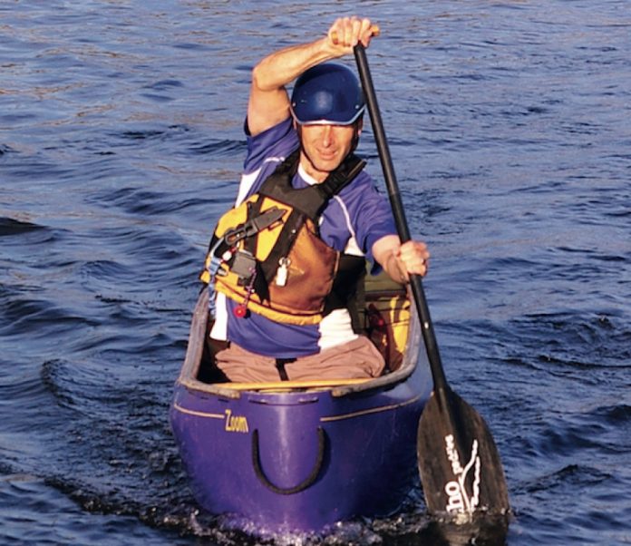
The forward stroke is enjoying a renaissance as more open canoeists use it as not just a method of propulsion, but as a means to steer their canoes. A proven skill that harkens back to the earliest C1ers, power steering is the ability to control your solo boat while using nothing more than basic forward strokes. The key is understanding that the stroke can be broken down into distinct variables that allow you to easily guide the canoe in whichever direction you wish to go. All this without having to draw from the traditional set of rudder strokes, which slow your canoe and waste valuable energy.

Power steering with the 2×4 technique uses the four main variables which define the relationship between any stroke and your boat. These are: stroke cadence or timing; stroke position; paddle angle; and boat tilt.

Individually or together, these stroke elements are used to change the direction of your canoe while paddling with forward strokes. Add the cross-forward stroke playing with these same elements on your offside, and you achieve total boat control using only forward strokes. It’s also easy to remember. Think of the two forward strokes and the four variables, and voila, you have the 2×4 technique.

2×4 Forward Stroke Technique

Power steering builds on the concept of carving, or paddling your canoe on an arcing path. To understand this, picture the canoe in motion and how the bow is cradled by bow waves. By using the 2×4 technique you can control how these bow waves direct the canoe’s path, much like the reins on a horse. By simply allowing a wave on one side of the canoe to be bigger than the wave on the opposite side, the larger wave will push the canoe into an arcing path. Canoeists “steer” by controlling the wave effect by paddling on the inside of this arcing path in such a way as to resist, or enhance, the circular route of the canoe.

The easiest way to get the sensation of paddling a controlled arc is to experiment with stroke timing. Get your canoe moving by alternating three to four forward and cross-forward strokes. Finish with a cross-forward stroke, pause and wait for the canoe to arc toward your onside.

Now continue paddling an arcing path with just forward strokes.

If the canoe begins to straighten out, slow or pause the timing of your strokes and allow the canoe to regain its arcing path. If the arc is sharper than you desire, simply increase your stroke rate to straighten your path. The timing of when you apply power to your stroke has the effect of tightening or widening your arc.

Stroke position has the same effect on the diameter of your arc. By positioning your stroke ahead of your knee you will experience a tightening arc. Pulling past your knee toward your hip causes the canoe to straighten its path.

Similarly, stroking with a nearly vertical paddle shaft keeps the canoe travelling in an arcing path, while an angled shaft can dramatically straighten your path.

Finally, paddling the canoe with more tilt to the hull uses the chine to carve a tight arc, while paddling with a flatter hull favours a straighter course.

All these elements apply equally to the offside with the cross-forward stroke. As a result, solo paddlers have complete control for turning left or right while the boat is under power. One important rule applies for power steering: always place your strokes on the inside of the arcing canoe– never paddle on the outside.

Implications on Instruction

Often, beginners learn the 2×4 technique after their first lesson and show effective boat control for entering and exiting eddies. The implications on instruction are groundbreaking as teaching more advanced stern strokes can be delayed until paddlers reach higher novice to intermediate levels.

The bane of many solo canoeists—and their instructors—is the difficulty in getting the canoe going in a straight line from a stand still. By teaching forward and cross-forward strokes to beginners, along with a method of boat control, new paddlers quickly overcome the number-one obstacle to success in solo canoeing. Greater success surely means more new paddlers sticking with open canoeing.

The rebirth of the forward stroke as a control stroke maximizes forward speed and provides directional control. Use of various stroke elements to tighten or lessen your arc means you can carve the canoe with complete control. Power steering with the 2×4 technique makes paddling a solo canoe easy!

Andrew Westwood is an open canoe instructor at the Madawaska Kanu Centre, member of Team Esquif and author of The Essential Guide to Canoeing. 

This article on the forward stroke was published in the Early Summer 2008 issue of Rapid magazine.

This article first appeared in the Early Summer 2008 issue of Rapid Magazine.
 

Skills: Islands in the Stream

Photo: Bryan Kirk
Skills: Islands in the Stream

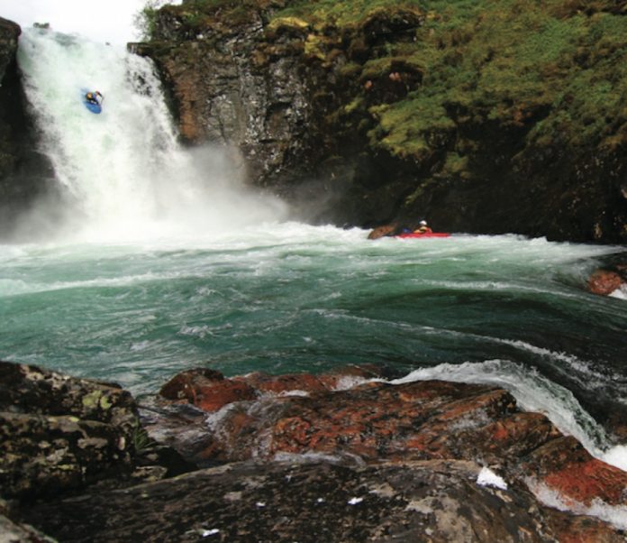
Rocks are often viewed as a river hazard, creating undercuts and sieves. What many paddlers don’t realize is that rocks can be very useful features on the river. Exposed rocks beside a drop can make the ideal launch ramp. Sliding across them may be the only way to avoid a nasty pin. Once you figure out how to make the most out of the river’s natural rock garden your river running and creeking will groove to new heights. 

Use ‘em and Abuse ‘em

Using rocks to your advantage basically means getting away from the main flow and plowing up onto the edge of a rock that sits at water level, close to a drop. By getting your boat out of the water and up onto a nearby rock you can slide past a potential pin spot or undercut ledge that the main flow would otherwise push you into. The best rocks are smooth, around water level, and relatively close to the drop. Plowing up onto a sticky or jagged rock will kill your speed (if not stop you completely) and throw you off line. Smooth rocks at the lip of a drop will often auto-boof you to safety, allowing you to land away from the meatiest part of the hole at the bottom. 

Body Positioning

As with any river-running skill you’ll want to maintain a forward paddling position. The trouble with leaning back is that you’ll be less balanced with excess weight on your stern. This increases the likelihood of your stern edges catching and is a more dangerous position if you happen to flip. To get yourself further up on a rock you can move your body weight to a less aggressive neutral position as long as you get your weight forward again before you land. 

The Approach

If you plan to boof straight out from the drop, aim to make contact with the rock at about a 20- to 30-degree angle, with speed. Before your bow makes contact with the rock make sure your weight is forward and you’re ready with a stroke on the side away from the rock. If you plan to land at the bottom of the drop pointing to the left or right you’ll need to adjust the angle at which you approach the rock. As a general rule, making contact with any rock will straighten your boat’s angle and it will be difficult to angle away from the rock. This means that if you make contact with a rock on the left it won’t be easy to land pointing hard right. 

Drying Out

Catch too much rock and you’ll lose all of your momentum, which often results in teeter-tottering over the lip of the drop. There are times when you’ll want to purposefully dry out, but for the most part drying out at the wrong time will blow your line. It’s important to understand the more rock you catch, the further you’ll slide back down into the main flow. When scouting a drop, look at where you plan on landing and consider the angle that you’ll slide off the rock. This angle will dictate how far you slide back into the main current. 

Sound Check

Pick a safe drop and spend some time figuring out how your boat reacts to slid- ing on rock. Try taking different approaches to the rock, using lots of speed or no speed, lots of angle, straight on, taking a fast stroke, slow stroke, et cetera. With a little bit of practice you’ll be rocking out in no time! 

Kelsey Thompson is a multi-time Canadian national freestyle medalist and Wave Sport team paddler, not to mention a music video producer. 

This article on river-running was published in the Early Summer 2008 issue of Rapid magazine.

This article first appeared in the Early Summer 2008 issue of Rapid Magazine.
 

The Ghost Coast: Newfoundland’s Wild Southwest

All photos this page: Ryan Creary
The Ghost Coast: Newfoundland's Wild Southwest

Amid the bouts of seasickness that overcome my gut like the swells that pitch and roll this rattle- trap ferry, I feel a kinship with Joey Smallwood. The man responsible for bringing Newfoundland into Confederation in 1949 wasn’t much of a seafarer. He once spent days seasick in the hold of a hired schooner as part of a hare-brained plan to unionize remote coastal fishers and preach his political ideals. Since fishing season lasted from break-up to freeze-up, Smallwood decided that a wintertime voyage was best. When the captain dismissed him for a lunatic, the soon- to-be leader of the province disembarked and continued on his own, walking the ice of the island’s bottom half—locally known as the Southwest Coast. 

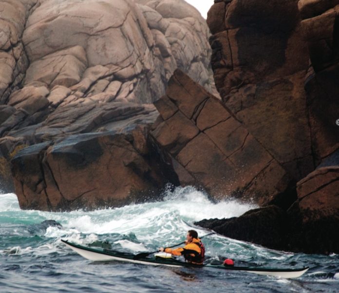
Adventure Kayak editor Tim Shuff, photographer Ryan Creary and I came to Newfoundland with more rational plans. We sea kayaked 200 kilometres of the Southwest Coast, visiting many of the long-lost com- munities Smallwood attempted to unite. For 11 mostly glorious days in September our trip was nothing like Smallwood’s, with no high seas adventure, pack ice or blinding blizzards. But now, hanging over the stern of the coastal ferry as it retraces our route from Francois to Rose Blanche, I can’t help but feel fellow to a man who got to know the people of the Southwest Coast in its heyday, even if it was in the most manipulative way. 

It’s fitting after a whirlwind journey by air and road to get here that Tim, Ryan and I find ourselves hunkered down with too much time on our hands scant kilo- metres from our launching point. We hummed and hawed in the fog at a wharf in Rose Blanche, New- foundland, while the local fishermen looked on with incredulity. Our general plan to spend the better part of two weeks paddling to the isolated outport of Fran- cois was as crazy to them as our immediate intention of launching into the three-metre seas punishing the breakwater. But we set off anyway.

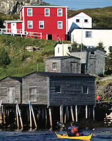
An hour later we washed ashore on a decomposing boat slip in the old village of Petites, population two, where gale force westerlies held us captive for two nights. Petites was once one of the hundreds of “out- port” communities spread out along Newfoundland’s 10,000 kilometres of rocky perimetre. Few faces peer from the windows of the 20-odd houses remaining

atop rickety two-by-four stilts at the water’s edge or clinging to the treeless, granite barrens of uptown. Despite its mid-latitude location, the landscape in this corner of Newfoundland is an arctic-like, windswept and glacier-carved expanse of bogs, domes and fiords.

Screen_Shot_2015-07-23_at_4.15.54_PM.png

At Petites we befriend one-half of the community’s resident pair who tells Tim and I how he returned to his birthplace in 2002 and bought a modest two-storey clapboard house for $2,700. A year later, the province sent in its last supply tanker to feed Petites’ diesel generators and most of the citizens collected $80,000 resettlement payouts. In choosing to stay, the man says the government paid him $12,000 for the house it now leases to him for one dollar a year. Petites’ last holdouts cook with propane and go to bed early. They let their subscription to satellite television expire and watch the caribou in- stead. The next morning, we’re paddling before the first curls of woodsmoke rise from their chimney.

There are about 90 kilometres of coastline to paddle between Rose Blanche and Burgeo, made up of rocky jetties, serpentine inlets, bedrock headlands, steep islands and, in the last half, sweeping sand beaches. Leaving Petites, we surf a residual swell and building wind waves past the ghost towns of Westport, French Cove and Cinq Cerf – outports that Smallwood once tried to unionize. The coastline is pleasantly diverse yet somewhat unremarkable, except for the portion between the active outports of La Poile and Grand Bruit where 300-metre-tall granite cliffs stretch far inland.

Wind holds us up for another day-and-a-half and we make tracks as soon as the swell is half-manageable, skirting the leeward side of a labyrinth of reefs with ominous names like The Smoker, The Jumper and The Galloping Moll. We pull into Burgeo after 35 kilometres and a long morning in the saddle.

Burgeo is the hub of the Southwest Coast with a highway to the outside world and an increasingly transient population of 1,700. The fish processing plant collapsed with the cod fishery and the town is now more of a bedroom community for Nova Scotia apple pickers and Alberta roughnecks. Streets of quaint saltbox houses radiate haphazardly from the probing fingers of the sea: Short Reach, Long Reach, Mercer Cove and Aaron Arm. The off-lying islands feel removed from the open ocean and make for great sea kayaking for the same reason that Rencontre—the largest of the lot—was chosen as rendezvous site for 17th century French sailors.

Everywhere we spend a night, entire lives have been lived before us. Smallwood for one was a benefactor of the clichéd Newfoundland hospitality—he need not have carried camping gear on his ice walk. Before the advent of deep-sea trawlers and on-board refrigeration, hardscrabble hamlets sprung up as close as possible to the best fishing grounds—sometimes within shouting distance from each other. Some outports date back 500 years to the time of Basque and French fishers and whalers, ranking them among the oldest European settlements in North America.

Up until Newfoundland ceded from England to become a province of Canada in 1949 and Smallwood took reign, outport communities thrived in an isolated, unheralded kind of way. Smallwood began the process of centralization and the majority of outports—like the codfish—started to disappear. By 1975, more than 300 communities and over 28,000 people had been uprooted. Our Sailing Directions guidebook, published in 1995, describes dozens of communities like Petites that have since been “evacuated” due to fishing moratoriums and the lure of greener pastures—not to mention healthy government-issued lump-sum compensation.

Screen_Shot_2015-07-23_at_4.16.57_PM.png

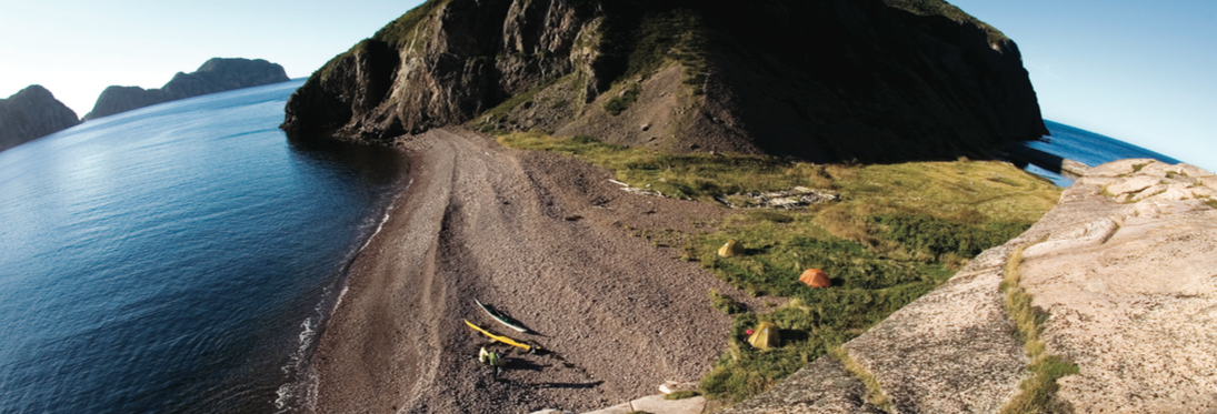
A day’s paddle east of Burgeo, we tuck into a sheltered harbour rimmed by 150-metre talus slopes and forested hillsides and find a spectacular campsite on a gravel spit on the north end of Fox Island. Only two houses remain but the rotting cribbing of old fishing stages and a grassy meadow suggest there were once many more. I follow a trickle of a stream up a bram- bly hillside and discover a shallow-dug well brimming with ice-cold, peaty brown, sugary sweet water. Ryan finds the old cemetery on a dome-shaped promontory, its weather-beaten tombstones overlooking the sea.

The weather settles into a stable trend and the next day we knock off the 18 kilometres of cliff-bound coast between Fox Island and Grey River by lunch. The community of Grey River occupies all of the marginally flat land in a triangle-shaped bight. Otherwise, the 20-ki- lometre-long granite fiord is inhospitable. After some lean years the outport now bustles, though there’s less activity at the wharf than there is at the helicopter landing pad. The fiord echoes with the whirring thump-thump-thump of rotors and reeks of aviation fuel—the sounds and smells of a prospecting boom.

Luckily, the crux of the trip comes on a magical day of lifting fog, skirting clouds and bright sun and we tackle the better part of the near-continuous 300-metre-high cliffs connecting Grey River to Francois in idyllic conditions. The landscape blows the mind—as much Newfoundland as it is a combination of Alaska, Hawaii and Thailand. A talus valley bound by soaring, glacier-worn buttes fans out to the sea at the tiny in- dentation of Seal’s Rest Cove. And at Cape La Hune, craggy, crumbling spires of volcanic rock contrast with neighbouring slabs of granite. We round the promon- tory rubbernecked and walleyed and set up camp at another abandoned outport.

Screen_Shot_2015-07-23_at_4.17.30_PM.pngWe spend two days at Cape La Hune not because of miserable weather—by now the Southwest Coast is fully enveloped in a 1,025-millibar high—but because it’s so hard to leave. Hiking up the breadbox-shaped peak behind the campsite oc- cupies an afternoon with scrambling up sloping rocks and crashing through tuckamore thickets of dwarf birch and fir trees. From the top, the Atlantic stretches uninterrupted to Antarctica, save for the inconspicuous dots of the French islands of St. Pierre and Miquelon to the south- east. Facing inland, La Hune Bay cuts a granite corridor through a sweeping expanse of tucka- more and barrens. On the treacherous descent I find an old threadbare rope—proof that the Cape La Hune outporters did more than just fish. Later on, I watch the moon rise over the rockbound coast from within the foundation of the old church, imagining the building itself departing on a barge bound for the horizon.
In some ways, there was method to Smallwood’s madness. Like a used car salesman pitching to the spouse who’s keener on colour than anything else, Smallwood appealed to the outports where, at the time, the provincial balance of power was held. As dubious as his reputation was in St. John’s, Smallwood became a backwoods legend for his Southwest Coast sea ice expedition and popular radio show. He solidified his cause by flying into these same remote communities that had never seen an automobile, let alone an airplane, with promises of money for all should Newfoundland vote to join Canada.

Walking the ice of the Southwest Coast, Smallwood found communities of people who knew nothing of the concept of unionized labour, much less government and current affairs—the same way he was ignorant of their arduous and simple lives by the sea. Maybe Smallwood’s resettlement plans and promises of centralized labour and its associated benefits were innocently skewed attempts at giving thanks for their hospitality. One way or another, when the people of Newfoundland chose to cut ties with Britain and join Canada largely on the strength of the rural vote, it marked a beginning of the end that continues today.

Upon ending our trip in Francois—with 175 residents, two stores and a high school, the most populous and well-endowed outport on the Southwest Coast—the weather takes a turn for the worse. We board the coastal ferry in foggy drizzle and southerly winds, with the wavelets in the bay a gut-churning harbinger of what’s to come on the open coast. The last thing I remember before falling into the throes of nausea is spotting a pink, white and green Republic of Newfoundland flag flying taut alongside a line of sopping wet clothes, less an affront against Smallwood than a fading grasp on a way of life. 

Conor Mihell is a freelance writer and kayak guide based in Wawa, Ontario.  

Screen_Shot_2015-07-23_at_3.37.00_PM.pngThis article first appeared in the Summer 2008 issue of Adventure Kayak Magazine. For more great content, subscribe to Adventure Kayak’s print and digital editions here.