Home Blog Page 527

River Alchemy: Random Beauty

Photo: garyandjoaniemcguffin.com
River Alchemy: Random Beauty

I stumbled on it some years ago on a rambling hike down a dry streambed in Driggs, Idaho. I found a perfect bend in a river. A 180-degree change in direction, carved from the alluvial plain. The gravel bank was perhaps eight feet high; it was plumb vertical, and had a perfectly walled arc, perhaps 100 feet in diameter. From every angle it was astoundingly geometrically perfect. It grabbed my eye and carried it around its curve. I had never seen such mathematical perfection in nature before.

Luna Leopold felt that same sense of awe in nature. As the son of Aldo Leopold, the famous pioneer of wilderness ethics and land protection in the United States, Luna Leopold was the first to set out to study rivers in a manner unheard of—he measured them… in great detail. In fact he spent a lifetime creating formulas to explain just how rivers work, and how it was possible for them to carve the perfect bend.

By and large, he was successful. 

He was the creator of what is now called quantitative hydrology, and in doing so re-established much of the fundamental assumptions of modern engineering.

Starting in 1953 with his obscure (to most readers) text, The Hydraulic Geometry of Stream Channels and Some Physiographic Implications, Leopold pulled rivers apart, feature by feature, and scratched out the formulas that explain their behaviours. Some of his findings are uncanny. Consider these, if you haven’t before: the wavelength a river meanders is, on average, 12 times its width; the Sine coefficient for those meanders is the same coefficient for the compression waves that form on a stream’s surface; and the riffle-pool interval is one half the wavelength of the meanders.

Fascinating.

He created formulas to explain helical flow, wave creation, hydraulics, sediment load and watershed flood rates. The list goes on and on. In my search to explain the perfect bend all roads lead to Leopold’s work. He was incredibly prolific and clearly a genius. While mathematically dazzling, his formula for the perfect bend left me spiritually unfulfilled.

A year later I was handed Barry Lopez in a used bookstore in Smithers, B.C., Lopez lives on the other end of the Sine curve from Leopold; if Leopold is pure science, Lopez is pure poetry. River Notes is Lopez’s river dissection, via a series of short stories so descriptive the book drips with water. His swirling eddies suck you in, carry you into the current, then delicately and surprisingly drop you in the literary ocean of deep thought with his famous single-sentence endings.

Lopez explores the idea of how a river can so seamlessly and completely change direction, while looking for instruction that may be useful to his own life.

Mired in depression, he laboured to examine every aspect of the bend in the river behind his home. If he could figure out this bend, then maybe he could figure out how to turn his own life around. Bed-ridden and feeling no hope at all, he hauls himself down to the stream and dips his hand in the water. The essence of the turn, he realizes, is not in the details (nor in any of Leopold’s formulas), but in some bigger connection between himself and the river.

Lopez’s exploration of the fine details of rivers is in a way an exploration of the human soul, but his life-changing river bend metaphor did not speak to me any more than Leopold’s algebra.

I’ve since returned to the sharp and blocky Canadian Shield rivers, rivers with turns seemingly unaffected by water and time pushing against them. In my lifetime I’m unlikely to find another bend so geometrically perfect.

With every new river I paddle I realize it was not the bend that was so intriguing, it was how the perfectly bending arc grabbed my eye, smoothly railing it around the corner in a new direction. It was not the bend in the river, it was what lay beyond that was so intriguing and so important. The perfect bend is not a complex equation. For me now, the perfect bend is the one just downstream, the one luring me to explore what is just beyond. 

This article on science and poerty was published in the Summer 2007 issue of Rapid magazin

This article first appeared in the Summer 2007 issue of Rapid Magazine.


Go North

Photo: Ian Scrive
Go North

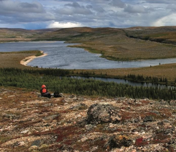
Tundra sunsets that last for hours, wildlife from another epoch, 

whitewater coursing through sheer canyons and rock cathedrals
reaching to the sky—if you
haven’t paddled in the north
you owe yourself a trip.

Planning for a northern river trip
can take up to a year, which is why you should start now. We’ve asked five experts which Arctic and
sub-Arctic rivers you have to paddle. 

You can take their word for it.

Thelon River

Northwest Territories and Nunavut

The Thelon River sweeps out of spruce-lined valleys into  vast treeless barrens. You can paddle for an entire summer under the watchful eyes of lumbering muskox, rocketing gyrfalcons, patrolling grizzlies and vast herds of caribou. This is as close as you can get to primeval Pleistocene wilderness on the planet.

The Thelon’s steady current counters the barrenlands’ relentless east winds. In places the wind and current can pile up big standing waves, but usually the paddling is easy, and the kilometres go by faster than you’d like.

Though the area is now empty of people, signs of ancient human life are everywhere. Dene campsites, inukshuks, burial sites, food caches, tent rings, arrowheads, chipping stations and rock blinds litter the valley’s barren ridges—as if the people who lived on this land just left.

Keep your eyes open

The ruins of the tiny log cabin where John Hornby and his party starved to death in 1927 can be seen on the north side of the Thelon below the junction of the Hanbury River. 

Don’t forget

Pack a spotting scope. You can set it up on a tripod and feel like you are on a prehistoric safari at every campsite.

Routes

The stretch from the junction of the Hanbury and Thelon rivers to Beverley Lake should take two weeks and is not challenging. For a trip of three weeks intermediate paddlers can start via the Hanbury, Upper Thelon, Clarke or Elk rivers. All involve some portaging, rapids and canyons. To extend either route allow 10 to 14 days to get from Beverley Lake down to Baker Lake. Between Beverley Lake and Baker Lake there are three very big lakes and some rapids. You should count on becoming wind-bound for a few days here and should be a seasoned Arctic traveller. There are commercial flights out of Baker Lake.

Max Finklestein is the co-author of Paddling the Boreal Forest and author of Paddling a Continent. He is an officer at the Canadian Heritage Rivers System and has paddled the Thelon six times.

South Nahanni River 

Northwest Territories

The South Nahanni’s canyons are bigger, longer and more impressive than any other Arctic river I’ve paddled. They have wildly varying characters, from the powerful whitewater of Virginia Falls and Fourth Canyon to the quiet waters and sheer vertical walls of the Gate and towering buttresses of First Canyon. They are magical to paddle through and better to explore on foot.

The whitewater is the real highlight of the Nahanni. If you start your trip at the Moose Ponds in the headwaters of the South Nahanni or the Flat Lakes on the Little Nahanni, you’ll have three days of nearly continuous technical rock gardens that push what can be done with loaded tandem canoes. For experienced whitewater paddlers, it is kilometres of pure fun. The river quickly grows in volume and below the access points at Island Lakes and Rabbittkettle the excitement comes in the form of big waves and increasingly stunning scenery.

Keep an eye out for

Two tufa mounds are a short hike away from the Rabitkettle River. These mounds of sandstone-like calcium carbonate have been built up by hot springs for 10,000 years and are up to 20 metres high.

Don’t forget

A wide-angle camera lense. For a day of the best scenery available to a canoeist you can’t beat the day through First Canyon, starting at Dead Man’s Canyon.

Routes

Most People fly from Fort Simpson into one of five put-in points. For trips of three weeks that start with three days of whitewater put in at the Moose Ponds or the Flat Lakes. The lower access points deliver you to a higher volume river with big waves rather than rock gardens. Outfitters will take people with novice whitewater skills, but the more whitewater experience you have, the more you will enjoy it. From Island Lakes it is three weeks with lots of time for hiking. From Rabitkettle Lake, and the start of Nahanni National Park, it takes two weeks. For the last two days of the trip the South Nahanni leaves the MacKenzie Mountains and meets the Liard River and your pick-up for the three-hour drive back to Fort Simpson.

Mark Scriver has been guiding for Black Feather since 1984. He is the co-author of Thrill of the Paddle and has paddled the South Nahanni, Tatshenshini, Firth, Hess, Horton, Natla, Snake, Mountain, Moisie, Clearwater, Seal and Chuluut Rivers.

Soper River

Baffin Island, Nunavut

The Soper doesn’t just feel like a northern river. It feels distinctly Arctic. Though there are some scrubby willows in the river valley there is no mistaking the fact you are far above the treeline. On top of that, you begin and end the trip in Inuit communities, not Dene communities like most rivers in the Northwest Territories. Seeing polar bear hides stretched out on frames in Kimmirut is a good reminder of where you are.

Despite the remote feel, the river is easy to get to. Paddlers in Eastern Canada can leave home in the morning and be putting up their tent beside the river the same afternoon.

The Soper’s cold waters have cut a U-shaped valley through the flattened peaks that gird the river. The park it flows through, Katannilik Territorial Park, means “place of many waterfalls” and you never go very long between water spouts cascading off the mountains. 

The best way to travel the Soper is to allot up to half of each day for side hikes. It only takes an hour to get on top of the ancient rounded mountains to watch the low midnight sun playing on Arctic wildflowers. 

Keep an eye out for

While hiking downstream of the Livingstone River confluence, look for small open-pit mines. Semi-precious mica and lapislazuli were mined as recently as the 1970s. Great rock hunting.

Routes 

Between Mount Joy and Soper Lake the river doesn’t surpass non-technical class II, except for the easily portaged Soper Falls at Soper Lake. A pace that allows for plenty of hiking will get you down the river in seven days. The season runs from July to late-August. First Air flies from Ottawa to Iqaluit, where you get on a plane that drops into a glacial valley below Mount Joy and touches its tundra tires down on an esker. Finish at Soper Lake, a 15-minute drive from Kimmirut. You can arrange for a shuttle and perhaps dinner with an Inuit family in Kimmirut from the Hunter and Trapper Association. First Air flies out of Kimmirut back to Iqaluit.

Wendy Grater is the owner and director of Black Feather Wilderness Adventures. She has canoed the Tatshenshini, Bonnet Plume, Snake, Firth, Mountain, South Nahanni, Natla-Keele, Coppermine, Hood, Burnside, Seal, Bloodvein and Soper rivers.

Hood River 

Nunavut

Any river that Bill Mason liked more than the South Nahanni must be worth paddling. What the Hood has going for it is everything—that is to say it is diverse. There are beautiful lake sections, pounding technical rapids and spectacular falls and canyons. Topping it all is the 60-metre Wilberforce Falls, a two-stage drop that is the highest waterfall above the Arctic Circle.

You don’t have to be a slalom champ to do the Hood, but the rapids are long and can be challenging. You need to be comfortable eddy-hopping down technical sets. Bring good skills and judgment and leave the testosterone behind. But know that you can’t paddle everything. There is no way around a few long, tough portages.

Keep your eyes open

The wildlife is off the charts. Perhaps most impressive are the muskox. You are assured of seeing herds of this seemingly prehistoric beast.

Required skill

Without a reliable back ferry for negotiating long rapids you shouldn’t be on the Hood River.

Routes

Charter a float plane out of Yellowknife to drop you in the headwaters near Lake Tahikafaaluk (make sure the ice is out before you get there). From there it will be a two- to three-week trip down to Bathurst Inlet Lodge and the charter back to Yellowknife.

Cliff Jacobson is the author of more than a dozen books on camping and canoeing. He was married at Wilberforce Falls in 1992.

Coppermine River 

Northwest Territories and Nunavut

The Coppermine is an intersection of things geological, biological and cultural. 

It takes you on a roller-coaster ride through different rock layers that reveal the meeting of geological epochs. 

Above the rock there is a thin layer of soil that seems fragile but somehow supports Lapland rhododendrons that are old enough they might have been brushed by Samuel Hearne’s foot in the 18th century. 

The river traverses the dividing line between the treeline and the tundra, which means you get both experiences, and have enough fuel to cook lavishly. More importantly, it crosses the border from the Northwest Territories to Nunavut, and from Dene to Inuit territory. It shows that rivers are bigger than politics. 

When you hike to a place of prospect and see the river as it cuts through time and space all these elemental things converge and leave you with a lasting connection to this empty land.

Keep your eyes open

As a warm-up for his real disaster, Sir John Franklin travelled to the Arctic Coast via the Coppermine in 1819, losing 11 of his 20 men. Things were still going well for the party when they hit Rocky Defile, a good place to pull out a copy of Franklin’s Journey to the Polar Sea and read the description of the rapid he named:

“The river here descends for three-quarters of a mile in a deep but narrow and crooked channel…confined between perpendicular cliffs resembling stone walls…. The body of the river pent within this narrow chasm dashed furiously round the projecting rocky columns and discharged itself at the northern extremity in a sheet of foam.”

They ran it, of course.

Don’t forget

Powdered wasabi and dehydrated pickled ginger for fresh Arctic char sushi.

Routes

Charter a float plane drop-off in Point Lake, from where you can speed down the river in two weeks or travel leisurely in three. With the exception of Bloody Falls on the last day the entire high-volume, but not particularly technical, river is usually runnable for paddlers with class III skills. 

James Raffan is the author of Bark, Skin and Cedar and has travelled the Coppermine River twice in the summer and once in the winter.
This article was originally published in the Fall 2007 issue of CanoerootsThis article first appeared in the Fall 2007 issue of Canoeroots Magazine.
 

Editorial: A Drop in the Bucket

Photo: Scott MacGregor
Editorial: A Drop in the Bucket

Driving home from a kayak fishing trip last week I realized I had done what most whitewater paddlers do every weekend—I filled my gas tank and cooler before I left home.

The week before, back at the Rapid office, I had been preparing an economic impact survey to measure the amount of money spent in Palmer Rapids during our Canadian Whitewater Instructor Conference and sixth annual Palmer Rapids River Festival. I’ll use the data from this to present a case to my local municipality, county economic development office and tourism association arguing that whitewater paddling is good for the area.

Meanwhile, the only things I left behind after my weekend in the abandoned-mining-town-turned-tourism-based fishing community were a couple of snagged lures and a case of empties.

For my fishing trip, I easily dropped $250 on gas, groceries and bits of tackle. Buying it all locally would have only cost me $18 more than it did at the highway gas bar and box store supermarket. With eight of us in our group and eight other cabins at the place we stayed, for an extra six dollars a day each, these guys at this one fishing camp could have injected $10,000 into the local economy simply by buying supplies at the Gowganda general store. And that doesn’t take into account the beer!

We need to stop thinking about our rivers as being free.

With increasing pressure on rivers for hydro development, river protection groups have to slap a sticker price on whitewater. These groups are standing up in public meetings across the country convincing local politicians and governments that paddlers will generate more business and more revenue than turbines.

I respect the efforts of groups like Les Amis who are committed to protecting the Kipawa River from hydro development. Unfortunately, this year Les Amis is officially cancelling the 21st annual Kipawa River Rally due to what vice President Peter Karwacki calls the “unsafe, unpredictable situation created by the punitive actions of [the federal government].” Karwacki recommends paddlers send letters of apology to local businesses in the host town of Laniel. Maybe the loss of revenue will spur local businesses to stand up and take notice. Sometimes you don’t know what you’ve got ‘til it’s gone.

We know that economic impact studies sway government decisions when it comes to whitewater paddling.

Whitewater parks are being built all across North America on the basis of their economic returns. Cities like Reno, Nevada and Wausau, Wisconsin have invested millions to create whitewater tourism and are reaping rewards. More complacent communities are letting developers shut off their natural rivers.

We simply have to stop thinking of rivers as being free and be conscious and proactive with our spending. We can pay for a shuttle instead of driving two cars from the city. Stay the night at a local campground, motel or bed and breakfast. Rent our boats locally. Shop at the local grocery store. Fill our gas tanks for the ride home. Plan to meet your friends at the restaurant for breakfast. Buy an ice cream cone. And if there’s a box at the take-out or campground, dude, put your money in the box.

We need to pay where we play. And if it costs us more to do so, it’s not an added expense, it’s an investment.  

This article on shopping local was published in the Summer 2007 issue of Rapid magazine

This article first appeared in the Summer 2007 issue of Rapid Magazine.


Butt End: Danger Zone

Photo: istockphoto.com/Suzann Julien
Butt End: Danger Zone

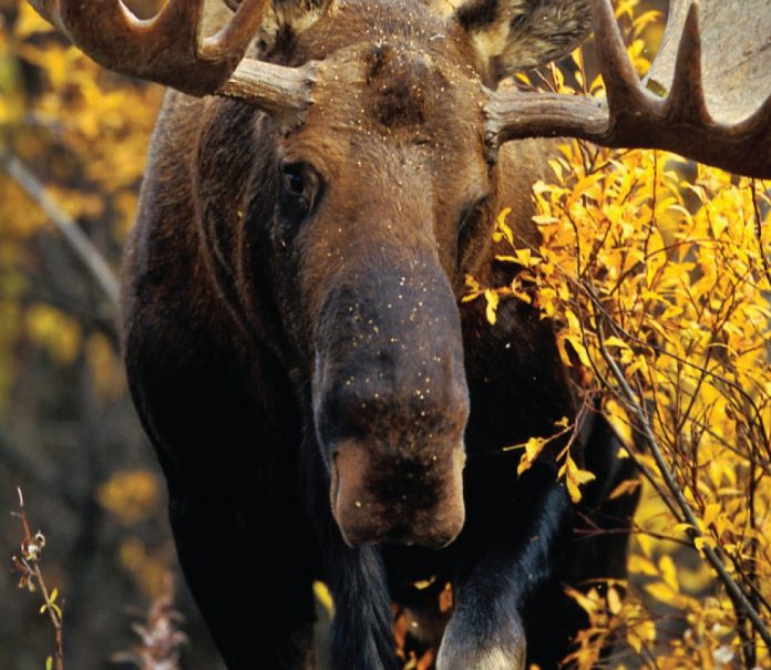
I stood my ground when the moose started to charge, not believing it was a real threat. When it changed its gait from a gallop to a sprint, I reassessed the situation and ran my ass off toward the truck. 

What was I thinking? If I had come across the same animal while out on a trip instead of by the side of the highway I would have admired it from a distance, not blindly walked up to it snapping photos as if it were a supermodel. 

A few seconds into the chase I realized that being part of the high school running club was far behind me, but the moose wasn’t. He was closing in and the only thing to do was to start zig-zagging in hopes of confusing him. 

It was the blast of a passing truck’s horn that saved me in the end. Not my buddy Andy. He was too busy trying to turn on his video camera. The moose jolted at the sound of the horn, zigged when I zagged and gave up the chase.

You don’t have to tell me I’m an idiot. I’m well aware. But it’s not all the time. I’m a safety fanatic while out on a trip. It’s an approach that has saved my hide many times out there. The moment the trip is over, however, I forget all those over-the-top safety measures, as if being reconnected with civilization means I can turn my brain off. 

Prior to the moose attack I had spent two full weeks paddling the Kopka. It’s a remote river in northern Ontario that’s challenging enough in normal conditions but was in high flood during our trip. It was the most testing route I’ve ever done—and at no time did I let my safety slip into question. We scouted every rapid prior to running it. We hunkered down during a wind storm rather than take a chance surfing breaking waves. We encountered 10 bears and gave them all a respectful berth. We even used safety harnesses while portaging an incredibly steep portage around Kopka Falls. We were the poster paddlers for safe canoe tripping. 

It wasn’t long after starting our drive home that we passed the moose feeding along the roadside. We hadn’t seen a moose on the trip, so I pulled over to take a picture. I took the lens cap off and transformed from safety boy to idiot tourist. You know the rest.

And what happened to the moose? He went back into the woods where it was safe, perhaps questioning how humans survive in the civilized realm we call the real world. If I were an evolutionary biologist I’d be worried about us.

Kevin Callan has never been to Pamplona, Spain, but hears it is an exciting place.

This article was originally published in the Fall 2007 issue of CanoerootsThis article first appeared in the Fall 2007 issue of Canoeroots Magazine.


Take a Hike

Photo: National Park Service
Take a Hike

Getting Started

Hiking may be the focus of your trip, or just a great way to break up long drives. To make your next outing with the kids energizing rather than exhausting, we’ve assembled some dos and don’ts for the hiking family.

• Do mix it up with fishing rods or bug nets to make it more than just a hike.

• Don’t be too ambitious—choose a shorter trail and slow down so kids can explore and ask questions.

• Do bring crayons, tracing paper, moulding clay and plants or animal field guides to make your hike a fun learning experience.

• Don’t diet on the trail—pack a tasty picnic.

• Do encourage shutterbugs—give children a camera to record their trip.

Delicate Arch Trail

Arches National Park, Utah

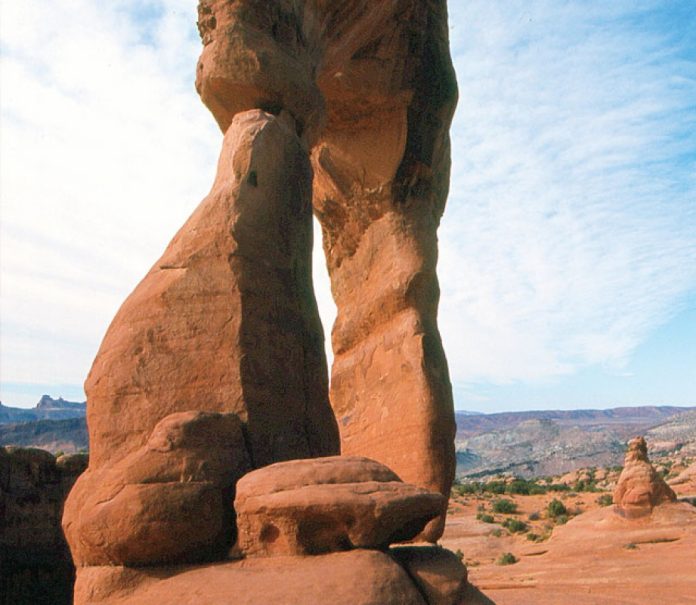
Cartoons come alive in this hole-in-the-rock wonderland. You won’t find obsessed coyotes chasing unflappable roadrunners, but the fantastic sandstone formations are enough to keep kids and adults fixated for hours. The finest arch in the park is 20-metre-high Delicate Arch, its red pillars framing the jagged skyline of the La Sal Mountains. If that doesn’t satiate your appetite, a 16-km (10-mile) scenic drive offers views of some of the park’s 2,000 other rock spans.

Setting out

The park entrance is 7 km (4 miles) north of the town of Moab on Route 191. Begin your hike at the Wolfe Ranch parking area and climb gradually over exposed sandstone to the arch. This 4.8-km roundtrip trail is rated moderate. More information is available at (435) 719-2299 or nps.gov/arch/. 

Harbour Rocks Trail

Kejimkujik National Park Seaside Adjunct, Nova Scotia

Seal-spotting, bird-watching, and ocean swimming are the highlights in this small park on the Atlantic Ocean. Gleaming crescents of white sand and sparkling aquamarine waters make Keji feel more Caribbean than Canadian. The Harbour Rocks Trail leads through berry patches and wildflowers to the coast where the whole family can frolic in the surf and view hundreds of sun-bathing seals.

Setting out

Kejimkujik Seaside Adjunct is located off Highway 103, 170 km southwest of Halifax. From the parking area, the Harbour Rocks Trail is an easy 5.2-km roundtrip on mostly level, gravelled surface. Learn more at (902) 682-2772 or pc.gc.ca/voyage-travel/pv-vp/itm2-/page15_e.asp. 

Pinguisibi Trail

Lake Superior Provincial Park, Ontario

Magnificent waterfalls and primordial groves of towering cedar and white pine are the highlights of the Pinguisibi Trail as it follows the Sand River on a lively descent over smooth Canadian bedrock. The many small pools along the way provide endless opportunities for budding young anglers to land a lunker. If energy levels are still high after the hike, cross under the highway bridge to dip your toes in the cold, clear waters of Lake Superior. 

Setting out

The trailhead is on the east side of Highway 17, 150 km north of Sault Ste. Marie at the Sand River day-use area. This easy to moderate hike is a 6-km return hike and travels over mostly level terrain with some short, steep sections. For more information call (705) 882-2026 or visit lakesuperiorpark.ca. 

Parker Ridge

Banff National Park, Alberta

If the Rocky Mountains needed an introduction, this trail would be it. Ascending above the treeline to the tundra environment of Parker Ridge, the thin air and panoramic vista will take your breath away. Kids can test their agility against that of resident mountain goats, while mom and dad enjoy the alpine wildflowers and eagle’s-eye view of the Saskatchewan Glacier. After your hike, visit the nearby Columbia Icefield, the hemisphere’s second-largest mass of ice and snow south of the Arctic.

Setting out

The trail starts on the west side of Highway 93, 8.8 km south of the Icefield Centre. One of the quickest ways to climb above the treeline in the park, Parker Ridge trail follows switchbacks 275 metres up a moderate grade and is a three-hour, 5.2-km return hike. Phone (403) 762-1550 or visit pc.gc.ca/pn-np/ab/banff/index_e.asp. 

This article was originally published in the Fall 2007 issue of CanoerootsThis article first appeared in the Fall 2007 issue of Canoeroots Magazine.

 

Weighing the Risks

Photo: Scott and Dougie MacGregor
Weighing the Risks

As parents we walk the tightrope, balancing potential risks and benefits all the time. If I let my daughter stick a screwdriver in the electrical socket, the benefit of improving fine motor control would be zapped by the risk of being electrocuted. Whereas falling off a bicycle on a soft lawn is worth the risk of a stained knee for the benefits of learning to balance and enjoying childhood freedom. As parents we make these kinds of decisions all the time. Learning to cut paper versus losing a finger. Having fun fishing versus getting hooked in the scalp. Exercise and adventure from hiking versus getting lost or poison ivy.

In the world of outdoor recreation and education this is called risk management. My friend Matt Cruchet runs Direct Bearing Risk Management Consulting, a very successful business helping organizations manage risk in their adventure programs. Unfortunately, our society is quick to point fingers at the risks involved with outdoor activities, making educators and some parents scared to take kids outside—especially with the ever-looming threat of legal action. Matt works with schools, camps and organizations like the Girl Guides of Canada to help quantify the benefits, identify the hazards and minimize the risks involved in their outdoor programs. 

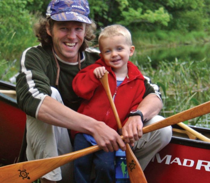
As camping parents we know that summertime is perfect for being outside and being active with our kids. This Canada Day long weekend I took my two-year-old son Dougie on our first father-son whitewater canoe trip. The reaction of other canoeists fell into two camps: one group, “I wish I’d started paddling that young”; and the other group, “What in God’s name do you think you’re doing with a baby in the rapids?” One couple actually paddled over and asked me this…it turns out they are teachers.

My friend Matt uses a diagram to help his clients think about risk. One axis is the likelihood of something bad happening, and the other axis is the severity of the consequences. Mosquito bites, for example, are very likely but result in only minor bumps or itching; the chance of getting struck by lightning is quite low but the consequences are severe. The worst kinds of risk are the ones that are very likely to happen and have severe consequences. And in the first quadrant is where Dougie and I paddle the Madawaska River—the chances of us flipping are quite low, as are the consequences with warm, low water, helmets and PFDs. 

In March, a Commons health committee report concluded that 26 per cent of Canadians between the ages of two and 17 are overweight or obese. Overfeeding and lack of exercise increase the risks of preventable life-threatening diseases such as diabetes and heart disease. Watching Dougie playing in the sand, scrambling over rocks, swimming in the shallow eddies and climbing into his sleeping bag at 7:30, I’m sure I’ve found the cure. For my family, the benefits of being outside and canoeing, hiking (see this issue’s hiking feature) and camping far outweigh the risks—so long, of course, that those risks are well managed.

By noon on our second day Dougie and I had caught up to the teachers. They were scouting Raquette Rapids, a 100-metre-long class II that flows over some shallow ledges and between two rock islands. I’ve run this rapid a hundred times. Dougie and I drifted into the current chatting about sitting still and pointing out rocks to avoid. I could feel glares of disapproval burning through the foam of my lifejacket as we floated past the teachers and down the last little chute into the lakewater pool. A perfect run.

A few minutes later, whistle blasts chirped to get our attention. Guess who was in the water? Their canoe was upside down and their gear was strewn around the rapid like a yard sale hit by a tornado. I’d normally have jumped up from our lunch spot on the rocks and helped them, but I couldn’t leave poor little Dougie on these dangerous rocks by himself. What kind of irresponsible parent would that make me? So I sat there spreading cream cheese on my “baby’s” bagel, wondering if they now think they should have started paddling when they were two. 

This article was originally published in the Fall 2007 issue of CanoerootsThis article first appeared in the Fall 2007 issue of Canoeroots Magazine.


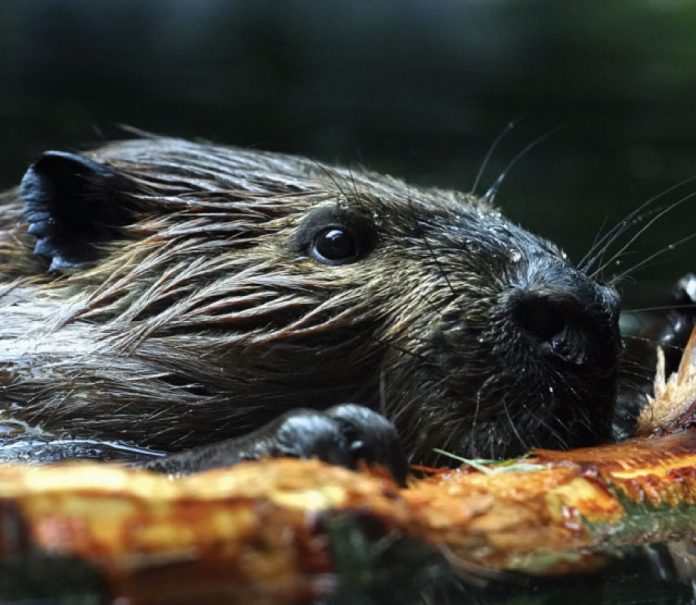
Betcha Didn’t Know About Beavers

Photo: iStock.com
Betcha Didn't Know About Beavers
  • Beavers are the second largest rodent. 
  • The beaver was the main currency of the fur trade. Pelts were trapped in the hinterland by natives, exchanged for goods at trading posts and shipped to Europe to be treated with mercury to make felt for hats. 
  • Beaver tails are sweet hunks of deep-fried dough that are popular on Ottawa’s Rideau Canal. They set back sugar-craving ice skaters $3.50.
  • Newborn beavers are able to swim within hours of being born.
  • Beavers were practically wiped out in Europe by demand for castor oil, a bitter excretion that was used to treat pains and is still used to scent perfumes.
  • The buckteeth of a beaver never stop growing.
  • Jerry Mathers gnashed some impressive buckteeth himself as star of Leave it to Beaver, a sit-com that debuted in 1957.
  • Beavers dam waterways with a mass of mud, rocks and sticks to create a pond that provides access to vegetation and protection from predators. The largest known beaver dam stretched nearly 1,500 metres across a river in Saskatchewan.
  • Female beavers tend to grow larger than males. 
  • The mating practices of beaver—of interest to a large number of humans—involve mid-winter romantic dalliances under the ice.
  • Beavers can hold their breath for 15 minutes.
  • The legendary DeHavilland Beaver bush plane has taken more canoeists to more remote put-ins than any other airplane. 

This article was originally published in the Fall 2007 issue of CanoerootsThis article first appeared in the Fall 2007 issue of Canoeroots Magazine.
 

Birds of Play

Photo: Chris Dowdell
Birds of Play

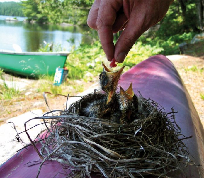
Three Ottawa-area canoeists have one more reason to fish with live bait after a May canoe trip on which they could have used a few extra worms.

Chris Dowdell, Ian Stimson and Roly Saul started their weekend jaunt on the Madawaska River by loading a borrowed canoe onto their car. The canoe was stored upside down at shoulder height so the men simply shifted it onto their roof racks and tied it on.

After a bumpy drive, the paddlers arrived at their put-in. As they flipped the borrowed boat off the car, a bird’s nest dropped out from under the seat, and out tumbled two tiny robin chicks. “I’ve always said we should be bringing chicks on our trips, but this isn’t what I meant,” said Dowdell.

The trio decided they couldn’t bear to leave the displaced robins at the mercy of the local wildlife. So, they took them along for the paddle. “We felt we could at least try feeding them and see what happened,” said Dowdell.

At their campsite, they kept their guests comfortable with a gourmet menu of steak bits and tablespoons of water—filtered, no less. Each evening, they placed the nest in a tree, sheltered by a makeshift tent of paper towel and twigs. To ward off carnivorous climbers, they booby-trapped the tree’s base with utensils. 

The robins warmed easily to their new surroundings. They lazed in their nest, gazing out at the water and squawking loudly when one of their guardians approached with food. “They adjusted well to their new moms, and seemed to enjoy the view,” said Dowdell.

But no good adventure tale is complete without a happy ending. At trip’s end, the men returned the canoe to its owner. Waiting for the chicks, worm in mouth, was the mother robin, who put the lie to the myth that mother birds reject chicks that have been handled by humans. 

Two weeks later, the chicks left their nest again, this time flying instead of floating.

This article was originally published in the Fall 2007 issue of CanoerootsThis article first appeared in the Fall 2007 issue of Canoeroots Magazine.
 

Editorial: If You Gotta Go, Go Now

Photo: Jan Waldin
Editorial: If You Gotta Go, Go Now

It was our third consecutive lunch of pitas and cheese and we were ready for a distraction. We had pulled up at a narrows about two-thirds of the way down Nunavut’s Coppermine River. The bank on the far side was splattered with head-high willow shrubs and Barb was adamant that there was a caribou grazing among them.

“There,” she said, “just to the left of the little clearing.”

The rest of us munched away, squinting across the river and assuring her we also saw it before realizing what we thought were antlers were just another pair of willow branches. 

This went on for 15 minutes, until the pitas were put away for another day, before Mike declared, “It must be a caribou. I can smell it.” 

Mike has admirable olfactory abilities, but this was too much. I was about to suggest he was smelling himself when I caught a whiff of what I imagined caribou breath must smell like. 

Ally turned around and laughed. Not 20 metres behind us four caribou were mowing down tufts of lichen. We could see every whisker, and hear every gum smack (I had assumed the noise was Mike eating dessert). It’s a good thing we had a large store of pitas, because if we had been relying on keen senses to deliver us food from the land we would have gone hungry. 

I couldn’t help but feel out of my element up there. The conventions that time and space follow down south, even on a remote river in the boreal, have no purchase in the Arctic. With the land frozen so much of the year, cycles such as growth and decay grind to a crawl while seasonal imperatives like spring runoffs and animal migrations take on a determined frenzy. It is hard to know what to expect, even hard to know how to adjust your eyes to a landscape that is so barren and hard to read it turns what you thought would be a half-hour hike into a half-day trek.

That was 10 years ago, and I haven’t been back to the Arctic, a fact that hit me in the gut last week when a couple I know asked me out for a beer and counsel about their plan to paddle the Coppermine.  

They were nervous, and had reason to be. They had paddled a handful of rivers, but their whitewater history wasn’t one that begged for a biography. The weather in late August could well be punishing. With only one canoe in their party they would have no one to collect pieces for them after a dump. 

As we batted around these caveats I couldn’t help but wonder if I was erring on the side of caution so I would feel better about my inability to muster a return trip above the 66th parallel.

As we often recount in these pages—call it our editorial mission—canoe trips on the whole are getting shorter and shorter. Fewer people are making the sort of time commitment needed to do extraordinary canoe trips. Everyone has reasons. I know I have mine. I just don’t know if they are good enough.

My friends emailed me last week to tell me they had weighed the risks and had decided to paddle the Coppermine. They may become stormbound for a few days. They may dump and lose equipment—or worse. One fate that won’t befall them, however, is they’ll never have to sit on a patio sipping a beer and mumbling sorry excuses for how they didn’t go north in 2007 because they were too busy. 

This article was originally published in the Fall 2007 issue of CanoerootsThis article first appeared in the Fall 2007 issue of Canoeroots Magazine.


In Parting: How Kayaking Makes You Smarter

Photo: Tarmo Poldmaa
In Parting: How Kayaking Makes You Smarter

There’s a highly successful and well-paid management consultant who, whenever he gets in a stressful pickle at work, solves his problems by sitting down to do needlepoint.

This is according to a book I am reading to better myself. It’s called The Breakout Principle: How to Activate the Natural Trigger That Maximizes Creativity, Athletic Performance, Productivity and Personal Well-Being. Wouldn’t you like to know the secret to all that?

According to the authors, Herbert Benson and William Proctor, when you get stuck with a problem at work or in life and grapple with it for a while until you aren’t getting anywhere, you can break out of that rut by doing something physically or mentally repetitive. They suggest meditation, walking, scrubbing the toilet—it can be just about anything. The needlepointing business guru supposedly solved a big problem by engrossing himself in a particularly intricate form of embroidery called petit point. Focusing on a repetitive activity pushes the brain’s reset button, allowing you to find new thought patterns for old problems. Your mind evolves and you get smarter through successive cycles of struggle and breakout. The harder the struggle, the greater the enlightenment is likely to be. It’s a “work hard, play hard” philosophy, coming to you from a pair of authors that includes a professor of medicine at Harvard—so it must be true.

Before you rush out to the craft store for needlepoint sup- plies, take it from me that kayaking has all the same breakout benefits while being a lot more fun. I find there’s no better way to get over writer’s block than to go out for a long paddle. The best escape comes in a following sea that’s big enough to make me pay attention but not so big it really scares me—the golden mean between too-easy and too-hard that produces the mental state psychologists call “flow.”

After a few good hours paddling downwind in a moderate swell, the first two things I need to do when I get to shore are 1) pee, and 2) pull out my notebook to write down all the brilliant ideas I just had on the water. Often the two are emergencies of equal urgency. If I start carrying a pee bottle in my cockpit, I will also have to rig a dictaphone to my Pfd. sitting at a computer, though our careers often demand it, is not a great way to be inspired.

I have come to think of my kayak cockpit as “the Oval Office” because it’s where I do my best work. Indoor work can nourish the mind, but it takes water to digest.

This article on increasing your productivity through kayaking was published in the Summer 2007 issue of Adventure Kayak magazine.This article first appeared in the Summer 2007 issue of Adventure Kayak Magazine. For more great content, subscribe to Adventure Kayak’s print and digital editions here.