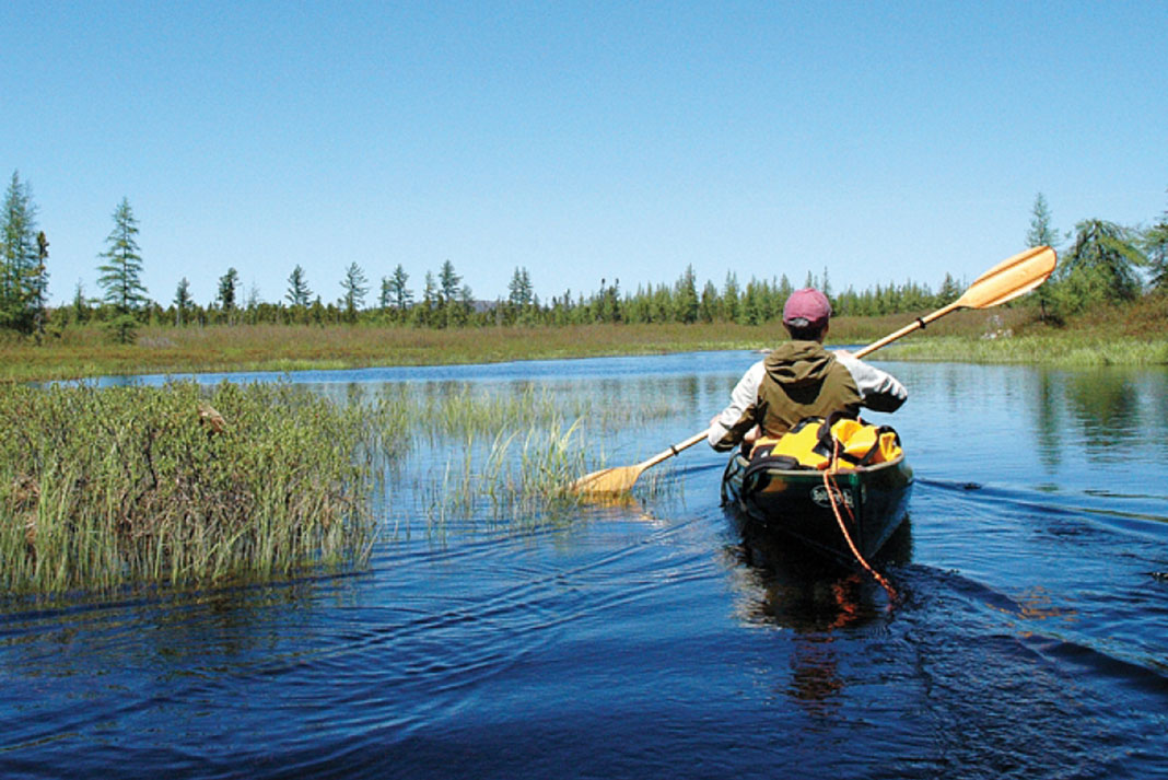
So this is what adventure looks like.
A storm raged overhead as I sheltered under my overturned canoe on the shore of the Yukon’s Lake Laberge. Watching lightning stab down at the surrounding hills in the gloom, I shivered.
Only three days into a five-week solo canoe trip down the Yukon River and I was already at the mercy of the elements, gusts of wind sending sheets of rain to pound against the hull. Against the howling wind, I clung to the gunwales of my only means of return to civilization.
I’m not the first to have come to the Yukon River for a taste of adventure. In 1898, news of a massive gold strike in the Klondike Valley swept the world and some 30,000 men raced to Canada’s Yukon Territory. Doctors called the fever “klondicitis.” After hiking heavy packs over the dangerous Chilkoot and White Pass to the headwaters of the Yukon River, prospectors built rafts and boats to float, pole and paddle their way to collect certain fortune. Gold lay thick in the creek beds, it was said. For most, the dream proved elusive.
Hearing the story as a boy, klondicitis hit me hard. I never shook off its romantic beckoning. Each summer I escaped my government job in the nation’s capital to paddle remote areas, but still the Klondike haunted me. And that’s how I found myself lying under my canoe, waiting for the storm to pass.
Warnings
My river journey began in Whitehorse, the capital of the Yukon, with warnings. In full flood, the Yukon River was carrying up to 40 percent more water volume than past years. Entire trees were caught up in the floodwaters, making for dangerous paddling companions. Often considered one of the more accessible northern rivers because it’s reachable by road and has few rapids, the Yukon River during the summer of 2012 was a whole different beast.
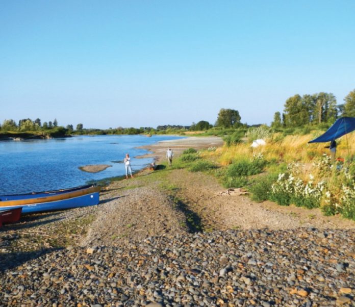
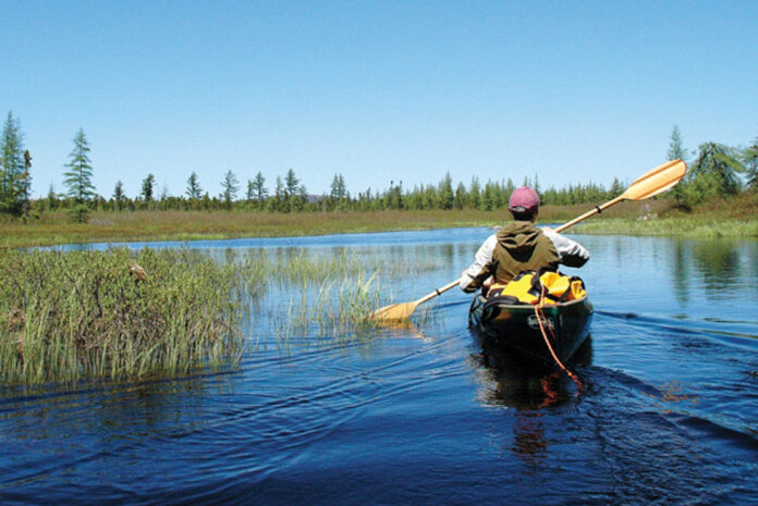
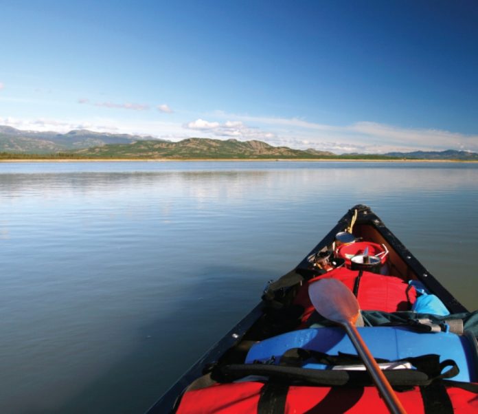
My heavily-laden 17-foot Nova Craft set off into strong current from a quiet eddy in town. My goal was to trace the gold rush to the Klondike Valley, then paddle to the Arctic Circle, 1,300 kilometers away. Paddling away from Whitehorse, almost immediately I was immersed in wilderness. That first night I set up my tent within sight of rotting paddlewheeler wharf pilings on the “marge of Lake Laberge,” a place made famous by Robert Service’s 1907 poem The Cremation of Sam McGee.
Lake Laberge is a widening of the river north of Whitehorse, 54 kilometres long and a dangerous and unpredictable lake for any canoeist. More than a few Klondike paddlewheelers, a popular means for traveling the river in the 19th century, rest on the bottom, victims of sudden storms, high winds and waves, which can whip up in minutes.
Chased all morning and afternoon by a storm, I was caught 30 kilometers down the lake. Already pitching and rolling when a grey wave swept over my stern, I headed for the nearby shore. And that’s where I stayed, sheltered under my canoe and then huddled in my tent, for two wet days.
Released from the clutches of the storm, I had my sights set on a ghost town at the northern reach of Lake Laberge. Eight hours of hard paddling found me, exhausted, setting up my tent beside a lonesome paddlewheeler, its ribs protruding from the gravel like a prehistoric skeleton. Close by, the remains of a telegraph station slowly composted into history. Klondike miners didn’t go north as pioneers to settle the land. Interested only in striking it rich, most left within a year of their arrival, pushed south by the hard winter and disillusioned with the promise of gold. Their log cabins illustrate the hard lives they led: dirt floors, windows improvised from whiskey bottles or tanned moose hides and a solitary stove to keep the cold at bay. Most of these ghost towns have disappeared into the black spruce forests, but their bones are still there for those who look.
Exploring
Hootalinqua, where the Yukon meets the Teslin River, is a beautiful ghost town. Its name means “running against the mountains” in reference to the fast and narrow section I’d just paddled. A North-West Mounted Police post, telegraph station, solitary trapper’s cabin and log store are all that remain. A narrow path, guarded only by swarms of mosquitoes, leads through the forest to a rocky lookout. Nearby, the paddlewheeler Evelyn still stands upright—though tilting—on supports where dockside workers abandoned her 100 years ago. Deep in the wilderness, ravens and hummingbirds perch on her sagging bow and stern.
Constant vigilance is a necessity for any wilderness paddler. From its headwaters in British Columbia, the Yukon River carves a circuitous 3,100-kilometer path through the wilderness to the Bering Sea, making it the 10th longest river in the world. Moose, caribou, wolverine, bear and eagles are often more common than people along its banks. With a year-round frigid water temperature, hypothermia is a serious concern. Rapids, whirlpools and sweepers pose navigational challenges. In its flood conditions, logjams forced furious paddling to find a clear and safe path and submerged logs were a constant danger; getting rammed by one would certainly have capsized me.
The challenges of Canada’s north attract adventurers from around the world. More than 300,000 people visit the Yukon each year, says tourism spokesperson Jim Kemshead. One in five of those are adventure enthusiasts. “The Yukon has a landmass the same size as California but whereas California has a population of 38 million, the Yukon is populated with 36,000 people. This makes for great expanses of pristine wilderness.”
At Carmacks, a small riverside town named after one of the original Klondike gold miners, I met a German couple kayaking from Whitehorse to Eagle, Alaska, with their young son and husky dog. A wolf had stalked their husky at Selwyn, a remote ghost town, they told me. Englishman, Eddy Hely, was another freedom-loving paddler traveling downriver. At 32 years old, Hely travels the world seeking adventures, working when money supplies run dry. It’s not an uncommon story for travelers along the Yukon.
Klondike Gold
Three weeks in, I arrived at Dawson City, nestled deep in the Klondike Valley at the confluence of the Yukon and Klondike rivers. I resupplied and took a few days off. I spent a day on a palaeontology dig organized by Dr. Grant Zazula of the Yukon government who researches the prehistoric animals, including mammoths, scimitar cats, camels and nine-foot-long beavers, that roamed the area before the last ice age. I uncovered a 30,000-year-old buffalo horn and jawbone, complete with several teeth.
Most paddlers end their trip at Dawson, which retains its frontier, gold-rush feel. Called the Paris of the North when its population ballooned to 40,000 in 1898, today little over a thousand people call it home year-round. Its dirt-packed streets, old-fashioned street-side facades and employees dressed in period costume are at odds with the bustling RVs and tourists. Though only 4,000 men struck gold in the Klondike during its hey-day, today a handful of hardened prospectors still try their luck in the rivers nearby.
If Dawson was the heart of the Klondike Gold Rush, then the Yukon River was the artery that fed it. Few prospectors followed the river past Dawson; fewer still to Fort Yukon, my final destination. Saying goodbye to Dawson and my Klondike quest, I took to the river. Warned of a wild ride ahead, anticipation spiked as I nosed the canoe into the strong current. Due to the flood conditions, I’d been clocking speeds up to 18 kilometers per hour and couldn’t imagine going faster.
With the river unrolling before me—endless kilometers of spectacular mountain beauty—it was easy to see how the area captured the imagination of so many artists—writers Jack London, Robert Service and Pierre Burton, most famously. Signs of the gold rush dried up as skeletons of paddlewheelers disappeared from the shore. Past the granite marker at the Yukon-Alaskan border and several hard paddling days from the Arctic Circle, the river enters a vast swampland of islands called Yukon Flats, a major North American breeding ground for cranes, geese and ducks. The shoreline flattened, swallowing all recognizable landforms. Because the river tears down these islands and gravel bars as quickly as it builds them, my GPS was of no help. Lost in a 230-square-kilometer area of the braided river, at least I could be sure that as long as I was on the river, I was inching closer to the Bering Sea. With an ample reserve of food, I was far from panicked. Before turning in that night, a pair of sand-hill cranes silently drifted past my campsite in the gathering dusk. Then a pair of wolves howled in the distance. Bliss.
The following day, after covering almost 1,300 kilometers, I hauled my canoe out of the current at the Alaskan village of Fort Yukon perched just above the Arctic Circle. This was the finish line. After five weeks of paddling the Yukon River in flood conditions—taking more than 133,100 paddle strokes—my case of klondicitis is worse than ever. But unlike the prospectors before me, I know I’ll be back.
If You Go…
Essentials for paddling the Yukon River
When to Go
Travel mid-June to take advantage of the daylight hours and experience the most of the midnight sun. On the summer solstice, June 21, travelers and locals alike meet on top of the Dome, a massive hill overlooking the river and Dawson City, to watch the sun dip below the mountains and rise again only a couple hours later. Or, paddle in July and time your arrival with the Dawson City Music Festival, a truly unique, grassroots event with world-class music (dcmf.com). August sees cooler temperatures, shorter days and fewer bugs.
Where to Paddle
Most long-distance paddlers on the Yukon River start in Whitehorse and take out 460 miles and two weeks later in Dawson City. Shorten your trip by half by starting or ending in the town of Carmacks. Alternately, shorten your trip but not your route by participating in the Yukon River Quest, the world’s longest annual canoe and kayak race that spans the full distance from Whitehorse to Dawson City but takes place over five days—winners regularly cross the finish line in under 42 hours. yukonriverquest.com.
Weather Concerns
“If you don’t like the weather, wait an hour” is a common saying in the Yukon. It’s unpredictable at best. Though temperatures can spike to 30 degrees Celsius and higher during summer months, a daily temperature of 18 degrees Celsius is average during the summer, dropping close to zero at night. Snow along the Yukon River is possible at any time of year.
Don’t Forget
This wilderness journey takes place in the heart of grizzly bear country. Bear spray and an emergency communications device are musts. Don’t forget an eye mask to ensure you get some sleep.
Outfitters and Guided Tours
Up North Adventures | upnorthadventures.com
Kanoe People | kanoepeople.com
Sea to Sky Expeditions | seatoskyexpeditions.com
Pathways Canada | canoe-yukon.com
Cabin Fever Adventures | cabinfeveradventures.com
Allen Macartney is an experienced wilderness paddler, writer and photographer. His expedition was sponsored by the Royal Canadian Geographical Society.
 This article first appeared in the Early Summer 2013 issue of Canoeroots Magazine.




 This article first appeared in the Early Summer 2013 issue of Canoeroots Magazine.