The crackle of embers stirred sleep from my eyes and snapped the daze I had fallen into. I glanced left and noticed Leah had dozed off too, her face being bit by bugs. I looked out at the hazy mist of midnight along the Severn River, rolling a few more logs in the fire and adjusting my belt. The leather had three new holes, souvenirs marking the rigor of the old canoe routes that had led us here, to the Hudson Bay Lowlands.
I was to stay attentive, for earlier in the day we noticed polar bear tracks creeping in the shallows, stalking caribou, and it was just the two of us. I wiped some of the blackflies from Leah’s face, little smears of blood following, and urged her to the tent. We stood up together, two skinny figures at the end of a ragged journey. Strong yet weary of the gnawing hunger that wasn’t letting calories stick to our ribs.
Canoeists retrace ancient routes to Hudson Bay
We had traveled 1,200 kilometers over two months, facing all the joys and challenges a long canoe journey delivers in Northern Ontario. Hard rivers, gorgeous sunsets, a mix of beautiful and bad campsites, a standoff with a wolverine, enough walleye for two lifetimes, near misses with wildfires and, of course, bad bugs. We followed a route of vanishing trails, a fading network of once-bustling portages crisscrossing between watersheds. These thousand-year-old trails have all but faded back into the wild mosaic of the landscape.
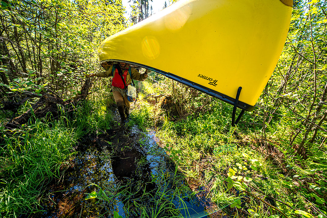
Fifty-eight days earlier, Leah and I had left the Pikitigushi River bridge east of Armstrong, Ontario, and paddled north. We began on the eastern edge of Wabakimi Provincial Park bound for the distant coastal Hudson Bay community of Fort Severn. When we started, we carried five packs weighing 600 pounds total, enough to deliver us to the polar bear-dense region without resupply.
Gathering stories, following trails
The route was not a conventional line for canoeing to Hudson Bay. Instead, it was a dream from my work as a photojournalist. While covering stories in the Nishnawbe Aski Nation communities found along these waterways, I often talked with the friends I made on assignments about the rivers and lakes at their doorsteps. I heard stories about where someone was born or about the journey the community of Nibinamik made when its residents took canoes loaded with their possessions and paddled and portaged from their former community of Landsdowne House 150 kilometers northwest to the Winisk River, where they settled.
I wondered about the trails they had taken and if those trails would still be there. I told my new friends I would return by paddle to visit them someday.
Back home, I studied the Canoe Atlas of the Little North to figure out how possible it was.
The line Leah and I drew went something like this: Whitesands, Fort Hope, Neskantaga, Nibinamik, Wunnimun Lake, Kingfisher Lake, Big Trout Lake, Wapekeka, and down into Fort Severn. The places in between are the traditional trails of the Nishnawbe, a series of carrying places often 8,000 years old. While we hoped to find joy and challenge, the portages were first eked out of the forest for hunting, seasonal migrations and to travel the complex land of muskeg, bedrock, water and stunted trees we now call Northern Ontario.
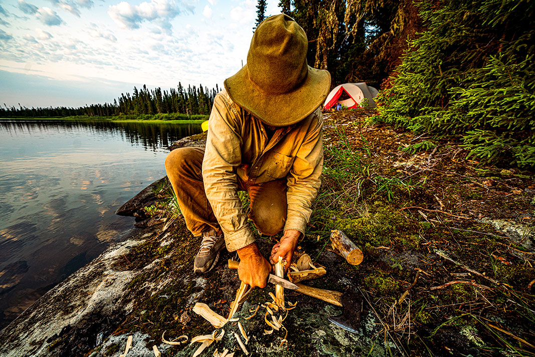
On each river we were challenged. The Marten Drinking River was dark and deep, with steep bouldery rapids and rock ledges covered in jack pine and spruce. Beside a rapid early in the morning, I made wood shavings in the misting rain, my hands aching in the cold, wishing there was birchbark closer to camp. Our little twig stove for boiling water sat beside a fireplace now grown-in with moss. We found these most everywhere we stopped.
We came to a gorge where we heard there was a long carry-around and all morning we searched. Paddling from the edge of a swamp to the brink of the rapid, which fell into a small canyon, we searched in vain for the faint trail to deliver us safely below. All we found were beaver trails and moose highways.
A search for signs of the past
If Nishnawbe had used this trail for thousands of years, and later the fur trade companies, there must be something that remained. At least, that’s what we told ourselves on the edge of the buggy spruce glade.
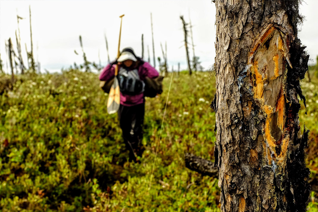
Descending into the gorge seemed reckless, so we reconsidered the first place we landed, in the corner of a swamp, a likely carrying place for a wooden canoe to land. Moving deliberately, scanning every scrape and butt end of a tree, my eyes settled on something I hadn’t noticed: a groove. If I looked at the trail, I missed it, but if I looked just above, I saw in my peripheral vision a faint trough in the deep moss, almost undetectable.
For hours we carefully retraced this faint hint of the past, following the trail of ghosts.
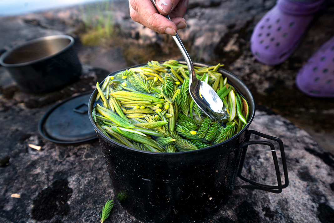
That evening, on the downstream side of the long, tedious carry, we drank spruce tip tea and talked about this beautiful river. If it were anywhere else in the province, it would be a summer highway of canoeists. Instead, these traveling corridors between watersheds, once the bloodline of the north, have all but disappeared into the boreal, gone with the winds and fire. For us, the journey is more important than our destination. The soul of a trip is in connecting the places in between.
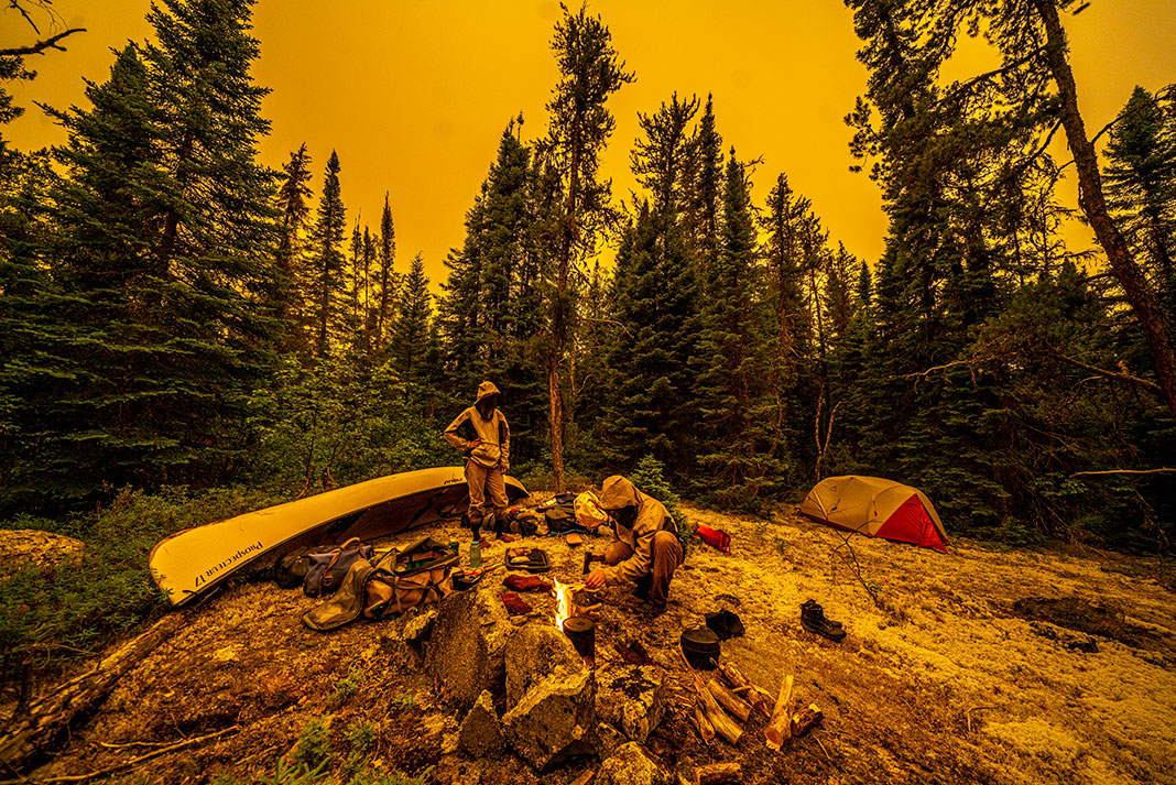
Ten days later, we found ourselves in the middle of the crossover the Nibinamik people used in the 1970s when fleeing the turbulent times of Landsdowne House and marveled at their creativity. The route was little more than a succession of small heights of land on Winisk River tributaries as it crossed from the Attawapiskat River, but the going was convoluted. Lakes like Onisabaweigan appear as a shotgun blast on our map, and navigating was a nightmare. In some places, there were winter trappers’ trails; in most places, we were left with muskeg headwater lakes, dry boulder beds where a glacial stream once flowed, and never a rock or suitable campsite.
Embracing the timeless spirit of travel
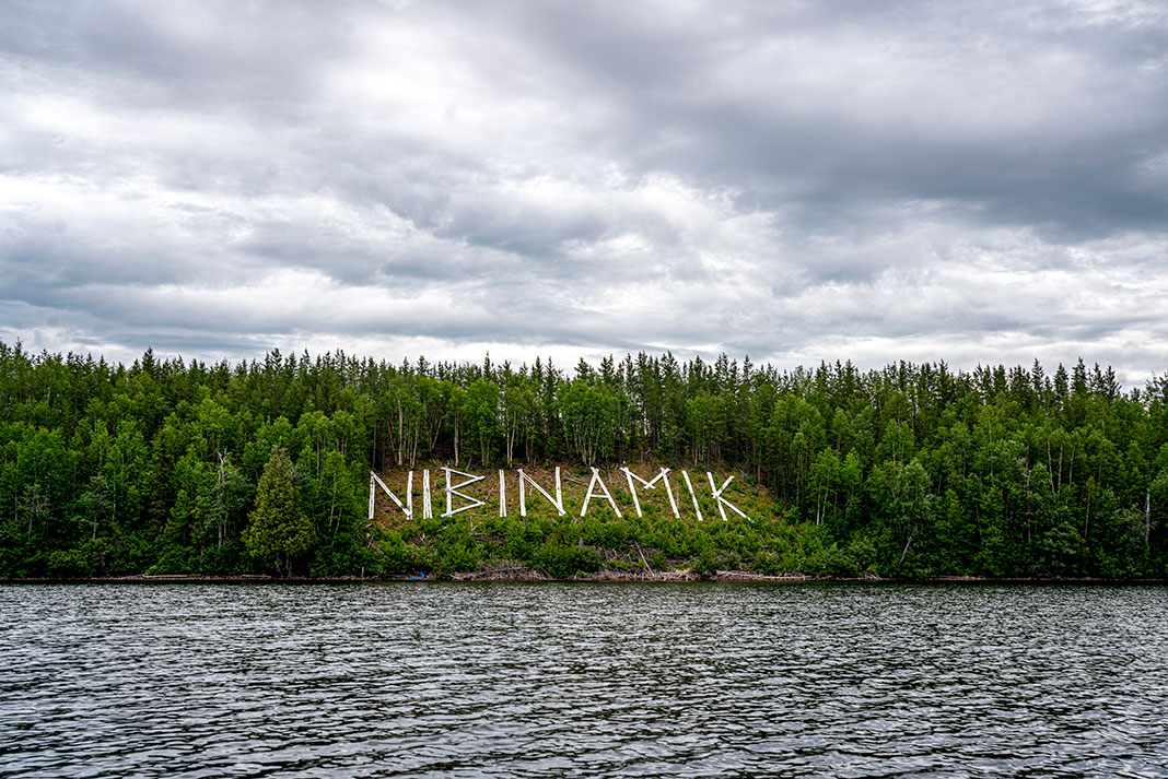
By the time we reached Nibinamik, we were beat down after a descent of Horley Creek. Nibinamik was locked down in Covid protocols like everywhere else on our journey. We could not stop, resupply or visit old friends. Still, passing by the giant wooden Nibinamik sign built into the town’s esker, made by the late Sam Beaver, we smiled at the Northern Hollywood homage.
Sprawled out on a bald rock island of Big Trout Lake, our tent in the spruce at the center, we luxuriated and swam in the cold, turquoise water. The lake reminded us of Lake Superior, except to the south we watched plumes of smoke rise from a forest fire we had narrowly skirted. What was supposed to be old trails through a network of creeks dividing the Asheweig and Fawn rivers was relentless portaging down 15 kilometers of dry creeks and over long out-of-use trails. Leah’s neck was a swollen war zone of blood and bites.

We understand why people don’t travel these ways anymore. Perhaps it’s too hard, the margins of joy too thin for people to devote months to. Busy schedules and limited holidays have encroached on what the essence of a canoe trip has always been—a process of reading the landscape by pack and paddle, a journey to uncover the story of river and lake.
These old canoe routes to Hudson Bay may mean nothing to a bucket list, but they mean everything to the spirit of traveling. Their intricacies represent a fundamental connection to the freedom we gain with time and patience. When we let a trail fade, we part ways with a story thousands of years in the making.
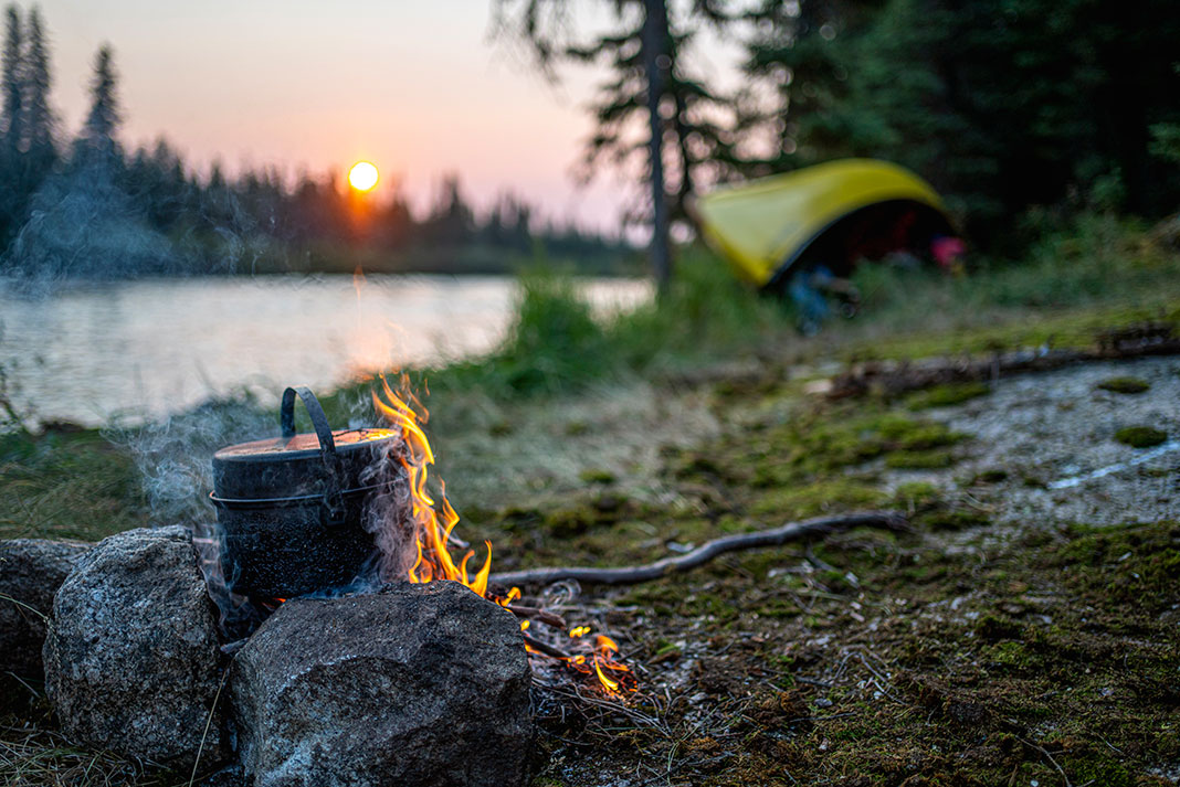
When I woke Leah on the banks of the Severn, we shivered against an icy wind not quite cold enough to knock the bugs down. The fire had become a smoldering heap of coals. I kicked at them, their glow mesmerizing my sleepless fog until Leah poured river water over them and steam rose fast to the grey sky. I placed my hand on Leah’s shoulder. We were to be in Fort Severn the following evening.
In time, our world would whisk back to planes, trains and automobiles as we made our way home. But for a moment, we felt the enormity of where the trails had brought us, and we wondered how many others had come this way. It’s hard to say who might next walk the lines we followed and if they will notice the signs we left. Maybe all trails fade someday. Yet, even when these old routes disappear further into the recesses of time, we will remember these vanishing trails that brought us so far.
David Jackson is a photojournalist who calls the north shore of Lake Superior home. Follow his adventures @davidjackson__.
The second of three carries heading to the height-of-land crossover from the Eabmet River in the Albany watershed to the Marten Drinking River in the Attawapiskat Watershed. | Feature photo: David Jackson


 This article was first published in the Fall 2022 issue of Paddling Magazine.



Great story. But this article, like many, would be better with some maps.