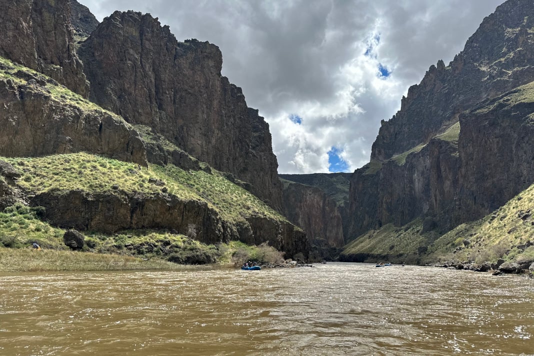
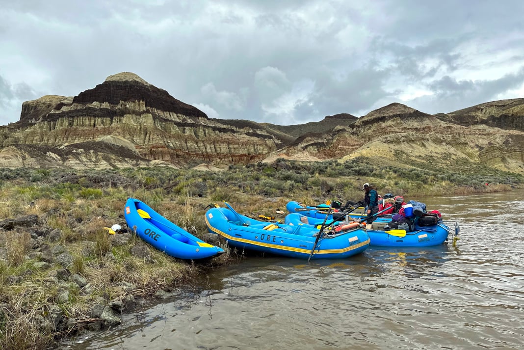
Chasing blind corners through Iron Point Canyon, I knew Montgomery Rapid was coming up fast. The telltale marker was an eddy on river left. Undoubtedly, there was always a commercial company pulled over for a scout.
This was my third trip down the Lower Owyhee River, the 67-mile stretch from Rome to Leslie Gulch, during what was arguably the best season to guide in two decades. There was still more than 200 percent snowpack cached in the mountains from the winter season of 2022 to 2023, and the river had spiked to 18,000 CFS in a day. The commercial trip I was scheduled to guide canceled. So I made the eight-hour trip home and back to nab my personal raft. When our group returned to the launch for a run, the river was still at 9,000 CFS.
Montgomery Rapid at 9,000 is juicy. The entry pool, where there’s typically tons of time to set up, was gushing through like a freight train. It converged with a wall on river left. My line on two previous descents was a shallow one on river right. Today, that wasn’t an option. The current pulled our boats left toward the wall. The move was to tee up, thread the needle between two truck-sized boulders, tightrope a green tongue to miss the holes on either side and ride the wash out without crashing into a lower left wall in the runout.
[ Stock up for your next river trip with the Paddling Buyer’s Guide ]
It all went well until I took the tongue too close to the hole behind the river right rock. My bow stalled in the eddy fence, and my stern whipped around in the current. I was sideways before I knew it and lost an unleashed oar. After a half a half-second pause in disbelief, I reloaded the oar lock with my spare Sawyer Square Top and started rowing upstream to catch the stray. And I managed to grab it before it could become a snack for oar-eating rocks below.
Fortunately, the rest of the Owyhee held little in the way of carnage and plenty of desert solitude.
Praying for snow and flow
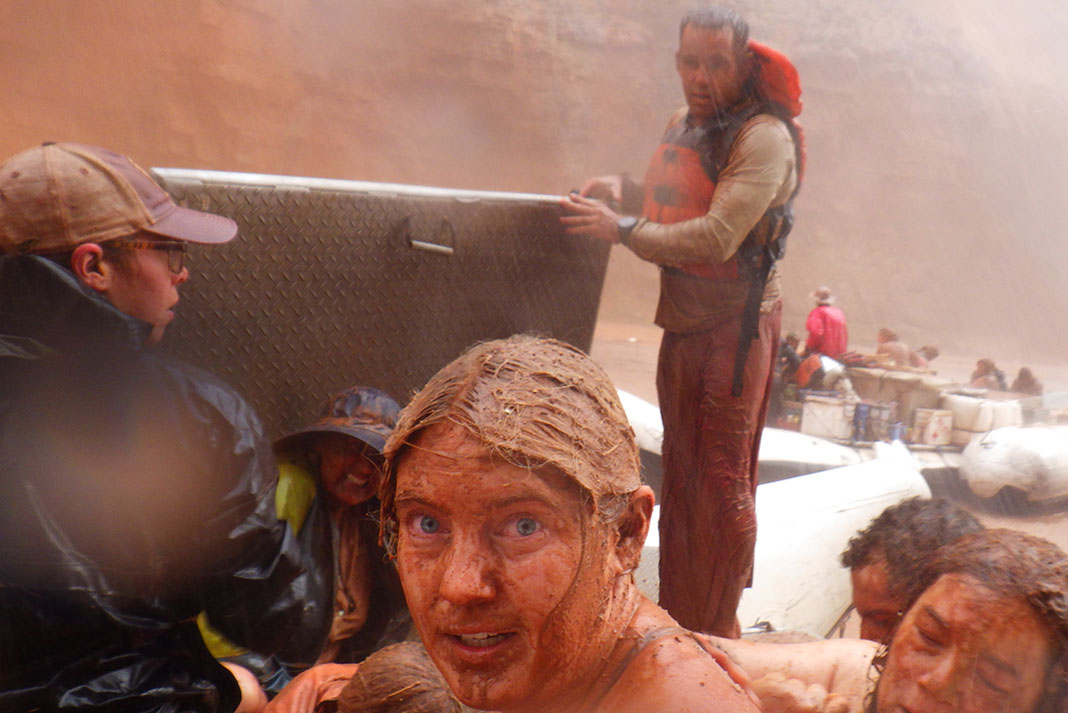
High water on the Owyhee isn’t just uncommon—it’s a sought-after prize that seasonally holds the attention of western boaters. A fever pitch for high water mirrors the Owyhee drainage’s history of attracting fortune seekers lusting to strike it rich and pad their pockets with gold.
By some accounts, an 18,000 CFS spike hasn’t been seen on the Owyhee River since 1992. And a fully loaded season where all commercial trips booked actually launch hasn’t happened in at least 15 years. It’s ironic that one of the commercial trips I was booked for canceled as a result of high water, as more often than not, trips don’t run due to low water. Let me explain.
Where obtaining permits and elaborate lottery systems might preclude boaters from getting on other bucket list rivers around the West—for the Owyhee River, its nature is unpredictable in terms of flow and atmospheric conditions and, therefore, is considered unreliable. In a typical Owyhee River season, a guide might only get to run one or two commercial trips, even though six are booked. The watershed’s combination of a boom-bust snow melt feeder system and wily weather can make it difficult to know whether booked trips will actually launch until the last minute. This is also true for private trips. In recent years, the snowpack has been so low it hasn’t held out for any significant length of time. Boaters have to be willing to catch the flow in March when the weather will likely be cold and precipitous.
In a word, the Owyhee River is moody—and it’s hard to catch her in a good mood. And like it or not, I think ultimately that is part of the attraction. Scarcity drives the market, but an Owyhee investment is worth the pay out.
Striking gold: How to catch flows for a Lower Owyhee River trip
When to raft or kayak the Owyhee River
March to May is the window of flow. This is problematic because while late March is a boater’s best bet in terms of river level, the weather will likely be unfriendly. Snow, hail and sub-freezing temps are real possibilities at this time of year. If boaters wait for more desirable weather, first off, it isn’t guaranteed, and second, generally speaking, flows are even less reliable approaching April and May. Keep in mind whatever dates you set to go, between flows and weather, plans are a crapshoot.
Owyhee River flows
The recommended river flow for the Lower Owyhee is between 800-6,000 CFS on the USGS gauge for the Owyhee River near Rome, Oregon. The best place to find flows is on the USGS website. The gauge is in Rome and is passed along the river profile in the first several miles of the downriver journey.
Owyhee River permits
Unlike a number of popular western U.S. rivers, the Lower Owyhee does not require winning a permit lottery. To float the Owyhee River, fill out a self-issue permit form and pop it in the Bureau of Land Management box at the put-in in Rome, Oregon. For other guidelines around fire and waste, see the latest Owyhee River Private Boater Information sheet published by the BLM.
Owyhee treasures
The upside of gambling on an Owyhee trip is a chance to witness some of the nation’s most awe-inspiring geology. From Pruits Castle, a striking set of alternating volcanic and lake bed sediment weathered into numerous hoodoos and towers, to Lamberts Dome, a rocky layer cake of black basalt, white chert and red oxidized layers. Add Weeping Wall, where the water table intersects a cliff line and moss, watercress, and flowers grow out of drippy seeps to your must-see list too. Devils Tower, numerous caves and the Cliffs of Rome are also main geologic attractions.
Perhaps the Owyhee’s favorite river amenity is its hot springs: Ryegrass and Greely. Unmaintained, muddy and a bit tight, be prepared to crowd in and share the hot water. These are charming backcountry hot springs, not to be confused with front-country cemented or sculpted hot pools.
Legend and lore: The Owyhee’s namesake
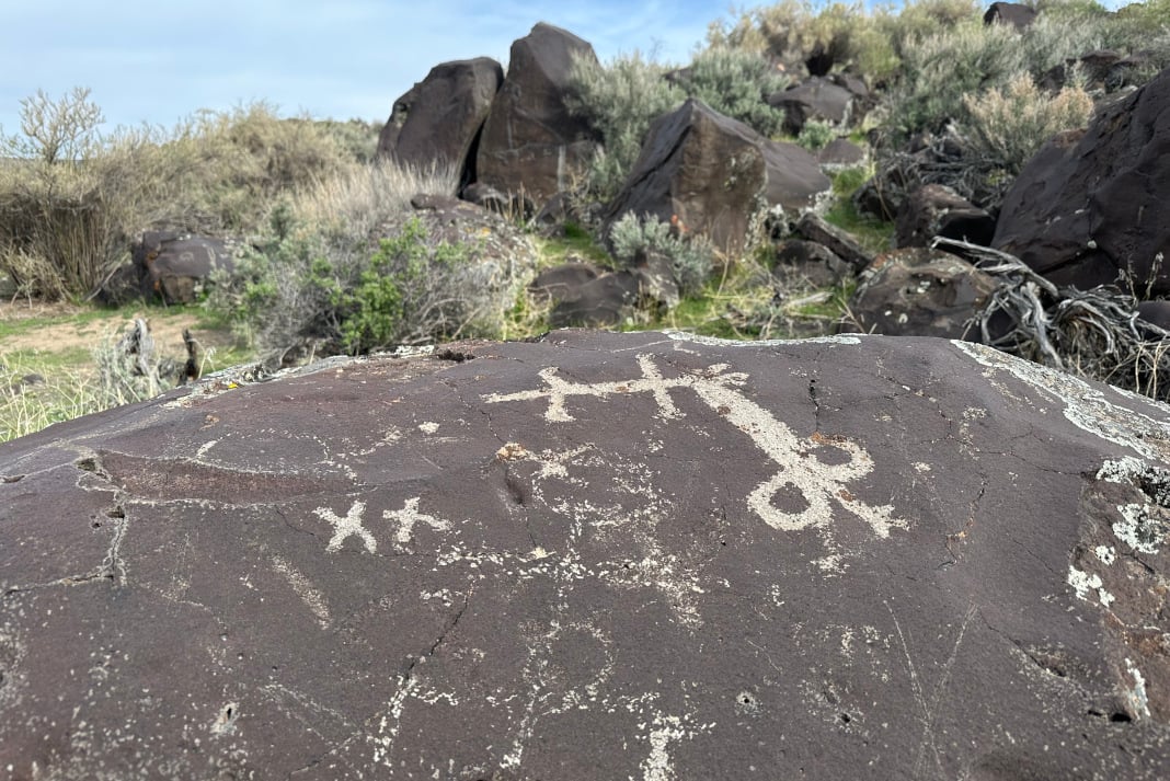
Named for three fur trappers from the Sandwich Islands, or Hawaii, Owyhee is actually a mispronunciation of the homeland of these fortune seekers who never returned from their walk about in the Jordan Valley region. Native people have inhabited the region for thousands of years, and artifacts of their presence can still be found, including flecked arrowheads and petroglyphs.
In more modern times, sheepherders and cattlemen have occupied the region with the animals they tend to. Be prepared to pass their defunct ranches and grazing grounds, where it’s worth pulling over to peak at the remnants.
Take-out options
The first take-out option is 45 miles downstream of Rome at Birch Creek. The road out of Birch Creek is often not open until a little later in the season and requires sturdy four-wheel drive vehicles to navigate.
The second option is Leslie Gulch, 67 miles from put-in with miles of flat water. For Leslie Gulch, it is wise to bring a small outboard in order to motor out. A sign a few miles downstream of Birch Creek indicates when it’s legal to kick on your motor.
Owyhee River shuttle
Shuttle services can be unreliable on the Lower Owyhee River. Many boaters have found themselves stranded at Birch Creek and, even worse, Leslie Gulch take-outs. And logistics for finding your way out can get squirrely in the Owyhee’s remote areas. The best recommendation for a shuttle service is to ask around for current circumstances. Poll the jury on your local boating forums, and be sure you have word-of-mouth information before picking a service.
If you decide to set shuttle yourself, it’s at least a two-hour drive from Birch Creek or Leslie Gulch back to the boat launch in Rome.
Notable Owyhee outfitters
Remember this region is Wild and Scenic, which means remote—thus, extra precautions should be taken regarding safety. It isn’t a bad idea to go with an outfitter. Northwest Rafting Co. has a stellar reputation for their commercial Lower Owyhee River trips.
Find more info and a boating guide for the Lower Owyhee River on the Bureau of Land Management site.
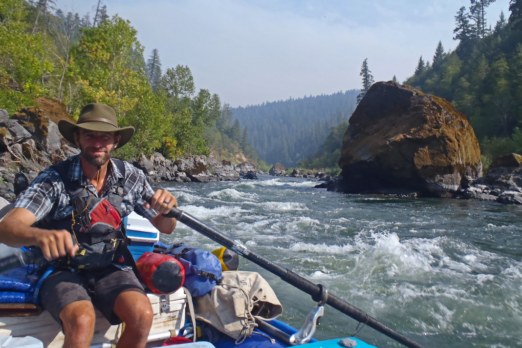
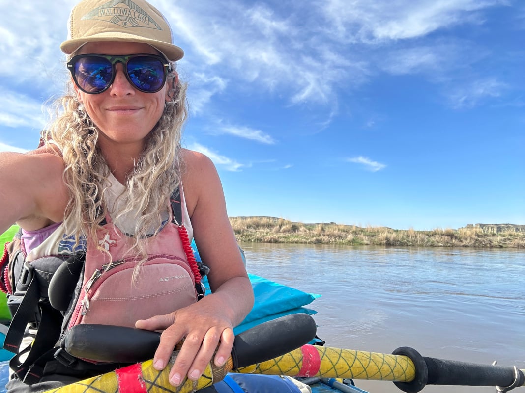
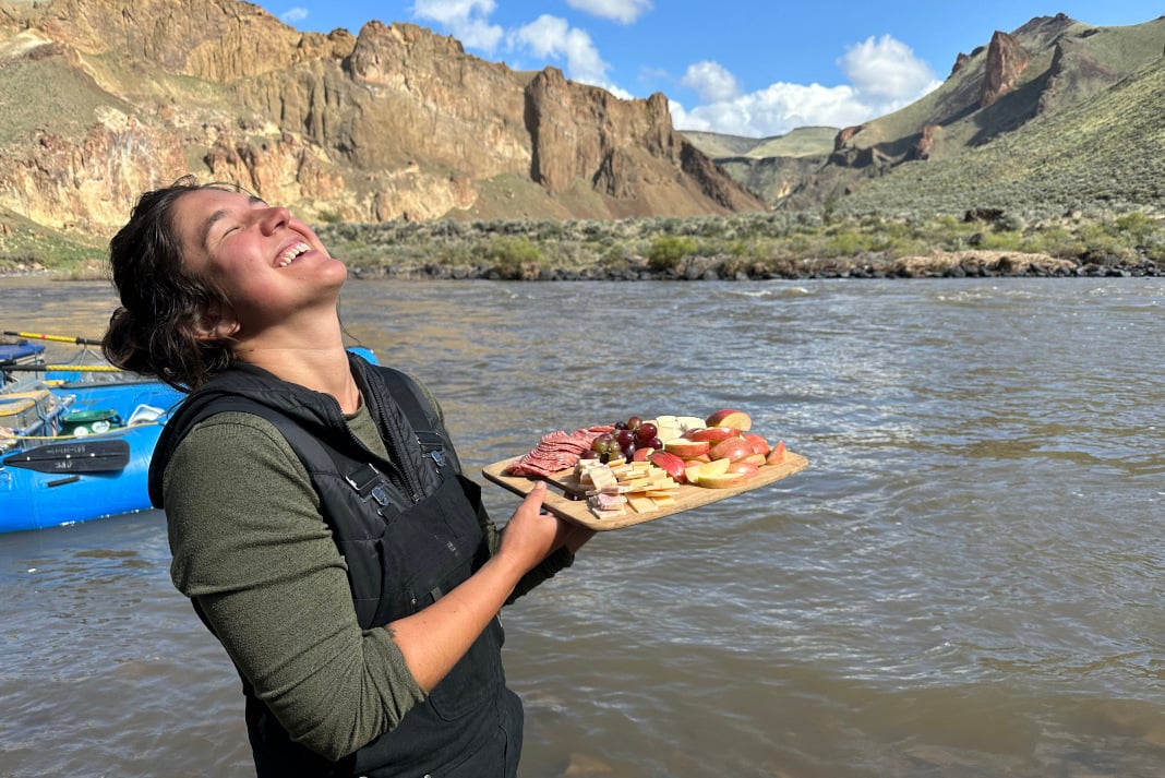
The author catching high flows and desert sun. | Feature photo: K.M. Collins


")


I was scheduled for an Owyhee trip that got cancelled this April. I was bummed after driving from Bend, OR but other
people had come from a much larger distance away. Actually I got lucky the trip was cancelled because I really messed
up: I forgot a water bottle, a water repellant jacket and reading glasses so I missed this trip (for the third time) but I was
not really sorry.