Home Blog Page 554

Park and Play: Hog’s Back, Rideau River, Ottawa

Photo: Rob Faubert

Ottawa is home to all things truly Canadian: Winterlude and BeaverTails, the Ottawa Senators hockey team, the Liberal government and, best of all, Back Bacon.

Don’t start your mouth watering just yet. Back Bacon is a fantastic park-and-play spot near the heart of downtown, and practically across the street from Carleton University.

“It’s like [the Ottawa River’s] Push Button on steroids,” says local Mark Dubois, who “re-found” the hole last year and began spreading the word. “It’s a real asskicker—a full-on strap-the-helmet-tight kind of hole, great for loops, ends, splits, whatever you’re into!” 

Back Bacon is at Hog’s Back, the place where the manmade Rideau Canal splits from the natural course of the Rideau River. The canal goes through the Hog’s Back Locks, and the natural river carries on over a series of limestone falls and rapids and then flows for about five more kilometres to dump into the Ottawa River next door to the PM’s house on Sussex Drive. 

A historical plaque nearby says that Hog’s Back was named by hungry loggers after a humped rock in the rapids that reminded them of swine. The rock disappeared during construction of the Rideau Canal back in the early 1800s. However, there’s now a McDonalds just around the corner on Prince of Wales Drive, so you can call it even.

Hog’s Back consists of one class V waterfall with multiple lines and three class III rapids below the falls. The falls were popularized by Mark Scriver and Paul Mason in their book Thrill of the Paddle. Shortly thereafter, up-and-coming hair boaters were making it a prime target for conquest, with some mixed results. In 2002, a few paddlers were charged with trespassing on National Capital Commission (NCC) property. They won in court because they had stayed in their boats and didn’t actually set foot on the NCC’s restricted riverside. So it’s all perfectly legal—just don’t go scouting the drops from the other side of the black fence.

Three channels emerge below the falls. The far river-left channel has the most flow. Halfway down this channel are two frothy, deep and powerful play holes with small eddies. The second, main hole, Back Bacon, is marked with a sign in the eddy. Local legend has it that the sign has always been there, but if you ask Dubois, he might fess up.

Back Bacon is a demanding hole that’s capable of pounding you silly— making it unsuitable for beginners—but will reward most intermediates with fast, exhilarating rides. 

The key to Back Bacon is to paddle hard. It’s quite powerful in the spring. You need to be aggressive when throw- ing moves and when you flush off, pad- dle just as hard to catch the small eddy. Local boy Nick Miller says:

“It’s a great spot for pretty much every hole move. Nice and sticky without being hard to manoeuvre in. It’s deep too…. The spot favours righties a bit, but you can definitely huck both ways ’til you’re dizzy. It’s a great spot for loops and it’s even retentive enough for tricky whus.”

If you’re in the Ottawa this spring make sure to stop by for some really good hole boating. It doesn’t get any more Canuck than this, so you’d better apologize if someone bumps you off the wave! 
Screen_Shot_2016-04-21_at_11.48.50_AM.pngThis article first appeared in the Early Summer 2004 issue of Rapid Magazine.


Bringing A River To Life: A Storyteller Saves The Missinaibi

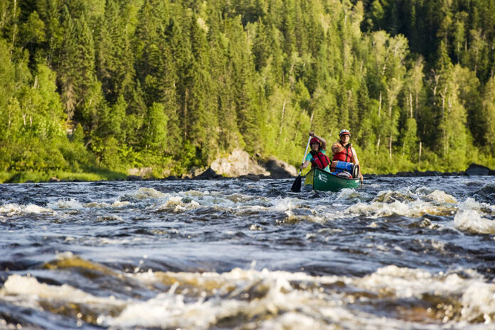
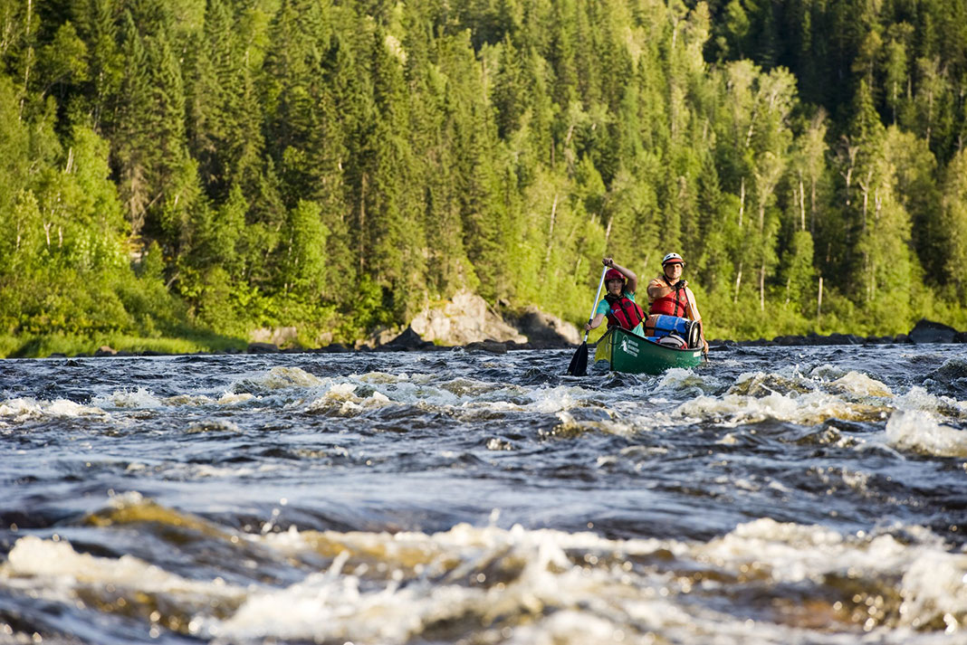
two people paddle through rapids on the Missinaibi River
Feature photo: Courtesy Destination Ontario

“So many stories! And the players we had were no slouches, eh?” That’s how my interview with Michel Lepage began. With an opening line like that, the storyteller could go just about anywhere. Lepage, Northern Ontario’s master storyteller, chose to take me down the river, or through the history of his favourite river, to be exact. The “players” go by the names of George Atkinson, Ed Jarvis, David Thompson and “Alex” Mackenzie. They span over 200 years of history and 400 kilometres of Ontario’s longest free-flowing wilderness river, the Missinaibi.

Bringing a river to life: A storyteller saves the Missinaibi

Lepage is at the same time brilliant, generous and self-deprecating; a visionary, business guru and whitewater paddler. His impressive resumé lists, among other things, VP Consulting of the prestigious accounting and consulting firm BDO Dunwoody. But Lepage humbly deflects any individual praise and passes it on—he claims a past of “more canoes than brains!” (followed by a belly laugh). Born and raised in Kapuskasing and Hearst, close to the Missinaibi, he has found the time during his high-profile career to come home and paddle the length of his favourite river almost a dozen times, researching and becoming an expert in the waterway’s history.

two people paddle through rapids on the Missinaibi River
Feature photo: Courtesy Destination Ontario

As the shortest route between Lake Superior and James Bay (using the Michipicoten River to connect), the Missinaibi has over 3,500 years of human past in its flow. Red ochre pictographs left by early Ojibway and Cree, a Hudson’s Bay fortified trading post, and portage trails packed hard by thousands of feet are only a part of this vein that feeds a giant roadless tract of Ontario’s North.

Long known to Lepage and his paddling friends (who first paddled the “Miss” in 1977), this was a jewel to be preserved. They were not alone, as groups such as Sierra Club International were also lobbying to have the Missinaibi protected. And it was—with 1988 Provincial Waterway status. In the same year, the Ontario government nominated the river for the Canadian Heritage Rivers System. The nomination gets completed to full designation with an approved comprehensive management plan based on community consultation and consensus—local participation is key.

Sixteen years later, the Missinaibi holds the dubious honour of having the longest time elapsed between nomination and designation. The requisite management plan is being tabled this May, in hopes of finally receiving full heritage designation. If the river does win its heritage status, it will be in no small part due to Lepage, who was pivotal in promoting the Missinaibi to the people who ought to know it best—the northerners who live in its watershed.

He did it by telling stories.

“My role, and you’re never alone in this, was making the river come alive.” His intimate knowledge of the river and his love of history led him to become the spokesperson for the Missinaibi in the North.

“I pulled out certain characters [from history] and followed them. I took the dryness out of it and made it a story, and that’s when people could relate to it.”

Probing into old Hudson’s Bay Company archives from Winnipeg, and Ministry of Natural Resources archeology sub-studies, Lepage set out to make the story of the Missinaibi known, especially to those who lived in nearby towns like Hearst and knew the river only from the glimpse offered by bridge at the Highway 11 crossing in Mattice.

From 1990 to 1993, Lepage’s Trials and Tribulations of John Thomas appeared as a running series in the Hearst newspaper, recounting tales from the river’s past based on the life of a Hudson’s Bay Company representative trading on the river in the late 1700s.

“People could read it week by week and say, ‘What the hell’s going to happen to this guy?’” These stories finally brought the river local and regional attention, which built support for the Canadian Heritage River nomination.

Lepage has a vision for the future of the North that includes the rivers, lakes and tourism. By sharing the stories of their past, he is helping identify opportunities in northern communities, such as his present consulting with the Constance Lake First Nation on a $10 million aboriginal interpretive centre on the banks of the Shekak River, just west of the Missinaibi. This, like Canadian Heritage River designation, is a way stories can build into a tangible touchstone— providing a place for people to touch the past and the historic value of the land around them.

“My role was making the river come alive.”

Our conversation was a roller coaster, or time machine, that wove the Missinaibi’s heritage status, the 1776 mapping of the river from its headwaters, Hudson’s Bay trading history, his survey of the river for the Ministry of Natural Resources, pre-contact aboriginal culture, “blah blah blah”—as Lepage often says. I sensed I was being taken for a ride, with casual but carefully placed Quebecois slang. “I’m French, I can talk until you die!” Lepage speaks with exclamation marks.

For Lepage, the Missinaibi River is alive, alive with history and a breathing landscape, which is the motivation for what he does. Whether the Missinaibi ever makes full Canadian Heritage River status is almost beside the point. It is the stories of the past that are the foundation for a new future in the North. Michel Lepage, master storyteller, is doing his part to make this happen.

Jeff Jackson is a professor in the Outdoor Adventure Program at Algonquin College in Pembroke, Ontario.

Cover of the Early Summer 2004 issue of Rapid MagazineThis article was first published in the Early Summer 2004 issue of Rapid Magazine. Subscribe to Paddling Magazine’s print and digital editions, or browse the archives.


Feature photo: Courtesy Destination Ontario


Re-Actionary: Roadside Charades

Illustration: Paul Mason

There are many obstacles to paddling in Canada: variable water levels, seasonal issues (a.k.a. winter), the Prairies, and the fact that all the great rivers are in Quebec! 

Quebec’s beautiful, sure, but the people smoke like chimneys and drown fries in gravy and cheesy curds. They pride themselves on that stuff. “Vive la difference,” they say. When you’re there, you’re different. You’re the “squarehead”—the outsider. And there’s nothing that protects their rivers from us paddling squareheads more than the language problem.

Driving to the rivers in Quebec is almost impossible. They all drive like maniacs. The drunken streetlights lie on their sides, and who knows if and when you can turn right on a red? Worst still, you’ll be following translated directions from one of your French paddling friends. The sounds “h” and “th” are very tricky for them to say. So a sentence like, “Head through the thoroughfare then hang a hard right to the thruway for half an hour” comes out like, “Ead roo dee orrow pass, en ang a ard right to dee drooway for aff an our.”

You thought he said, “Dead Rudy passed away, his angered wife is a drooling wafer shower,” and you’re thinking, “Who’s Rudy?”

Your friend’s map scribbled on le hotdog napkin says turn on Rue Tabernacle, but the road sign is nonexistent. So you’re lost. That’s a problem anywhere. But in Quebec it’s a problem with a particularly dire edge to it—when you finally ask for directions, no one in la belle province seems to speak English. You’ll be disappointed to know how 10 years of public school French amounts to no help what-so-ever. “Au claire du la luna” or “Frere Jackass” don’t amount to much when you’re deep in the pepper pickies.

Reluctantly you’re forced into roadside charades. You’re in the woods, lost, confused and hungry and you’re dancing in tight black fuzzy rubber trying to show, with your body, the words you cannot say in French. Try acting out W-A-T-E-R-F-A-L-L, P-U-T I-N and B-O-O-F to a grizzly lumberjack wielding a chainsaw in one hand and a cigarette, a can of 50 and a family-sized poutine in the other. You might be surprised to find out how much it looks like you’re saying, “I want to sleep with your wife.”

The language barriers don’t stop at the put-in—if you make it that far. Paddling requires knowledge and communication. It’s important to know where the blind drops are, where the sieves are, that sort of stuff. And all those peppers know this stuff, of course, but it’s locked in their tetes (no, not teats).

You ask them, “Hey Jean Claude, Guy, what’s around the corner?” And they just smile and nod. That’s their answer. But, my Anglo friends, it is the wrong answer. I once asked a guy, “Francois, will I surely die if I paddle around this next bend?” He just smiled and nodded.

Maybe the paddling peppers know exactly what you are asking. Maybe they don’t want to give us directions to the best lines, choice campsites, and funkiest discos, so we won’t come back. After all, we all like to keep our favourite runs a secret, don’t we?

That’s why when an American asks, “Y’all know wheres I can find the Ah-to-wah-wha Rivah?” I tell him to head north past the guys in toques drinking beer and playing hockey. When you see the beavers, go west. This, my Yankee squarehead friend, is where you’ll find all the best paddling—Saskatchewan!

Ben Aylsworth likes Quebec and likes Quebec rivers but loves Quebec women. 

Screen_Shot_2016-04-21_at_11.48.50_AM.pngThis article first appeared in the Early Summer 2004 issue of Rapid Magazine.


Editorial: Back Out in the Open

Photo: Jason Chow

“Are you ready?” asked some racer’s kid holding our stern by the grab loop. The shallow, swirling eddy waters below Whitehorse Falls on the Gull River were further confused by the other 23 bobbing open canoes waiting their turn to be released.

“Are you ready?” the kid asked again waiting for some acknowledgement, like a yes, so the man beside him with the clipboard and walkie talkie could begin the countdown.

For me, the countdown began six months earlier when I hung up the phone with Andy Walker who called to ask if I’d paddle the North American Open Canoe Slalom Championships in the bow of his Caption. I told Andy I was flattered; he told me that everyone else good already had a partner. It will be fun, he said, and besides he’d heard that at one time I was pretty good.

For the sake of every now-overweight high school football hero—elbows on a bar shelling peanuts, bragging about the good old days—I said yes.

“Hey, Mister! Ready?”

Sculling to keep the boat pointed toward the first gate, I felt like a six foot two inch praying mantis perched on an eight-inch foam pillar. It hadn’t occurred to me until just then that I hadn’t been in a open canoe in four years, seldom paddled in the bow, never paddle on my offside and had never run slalom gates.

Andy must have told the kid we were ready. The guy with the stopwatch yelled “GO” and as we wobbled toward the first gate, I realized what Andy had heard was right. I was pretty good… at one time.

At one time I was, at least in my own mind, a pretty hot open boater. Together, my old Ocoee and I danced, it following my lead, matching every step. Since then, paddling progressively shorter, lighter and “cooler” C1s, I’d lost my open boater self to planing hulls and too many squirt turns and cartwheels. Now I was back in my old neighbourhood but it wasn’t the same.

Dizzy, with arms like over-cooked spaghetti, and soaking wet, I dragged Andy’s boat up the stone dust trail beside the racecourse. I wasn’t disappointed in our time, by how many gates I slammed into, or that we rolled mid-race and floated the last two gates full of water. I was actually reasonably pleased with all that. What bothered me was that I’d lost that feeling, the strength, balance and unquestionable confidence that I once had.

That day at the OC Championships I knew, like every aging athlete, I had to make the choice: Get back in the saddle or take up my stool at the bar. 

Hey, buddy! Pass the peanuts! 

Screen_Shot_2016-04-21_at_11.48.50_AM.pngThis article first appeared in the Early Summer 2004 issue of Rapid Magazine.
 

The North Stein: Steep and Cheap

Photo: Braden Fandrich

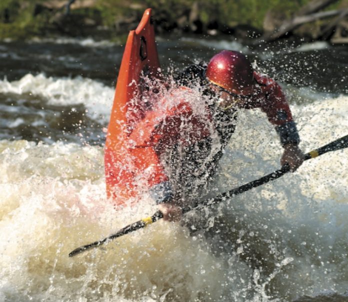
British Columbia is a tough place to explore. Not because of access, grizzly bears, or deep canyons. No, it’s the Germans. It seems as though every river you scout or even mention in B.C. turns up the same response: “Oh yeah, I think some Germans paddled it a long time ago and said it was no good.” 

The North Stein was no different. People had been talking about it for years—locals, travellers, pro boaters, you name it—eyeing it as a potential creek access to its famous bigger brother, the Stein River. The North Stein too, had the usual story of some Germans paddling it years ago and saying, “don’t go back.” Luckily, our group didn’t hear this story until we had our minds set on the adventure, whatever it was to hold.

The main Stein is a classic two- to three-day run in southern B.C.’s Coast Range. The normal put-in is Stein Lake, accessed only by floatplane. The flight to Stein Lake is nothing short of incredible—huge moun- tains laced with shining glaciers, amazing cascades, multiple creeks and lakes of varying colours, and a patchwork landscape. Unfortunately the cost of flying into the lake doesn’t fit into a kayaker’s budget, except on rare occasions. 

TWO RIVERS FOR LESS THAN THE PRICE OF ONE

In 2002, we flew in to run the main Stein and gazed down at the North Stein: whitewater, and lots of it. It looked incredibly steep from the air and dropped right to the main Stein only two kilometres below the normal put-in at Stein Lake. It also originated closer to the main highway between Lillooet and Pemberton. Maybe, we thought, there was a logging road that led to or near its headwaters that started from the highway.

This sparked a curiosity that would stay with us for the whole trip. If the North Stein could be successfully completed, it would open up an alternate and much cheaper access route to this amazing drainage. Also, you would get two rivers for less than the price of one.

The dry season of fall was soon upon us. With no boating to be found in the area, scouting out new runs was the only way to satisfy Lytton local Braden Fandrich’s kayaking urges. The North Stein was still itching at his mind. Borrowing a four-wheeler, he went out to find a way to access the North Stein by vehicle. To his amazement and excitement, he found an old overgrown logging road off the main highway from Lillooet that eventually led to the backside of the North Stein drainage. From here it would only be about a 10-kilometre hike up and over a pass into the North Stein itself. 

THE DRIVE INTO THE UNKNOWN

Only having a single scout from an airplane isn’t usually your best plan of action for dropping into an unknown, steep waterway, but we were in for the adventure. Our crew was lean and mean, fast and furi- ous: Braden—smooth Canadian all-arounder; myself— a yank known for getting a bit dangerous at times but coming out sparkling clean; and Corey Boux (pronounced like “bucks”)—Canadian glamour huckster. It was late July and the river levels in the area were perfect for an undertaking like this, not raging high but not back-jarring low either.

With our boats packed for four days, 80-plus pounds, the drive into the unknown began. Thick brush scraping down on both sides of my 4×4 left only a small portion of the windshield that could be seen through. The last person on this road must have been Braden the year before on his quad. And before that who knows. The road seemed to end many times but we pushed on hoping to get as close to the base of the mountain pass as possible.

We finally arrived at a point where the road ended for sure. Immediately after getting out of the truck we were swarmed by hungry mosquitoes. They followed us for the entire hike to the put-in, some seven kilometres later. Our bodies sweated profusely, to the delight of the mosquitoes, from heaving our loaded boats on makeshift backpacks up and over the summit, and having to wear all our underlayers for protection from the bugs. For the next few days a blind person could have read random sentences on our bodies from all the bites.

Even in a fog of mosquitoes, we couldn’t help but relish the majesty of the environment. When doing the main Stein we only saw this alpine beauty from the seat of the plane. But while on this hike we were immersed in it. An enormous green, glacier-carved valley surrounded us. The spring water we drank tast- ed like the lips of an angel. It flowed directly out of the ice fields above. The hike went from steep, boulder-strewn uphill to the top of the pass, to a flat, mossy valley, to a steep tree-covered downhill, which, much to our surprise, ended at our put-in.

Whether the hike to the put-in took three or five hours was beyond recollection. We were on river time, and now that time had finally come. We were all thank- ful to see enough water to float on. Now we could gain refuge in our drytops from the onslaught of mosquitoes.

READY FOR WHATEVER THE CREEK THREW AT US

Now the real adventure begins. What was this creek to hold? How steep was it at river level? Would we portage more than paddle? Could we portage when we had to? How many days would it take us? Did we have enough food? We drifted around the first bend, ready for whatever the creek was to throw at us.

The North Stein flows 12 kilometres before reaching the main Stein. After the hike it was nice to not have to contend with pounding class V but to just lay back, relax and enjoy the surroundings. The rest of that first day we just slowly drifted 10 kilometres through amaz- ing scenery and a few logjams. We remembered from the flight the year before that once the action started
it didn’t stop until the river ended. We camped at the first major slide we came to, which marked the begin- ning of the slanted, white-filled river that would take
us straight to the Stein itself. With about an hour left of daylight we cooked dinner, talked shit, and counted our mosquito bites. Tomorrow would be our day of reckoning, the mystery of the North Stein unravelled.

WAKING UP TO QUALITY WHITEWATER

Waking up to quality whitewater, an entire day in fact, is why I thank my mother for giving me life. It is hard to imagine an entire day, dawn ‘til dusk, of sensational whitewater, but this is what we found ourselves immersed in on day two of our journey—two kilometres dropping 900 feet each. These two kilometres on the North Stein were, as Boux put it, “the best creek I have paddled in B.C.”—a granitic paradise much like California, but with the consistency of Norway. 

There were 19 slides and waterfalls growing in size and difficulty, each with a calm pool at the bottom. Standing on the brink of a drop you could see three drops above that had just been paddled and two horizon lines below to come. Four of these 19 drops we portaged. Light tree cover and no canyon walls made the portages quick and painless. Two of these could probably have been paddled if we were closer to help. Commenting on the few portages that we did,

Fandrich said, “The portaging was the easiest I have ever done on a steep creek, or in B.C.” After all this came the legendary upper portions of the main Stein River with its big-volume slides.

FIRST DESCENT OR NOT IS BESIDE THE POINT

Three days after we started, we were sitting in the resort hot tub at Kumsheen Rafting with big meals in our bellies and beers in hand, talking of our adventure, the Germans, and other rivers that we had heard of them doing. Maybe they had paddled everything around here, found the area to be so pristine and majestic that they just wanted to keep it secret. Maybe all the stories we had heard would lead to more gems. Or maybe the Germans had never paddled the North Stein at all.

First descent or not is beside the point. Let it be just as adventurous on the tenth descent as on the first. That is why we kayak anyway. It isn’t about the rapids, how big the slides are, or how much portaging we do. It is all about the journey itself. The hardships, the friendships, the paddling, and the outcome, all in one.

What matters is that the money dilemma on the Stein has been removed. In it’s place is an alternate and incredible route. A route so breathtaking that pad- dlers who venture there might not only find granite and water, but something about themselves and the true meaning of paddling. I think the Germans would be proud.

David Norell produced the videos The Revolution and The Revolution 2: Broke, Hungry And Happy. Full coverage of the North Stein will appear in his next release tentatively titled The Revolution 3, due out in Spring 2004. 

Screen_Shot_2016-04-21_at_10.54.02_AM.pngThis article first appeared in the Spring 2004 issue of Rapid Magazine.
 

Skills: Wave Turns

Photo: Scott MacGregor

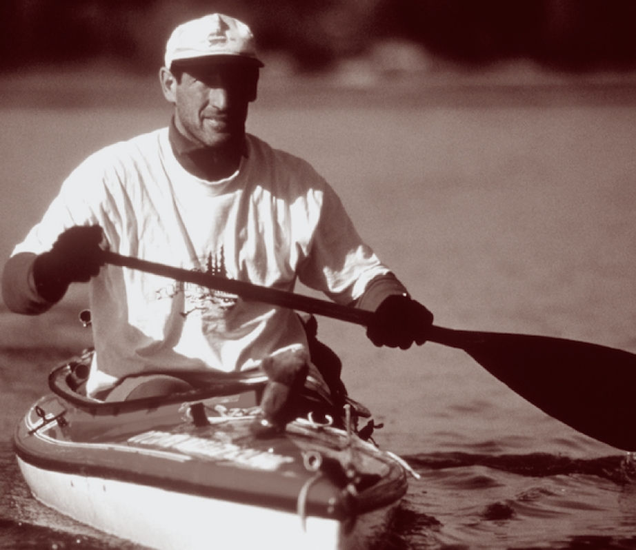
Let’s face it: canoes are big boats, and they can be difficult to paddle. The result is that we often work too hard paddling whitewater. When teaching open canoeing, I frequently point out the many opportunities to use water features to reduce the effort of paddling rapids. One of my favourites is the wave turn. Suppose you need to turn from facing downstream to facing upstream. Why take a half-dozen strokes to turn your boat when you could use a breaking wave to do the work of spinning the canoe for you? 

Wave turns are as much an exercise in water reading as they are in good boat control. To plan a wave turn, scan downstream looking for a breaking wave with a foam pile perpendicular to the current. The best foam piles have aerated water falling from the wave peak down to the wave trough. Small holes work too, but be careful to wave turn only on features that you also would feel comfortable surfing.

The secret to wave turns is boat position. Begin your approach by aiming your bow at the corner of the breaking wave so the bow points toward the foam pile. Accelerate gently so the bow of your canoe hits the white water at the top of the wave crest. The foam pile is not moving downstream and will catch and hold the bow of your canoe. The stern, which is still in the downstream current, will pass the stalled bow. The result is a spin that turns the canoe upstream. Spinning and catching the wave without the canoe sliding downstream requires that you engage a suitable foam pile with correct boat angle, speed and bow placement.

In some ways, spinning and stalling on a wave serves the same purpose as a mid-current eddy pool. What makes this move better is that you can stay on the wave and enjoy a front surf. The true benefit, though, is that you’ve halted your downstream momentum and are ready to stage your next move.

You may decide to front ferry or (as shown) choose to change direction and S-turn to an eddy along shore. Both manoeuvres will seem easy because the cross-current momentum, generated by the brief front surf, carries into your next move. 

The wave turn offers all these benefits while requiring minimal strokes—in fact, I didn’t mention one stroke in this entire article. Just stuff your bow into the corner of a breaking wave and let the river do the work. Reducing your effort by using water features, like waves and holes, is the key to making paddling a canoe look easy. Have fun, and don’t work too hard.

Andrew Westwood is a frequent contributor to Rapid and is an open canoe instructor at the Madawaska Kanu Centre. 

Screen_Shot_2016-04-21_at_10.54.02_AM.pngThis article first appeared in the Spring 2004 issue of Rapid Magazine.
 

Park and Play: Puntledge River B.C.

Photo: Wayne Barson

Sirens usually trigger a flight response in humans—running for shelter from disaster. Conversely when the siren sounds on the Puntledge River, kayakers grab their paddles and boats and start running to the source of the sound.

Along its 16-kilometre course Vancouver Island’s Puntledge River drops and meanders among sandstone rock cuts and waterfalls from the dam at Comox Lake through the happening little recreation mecca of Courtenay before spilling into Comox Harbour. At times of heavy rain or snowmelt, BC Hydro opens the sluice at the Comox Lake dam releasing a torrent of water and raising river volumes from a benign 8 to 15 cubic metres per second (cms) to a thundering 80 cms. 

“It’s the shit when it’s on but it’s only on 20 or so days a year,” explains island paddler Mike McCulloch.

West Coast whitewater pioneer John Noble, who lives just a 10-minute commute between his coffee maker and the Puntledge, says the river lays the boots to the Clearwater, its closest competitor in B.C. for surfing. 

The key is knowing when to make a trip to this fickle but coveted river. And that’s where McCulloch and his paddling buddy Shayne Vollmers come into the picture.

Vollmers has been somewhat of a crusading kayaker during the past year, arguing that paddling is part of the island’s tourist economy and therefore paddlers should have their hedonistic needs considered in water management plans. He has been aggressively lobbying BC Hydro to notify paddlers about upcoming water releases so that people have more than an hour’s notice and can be packed and ready when the magic volume of 80 to 100 cms arrives. In addition, he wants the power company to schedule occasional weekend releases so that weekend warriors like himself can also indulge. 

WHEN TO GO

Now that the lines of communication have been greased, Vollmers and other locals are working on another interesting project that involves building a permanent play feature that will go off year-round regardless of water levels. Stay tuned. For now, summer paddling on the Puntledge is a non-starter. Things can get exciting when the fall rains arrive in early to mid-October and decent paddling opportunities can occur throughout the winter and early spring.

WHERE TO GO

Drive up Lake Trail Road from Courtenay. Turn right on the Comox Lake logging road and drive until you reach the Timberwest logging camp. Turn right onto the Duncan Bay logging road and continue until you pass over the pipeline. There’s a gravel pull-out on your right next to a yellow gate. Park it. After marching down the pipeline for 350 metres, you’ll con- front your first technical challenge—the access trail that disappears into the trees on the left. Slither down this steep and muddy chute to the river’s edge.

Screen_Shot_2016-04-21_at_10.54.02_AM.pngThis article first appeared in the Spring 2004 issue of Rapid Magazine.


Re-Actionary: Rodeo in the Olympics?

Photo: flickr.com/saumag

At a real rodeo, if you can ragdoll on a bull longer than seven seconds before it kicks your head in, you’re a star. That’s pretty sad. Also sad (for the bull mostly) is the fact that they tie a rope around his “prairie oysters,” as they like to say, to make him more angry than he’d otherwise be with some Stetson-wearing jackass cowboy strapped to his back. But the saddest fact of all is that cowboy rodeo has something that “kayak rodeo” will never have…

An audience. 

It was close. There were moments in the late ‘90s when I thought maybe, just maybe, freestyle kayaking would catch on. As boats got easier to throw down, the sport became more dynamic. Tricks like blunts, splitwheels and loops evolved. It seemed possible that freestyle might make it to Saturday ABC Sports. There were even some pot-induced illusions of rodeo kayaking being introduced at the Olympics. But it wasn’t. Wanna know why? 

Watching a guy getting stomped on by a bull is the ultimate payoff for viewers of cowboy rodeo. Sure, a lot of people got trashed at the recent rodeo Worlds in Austria, but it was just a sticky hole—they were never
in any real danger. Look at any other sport in the “extreme” domain. Big wave surfing—20-foot waves minimum. Motocross—50-foot airs. Snowboarding—15- foot walls and 10 feet of air. What does kayak rodeo have on these extreme sports? Spinning, twirling, looping like a gaylord in stretchy outfits on some white water for a panel of biased, has-been judges. What other sport does that? Oh right…figure skating.

I’ve had more than one sponsored freestyle paddler tell me that rodeo is like masturbation—fun to do, but no fun to watch. And I guess they’d know; they’re the pros.

Cowboy rodeo brings the animal abuse to your local fairgrounds. They set up a coral and fill grandstands. Nobody watches kayak rodeo because to get to the event site you’ve got to have a master’s degree in orienteering and be sleeping with one of the organizers (I use the term “organizer” loosely). Take the Canadian team trials, the biggest event in the country. They’re usually held on the Ottawa River, an hour-and-a-half drive from anyone with teeth. You have to know the river, paddle to the site, and then hope the judges show up.

“Dude, like why isn’t your mom here to watch?” “Dunno.”

Did you know the Houston Livestock Show and Rodeo has about 31,000 members, who pay a $50 annual membership fee? That’s just Houston. One city, man. That adds up to over 1.5 million bucks a year.

What’s my point? You should be the responsible parent and get your kids into bull riding. But also, kayaking rodeo organizations suck. Imagine what would happen if at the next Houston show the cow- boys rode ponies? Wrassled goats? Or had to walk seven miles through the mud to get to the stadium? I tell ya what would happen, Billy Bob, it would be boring and no one would come to watch.

It would be just like…a kayak rodeo.

Ben Aylsworth has been paddling for a long time and still doesn’t know the difference between an orbit and a space Godzilla, nor does he care. 

Screen_Shot_2016-04-21_at_10.54.02_AM.pngThis article first appeared in the Spring 2004 issue of Rapid Magazine.
 

Editorial: A Man Without a Boat

Photo: flickr.com/StefanSchmitz

“I don’t have a boat,” I said, rather stunned by the sound those five words made in the pit of my stomach.

I hardly believed it, but after a few seconds of mentally replaying each boat sale—me standing with a white envelope of cash, him tying my boat to his car—I realized the mag- nitude of what’d I’d done.

Today is the third day of January. It’s sunny, seven degrees above freezing. Water is gushing off my tin roof and then, surely, into the nearby creeks and the Madawaska River. Tanya tried to help. Why don’t you go for a hike? Lame. Take down the tree? No. Install the new TV antenna? Whatever. Fine then. Sit there and feel sorry for yourself. Okay.

For the first time in 10 years, I didn’t have a boat to paddle.

I’ve heard the argument made before, usually by the bean counters—the type of people who balance their chequebooks and cut their grass diagonally. They say that finan- cially it makes more sense for most paddlers to rent their boats. Work it out, they say: New boats cost roughly $1,500. Let’s say weekend rentals cost $50. So for the price of a new boat, you get 30 weekends a year. Or, more likely, two weekends a month, five months a year for three years—always in the boat of your choice.

Not a bad deal until one warm winter day you’re standing on a ladder mounting the Recoton TV 3000 antenna to your roof while cars with boats on top honk and paddlers wave on their way to the river that’s only 10 minutes from your house.

As selfish as it would be to keep them, I’ve regretted selling every boat I’ve ever owned. I sometimes get nostalgic about the time we’ve spent together, the good times we’ve had. They were more than hunks of plastic; they were stages of my life, some of the best trips and longest summers.

I use them to measure time and remember seasons, like farmers would remember a particular bumper crop or, in some cases, a horrible drought. When I see one of their buyers on the river I inquire about my old boats like you would question a friend about an old girlfriend. How is she keeping, I ask. Is she getting out much? Sometimes, I’ve even asked to take her out for the afternoon, for old times’ sake. Although I always find that there was a good reason we went our separate ways.

In recent years you could count on manufacturers putting its boats on the market before fall—even mid-summer. But with all manufacturers now back on a normal pro- duction schedule of releasing the new models in the spring, my late-summer purge was too hasty. I got caught without a boat for the best fall paddling Ontario has seen in a decade. It will be a season without memories, like it never happened.

However, the move back to spring boat releases is good news for paddlers. Awaiting a spring and the arrival of the year’s new designs builds excitement, anticipation and hype. No longer will your boat be outdated mid-season, completely depreciating by the time kids are back in school.

You’ll be more inclined to hang onto it until spring when the demand, and therefore the resale price, will be higher—keeping even the bean counters happy. 

Screen_Shot_2016-04-21_at_10.54.02_AM.pngThis article first appeared in the Spring 2004 issue of Rapid Magazine.
 

Lake of Two Skies: a Trip Through Great Slave Lake

Photo: Dave Quinn
Lake of Two Skies: a Trip Through Great Slave Lake

“Two skies, Dave, two skies. That’s what my Dad used to tell me, on days like today.”

Henry Basil, our local guide, rests his paddle on the coaming of our tandem kayak as he scans the ethereal waters of Great Slave Lake in the Northwest Territories. Henry grew up in Lutsel K’e (temporarily known as Snowdrift on Canadian maps) on Great Slave’s East Arm, and he has seen many mornings like this one, where the waters of the lake appear as a mercurial spill on a giant table, sky and lake blending on the horizon.

The wakes of our four boats are the only ripples on the lower sky twin that Henry’s father described so perfectly—the cloudless azure above mirrored perfectly in the still waters of the Arm.

“Yeaah—hway!” exclaims Henry in his local Chipewyan language, his arms raised in thanks to the sky, “Thanks to the creator for this day!”

The rugged and remote East Arm of Deh Cho—Big Lake, as Great Slave is known to local Dene—has drawn visitors from the south for almost 200 years. The lake sits at the northern limit of Canada’s dwindling boreal forest. Not far north, the forest gives way to tundra. The terminus of the East Arm provides the most direct access to the waterways that flow to the Arctic Ocean, and European explorers used these waters as a gateway to overland exploration of our vast Arctic. Names like George Back, John Rae and the infamous Sir John Franklin all based expeditions from Fort Reliance, of which the ruins can still be seen at the tip of the Arm.

The East Arm’s endless peninsulas and countless islands are made of some of the oldest stones on the planet—the tortured plutonic mass known as the Canadian Shield, scarred by repeated glaciations and heaved into their present formations by the incalculable forces of geology and time.

The ancient rock is rife with the treasures that have lured southerners north for a century. The Northwest Territories suffered its first mineral rush, for gold, in the early 1900s. Vast tracts of forest cover were burnt off to ease the difficulties of prospecting in the boreal forest. Hunters decimated populations of muskox, moose and caribou to feed the hungry hordes of prospectors and miners flooding north to seek their fortunes.

Today, with the gold seams played out, a second wave of prospectors and transient mine workers are migrating north to work the “diamond rush.” One mine, called Ekati, produces a staggering six percent of the entire world supply. Major players like Ekati and Diavik try hard, at least on paper, to work with local First Nations and northern interests. However, many northerners are tired of watching resources and riches disappear from their traditional lands. 

Our group includes a ski bum from Canmore, two Minnesotan insurance brokers, a retired engineer from Nashville, an eight-year-old with a passion for lengthy swims in frigid water, and three guides—Jane Whitney, Henry, and myself. We are drawn here not for the lustre of gold or the sparkle of diamonds, but to search for a differ- ent kind of treasure. And we are heavily armed, not with the shovels and dynamite of a geological exploration crew, but with the cameras, sketchbooks, and nature guidebooks of seasoned connoisseurs of wild spaces.

We met up with Henry in a quiet backwater of Wildbread Bay: us arriving in a Twin Otter floatplane; Henry in Lutsel K’e chief Archie Catholic’s power boat.

As we stuffed his gear in the bow of our double Klepper, Henry told me that he had never kayaked, although he had made several large canoe journeys along the shores of the lake.

“Can you swim?” I asked him as we paddled toward our camp for the night.

“Yeah, sure!” he replied gleefully, “Like a rock!”

As our journey unfolded, and the hours of paddling together sculpted our discussions, I learned that I was paddling with someone who was not only an accomplished hunter and fisherman, but an exceptional human in all regards. I came to think of Henry as a man like a favourite old book—worn and weather-scarred on the outside, but its pages filled with understated tales of wonder, inspiration, and sadness. He grew up in the 1950s “on the land,” as he puts it, following his father on hunting and fishing trips. One winter day, government agents working for the Indian Affairs Department actually followed Henry’s family by tracking them in the winter snows, and he and his siblings were forcefully removed to residential school in Resolution. Of the nine children abducted with Henry, only three survive today.

“I needed to do something to survive after the horrors of residential school,” explains Henry, “so I started running. It ́s three miles from my house to the end of the airstrip in Lutsel K’e—the only road in town. People would wonder what I was doing, running like that every morning!”

Henry’s legs carried him first to the Edmonton Marathon, then to Montreal. His times at these races and an Arctic College sponsorship sped him all the way to the New York Marathon in 1989, where, despite tearing blisters caused by new running shoes, he turned in a respectable three hours, forty-five minutes at the age of 42. Not bad for a man from a community with only three miles of road, and six months of winter.

On day two Henry calmly informs us that we will be catching fish as we paddle across the mouth of a channel known as The Gap, which joins Wildbread Bay to Christie Bay to the south. As if on command, the tip of his rod dips lakeward, and the heart-starting zzziiing of line playing out fills the paddling silence.

“Got somethin’ on the end of my line!” Henry grins as he hands the dancing rod over to wide-eyed Navarana, Jane’s eight-year-old daughter. We all laugh with her as she lands a lunker lake trout almost half as long as she is. 

For thousands of years the Chipewyan Dene and their ancestors have subsisted off the plentiful moose and cari- bou in the forest and on the tundra, and from the rich lake trout, whitefish and grayling fishery in this region of the lake. The people in Lutsel K’e, I learned from Henry, still follow traditional rites and subsist largely on the seasonal movements of caribou and on the still-abundant fish in the Arm, and evidence of modern hunting and fishing camps can be found on most beaches.

That afternoon, monster northern pike leave ripples like small torpedoes through the reeds as we near a small portage that connects Wildbread to McLeod Bay. We easily haul our gear across the 200-metre path in the recently burnt boreal forest, and paddle a few kilometres along the shore of a small bay before we heave our kayaks up onto a smooth granite ramp to make camp for the night.

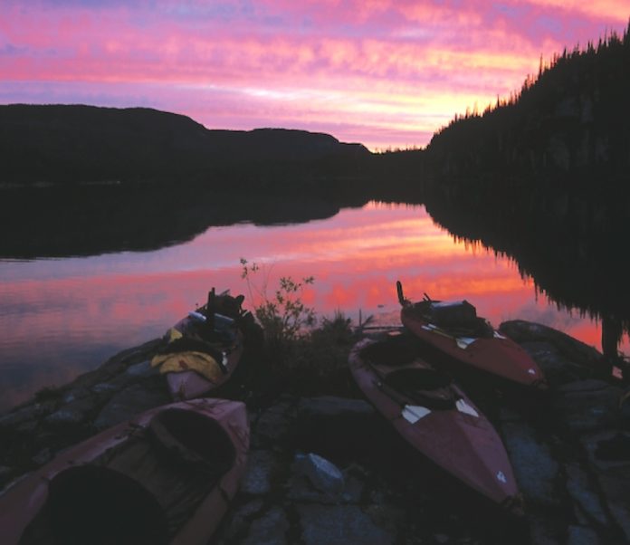
In the evening the brilliant purple–pink orange of the sky and lake, cloven by the classic lines of a boreal black spruce and birch silhouette, creates a spectacular Great Slave sunset. We sit on a glacier-polished slab and watch the show as we slurp down fresh trout, grilled to perfection by Henry over a spruce fire.

We soon settle into the comfortable, carefree routine that only extended trips can bring. Henry, who wakes with first light every day, has a fire going and coffee ready by the time the rest of us finally unzip the bags and tents and pile out into the sunny morning. We munch down a hearty trip- ping breakfast, pack up camp into the boats, and paddle several hours before our bladders and bellies pull us to shore for a break. After a quick lunch, we paddle again until we find a suitable camp—one that has good sunset and sunrise exposure, and that provides good shelter in the event of nasty weather—a tall order that is seldom fulfilled.

Our routine on this early September trip surprisingly involves a daily (sometimes bi-daily!) swim. Daytime temperatures consis- tently reach into the twenties, and many of us pile straight into the water as soon as camp is set up—and we all watch from shore as little Navarana temerariously splashes around for hours, some- times right up until the sun begins to dip low on the horizon.

Ten days in the wilderness tends to fly by like a flock of geese heading south—by the time you hear them they are well on their way overhead, and soon are disappearing from view. Too soon we are at our last camp on the Utsingi Peninsula, awaiting our floatplane pick-up.

We hike a short way along the ridge of the angulated peninsula toward its point and the mouth of the East Arm. The timeless perfection of the rock is peppered with fossilized colonial algae known as stromatolites—the world’s oldest known fossils. These circular paleolithic patterns range from fist-sized to the circumfer- ence of a truck tire, and cover the ground so completely in some spots that it is impossible not to tread on them.

From the ridge, a vast Canadian Shield—cracks brimming with crowberry and yellow-leafed birch—slopes subtly into Christie Bay, toward Henry’s home—Lutsel K’e. The north rim ends abruptly, dropping several hundred dizzying metres in a continu- ous wall tens of kilometres long into the East Arm.

We look back over part the maze of islands and inlets of our route and are filled with the joy of an eagle-eye view of our accom- plishment. Finally our eyes scan west past Et-Then Island (caribou in Chipewyan) to the blue vastness of Deh Cho—the Big Lake—the worlds third largest.

The entire group listens intently as Henry tells frigid understated tales of winter travel by dog team and snow machine in the area. He points out a “snowmobile portage” that hunters use to bypass the thin ice around Utsingi Point, and tells harrowing and entertaining tales of winter hunts, long journeys and close calls.

As I watch this smiling man spin his yarns, I realize that not all treasures in the North are geological. Some, like Henry Basil, are humans who share the gold in their hearts and the sparkle of diamonds in their eyes.

Dave Quinn is a wandering wilderness guide, wildlife biologist, and outdoor educator who stores his stuff in a house in Kimberley, B.C. He and his partner, Kelly Comishin, run Treehouse Outdoor Education, specializing in adventure and wilderness therapy. 

akv4i1cover.jpgThis article first appeared in the Spring 2004 issue of Adventure Kayak Magazine. For more great content, subscribe to Adventure Kayak’s print and digital editions here.